Yellowstone Photography Road Trip
(non-climbing)
A week in Yellowstone.
Region: Wyoming
Mode:

Date(s): September 1-7, 2011 (Thu-Wed)
Partner(s): My camera and faithful red Subaru

|
|
|
|
|
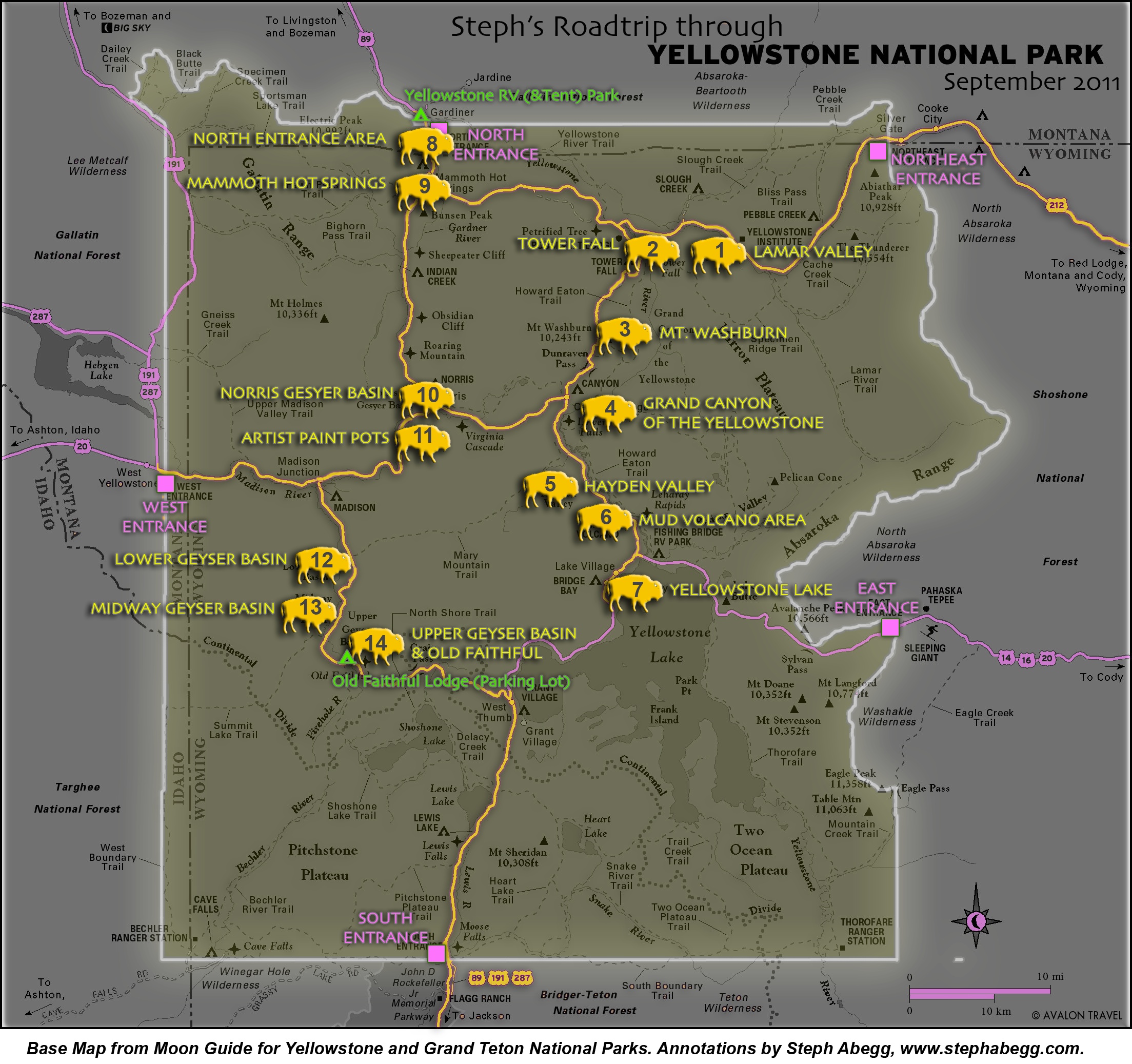
 1
1
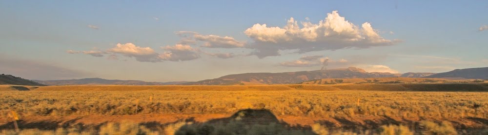
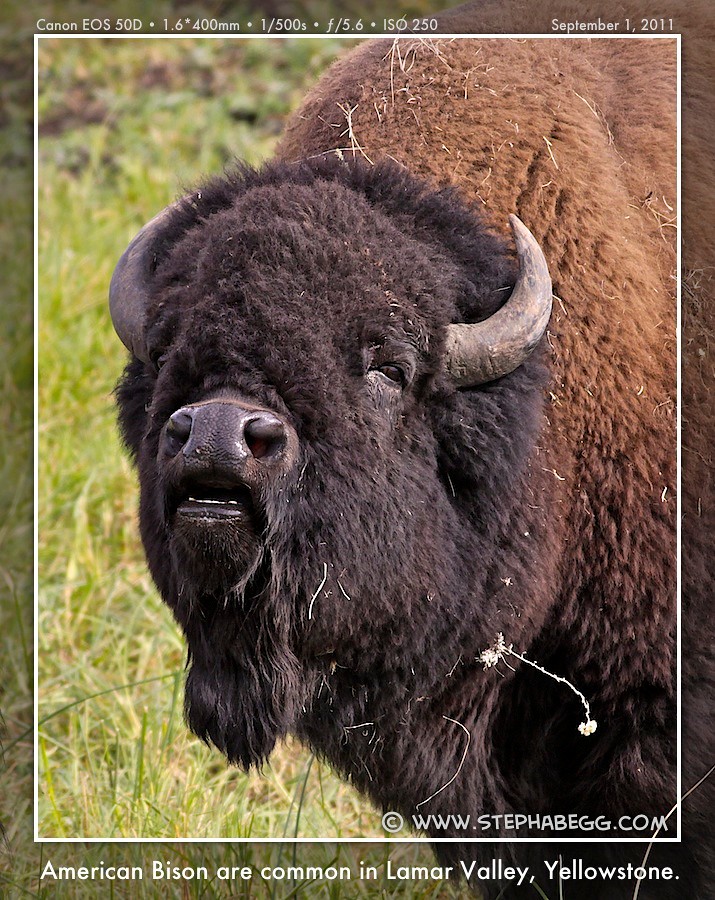
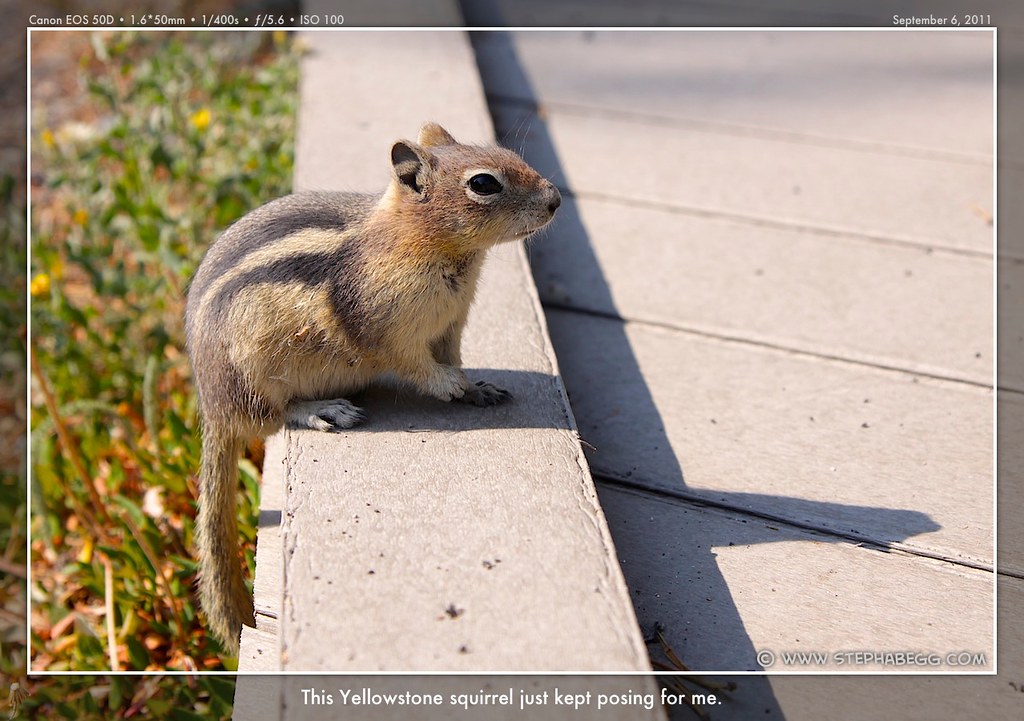
| In the remote northeast corner of Yellowstone, the grass and
sagebrush of Lamar Valley is a great place to look for wildlife of all
types, from the ubiquitous ground squirrels to an occasional grizzly.
Elk, pronghorned antelope, and large herds of bison are commonly seen,
and coyotes are often slighted, but the main attraction is wolves that occupy this area and are occasionally seen. The northeast corner is also one of the few places to see tall mountains in Yellowstone, providing a
gorgeous backdrop for the valley. Morning being the best time for wildlife, I devoted one of my mornings to Lamar Valley. Even though it was not yet sunrise, I was surprised when I rounded a corner to come upon a quarter-mile traffic jam of cars haphazardly lining both sides of the narrow road. A crowd of photographers and wildlife aficionados lined the field. It turned out that there was a bison carcass that had attracted both a pack of wolves and a grizzly. I had never see a wolf or grizzly before, so although they were too distant for more than fuzzy specks in a photo, it was a cool sight to witness. |
PHOTOS (Click to enlarge) Bison 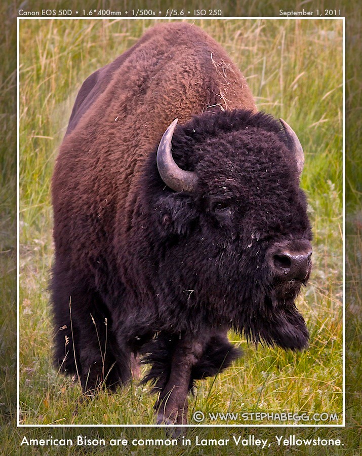


Wolf-watching 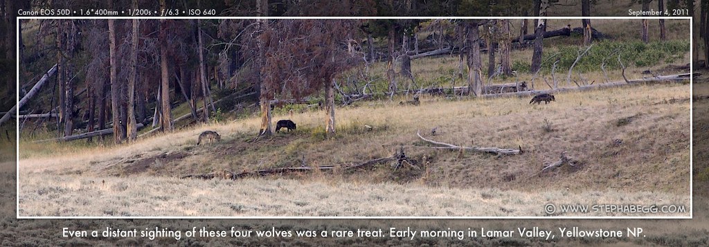
 Other wildlife 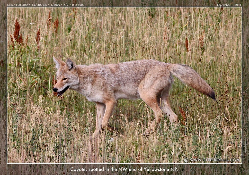
 |
2
| Located in the northern end of the park, this very accessible
132-foot waterfall is a short walk from the parking lot. The towerlike
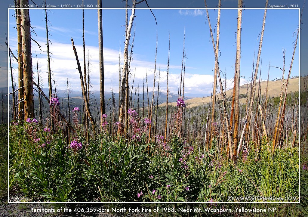
black rocks of the area are volcanic basalt. The trail to the base of the falls was closed due to washout, so I didn't get any good photos of the falls. But that was okay, as I was more captivated by the basalt formations alongside the road (just north of Tower) and the evidence of the 406,359-acre North Fork Fire of 1988 (just south of Tower) than the crowded Falls viewpoint. |
PHOTOS (Click to enlarge) Along the road near Tower Falls 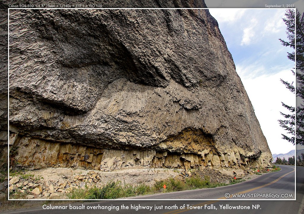
|
3
| On my first day in the park, I hiked/biked to the summit of the 10,243-ft Mt. Washburn since I wanted the "commanding vistas in all directions" that my guidebook mentioned. The vista ended up being somewhat lackluster due to the haze of clouds, but the summit view did give a nice overview and sense of the largeness of the park. The actual climb of Mt. Washburn is a 6-mile 1400-ft-elev-gain hike on a wide dirt path. There is a fire lookout at the summit with part of it open to the public. Since the path was rather loose and steep in sections, I ended up biking about half and pushing my bike about the other half. Although I did not realize it until a couple of days later, this was actually my first mountain summit since I nearly lost my leg in a climbing accident in September 2010. At 352 days since the accident, this made it within a year! |
PHOTOS (Click to enlarge) On the summit 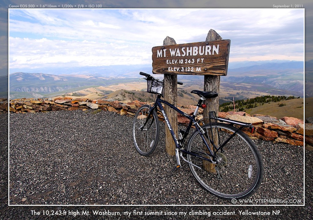
|
4
| Although Yellowstone is best known for its geysers and wildlife, for
many visitors the Grand Canyon of the Yellowstone is the park's most
memorable feature. This 20-mile-long canyon ranges 1,500-4,000 feet
across and has colorful yellow, pink, orange, and buff cliffs that drop
as much as 1,200 feet on either side. The canyon was created as water
from melting glaciers eroded the geothermally-weakened rhyolite lava
flows in the area. Two towering waterfalls mark the contact of harder
and more erodible regions of rhyolite. The Lower Falls is a breathtaking
308-foot drop (twice the height of Niagara Falls!) and the Upper Falls
is a slightly-less-dramatic-but-still-impressive 109-foot drop. The
Brink of the Lower Falls and Brink of the Upper Falls let you peer over
the
edges as water plummets in a thunderous roar over the precipice. It was
as I was peering over the Lower Falls that my Nalgene waterbottle
decided it was time to jump. I only wish it had given me a bit more
warning so I could have taken a photo of its suicidal yet majestic
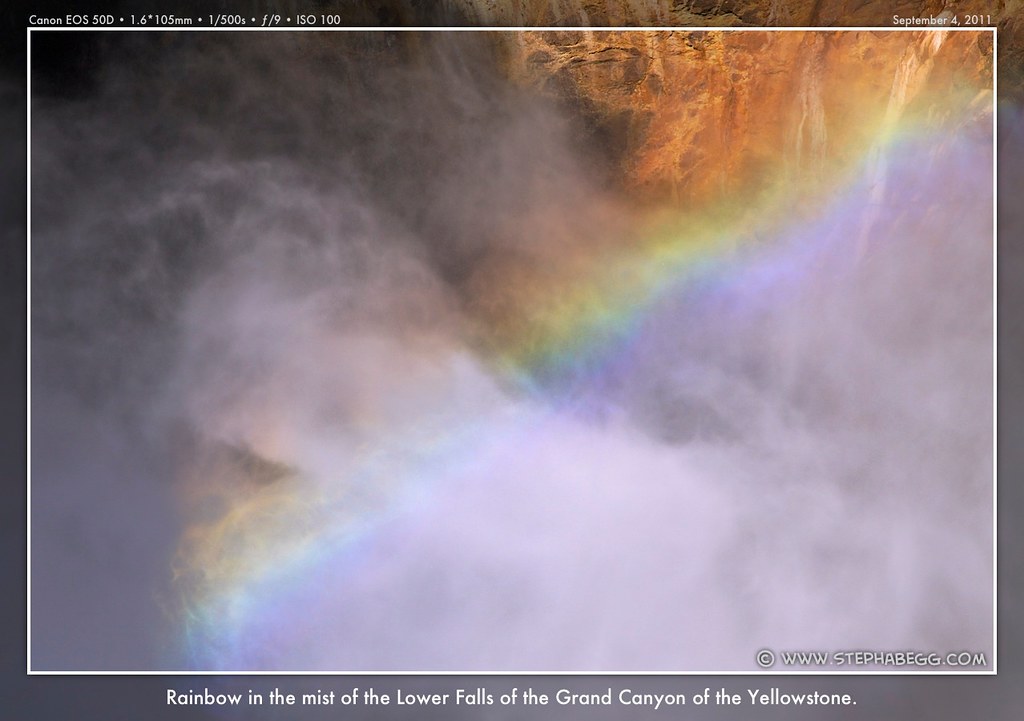
plunge into the roaring spray below. Grand Canyon is accessible by road from both the north and south sides, and there are multiple overlooks. Of course, over the course of my Yellowstone visit, I went to both sides and all overlooks. Although I marveled at the dramatic Brinks and enjoyed revisiting the Red Rock Point of our 1994 family portrait, my favorite overlook was Uncle Tom's Trail on the South Rim which descends on metal ladders and ramps literally bolted to a vertical hillside to an overlook that directly faces the 308-foot Lower Falls. Being midday with the sun slightly behind me, there was a gorgeous rainbow. (Interesting note: Uncle Tom's Trail was named after Tom Richardson, who, with the help of wooden ladders and ropes, used to lead paying tourists to the base of the falls until his permit was revoked in 1903. This would have been an impressive feat given the cliffy terrain, so I wonder if his permit was revoked after some fatal accident occurred....) Definitely out of place on the lip of the Grand Canyon of the Yellowstone is a signed "Glacial boulder" on the North Rim road. I had to stop and take a photo of this 500-ton chunk of the Beartooth Mountains that was deposited here by a glacier during the glaciation that ended 15,000 years ago. |
PHOTOS (Click to enlarge) Upper Falls 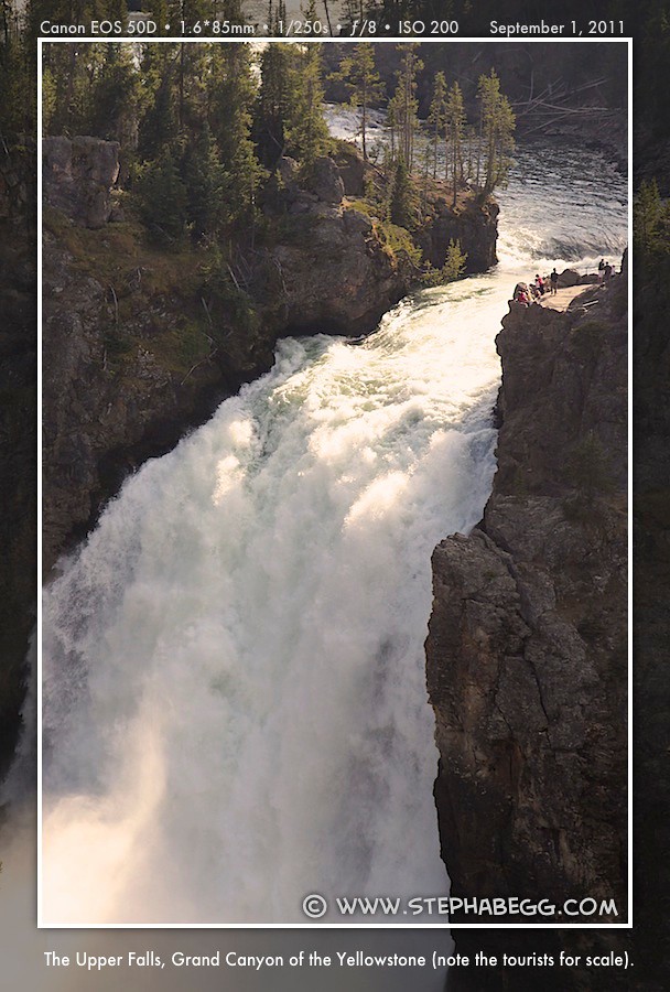
Lower Falls 
Glacier Boulder 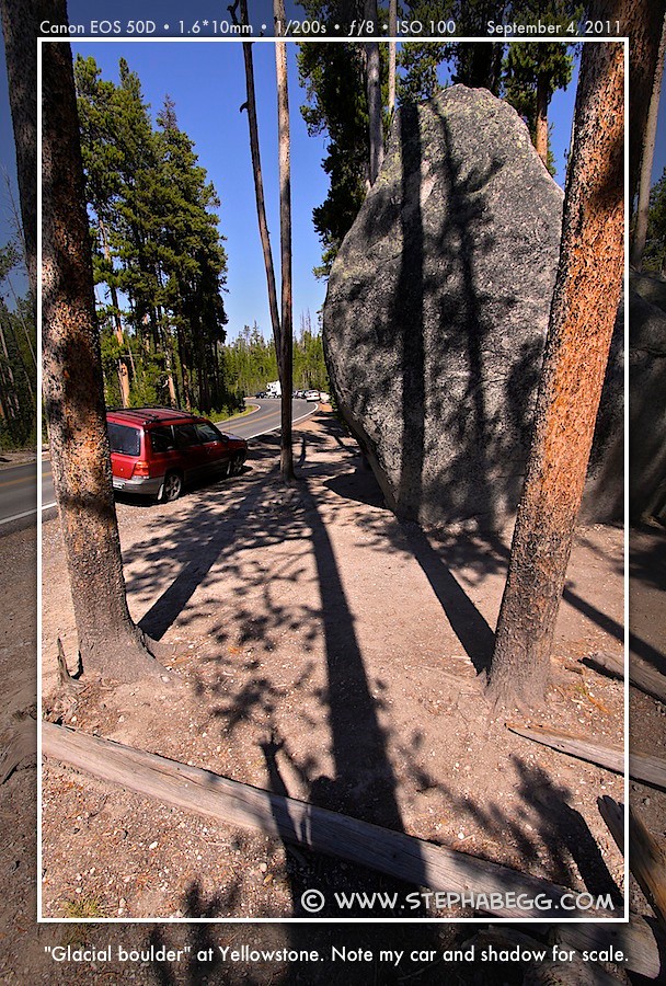
|
5
| This lovely open valley south of Canyon is a mix of grasses and
sage, with occasional lodgepole pines. Reaching eight miles across, this
relatively level part of the park was once occupied by an arm of
Yellowstone Lake. The sediments left behind by the lake, along with the
glacial till, do not hold sufficient water to support trees, so the area
is occupied by grasses, forbs, and sage. It's a great place to escape
the crowds, as well as to see grazing bison and elk, plus the occasional
grizzly, especially on the east side of the valley. Waterfowl,
including Canada geese, trumpeter swans, pelicans, and many kinds of
ducks, are plentiful in marshes along the Yellowstone River. According to numerous signs in the valley, bison are dangerous animals that must not be approached. I was hoping to find a bison for a backdrop of one of the signs, but the park seemed to have realized the photographic-potential of this scene, and the signs were placed in the rare patches of bison-infrequented forested areas. Also, I discovered that I am much better at handling traffic jams when it is because of a bison in the road or an elk in the field. (In fact, I think my camera and I even started a traffic jam or two during my time in Yellowstone.) Stand-still traffic in Seattle, that's another matter. |
PHOTOS (Click to enlarge) Hayden Valley 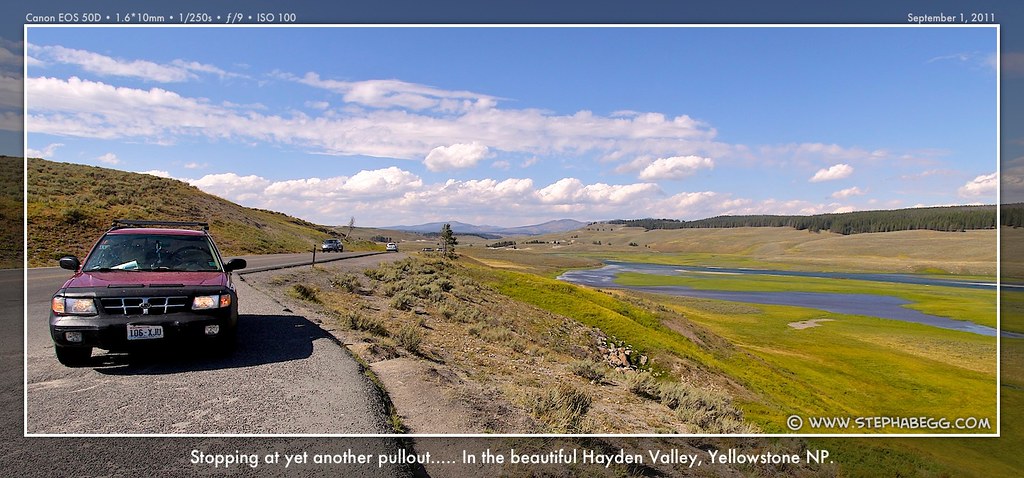
Wildlife 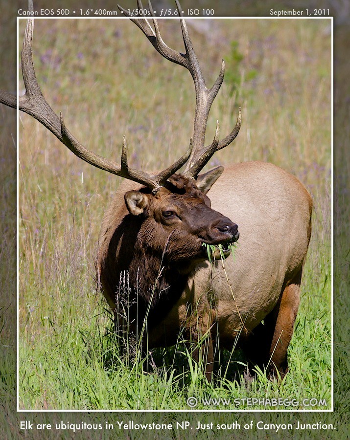
 |
6
| A bad case of geological heartburn. The names tell it all: Dragon's Mouth Spring, Churning Caldron, and Sulphur Caldron. The thermal features in the Mud Volcano area are primarily mud pots and fumaroles. Fumaroles are vents that shoot steam, carbon dioxide, and even hydrogen sulphide gas. Mud pots are essentially wet fumaroles. Hydrogen sulfide gas combines with water to produce hydrosulfuric acid. This acid then breaks down surrounding rocks to form clay, and the clay combines with water to create mud. As gas passes through the mud, it creates the bubbling mud pots. Hydrogen sulfide is poisonous, and toxic fumes sometimes kill bison and elk that cluster around the geothermal areas in the winter. As far as mud bubbles go, I thought those at the Artist Paint Pots and Fountain Paint Pots were much more impressive than the ones in the Mud Volcano area. |
PHOTOS (Click to enlarge) Mud bubbles 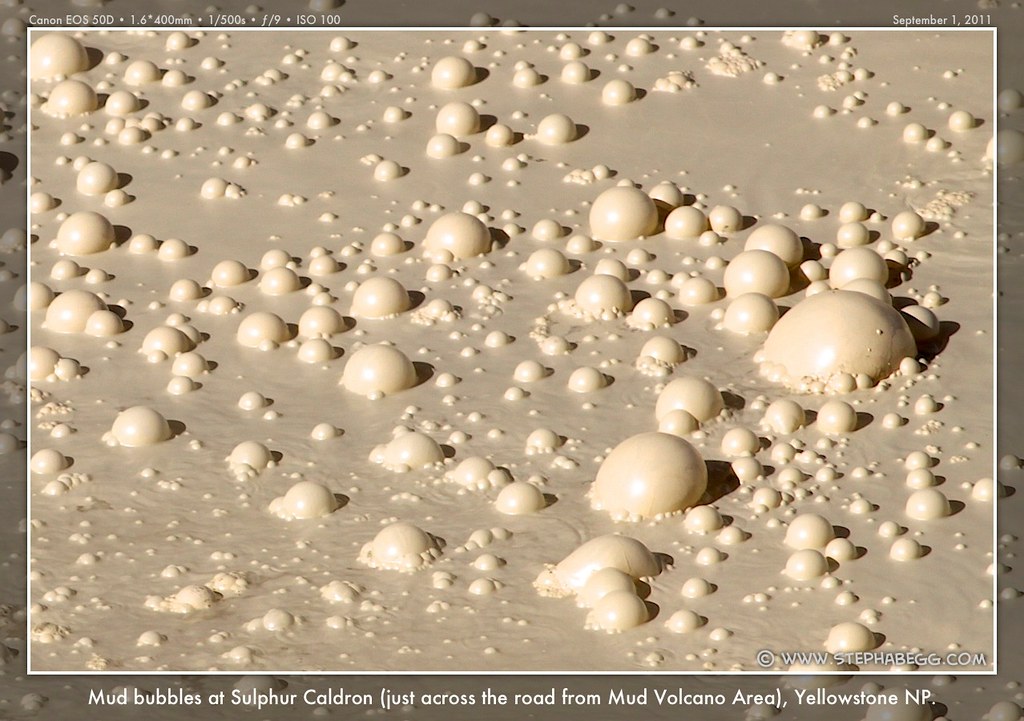
|
7
| The statistics for Yellowstone Lake are impressive: 110 miles of
shoreline, 20 miles north to south and 14 miles east to west, with an
average depth of 139 feet and a maximum depth of 390 feet. Set in an
ancient volcanic caldera, Yellowstone Lake is also America's largest
high-elevation lake. The lake is covered by ice for at least half the
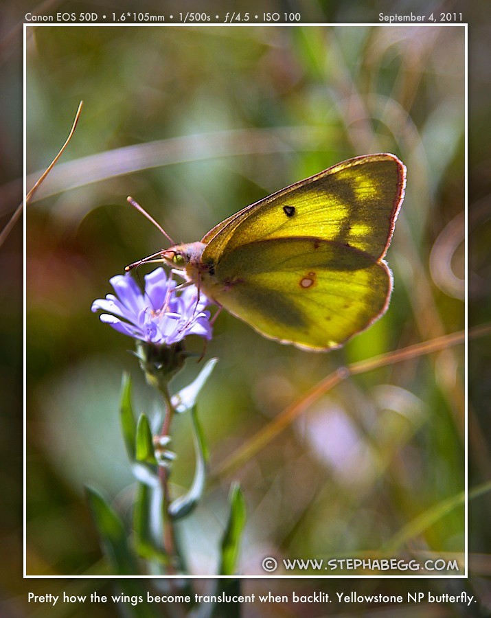
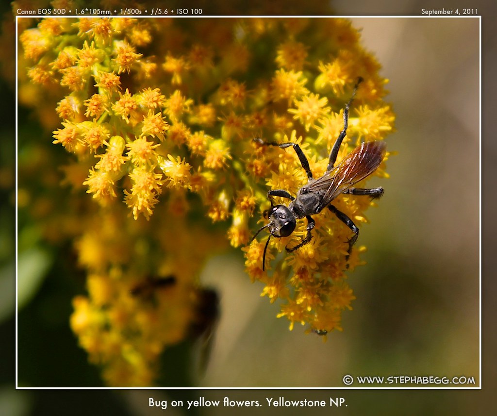
year, but boat tours and fishing are popular during the summer. Lake Yellowstone Hotel, built in 1889-1891, lies on the shoreline of its namesake. The hotel is the second-largest wood-framed building in North America and requires 500 gallons of paint each year to keep it in shape. Today, Lake Yellowstone Hotel is one of the nicest places to stay in the park. But one night costs about the same as a couple weeks worth of camping, so I hung out in the Sun Room for a few minutes, snapped a few photos, and then found some butterflies in the nearby field. |
PHOTOS (Click to enlarge) Lakeside bugs 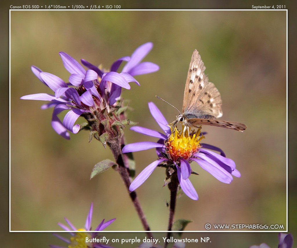
|
8
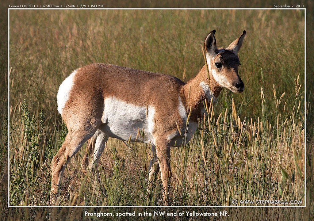
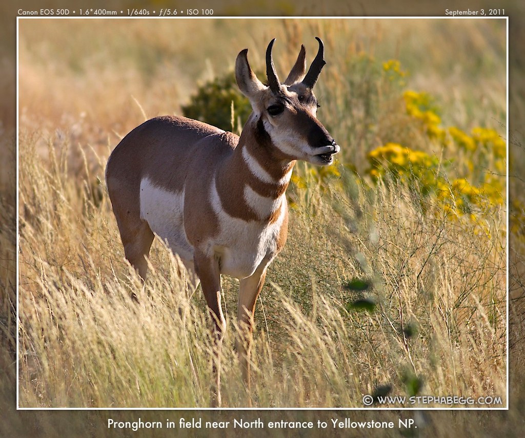
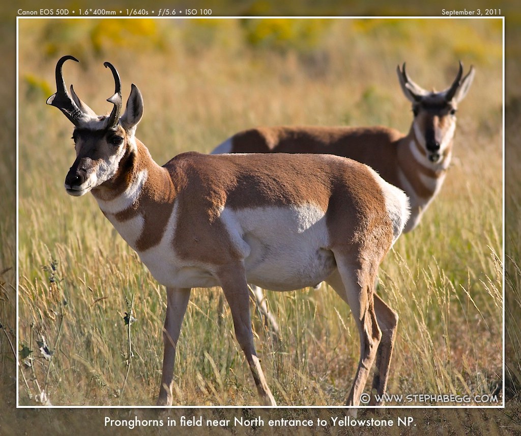
| For the first four nights of my trip, I stayed at the Yellowstone RV Park in Gardiner, so I became very
familiar with the area around the North entrance to the park. A couple of times when I was taking a break from the crowds or processing photos, I
went on a bike ride on the 5-mile stretch between the North entrance
and Mammoth. There were almost always pronghorn in the field, and
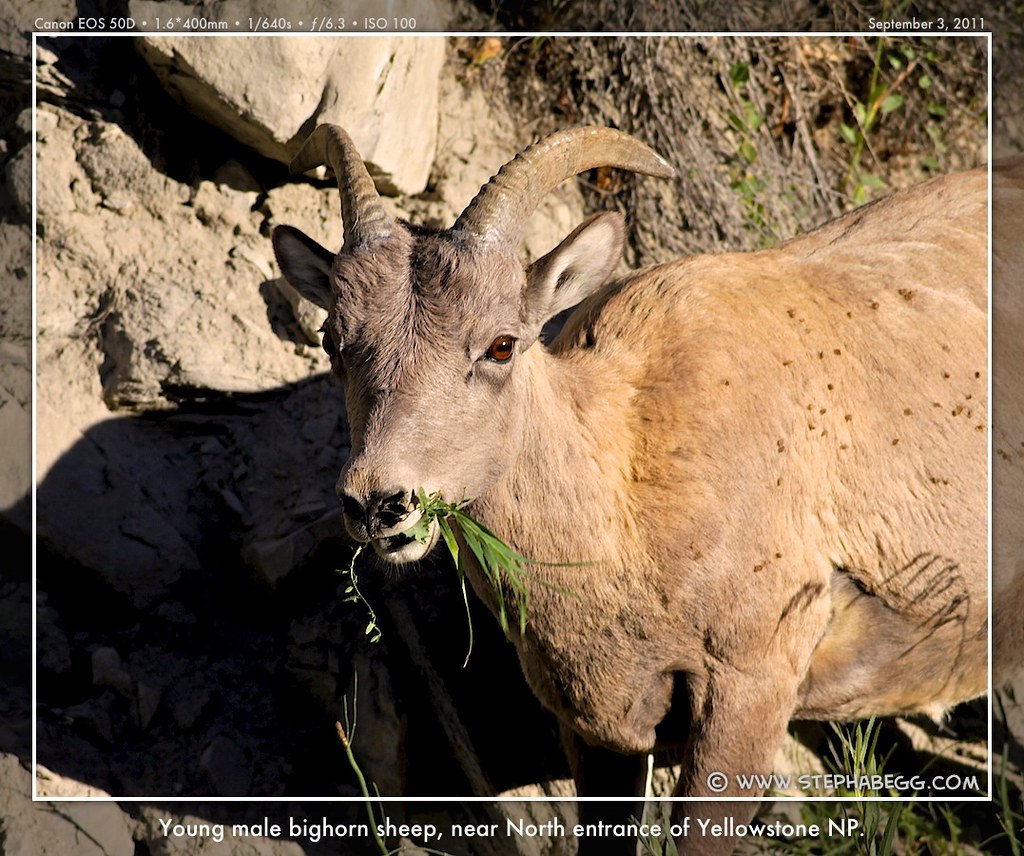
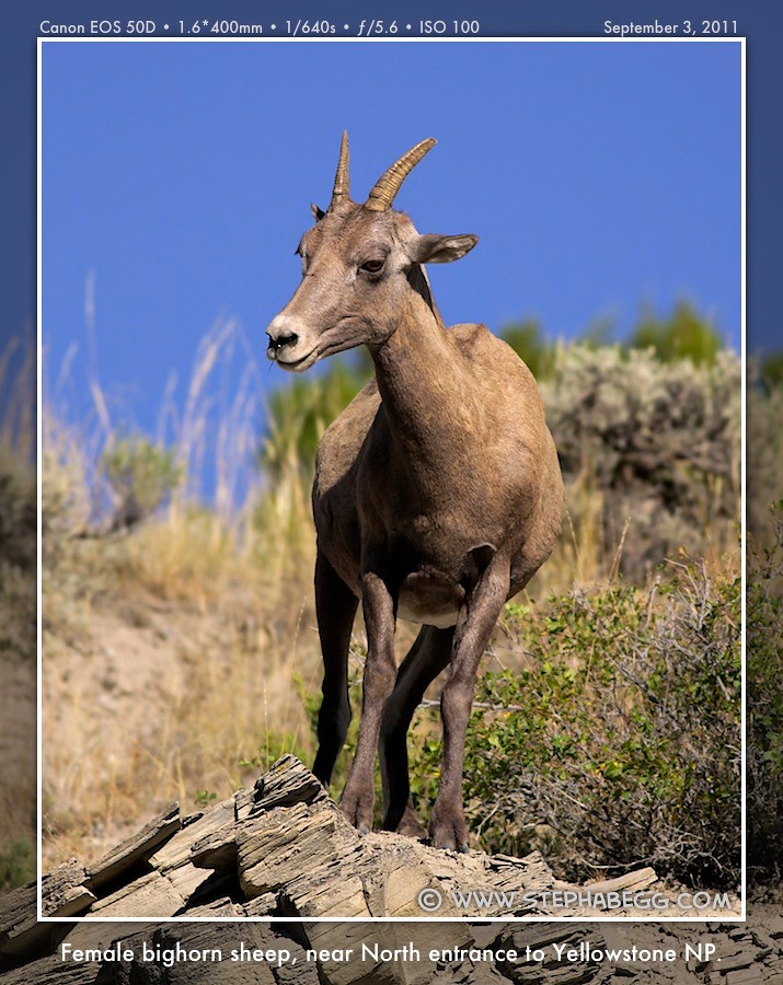
bighorn sheep on the hillsides. Also at the North entrance is the Roosevelt Arch, which was built in 1903 and dedicated by President Theodore Roosevelt, a man regarded by many as Yellowstone's patron saint. Gardiner—founded in 1880 and now hosting a population of about 800—was the primary entry route into Yellowstone for many years, and remains the only year-round entrance to the park. I really enjoyed my stay in Gardiner. I even came to grow fond of the water spicket at my campsite, which took it upon itself to be the resident geyser every time I filled my water bottle. |
PHOTOS (Click to enlarge) Roosevelt Arch  Wildlife 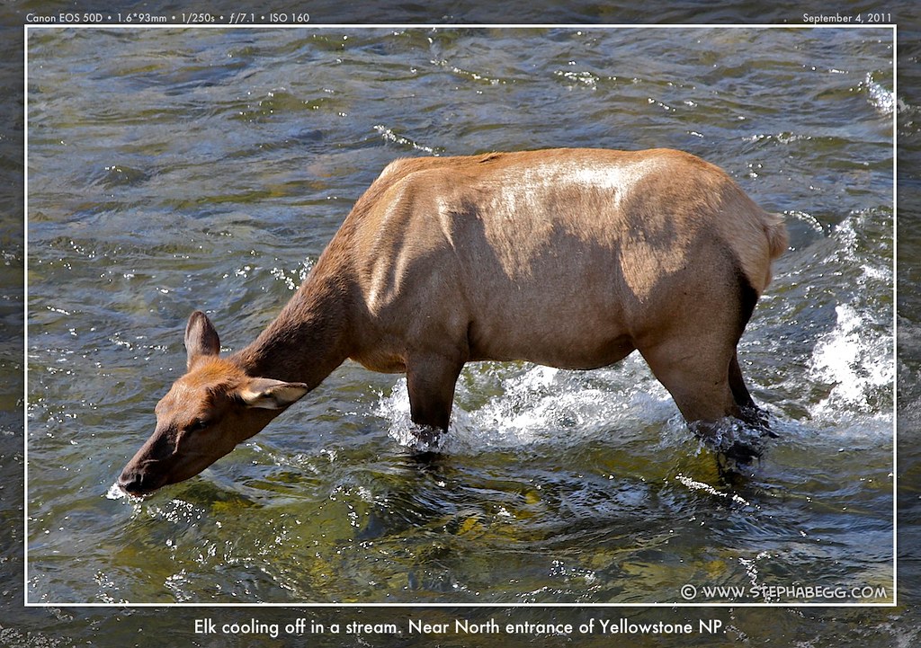


|
9
| The underground water temperature under Mammoth is not hot enough to form geysers, so the area instead consists of hot springs. Mammoth Mammoth Hot Springs consists of a series of multihued terraces down
which hot, mineral-laded water trickles. This water originates as snow
and rain that falls on the surrounding country. As it passes through the
earth, the water comes into contact with volcanic magma containing
massive amounts of carbon dioxide; the now-acidic water passes through
and dissolves the region's limestone, and the calcium carbonate remains
in solution until it reaches the surface. Once on the surface, the lime
precipitates out, forming the travertine terraces that are so prominent
at Mammoth. The rate of accumulation of travertine is astounding: more
than two tons a day at Mammoth Hot Springs. The springs are constantly
changing as limestone is deposited and water is forced in new
directions. As a result, old dried-out terraces stand on all sides,
while new ones grow each day. One of the most interesting aspects of the
hot springs here is the variety of colors, a result of the many
different species of algae and bacteria that live in the water. Various
factors, including temperature and acidity, affect the survival of
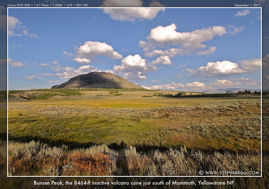
different species. Since I stayed most nights in Gardiner, I passed through the Mammoth area often. I found a lot to photograph in the area immediately around Mammoth. The fields along the road between Mammoth and the North entrance at Gardiner often contained wildlife as I drove by in the morning (I took so many photos in that area that I made a "North Entrance Area" section on this page). And immediately to the south, the road travels through a narrow canyon of hoodoos with the pretty Rustic Falls waterfall and then Bunson Peak. Since Mammoth is a popular area among tourists, are plenty of signs in this area warning about the dangers of approaching wildlife. Yellowstone is not a petting zoo. An apropos quote from Lee Whittlesey's Death in Yellowstone: Accidents and Foolhardiness in the First National Park. "Can you tell me something? These animals that are just running around out here....they couldn't be wild, could they, or you wouldn't just have them running around loose?" |
PHOTOS (Click to enlarge) Hot Springs 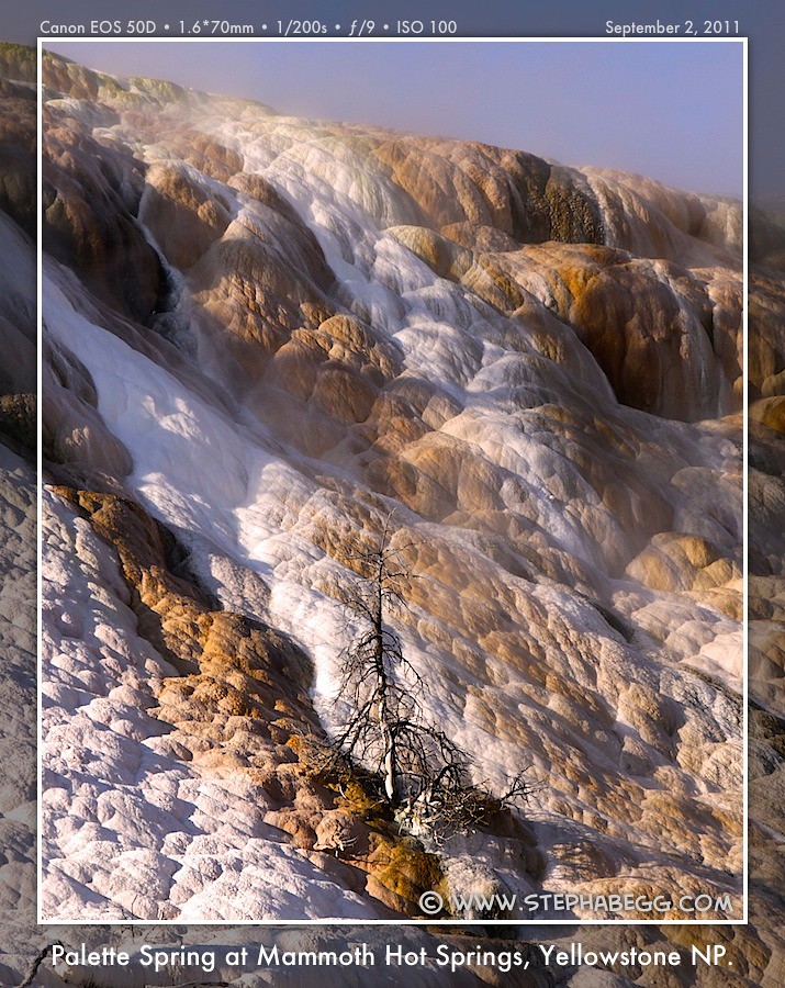
Just south of Mammoth 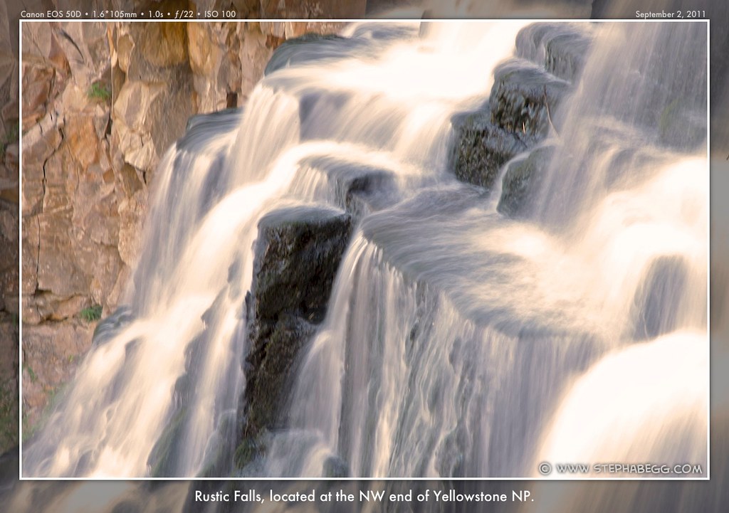
Other 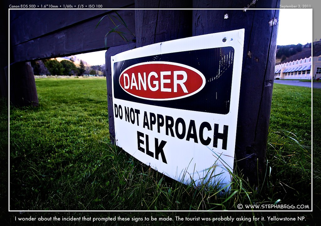
|
10
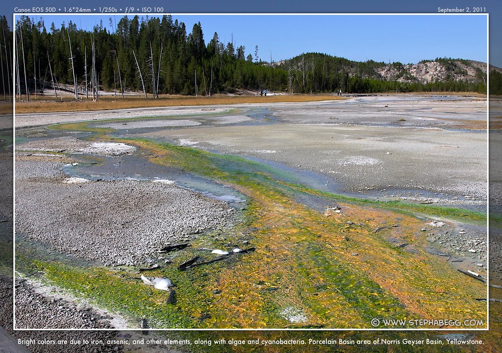
| Norris Geyser Basin is Yellowstone's oldest active geyser
basin. The area sits atop the junction of several major fault lines,
providing conduits for heat from the molten lava below. Because of this,
it is apparently the hottest geyser basin in North America, if not the
world. Norris Geyser Basin is an open, barren place, due to the high
acidity of the water. Even so, I found it to be one of the most colorful of the geyser areas. It's also a constantly changing place, with small
geysers coming and going on an almost daily basis. |
PHOTOS (Click to enlarge) Porcelain Basin 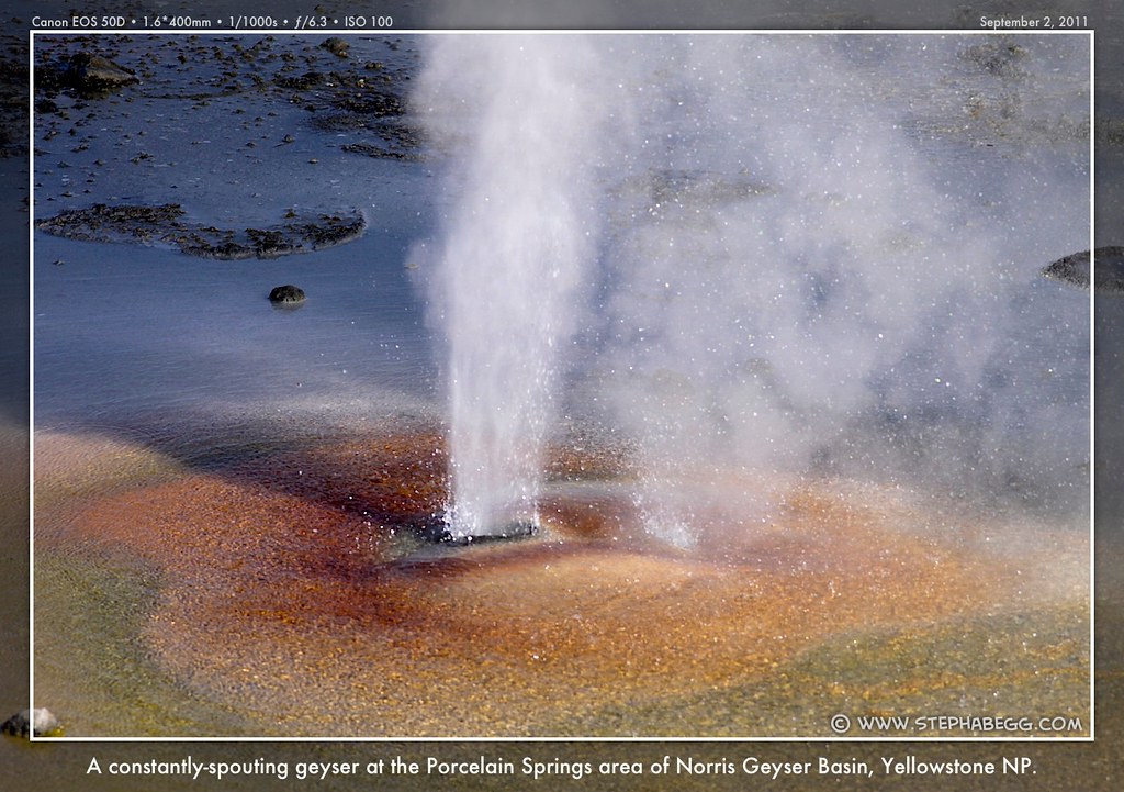

Back Basin 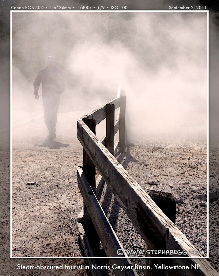

|
11
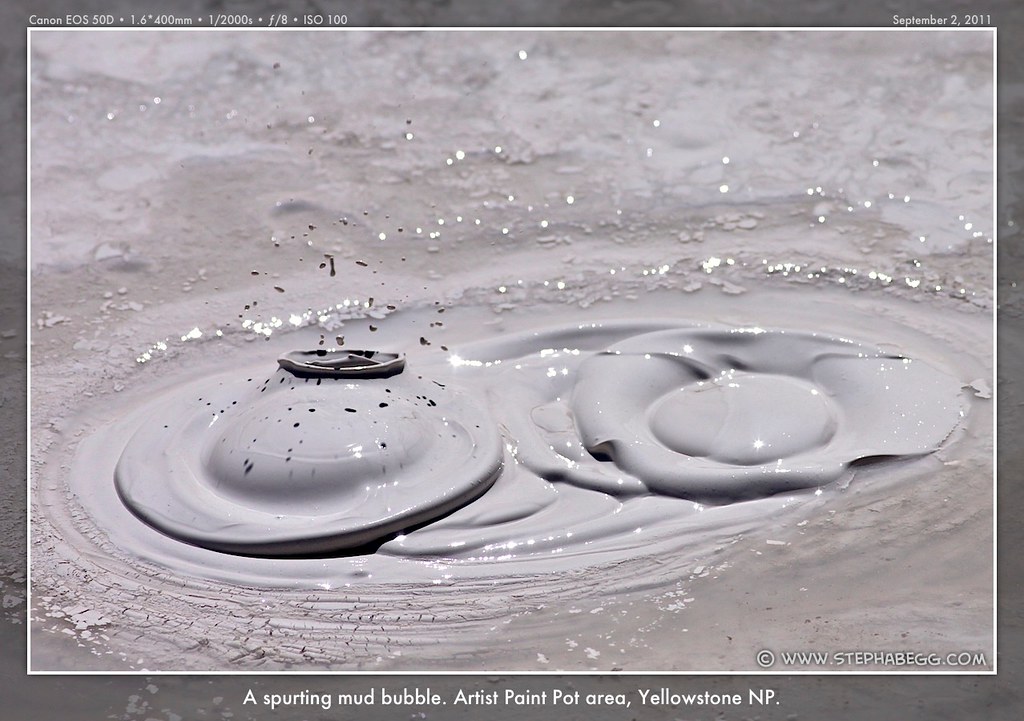
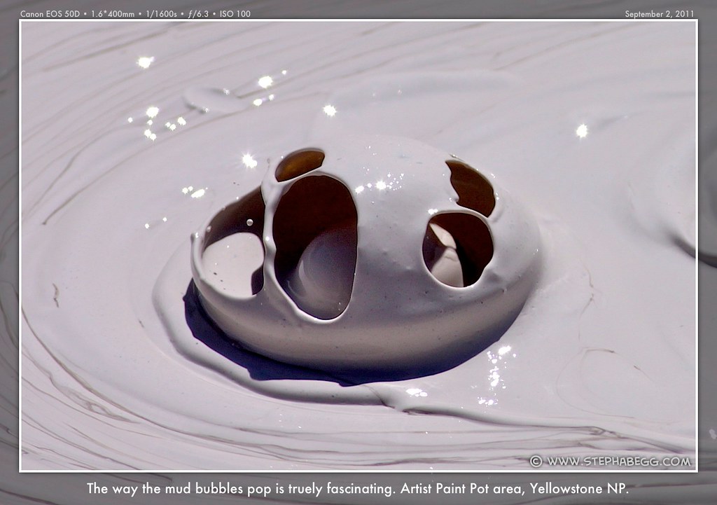
| The Artist Paint Pot area, just south of the Madison junction, is
filled with colorful plopping and steaming mud pots and hot springs.
Although it's a short hike, the paint pots see far fewer visitors than
the roadside attractions, making this a nice place to escape the crowds. It was the mud pots that captured my attention here. (Mud pot formation was described earlier in the Mud Volcano section.) I found I had to use a shutter speed of about 1/1000 and high-burst mode in order to capture the unique and fleeting mud bubbles. The mud bubbles seem alive, and each has a unique personality. I could have spent my whole week photographing those mud bubbles, but after about a thousand photos, I decided to move on....after all, there were more mud pots to be found at the Lower Geyser Basin.... |
PHOTOS (Click to enlarge) Mud bubbles 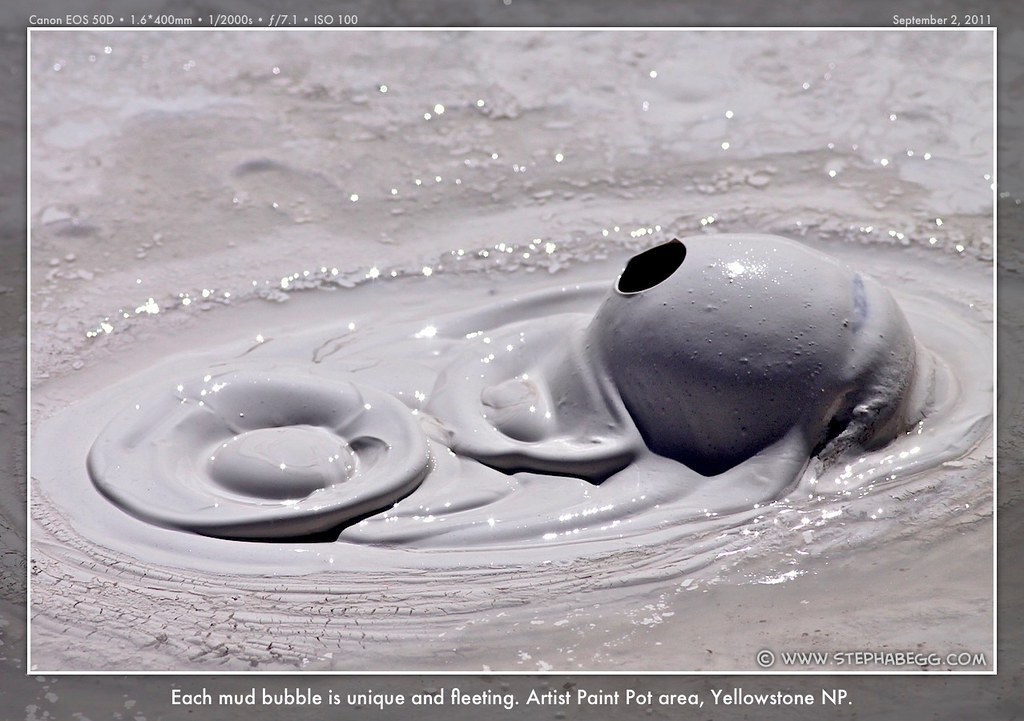

|
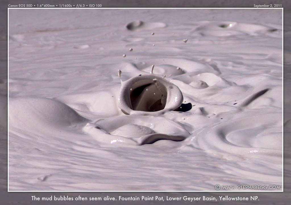
12
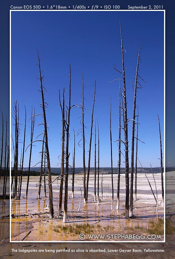
| The Fountain Paint Pot (at least for me) is the main attraction of the Lower Geyser Basin. Like the Artist Paint Pots, the mud bubbles of the Fountain Paint Pots are created by pressure from steam and gases, which can thrown gobs of mud 20 feet into the air. I spent another hour in high-burst mode photographing these mud bubbles. Other attractions at the Lower Geyser Basin are the colorful Silex Spring (colored by different kinds of algae and bacteria) and the almost constantly-erupting Clepsydra Geyser (I remembered an 11-year-old me sitting on the wooden railing in front of the geyser getting my photo taken by my mom). Also in the area are dead lodgepole pines, which are being petrified as silica is absorbed, creating a bobby-socks appearance. And the gigantic Great Fountain Geyser on the opposite side of the road is closer to Lower Geyser Basin than anywhere else, so I included it in this section. Witnessing an eruption of this geyser is a rare treat, since it erupts only every 10-14 hours. |
PHOTOS (Click to enlarge) More mud bubbles 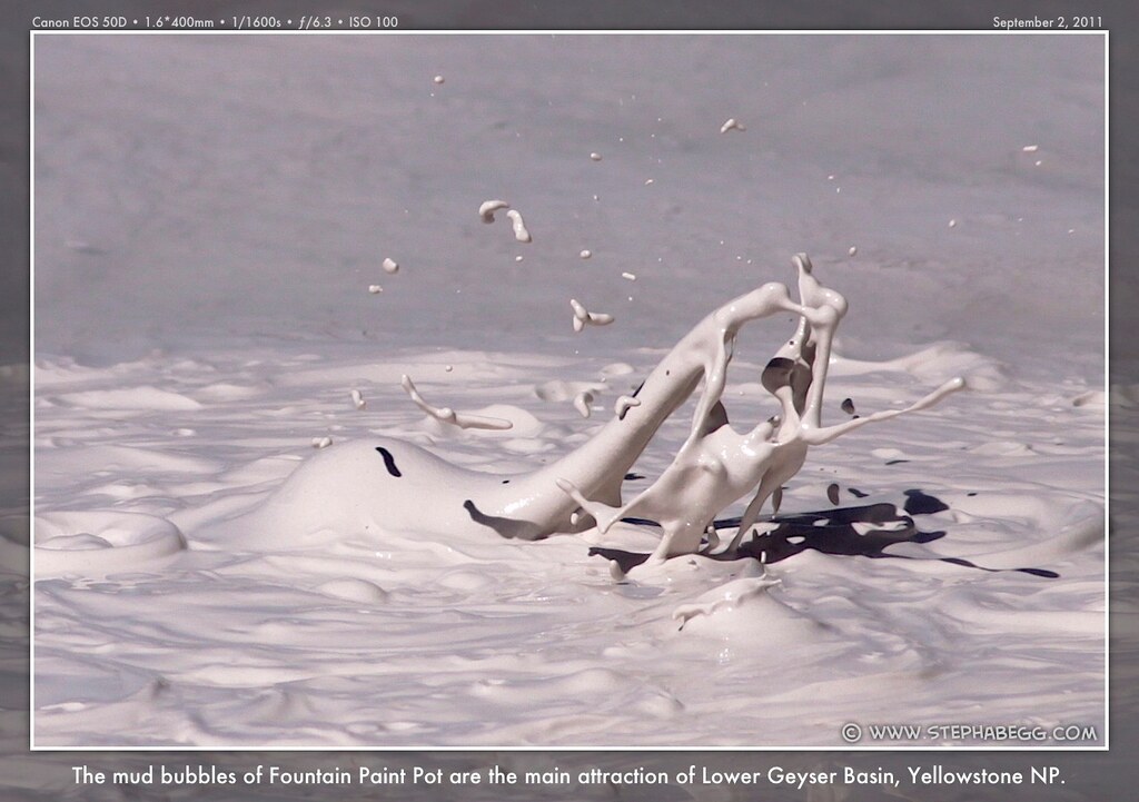
 Silex Spring 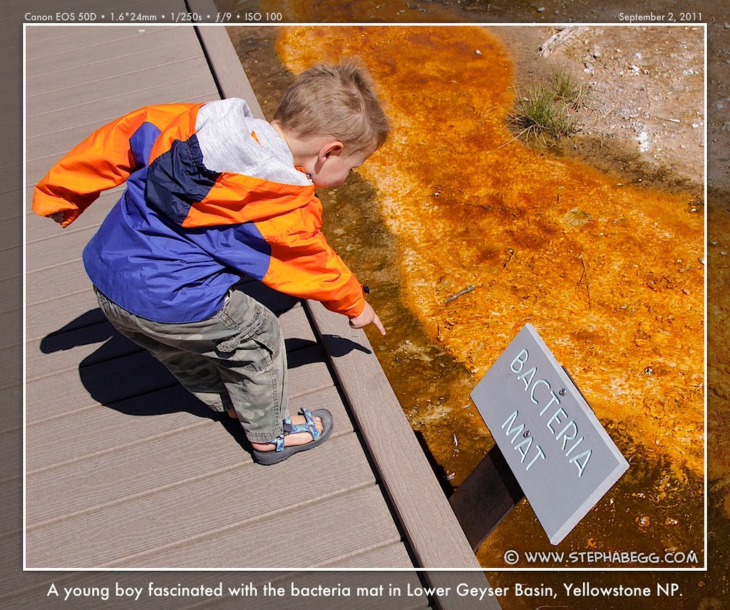
 Clepsydra Geyser 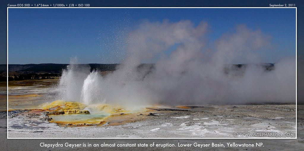
 Petrifying Lodgepoles 
 Great Fountain Geyser 
|
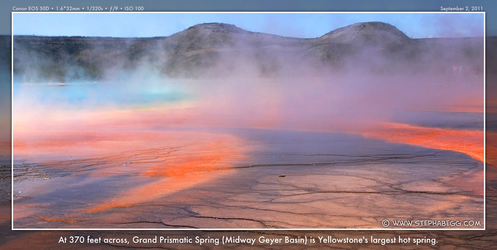
13
| Midway Geyser Basin is a large and readily-accessible—and hence tourist-ridden—geyser basin
with a loop path leading to most of the sites. The featured attractions
are the spectacular Great Fountain Geyser and the brilliant-colored
Grand Prismatic Spring, Yellowstone's largest at 370 feet across. The colors in
Yellowstone's hot springs come from a variety of sources,
including algae and bacteria as well as various mineral, particularly
sulfur, iron oxides, and arsenic sulfide. The algae and bacteria are
highly temperature specific and help create the distinct bands of colors
around many hot springs. This is an area of grand sights and bright colors. The first time I stopped here was at the beginning of Labor Day weekend. The first thing I noticed was the rather impressive line to the outhouse. But I figure a trip to Yellowstone without traffic jams and line-ups is like a trip into the North Cascades without bushwhacking—i.e., incomplete and somehow disconcerting; so I tried to relish the crowds as part of the authentic Yellowstone experience. I did a quick lap of the teeming boardwalk, taking about 100 photos in the process, and decided to come back after the holiday weekend was over (unfortunately, I never did make it back, as I got too distracted by the big geysers of the Upper Geyser Basin). |
PHOTOS (Click to enlarge) Great Fountain Geyser 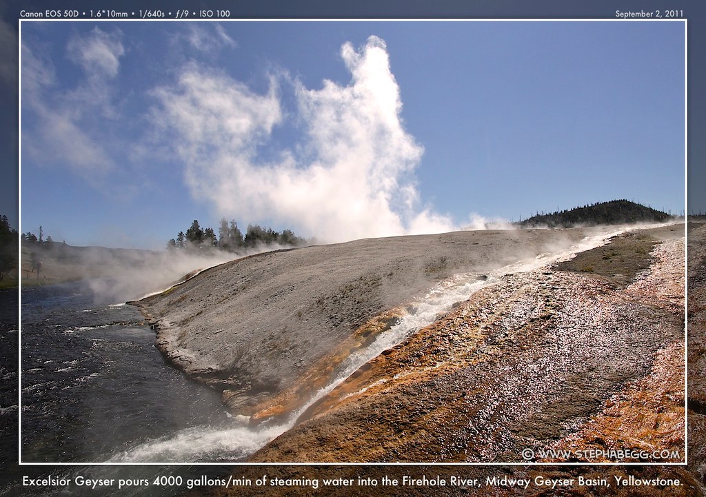
 Grand Prismatic Spring 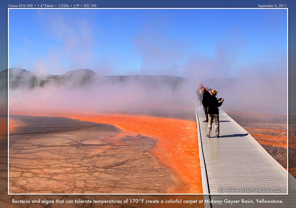
 Part of the Yellowstone experience 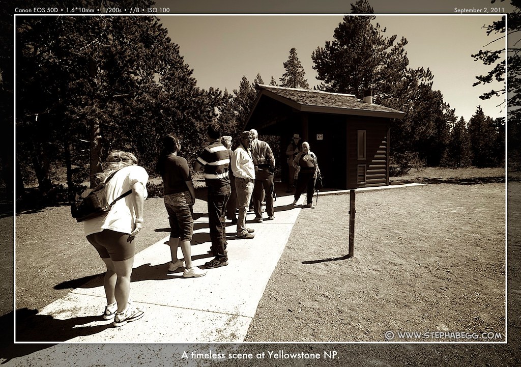
|
14
| The scene is almost comical. With each tentative spray, camera
shutters begin to click. The benches are packed with hundreds of people.
Then, suddenly, the geyser shoots a jet of water skyward, and shutters click frantically and exclamations are heard in
languages from all over the world. Then, as suddenly as it started, the
eruption stops. Tourists erupt from their
seats and make a
mad rush back to the visitor center, the store, the hotel, and
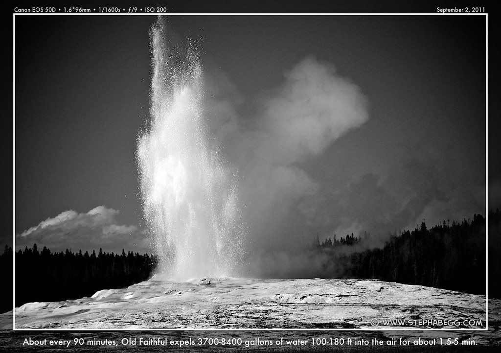
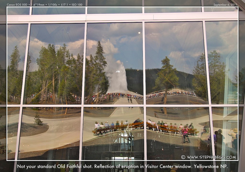
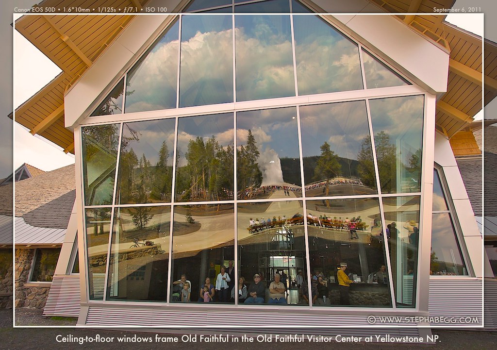
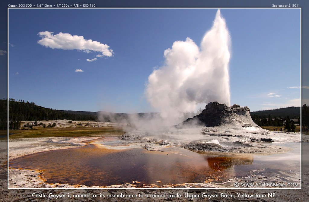
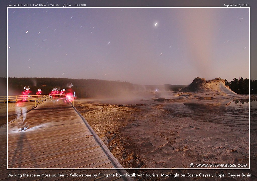
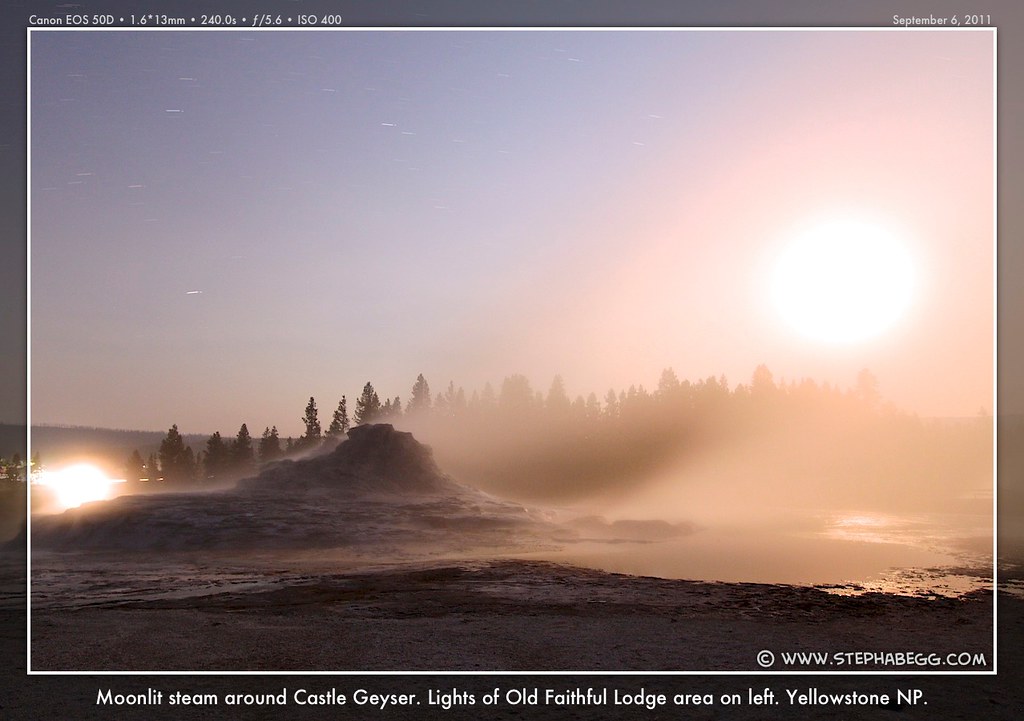
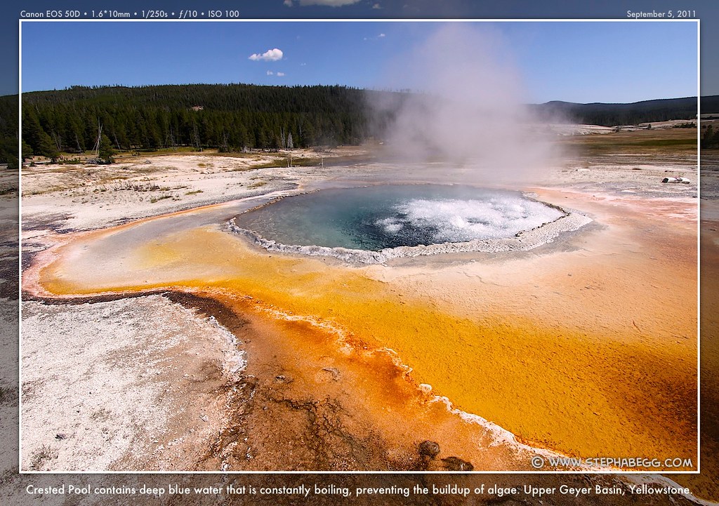
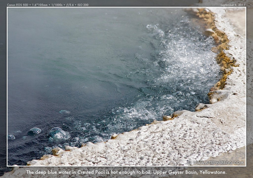
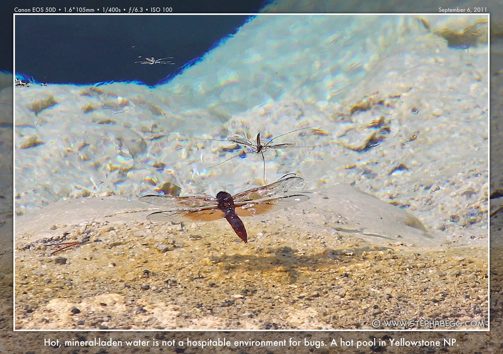
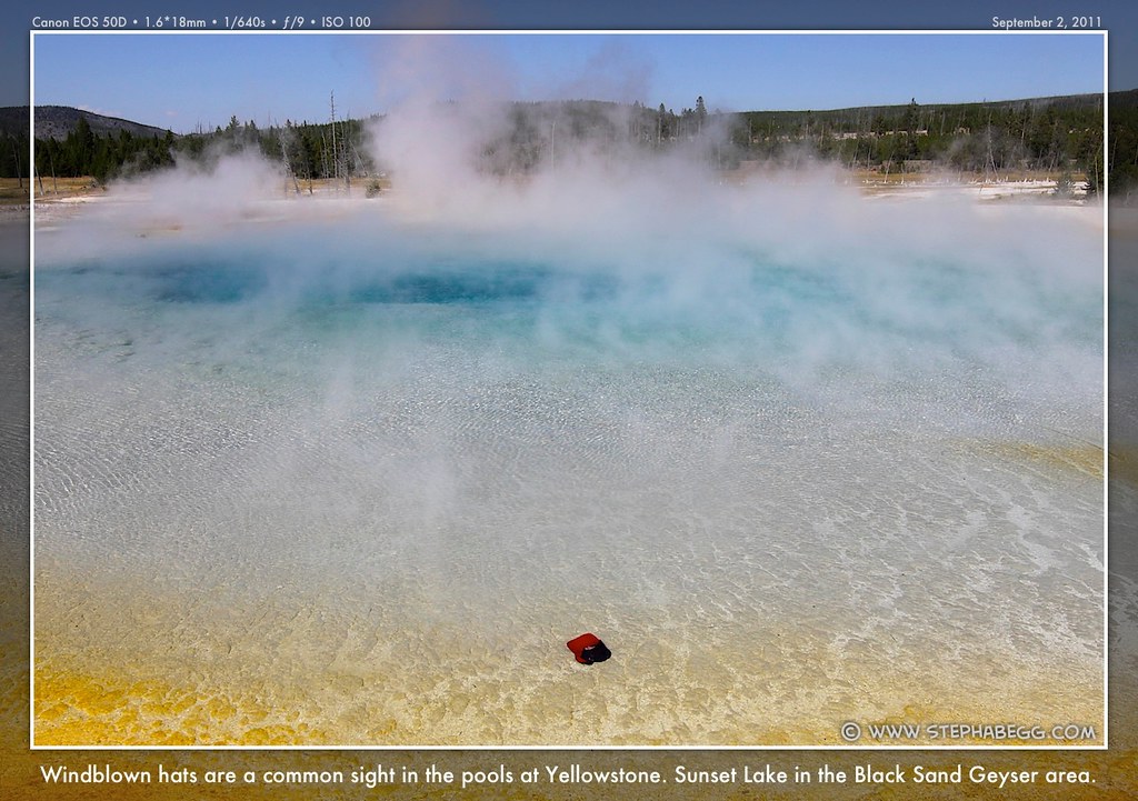
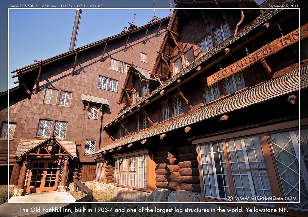
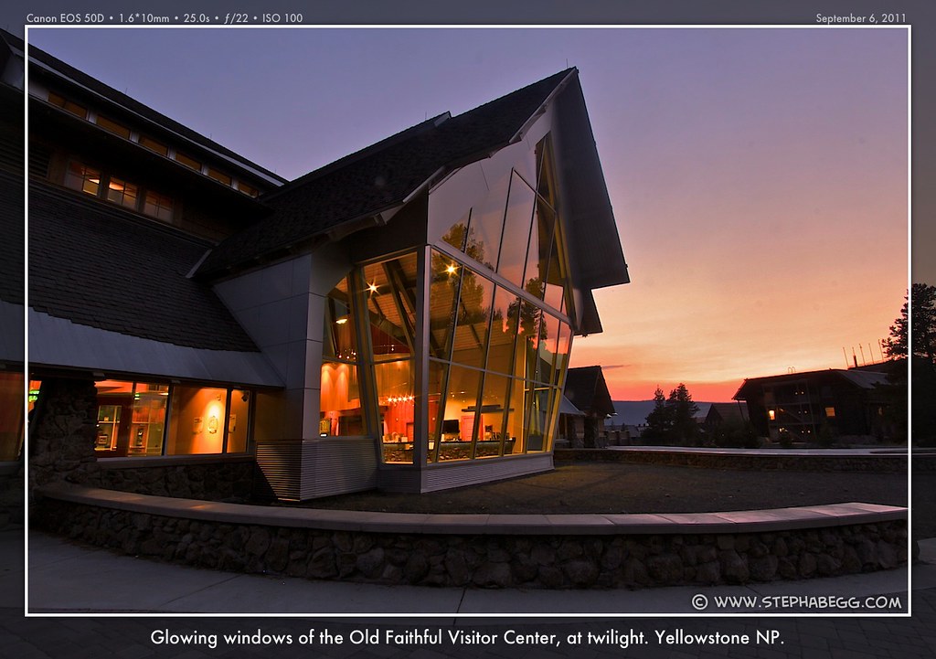
the bathrooms. The benches are empty. Then, a tentative spray.... The park's icon, Old Faithful Geyser is visited by virtually everyone who comes to Yellowstone. Old Faithful is neither the tallest nor the most frequently erupting geyser in the park but it always provides a great show and is both highly accessible and fairly predictable. For many years it erupted almost on the hour, but it has slowed in recent years and is now averaging about 90 minutes per cycle, from 51 to 120 minutes. In general, the greater the length of the eruption, the longer the interval until the next eruption. During a typical eruption, between 3,700 and 8,400 gallons of water are sent 100-180 feet skyward over the course of 1.5 to 5 minutes. So how does a geyser work? In a geyser like Old Faithful, steam bubbles upward from the superheated source of water and expands as it rises. These bubbles block the plumbing system, keeping hot water from reaching the surface. Eventually, however, pressure from the bubbles begins to force the cooler water above out of the vent. This initial release triggers a more violent reaction as the sudden lessening of pressure allows the entire column to being boiling, explosively expelling steam and water to produce a geyser. Once the eruption has emptied the plumbing system, water gradually seeps back into the chambers to begin the process anew. Some of Yellowstone's geysers have enormous underground caverns that fill with water; in its rare eruptions, for instance, Steamboat Geyser can blast a million gallons of water into the air! I first visited the Old Faithful area on the second day of my Yellowstone road trip. Since Old Faithful is only one of the many geysers in the Upper Geyser Basin area, I wanted to check out some of the other geysers in the area. So I did some postcard-viewing research at the Old Faithful Visitor Center. I was particularly drawn to a postcard featuring the beautiful Castle Geyser, which does indeed resemble a ruined old castle and expels water and steam 75 feet up into the air. I learned that I had just missed an eruption, and the next one would be 11-13 hours away. I decided to keep tabs on the eruption schedule (the park has an automated phone line which posts the next eruptions for various geysers) and come back in a few days. A few days later the geyser prediction hotline informed me that Daisy Geyser was erupting at 10:30am, Castle Geyser at 1:15pm, Riverside Geyser at 2:45pm, Great Fountain Geyser at 5:00pm, and the Grand Geyser at 6:30pm. (Note that these are some of the only predictable geysers in the park, many of the others are not predictable and you are lucky if you happen to be in the right place at the right time.) I figured there was just enough time to bike between the five geysers and catch the eruptions. Now that's the kind of bike touring I like! Of course, one of the goals of my trip was to photograph Old Faithful (and hopefully some other geysers too) erupting at night. This is definitely a challenge since you have just one shot per eruption, and many of the geysers erupt infrequently. My two nights of geyser night photography were my most favorite and most memorable times in the park—it is quite a unique and humbling experience to be the lone soul watching (and listening to) a gigantic geyser grumble and explode in the darkness. At night you can really enjoy the essence of Yellowstone without all the noise and distraction. When looking for a place to hang out between nighttime eruptions, I discovered that the lobby of the Old Faithful Snow Lodge had everything I needed: plug, wireless, and bathroom. And comfy couches as an added bonus. When it was 3am an still no one seemed to care or notice that I was there, I decided this would be a great place to spend a few nights. I'm thinking of writing "The Dirtbagger's Guide to National Parks".... My stay in the Old Faithful area spanned Labor Day weekend. I noticed the dissipation of crowds after Labor Day, and this inspired me to stay a couple of more days in the area, enjoying the rare opportunity to experience the most popular part of Yellowstone without walls of tourists on the boardwalks. My days here were very enjoyable, and I wanted to just stay here forever walking the boardwalks, biking on the bike trails and roads, and doing nighttime geyser photography. I took more photos in the Upper Geyser Basin than any other area of the park. |
PHOTOS (Click to enlarge) Old Faithful 


Geysers in Old Faithful area 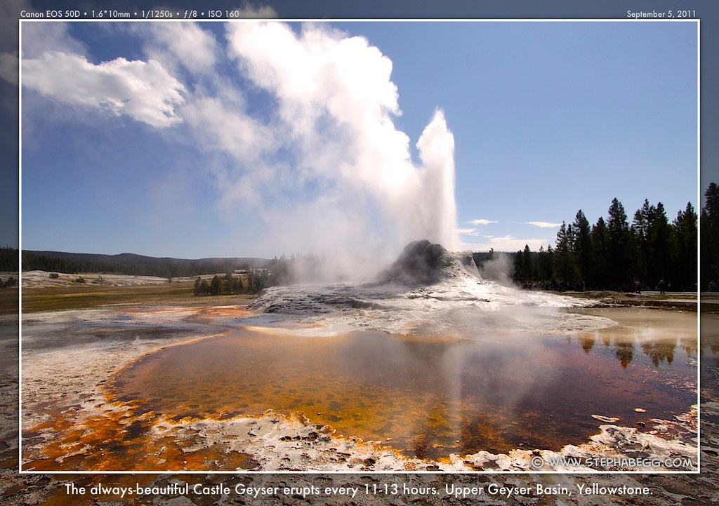
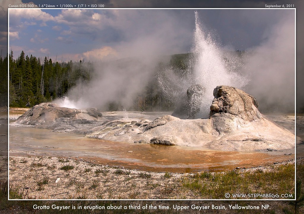

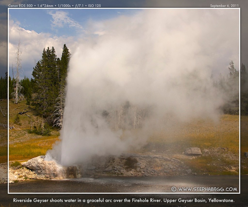

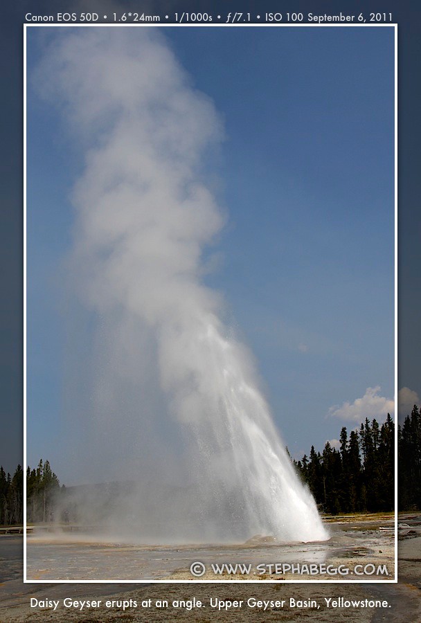
Pools in Old Faithful area 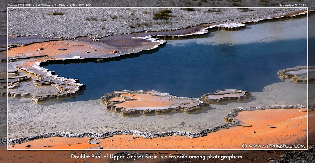
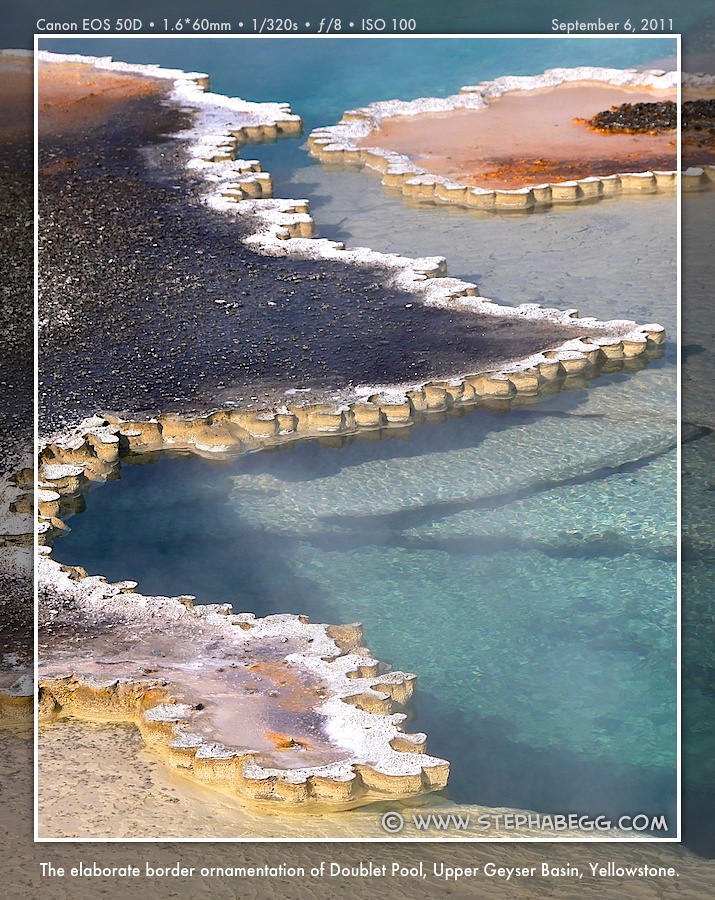
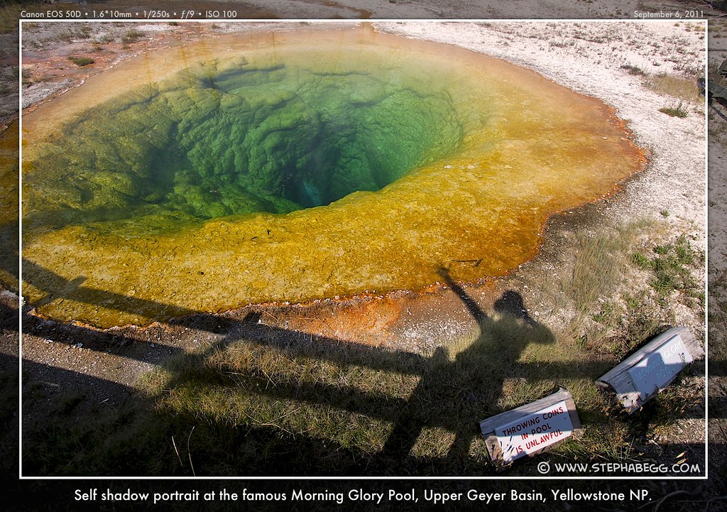 Black Sand Basin 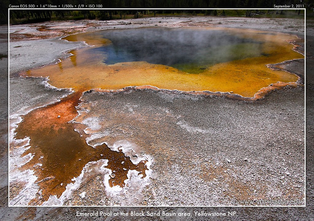
 Other 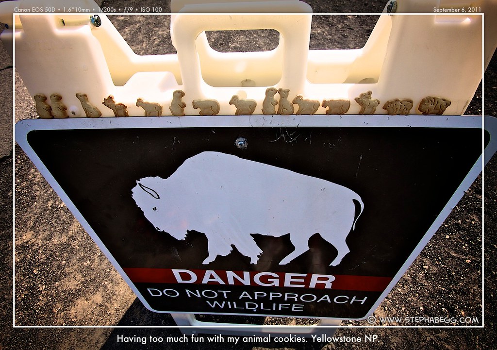


|
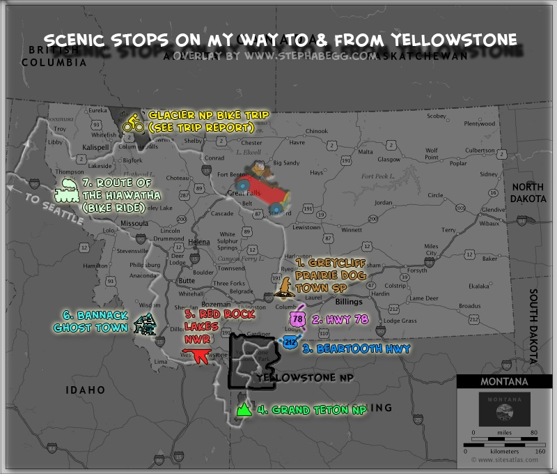
1
| When using my road atlas to plan my route between Glacier to
Yellowstone, I noticed that at the junction of HWY 191 and I-90 in
southeastern Montana was a "Greycliff Prairie Dog Town State Park." A
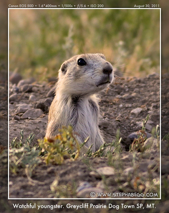
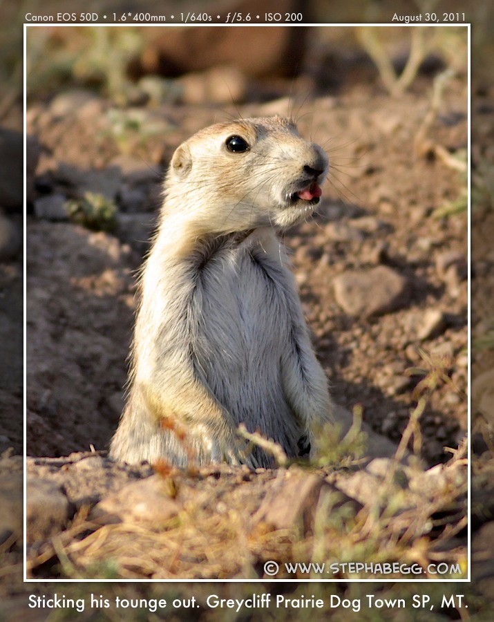
necessary stop for sure. The 98-acre state park consists of a self-pay box, a round-about parking area, and a few informative signs. And of course hundreds of black-tailed prairie dogs. The black-tailed prairie dog is unique to North America, and inhabits a broad belt of the short and mid-grass prairies from Canada, through the US and Mexico. The Greycliff prairie dog community is protected and preserved through the efforts of the Nature Conservancy, the Montana Departments of Transportation and Fish, Wildlife and Parks. I enjoyed a few hours photographing these cute and vociferous relatives of the ground squirrel (no, they are not related to dogs, but the name is a misnomer imparted by early French trappers who referred to them as "petit chien"). Black-tailed prairie dogs are very social animals, and the area was a symphony of barks and squeaks. When danger approaches (i.e. a photographer named Steph), prairie dogs sound an alarm call of sharp "barks" accompanied by flicks of the tail; the alarm call spreads quickly, and the entire park would become suddenly deserted as prairie dogs everywhere dove into their holes. This certainly made them a challenge to photograph. Patience is key, An interesting tidbit I read on the park's interpretive signs is the distinction between two types of mounds. Crater shaped mounds are usually "back doors" and dome shaped mounds are usually "front doors". Also, some of the prairie dog burrows reach a depth of fourteen feet. A fun and worthy stop, for sure. |
PHOTOS (Click to enlarge) Cute black-tailed prairie dogs 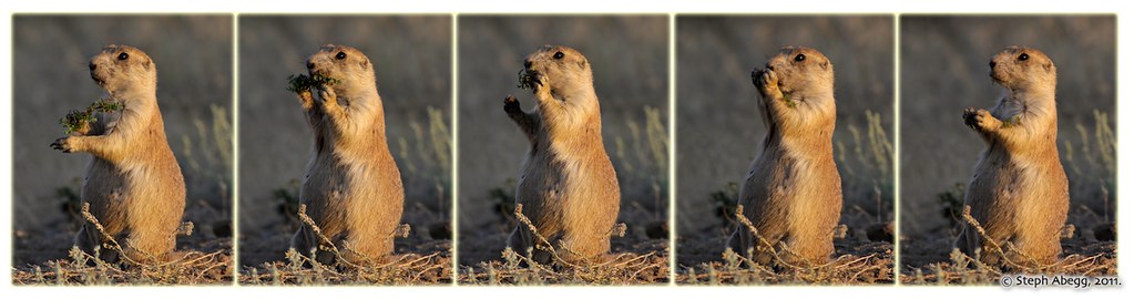
 "Front doors" and "back doors"  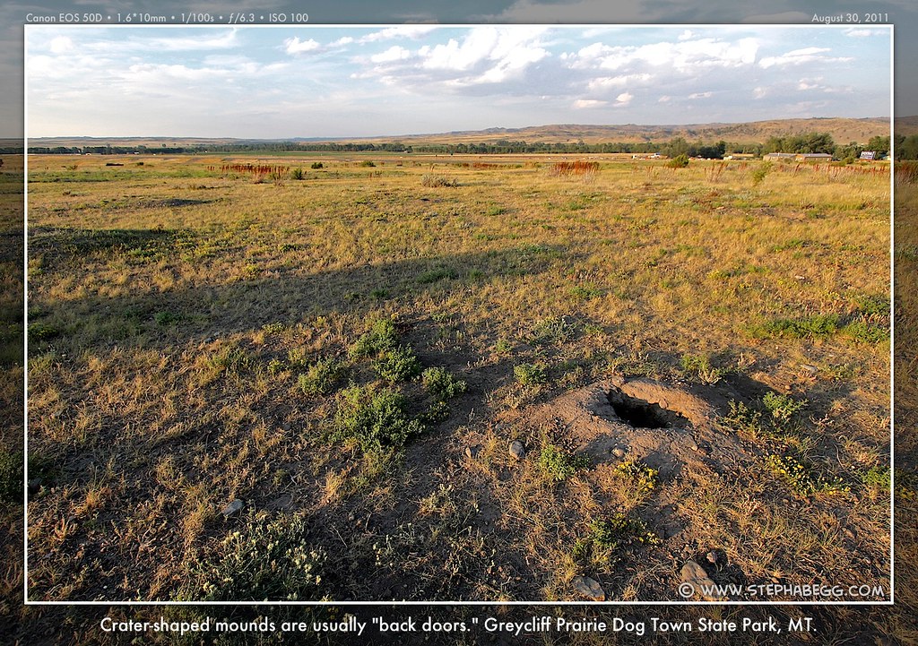
And some nearby sunflowers 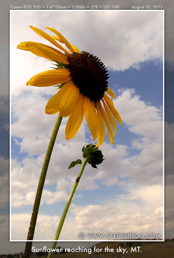

|
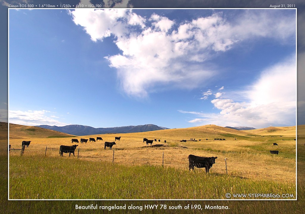
2
| The stretch of Highway 78 between I-90 and Red Lodge was an
unexpected treat. I drove the first 10 miles in the dark, and stopped
when I found a cheap plug at a quiet RV park. It was a good thing I left
the rest of the drive for the next morning, as it was spectacular.
Rolling hills of grass speckled with cows, lit golden in the morning
sun, against a backdrop of dark thunderheads rising above distant
mountains. Needless to say, the 47.3 stretch of Highway 78 took me much
longer than an hour—I just kept stopping to take photos. Red Lodge is a funky historic mining town worth stopping at in itself. So I did. |
PHOTOS (Click to enlarge) Road trip camping 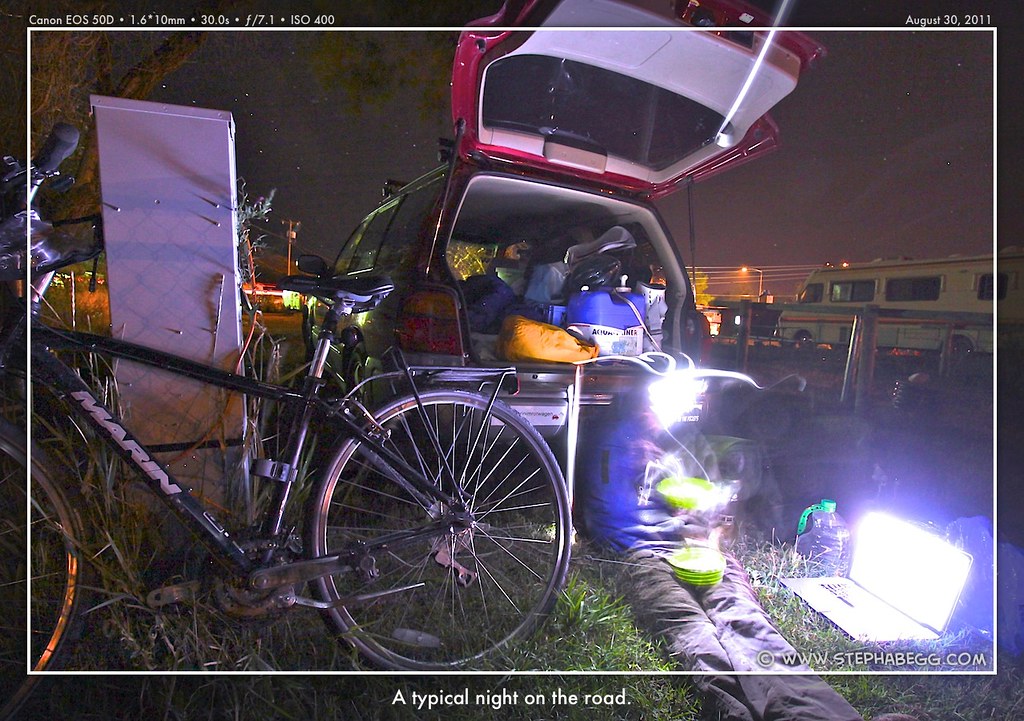
A beautiful drive 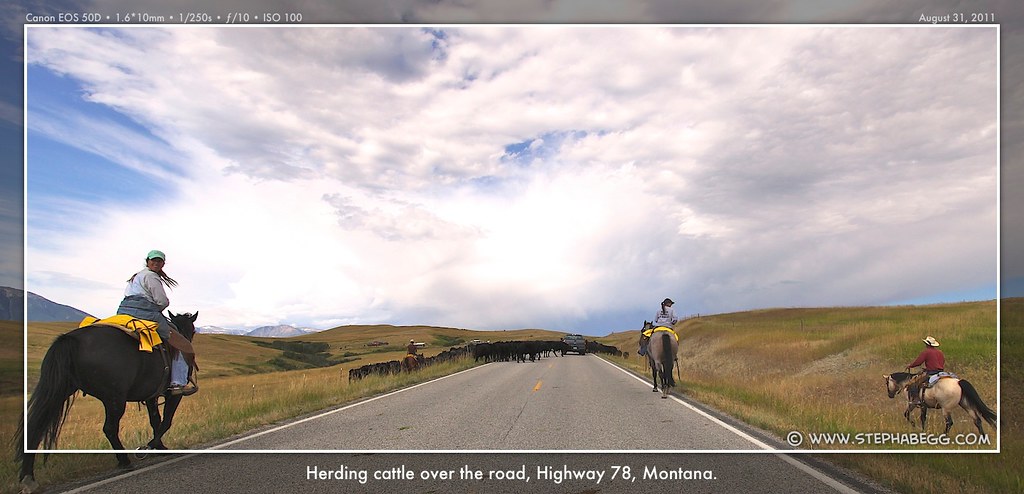


Red Lodge dog 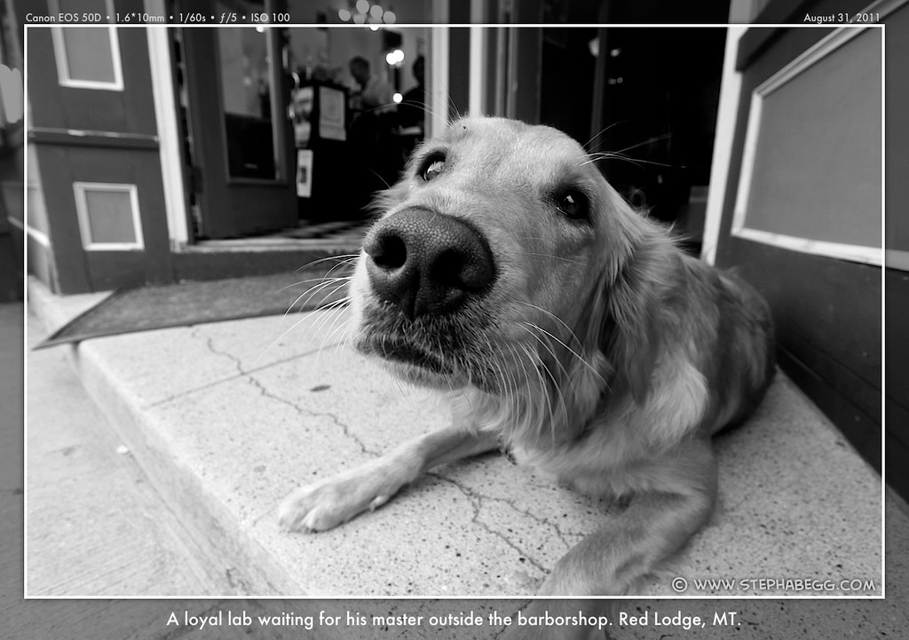
|
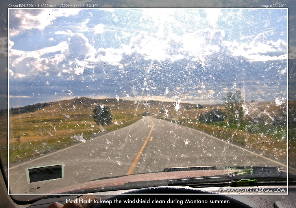
3
| Although the North entrance at
Gardiner would have provided the shortest route between the Glacier and
Yellowstone, I
opted to enter Yellowstone via the Northeast entrance near Cooke City,
so that I
could drive the Beartooth Highway. Heralded as one of the most scenic
drives in the United States, the Beartooth Highway is the section of US
Highway 212 between Red Lodge, MT and Cooke City, MT. Since Cooke City
is at the NE entrance of Yellowstone National Park, this highway
provides a great approach to the park. The Beartooth Highway traces a
series of steep zigzags and switchbacks along the Montana-Wyoming border
to the 10,947 ft high Beartooth Pass, one of the highest highway passes
in North America. All the way it features breathtaking views of the
Absaroka and Beartooth Mountains as well as open high alpine plateaus
dotted with countless glacial lakes, forested valleys, waterfalls, and
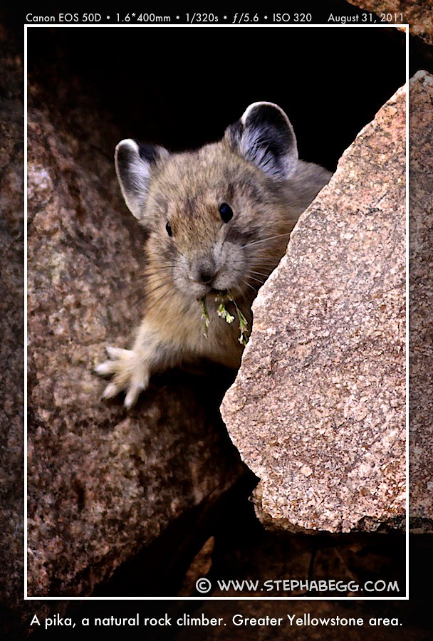
wildlife. Due to the severe weather in the area, the Beartooth Highway is closed in the winter. Even during the summer, it can face road closures due to ongoing construction. When I drove it, it was closed nightly between 8pm-8am, but open during the daytime. That didn't affect my plans though, as I had no intention of missing out on the scenery by driving this road in the darkness. It was difficult to capture the essence of the road in a photograph, so for the most part I just enjoyed the amazing drive. I did pull off at one of the popular viewpoints, but I got distracted by a pika and forgot to take any photos of the road. By the time I arrived in Cooke City, the bug splats on my windshield had become rather impressive. Albeit a bit distracting and hazardous, especially considering Yellowstone's road-sauntering bison to come. So I cleaned my windshield, flashed my National Park pass, and the described-above Yellowstone adventure had begun! |
PHOTOS (Click to enlarge) Beartooth HWY Pika 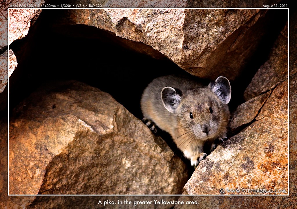
Cooke City, MT 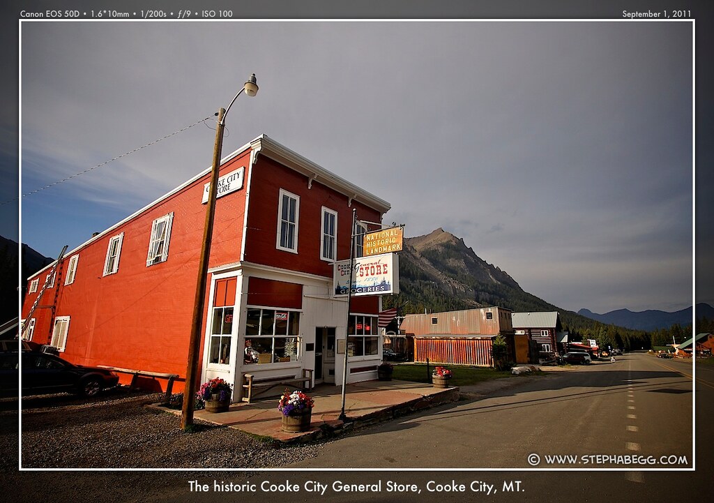
|
4
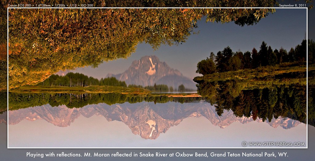
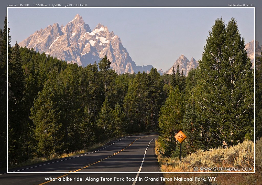
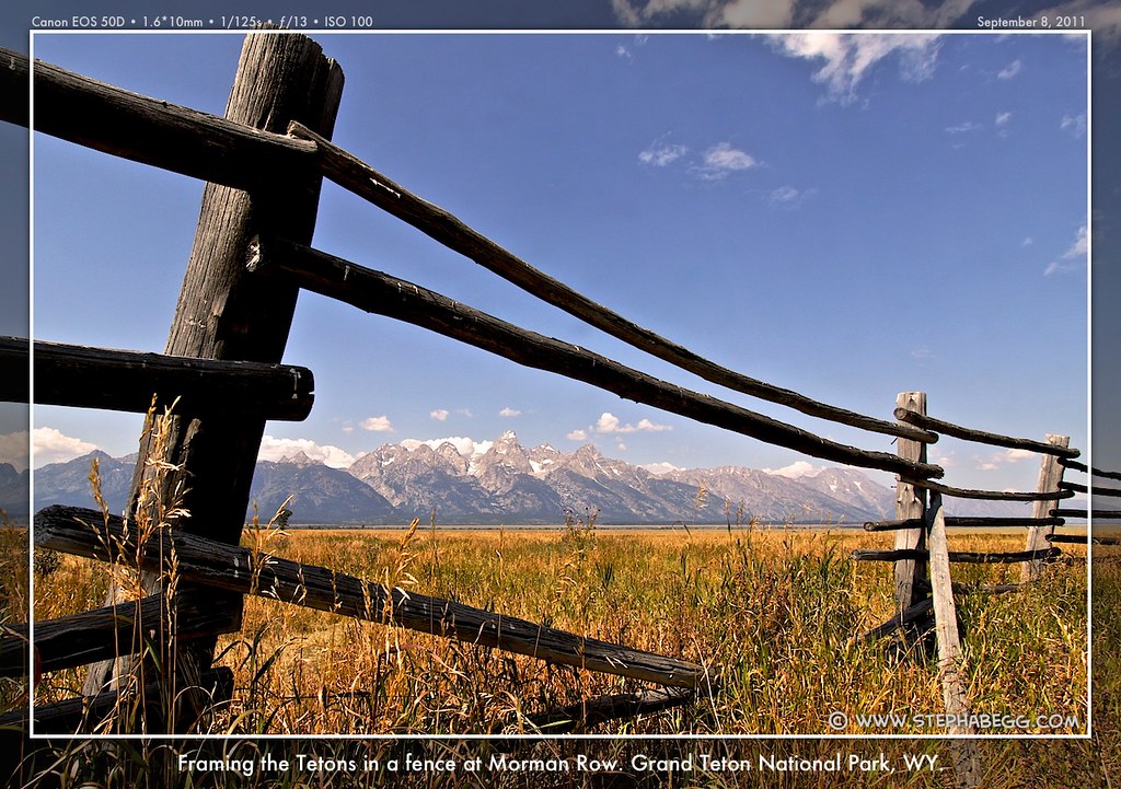
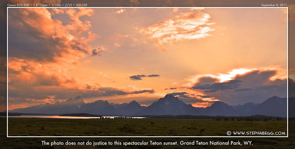
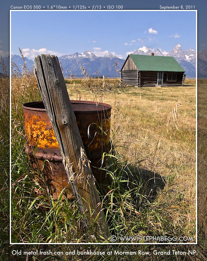
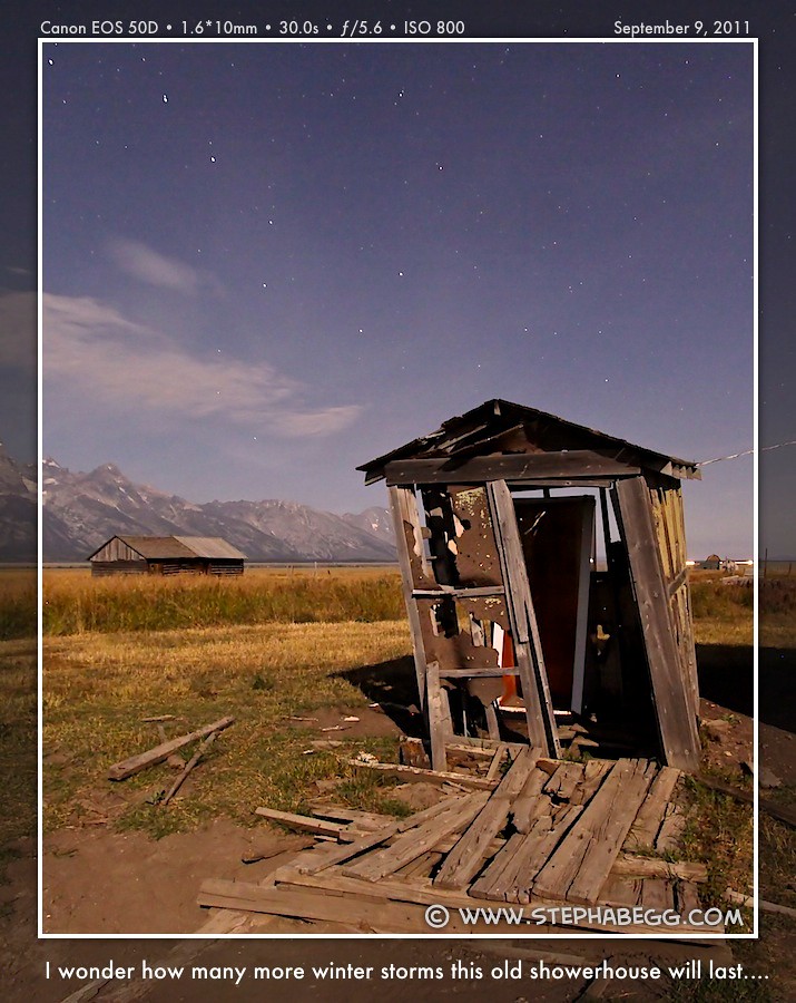
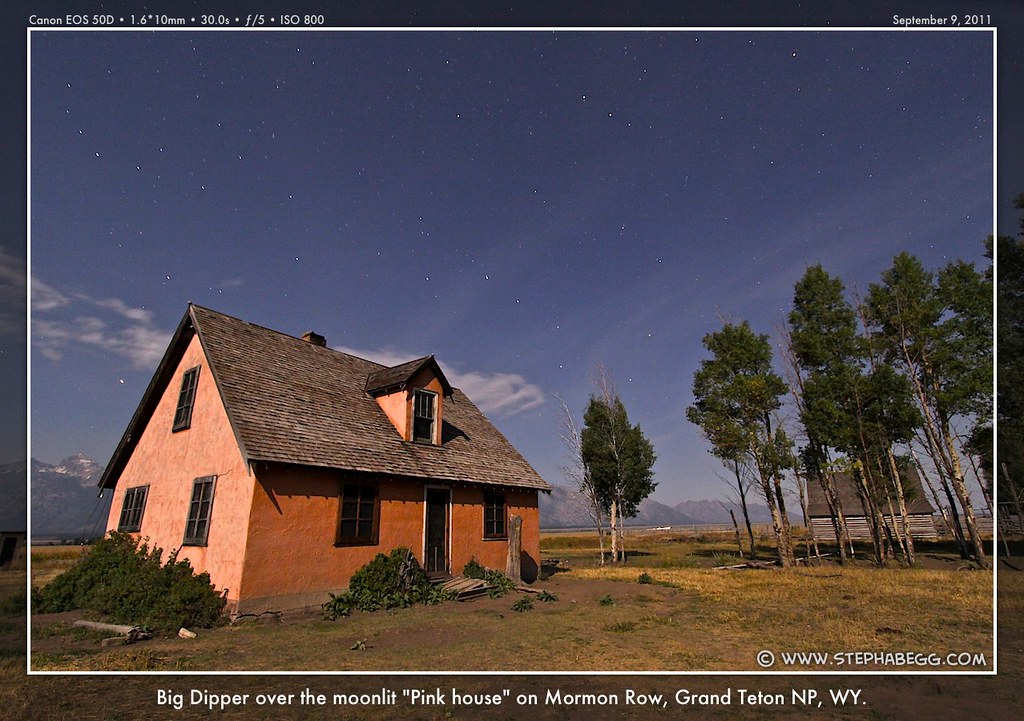
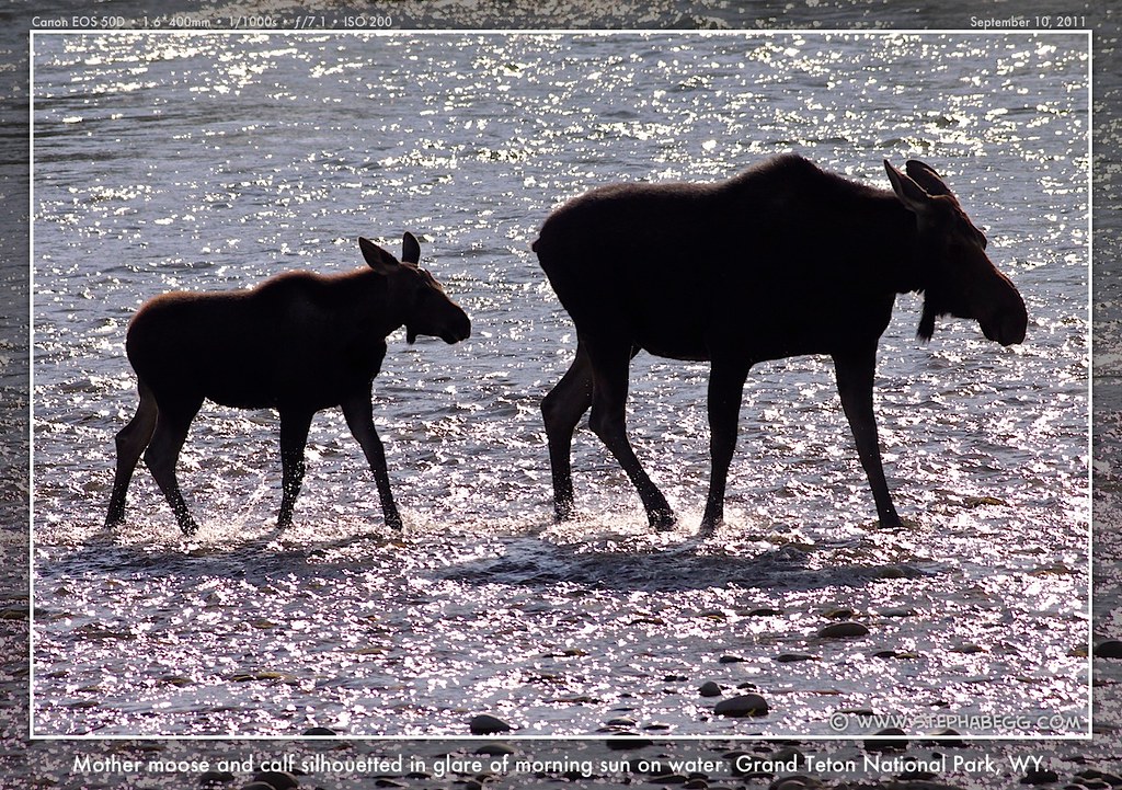
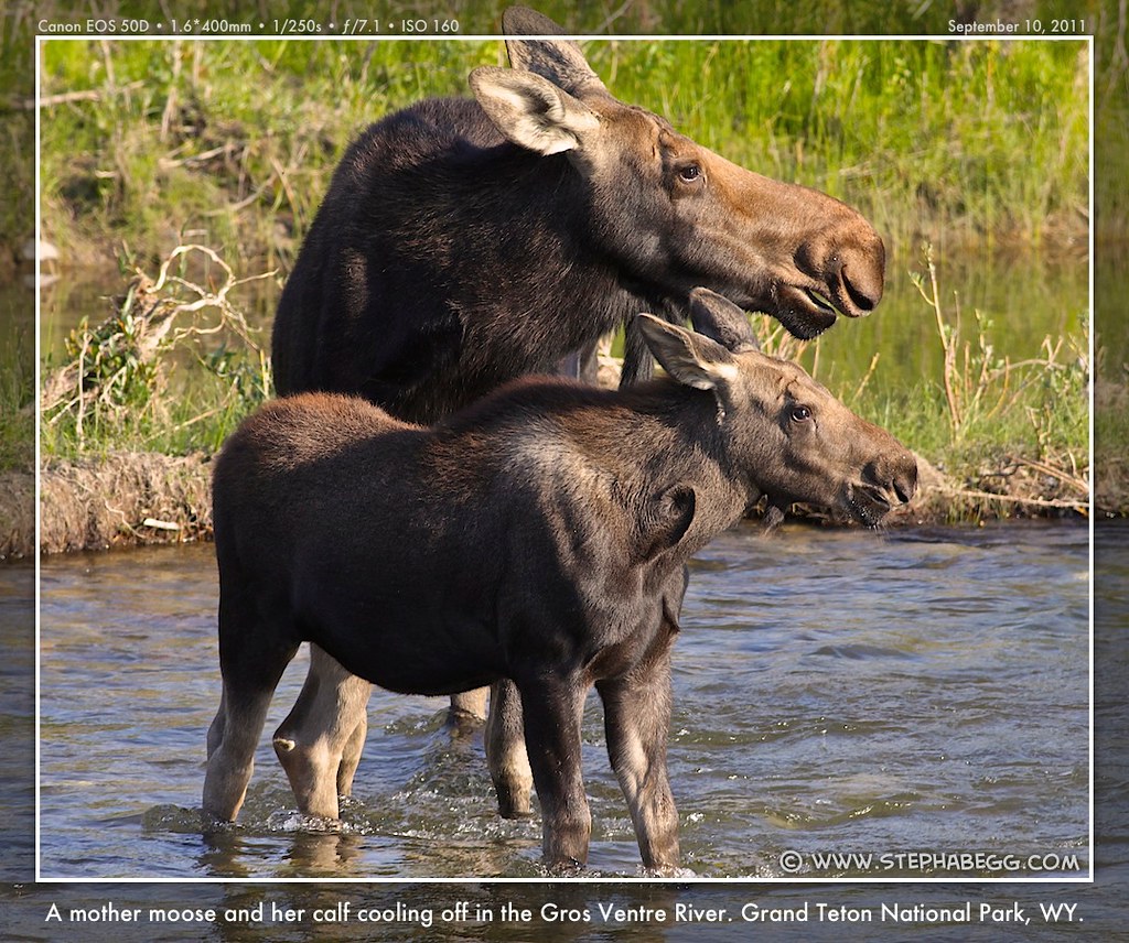
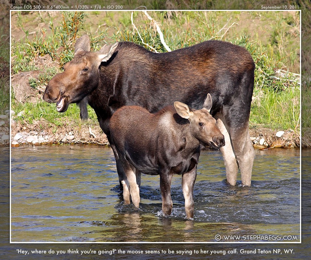
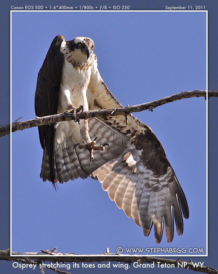
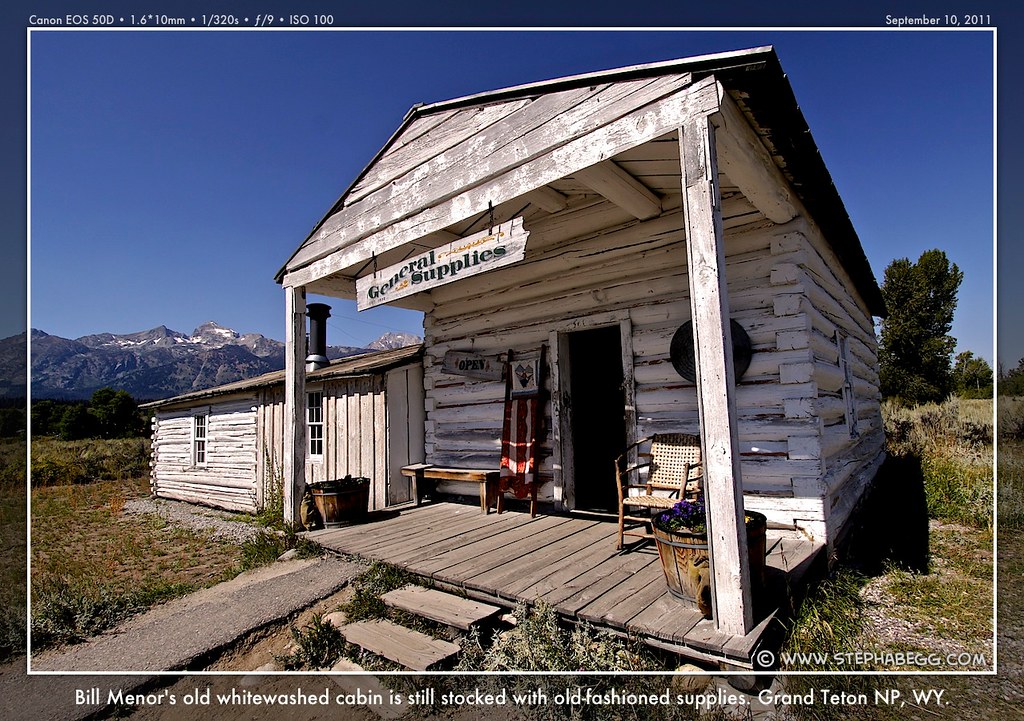
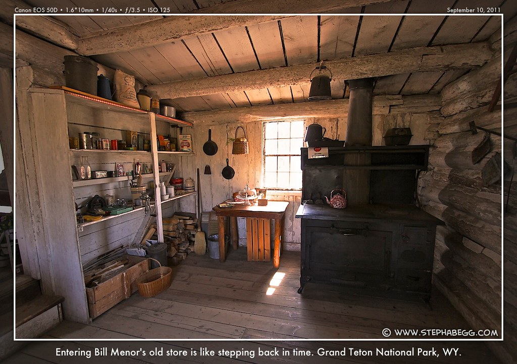
| I had been to Grand Teton National Park a couple of times before (once to climb the Grand Teton, and another time on a bird photography road trip). It is a place I could return to again and again. And only ten miles to the south of Yellowstone, there was no way I was going to pass the stunning mountainscapes of this national park by. I planned to just drive through. I spent three and a half days in Grand Teton National Park. So much for the quick throughway. The first day I embarked upon an impromptu 60-mile bike ride all over the park. I had left my car figuring I would just bike a few miles and then come back, but the towering mountains and grand views were so distracting I just kept biking. My ride was a nice loop trip, that went first south on the Teton Park Road and then back north on Highway 26/89/191; in shortest form, it's a 43-mile loop, but since I can't resist exploring side roads and overlooks, I made it a pleasantly tiring 60 mile day. Now having biked in Glacier, Yellowstone, and Grand Teton, I had come to realize that biking really is a great way to experience a National Park. It's fast enough that you can cover a decent amount of ground, but slow enough that you are really be able to observe and enjoy the scenery. Plus, I find that for a photographer, it's nice to be able to just stop suddenly and pull out the camera, which is something that is not always possible when driving. Most of my second day in the park I hung out in the spacious view-fronting lobby of the Jackson Lake Lodge (for the plug and wireless internet, what else!). In the evening I spent a couple of hours checking out the funky town of Jackson Hole, and once it started to get dark I headed to Mormon Row to do some night photography. Mormon Row had been my favorite stop on my bike ride. Here, the combination of old buildings and Teton backdrop is great for photography, and I had made a mental note to come back at night. It was a full moon, so the stars were not bright, but the moonlight and shadows were fun to work with. You don't have to obey the "no overnight camping" signs if you aren't sleeping, right? (I discovered that the Craig Thomas Discovery and Visitor Center at the Moose Junction offers free wireless internet. Better yet, they have outdoor plugs with benches within cord-reaching distance. My motto has become: Not camping if you aren't sleeping.) My third day I went on another bike ride, this time around the country roads at the southeast end of the park. I stopped at Menor's Ferry, which is the area where William D. Menor homesteaded in 1894 and later built a cable ferry which for many years was the primary means of crossing the river in the central part of Jackson Hole. I enjoyed learning about how the ferry used its angle with respect to the current to propel itself across the river. My day ended with a highlight of the trip, since when I returned to my car after my bike ride, a mother moose and her calf were wading through the Gros Ventre River below. I joined the line-up of tripods and big lenses that were already on scene. When photographing the moose, another photographer tipped me off on an osprey nest he had spotted on the NW shore of Jenny Lake. So, the next morning (my fourth and final morning in the park), I tracked down the osprey for a photo. It was sad to leave Grand Teton National Park, but I knew I'd be back. For some reason, of all the national parks I've been to, the Grand Teton National Park had a certain magnetic pull for me. I just feel at home there. During my few days in the park, I just couldn't stop taking photos of the towering Grand Teton. Something compels me about that mountain. With the perfect late-summer conditions and the bomber weather forecast, I was halfway tempted to try to climb it. It sure would make a story to have this be my first significant post-injury climb. But even the hike to the base would be about 5x as much as I had demanded out of my leg thus far, so climbing the Grand at this time was probably a wishful thought best left unimplemented. |
PHOTOS (Click to enlarge) Teton Views 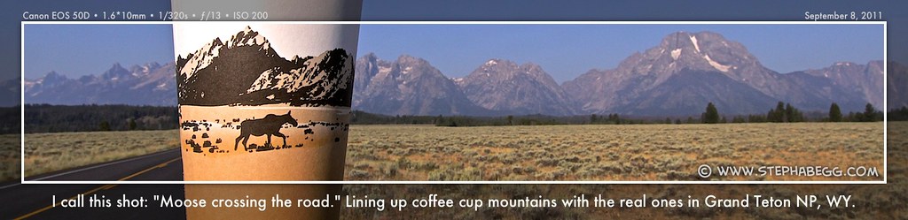

 (And of course a labeled panorama...) 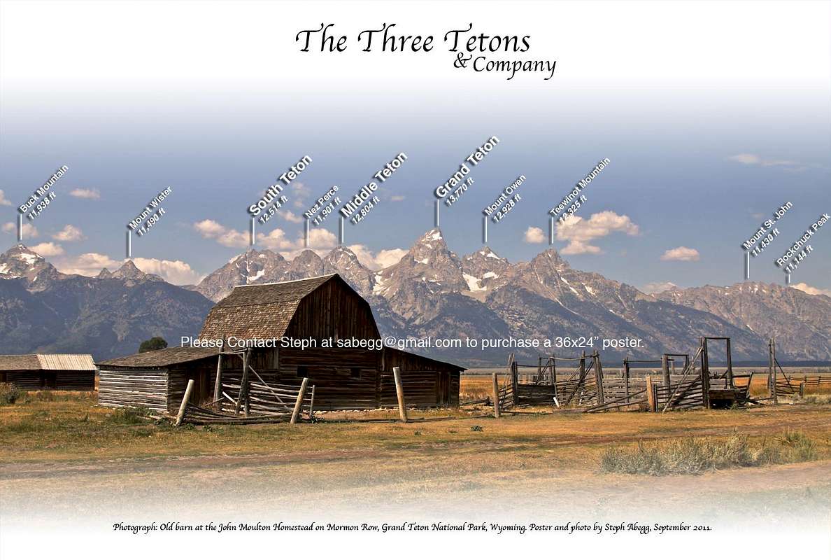
Mormon Row 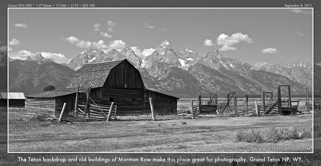


Wildlife 


Other 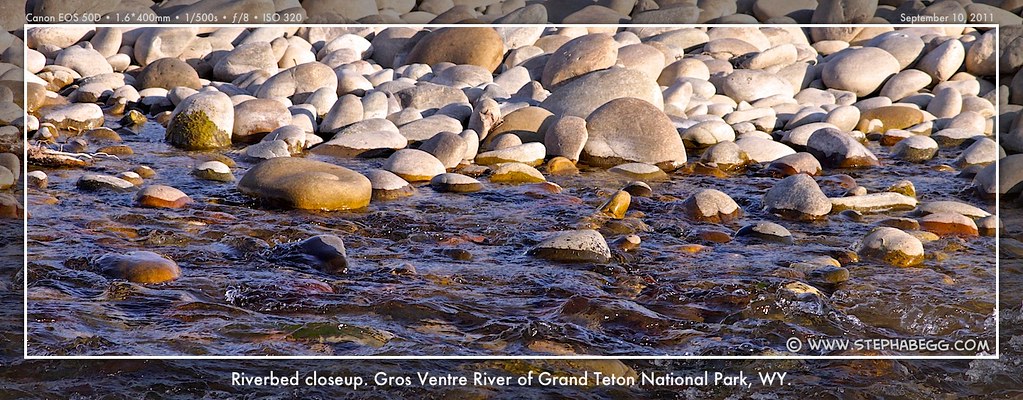


|
5
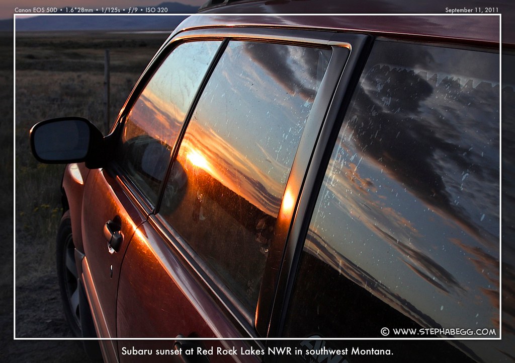
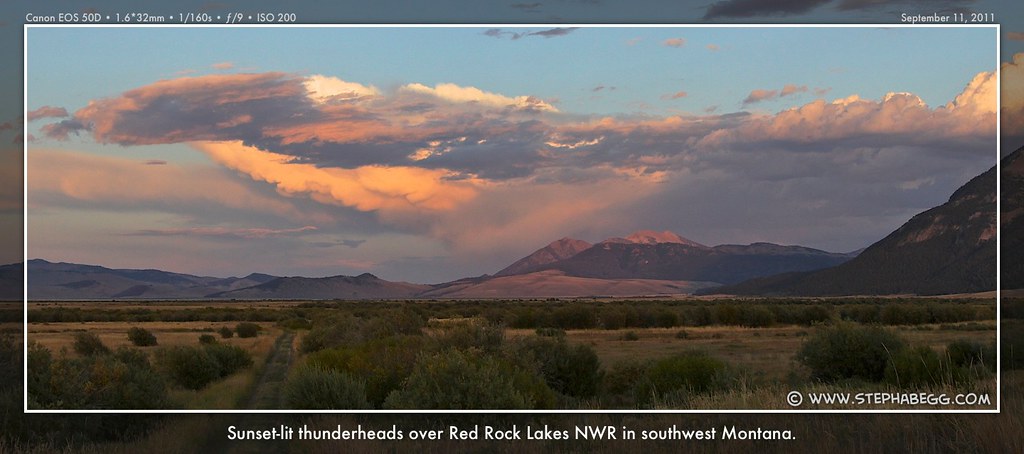
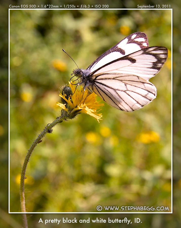
| As a tip from a friend (this friend had also tipped me off on the Beartooth Highway, so I thought highly of his suggestions), I took the slow route to I-90 via the Red Rock Lakes National Wildlife Refuge in the southwest corner of Montana not far from Yellowstone. The refuge is a remote high elevation mountain wetland-riparian area that provides a great habitat for the trumpeter swan and migratory birds. Spending the night on the refuge, isolated from civilization by several miles of dirt road in any direction, was a special experience. Nighttime became a symphony of quacking, peeping, mooing, howling, barking, squeaking, cooing, screeching, flapping, and rustling. It's hard-to-come-by moments like these where you temporarily forget about life and get fleeting glimpses of pure existence. I think what Google Maps needs is a "most scenic" route selection choice. |
PHOTOS (Click to enlarge) Evening in the refuge 


Birds 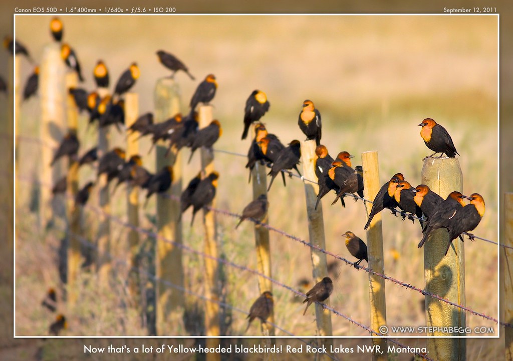
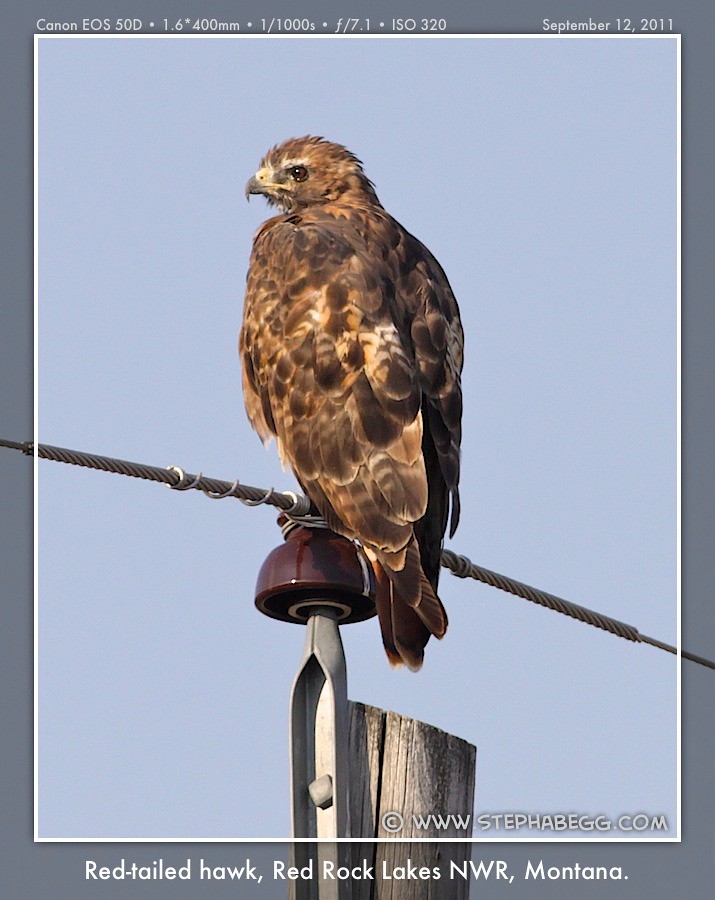
Other 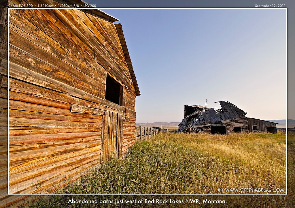

|
6
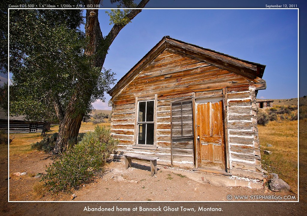
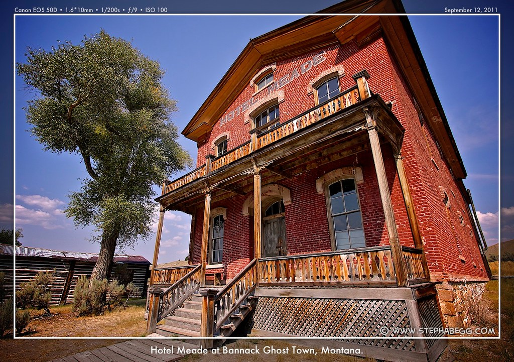
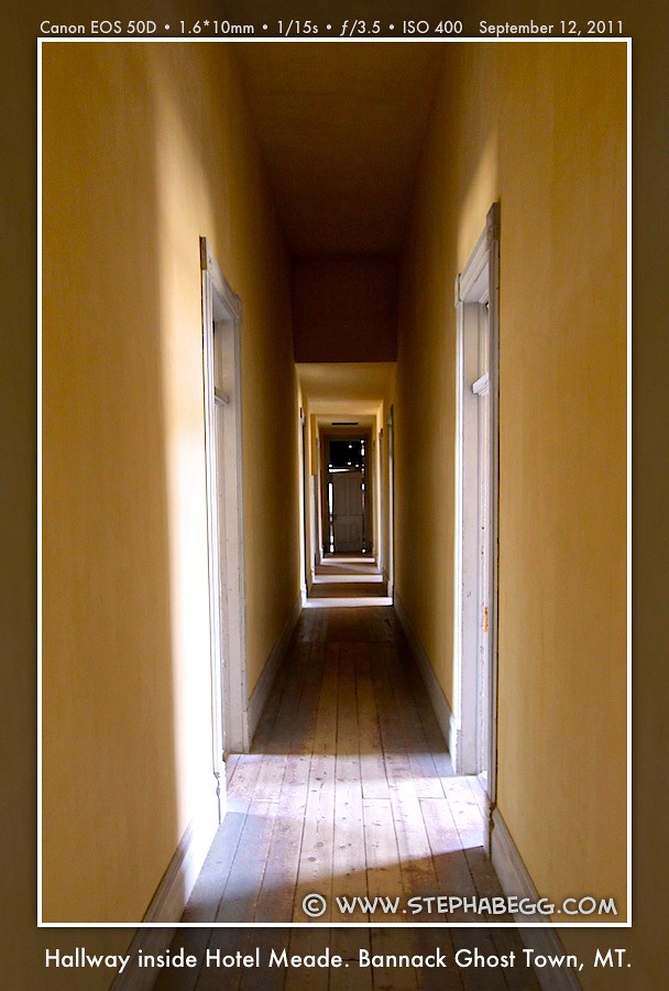
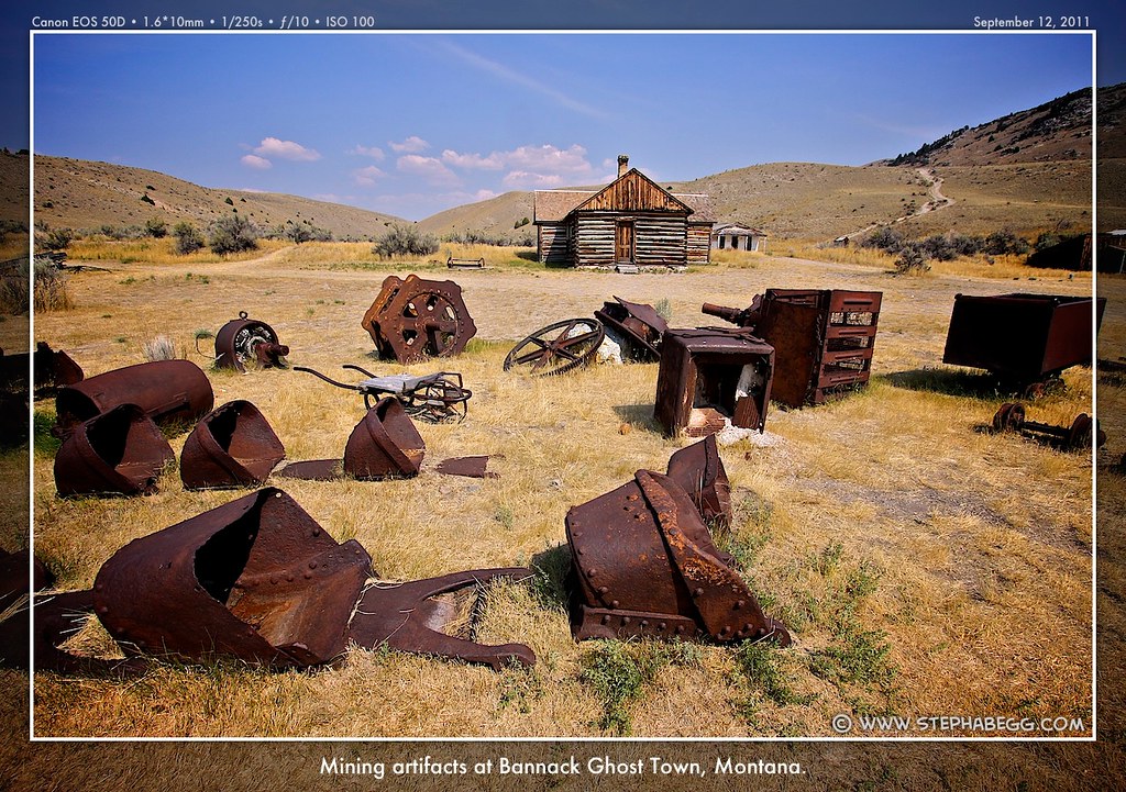
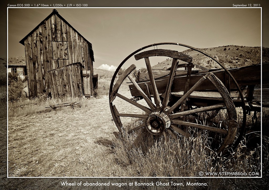
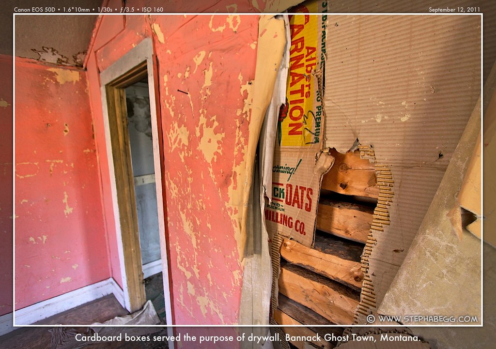
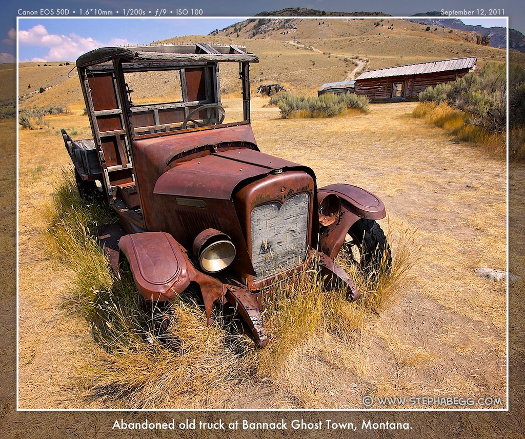
| When I saw "Bannack Ghost Town" on my map within a few miles of my route, I had to check it out. Bannack was founded in 1862 when John White discovered gold on Grasshopper Creek. As news of the gold strike spread many prospectors and businessmen rushed to Bannack hoping to strike it rich. In 1864, Bannack was named as the first Territorial Capital of Montana. Bannack was the site of many "firsts" in the state''s history—the first jail, hotel, chartered Masonic Lodge, hard rock mine, electric gold dredge, quartz stamp mill, saw mill, and brick courthouse. Then, in 1863, gold was discovered near Virginia City and many prospectors left Bannack in hopes of finding the mother lode in Virginia City. From the late 1860's to the 1930's, Bannack continued as a mining town with a fluctuating population. By the 1950's gold workings had dwindled and the town slowly died as most folks moved on. The last residents left in the 1970s. Today, over 50 of the buildings remain, a town frozen in time with a story to tell. In fact, Bannack State Park is the best-preserved of all ghost towns. I enjoyed walking around taking photos and imaging the footsteps of those seeking the rich lode hidden in the surrounding hills. I couldn't help thinking the ghost town would be a great place to do some night photography....but some commitments were calling me back to Seattle, so I continued my drive home. Unfortunately, you can't stay on the road forever. Bannack was my last real photo stop of the trip. After Bannack, I drove a couple of hundred miles along the Pioneer Mountains Scenic Byway and the Anaconda-Pintler Scenic Highway—both of which paralleled the less interesting I-15—and then I was on I-90, just east of Missoula. Eight hours to Seattle from here. |
PHOTOS (Click to enlarge) 


|
7
|
Well, one more stop. (Not really a photography stop, but an interesting stop nonetheless.) When on the road, I'm on a constant lookout for ways to break up a day's drive by stopping for a scenic bike ride or walk. So when my driving route passed right by the Route of the Hiawatha bike trail, I thought this would be a great place to stretch the legs. Winding through 10 tunnels and 7 high trestles, this 15-mile biking/hiking trail (30 miles round trip) crosses the rugged Bitterroot Mountains between Idaho and Montana. It follows what was once one of the most scenic stretches of railroad in the country, part of the Milwaukee Railroad that carried passengers and freight from the Northwest to the Midwest. The rail line was completed in 1906, and operated until it finally underwent bankruptcy in 1977. With government funding and private donations, the rails were removed, and the construction of this spectacular wilderness bicycle and hiking trail was undertaken in 1997. The Route of the Hiawatha is best known for the long, dark St. Paul Pass, or Taft Tunnel, which burrows for 1.66 miles under the Idaho/Montana state line. It's always fun to do a bike ride with a great view and a unique history. Beats biking the Burke-Gilman Trail over and over in Seattle.... |
PHOTOS (Click to enlarge) 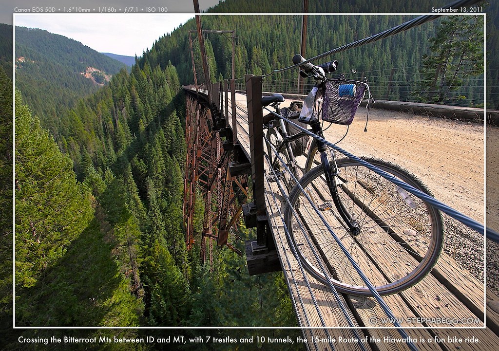
|