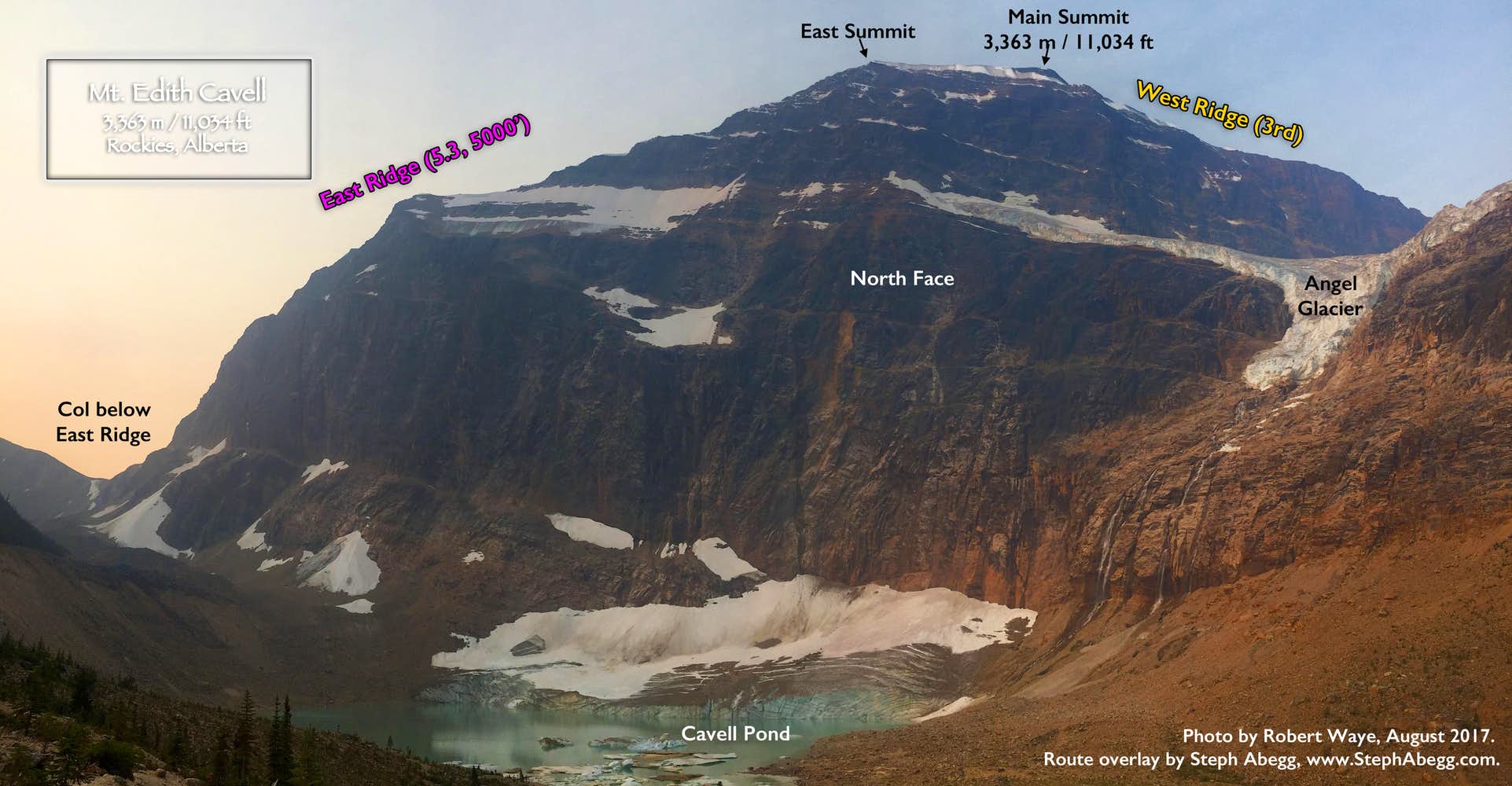
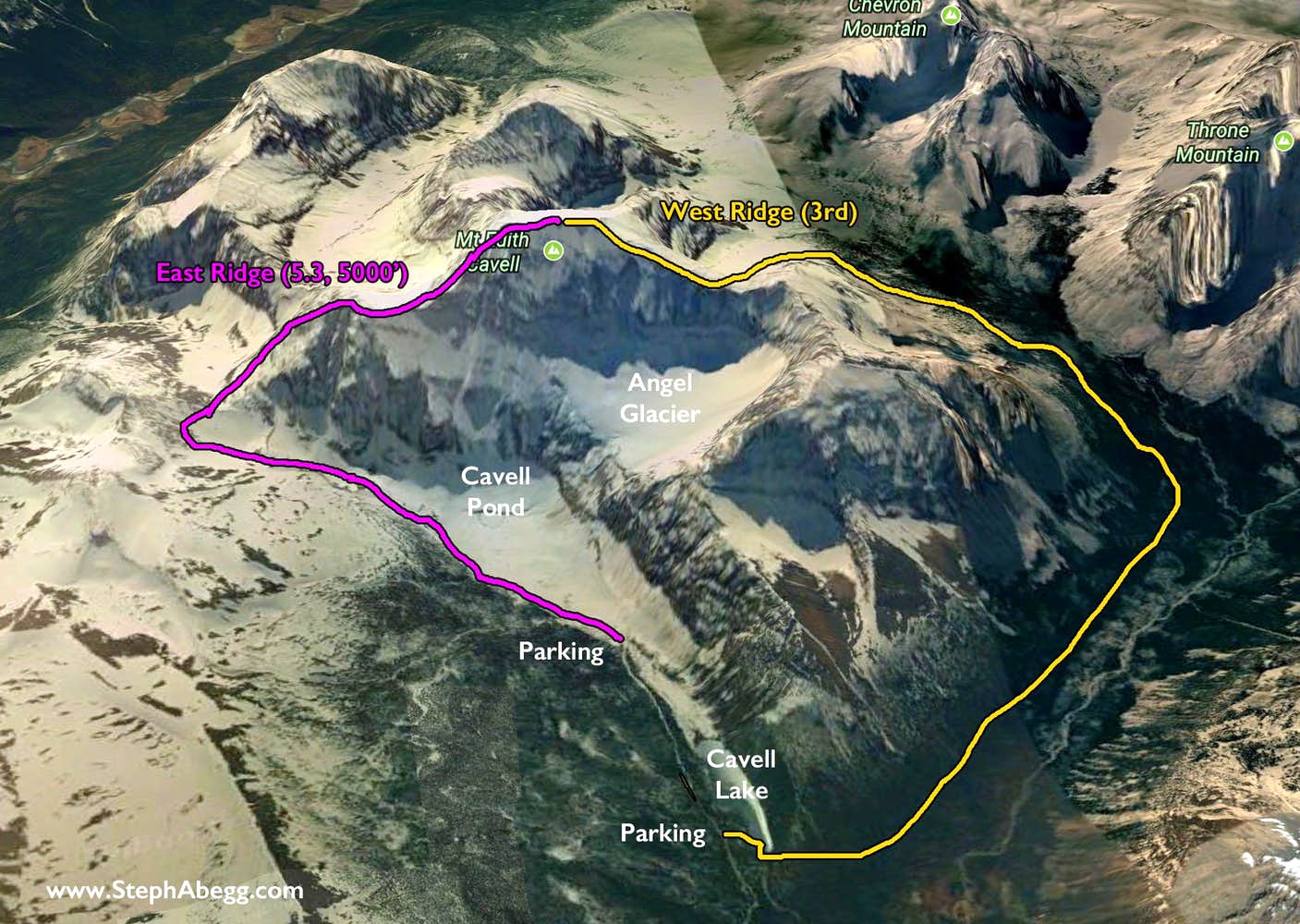
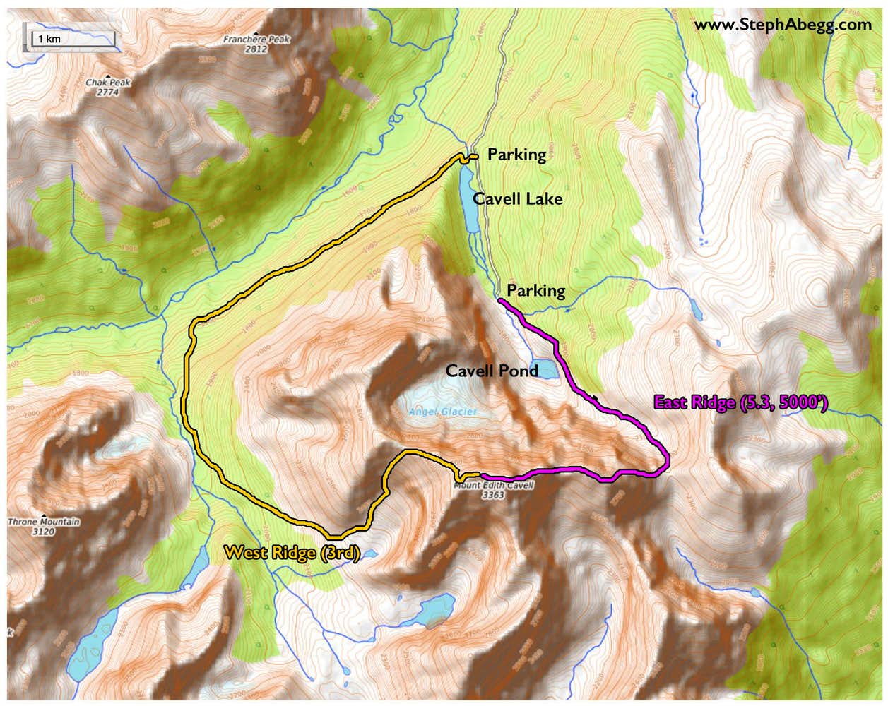
Edith Cavell
Route:
East Ridge
5.3, 5000'
A nice loop up and over one of the Canadian Rockies iconic summits.
Region: Alberta
Elev: 3,363 m / 11,034 ft
Rock: Quartzite
Mode:

Date(s): August 30, 2017 (Wed)
Partner(s): Robert Waye
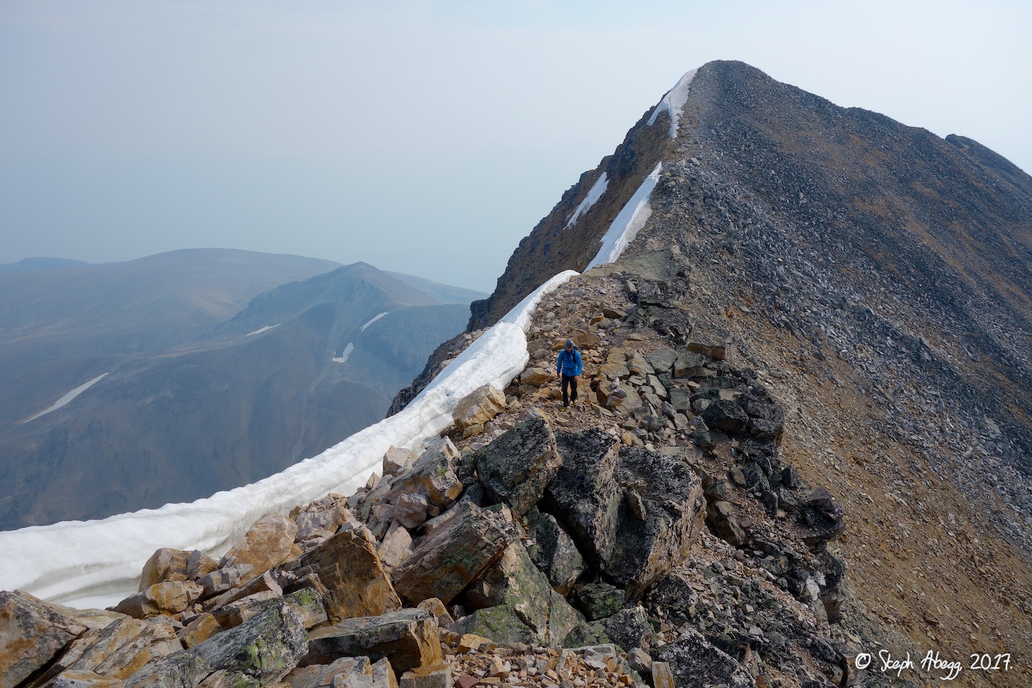
| Photos: |
Photo descriptions: | |
|
Approach
|
1.
 2.
 3.
 4.
 5.
 6.
 7.
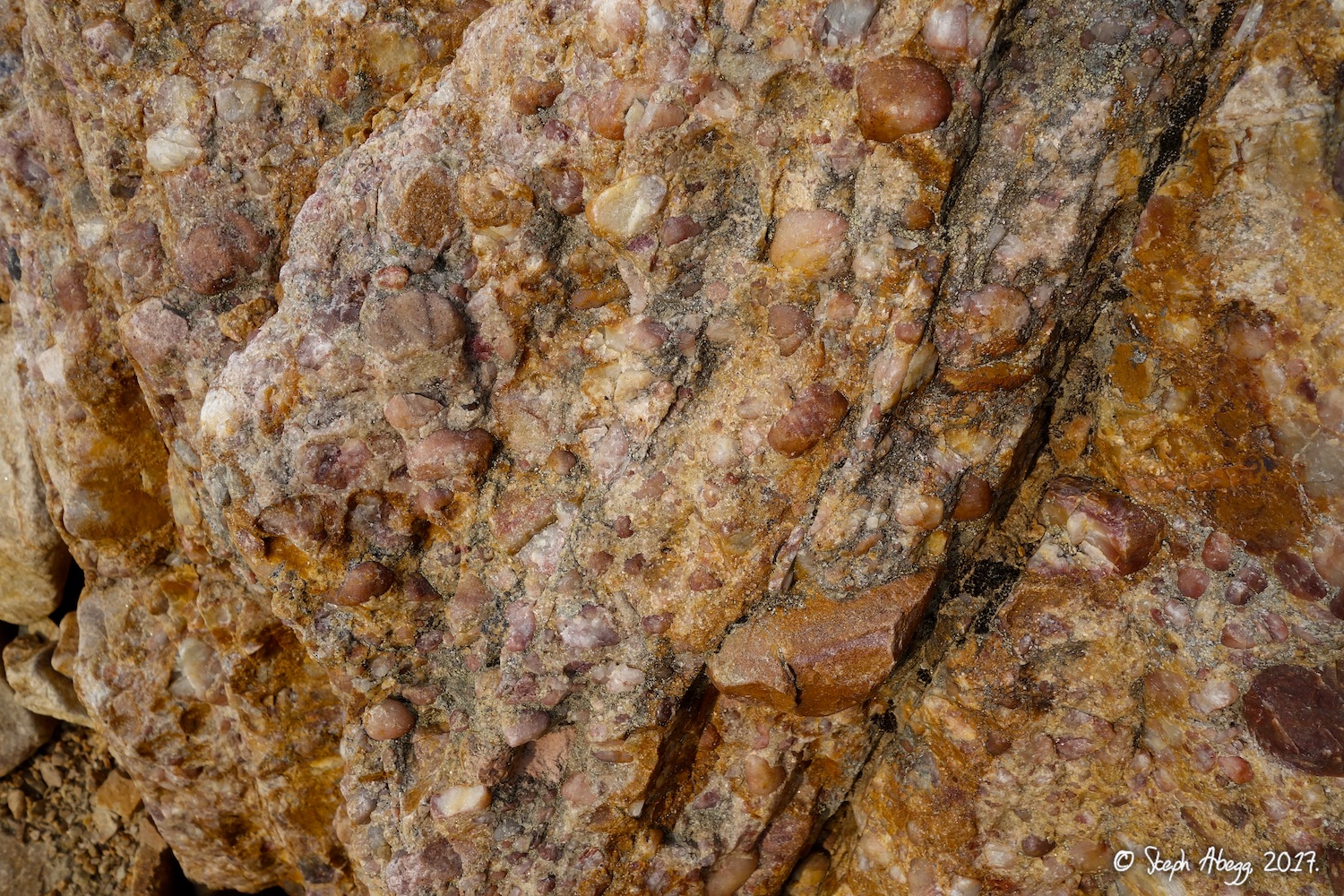 |
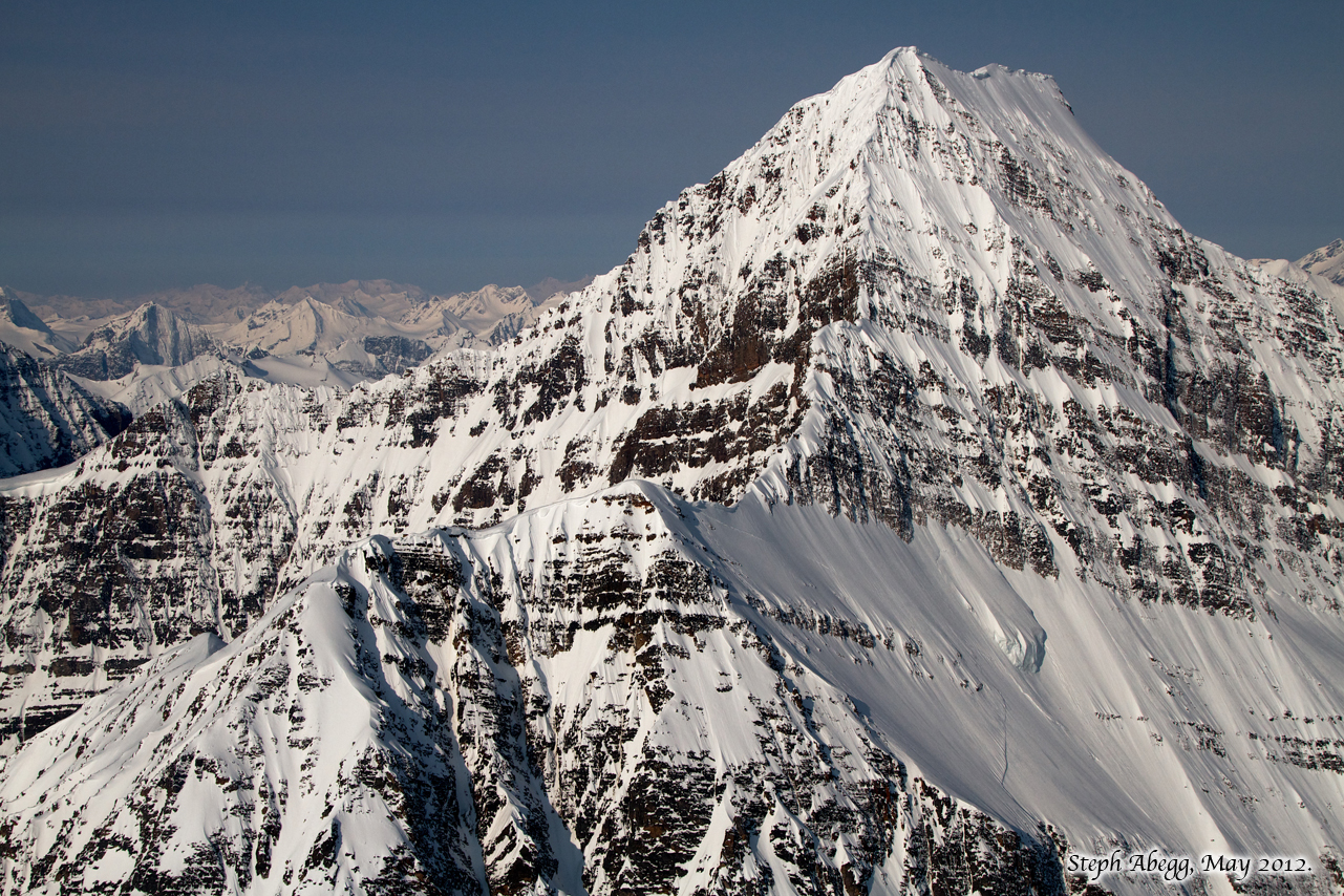
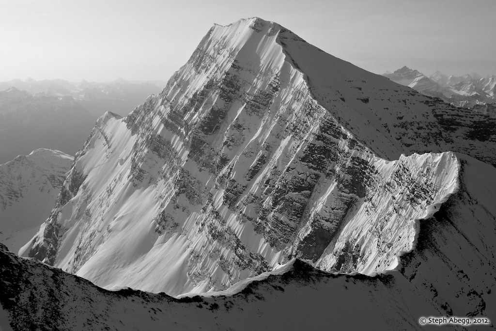
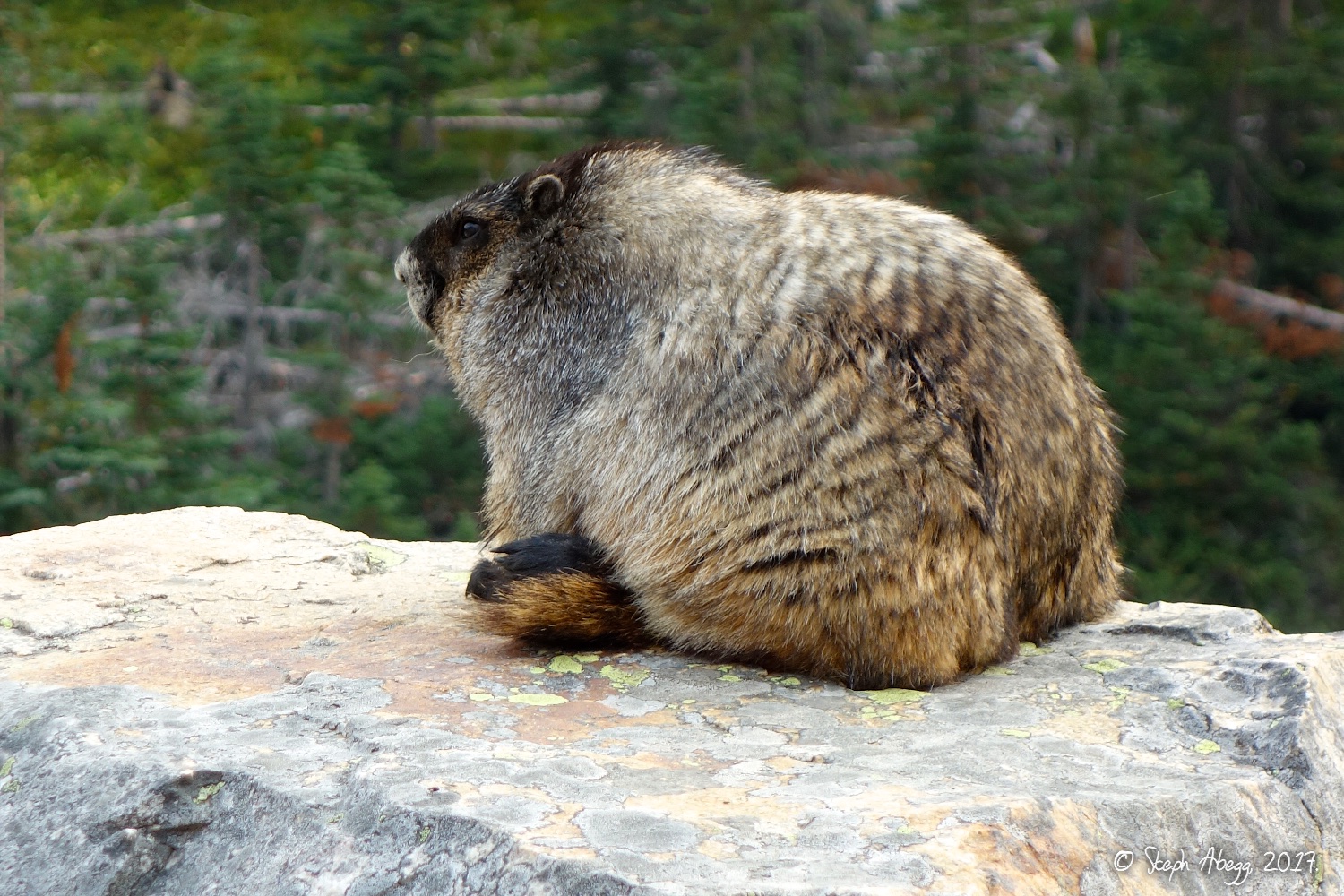
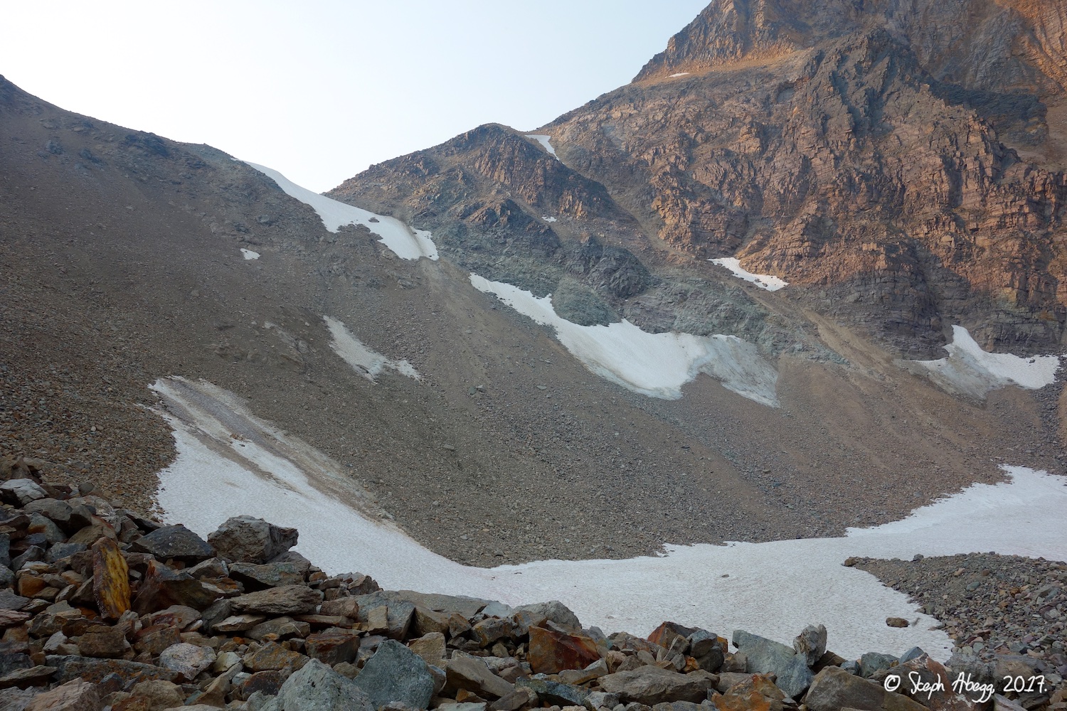
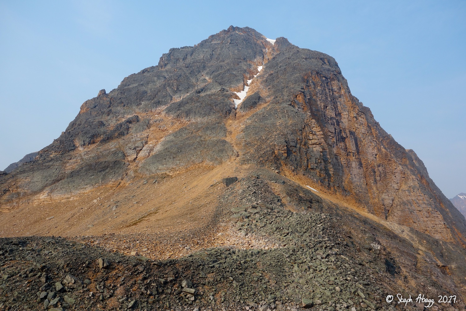
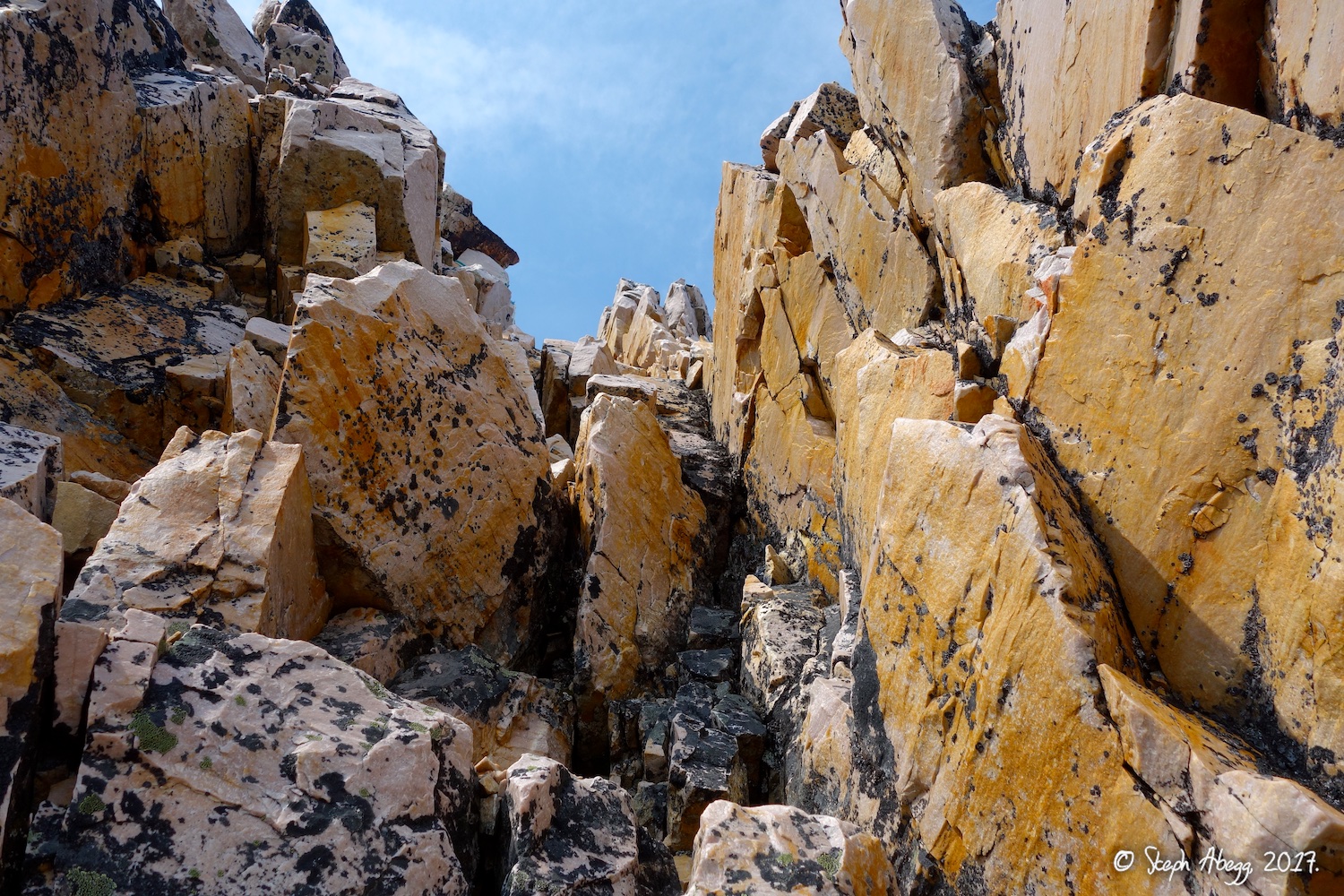
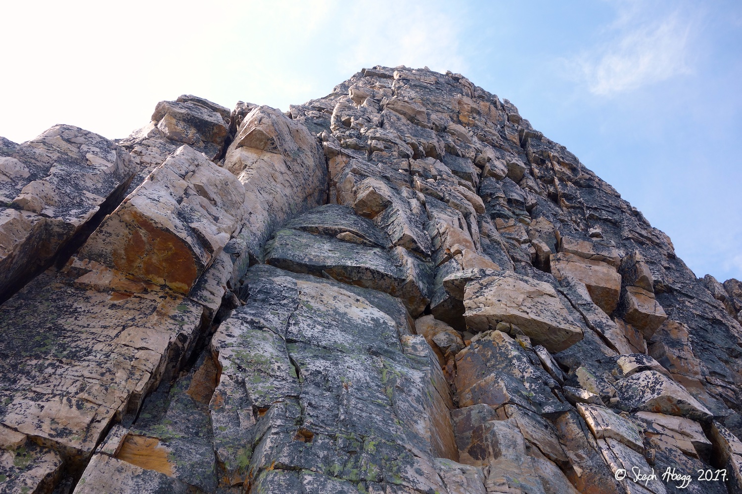
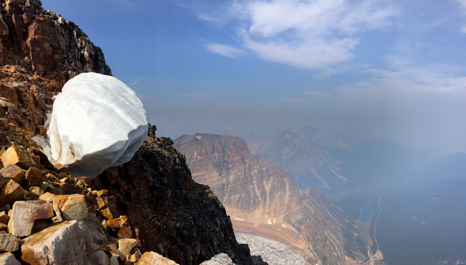
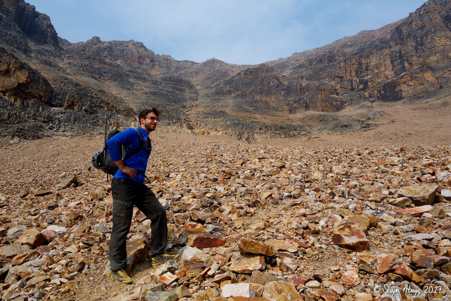
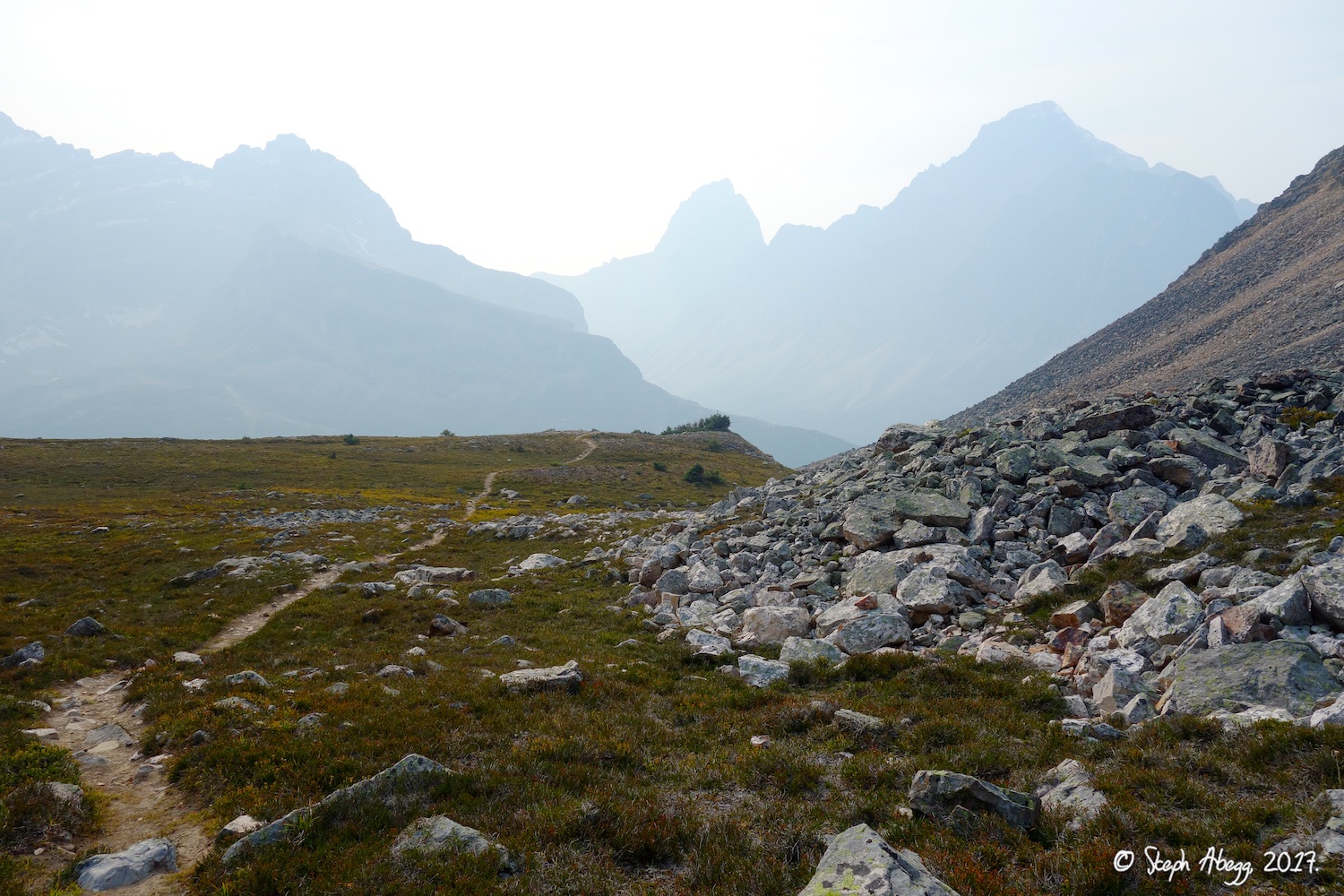
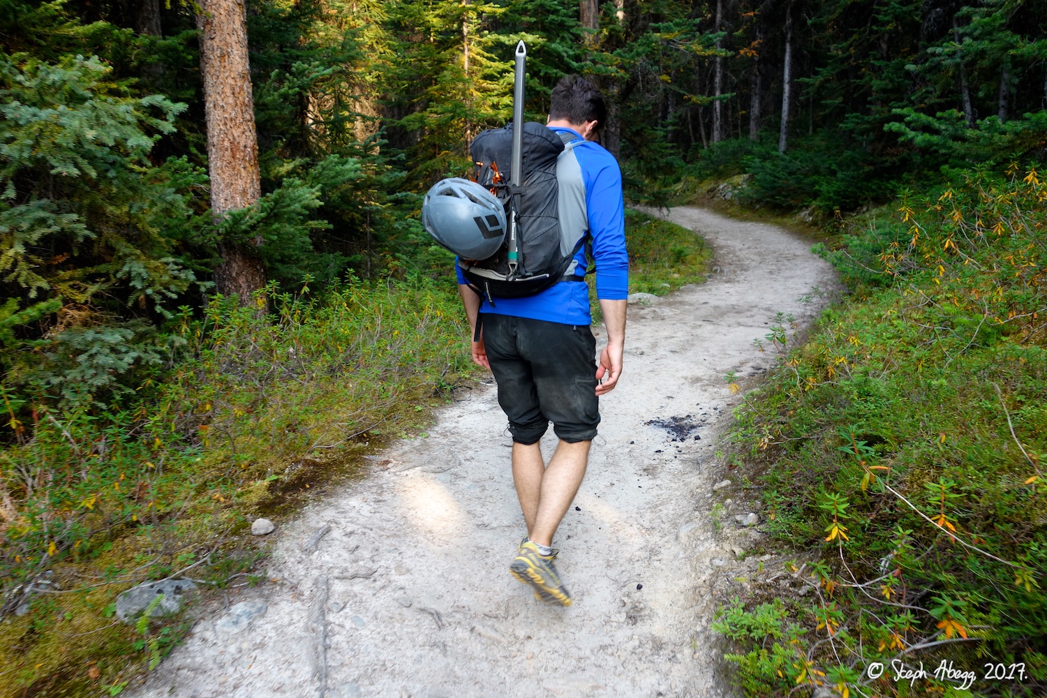
1. Edith Cavell from near the trailhead. (Photo taken by Rob when he drove up to check out the trailhead the afternoon before the climb.) 2. In summer 2017, the parks service was doing construction at the Edith Cavell trailhead, probably making more parking spots for future summers. (The yellowish tinge to the air is caused by smoke from forest fires, which had been blown in by winds overnight.) 3. We scrambled along the top of the moraine for about 10 minutes before spotting this much easier trail to the left of the moraine. Should have known there would be a trail—this is the Rockies, not the North Cascades! 4. This marmot was either desensitized to tourists or too fat to move. 5. Looking at the talus/scree slopes to be crossed to get to the base of the East Ridge. 6. Looking up the East Ridge from the col below it. 7. Metaconglomerate near the start of the East Ridge route. |
|
Climb
East Ridge
|
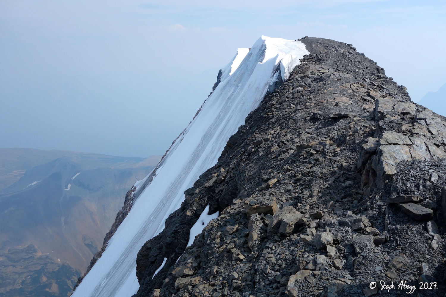
8.
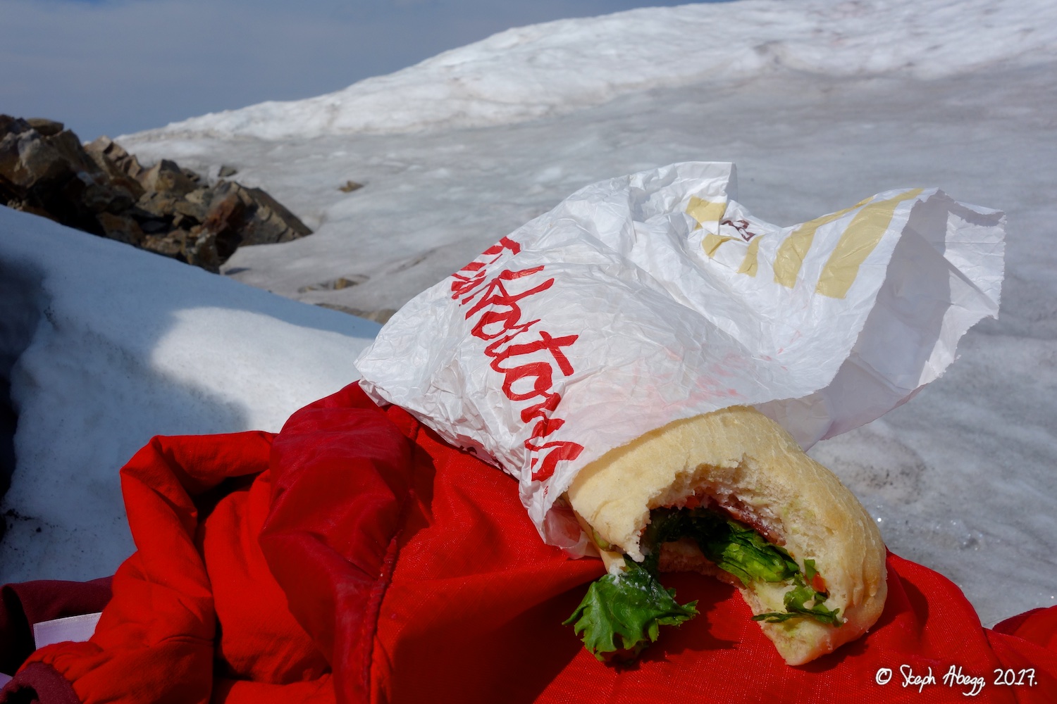
 9.
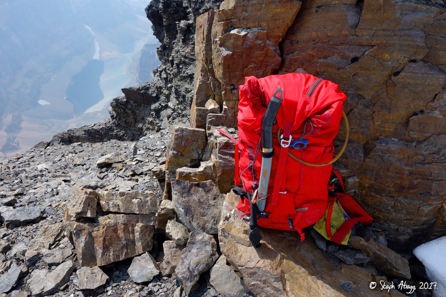
 10.
 11.
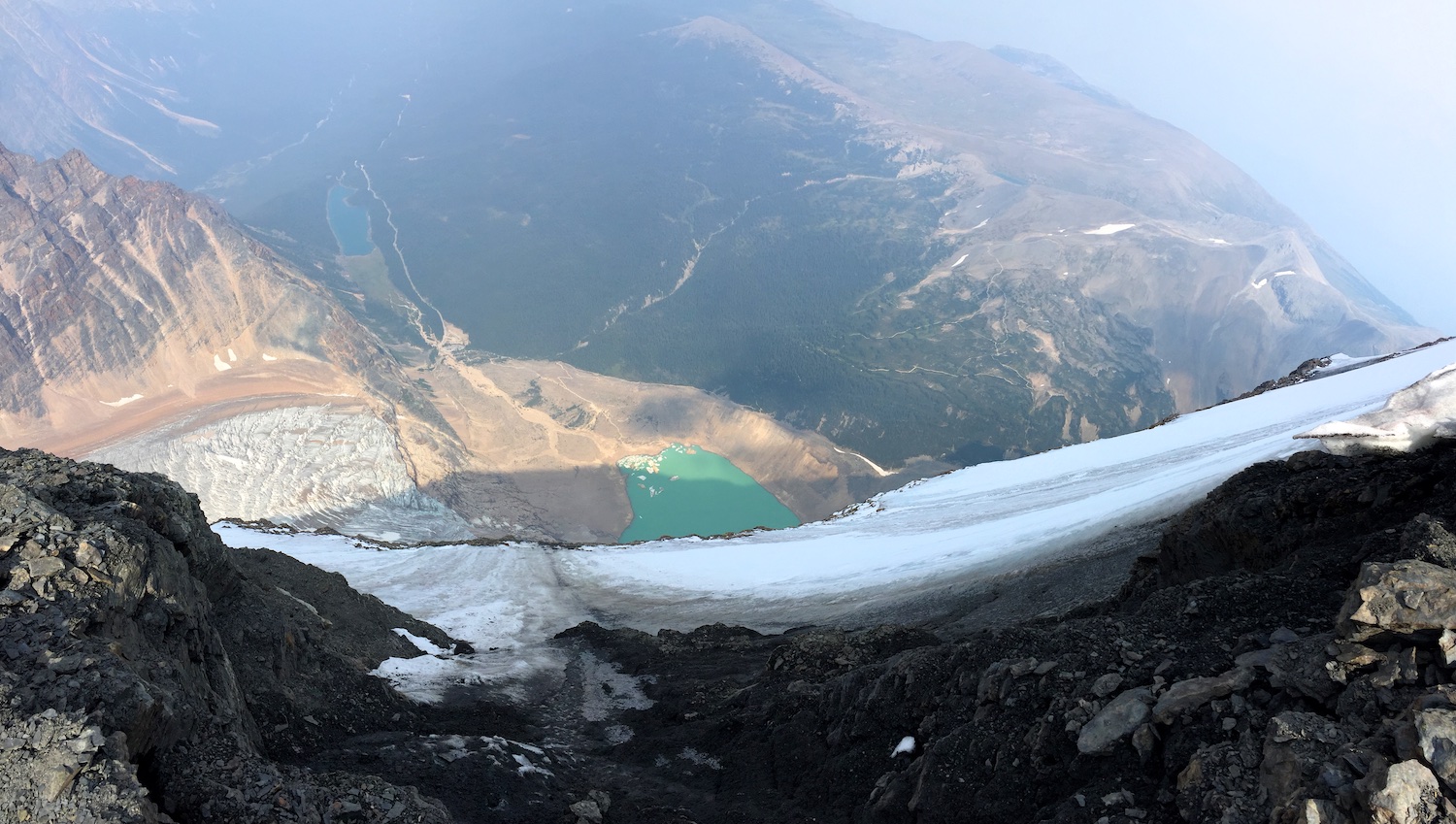
 12.
 13.
 14.
 15.
 16.
 17.
 18.
 19.
 20.
 21.
 22.
 23.
 24.
 25.
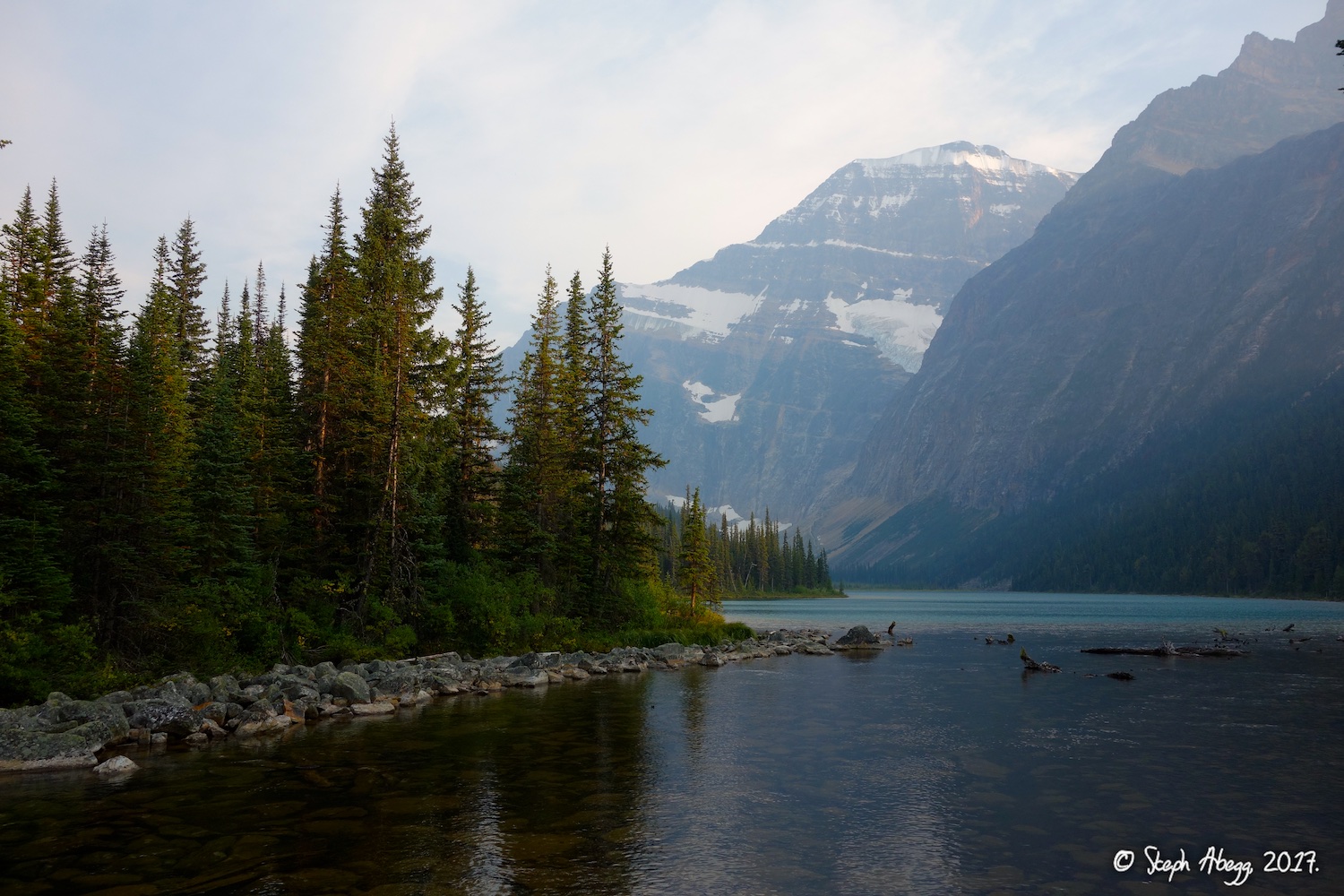
 26.
 27.
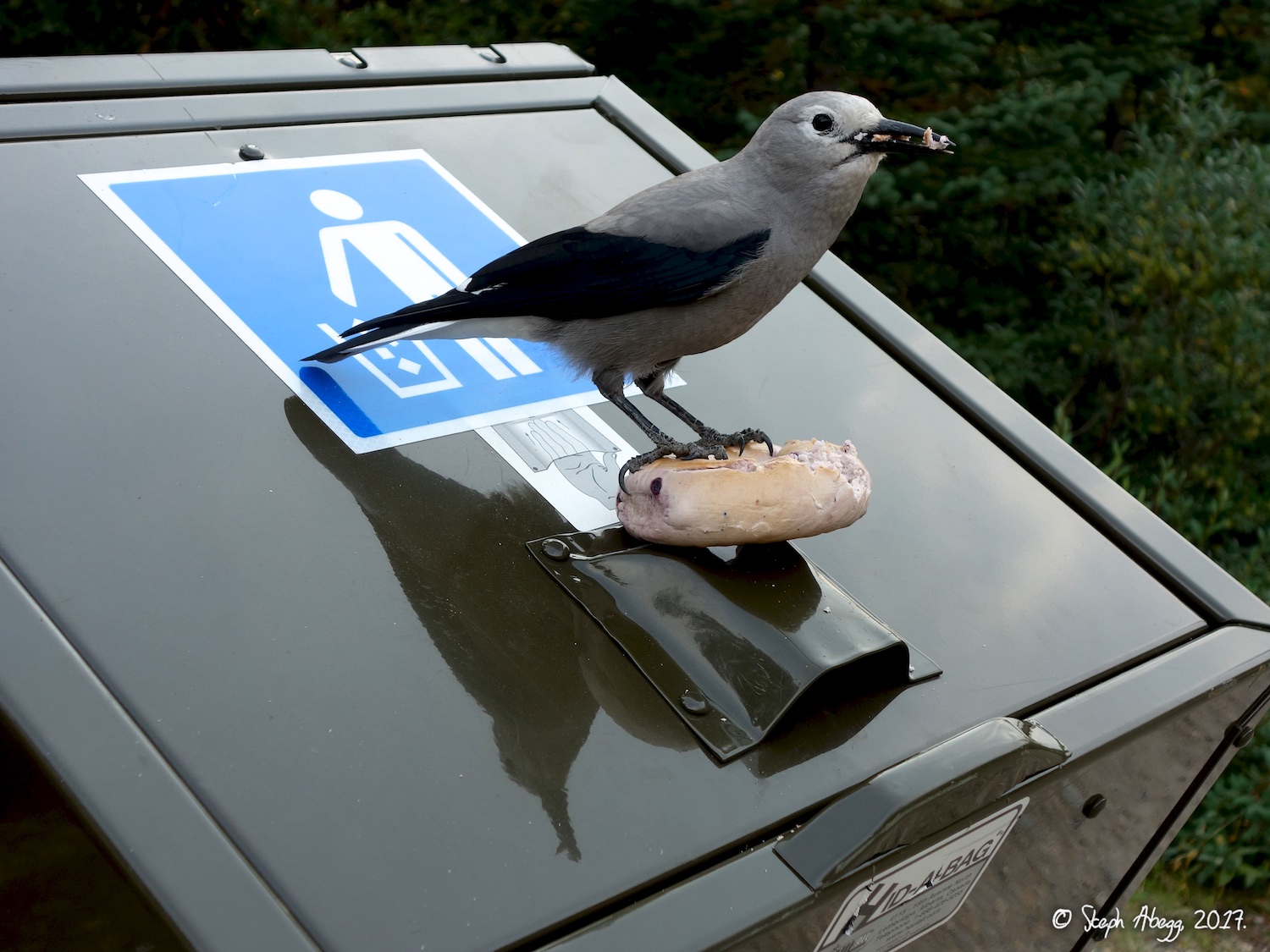
 28a.
 28b.
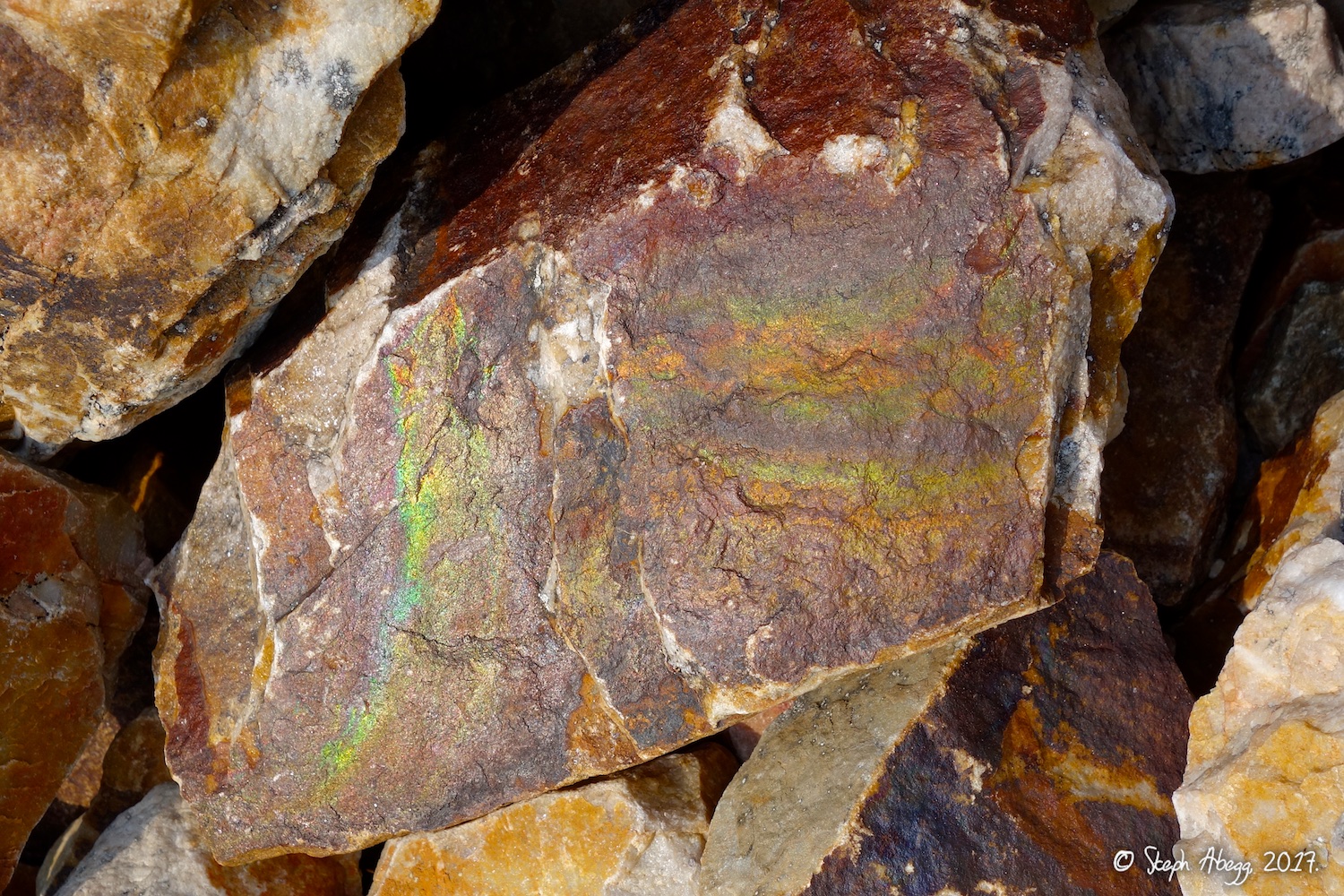 |
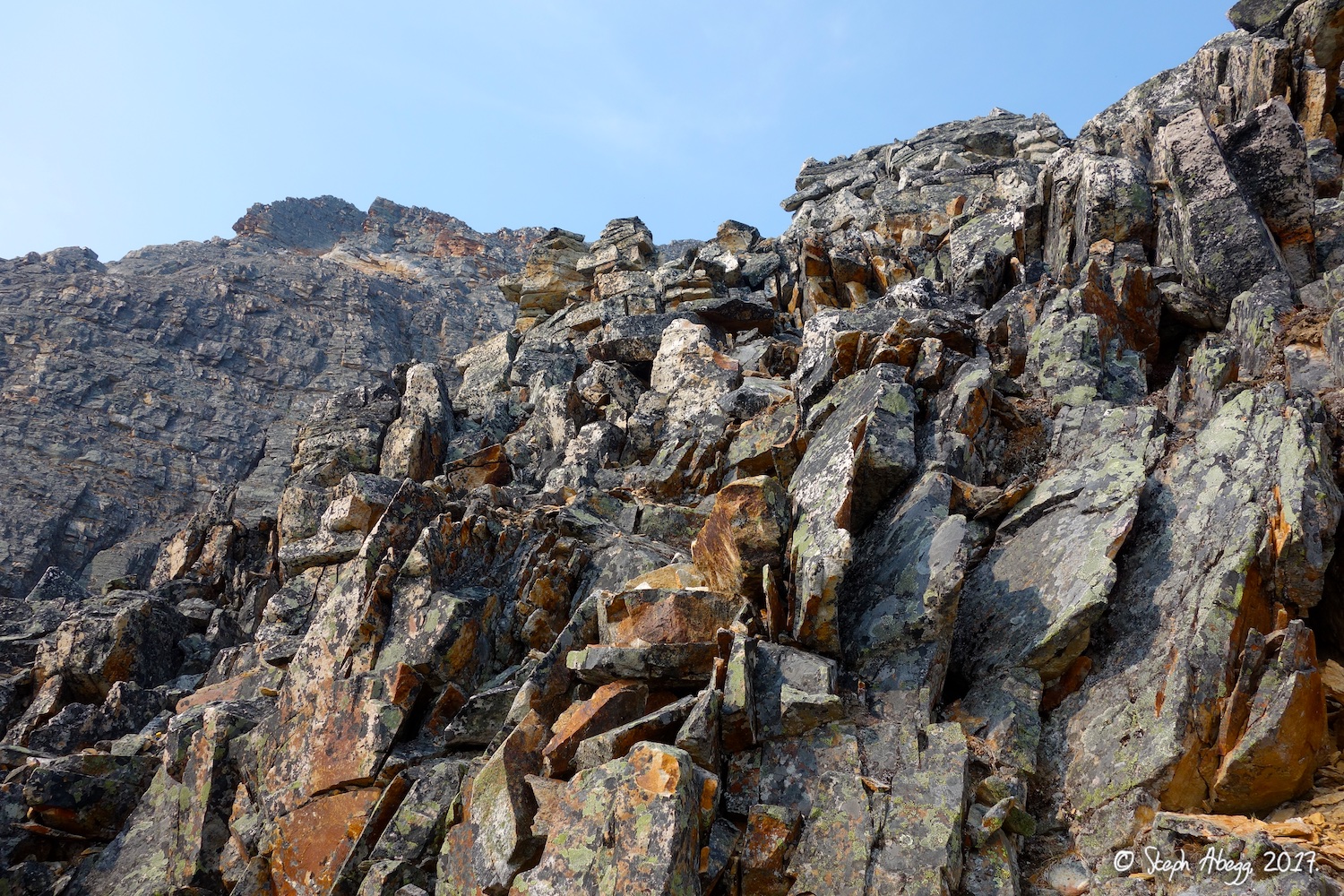
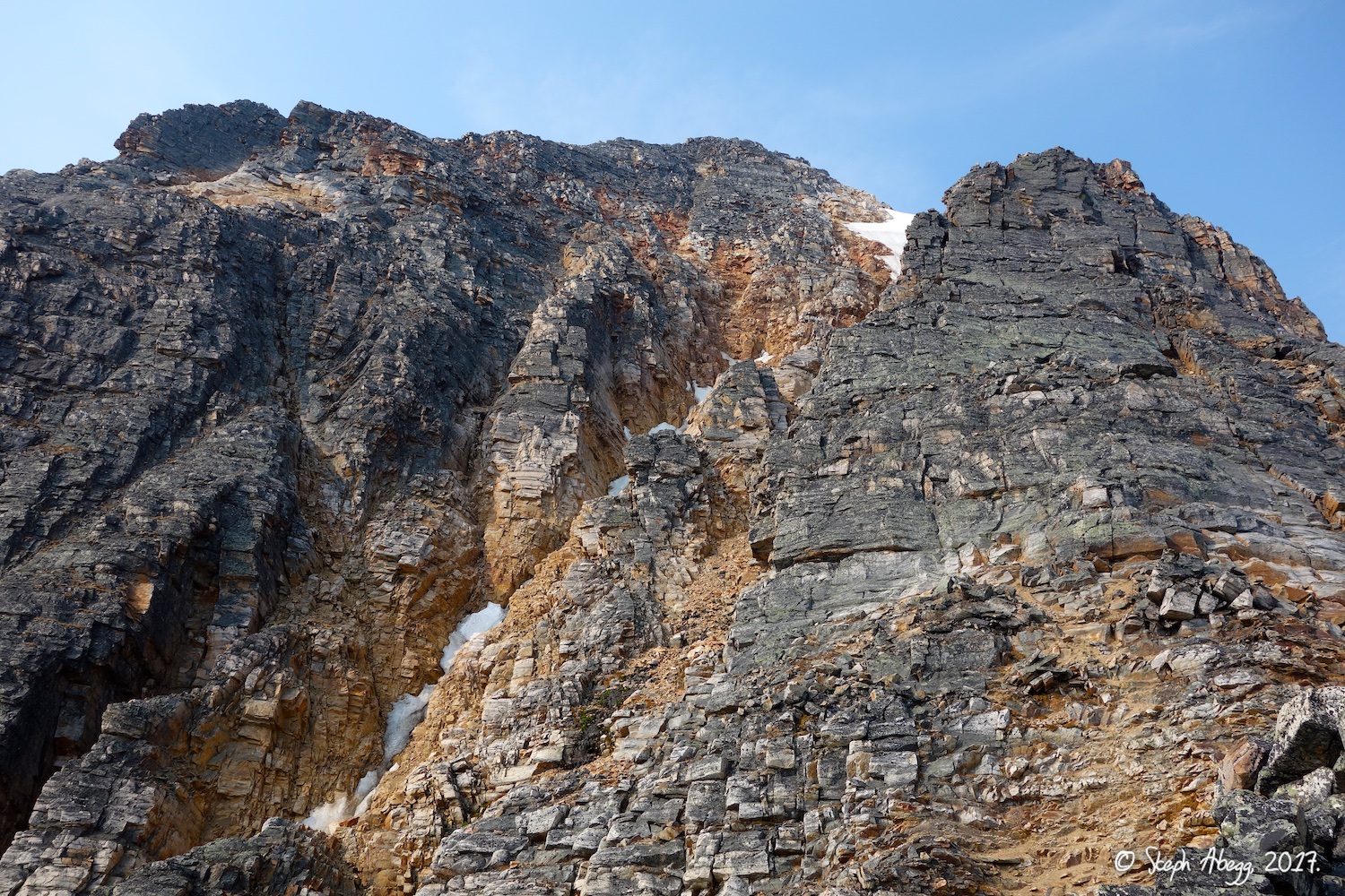
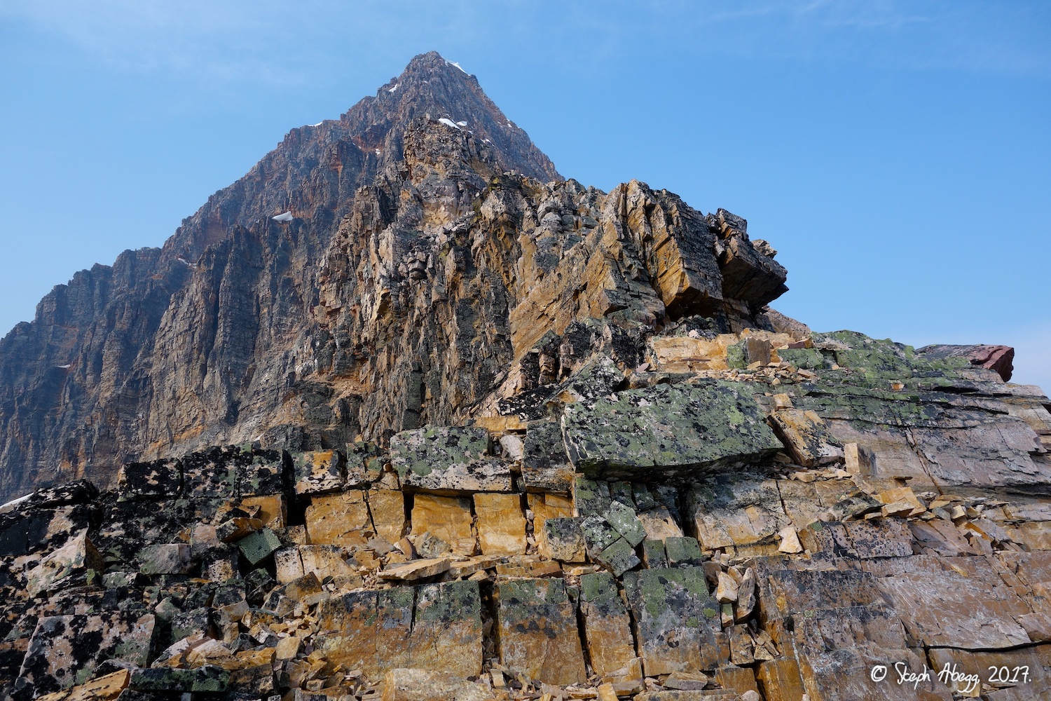
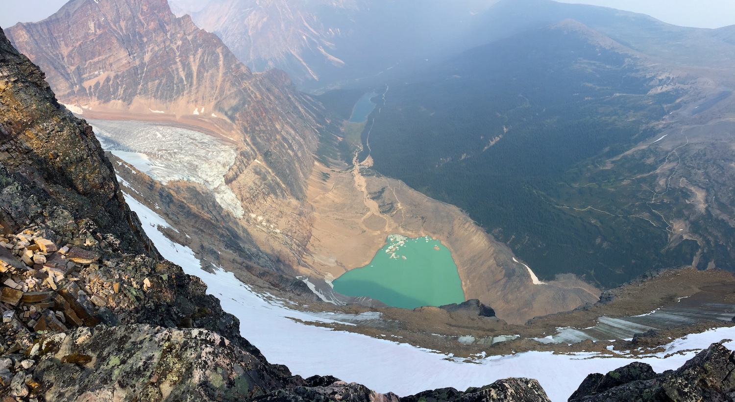
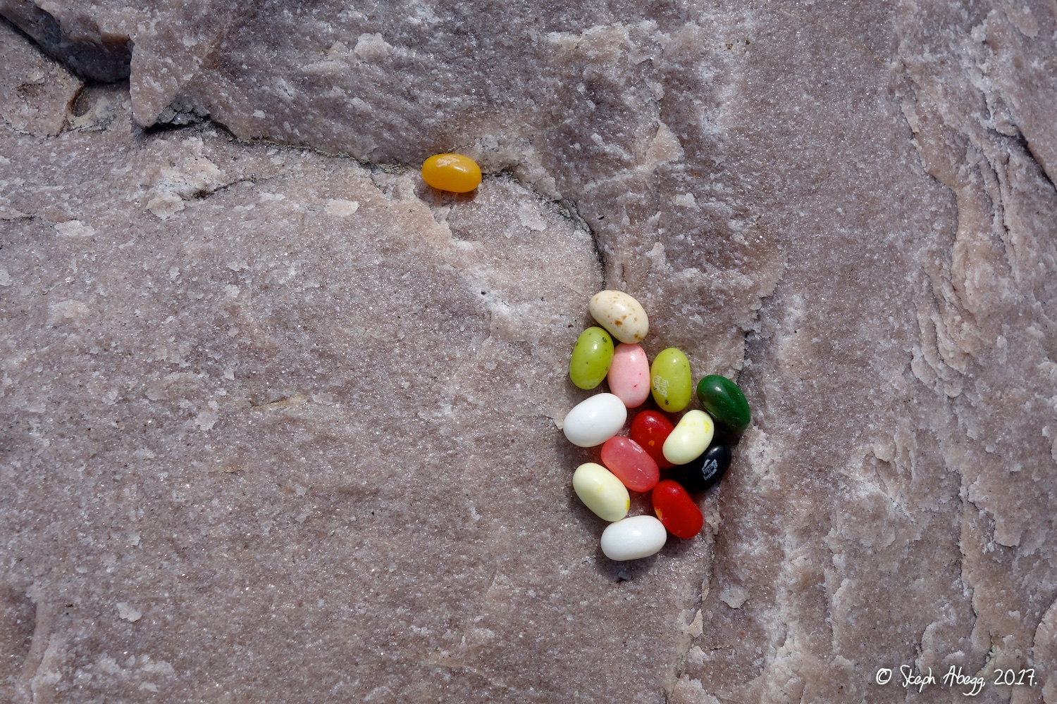
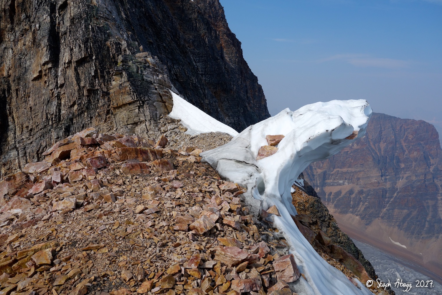
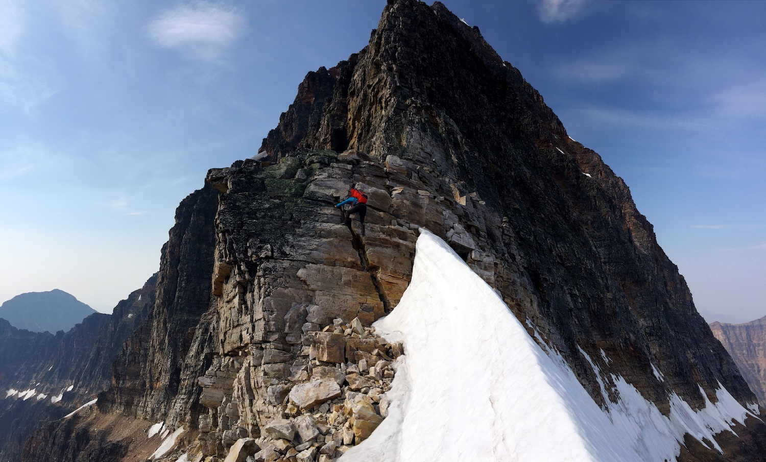
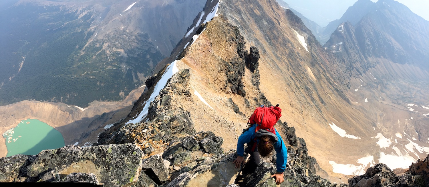
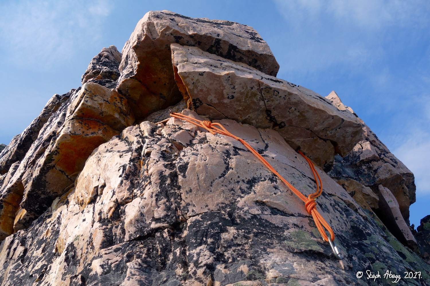
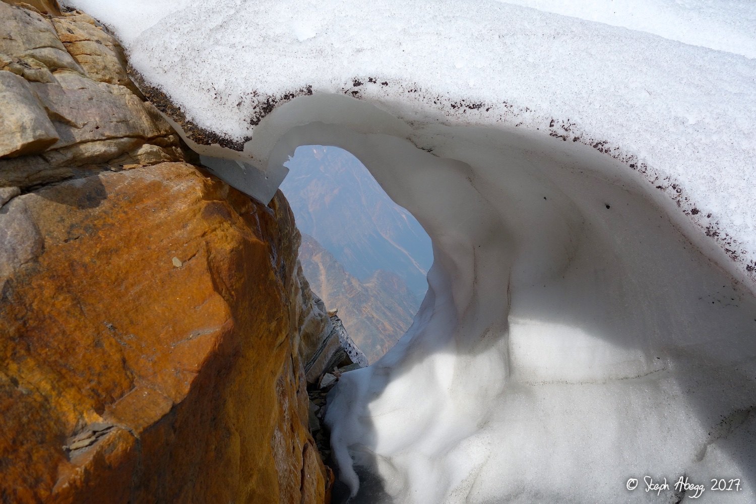
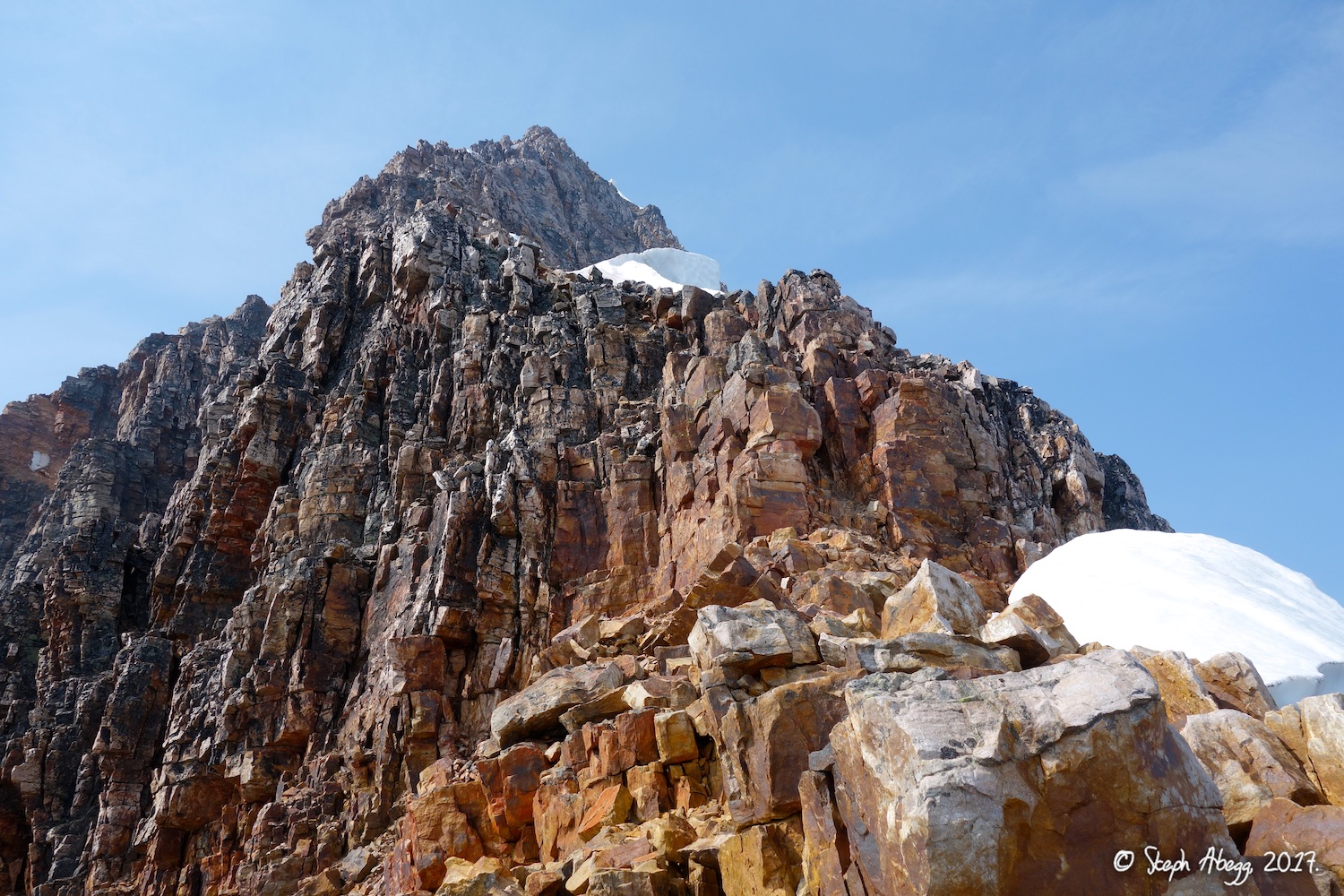
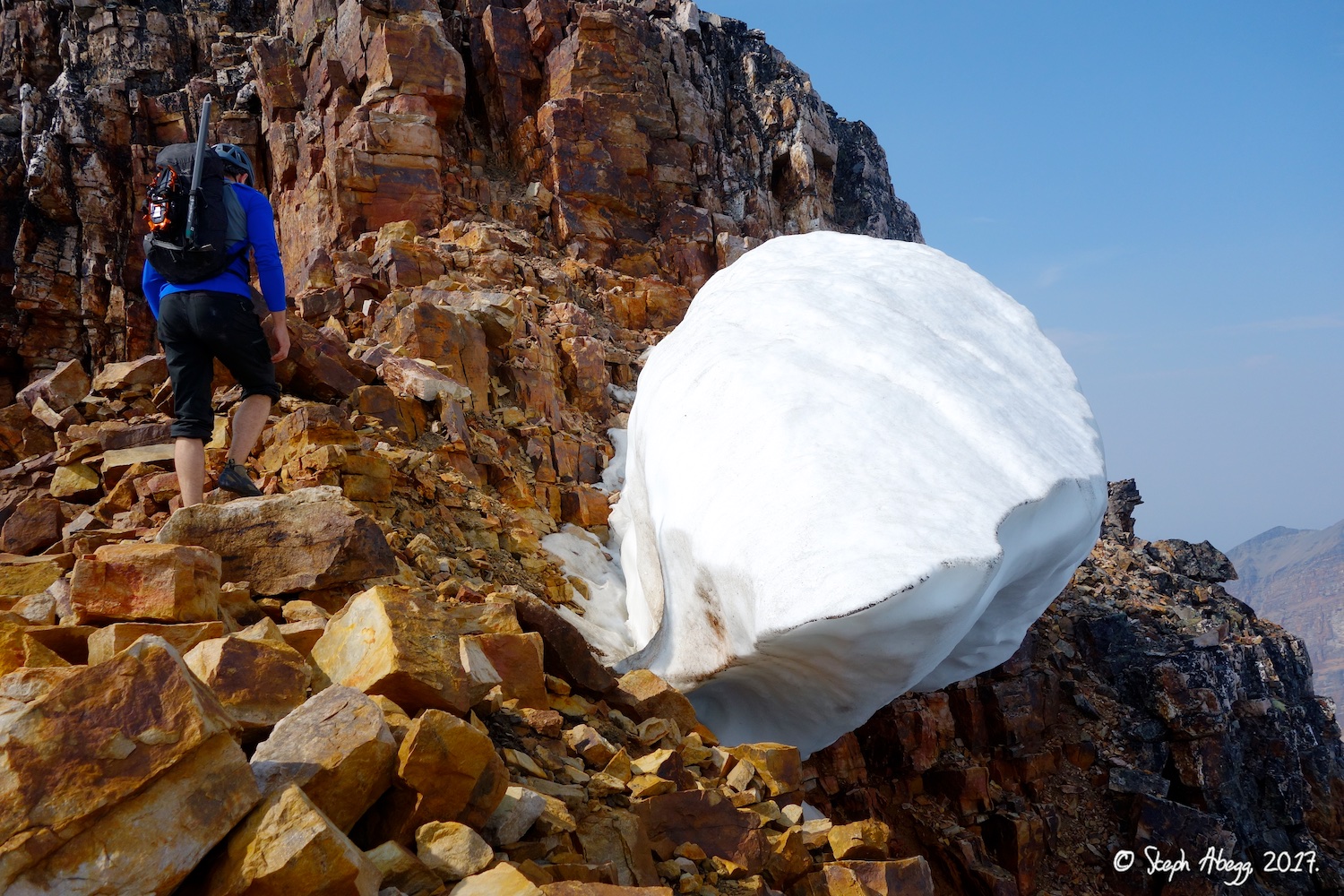
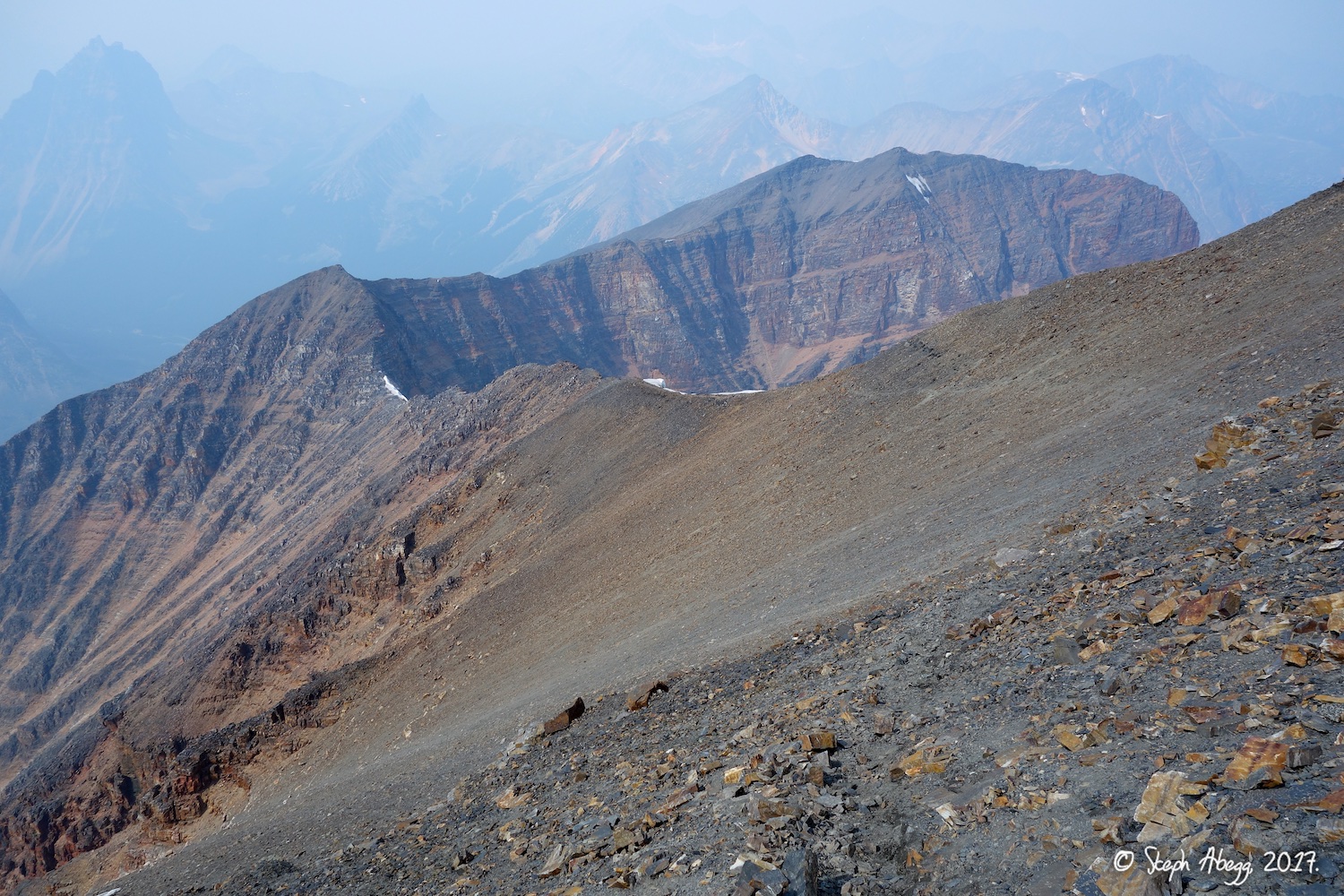
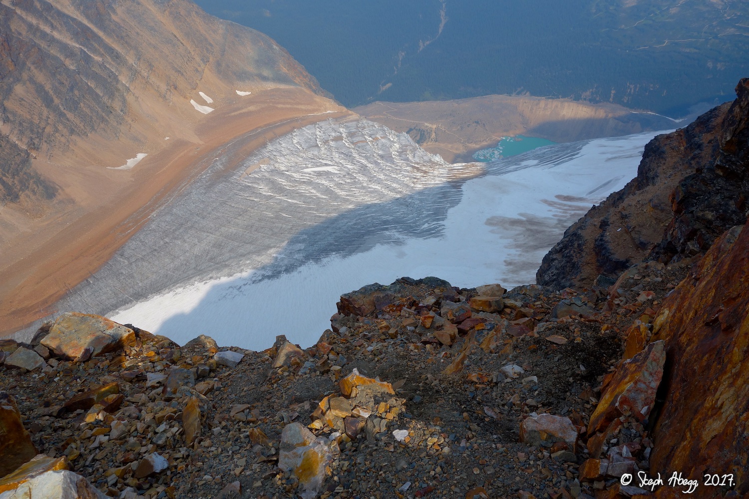
8. The East Ridge starts with a bunch of 3rd class. 9. We went up the dark rock on the right, crossed just below the snowfield peeking around the corner at the top, and then went up dark rock on the left. 10. We crossed just under the snow and the orange gully and headed up the more solid dark rock. 11. Approaching the final steeper section of the ridge. There is still about 500m / 1600' to go at this point. 12. Looking back along the East Ridge at a flattish section of ridge. 13. More 3rd class climbing. 14. Looking down at Edith Glacier and Cavell Pond and Cavell Lake below. (Photo by Rob.) 15. Beautiful quartzite. Jelly beans for scale. 16. Some fun 4th class climbing on solid quartzite. 17. The remnant of a cornice. 18. Steph on the East Ridge. (Photo by Rob.) 19. Steph on the East Ridge. (Photo by Rob.) 20. Looking up the crux 5.3 section of the route. We decided we were comfortable soloing this in rock shoes. This was the best section of the route, but only lasted about a pitch worth. Wish there was more of this kind of climbing on the route! 21. Rob on the East Ridge. 22. The fixed rappel anchor at the top of the 5.3 pitch. We would have used this to rappel this part of the route if we had come down the East Ridge. 23. A hole in a melting snow patch. 24. A hole in a melting snow patch. Steph for scale. (Photo by Rob.) 25. Looking up the final section of the East Ridge after the 5.3 step, which is 3rd class again. After this step, there is still about 400m / 1350 feet to go to the summit. 26. A hanging snow patch. (Photo by Rob.) 27. A hanging snow patch. Rob for scale. 28. Some interesting peacock-like coloring on the rock approaching the summit. One theory is it could be caused by bacteria, which can cause an "oily sheen" on a rock surface. |
|
Summit 3,363m / 11,034 ft
|
29.
 30.
 31.
 32.
 33.
 34.
 35.
 36.
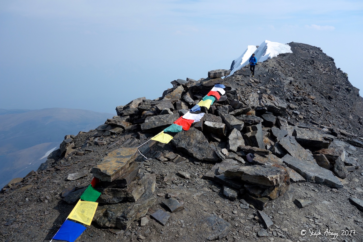 |
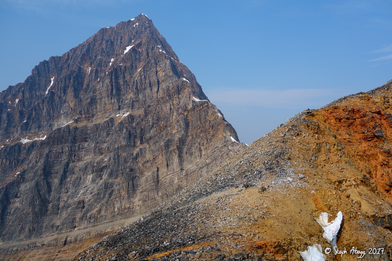
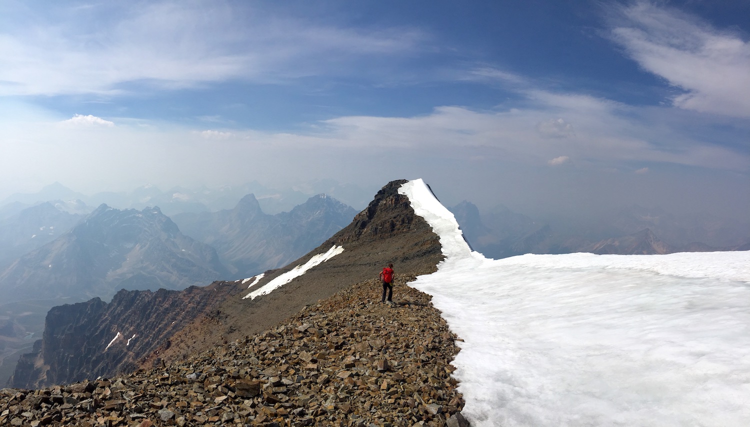
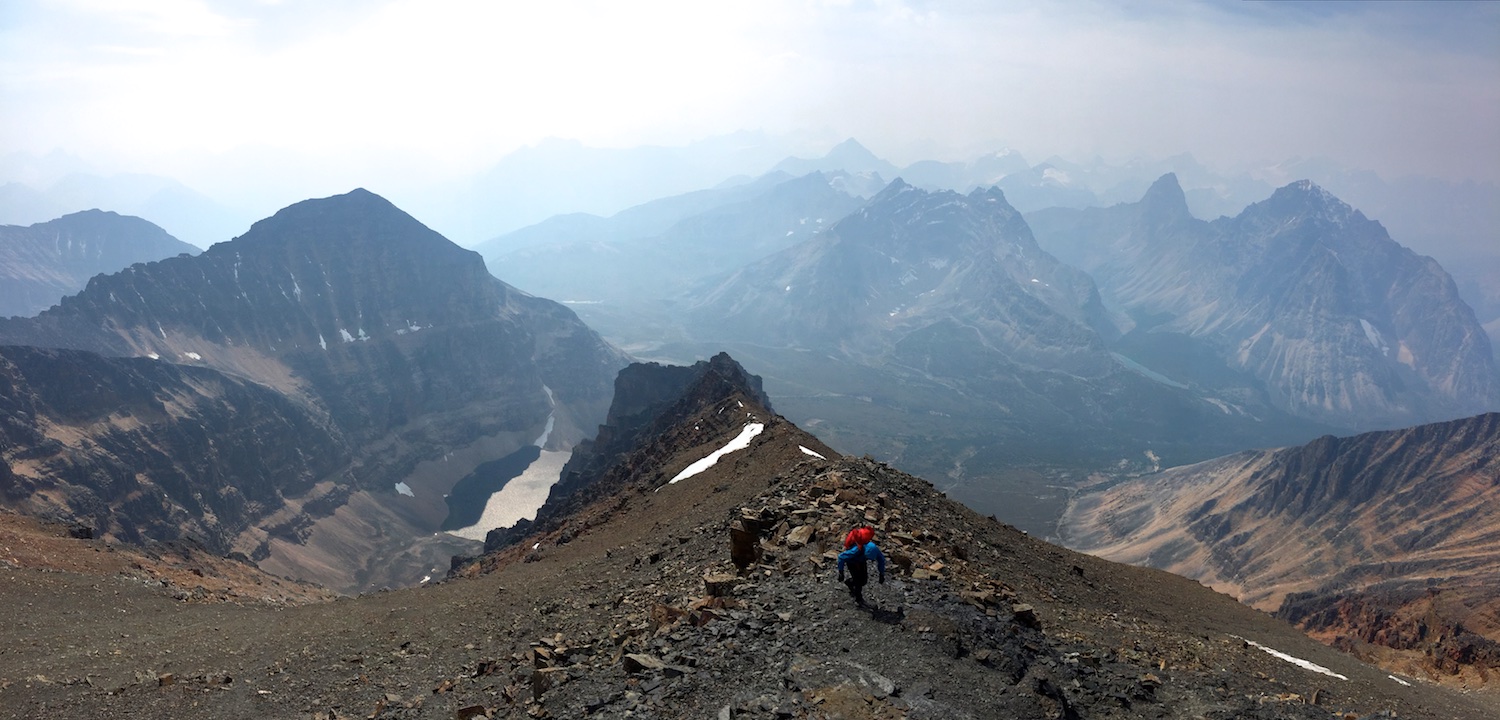
29. Approaching the eastern summit (the western summit is a bit higher). Late season conditions make this just a mellow hike along rock, but earlier in the season this section is snow and can require crampons and axe. (Photo by Rob.) 30. Due to the leisurely start to the day (I did not leave Jasper until 7:45am), I had stopped at Tim Hortons in Jasper that morning for coffee and picked up a sandwich for lunch. Yum! 31. Most of the stuff in this pack I never used.... 32. Water on the summit. We could have gone lighter on our water as well. 33. Looking down the North Face, with Angel Glacier and Cavell Pond far below. (Photo by Rob.) 34. The steep, rugged North Face is on the left. We talked to a party that climbed the North Face route the day before we climbed the East Ridge. Definitely a more serious endeavor than the East Ridge. 35. Steph on the higher western summit of Edith Cavell. (Photo by Rob.) 36. Colorful prayer flags on the west summit. |
|
Descent
via West Ridge
|
37.
 38.
 39.
 40.
 41.
 42.
 43.
 44.
 45.
 46.
 47.
 48.
 49.
 |
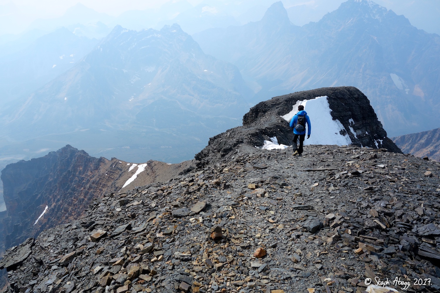
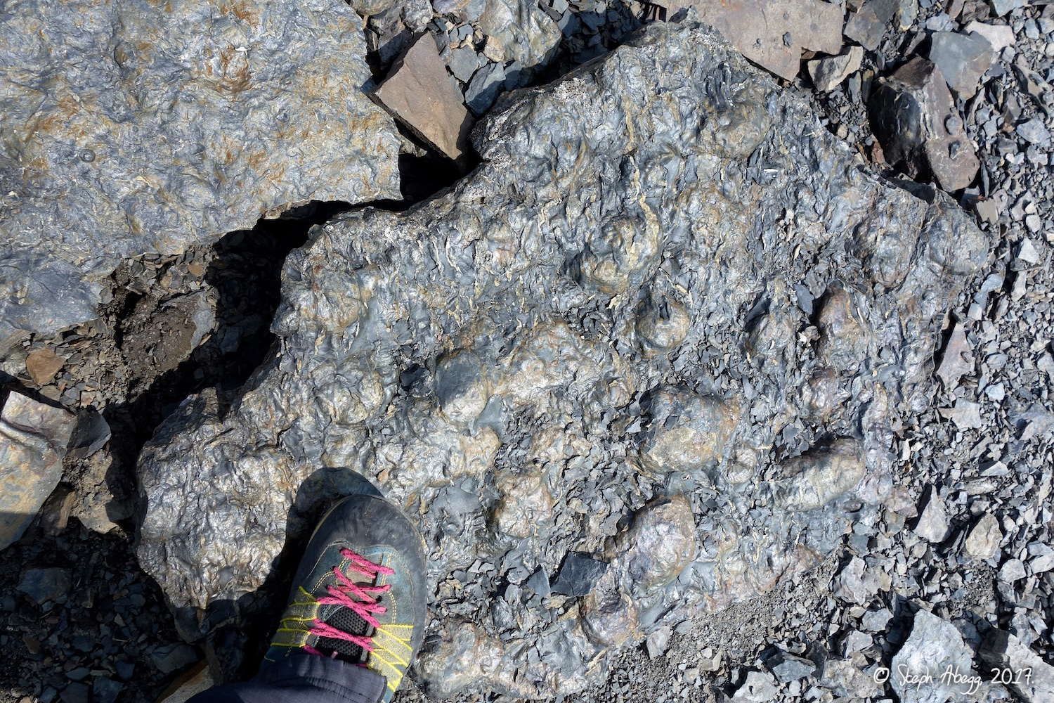
37. Rob at the start of the West Ridge descent. If you squint through the smoke, you can make out a beautiful anticline displayed in the mountain across the valley. 38. Interesting bulbous formations in the slate near the summit. Foot for scale. Maybe fossils of some sort? 39. In this photo it looks as if I am headed back up, but I am actually turning right, as the West Ridge route goes right and maintains the ridge here. (Photo by Rob.) 40. The West Ridge route takes a path across this and then goes down and left on the scree/talus. 41. The first bit of the west ridge descent gives great views of the Angel Glacier and Edith Pond far below. This photo is practically a glacial geology lesson: Firn line between grey glacial ice and remnant snow, slide debris on surface, greenish-blue lake caused by glacial silt, prominent end moraine, no prominent lateral moraine (thus showing steady glacial retreat), and "ogives" (concentric bands in the ice). 42. Rockies choss. 43. At the base of the chossy slope. We came down just right of Rob's head in the photo. 44. A nice path through pretty meadows. Too bad about the smoke, as I imagine the views would be pretty without the smoke. 45. The last few kilometers of the west ridge descent follow the Tonquin Valley trail back to the car. This is a really nice trail, and flat too. 46. Apparently there are a fair number of bear sightings in Tonquin Valley. We did not see any bears, but we saw evidence of their existence.... 47. Edith Cavell as seen from Cavell Lake, just before the trail meets the road. 48. The West Ridge descent dumps you out on the road about 2km from the parking lot for the East Ridge. Although we had two cars and could have easily left one here, we had foolishly left both at the upper trailhead, initially having planned to descend the East Ridge. But at some point during the day we decided a round trip would be nice, and came down the West Ridge instead. It took Rob 9 minutes to run up the road to collect a car. Thanks Rob! 49. While Rob ran up the road to get a car, I photographed this grey jay aka "camp robber" feasting on a discarded bagel. |