I first climbed this Fifty Classic route with my mentor Clint, who drove all the way from California to climb it. Ten years later, with another decade of climbing and overlays under my belt, I climbed the route again.
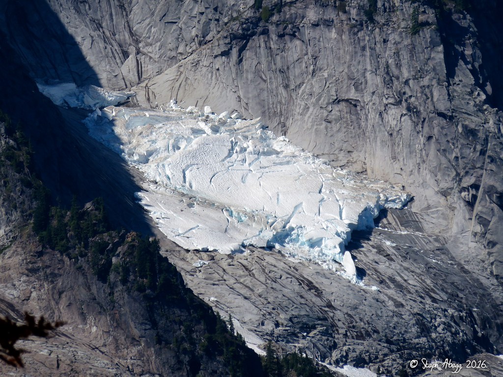
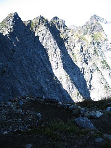
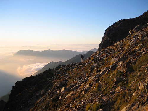
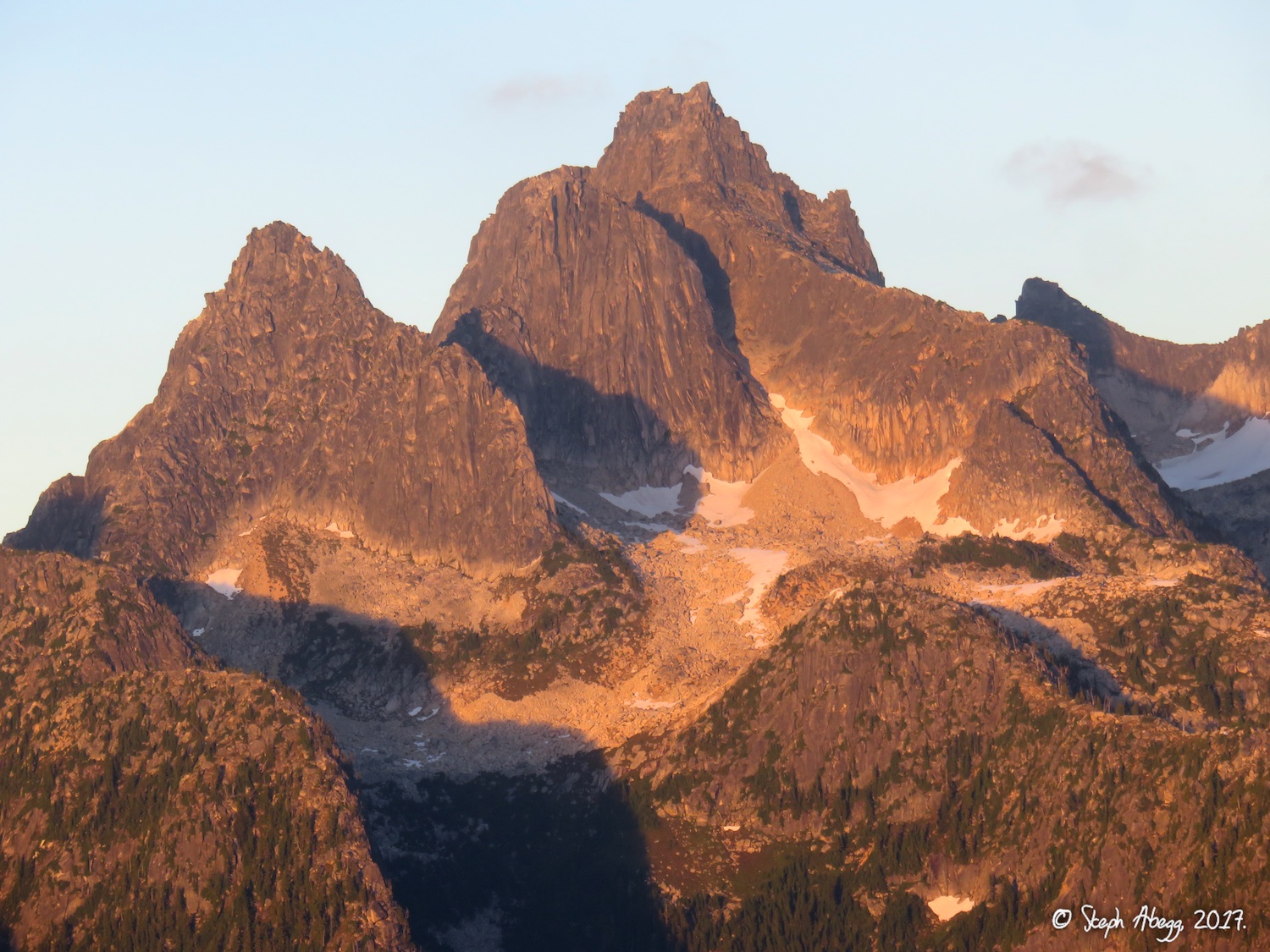
In interest of safety, climbers often wait until the pocket glacier slides off to climb the NE Buttress of Slesse, as I did on both occasions I have climbed Slesse. Some years the pocket glacier slides by July, while some years it hangs around through September. The photo to the right was taken on August 12, 2016. The pocket glacier was unusually large for so late in the summer. On a particularly warm day a week later, the entire glacier slid off all at once!
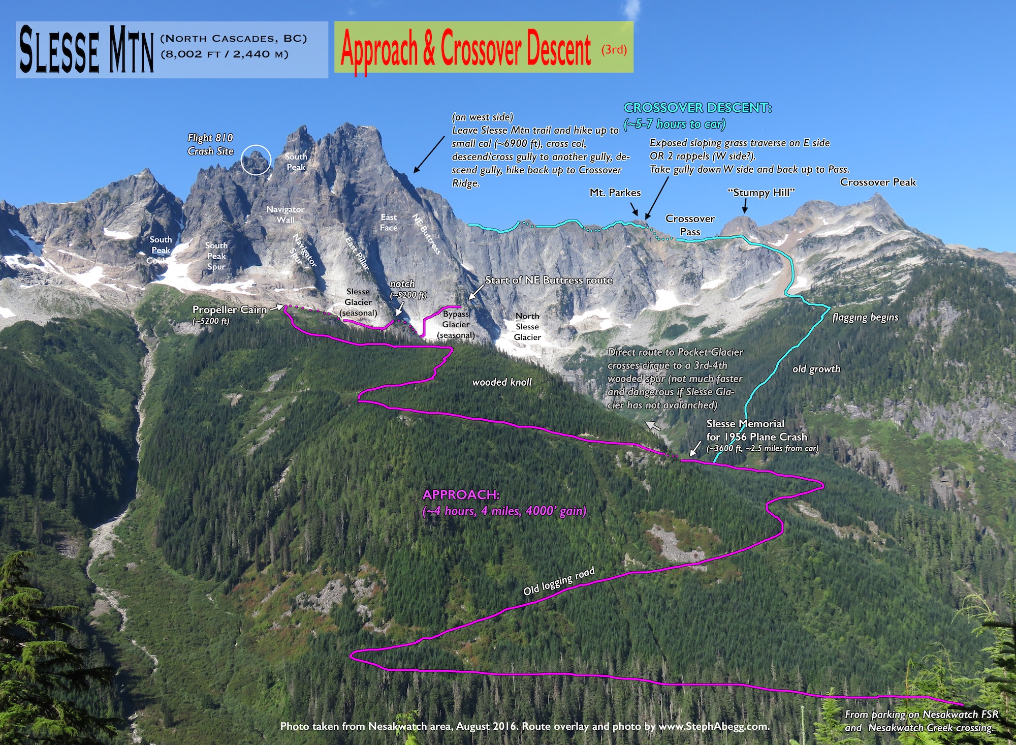
Part of climbing Slesse is deciding which descent option to take: the Slesse Mountain Trail or the Crossover descent. The advantage of the Crossover descent is that you return to the trailhead where you started on the east side of the mountain; the Slesse Mountain trail, however, dumps you out at a different trailhead on the opposite side of the mountain, requiring a second vehicle and driving down more (potentially rough, every year is different) logging roads. The advantage of the Slesse Mountain trail is that it is a pretty easy slog out, which can be nice if it is dark or if you are tired; the Crossover descent requires more involved routefinding and some travel over steep snowfields and talus, which is not as fun in the dark or when tired. In 2007, Clint and I chose to hike out via the Slesse Mountain Trail. In 2017, DR and I took the Crossover descent. After doing both, I decided I have no strong preference of descent option—the advantages/disadvantages of the two descent options about balance out for me. I would make my decision based on road conditions, snow conditions, availability of second vehicle, hours of daylight, comfort with routefinding and rugged terrain, partner's preference, etc.
Road Conditions
The condition of the logging roads vary from year to year. In both 2007 and 2017, I have been able to drive my Subaru Forester to the Slesse trailhead, but I have had friends that were on other years unable to get their car all the way to the trailhead (especially if it is a low-clearance vehicle). But I think that the presence of the Slesse Memorial Trail at the start of the approach means that the road is repaired and re-graded often enough that you can usually expect to be able to drive at least most of the way to the trailhead, especially if you have a high-clearance vehicle.
Trip Reports
CLICK ON TRIP REPORT TO DROP DOWN CONTENT
THIS TRIP REPORT IS STILL MOSTLY IN THE EMBEDDED HTML FORMAT OF MY OLD WEBSITE. MOBILE Tip: Try Landscape mode. It is generally more mobile friendly.
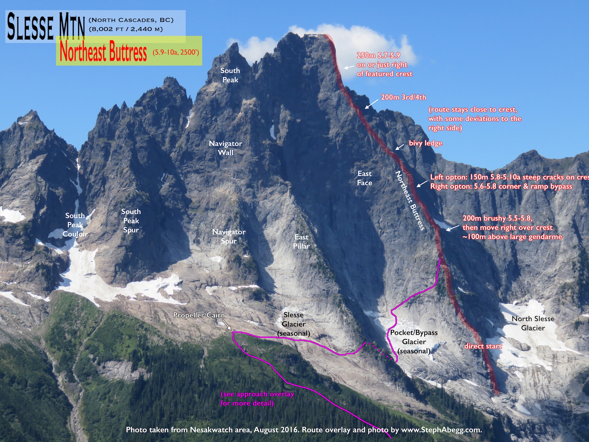
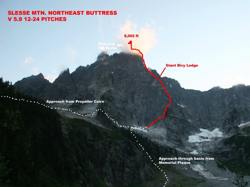
ROUTE OVERLAY
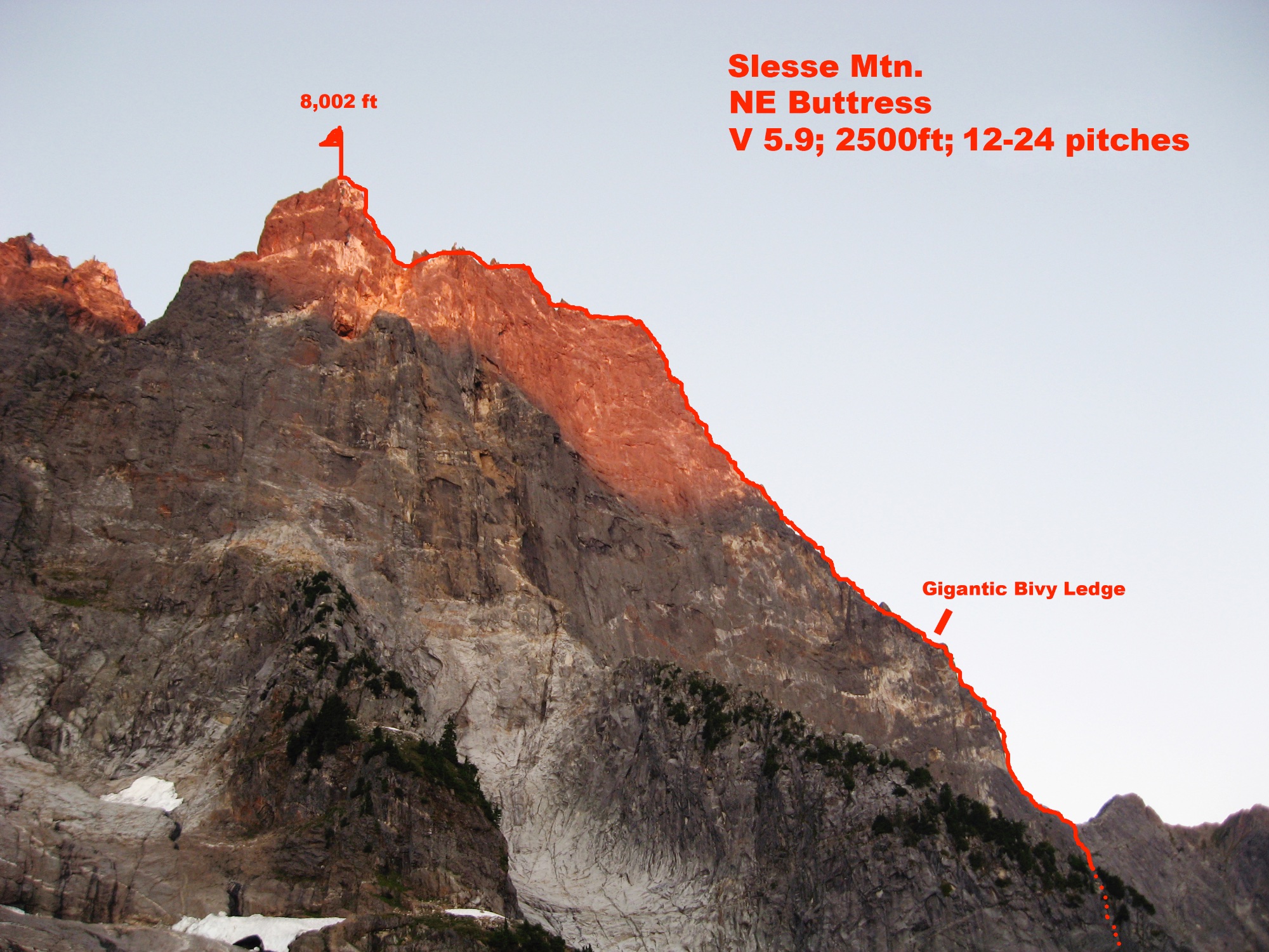
The route up the NE Buttress of Slesse Mountain (aka Mount Slesse). 2500ft of stellar climbing! (This photo was taken from the Memorial Plaque on the east side of Slesse on a hike in 2006).
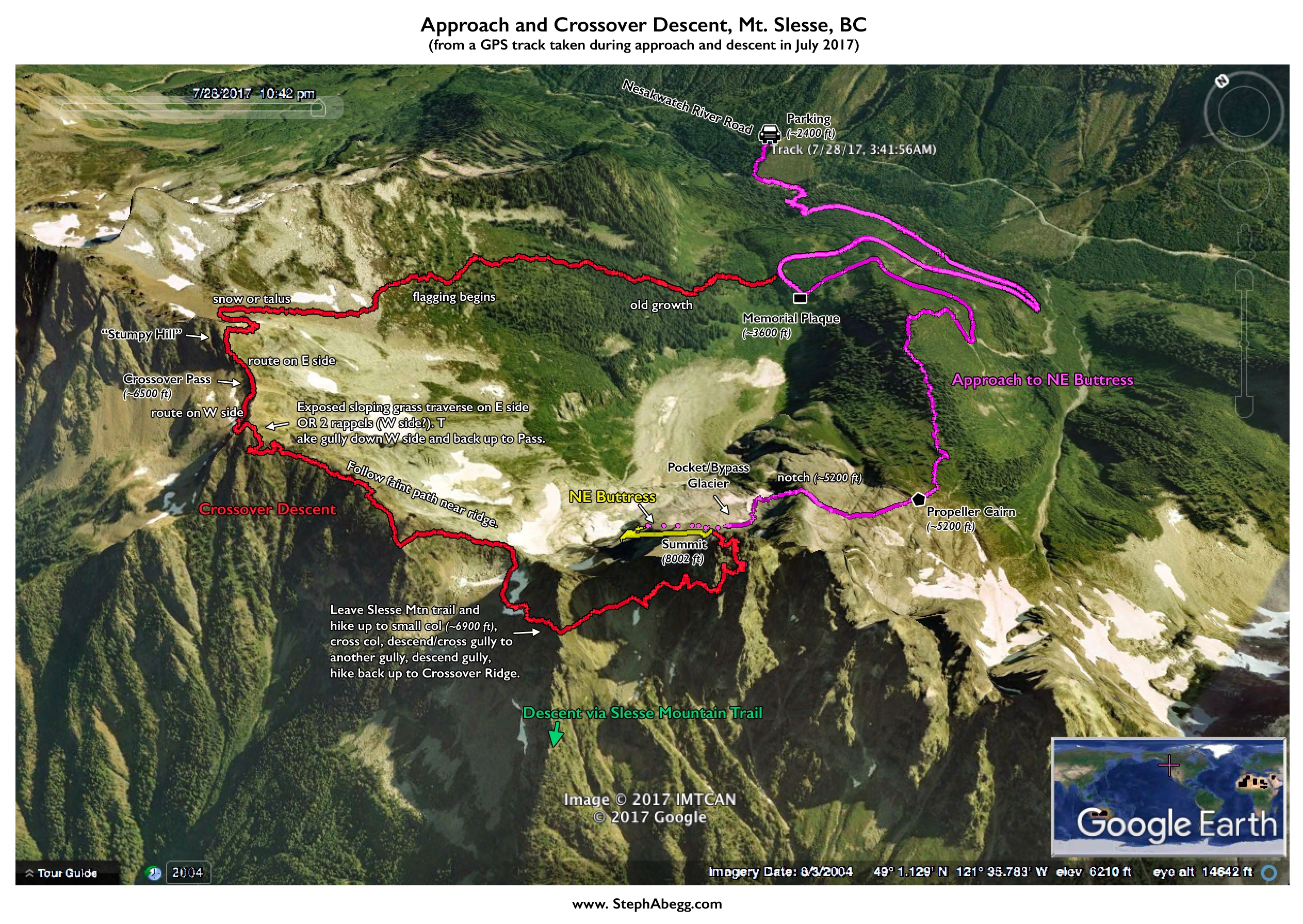
See updated route overlays on 2017 trip report on the second half of this page.
MAP
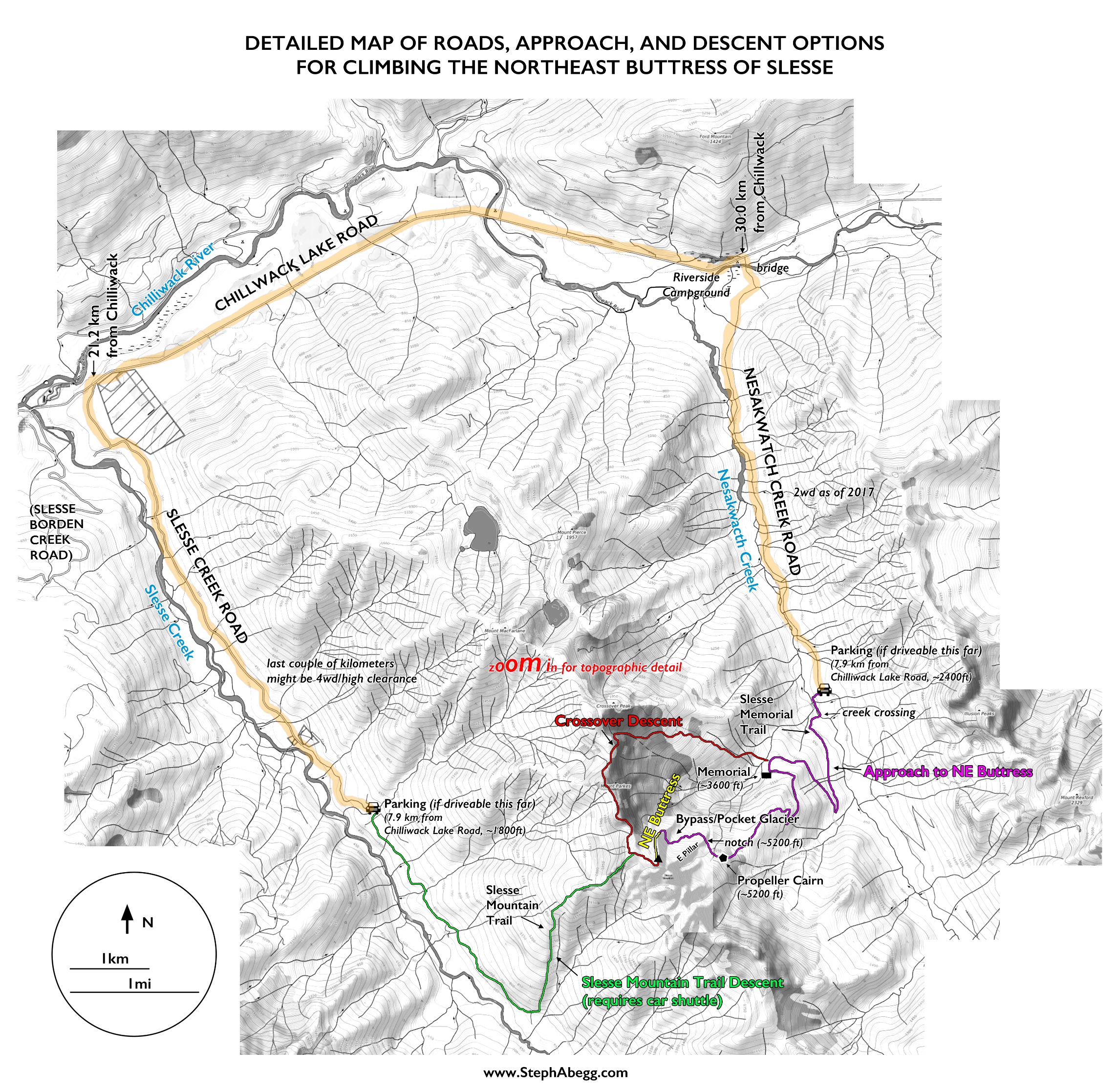
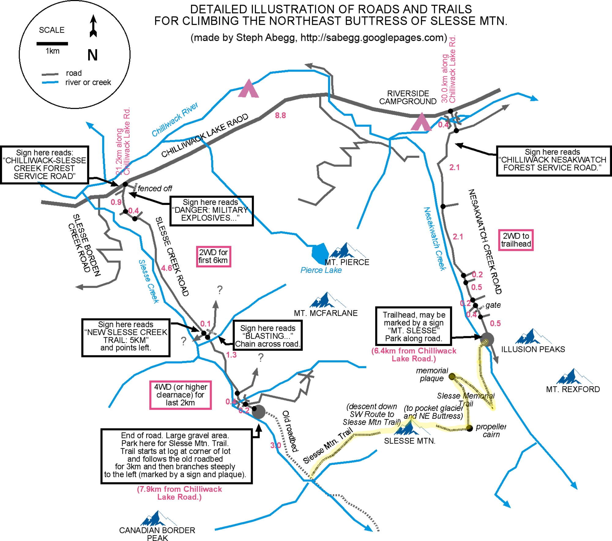
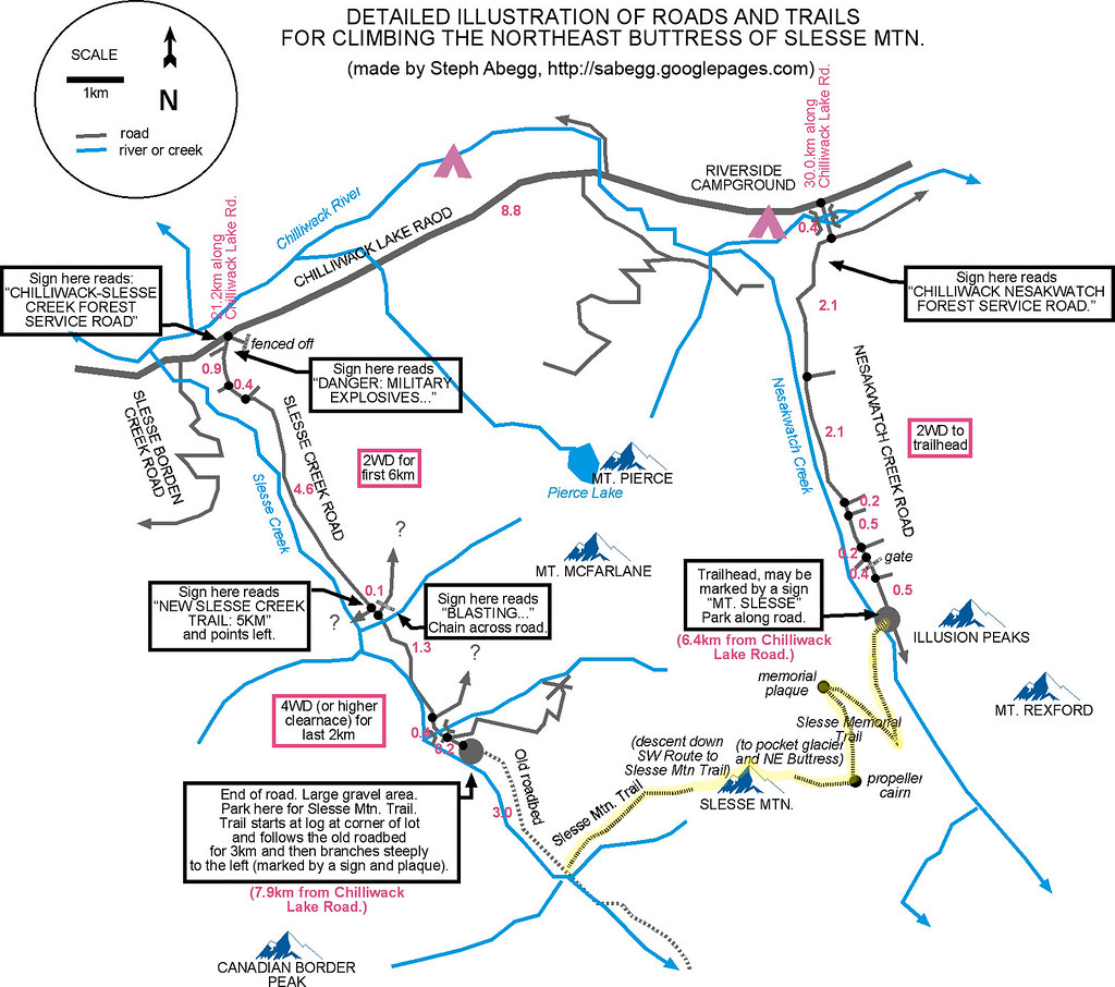
When figuring out the logistics of the car plant and access trails for climbing the NE Buttress of Slesse, I discovered a lot of ambiguities and confusion. Even though we prepared well, Clint and I still got lost up some logging road spur while trying to follow an outdated description of the trailhead for the Slesse Mountain trail. So, I drew up the above illustration, in hopes that it could clear up a lot of ambiguities. Click on the above illustration to enlarge. The route is highlighted in yellow. The distances are in kilometers. It took 15 minutes to drive the 7.9km on the Slesse Creek Road, 9 minutes to drive the 8.9km on the Chlliwack Lake Road, and 14 minutes to drive the 6.4km on the Nesakwatch Creek Road. Note that this map was created in 2007, and so take this info with a grain of salt that grows larger with each passing year. I made an updated version for my 2017 trip report on the second half of this page. The updated map also shows the Crossover descent.
INTRO
Having lived in Abbotsford, British Columbia, for my high school years, I have caught several glimpses of the prominent form of Slesse on the horizon, located just north of the US-Canada border. Slesse means "fang" in the native Salish tongue, which aptly describes it's spire profile from many directions. The 2500-foot-tall Northeast Buttress is one of Steck and Roper's Fifty Classic climbs, and one of the more aesthetic line and sought-after big route in the Cascades.
In August, when my Californian climbing partner Clint Cummins drove north to climb in the Bugaboos with me (where we climbed Beckey-Chouinard on South Howser Tower and Snowpatch Route on Snowpatch Spire), we had initially planned on climbing the NE Buttress of Slesse before he made his long drive back south. However, by mid-August the pocket glacier had not yet slid; we had decided not to climb Slesse unless the pocket glacier slid, in light of the unfortunate death of a climber earlier in the season from a calving chunk of glacier. So Clint drove home to California, and we put Slesse on hold for another year. However, when the pocket glacier slid at the end of August and a great stretch of weather appeared in the forecast, Clint and I revisited our plans to climb the Northeast Buttress of Slesse. Clint drove all the way from California, and off we went for another great climb together!
Due to the lack of water on the route (in the late summer the snow at the bivy ledge is melted), the early-autumn nighttime chill, and the fact that it is more enjoyable to climb with lighter packs, we decided to climb the route without a bivy. The day before the climb, we planted a car at the Slesse Mtn. Trailhead on Slesse Creek Road, and then drove 23 km to the trailhead for the Slesse Memorial Trail on Nesakwatch Creek Road. We pulled out our sleeping bags and slept beside the car near the trailhead. Having no alarms on our watches, we slept in an hour later than we had wanted to, but we still got an early start and we were hiking by 4:15am. After a stellar climb, we arrived on the summit a couple of hours before sunset, and by midnight were stumbling onto the Slesse Creek road where we had planted our car the day before.
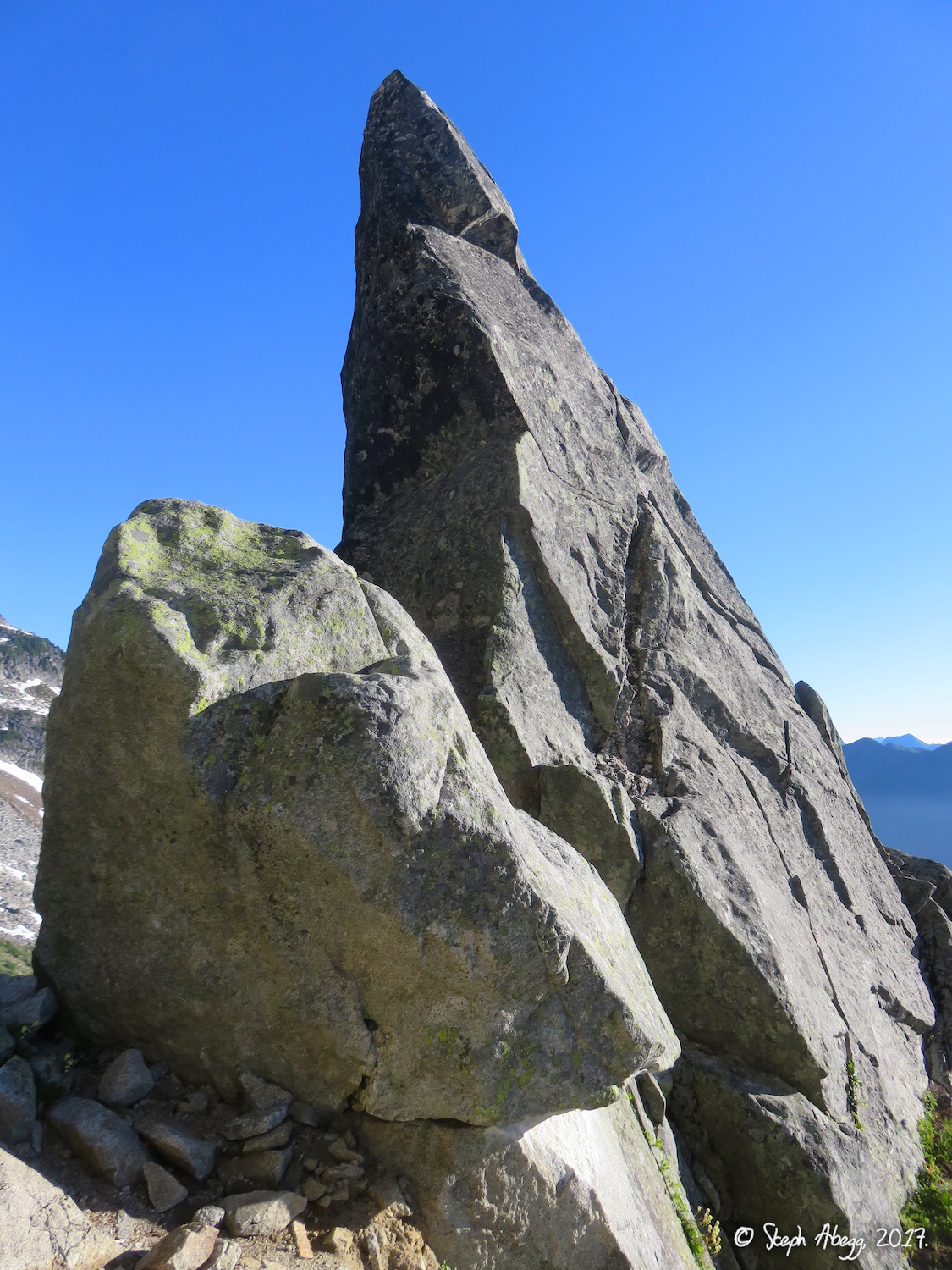
The following page details our 20-hour car-to-car climb of the Northeast Buttress of Slesse, and of course gives lots of photos. The Northeast Buttress is well-known for its status as one of Steck and Roper’s Fifty Classics. It is certainly a classic climb!
PHOTOS
APPROACHING THE CLIMB
The trailhead for the Slesse Memorial Trail, which is used to approach the NE Buttress. Thanks to whoever made the nice sign! Certainly makes this trailhead easier to find than the trailhead on the other side! The trail starts at an elevation of about 2000ft, and climbs first to the Memorial Plaque at 3600ft, and then beyond this to the Propeller Cairn at 4900ft (or 5200ft according to Google Earth).
2017 Update: The trailhead as of 2017 is a bit further up the road and has a Slesse Memorial Trail sign instead.
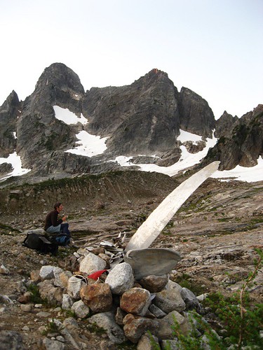
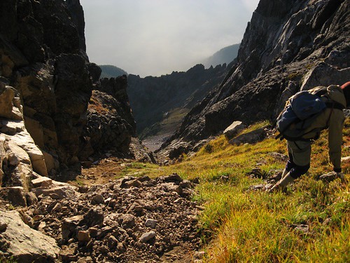
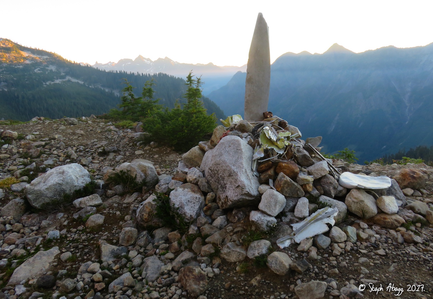
Clint at a short break at the Propeller Cairn (a memorial to the crash victims of Flight 810). It took us 2.5 hours of hiking to get here. We filled up on water here before heading over to cross the East Buttress to gain the pocket cirque below the NE Buttress. There is an alternative approach that bypasses the Propeller Cairn and goes straight from the Memorial Plaque through the basin straight to the pocket cirque. This might have been a bit faster than going to the Propeller Cairn, but it was dark and we preferred to stay on a trail.
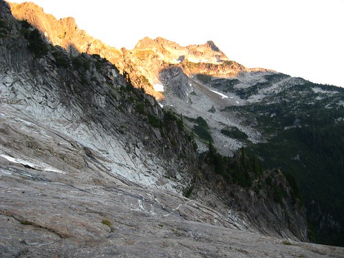
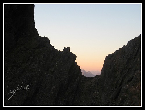
To get to the NE Buttress from the Propeller Cairn, traverse slightly downwards across glacier slabs to an obvious notch in the East Buttress (the notch is right-center in photo).
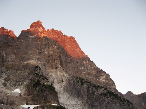
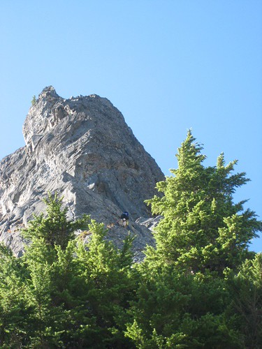
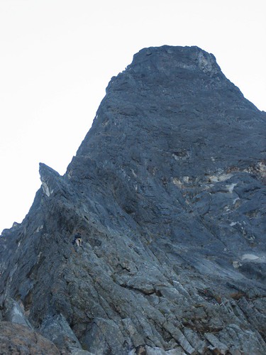
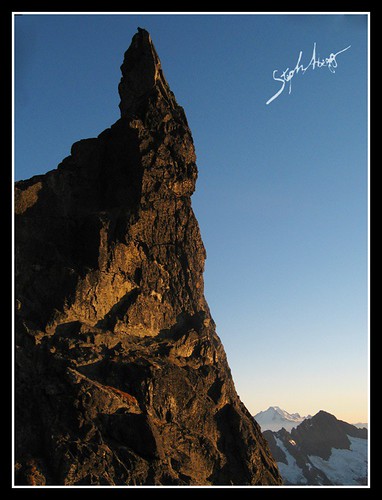
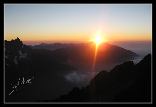
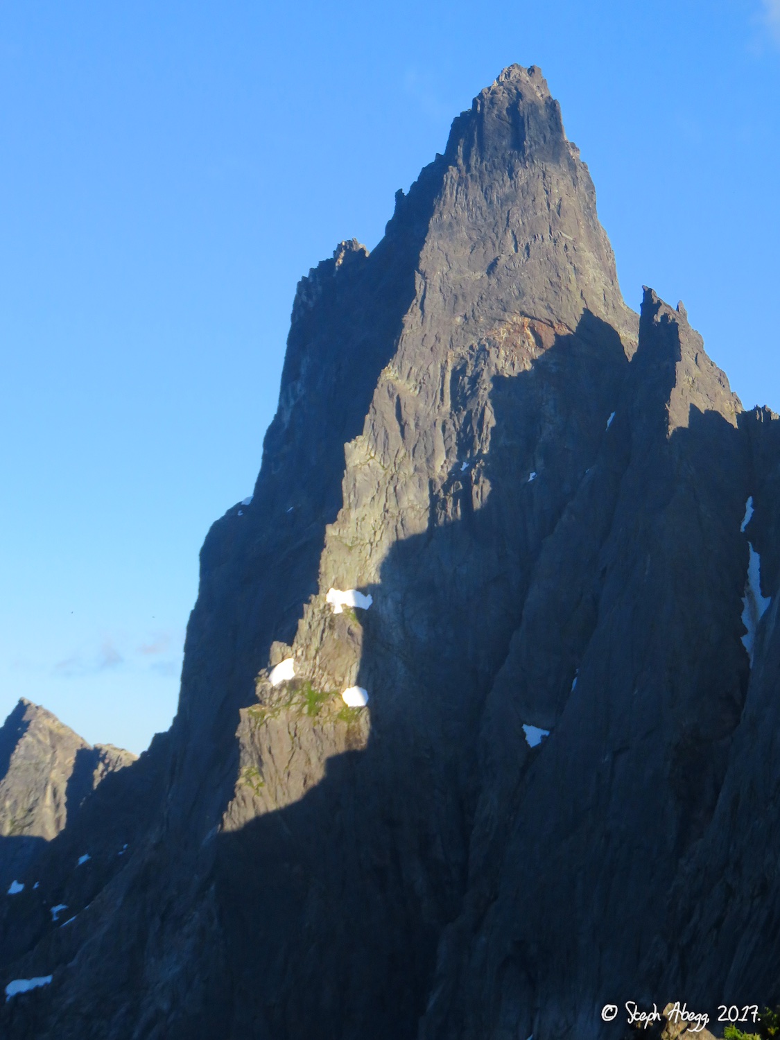
Slesse in morning light. The 2500ft NE Buttress is on the right skyline.
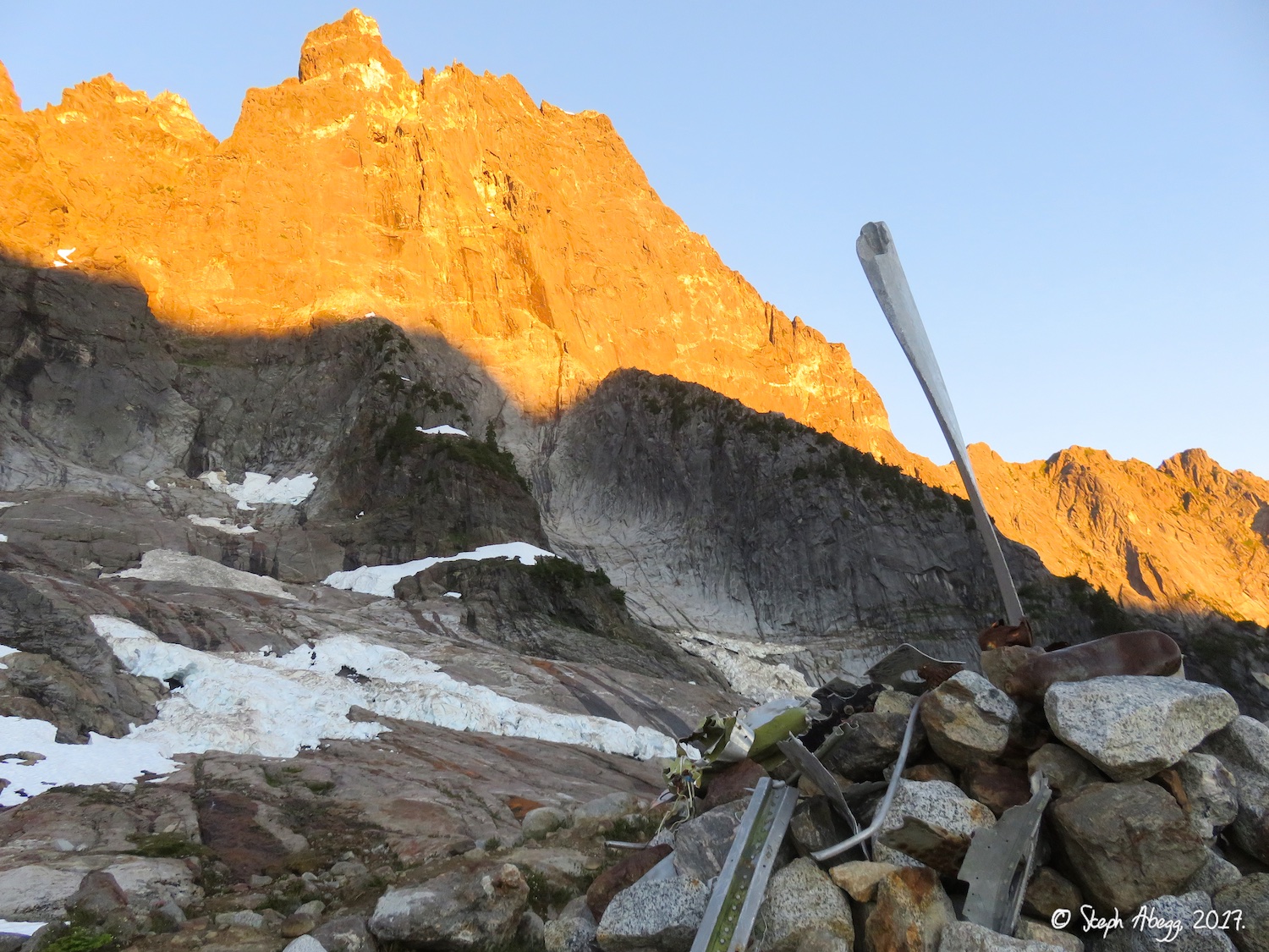
The pocket cirque. The pocket glacier had slid at the end of August. Over the years the pocket glacier has proven itself to be a serious hazard, since calving chunks have killed several climbers crossing underneath.
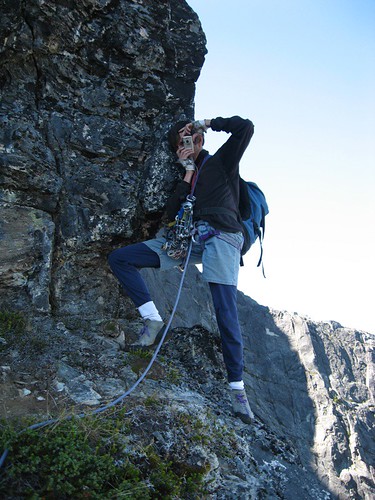
Clint crossing the pocket cirque. This photo was taken seconds before Clint was abducted by aliens beaming him out of the sky…
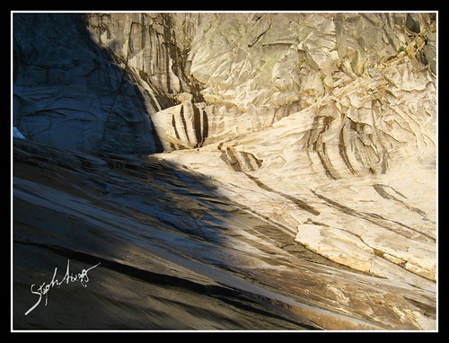
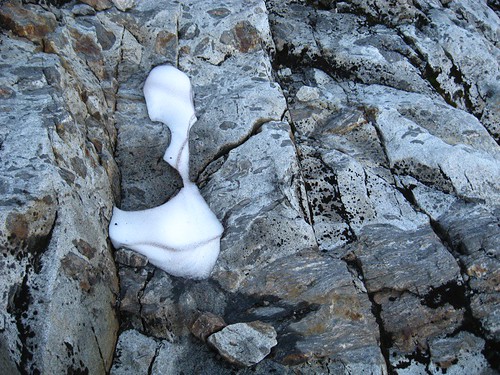
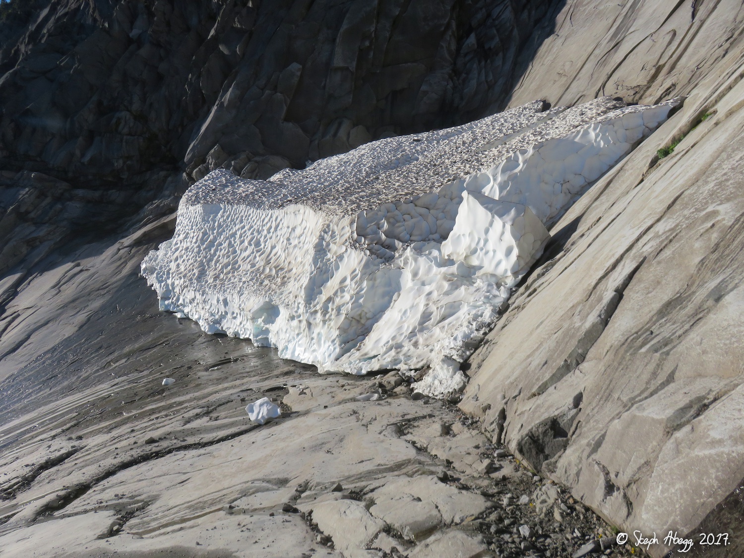
Nice light on a cool formation on a block of snow sitting on the polished slabs.
CLIMBING THE NORTHEAST BUTTRESS
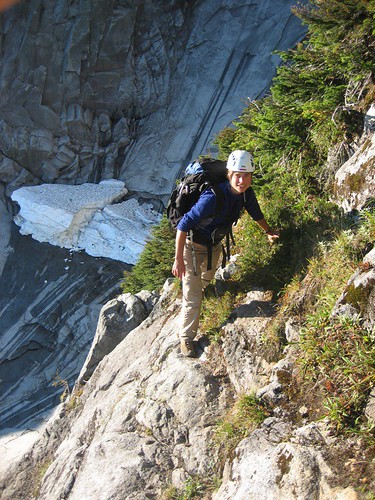
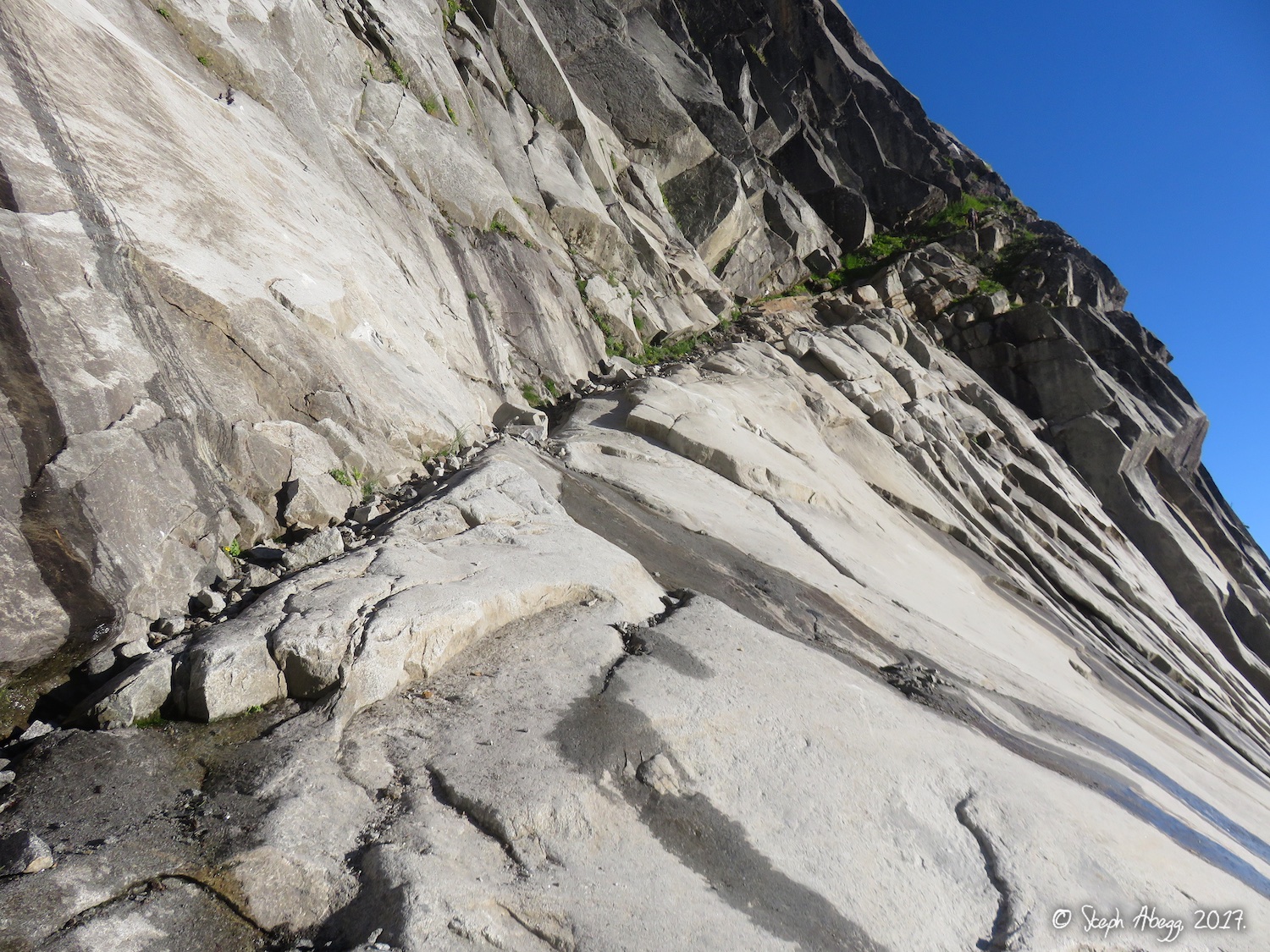
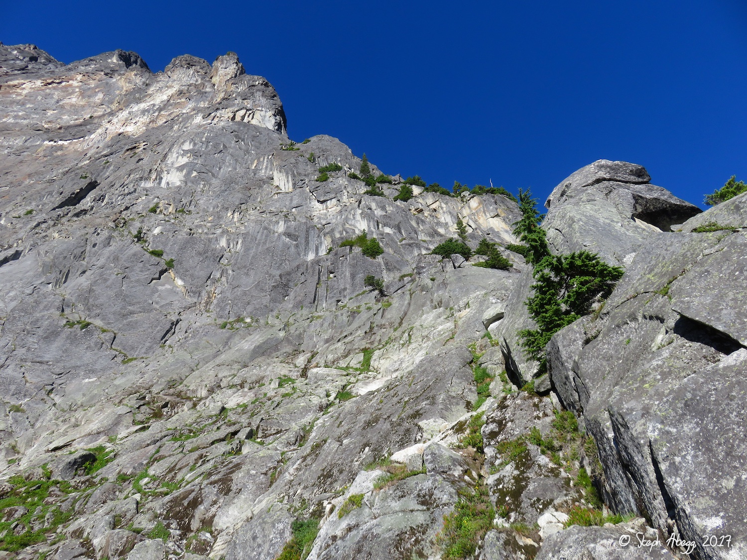
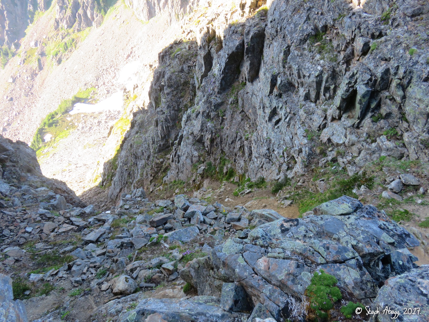
The diagonal ledge (Class 3) that leads from the pocket cirque onto the buttress. This is the popular Bypass Variation that avoids the lower unaesthetic mossy pitches.
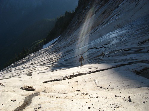
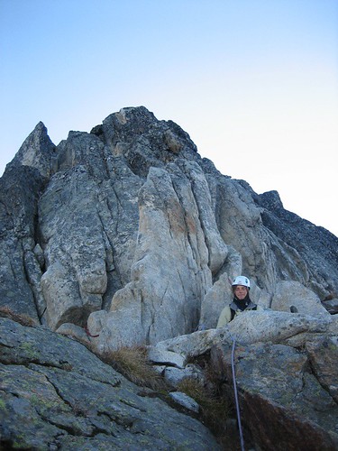
Steph on the Class 3 ledge. Behind you can see the remaining snow in the pocket cirque. This snow is on relatively flat ground so unlikely to slide.
Clint scrambling the Class 4 terrain just above where the Bypass Variation ledge meets the ridge. There is one short shrubby 5.6+ section.
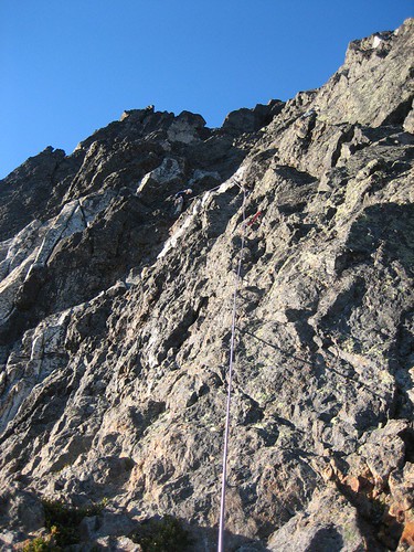
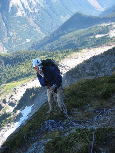
Steph soloing the 5.7 runout crack, the first stiff climbing on the route. It’s really runout this way!
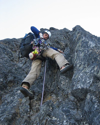
PITCH 1. We decided to rope up as the wall steepened. This pitch climbs flaky cracks and then a corner (5.8). Clint led this pitch, which continued to a belay behind and up from where he is standing in the photo.
Steph leading PITCH 2. This is low 5th-class bushy steps.
Steph climbing the arête at the top of PITCH 3. This pitch started with a 5.7 steep wall and ended on a fun arête. This pitch was part of the direct approach on the buttress, which is slightly harder than a variation to the right.
Clint starting up PITCH 4 (direct variation). This was a fun pitch of steep 5.8 cracks on the right side of the buttress in the photo. There were lots of knobs in a granite/metamorphic contact zone. As you can see in the photo, on this pitch Clint narrowly escaped being beamed up by aliens again….
The steep 5.8 cracks on PITCH 4 and knobby contact zone above. This was a stellar pitch. We didn’t find the 5.10 "thin wires" mentioned in the topo for this direct variation, but the direct variation (PITCHES 3-5.5 by our counting) was some of our favorite climbing on the route!
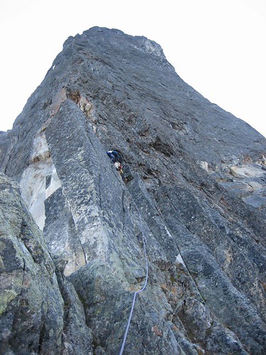
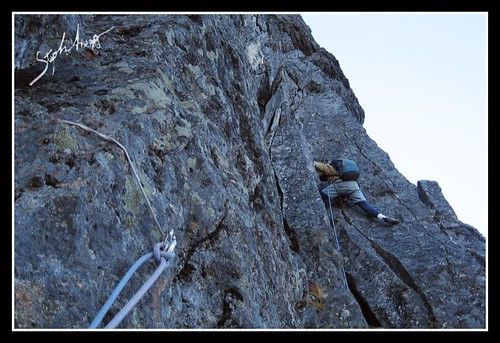
Steph climbing PITCH 5. This pitch had an amazing steep 5.9 lieback. More stellar climbing on the direct route.
PITCH 6. This pitch featured what the topo called a "strenuous 5.8+ lieback," but it wasn’t too hard (it was fun though!). This was a long pitch that brought us to the gigantic bivy platform. Some stellar climbing!
Shadow of Slesse below from midway through the climb.
This photo shows the gigantic bivy platform halfway up the route. The buttress in the photo that is lit by the sun looks like it could have some good climbing.
There was no snow remaining at the bivy ledge. But there was a tiny patch a couple of pitches above the bivy sites – enough for a pot of tea, perhaps….
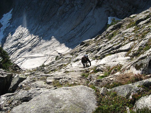
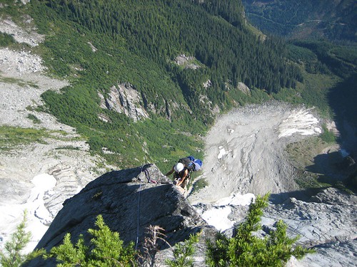
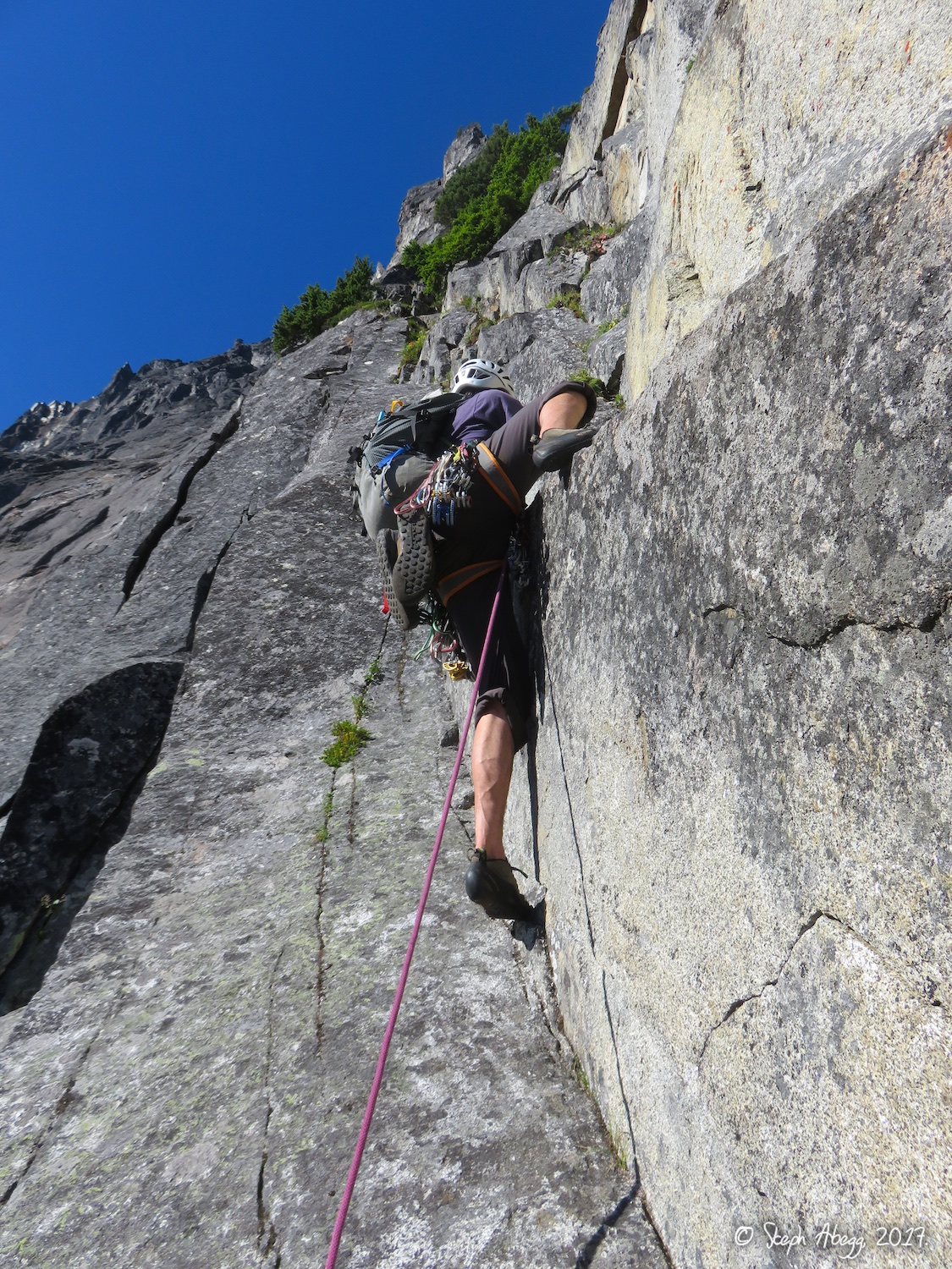
Clint had led 5 of the first 6 pitches up to the bivy ledge. It was now my turn to have some fun leading (I ended up leading 5 of the last 6 pitches). This photo shows Steph leading the 600 ft of simulclimbing above the giant bivy ledge. This was class 4 to 5.5 near the crest. For the sake of numbering, of the simulclimbing is considered to be PITCH 7.
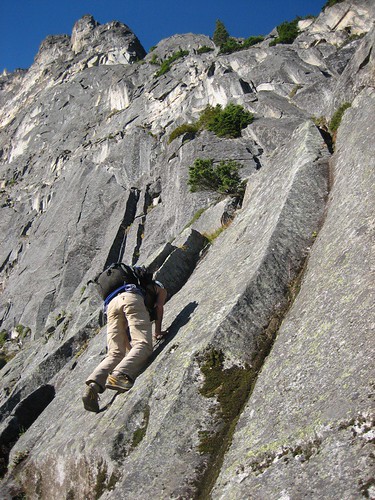
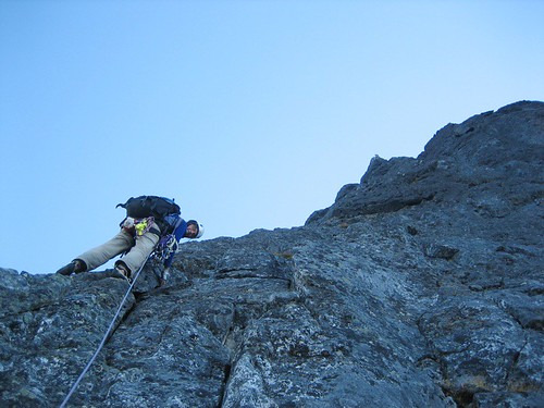
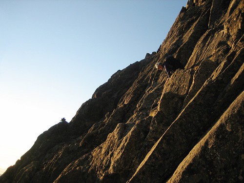
Steph leading PITCH 8. This pitch starts just right of a leaning pillar and climbs steep cracks and steep 5.8+ to a grassy belay ledge.
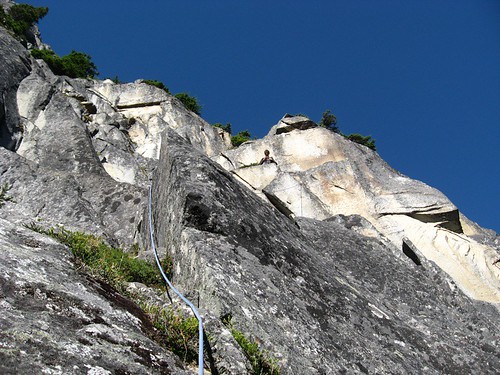
Steph leading off PITCH 9, which climbs a 5.7 rotten pillar and then wanders out right, up steep cracks, and then back left to a ledge..
Clint leading off PITCH 10. Fun 5.8 cracks lead past a bolt through a small 5.8/5.9 roof.
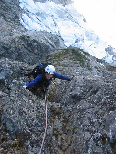
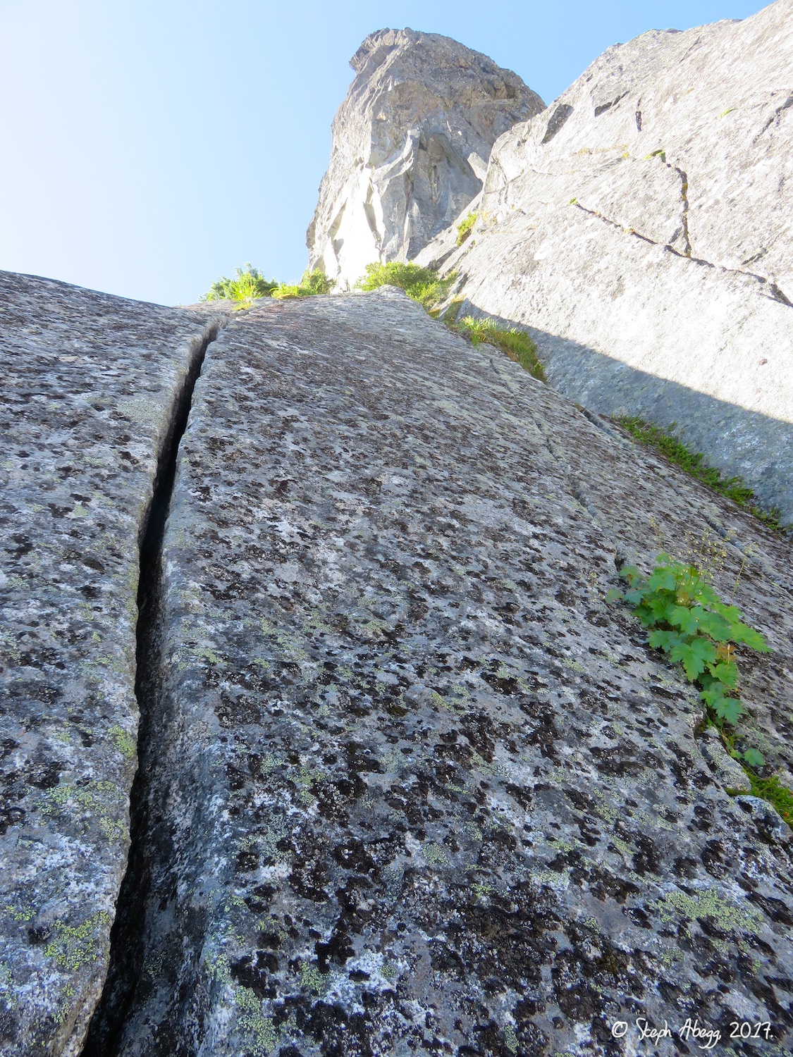
Steph leading off PITCH 11. This was fun and exposed 5.7 cracks and flakes past an alcove up a steep juggy wall to a ledge (you can belay in the alcove to reduce rope drag on the final steep moves).
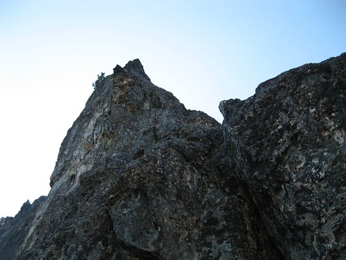
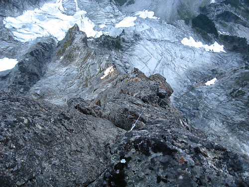
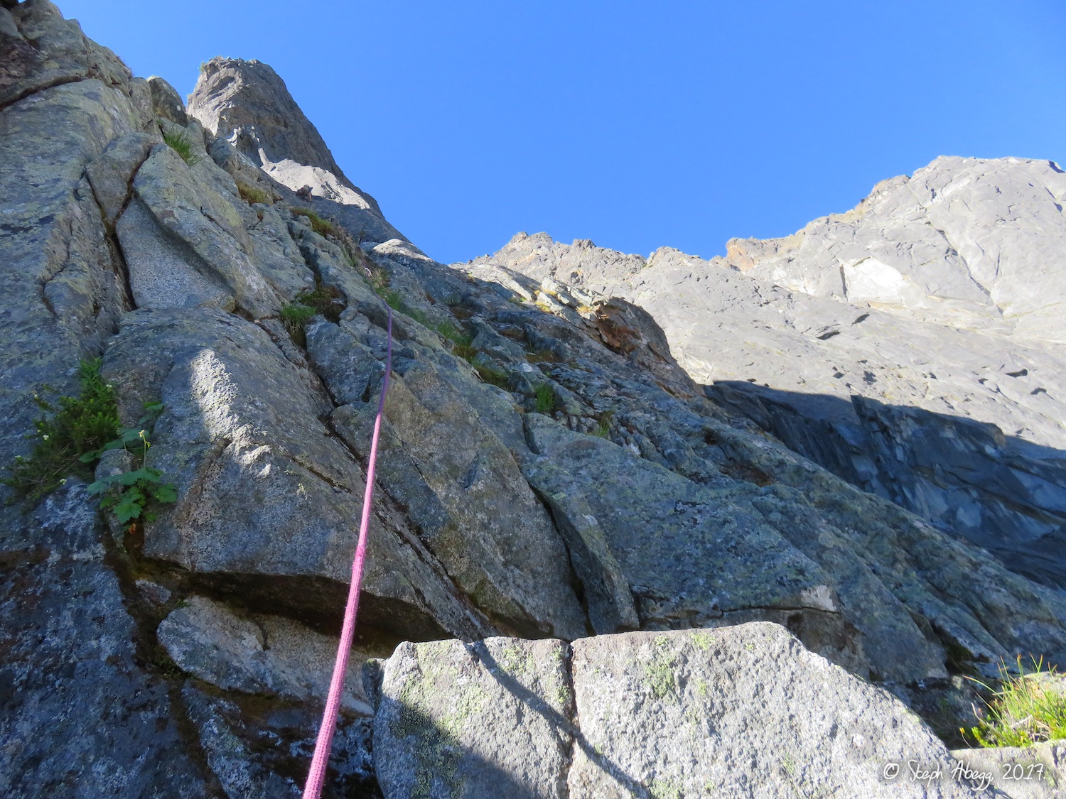
Looking down PITCH 12 (and the entire NE buttress). This pitch was fun and moderate cracks and knobs, with many possible variations and what the topo describes as an "awkward 5.8 traverse" (although we didn’t find it too awkward). .
Steph at the belay just before PITCH 13, the final climbing to the top. The final pitch climbs solid 5.7 pillars to loose blocks on the summit ridge..
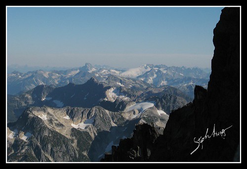
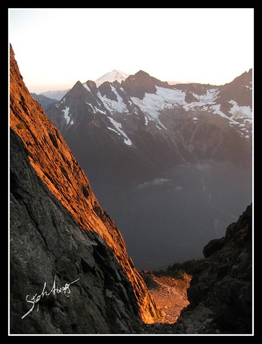
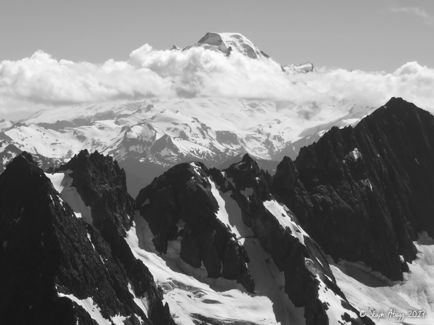
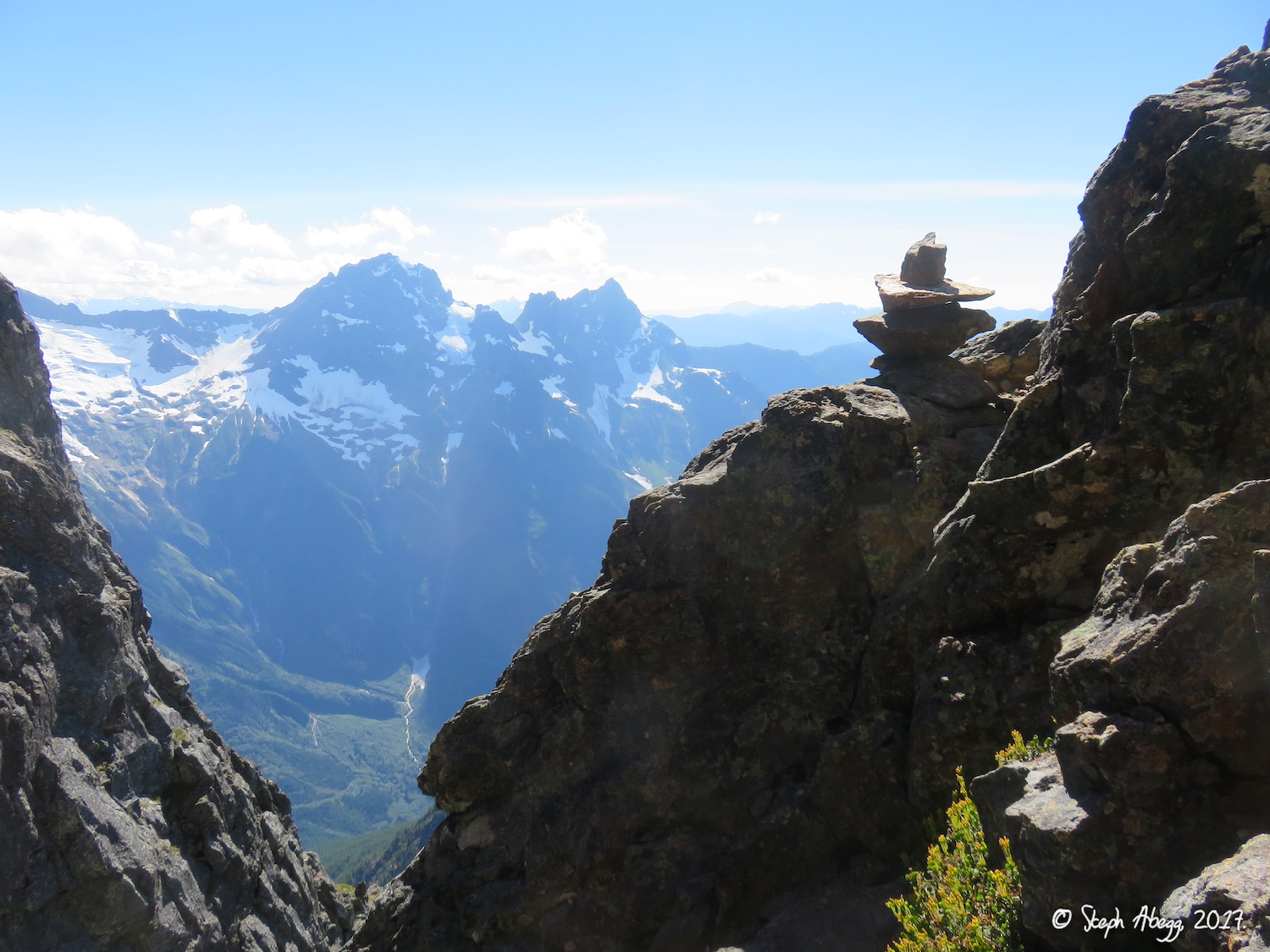
View of the North Cascades looking towards the Picket Range (Luna Peak at left center, Challenger to the right. This photo was taken just before the summit block.
Clint topping out on the loose blocks just before the summit.
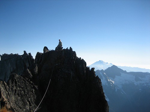
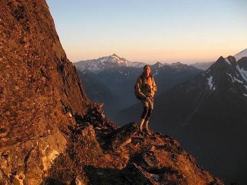
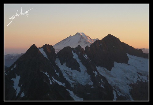
Steph on the summit, Mt. Baker in the background.
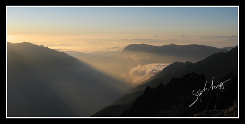
Evening light to the west. We got to the summit at 5:30pm, with 2 hours of daylight to make it past the downclimbing and gullies to the trail.
THE DESCENT
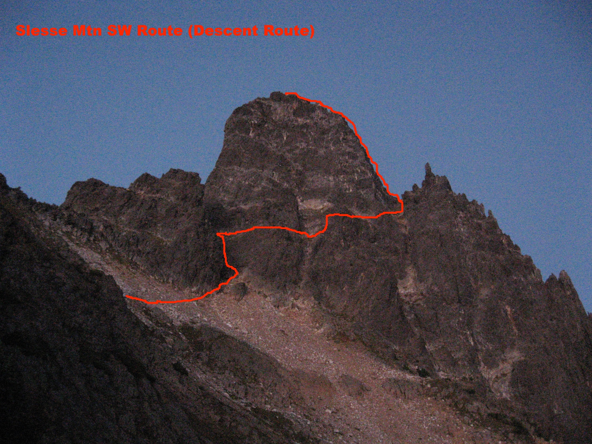
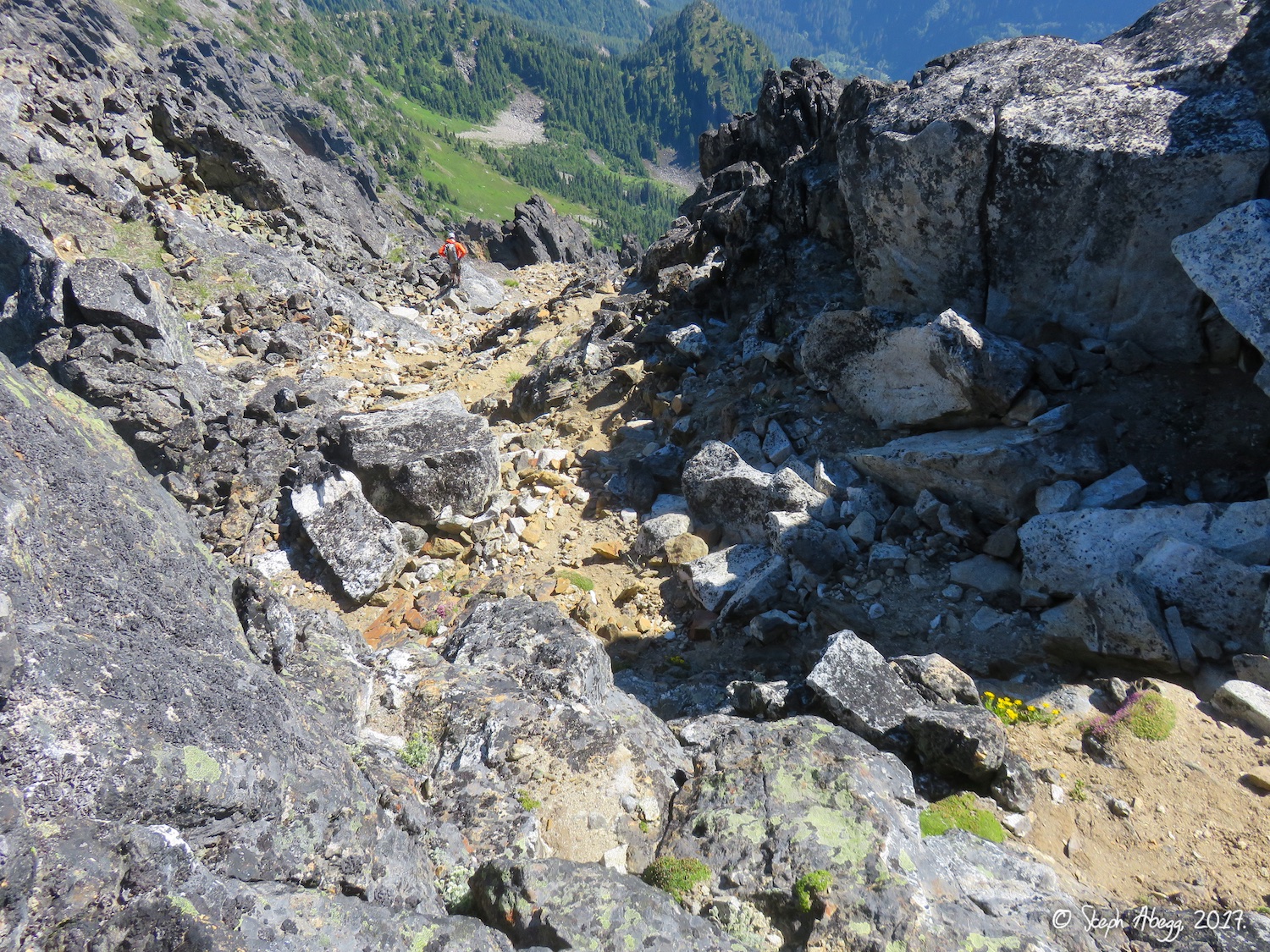
This photo shows Slesse from the west. Overview of the descent: One way off the mountain is to descend the standard Southwest Route (Class 3 to 5.6). From a minor notch just S of the summit, downclimb 150 ft (Class 3) in a loose gully. Traverse to skier’s left and downclimb the upper pitch (5.6) of the SW route to the notch behind a giant gendarme (or rappel, but there are quite a few rope-eating flakes in this area). The rest of the descent is Class 3. Descend westward nearly to the bottom of the gully between the gendarme and the main summit. Then make an ascending traverse around the corner N (skier’s right) onto terrace; continue traversing N, downclimbing an open slabby gully a couple of hundred feet and then continue traversing N to the gully adjacent to the NW Face (below a prominent notch). Descend the gully to the trail. The advantage of this route is that it is well-traveled and pretty easy. The disadvantage is that you end up on the other side of the mountain from where you started (we planted a car).
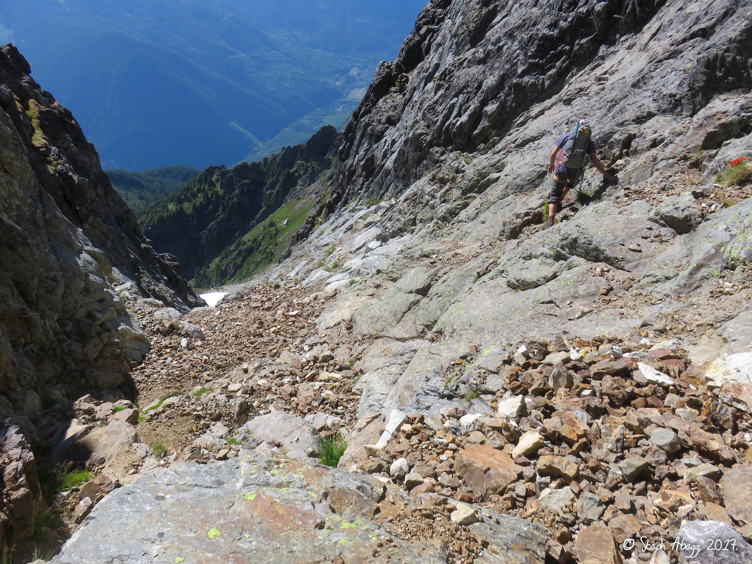
Downclimbing the steep 5.6 of the upper SW Ridge route. We wanted to avoid rappelling since I’ve had bad luck of getting ropes eaten by flakes this year.
After the downclimbing, we descended this gully until a giant gendarme on skier’s left, and then traversed right (north) onto terraces, following a path of cairns.
The giant gendarme adjacent to the gully in the previous photo.
At the gendarme you traverse to the skier’s right (north) to a cairn (left-center in photo), and around this terrace to continue a northward traverse.
Steph on the traverse north on trail and terraces. The proper descent drops a couple of hundred feet down the first slabby gully and then continues traversing northward to the gully adjacent to the NW Face.
Clint on the traverse north to the gully adjacent the Northwest Face. There are cairns and signs of travel along the entire traverse.
We traversed ledges and trail until this notch adjacent to the NW Face, which is above the final easy gully that brings you to the trail.
Descend the gully below the notch. The trail is at the bottom of the gully. From here, its about 4500 feet down to the car. The trail certainly wastes no time with the last 3300ft (after the camp at the 5800ft alp).
Sunset as we made the final bit of the traverse to the trail. We were glad we did not have to do any of the trickier routefinding down gullies in the dark.
Sunset colors on Mt. Baker.
This is a photo of where the Slesse Mountain Trail comes out, 7.9km up the Slesse Creek logging road. There is a log and flagging in the corner of the parking area. The trail follows a roadbed for the 3km leading to the road. From the base of the last gully, it took us 4 hours and about 4500 steep vertical feet to get to our car we had left near the trailhead the day before. (Photo taken the day before the climb.)
Parking at the trailhead for the Slesse Mountain Trail. When we planted our car the day before, we were not sure we were at the right trailhead until a pair of hikers coming down from Slesse assured us we were in the right place. (Photo taken the day before the climb.)
THE CLIMBERS
Clint likes to take photos too, it’s great! Many of the photos in this trip report were taken by Clint. And thanks to Clint for driving all the way from California to climb Slesse with me, and for letting me have the fixed nuts we cleaned off the route. Clint’s a great climbing partner!
(These photos were taken at the same time, just before the pitch leading to the giant bivy ledge. Turns out the time settings on our cameras were only 1 second out of sync. Once I climbed with someone whose camera was 13 hours out of sync, which made coordinating the shots a bit difficult!)
Clint.
Steph.
ELEVATIONS
6000ft up and 5500 ft down, a long day….
Trailhead of Slesse Memorial Trail
2000ft
Memorial Plaque
3600ft
Propeller Cairn
4900ft
(5200ft according to Google Earth)
Buttress Start
5500ft
Summit
8002ft
Base of the last gully on the descent
7000ft (approx)
Camp at the Alp (on the Slesse Mountain Trail)
5800ft
Trailhead for Slesse Mountain Trail
2500ft
PITCHES AND TIMES
The following table gives the split times for our 20-hour car-to-car climb of the NE Buttress of Slesse. We had 13 hours between sunrise and sunset, and timed our climb so that we were always on a trail while it was dark. We decided that car-to-car is the way to do this climb, since it avoids an uncomfortable bivy, worrying about availability of water, and allows you to climb with lighter packs. Our car-to-car time was about 20 hours.
See updated time table in 2017 trip report where I compare 2007 and 2017 times.
TIME
LED BY
Leave Trailhead of Slesse Memorial Trail:
4:15am
Sunrise:
6:43am
Arrive at Propeller Cairn:
6:43am
Start up 3rd class ledge after pocket glacier:
7:50am
Start Pitch 1:
9:00am
Clint
Start Pitch 2:
9:25am
Steph
Start Pitch 3:
9:53am
Clint
Start Pitch 4:
10:23am
Clint
Start Pitch 5:
11:41am
Clint
Start Pitch 6:
12:25pm
Clint
Arrive at Bivy Ledge:
1:12pm
Start Pitch 7 (Simucllimb):
1:23pm
Steph
Start Pitch 8:
2:05pm
Steph
Start Pitch 9:
2:42pm
Steph
Start Pitch 10:
3:10pm
Clint
Start Pitch 11:
3:50pm
Steph
Start Pitch 12:
4:30pm
Steph
Start Pitch 13:
5:04pm
Steph
Both on summit:
5:17pm
Begin descent:
5:26pm
Reach trail at bottom of last gully:
7:17pm
Sunset:
7:23pm
Arrive at Trailhead for Slesse Mountain Trail:
12:00am
THIS TRIP REPORT IS STILL MOSTLY IN THE EMBEDDED HTML FORMAT OF MY OLD WEBSITE. MOBILE Tip: Try Landscape mode. It is generally more mobile friendly.
Mt. Slesse had been one of my first big alpine climbs. I climbed the route with Clint Cummins, with whom I did some of my first multipitch climbs and who I will always thank for getting me off to a strong start for my future of climbing endeavors. I had wanted to climb Slesse again for awhile, especially since the trailhead is little more than an hour from my parents' doorstep. I was curious about the Crossover descent (which avoids the car shuttle Clint and I had done) as well as the harder (10a) direct route option midway up the buttress.
In 2017, the pocket glacier on Slesse slid unusually early (sometime in the spring). This was a good opportunity to do the route in earlier summer, when the days are longer and warmer. So in late July, my friend DR and I headed up to climb the Northeast Buttress. We had a fun day, taking nearly 19 hours car to car without ever rushing (the rather involved Crossover descent was a significant portion of this, nearly 7 hours). I found it an enjoyable experience to do a route that was familiar enough that the logistics and routefinding were fairly trivial, yet enough time had gone by that most of the climbing was fresh and fun. Below are some overlays of the route and descent and photos from the climb. Enjoy!
6:45 (mostly in daylight, ok conditions, moderate pace)
Total Car to car time
19:45
18:58
Clock times
Leave Trailhead of Slesse Memorial Trail
4:15am
3:42am
Sunrise
6:43am
5:35am
Propeller Cairn
6:43am
5:49am
Start up 3rd class ledge after pocket glacier
7:50am
6:57am
Bivy Ledge
1:12pm
11:34am
Summit
5:17pm
3:29pm
Begin descent
5:26pm
3:55pm
Reach trail at bottom of last gully (about where Crossover descent leaves Slesse Mountain Trail)
7:17pm
5:18pm
Sunset:
7:23pm
8:52pm
Arrive at car (2007: Trailhead for Slesse Mtn Trail; 2017: Trailhead of Slesse Memorial Trail)
12:00am
10:40pm
Photos
Photos:
Photo Descriptions:
Approach
1.
2.
3.
4.
5.
6.
7.
8.
9.
10.
11.
12.
13.
14.
1. The well-marked trailhead for the Slesse Memorial Trail.
2. Nice bridge crossing Nesakwatch Creek shortly after the trailhead.
3. On the trail approaching the propeller cairn. 10 years ago, I recall this trail was actually a little hard to find at times!
4. The propeller cairn. Google Earth says about 5200ft, even though guidebooks say 4900ft.
5. Mt. Slesse basking in the first rays of morning sun, with the propeller cairn in the foreground.
6. If you look for it, you can see the wreckage from Flight 810 in this photo, from the tragic plane crash in December 1956.
7. Remnants of the Slesse Glacier when walking across the glacial slabs between the propeller cairn and the notch.
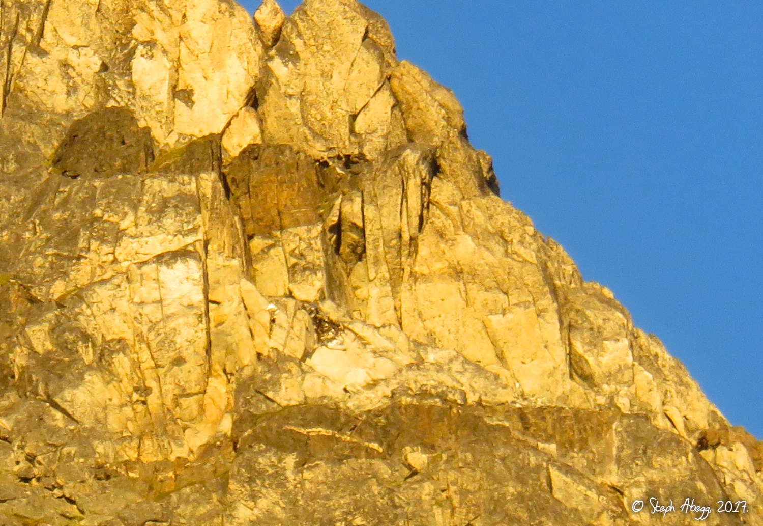
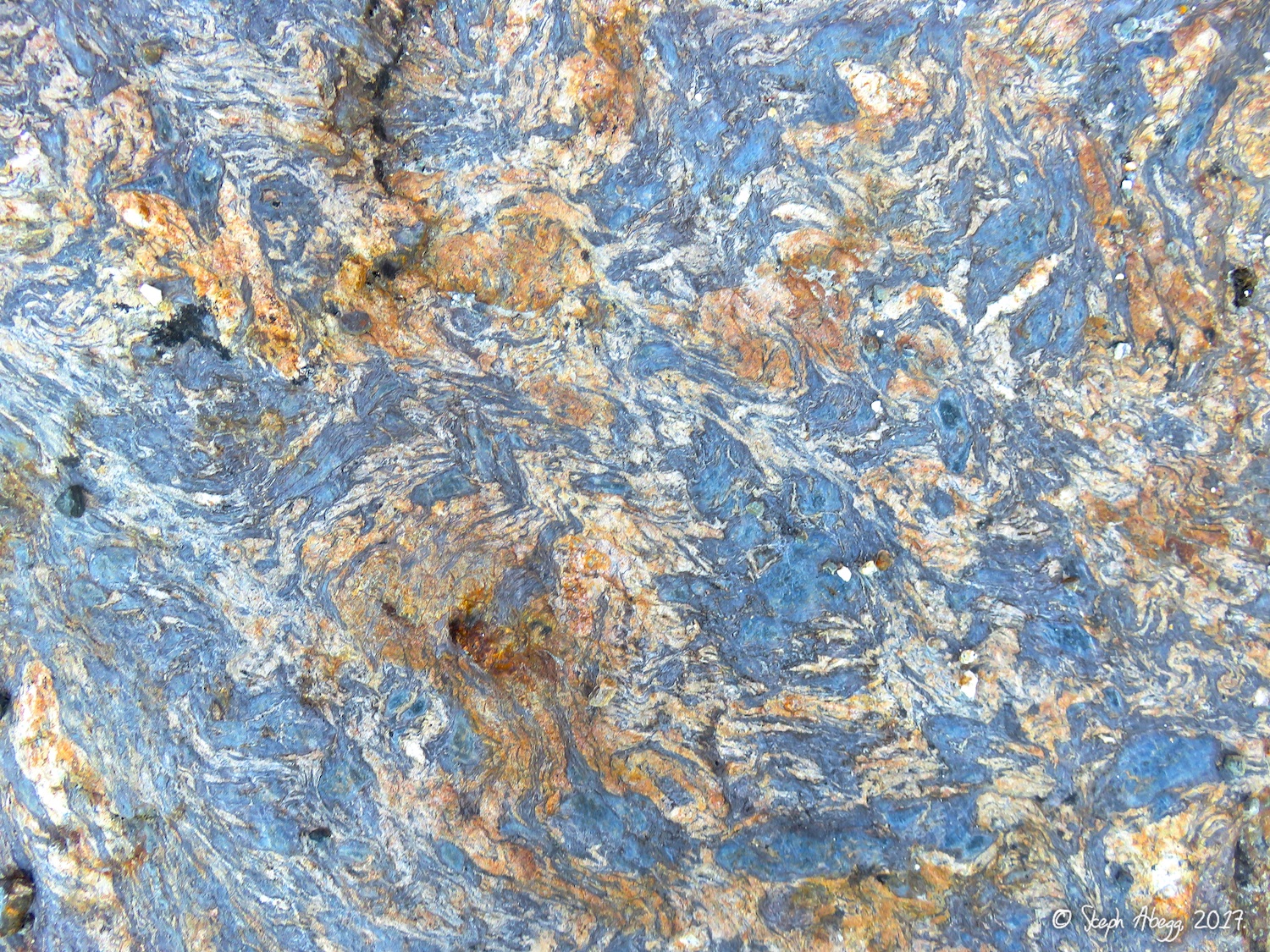
8. I noticed really pretty banding on the glacial slabs on this side of the mountain. Probably gneiss?
9. The notch. Google Earth says about 5200ft.
10. Descending the north side of the notch.
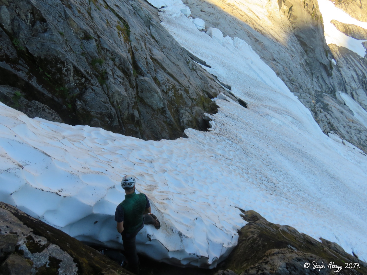
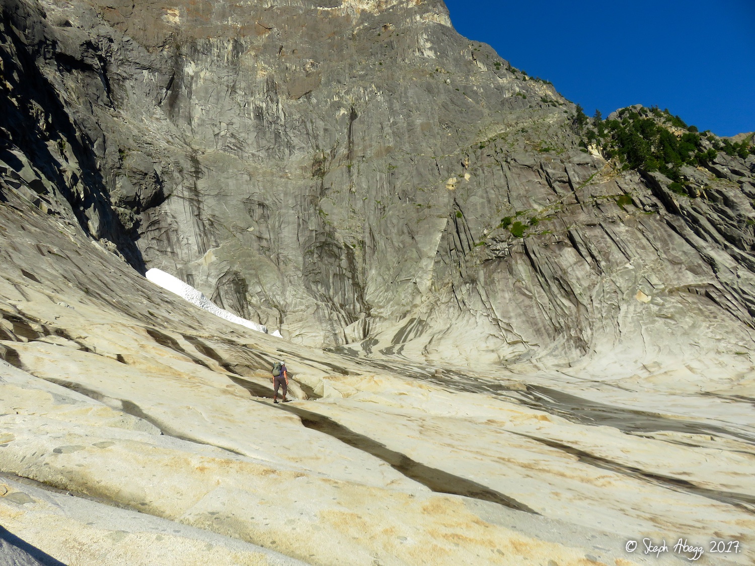
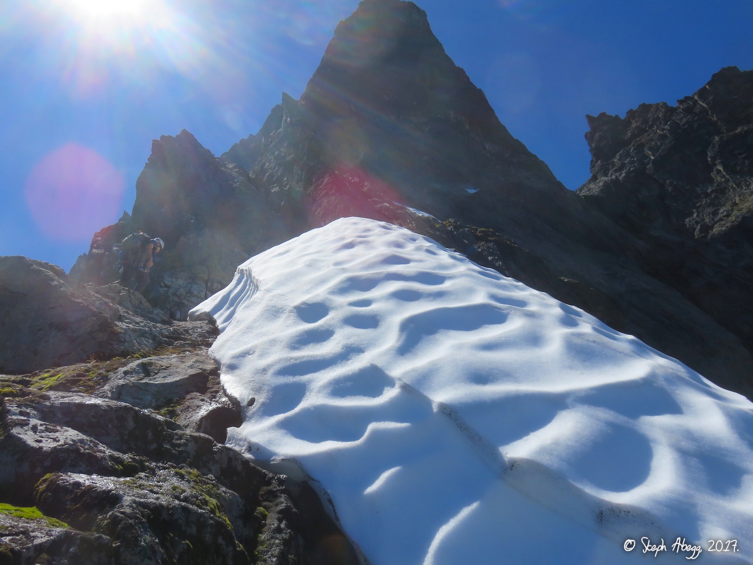
11. A snowfield we had to cross before arriving at the cirque below the pocket glacier.
12. Crossing the cirque below the pocket glacier. The glacier had slid early this year.
13. The remains of the pocket glacier at the flat upper end of the cirque.
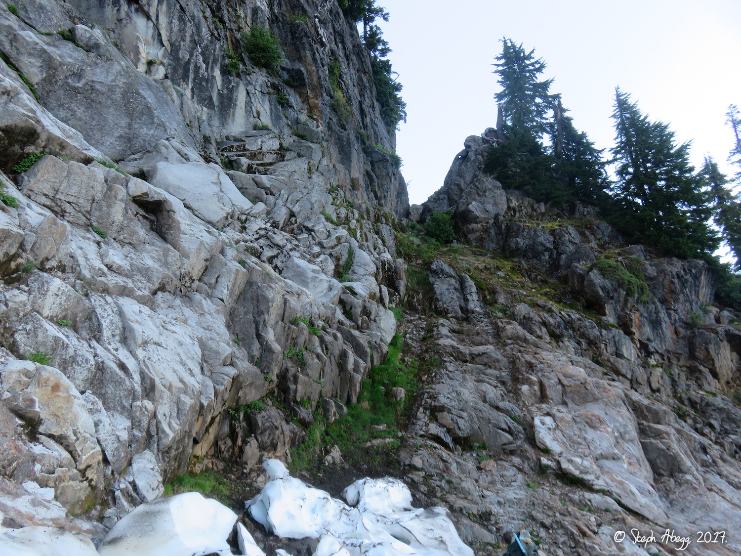
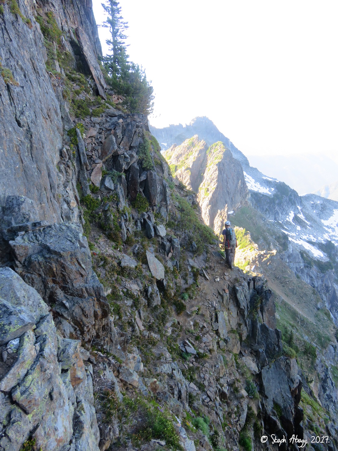
14. The 3rd class ramp leading to the NE Buttress.
Climb
15.
16.
17.
18.
19.
20.
21.
22.
23.
24.
25.
26.
27.
28.
29.
30.
31.
32.
33.
34.
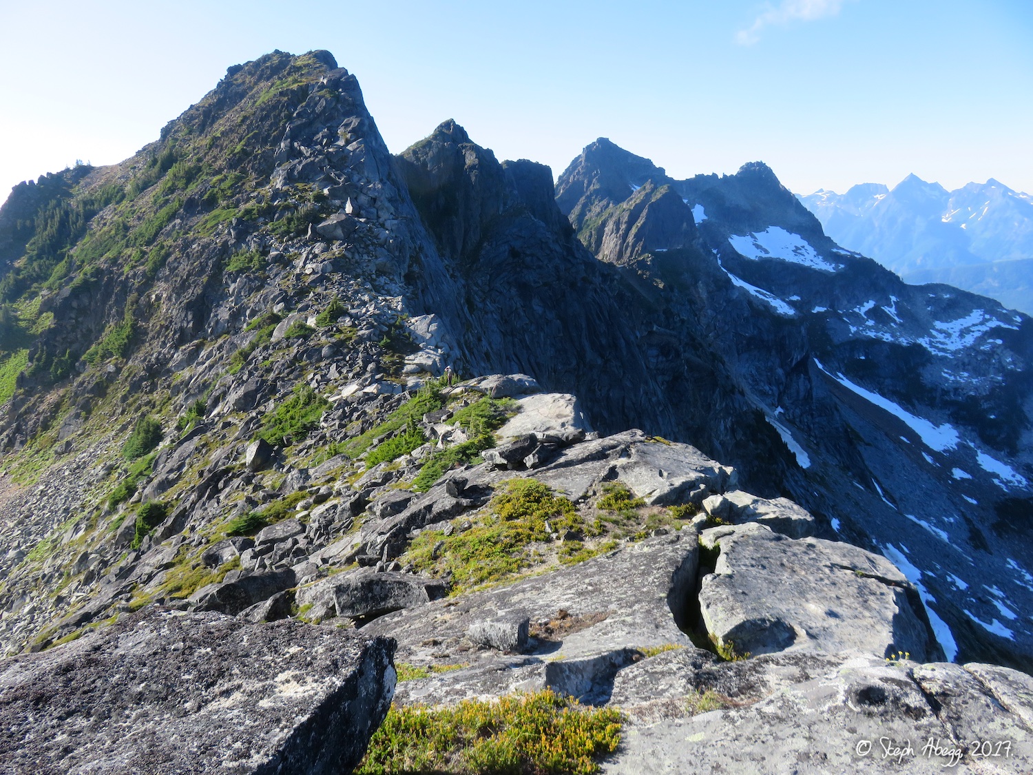
15. Looking up at the NE Buttress from the end of the 3rd class ledge.
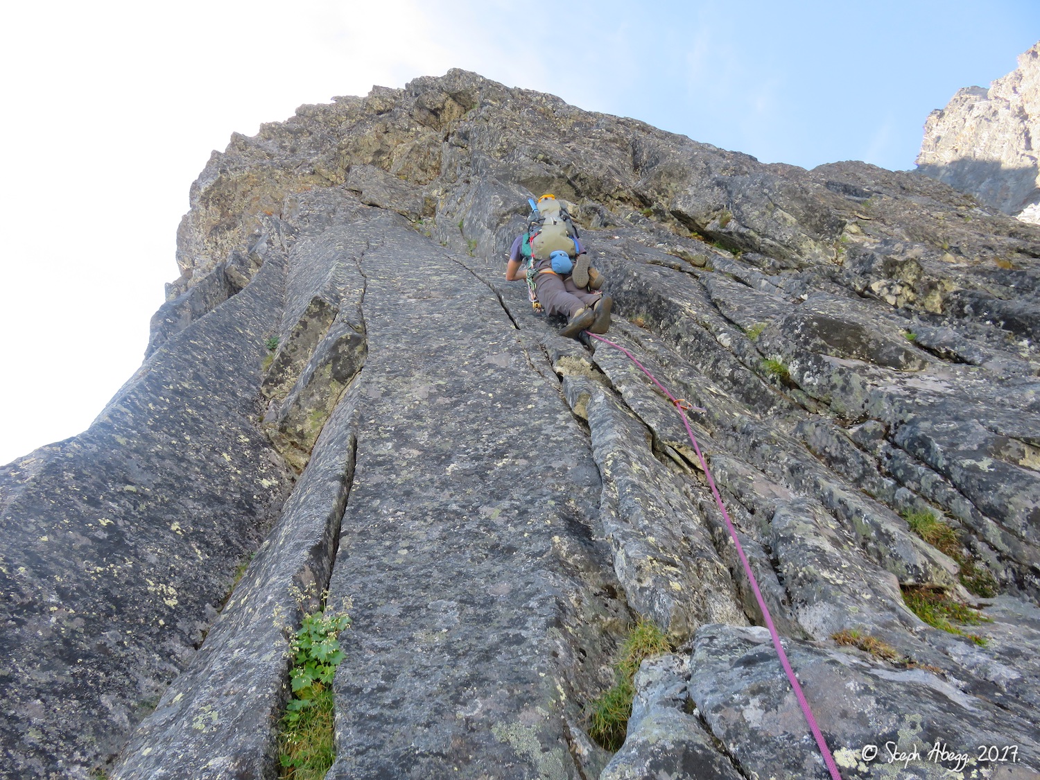
16. We soloed up to the base of the first 5.8 corner. This involved a couple moves of low 5th and a short 5.7 bit, but it saved some time. (Photo by DR.)
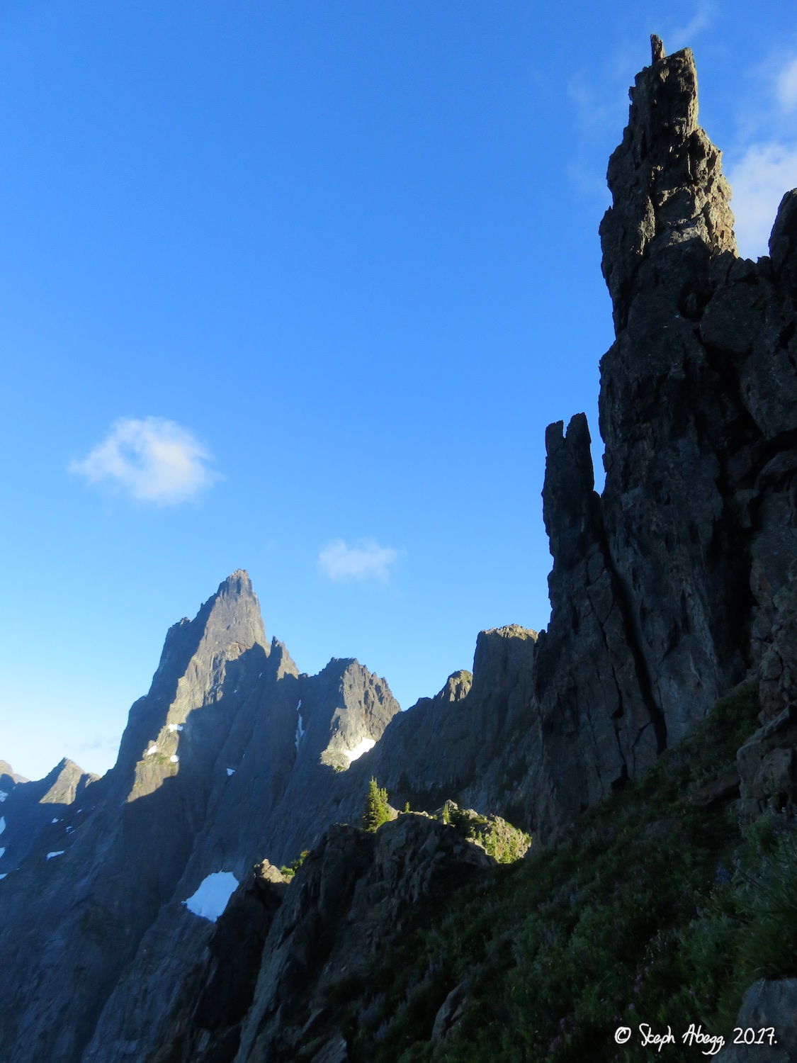
17. The prominent gendarme on the lower buttress, noted in several route descriptions.
18. The 5.8 corner where we roped up.
19. Easy low-5th climbing right of the crest.
20. Nice cracks. This is just before or on the direct route option.
21. This pitch is on the direct route option, and climbs through the contact zone between granite below (cracks) and metamorphic rock above (juggy).
22. Photo by DR looking down the pitch is the previous photo. This photo also shows the NE Buttress below.
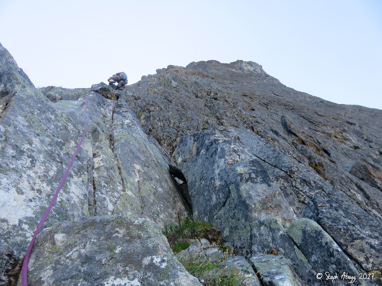
23. Looking up the 200m 3rd/4th class section above the bivy ledges. We soloed this.
24. Climbing on the buttress crest, just after roping up after the 3rd/4th class terrain. 25. Good climbing on the upper buttress.
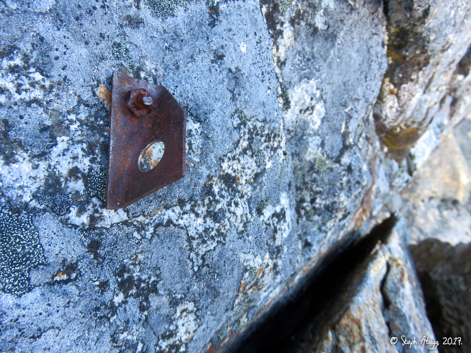
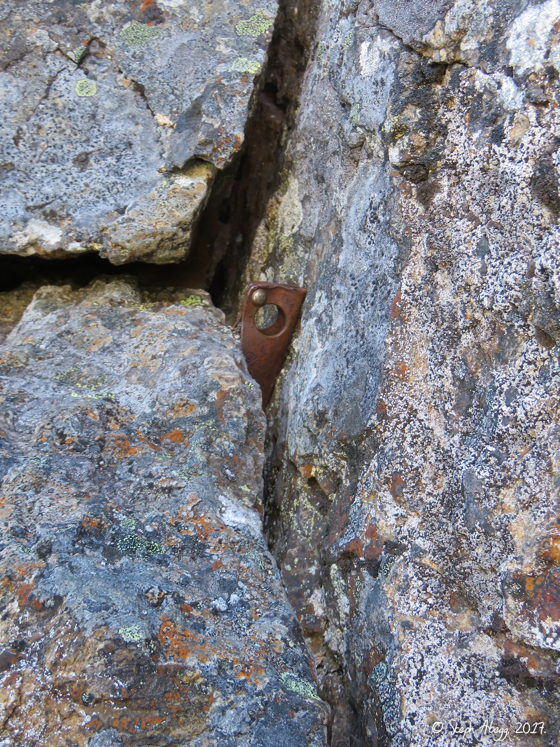
26. Old bolt on the upper buttress.
27. Old piton on the upper buttress.
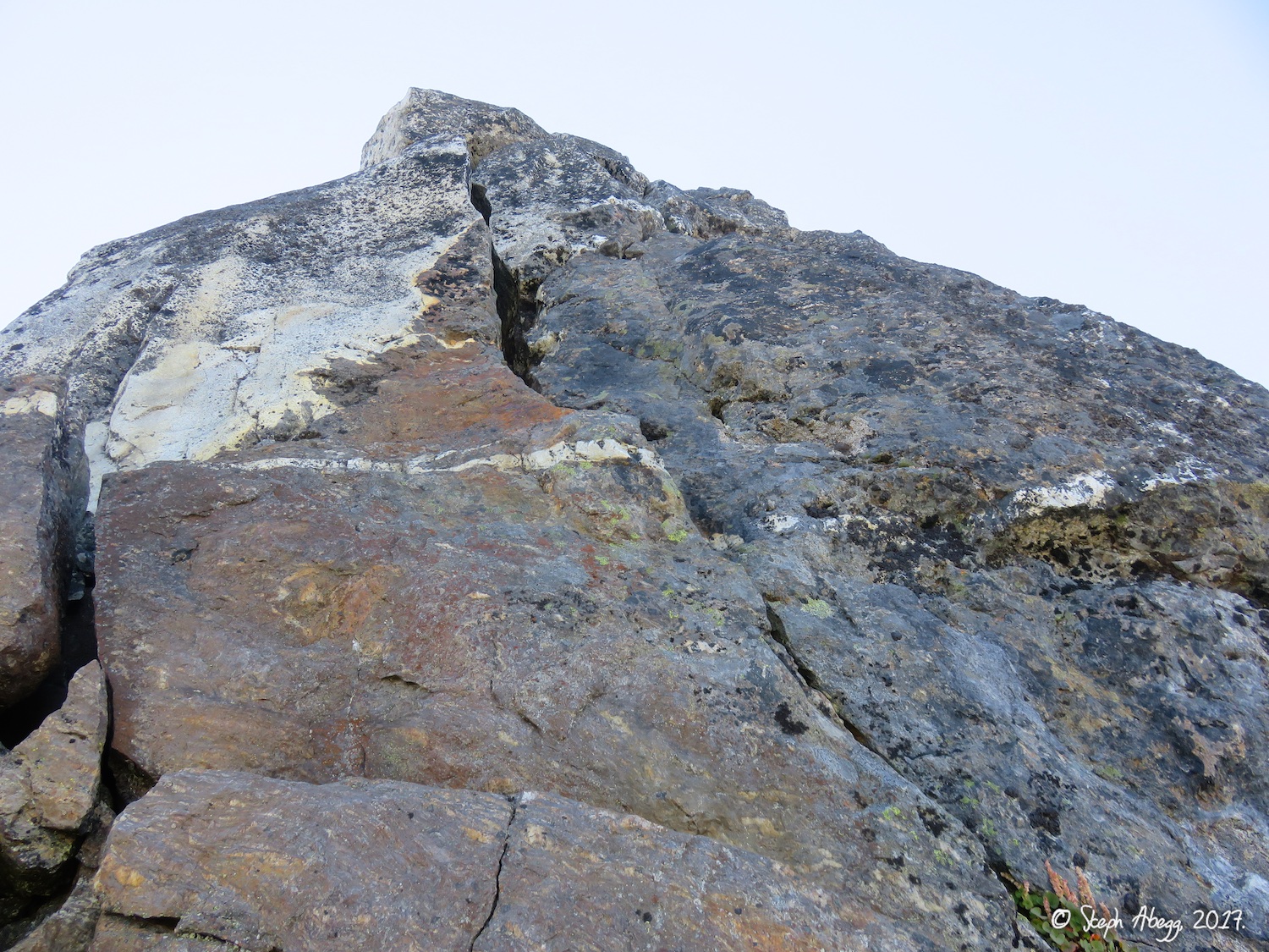
28. Looking down while climbing on the upper buttress. The route here stays pretty close to the crest so the position is awesome.
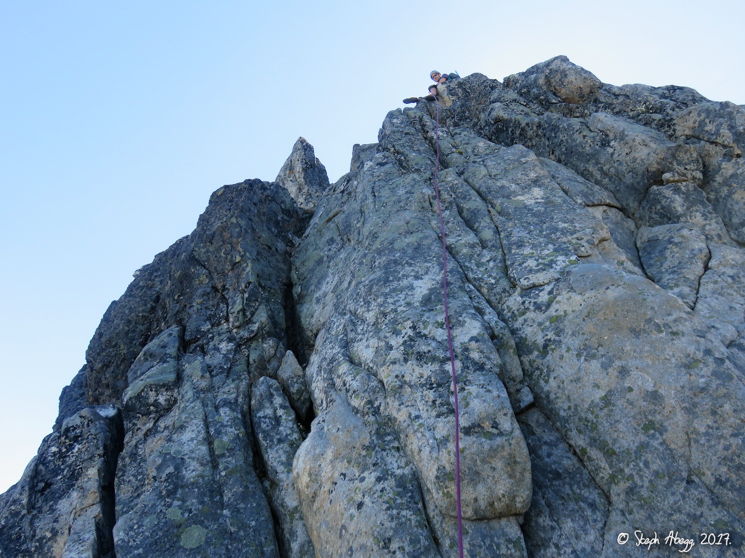
29. The second to last pitch from the top.
30. The last section of climbing to the top. This part is on granite again. Slesse has pretty interesting geology.
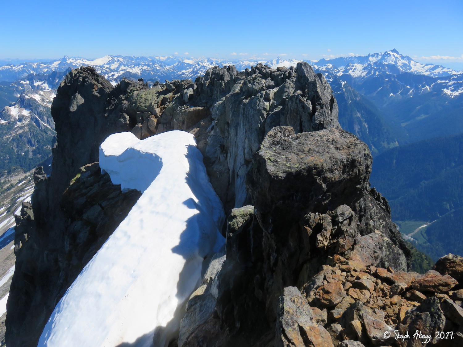
31. The summit of Slesse. Mt. Shuksan is to the south.
32. American and Canadian Border Peaks to the southwest of Slesse.
33. Mount Baker, behind The Pleiades and Mt. Larabee.
34. Black and white version of previous photo.
Descent
35.
36.
37.
38.
39.
40.
41.
42.
43.
44.
45.
46.
47.
48.
49.
50.
51.
52.
53.
54.
55.
56.
35. Starting the descent from the summit of Slesse. 36. Rappelling into the gully.
37. Scrambling down the gully.
38. Exit the gully to skiers right, at the cairn. This is easy to miss.
39. The Crossover descent leaves the Slesse Mountain Trail here and heads to the notch in the photo.
40. The other side of the notch in the previous photo.
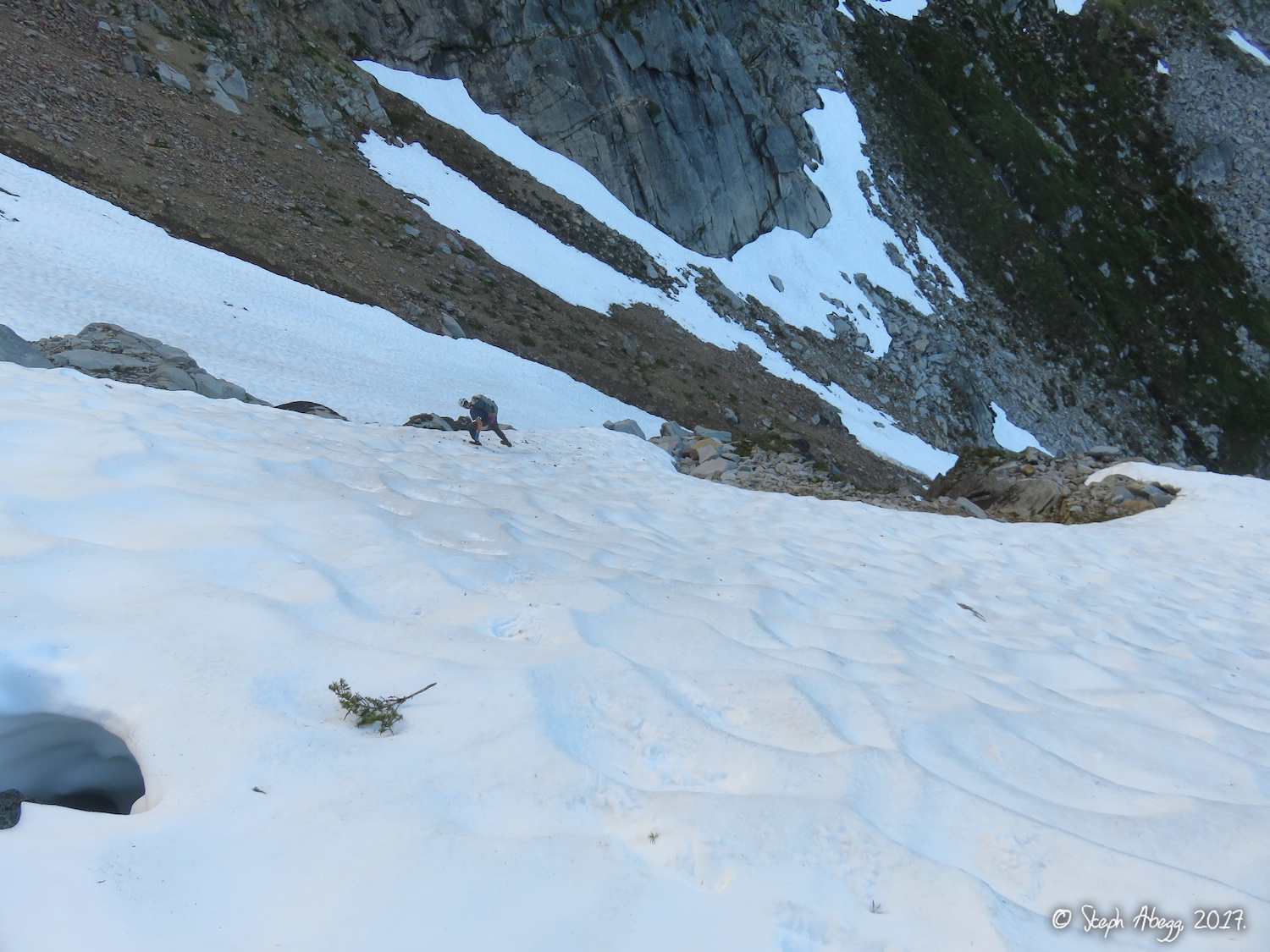
41. A steepish snowfield to negotiate. I had decided not to bring my axe (although I did have crampons) but I wished I had my axe for this part.
42. Rappelling off a horn to get past some of steep, hard snow.
43. Pleasant terrain on the crest.
44. More pleasant terrain. 45. Not so pleasant terrain getting around Mt. Parkes. Apparently there is a way to stay high and then rappel into an easy gully system, but we scrambled around right on somewhat sketchy 3rd class grassy ledges.
46. Whatever way you get around Mt. Parkes, you end up here. Descend the gully westward. After this head back up east towards Crossover Pass.
47. Crossover Pass.
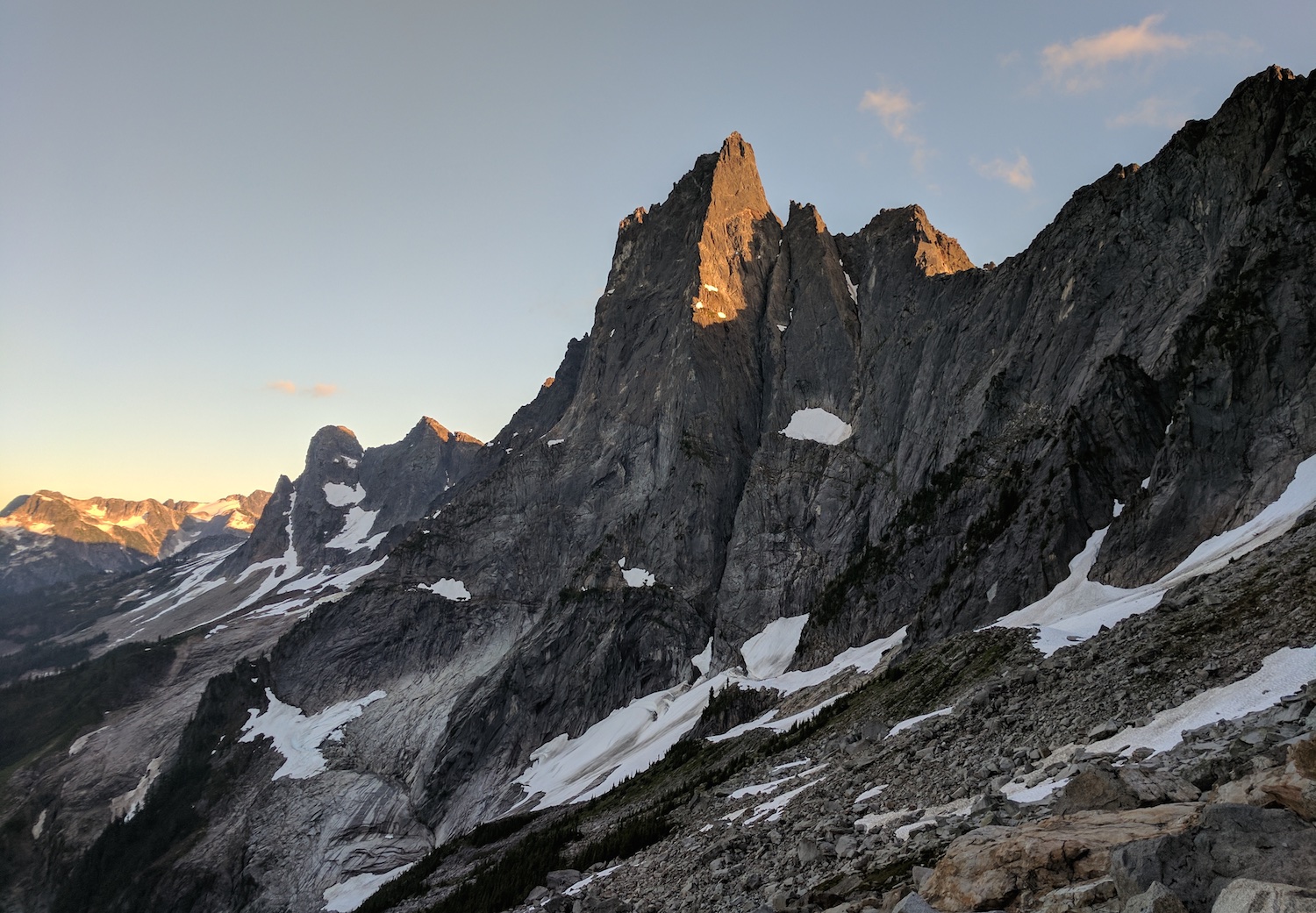
48. Views of Mt. Slesse from near Crossover Pass. From here Slesse does look like a Fang (Slesse means Fang in the native Salish tongue).
49. Zoomed in vies. The NE Buttress is the shade/sun line.
50. Descending snow after Crossover Pass. Again, I wished for my ice axe. But crampons were definitely nice to have.
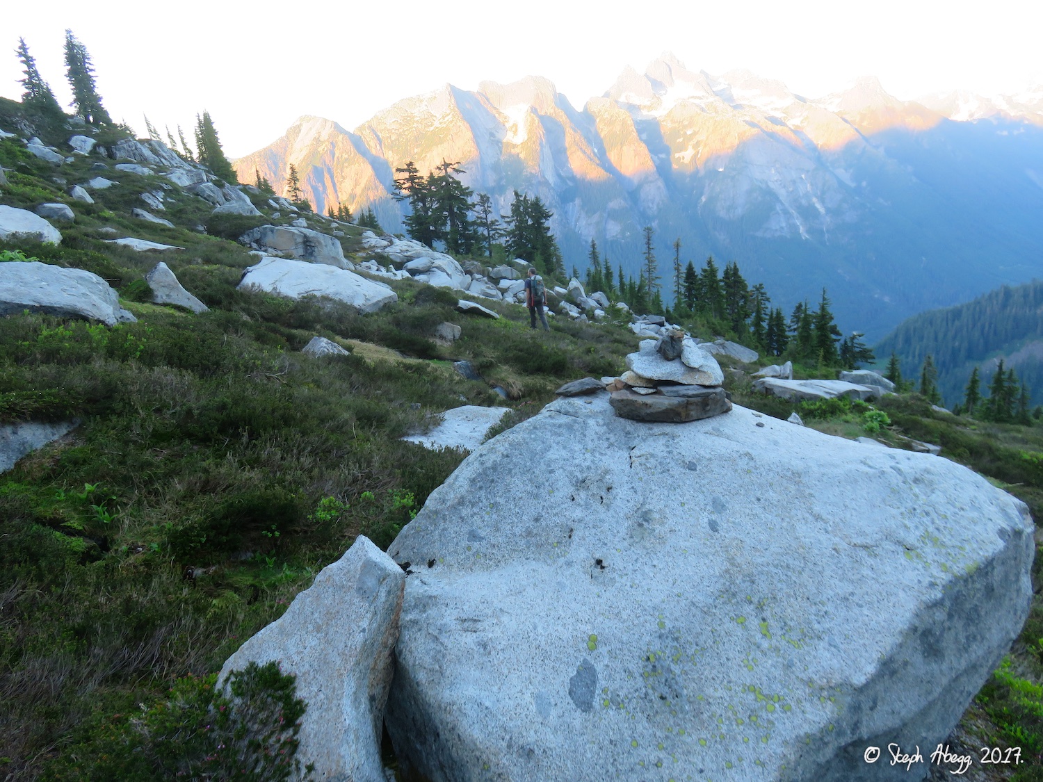
51. Cairn marking the way.
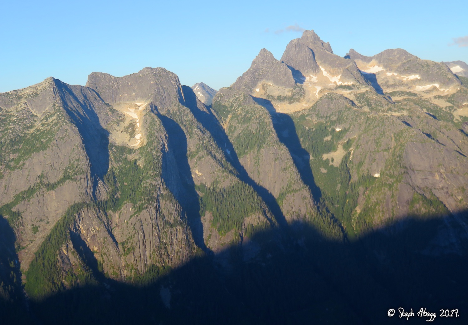
52. Illusion Peaks, Nesakwatch Spires, and Mt. Rexford to the east.
53. Pink evening light on Nesakwatch Spire.
54. Nice evening light on Slesse.
55. Another nice photo by DR.
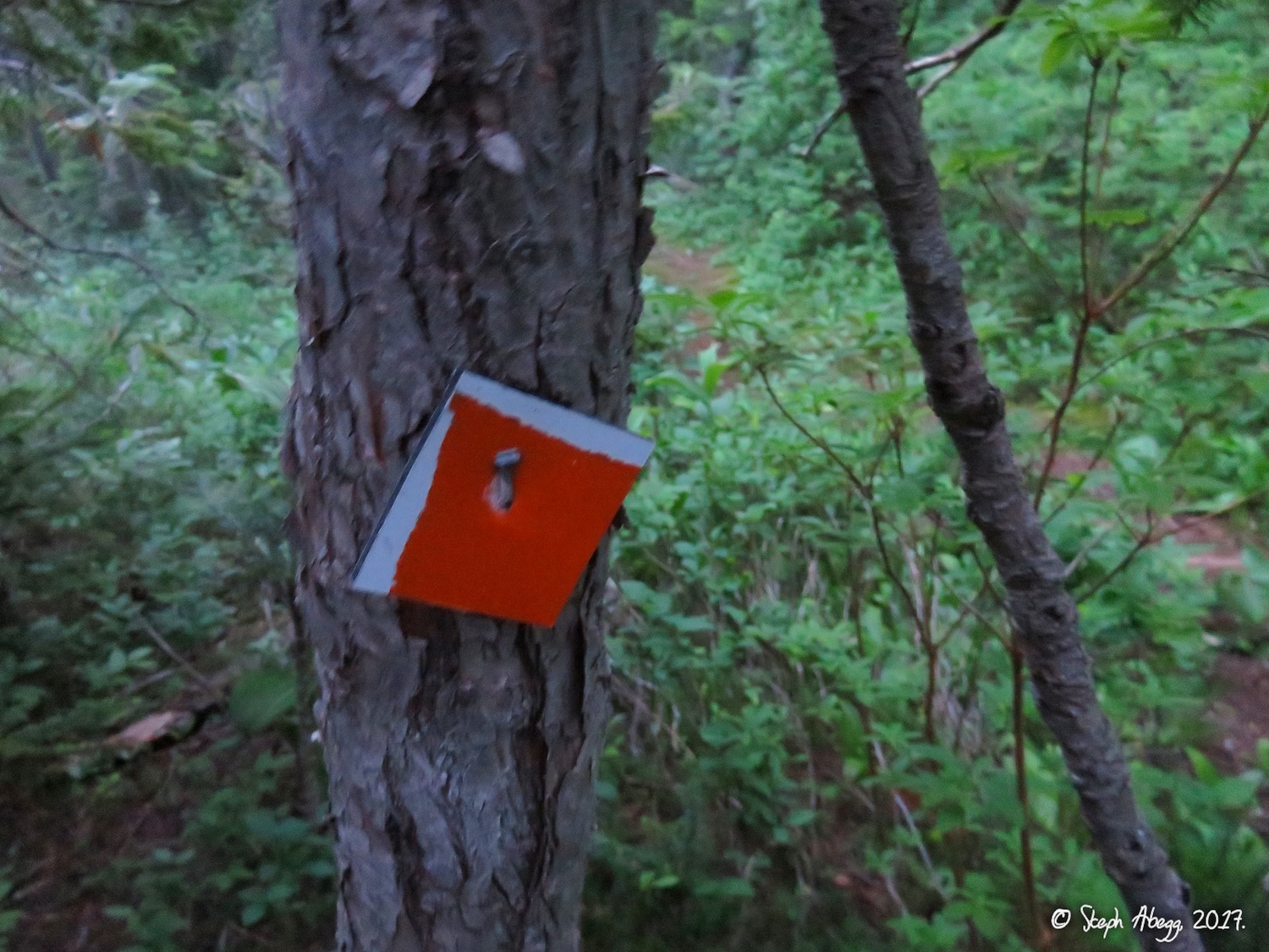
56. The lower Crossover descent through the trees is well-marked with reflectors (thanks to whoever did this!). Most climbers car-to-car the NE Buttress of Slesse, making for a long day (15-20 hours), so coming down in the dark is fairly common.
Useful beta. Updated route information. Corrections. Historical notes. Interesting facts. No fluff please. Please do not put links in your comment, as my spam filter will filter those comments out.