Takakkaw Falls, Takakkaw Falls (5.7, 12p, 1260′)

Takakkaw Falls

Route:

Takakkaw Falls

5.7, 12p, 1260'

An amazing position next to a 1260-foot waterfall, finishing by tunneling 200 feet through the cliff and popping out at the top of the falls.

Region: Alberta
Elev: ~1,600-1,900 m / ~5,250-6,250 ft
Rock type: Limestone
Type: 
Date(s): August 29, 2017 (Tue)
Partner(s): Robert Waye

Route Overlay

CLICK TO ENLARGE

Intro

Rob Waye and I were climbing together for three days in the Canadian Rockies. On the first day, we climbed The Fold on Mt. Kidd, in the Kananaskis area just south of Canmore. Our plan was to climb Edith Cavell on the third day, near Jasper. So we were looking for a climb between Canmore and Jasper that would get us down in time to pick up a permit in Jasper for climbing Edith Cavell the next day. The "Takakkaw Falls" route in Yoho National Park (just a bit west of Lake Louise) sounded like just the route we were looking for.

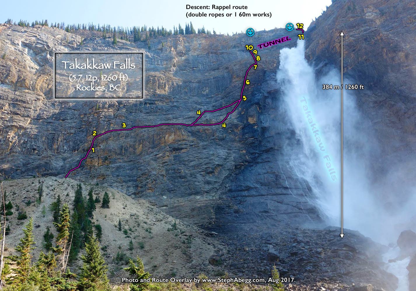
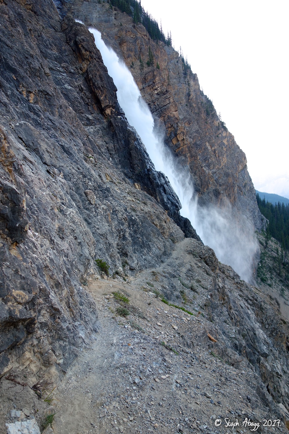
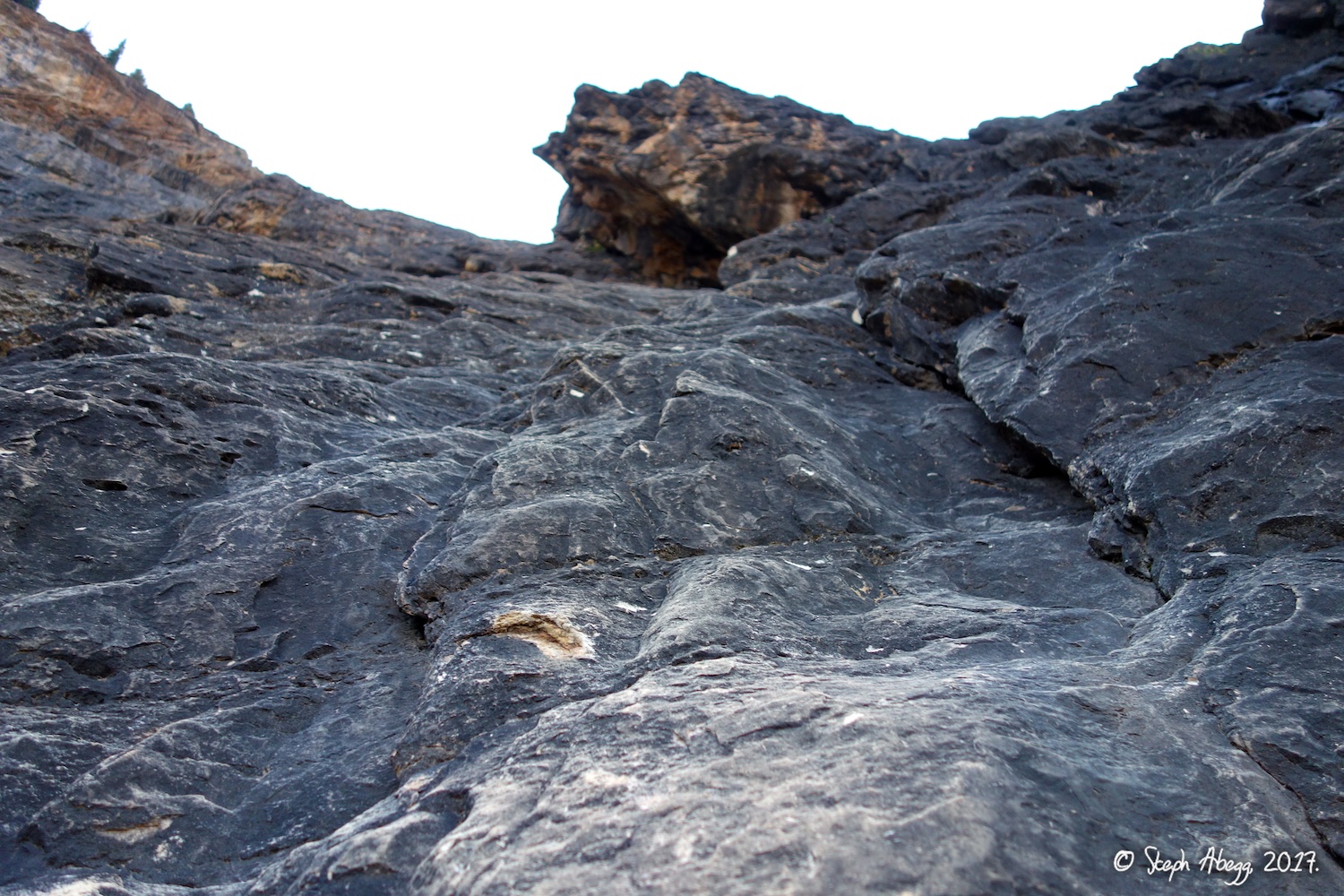
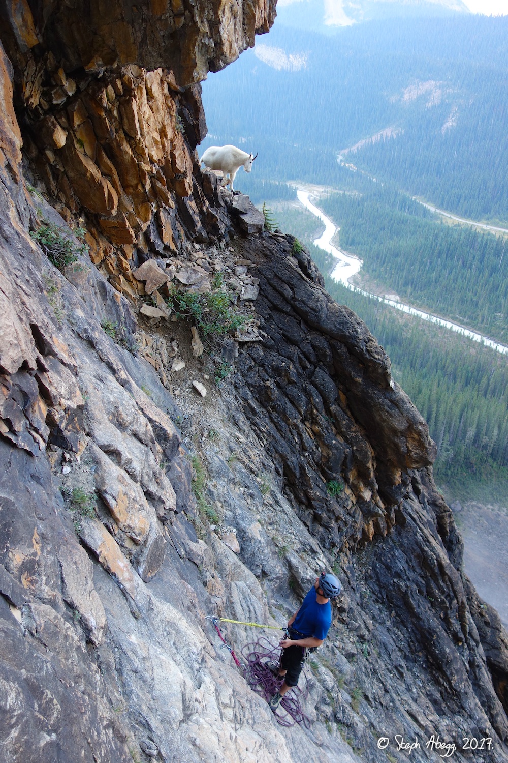
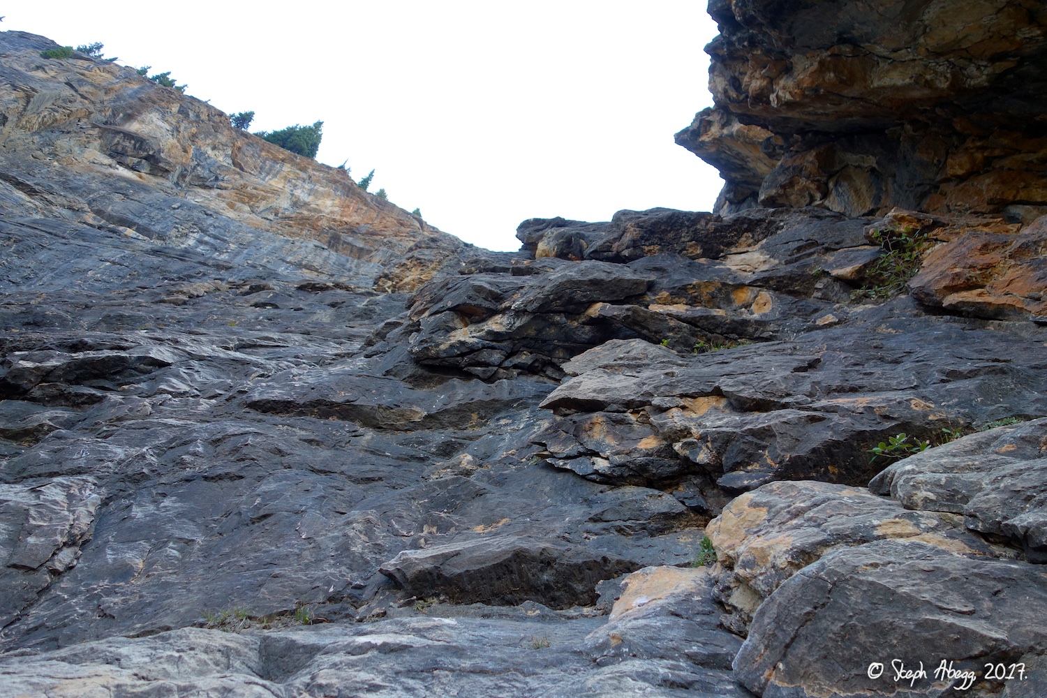
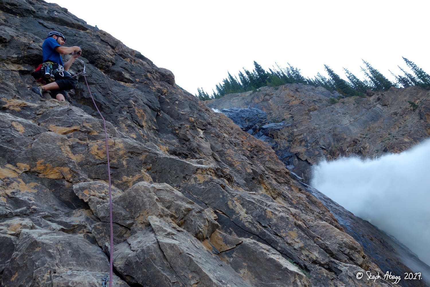
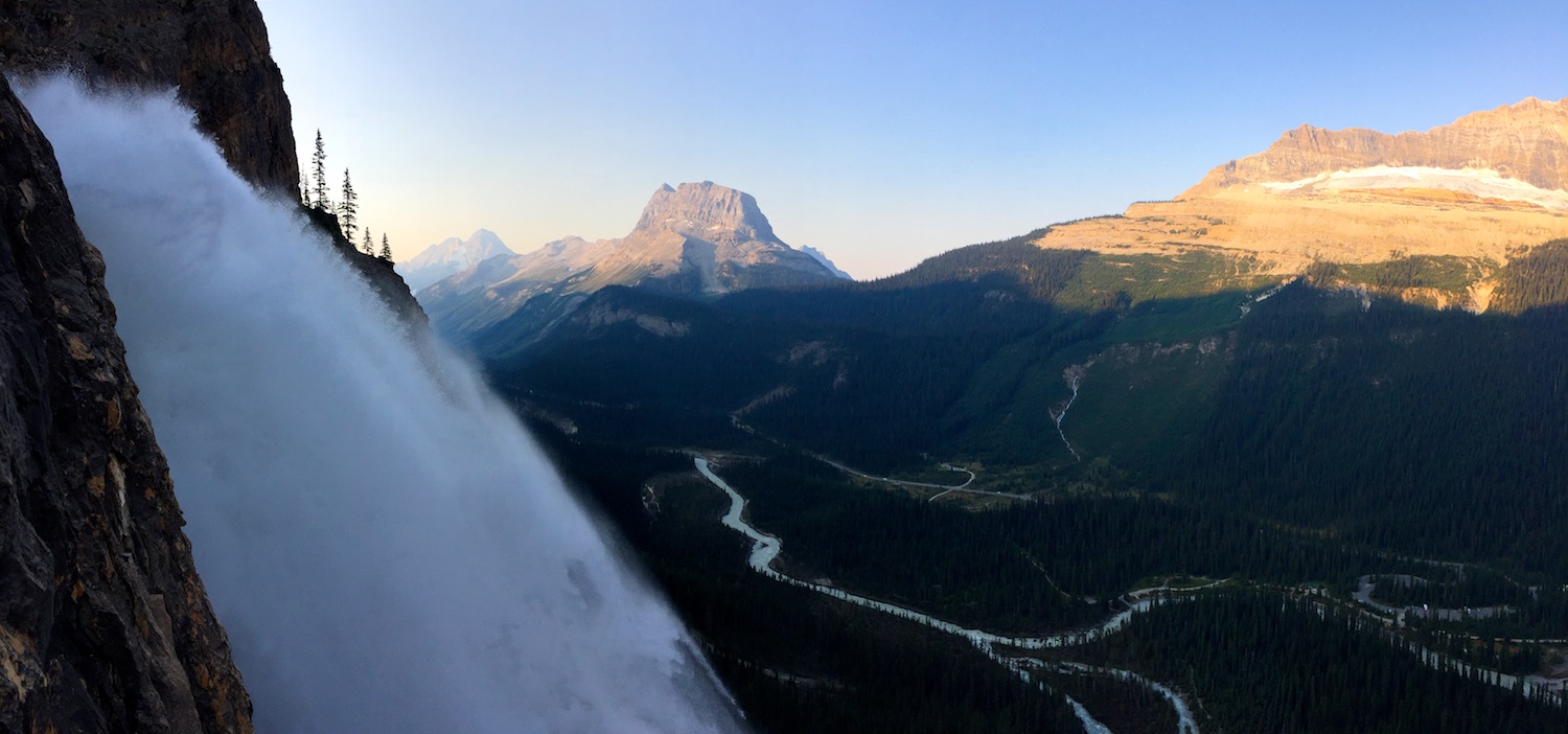
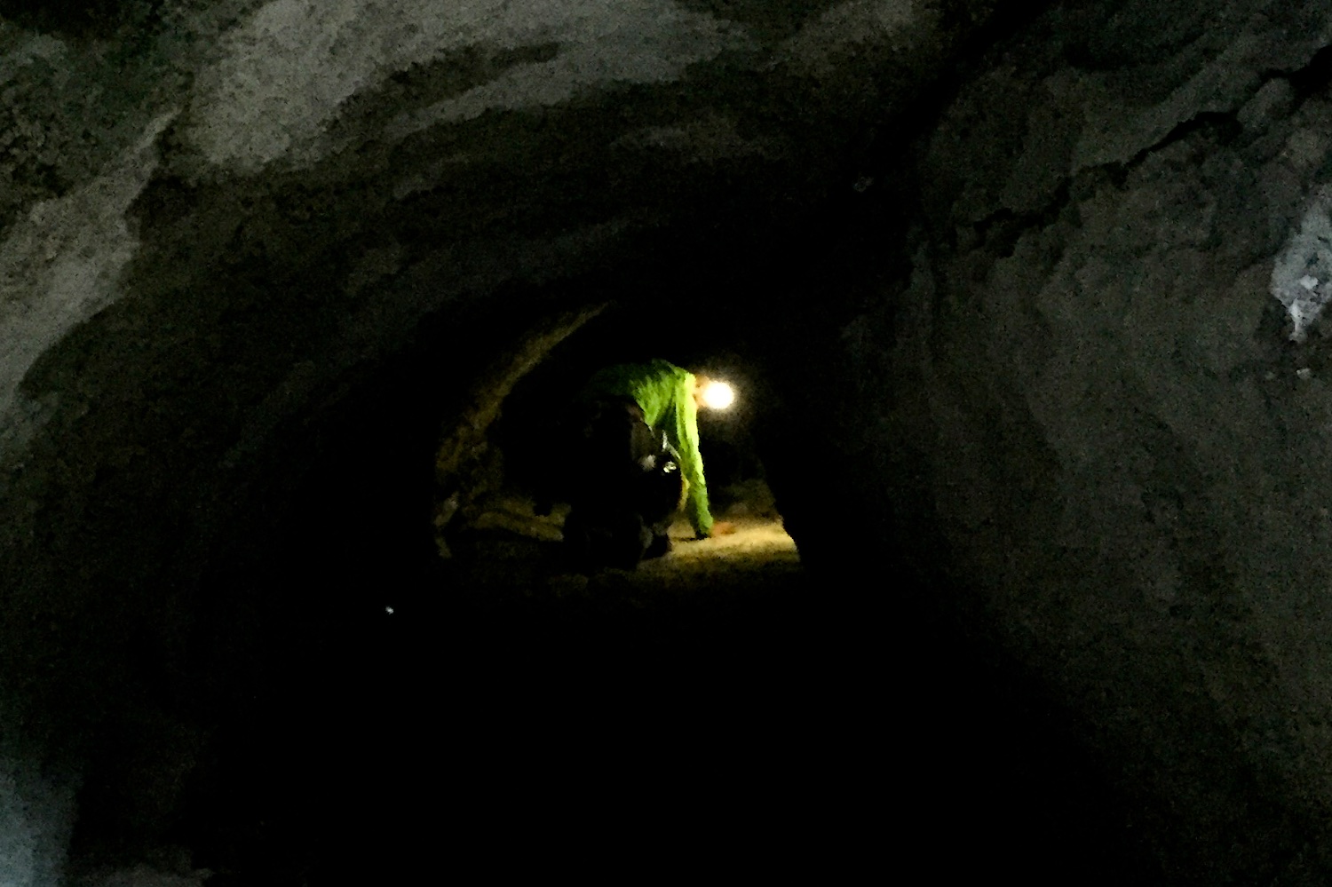
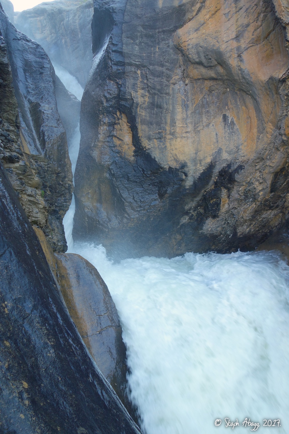
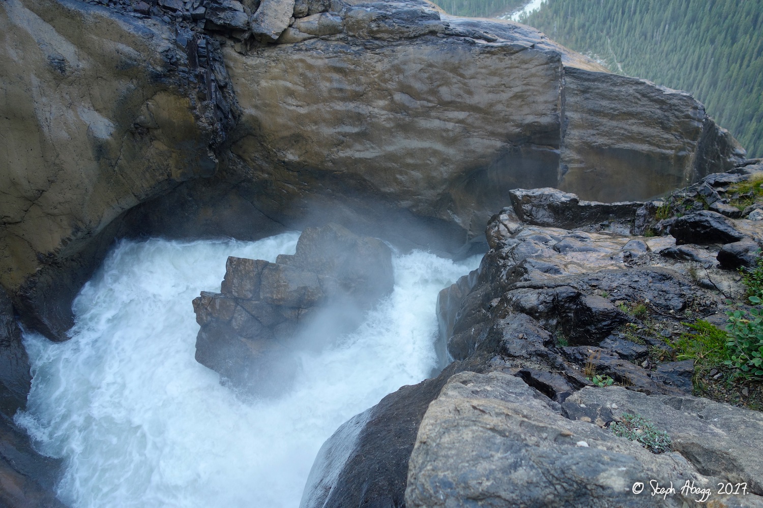
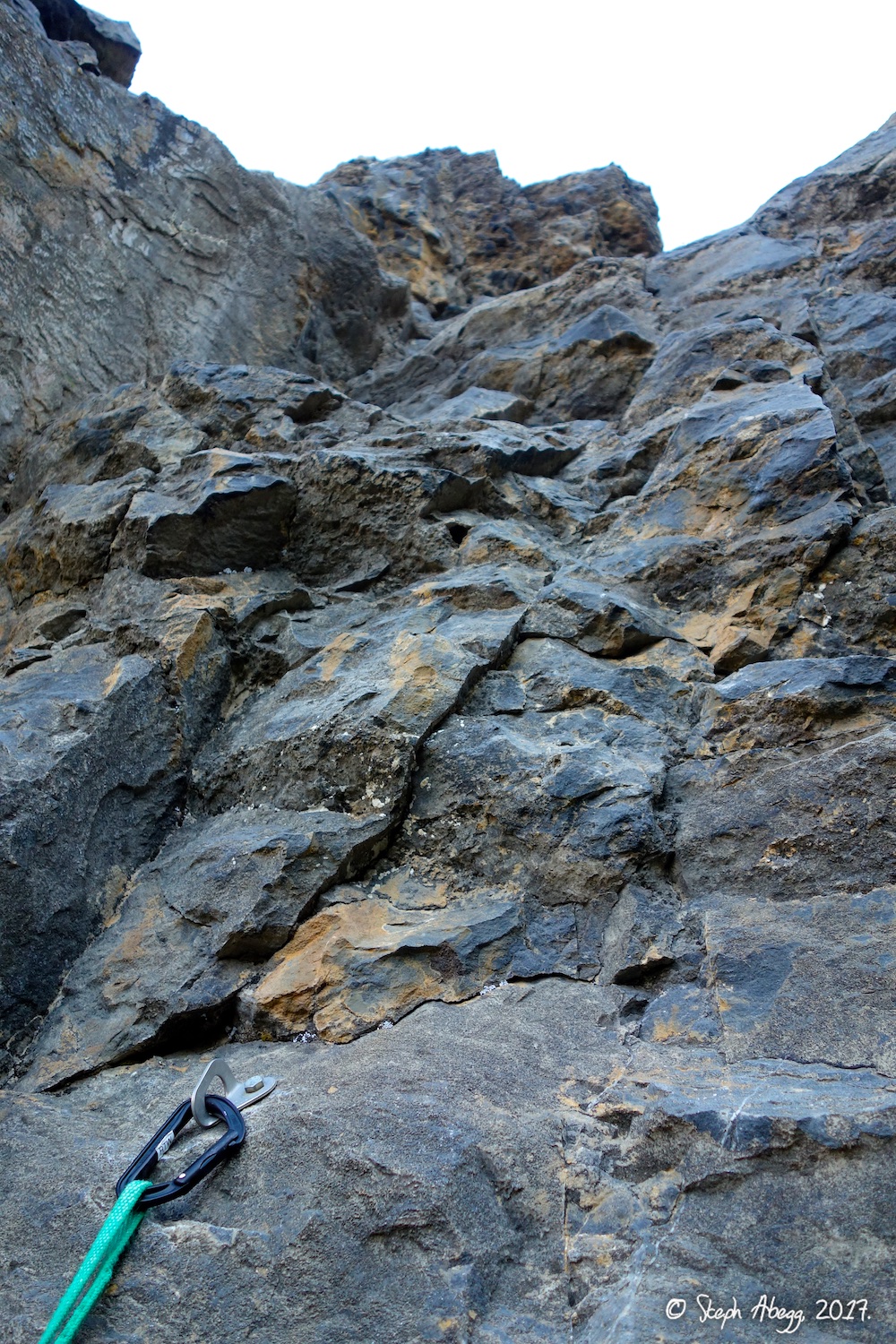
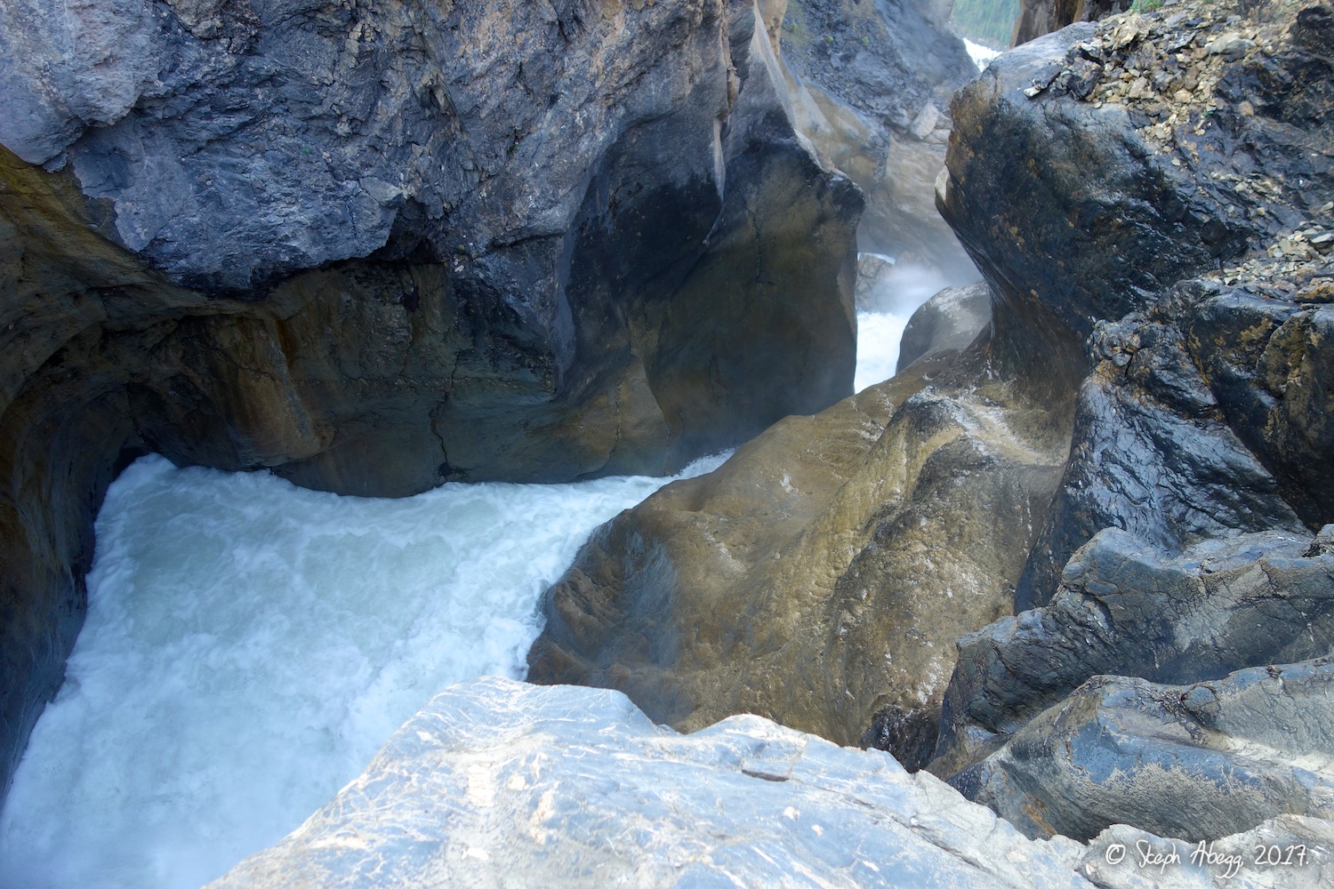
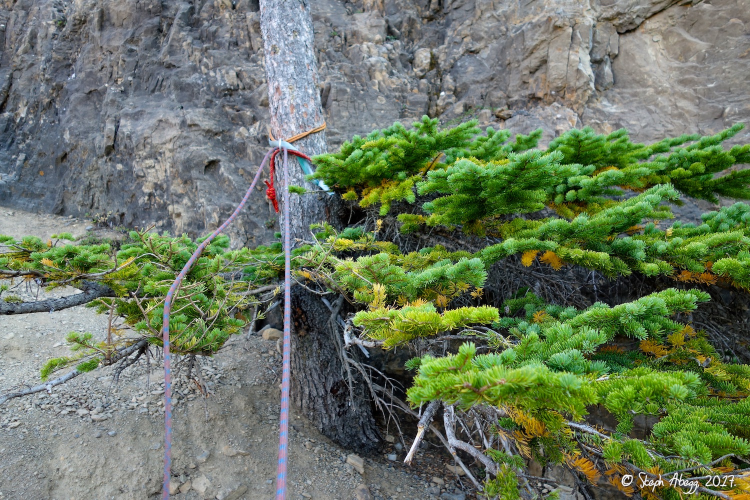
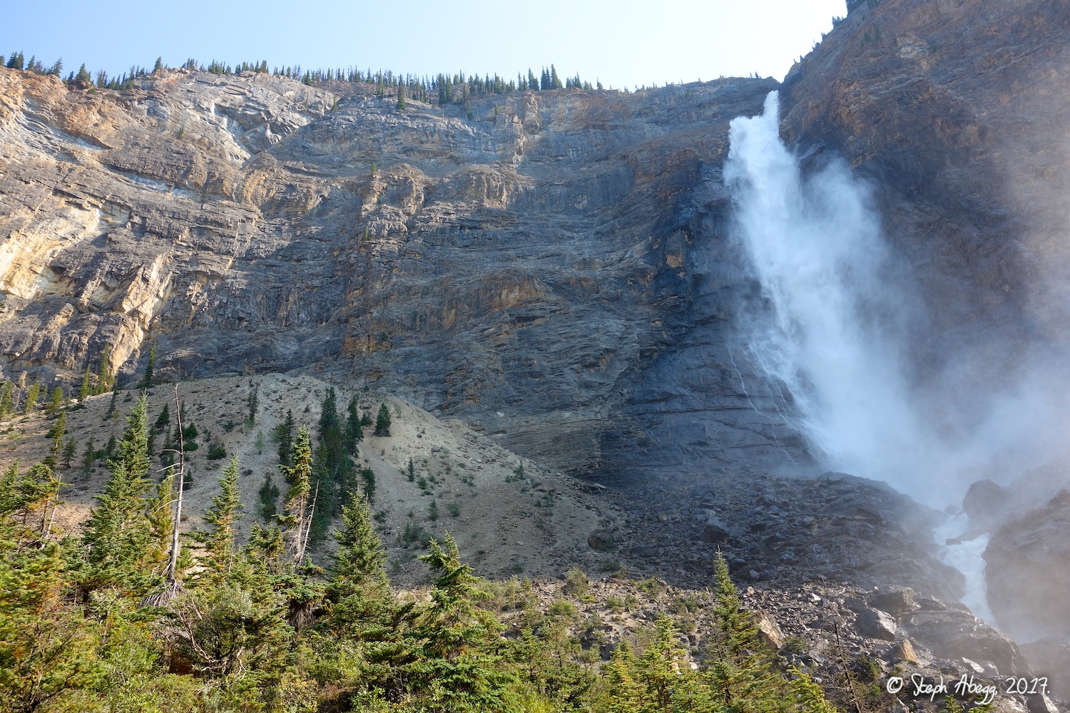
The route just sounded super unique: after climbing for 10 pitches alongside the 2nd highest waterfall (384 m = 1260 foot) in western Canada, you crawl through a 200+ foot tunnel, popping out just above the top of the falls. (While crawling through the narrow tunnel, I thought of what it must have felt like for the FA'ers Bernie Schiesser and Sid Marty in 1966—finding the tunnel, crawling through it in the pitch dark having no idea if it would dead end or drop off, and then the amazing surprise of popping out right at the source of Takakkawa Falls.) The climbing itself is technically easy (low 5th), but it is pretty fun face climbing on reasonably solid limestone. Plus, the belays are bolted, very little trad gear is needed (we brought just 4 cams which was more than sufficient), and the descent is rappelling the route, so the route can go quickly. In fact, it took Rob and me four and a half hours car to car, giving us plenty of time to get to Jasper.

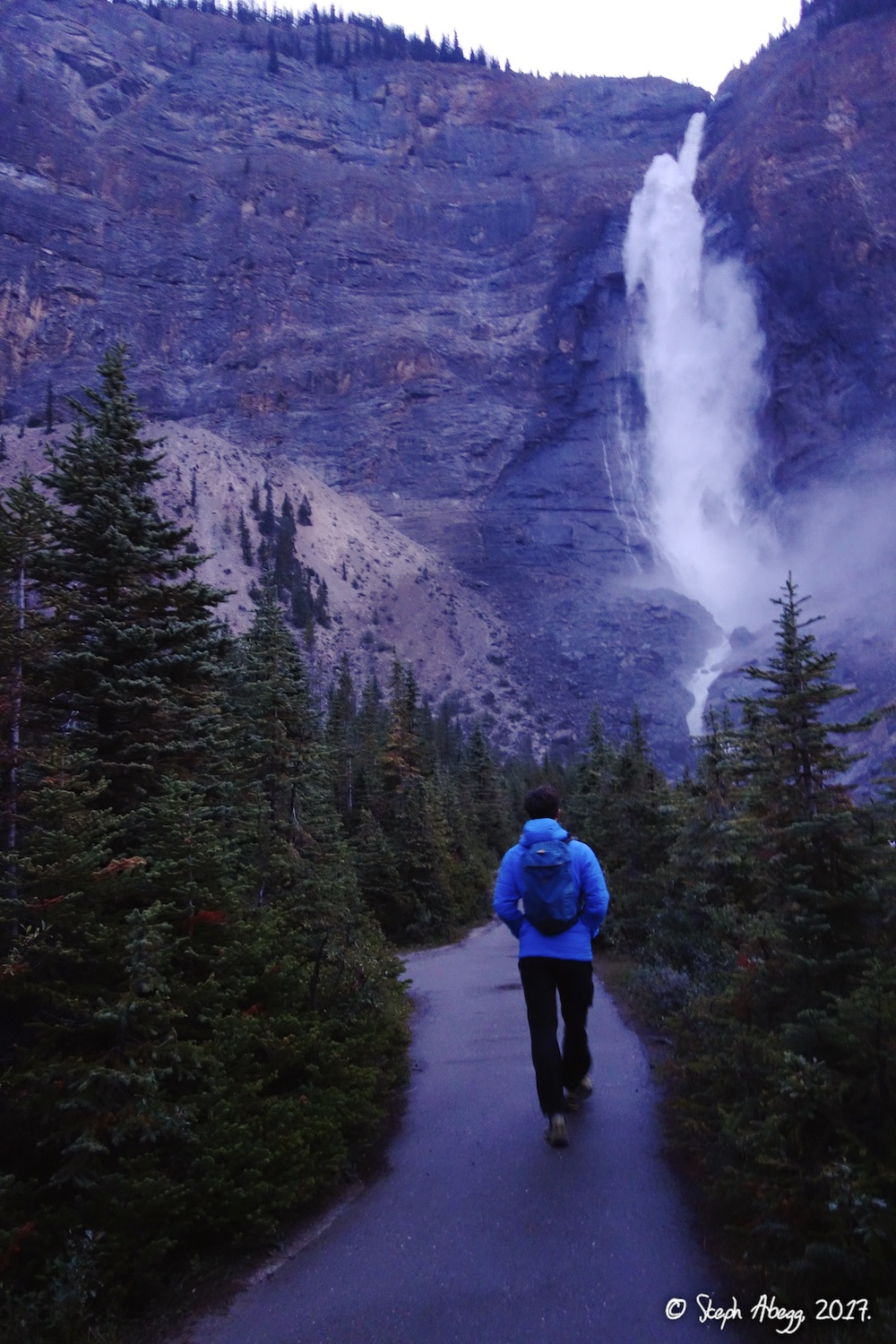
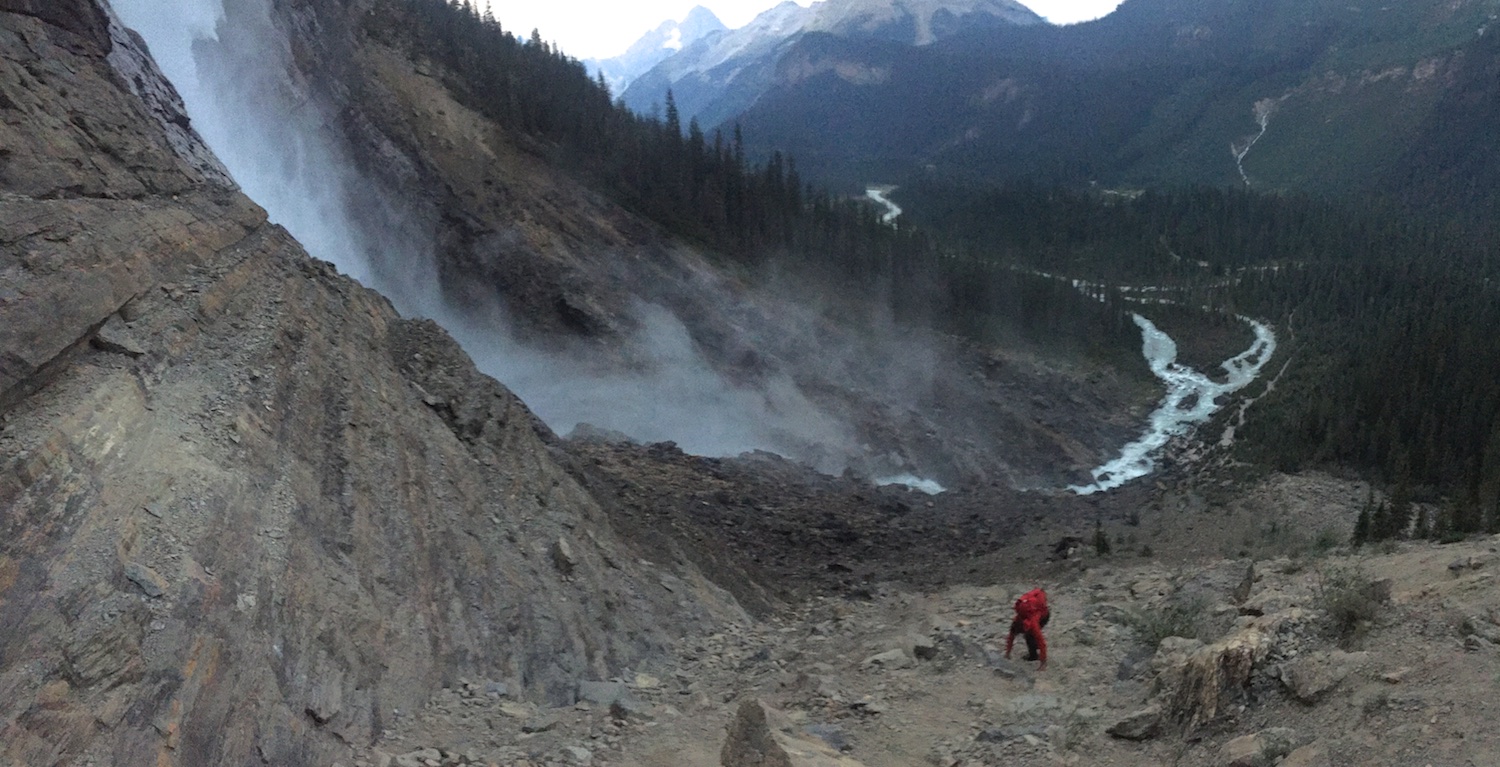
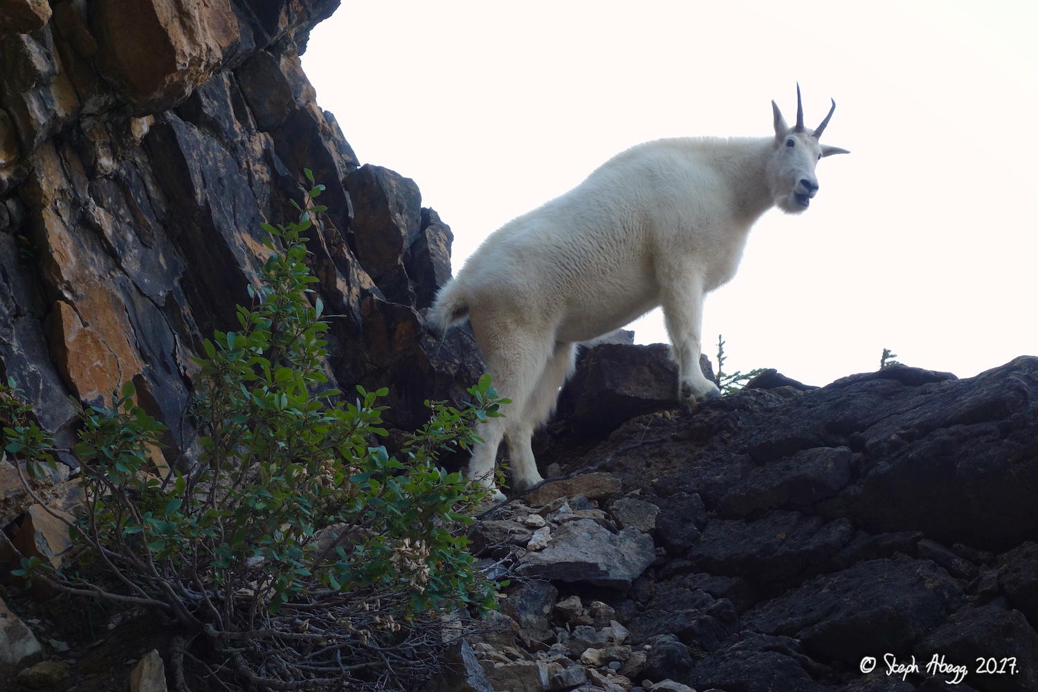
This climb is certainly worth doing, if only for its uniqueness. The following page gives some photos of our morning adventure.

Time Stats

Hike to base: 27 minutes
Climb: 1 hour 58 minutes
Rappel route: 55 minutes
Hike to car: 20 minutes
Total car-to-car: 4 hours 30 minutes

Photos

THIS TRIP REPORT IS STILL MOSTLY IN THE EMBEDDED HTML FORMAT OF MY OLD WEBSITE.


Photos:
Photo descriptions:
Approach 
Tourist trail to Takakkaw Falls viewpoint, continue up climbers trail to top of scree cone.
1.   
2.   
  
   
1. Starting off the approach on the tourist trail sans tourists (tourists don't like to wake up at dawn).
2. Scrambling up to the base of the route. (Photo by Rob.)
Climb
3rd to 5.7, 1260', 12p
3.   
4.   
5.   
6.   
7.   
8.   
9.   
10.   
11.   
12.   
13.   
14.   
15.   
16.   
17.   
 
3. Rob starting up Pitch 1. He is at the first bolt on the route.
4. The belay stations are all bolted on this route. This is the belay station at the top of Pitch 1. We did not belay here since we linked Pitches 1 and 2.
5. "Pitch" 3 and "Pitch" 4 are essentially a hike along an exposed trail.
6. Looking up Pitch 5.
7. A mountain goat en route.
8. "What do you need a rope for?" asks the goat.
9. Looking up Pitch 6. This pitch is a gear pitch. We had 4 cams (0.5, 0.75, 1, 2) and I used the 0.75 and 2 on this pitch. This was the only pitch we placed gear on, although we could have placed it elsewhere if wanted.
10. The rooster tail from the belay at the top of Pitch 7. (Photo by Rob.)
11. Rob stopping mid-pitch to photograph the falls (Pitch 8).

12. Rob's photo of the falls. 
13. It's not every day you get to climb beside a 1,260-foot waterfall.
14. Pitch 9 climbs through a band of shale. There is not pro on this pitch, but it is fairly easy.
15. The entrance to the tunnel.
16. Bring a headlamp! It's dark in there!
17. Steph crawling through the tunnel. (Photo by Rob.)
Top of falls

18.   
19.   
20.   
21.   
22.   
23.   
18-19. The top of the falls, just after the exit from the tunnel.
20. To get to the source of the falls, climb one more pitch after exiting the tunnel. This involves a short section of 5.6, protected by just one belay bolt at the very bottom of the pitch. We felt it was worth going to the top to see the source of the falls.
21. Above the falls.

22-23. Cool water-formed grooves just before the water begins to plummet 1,260 feet.
Descent 
Rappel route (we did 9-10 rappels with a single 60m rope; you can also use double ropes and do half as many rappels and twice as much rope management)
24.   
25.   
26.   
27.   
28.   
29.   
30.   
24. If you do Pitch 12 above the tunnel, one rappel option is to do a single-rope rap off of this tree back down to the tunnel and reverse the tunnel. With two ropes, there might be another rap anchor to the left that allows you to rap to the belay anchor on the left side of the tunnel and hence bypass having to reverse the tunnel.
25. The exit of the tunnel. Since we only brought one rope, we reversed the tunnel.
26. Interesting fracture pattern on the ceiling of the tunnel.
27. Rappelling back down along the falls.  We rappelled with a single 60m rope.
28. Rob at the belay anchor at the top of Pitch 7, taken on the way down. This is a much better viewpoint of the falls than the tourist trail viewpoint below.
29. Recent rockfall to climbers' left of Takakkaw Falls route. This had occurred at some point over the previous winter, according to an article I found on gripped.com.
30. Looking back up at Takakkaw Falls on the descent. The sun was just beginning to hit the route as we descended (this photo was taken around 10:40am). The route climbs to the left of the falls.

Comments Pertaining to this Page / Trip Report

Useful beta. Updated route information. Corrections. Historical notes. Interesting facts. No fluff please.
Leave a Reply

Your email address will not be published. Required fields are marked *