This page provides links to my trip reports in California.
Navigate the trip reports by area, map, or month of year.
This page provides links to my climbing trip reports in California. Drawn by the the splitter granite cracks and stable weather, I've made several road trips to California over the years, climbing in Yosemite, Tuolumne, the High Sierra, Whitney Portal, Tahoe area, the Needles, Joshua Tree, and the South Cascades.
Trip Report Navigation Option #1:
Trip Reports by Area
TRIP REPORTS MAY BE IN MULTIPLE TAB CATEGORIES | USE SEARCH BOX TO SEARCH FOR SPECIFIC REPORTS
Trip Report Navigation Option #3 (not available on mobile):
Trip Reports by Month
CHRONOLOGICAL LIST | WHERE TO CLIMB IN California IN THE WINTER? SPRING? SUMMER? FALL?
Selecting multiple months at once will usually result in no result. But it is a page (like a cragging page) where I have visited the area multiple times, you may get a result.
The date shown on the thumbnail represents the most recent trip report on the page, if the page represents multiple days of climbing.
Order By :
Order :
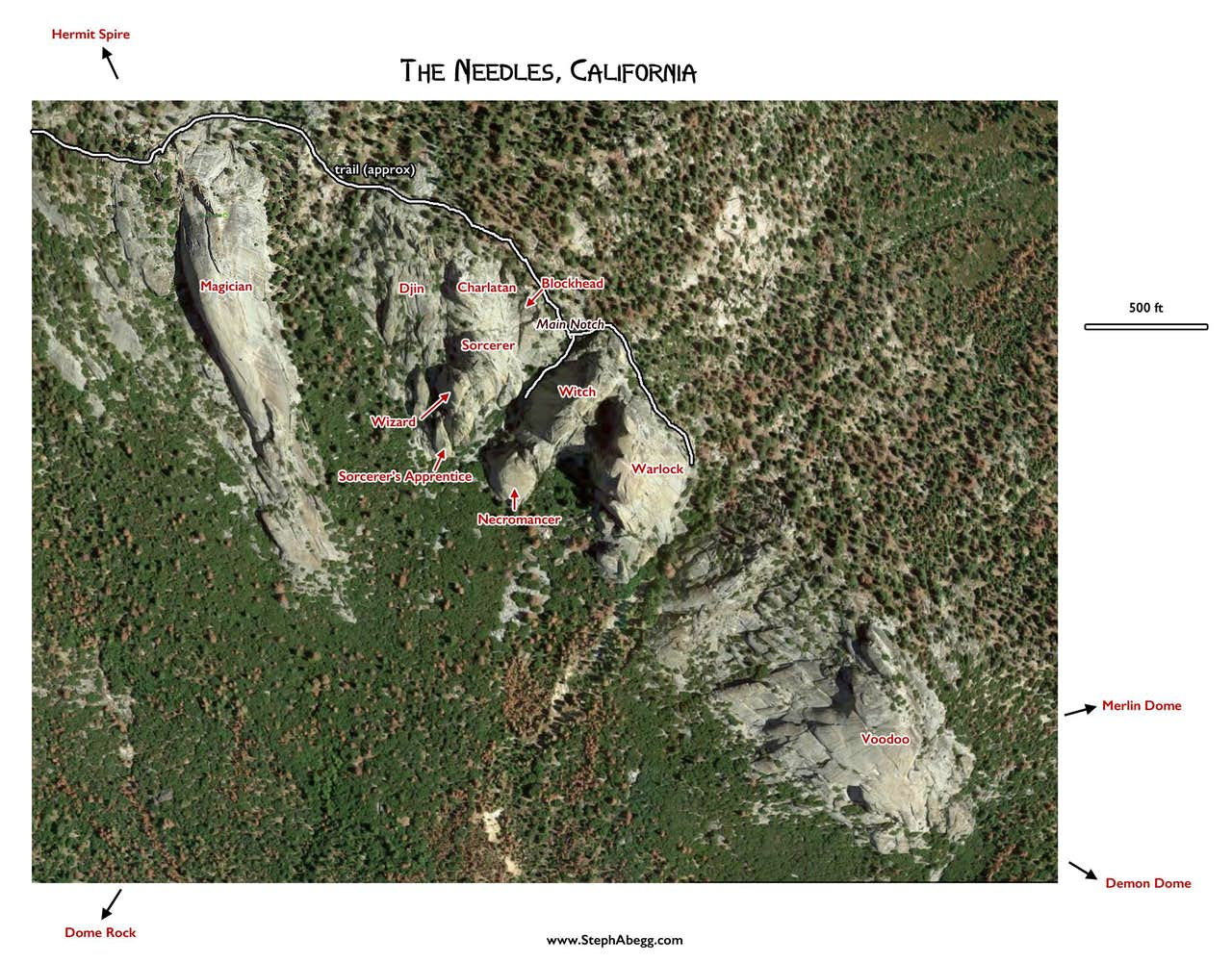
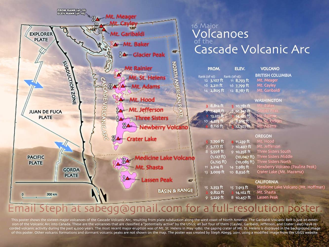
Some Area Maps for California
CLICK TO ENLARGE
Sometimes I put together a map of an area to wrap my head around the climbing (or adventuring) objectives. I made these maps for my first visit to the Needles in southern California and after I did an aerial photography adventure along the Cascade Volcanic Arc.
The button below opens graphs showing the number of days (by year and by month) represented by my California trip reports. These graphs are based on SQL queries to all pages on my site. They may take awhile to load.
Trip Report Stats for California
GRAPHS | NUMBER OF DAYS
Below are graphs showing the number of days (by year and by month) represented by my California trip reports. These graphs are based on SQL queries to all pages on my site. They may take awhile to load.
I've made several summer (June-August) trips to Yosemite and the High Sierra. I also had one fall trip to Yosemite in 2024.