THIS TRIP REPORT IS STILL MOSTLY IN THE EMBEDDED HTML FORMAT OF MY OLD WEBSITE. MOBILE Tip: Try Landscape mode. It is generally more mobile friendly.
Route Notes:
Tom Sjolseth, Daniel Jeffrey, and I took advantage of that one nice day in June to climb the North Ridge of Baker. This route is often regarded as one of the best technical snow-and-ice climbs on a Cascades volcano. We had great early summer conditions, and even with a spicy ice pitch variation, a party of three, and a scenic forested detour on the descent, we climbed the route car-to-car in 14 hours. Car-to-trip-report: 30.5 hours.
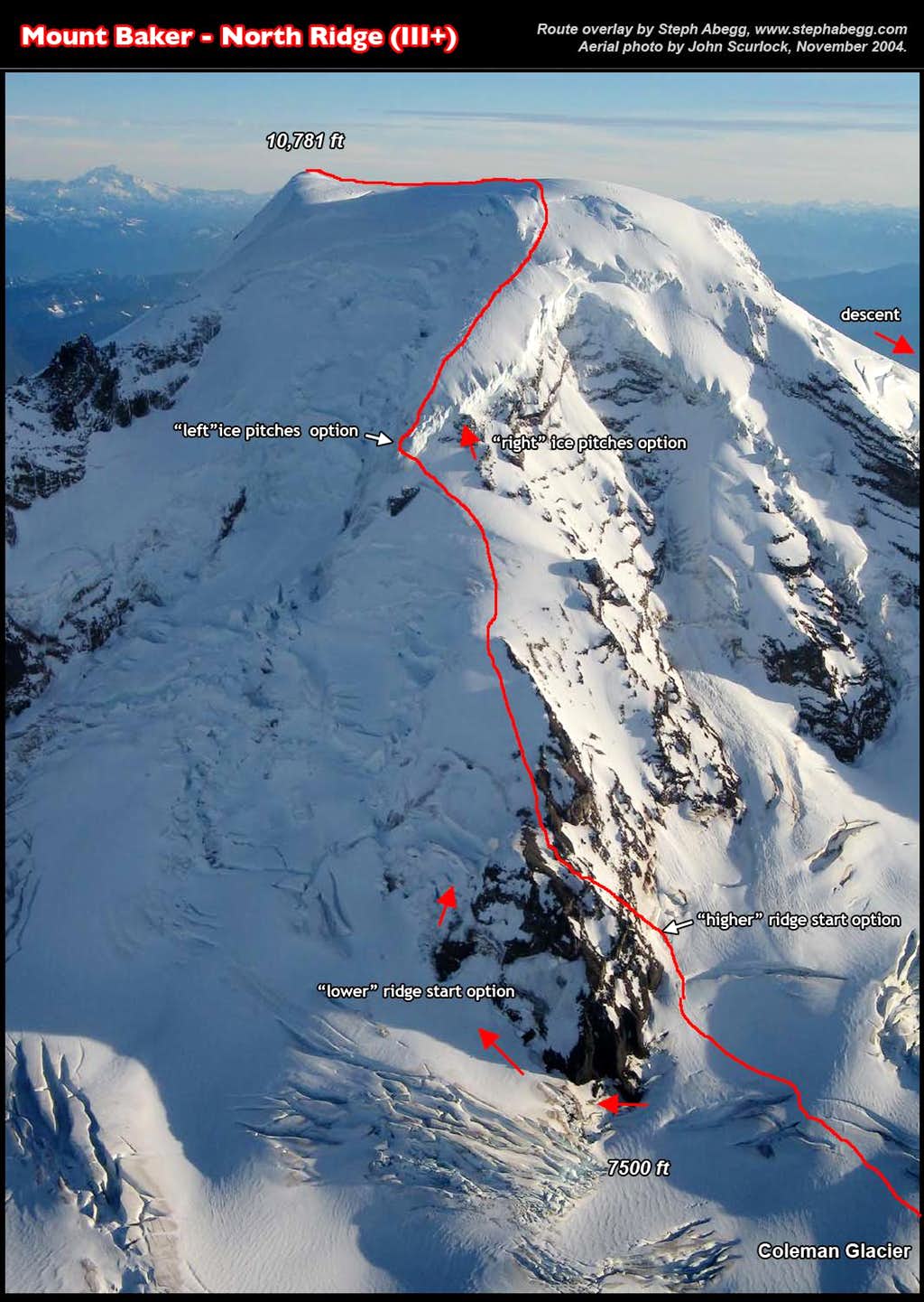
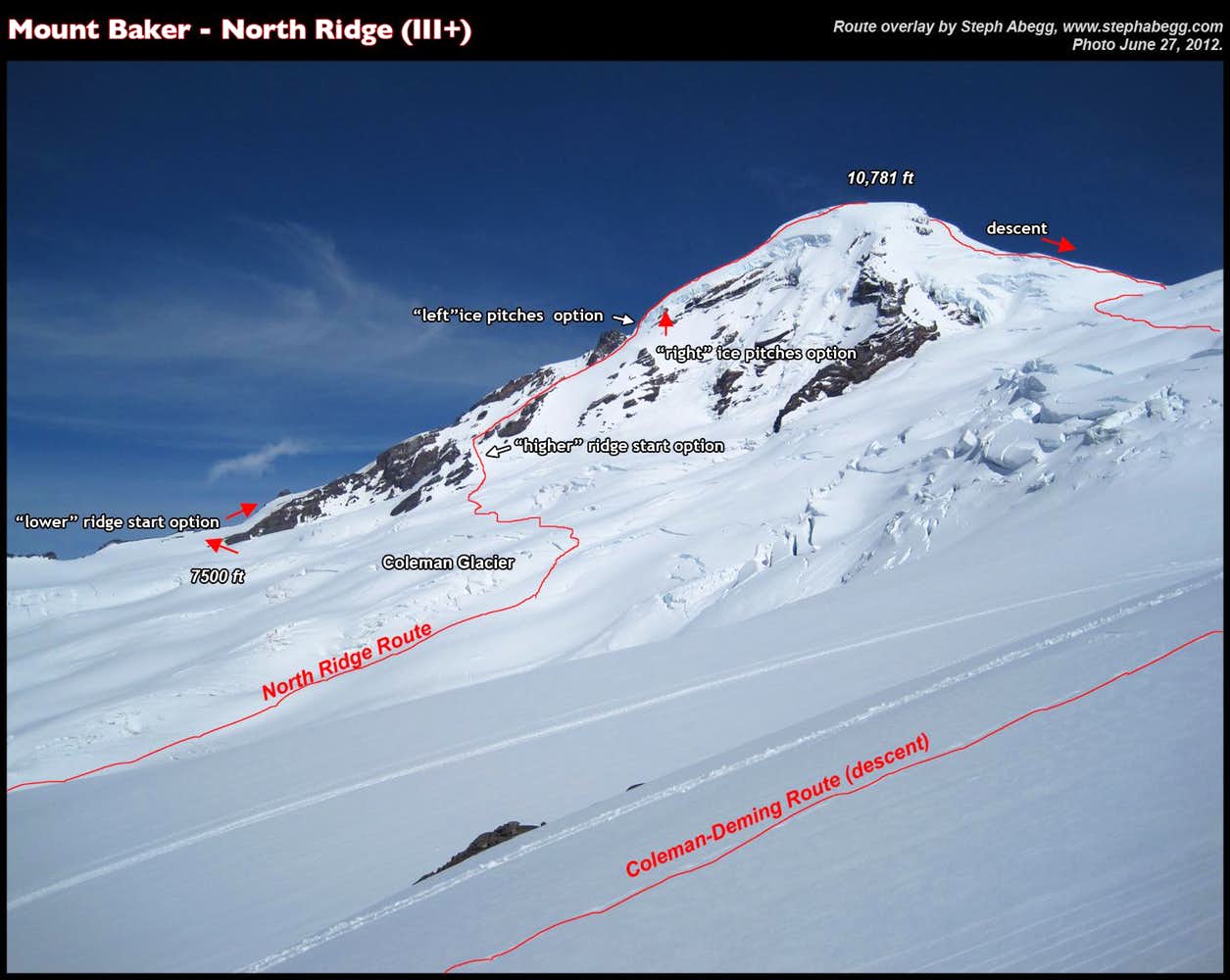
There is plenty of route beta for Baker's North Ridge in printed guides and online, so in the following trip report I will just provide more interesting stuff like stats, an aerial view of us on the crux ice step, route overlays, and (of course) plenty of photos from the climb.
Stats:
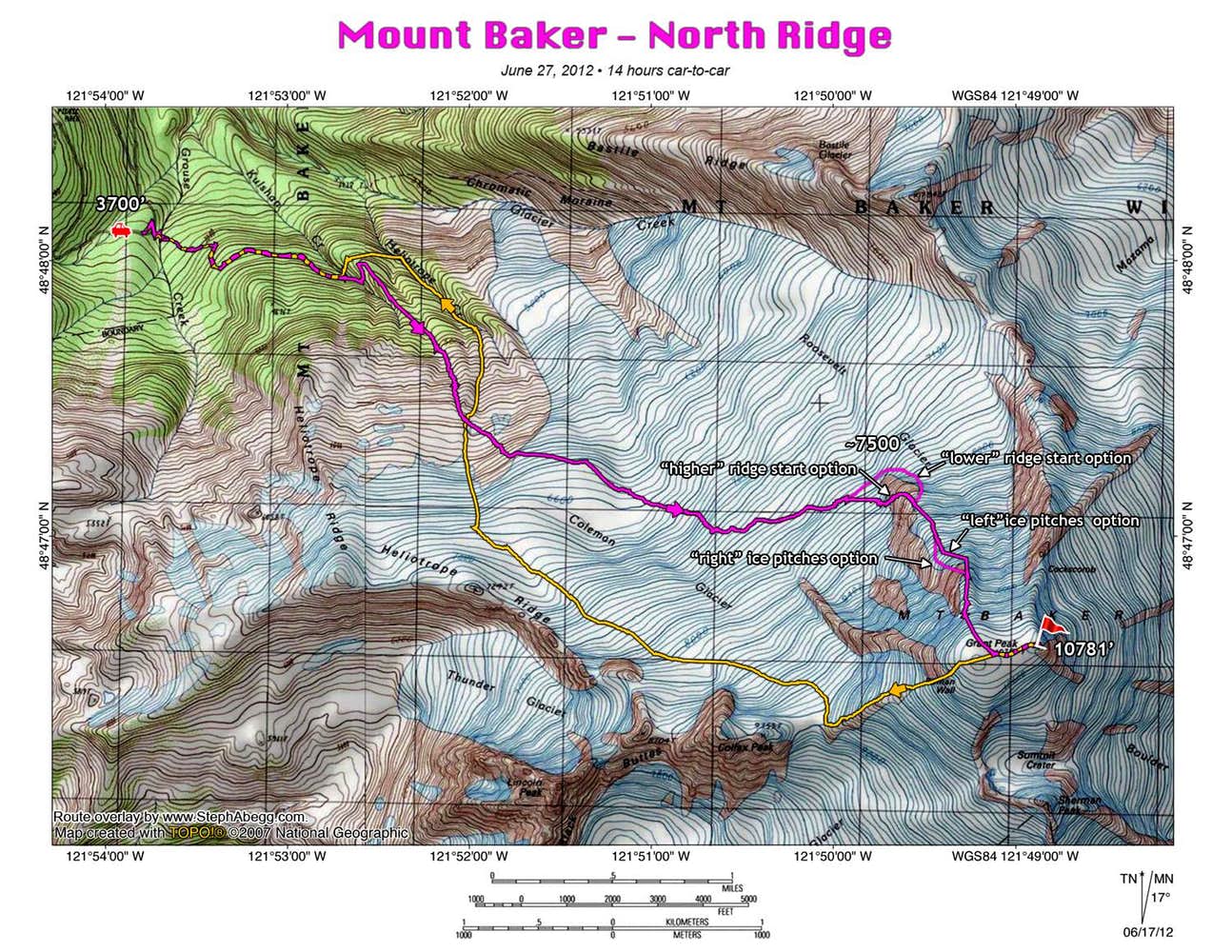
Roundtrip distance: ~11.5 miles (according to my GPS) Elevation gain/loss: ~8000 ftcumulative for entire trip TH to Coleman Glacier: 1:58; Coleman Glacier to base of N Ridge: 2:12; Base of N Ridge to Summit: 5:58; On summit: 0:14; Summit to TH: 3:48; Total car-to-car time: 14:10
6:46 pm (Tues night): Arrive at Heliotrope Ridge Trailhead (3700 ft) on Glacier Creek Road (road became drivable all the way to the trailhead just a few days previous)
10:00 pm (Tues night): Get to sleep
2:30 am (Wed morn): Wake up
3:07 am; 3,700 ft: Start hiking
5:05 am; 6,000 ft: "The Hogback" / Coleman Glacier
5:06 am: Sunrise
7:17 am; 7,800 ft: Base of N Ridge
1:15 pm; 10,781 ft: Summit
5:17 pm; 3,700 ft: Arrive back at car
9:14 pm: Sunset
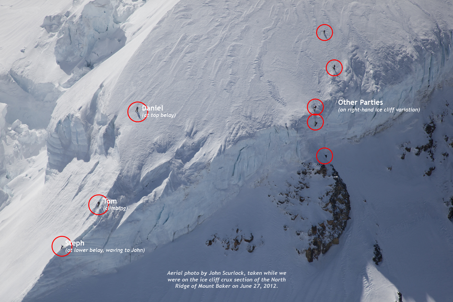
John Scurlock fly by:
Friend and aerial photographer John Scurlock knew I was climbing the north ridge of Baker, so he made a brief Baker detour on a fueling flight to Arlington. When I got home, sure enough, there was an email and a bunch of photos from John. Pretty cool to see yourselves climbing from this perspective!
Photos:
Due to the technical and car-to-car nature of this climb, I decided to just bring a point-and-shoot camera rather than my shoots-much-better-photos-but-not-when-you've-got-only-one-hand-free SLR. It was a stellar day in the mountains, so I still got some fairly decent photos nonetheless.
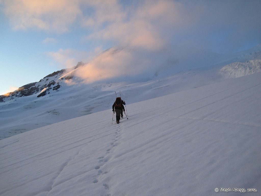
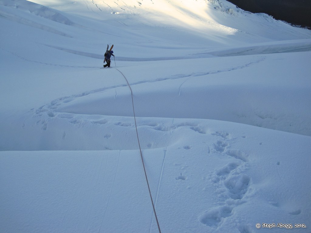
Tom traversing the Coleman Glacier towards the North Ridge. Fairweather early morning clouds over the summit of Baker. This photo was taken shortly before we started encountering bigger crevasses and roped up accordingly.
Lincoln Peak shrouded in early morning mist.
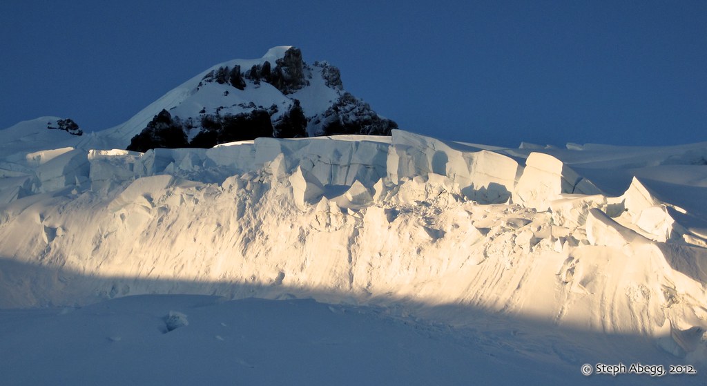
Sunlit seracs on the upper Coleman Glacier, with Colfax Peak still in shadow behind.
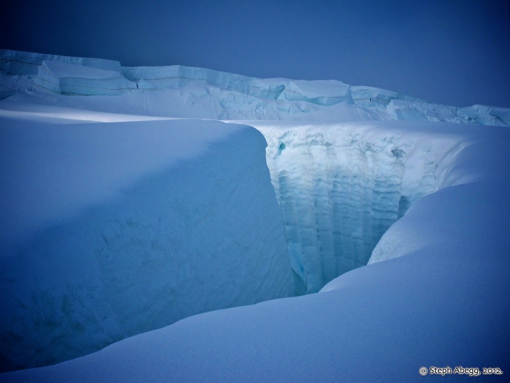
There are some giant cracks on the Coleman Glacier.
A watch-me-here snow bridge.
Looking back at the Coleman Glacier we just crossed.
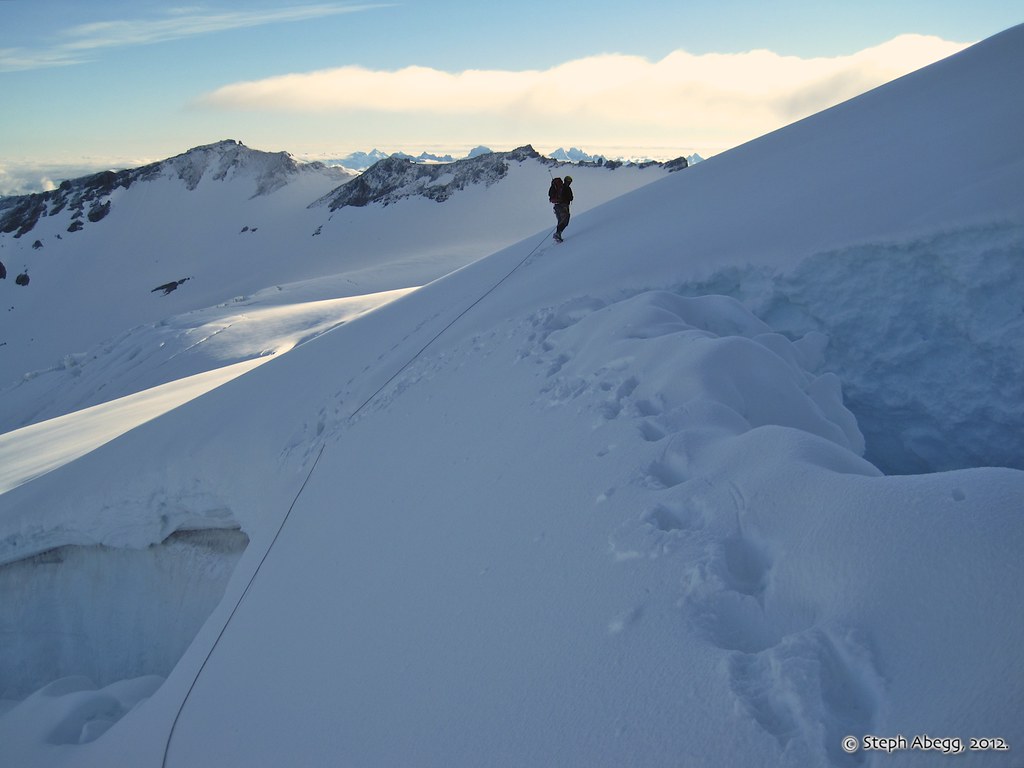
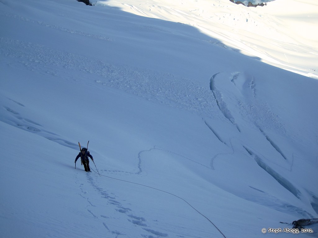
What a nice day! We headed up the slope just to the right above Tom's head in this photo. This is the "higher start" in Nelson and Potterfield's guidebook. In later season, icy conditions and/or rockfall and/or the bergschrund might prevent easy access to the ridge this way, and an alternative is to go around the toe of the ridge ("lower start") on the left.
Sunlight and shadow.
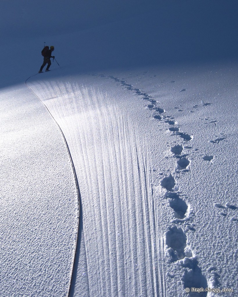
Another snowbridge on the Coleman Glacier.
Ascending the slope ("higher start") to gain the North Ridge proper.
Easy travel on the 35-40° slopes of the lower North Ridge.
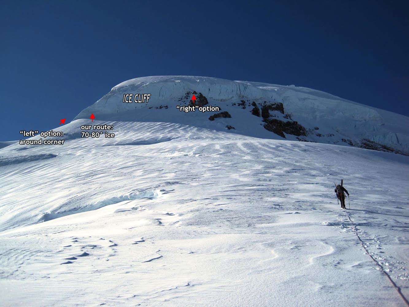
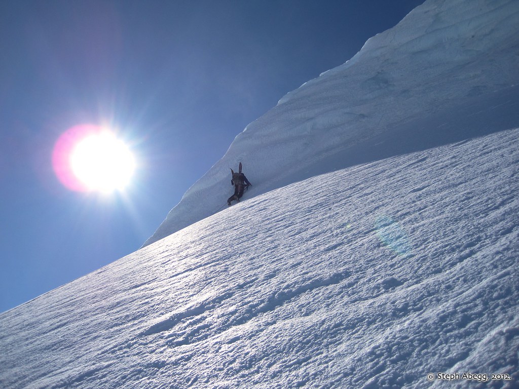
At 9,600', things get interesting. Here there is an obvious steep step. There are several possible route variations here. We chose to go left, while a couple of other parties on the route chose to go right. If we had gone left around the toe of the ridge, it would actually have been pretty mellow, but we got suckered into a 70-80° ice cliff (just to the right of Daniel in this photo).....
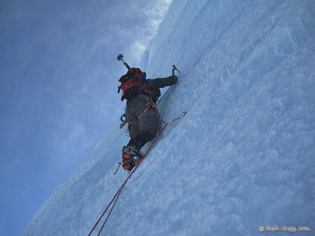
Tom leading the 70-80° ice cliff pitch, perhaps 50' or so. This is definitely past my leading comfort zone. But in retrospect it was a fun pitch and added a bit of spice to the route.
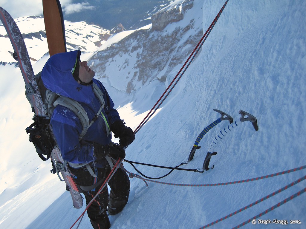
Daniel at the screw and tool belay at the base of our ice cliff pitch.
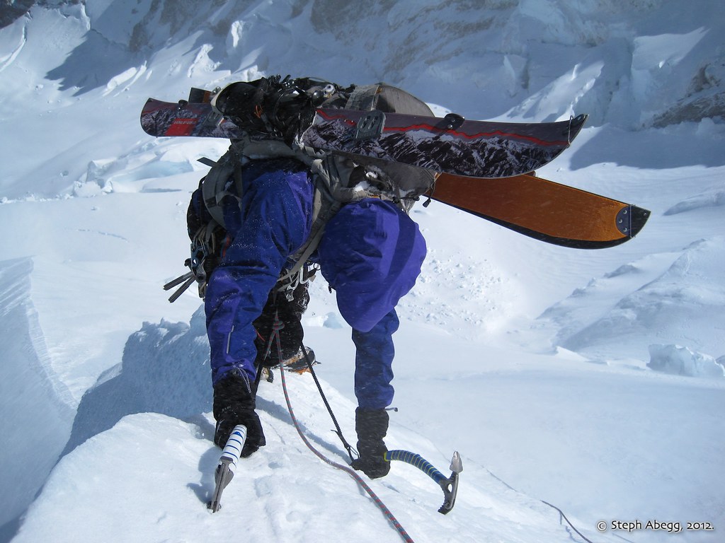
Daniel topping out on the crest of the ice cliff at the top of the first pitch. That splitboard might be heavy and clunky here, but it will be worth it for the 30 minute descent and the impressive car-to-car time!
Looking up the second ice pitch, along the crest of the ice cliff. This was easier than the first pitch but still required a few screws along the way.The nice part about climbing the left side of the ice step is that it feels like you are staying more on the ridge crest.
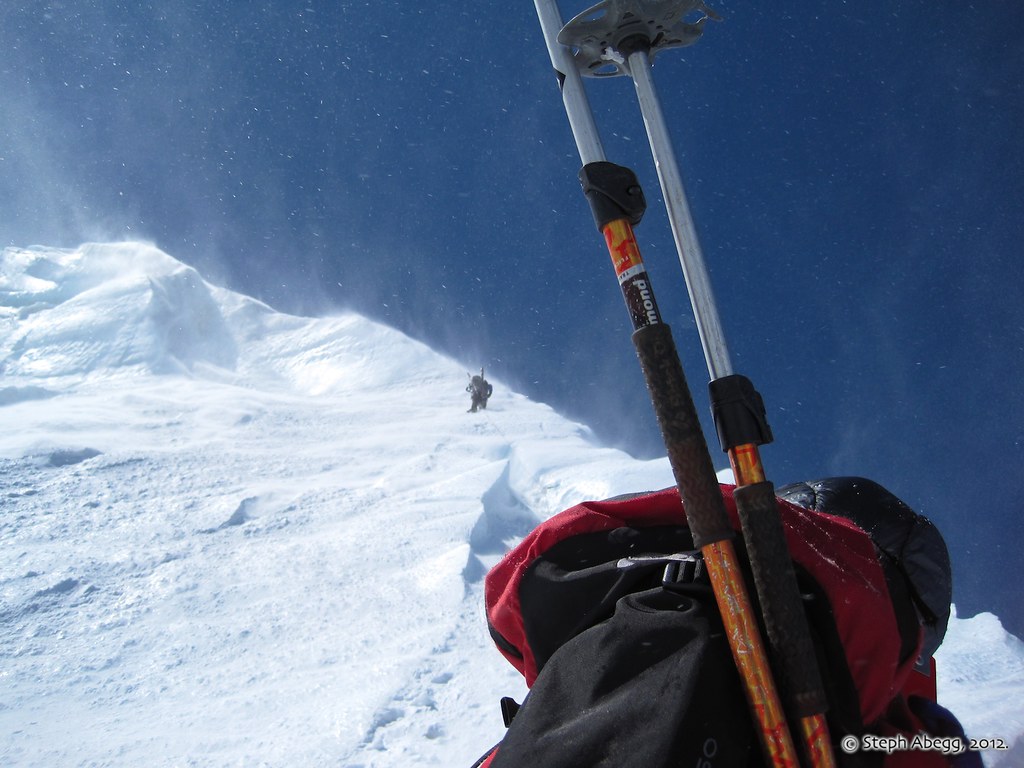
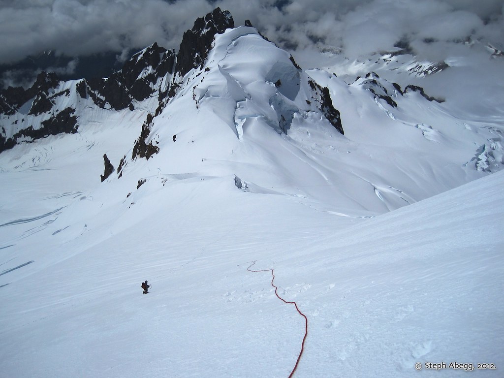
Above the 2-pitch ice step, the ridge opens up onto broader snow-and-ice slopes. A slip here would be difficult to stop and you'd find yourself back below the ice step you just ascended and probably not in any shape to reascend it, so we stayed roped up and set a couple of pickets as we continued upward. As the photo shows, it was a bit windy and the anchors often had to be dug out from a fresh layer of spindrift.
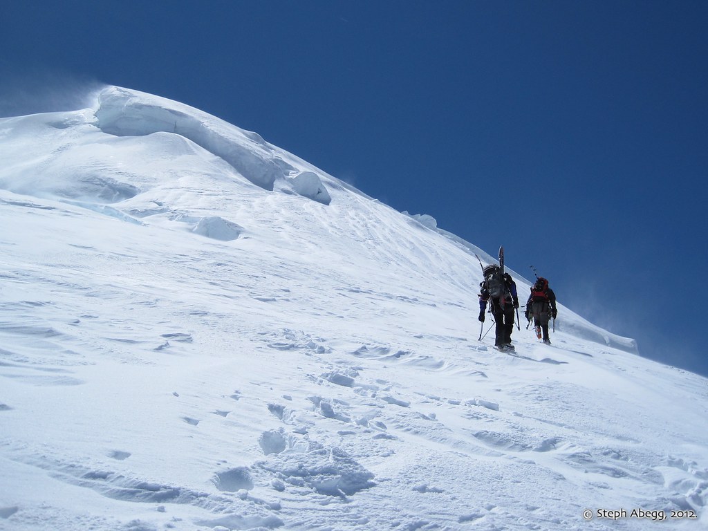
Eventually the rope and pickets got annoying and the terrain kicked back enough that we decided to unrope and slog to the summit. There were a few steep and icy sections on the final section, but the conditions made for good crampon point and axe tip purchase. (I had thought that this final section would pose some serac and crack issues, but perhaps these were chocked in with early-season snowcover.)
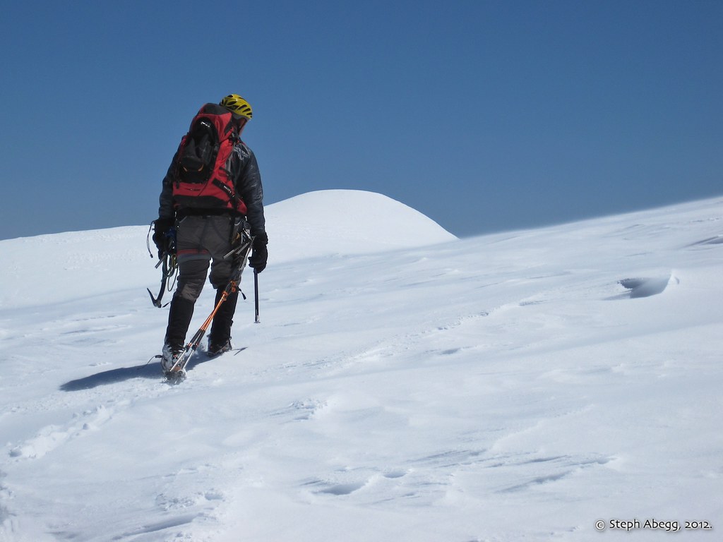
Daniel ascending the final slope to the summit plateau.
Tom on the summit plateau. The true summit (called Grant Peak) is the highest point in the middle of the photo.
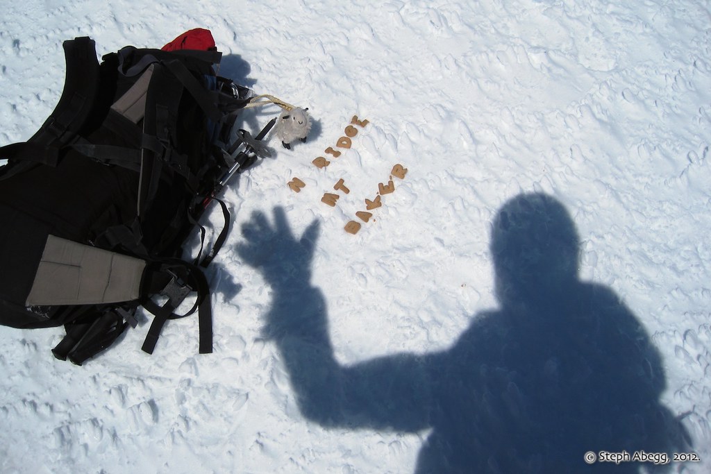
On the summit! Always bring a pen and alphabet cookies to the summit—then, if the register lacks a pen, you've got one, and if the register is buried, just sign the summit, take a photo, and eat the register.
Descending the Coleman-Deming route.
There are some large crevasses on the Coleman Glacier, so Tom and I stayed roped up for most of the descent. Daniel had brought his snowboard, which I suppose in theory would make it easier to coast right over thin snowbridges and jump larger cracks that you cannot avoid in time.
A sun halo above Colfax Peak. A sign of weather to come....
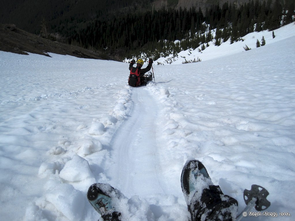
We enjoyed a few 300 ft/min glissades. In fact, we enjoyed our final glissade so much that we ended up taking it nearly to trailhead elevation in the wrong drainage....a scenic detour through the forest ensues....
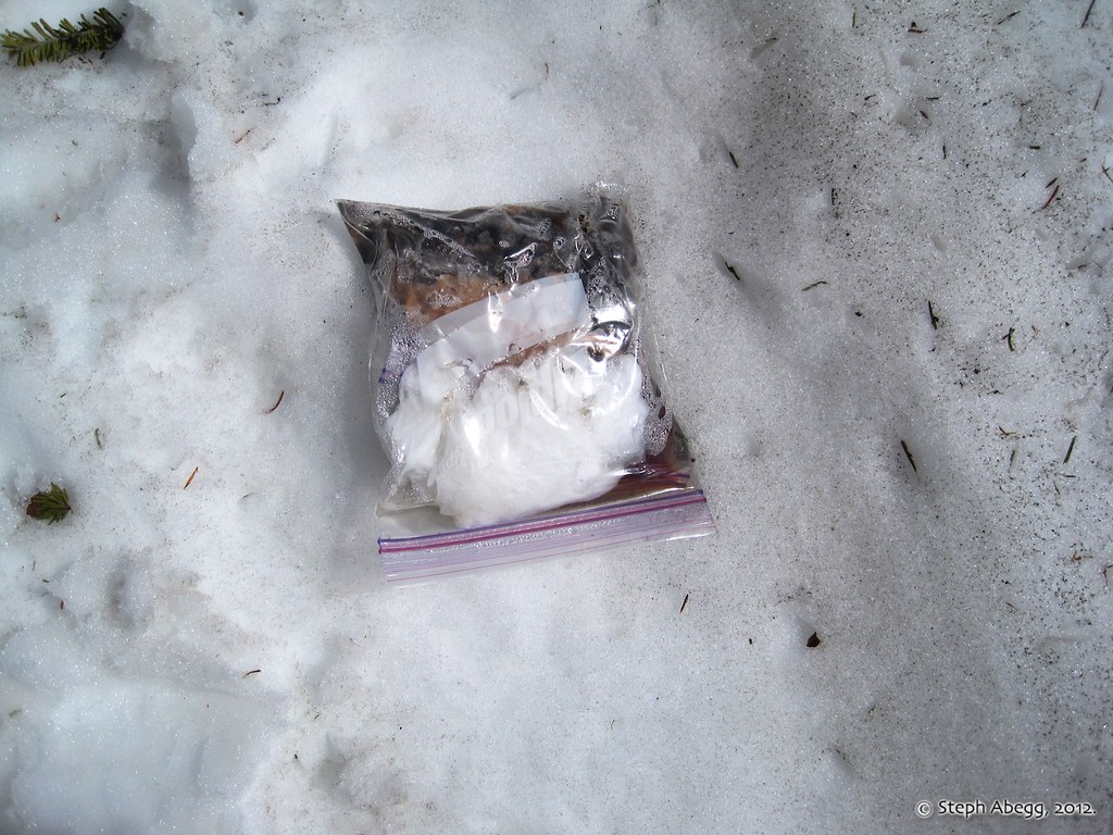
Found on the lower Coleman Glacier. Seems rather odd that you could lose such an item, as a bag of droppings in your backpack would certainly be something I would want to keep tabs on at all times. Especially if it's anywhere near those alphabet cookies you can eat after you get to the summit.
Useful beta. Updated route information. Corrections. Historical notes. Interesting facts. No fluff please. Please do not put links in your comment, as my spam filter will filter those comments out.