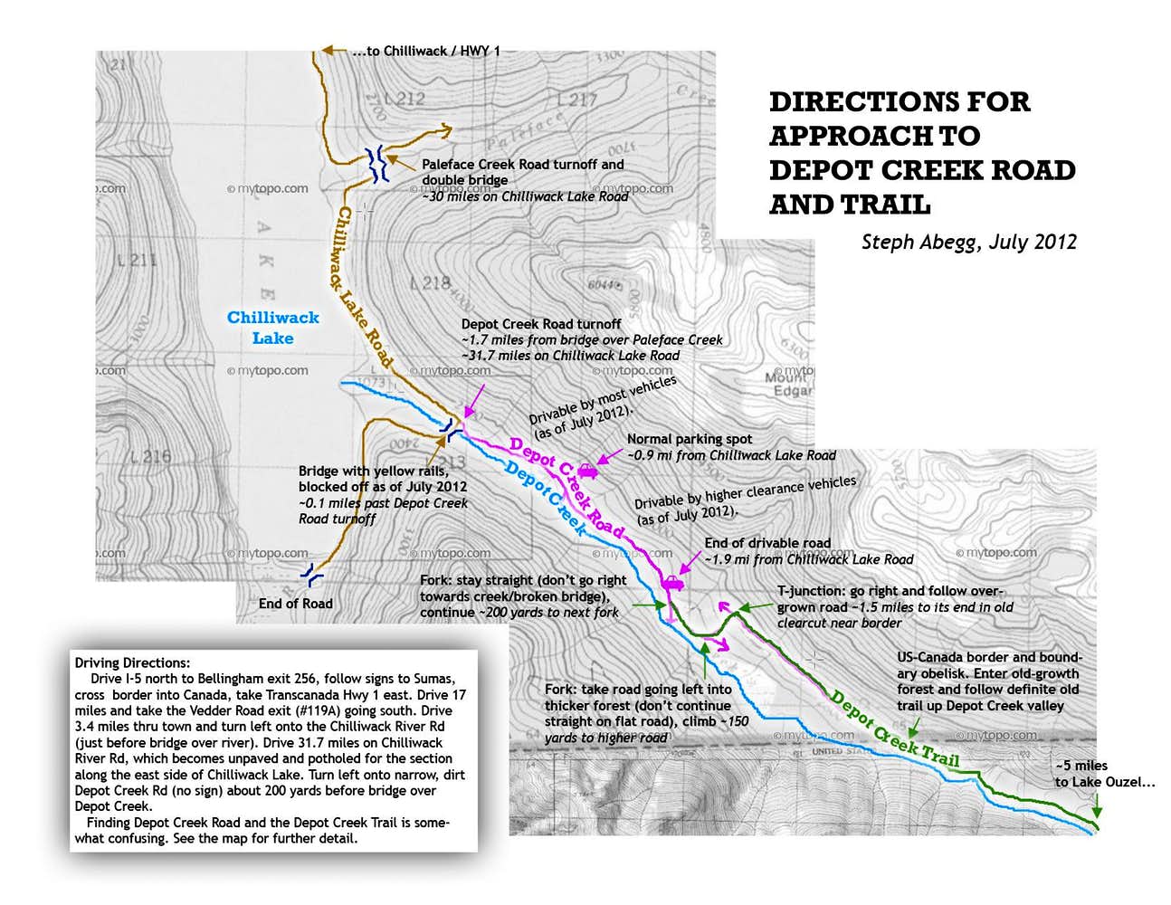
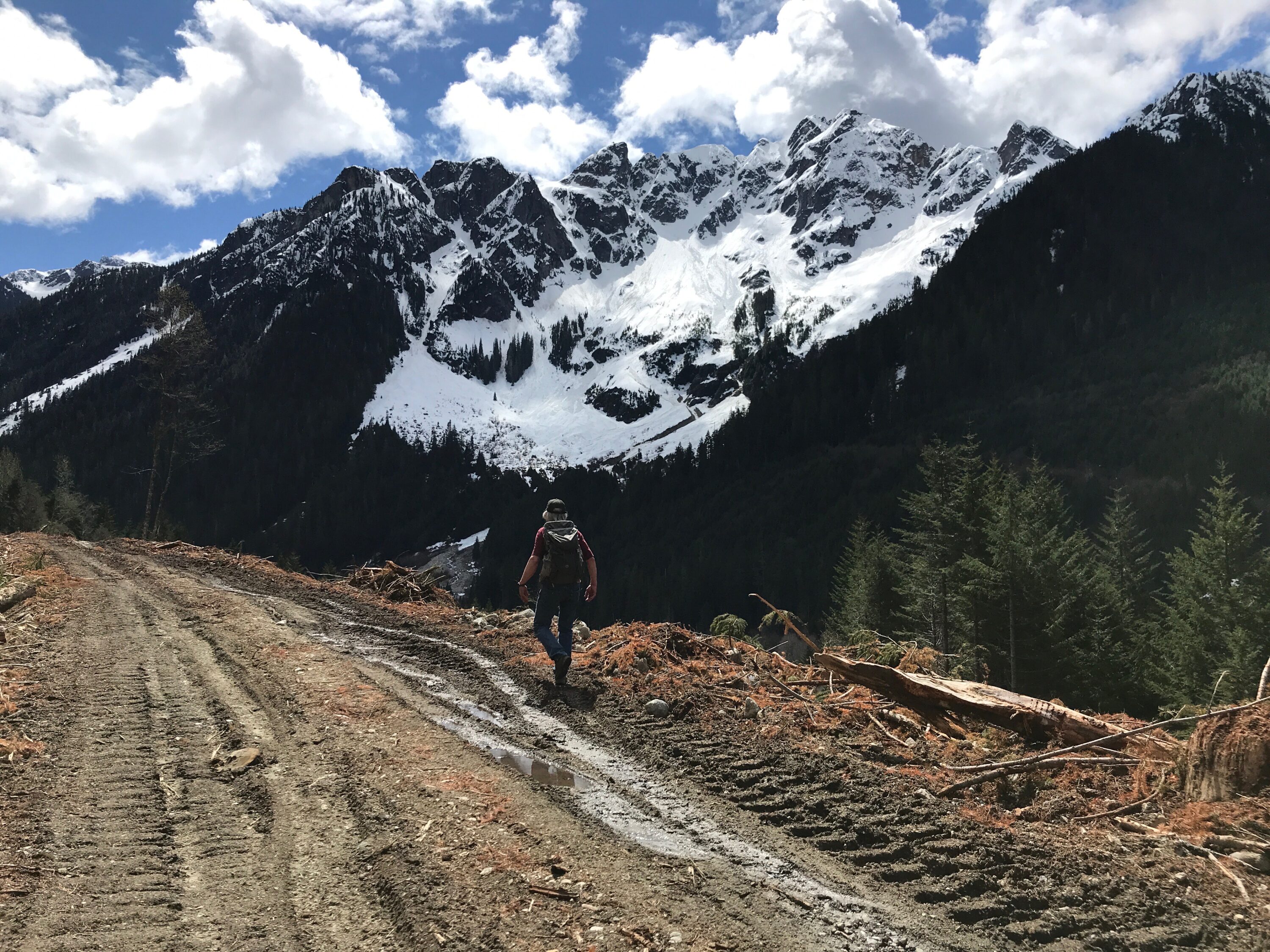
Upon my recommendation for a good dayhike, my parents (who live in Chilliwack, BC), went hiking up to the border swath which is at the beginning of the approach from Depot Creek Road. They reported that the area was rather extensively logged in 2020 and that the overgrown road that used to lead to the border swath is now at the top of this clear cut. Overgrown no more. Here are some notes from my dad reflecting my approach map given in my 2012 trip report below:
There is now a hand painted “Depot Creek Road” sign at the turnoff from the Lake Road. As you indicate, if you miss this, the gated bridge at Depot Creek is a clear indication that you need to retrace your steps by about 1000 feet (300 meters).
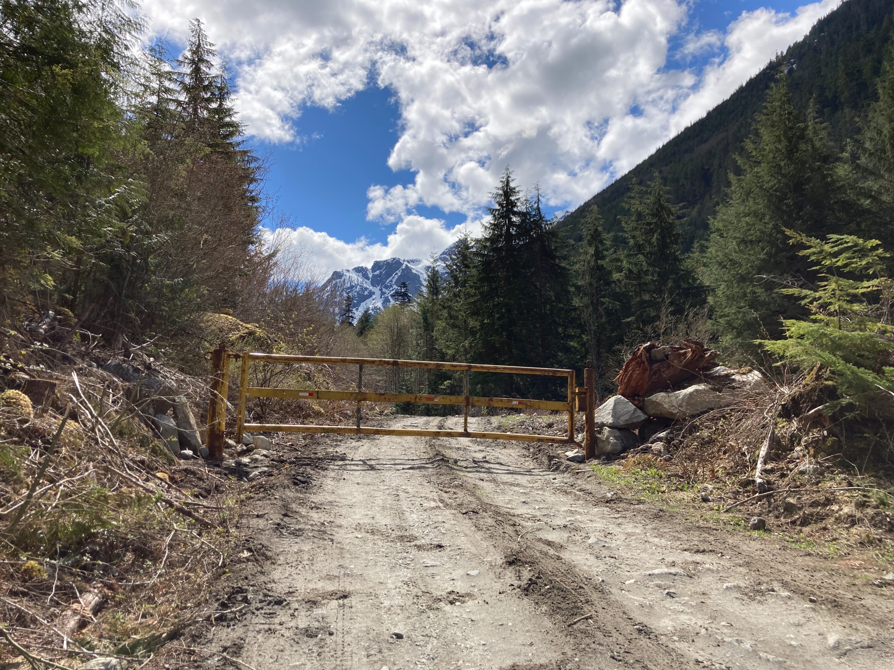
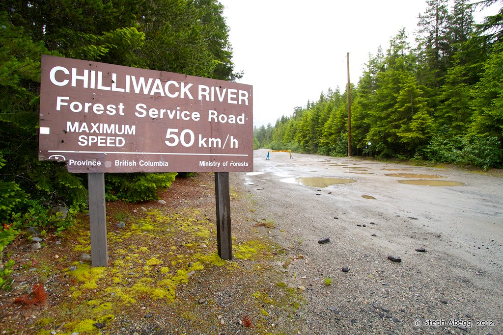
There is currently a locked gate across the Depot Creek Road at about the 0.9 mile (1.4 km) mark. (Photo 2)
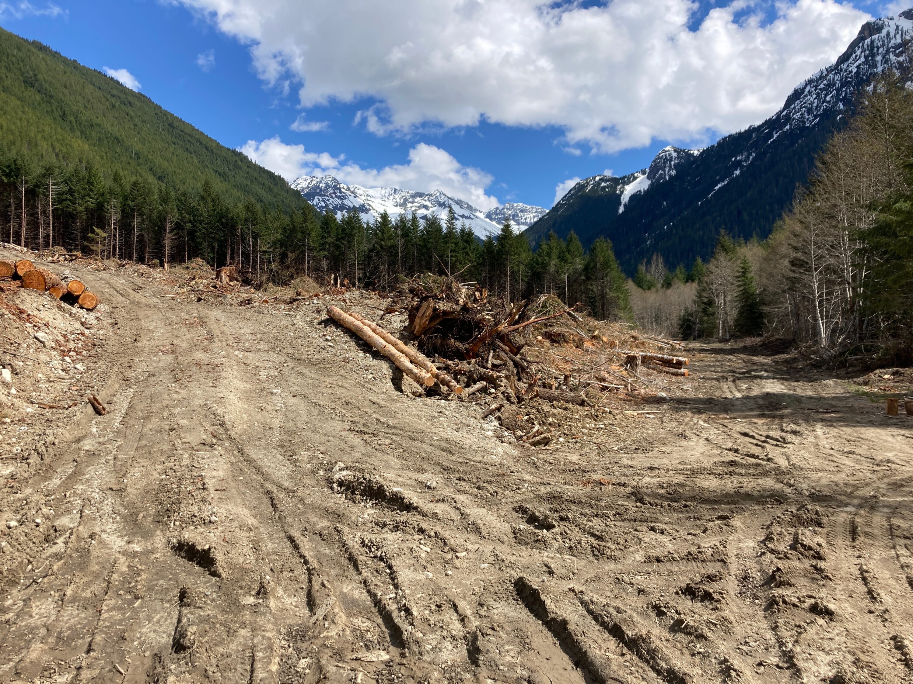
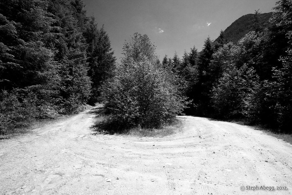
About 1500 feet before the sharp left turn that rises to the T-junction – as indicated on Gaia, paper maps, or pre-2020 route descriptions – take the left fork up the left side of the clear cut. (Photo 4)
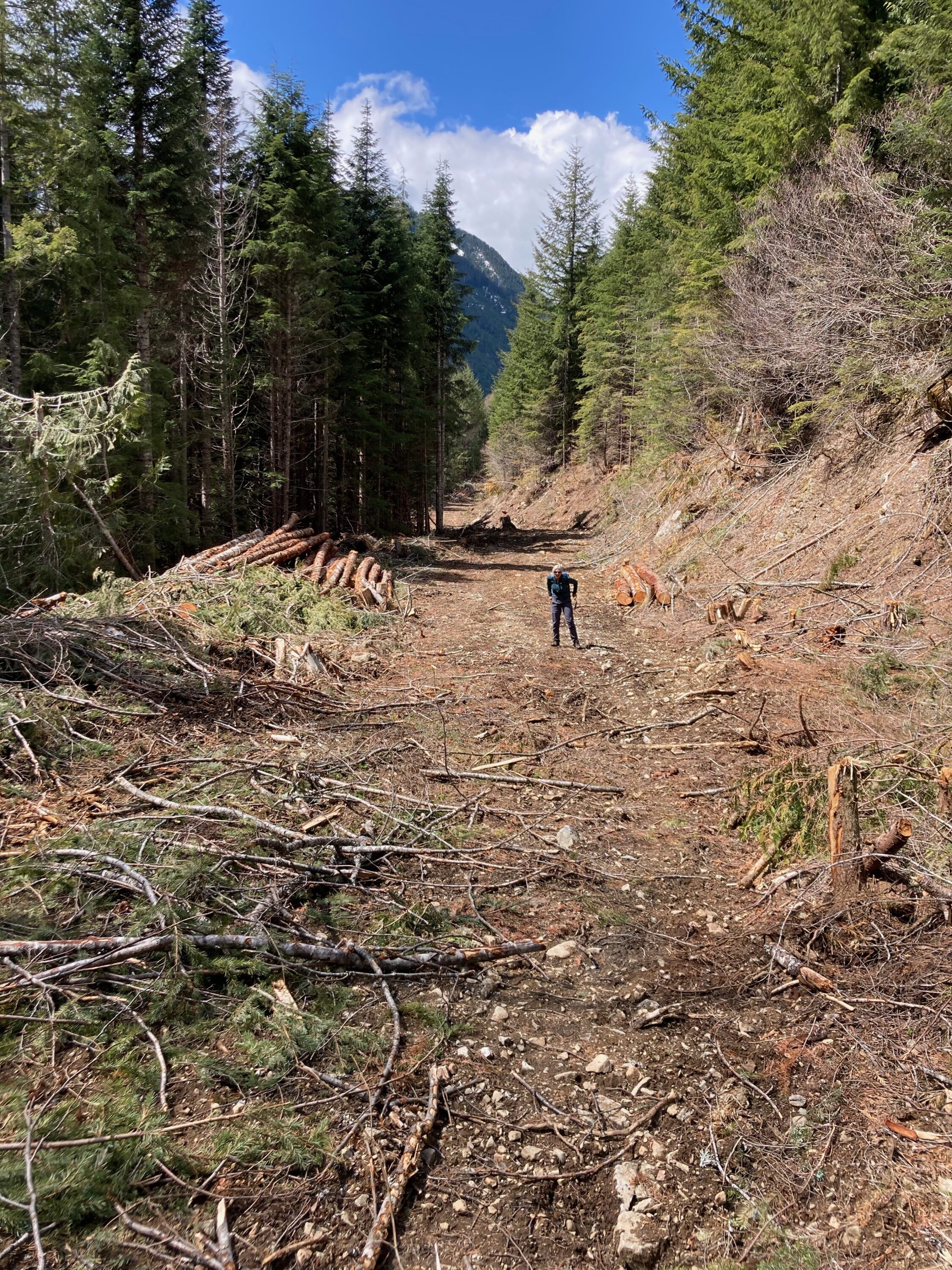
At the top of the clearcut this road then becomes what used to be the “overgrown road.” It is now graded and cleared to within 150 feet (50 meters) of the border swath. (Photo 5)
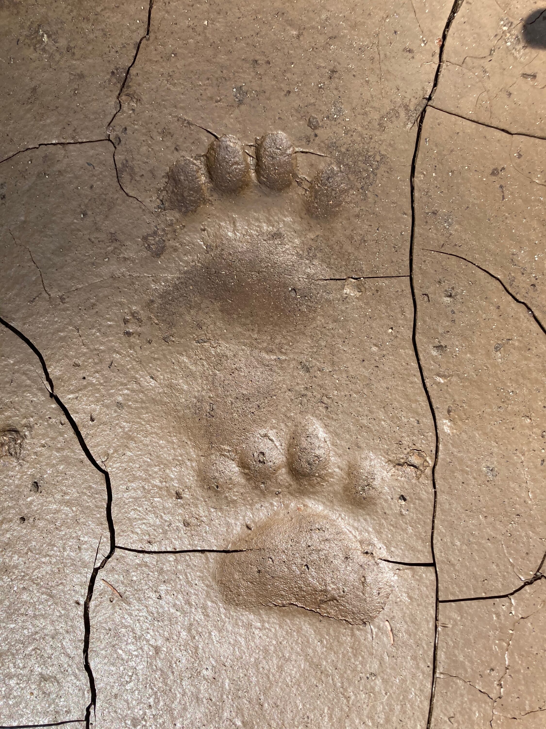
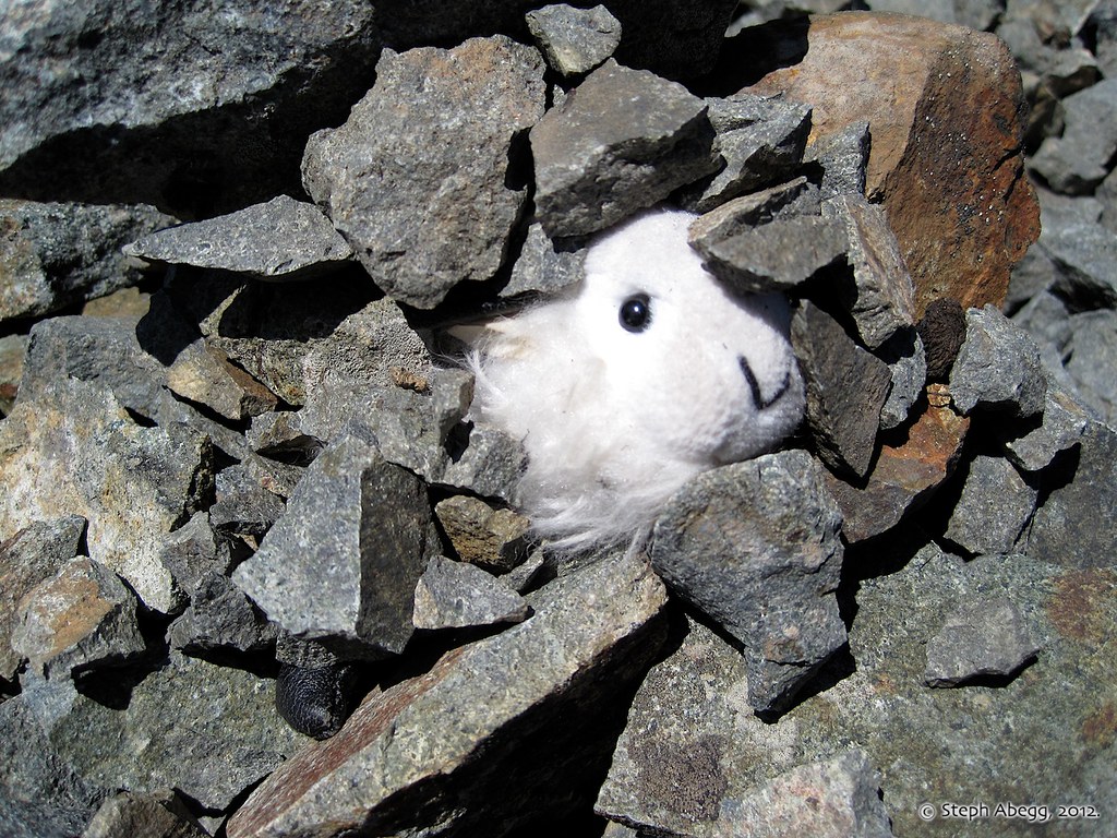
Watch out for the barefooted 4-toed hikers that frequent this area. (Photo 3)
THIS TRIP REPORT IS STILL MOSTLY IN THE EMBEDDED HTML FORMAT OF MY OLD WEBSITE. MOBILE Tip: Try Landscape mode. It is generally more mobile friendly.
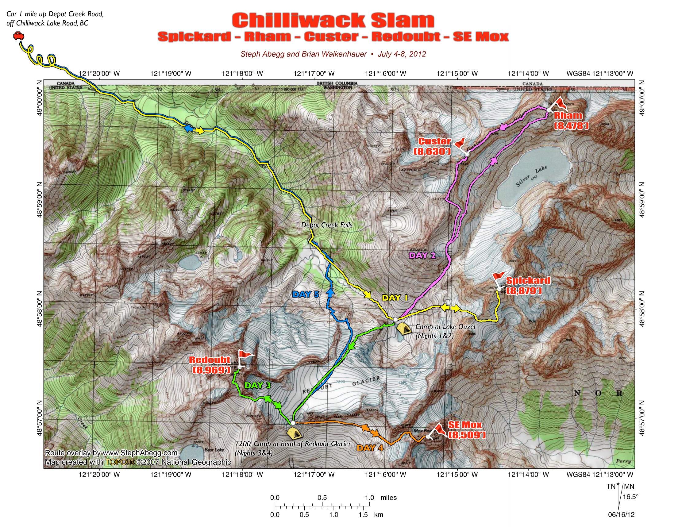
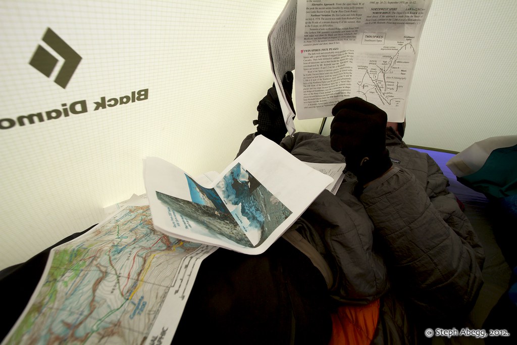
Brian and I started planning this trip back in February. By March, we had all the needed route descriptions scanned and printed and I was already putting together a topo map of approximate route lines. We were ready to go! Of course, several inches of snow had to melt first.
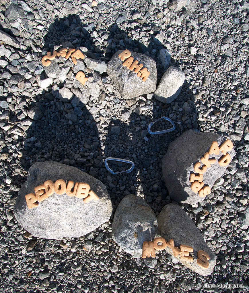
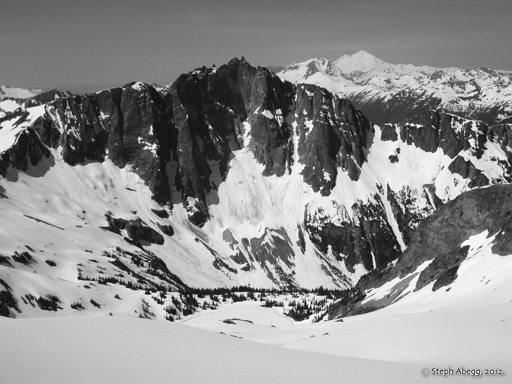
The Chilliwack Group has particular appeal to peak-baggers because it has five* of Washington's 100 highest summits within close proximity—#16 (Spickard), #18 (Redoubt), #39 (Custer), #56 (SE Mox), and #60 (Rahm). We figured we could easily climb all five in a matter of 4-5 days. At this point, I am not specifically pursuing the Top 100 summits yet, but a trip like this at least inspires the idea to begin to stew in the back of my mind. After all, SE Mox is often considered to be one of the hardest summits on the list, so having that one tagged would make the list all the more achievable. (*Note: At the time we did not realize that there were actually six Top 100 summits in the area, with NW Mox being #75; if we had known we would have climbed NW Mox on our final day before hiking out. Oh well, just gives a reason to go back to the area!)
Even with all our winter day trip-planning, Brian and I had never really nailed down a specific order in which to climb the five summits. The decision was finally made when an early July snowstorm left a fresh dusting of snow on the North Cascades, encouraging us to plan on first climbing the more moderate Spickard, Rahm, and Custer, giving the snow a chance to melt off of the steeper and rockier Redoubt and SE Mox, which we would climb from a basecamp at the head of the Redoubt Glacier. At the onset of the trip, we had been a bit concerned that the early season snowcover would pose some problems, but in the end we discovered that the snow covered much of the annoying scree and talus we had read about, expedited our traverses and descents, and gave the climbs more of an alpine flavor. All told, the conditions and weather turned out perfect for a successful and fun trip. According to the summit registers, we were the first climbing party in the Chilliwacks in 2012.
The following page gives maps, route overlays, photos, commentary, and the adventures of a particular tiny stuffed mountain goat. Enjoy!
Itinerary
Day 1:Depot Creek TH (2300 ft) to Lake Ouzel (5700 ft), climb Spickard (8879 ft, #16, via South Slope) 6580+ ft elev. gain, 6:15 Car to Lake, 2:30 Lake to Summit, 1:10 Summit to Lake
Day 2:Climb Rahm (8478 ft, #60, via SW Route) and Custer (8630 ft, #39, traverse from Rahm, descend South Ridge) 4150+ ft elev. gain/loss, 3:20 Lake to Rahm, 2:45 Rahm to Custer, 2:00 Custer to Lake
Day 3: Move camp to head of Redoubt Glacier (7200 ft), climb Redoubt (8969 ft, #18, via South Route) 4300+ ft elev. gain/loss, 2:00 Lake Ouzel to Redoubt Glacier Camp, 2:30 Camp to Summit, 1:35 Summit to Camp
Day 4: Climb SE Mox(8509 ft, #56, from West)4000+ ft elev. gain/loss, 5:30 Camp to Summit, 3:00 Summit to Camp, (6:00 r.t. from Col of the Wild)
Day 5: Hike Out9.1 miles, 5720+ ft elev. loss, 5:50 Camp to Car
Trip Report by Day
CLICK ON DAY TO DROP DOWN CONTENT
DAY 1:
Depot Creek TH (2300 ft) to Lake Ouzel (5700 ft), climb Spickard (8879 ft, #16, via South Slope) 6580+ ft elev. gain, 6:15 Car to Lake, 2:30 Lake to Summit, 1:10 Summit to Lake
Most parties approach this area from the north, which involves driving into Canada and then crossing back over the international boundary by foot. The access road is the Chilliwack River Road. Don't worry if you don't know how fast 50 km/hr is, you'll never reach that speed on this road anyway because of the....
....infamous Chilliwack Lake Road Potholes of Doom.
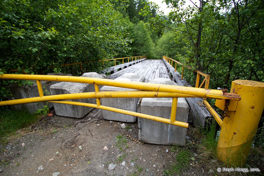
Despite the "Directions to Depot Creek Road" map I had already started to work on before we left for the trip, we still drove right past the Depot Creek Road and found ourselves at a yellow bridge blocked off to traffic. This turned out to be the bridge across Depot Creek. The Depot Creek Road turnoff is about 0.1 miles before this.
The Depot Creek Road is on the left. Chilliwack Lake Road continues on the right. As viewed from the north.
Beware of trying to drive too far on the Depot Creek Road....
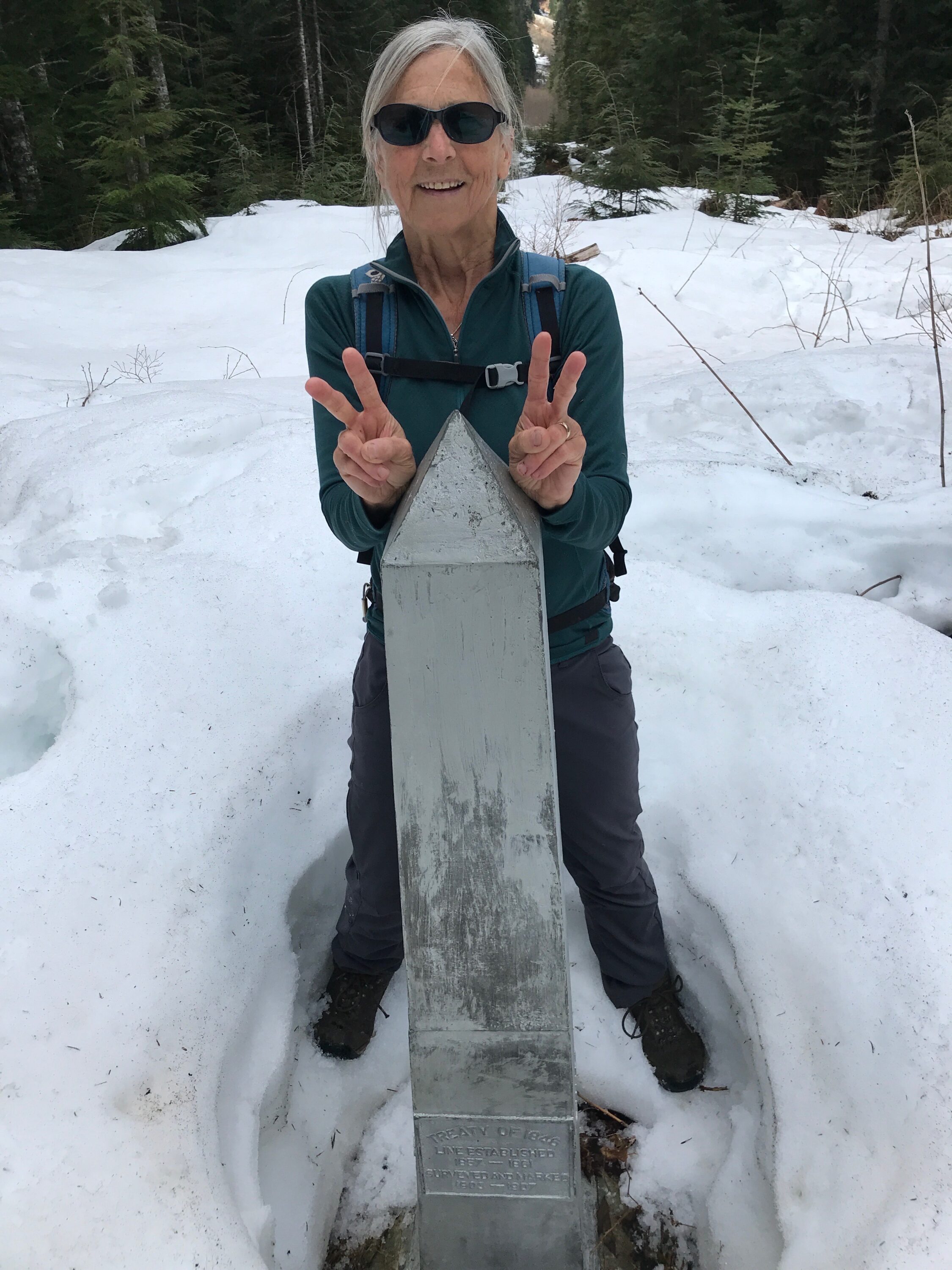
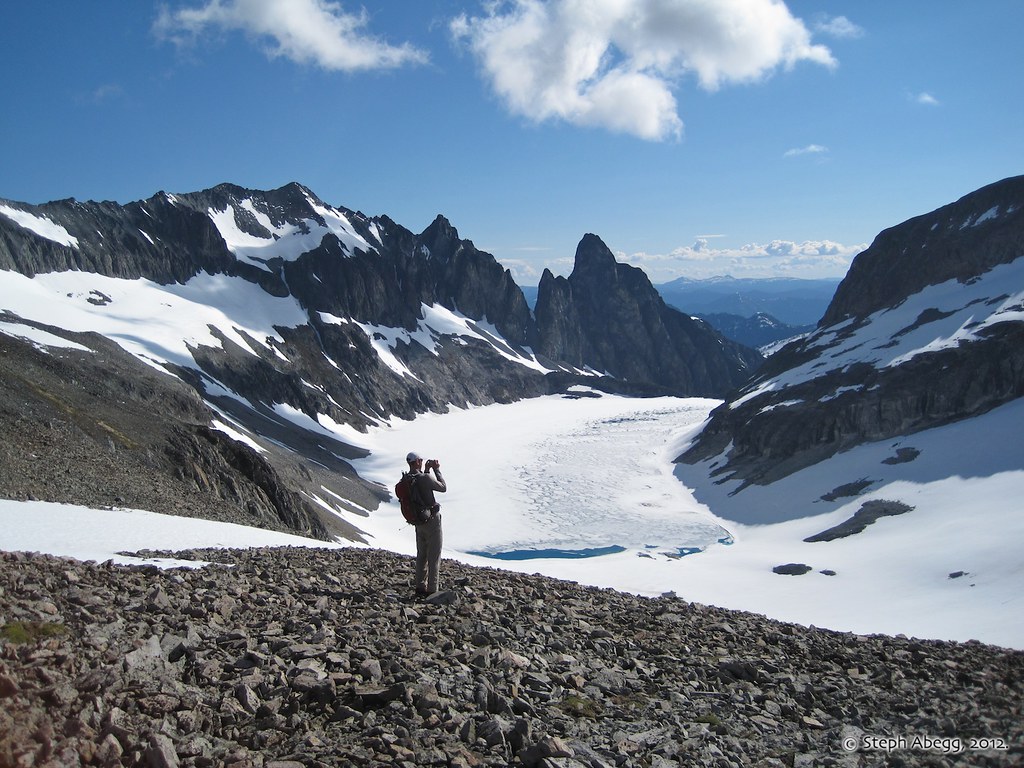
The border obelisk and border swath a couple of miles from the car. It's about 5.5 miles from here to Lake Ouzel.
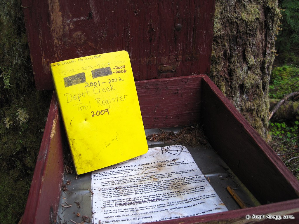
The Depot Creek Trail register.
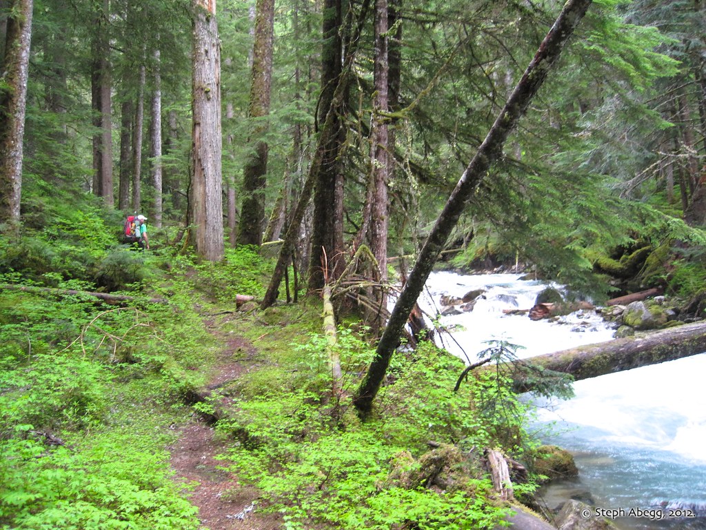
The trail is actually pretty easy to follow.
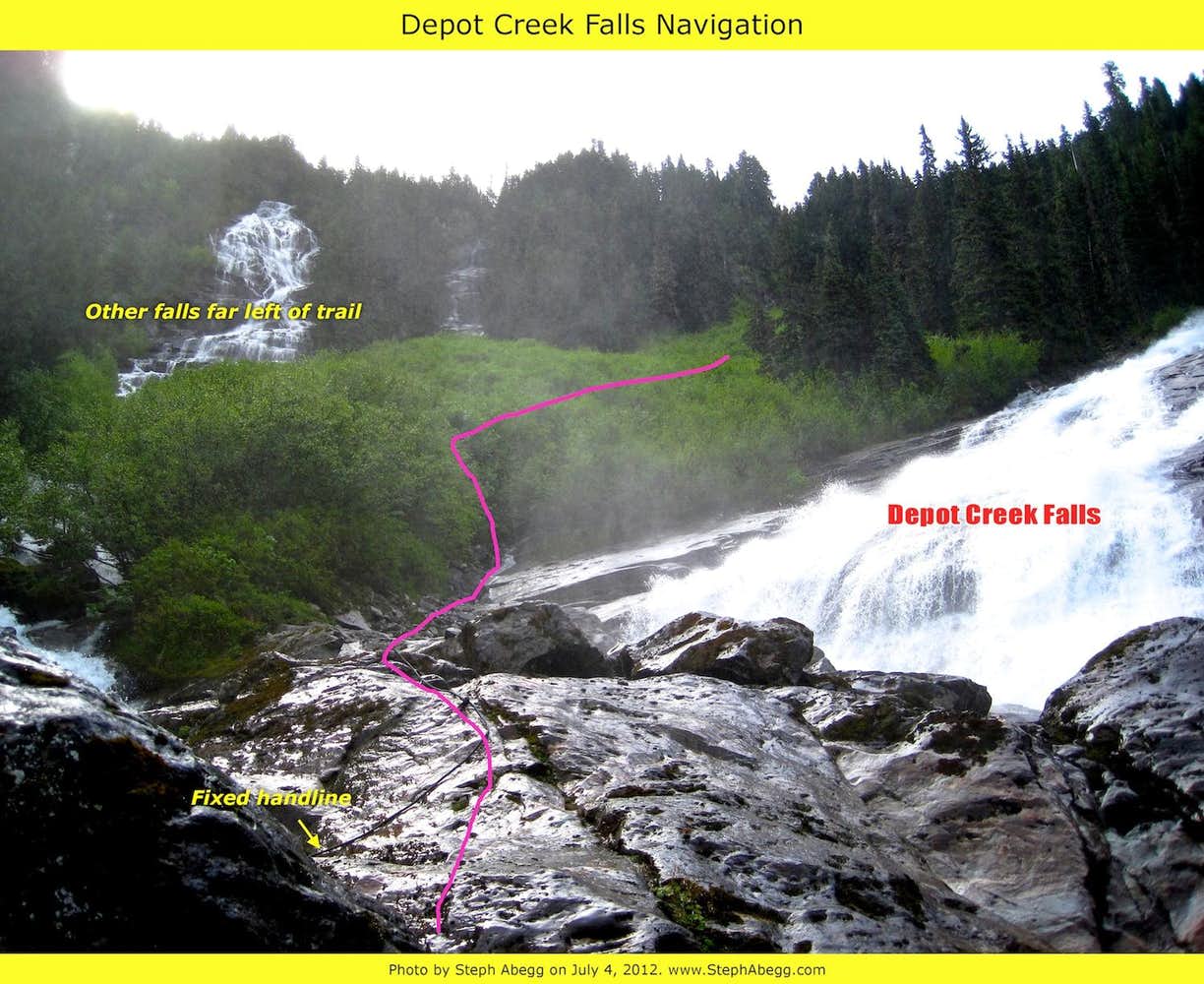
A few miles from the border crossing, the trail reaches the impressive Depot Creek Falls. There are handlines to help cross the wet slabs.
Handy handlines at the falls.
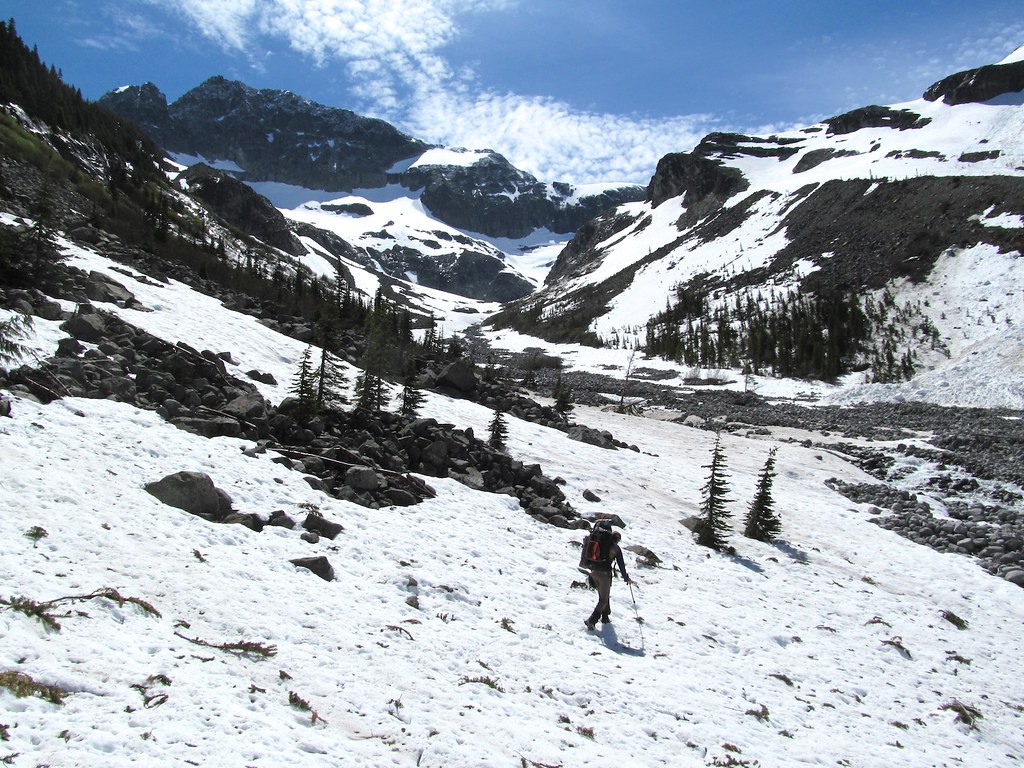
There was still a lot of snow in the upper basin as we approached Lake Ouzel. It was unclear whether the expedited pace of snowcovered talus higher up made up for the postholing and creekhopping lower down.
(Photo by Brian Walkenhauer.)
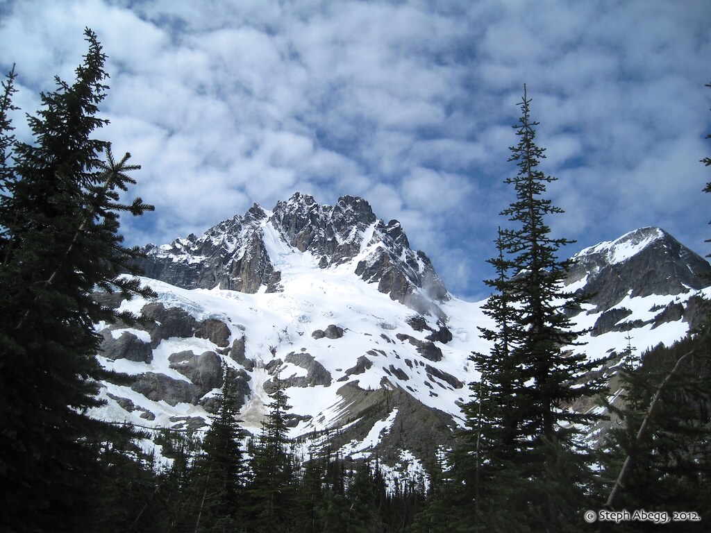
Fresh snow dusting on Mt. Redoubt. Looks like a lot of snow on that NE Face route.
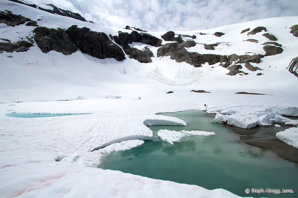
We were pleasantly surprised to find running water at Lake Ouzel.
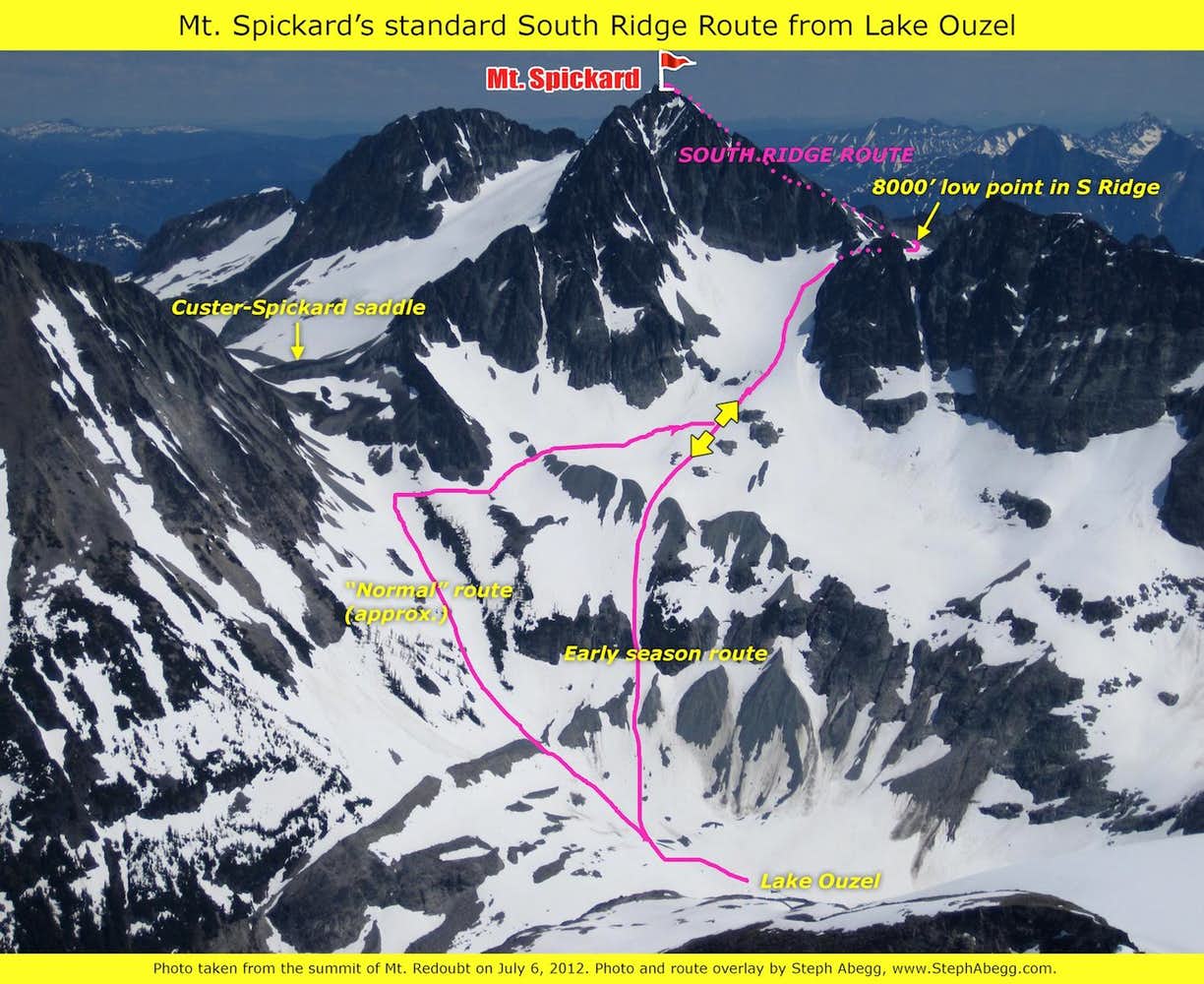
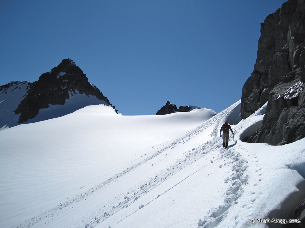
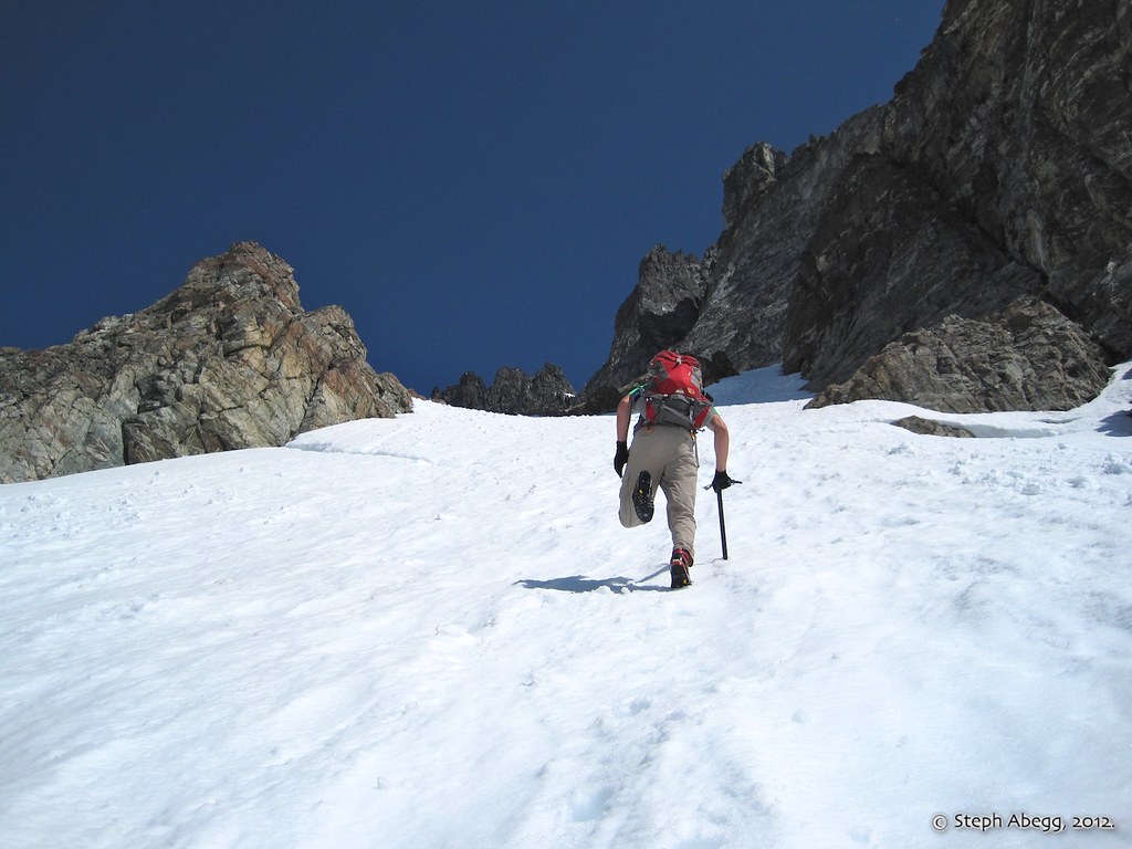
It took us just over 6 hours to get to Lake Ouzel, where we established our camp for the first two nights of the trip. After setting up our tent, we headed up to climb Mt. Spickard via the standard easy South Ridge route. The photo on the left gives an overlay of our route. The early season snowcover definitely allowed for a quick ascent and descent, and in 4 hours we were back in camp enjoying a nice evening.
Steph ascending the moderately steep snow slopes toward the low point in the south ridge.
(Photo by Brian Walkenhauer.)
The route crosses the easy pass at around 8000' and contours east to the wide open SE slope. (This photo was taken as we were descending and hence traveling from the SE slope towards the 8000' pass.)
Brian looking up the wide open SE slope. The ascent to the summit was straightforward from here.
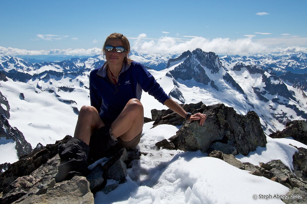
Steph on the summit of Spickard, with Mt. Redoubt behind.
(Photo by Brian Walkenhauer, with Steph's camera.)
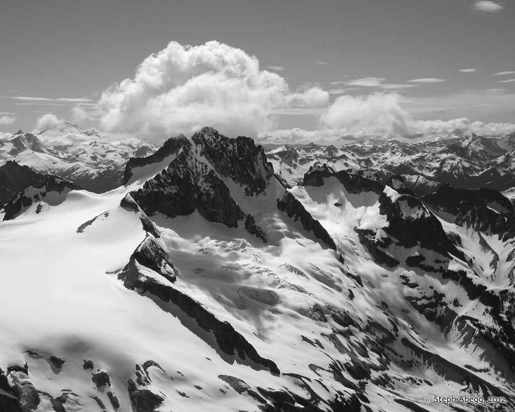
Mt. Redoubt as seen from Mt. Spickard.
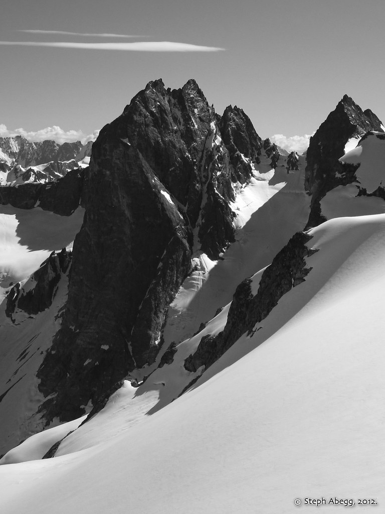
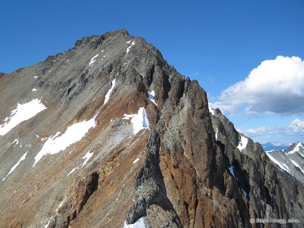
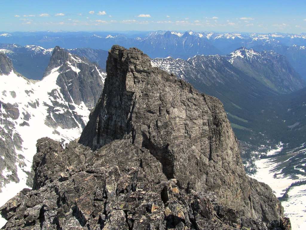
The impressive SE Mox Peak as seen from the SE side of Spickard. The buttress on the left (the NE Buttress of "Hardest Mox", Grade V 5.10-) was climbed by Rolf Larson and Eric Wehrly in September 2008.
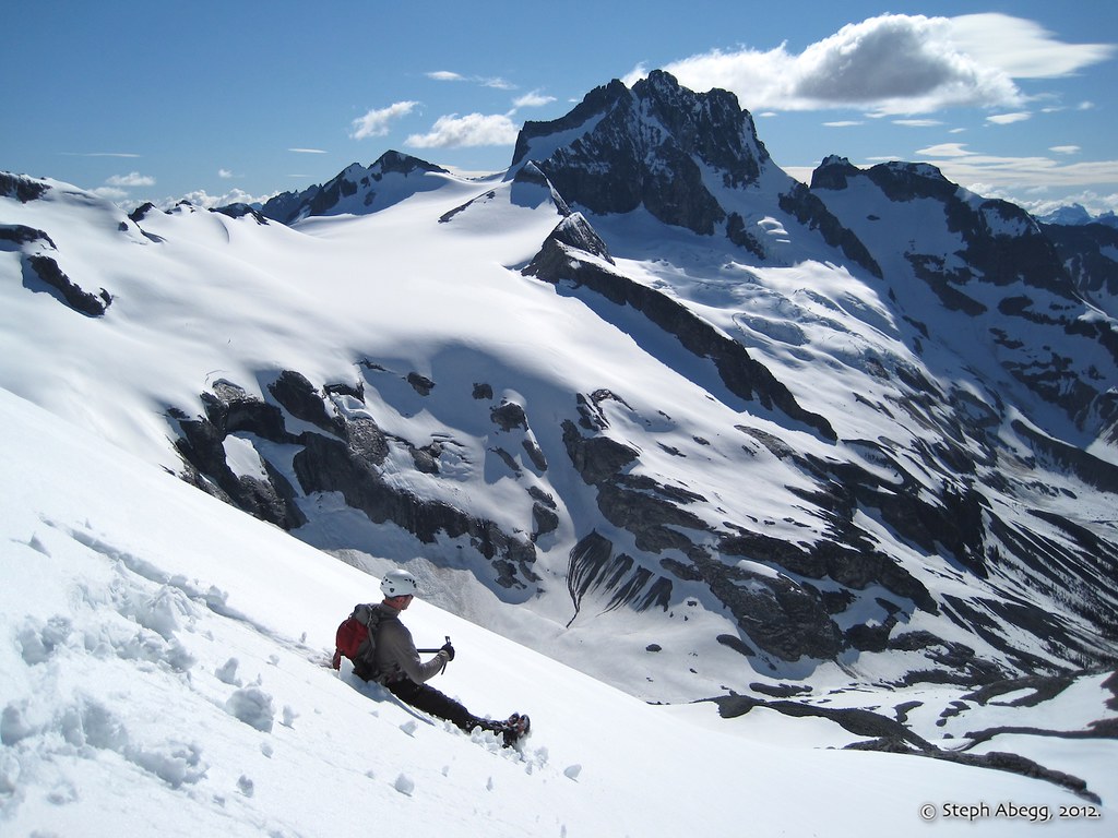
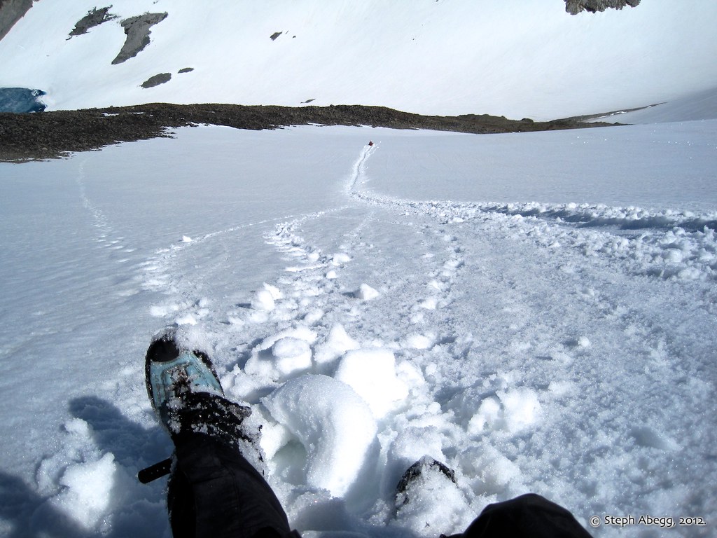
A glissade with a view.
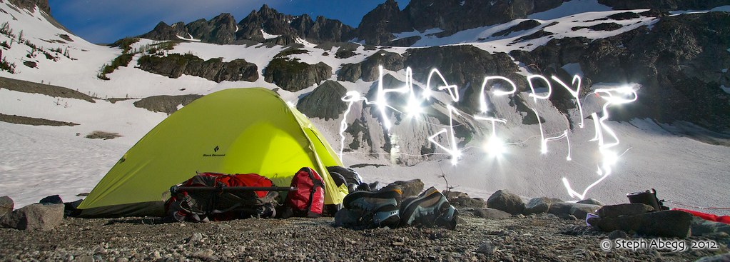
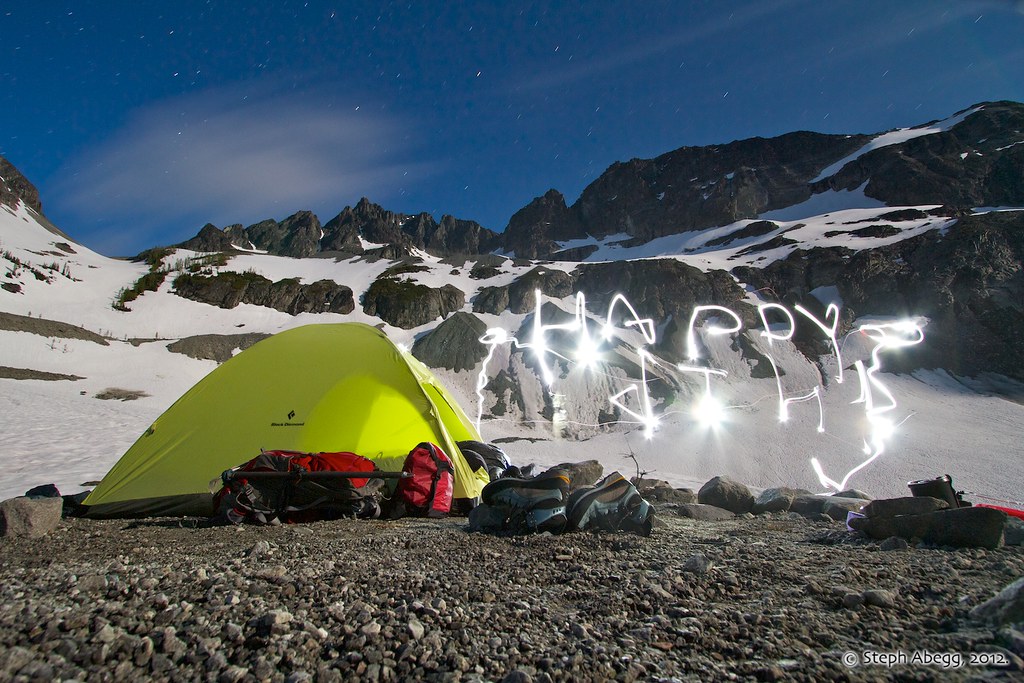
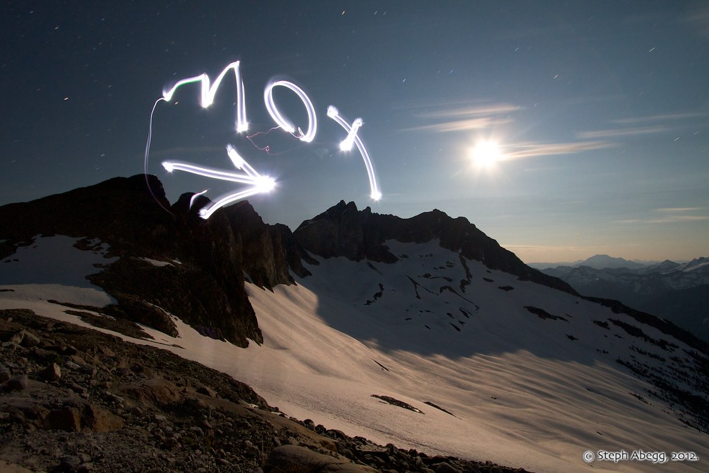
Celebrating the 4th of July with a headlight and a long exposure photograph. (Exposure: 2 min, f/8.0, ISO 400)
DAY2:
Climb Rahm (8478 ft, #60, via SW Route) and Custer (8630 ft, #39, traverse from Rahm, descend South Ridge) 4150+ ft elev. gain/loss, 3:20 Lake to Rahm, 2:45 Rahm to Custer, 2:00 Custer to Lake
On the second day of our trip, we shouldered day packs and headed for Mt. Rahm and Mt. Custer. These have the reputation of being some of the chossiest peaks in the Cascades.
Heading for the saddle leading into the Silver Lake basin.
A cool cloud swimming over the Redoubt Glacier.
The beautiful Silver Lake Basin. Rahm is on the left, while the Toothpick and Devil's Tongue are at the far end of the Lake. Throughout the day we watched the lake melt significantly.
The snow allowed us to make an easy traverse high above Silver Lake. The glaciated north face of Spickard looms behind me in this photo.
(Photo by Brian Walkenhauer.)
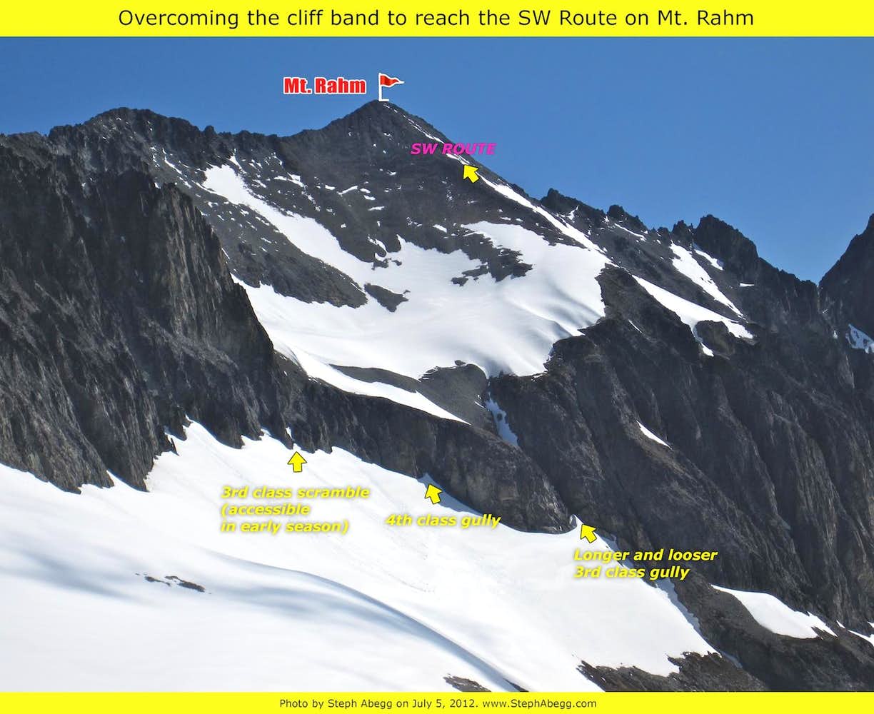
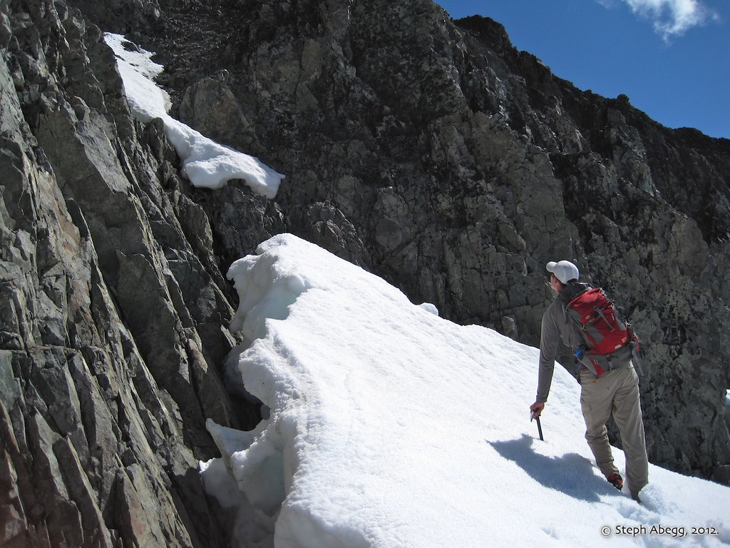
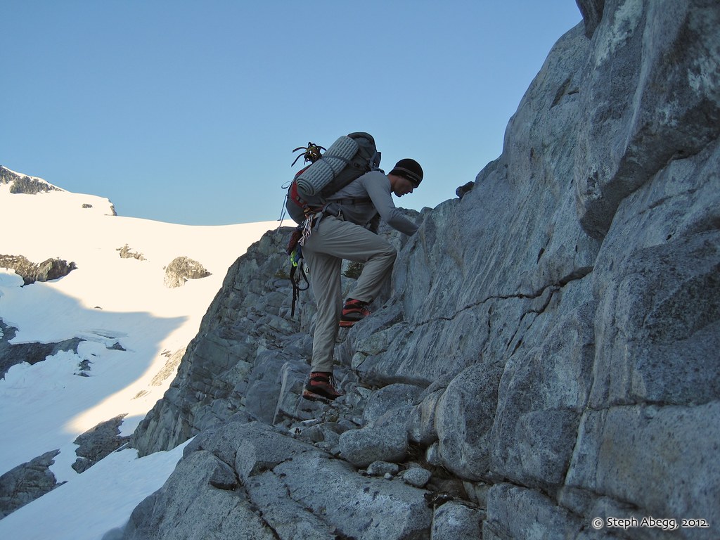
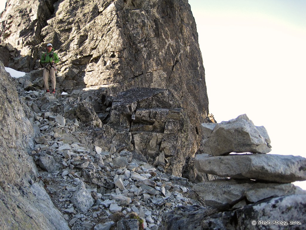
The crux of Mt. Rahm is finding a way through a short terrace of cliffs (see annotated photo to left). Brian and I had read about 2 options: a 4th class gully along the middle or a longer hidden 3rd class gully to the right. When we approached the terrace, we saw that we had a third option of an easy scramble at the far left. This route would probably not be accessible once the snow melted further down the rock.
A convenient snow finger allowing us easy access to a scramble at the far left of the terrace on Mt. Rahm.
Class 3 enhanced by camera angle.
The easy scramble above the snowfinger.
Rubble of Rahm.
On the summit of Rahm. Spickard across and a melting Silver Lake below. This view is worth the rubble pile below!
A clump of ladybugs on the summit of Rahm.
This is a familiar phenomenon in the Cascades. It is unknown exactly why many convergent ladybugs seek out high
elevations, but many people speculate it is because high mountain
summits are located far away from most primary predators such as other
insects, birds, and spiders. It is also unknown why certain summits are
preferable ladybug gathering sites over other nearby summits, but many
people speculate it might have to do with the coloration of the summit
terrain, surface temperature of that terrain, and/or hiding places (such
as cracks) within that terrain. To learn more about the mystery of summit ladybugs, here's a an interesting article on summitpost.
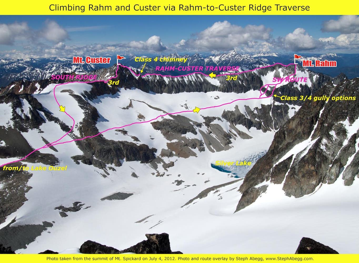
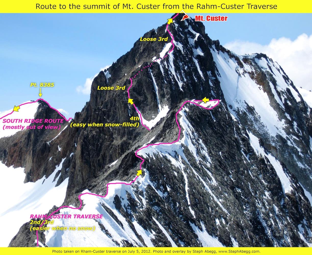
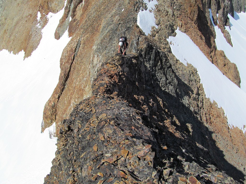
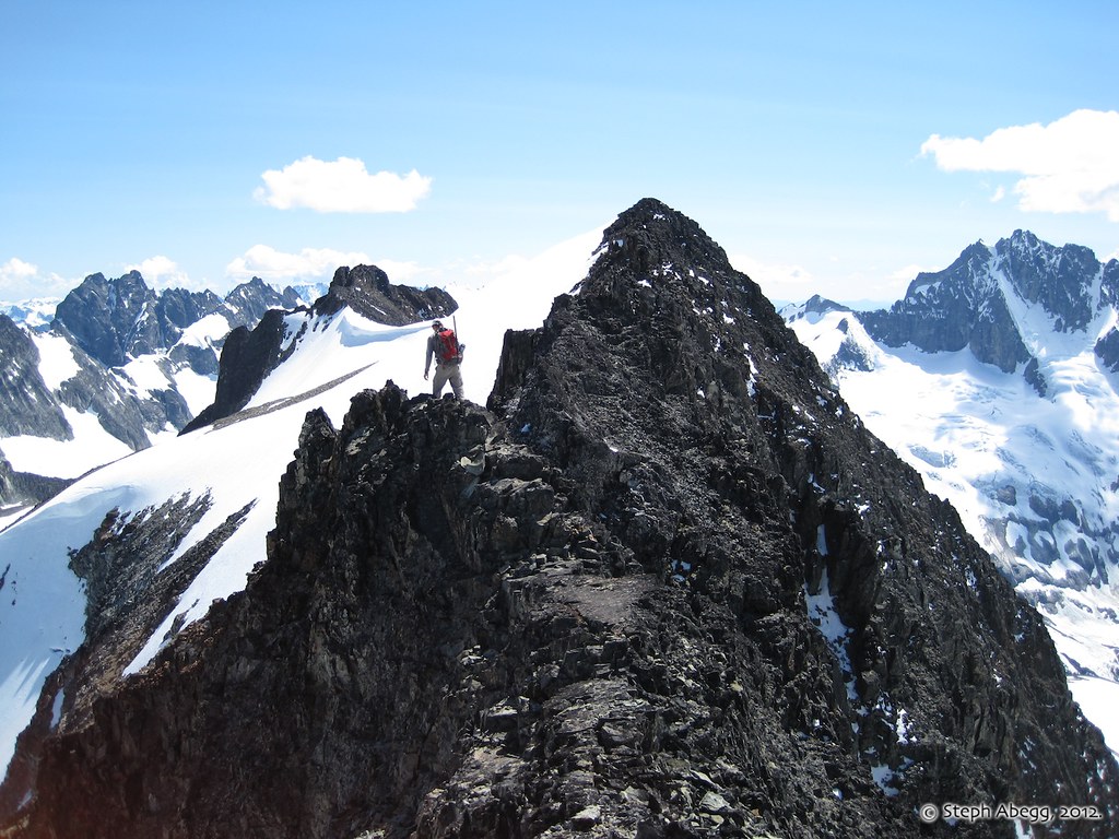
Since we wanted to climb Mt. Custer as well, the idea of a high traverse between Rahm and Custer was appealing. The traverse is about 1 mile of wonderfully-exposed Class 3 ridgeline. A few sections were a bit spicy due to some deep and soft snow still sitting on the ridge. We took our time and it took 2:45 traverse from Rahm to the summit of Custer. This photo shows the traverse stretching all the way to Mt. Custer.
Steph on a snow-free section of the exposed traverse between Rahm and Custer.
(Photo by Brian Walkenhauer.)
The ridgecrest is highly exposed to the north side, with a steep drop of ice and snow. (Photo by Brian Walkenhauer.)
The south side of the ridgecrest is grooved with numerous gullies that put Rahm's rubble to shame. Basically, you want to stay on the ridge as much as you can.
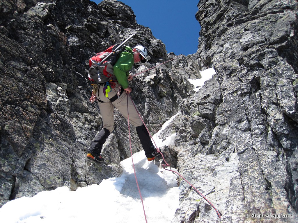
The crux of the traverse between Rahm and Custer is where the ridge meets Custer. About 50 feet down is a break that provides 4th class access to the 3rd class choss above. When filled with snow (as it is in this photo) it is rather easy.
Brian climbing up the "crux" of the traverse between Rahm and Custer. This actually was very easy because of the snow.
Steph on the exposed terrain leading towards the summit of Custer. Remember, Custer is an acclaimed choss pile, so holds cannot be trusted.
(Photo by Brian Walkenhauer.)
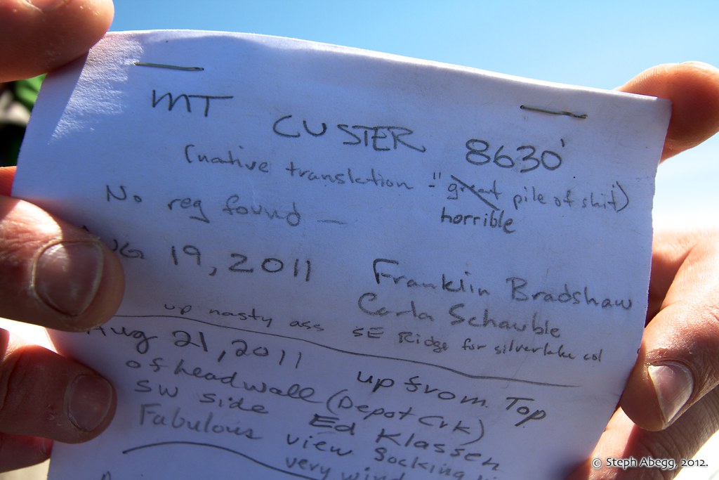
The Mt. Custer summit register.
I'd agree with "horrible".
Steph on the "knife-edge" section on Custer's south ridge, whch we descended. (Photo by Brian Walkenhauer.)
Brian approaching Point 8385 on the descent from Custer. From here we were able to glissade snow slopes back into Silver Lake basin.
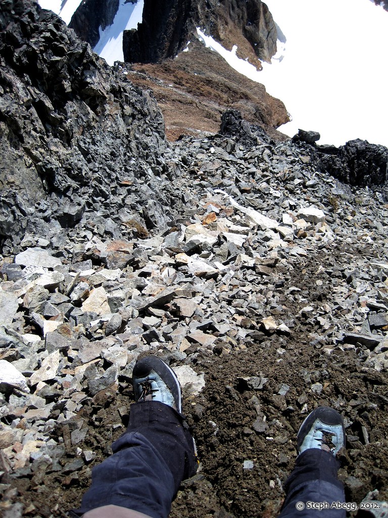
Looking back at the Custer Choss Pile. Custer is part of an ancient volcanic caldera, so its rock quality is typical of any Cascades volcano.
Glissading into Silver Lake Basin.
Compare this mid-afternoon photo with the one taken in the morning on the approach to Rahm. Lots of melting!
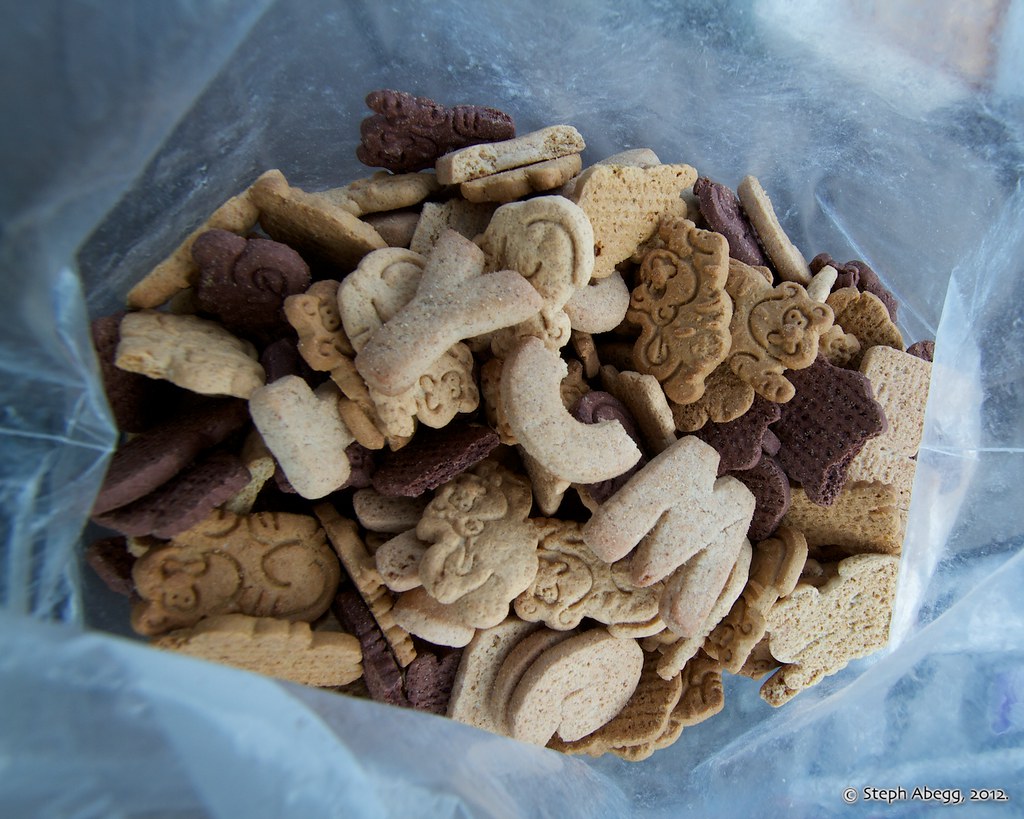
A bag of Alphabet cookies can keep me entertained for hours.
Moon over our Lake Ouzel camp. This photo was taken shortly after a Mountaineers party arrived. Their plan was to climb Spickard and Redoubt over the next two days (which they did).
DAY3:
Move camp to head of Redoubt Glacier (7200 ft), climb Redoubt (8969 ft, #18, via South Route) 4300+ ft elev. gain/loss, 2:00 Lake Ouzel to Redoubt Glacier Camp, 2:30 Camp to Summit, 1:35 Summit to Camp
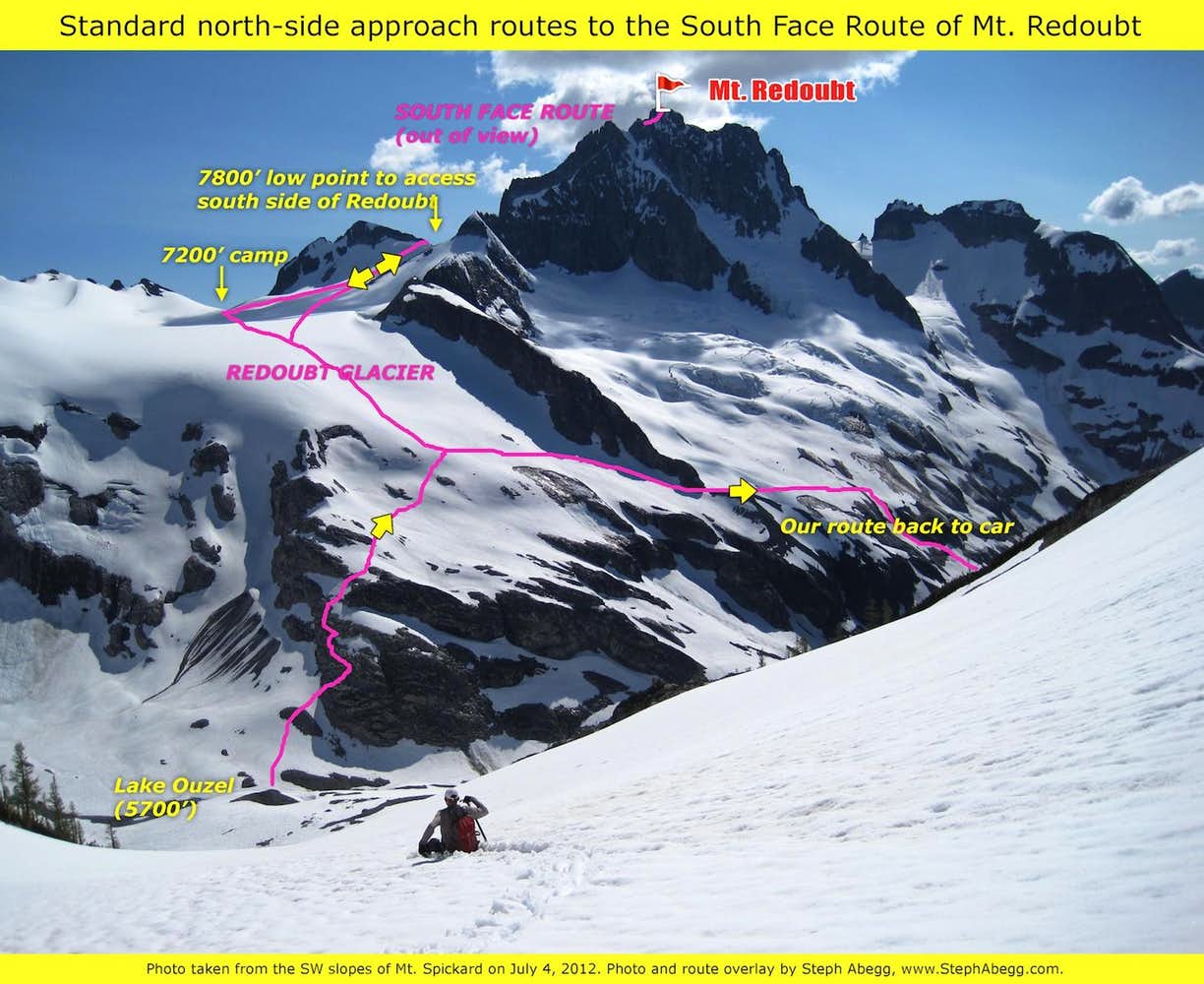
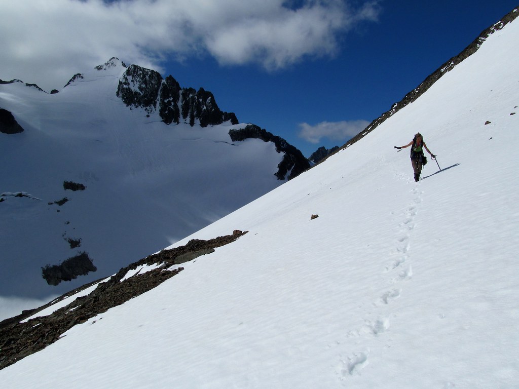
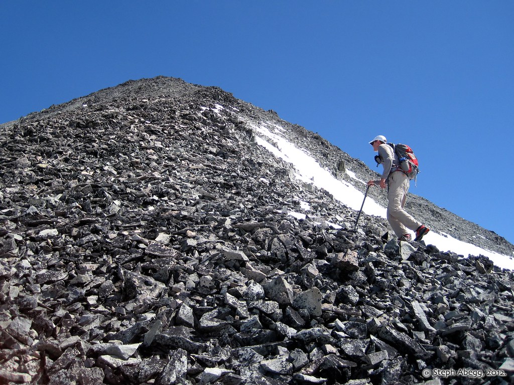
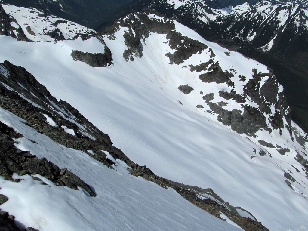
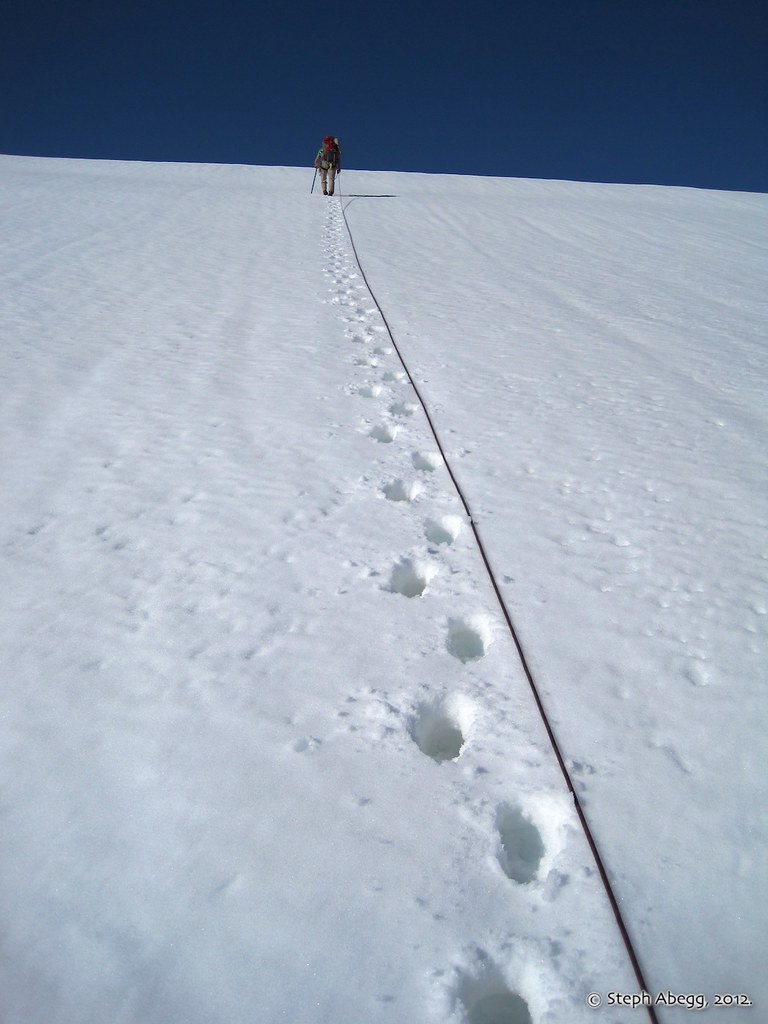
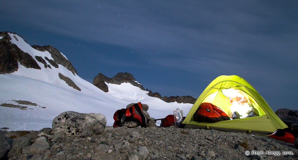
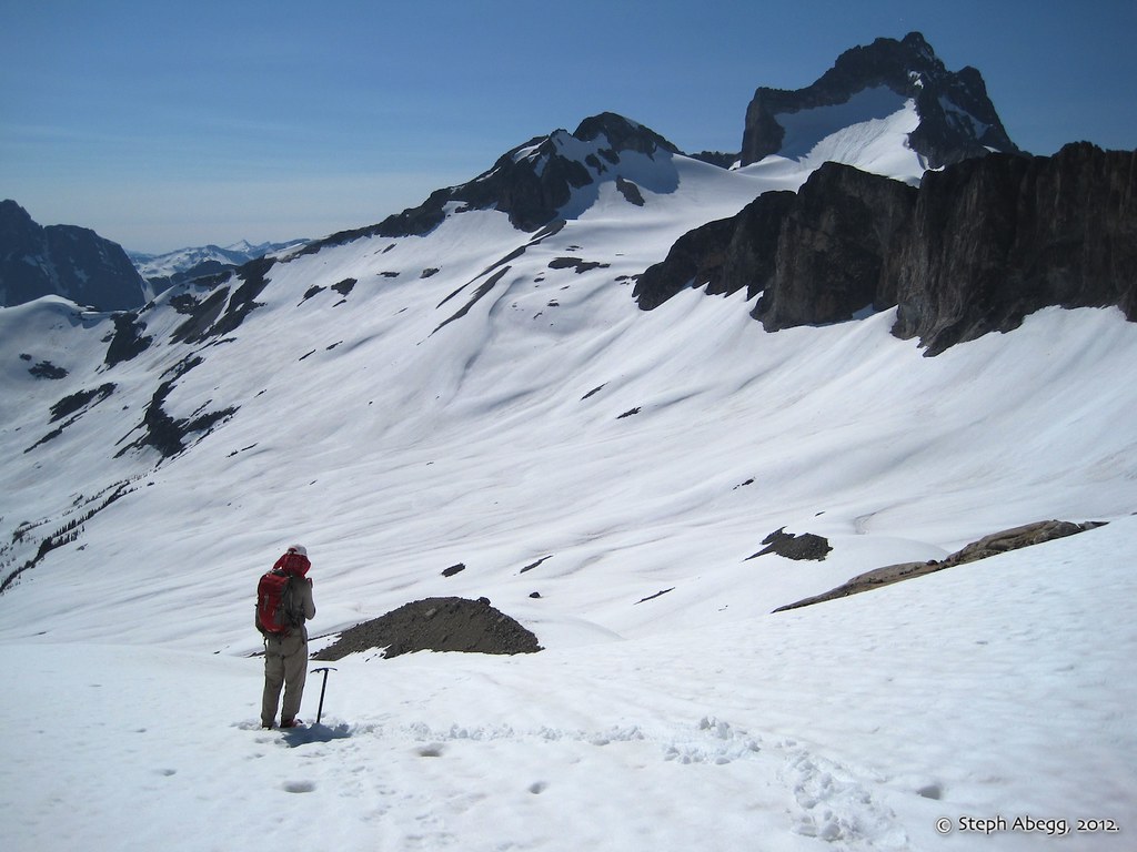
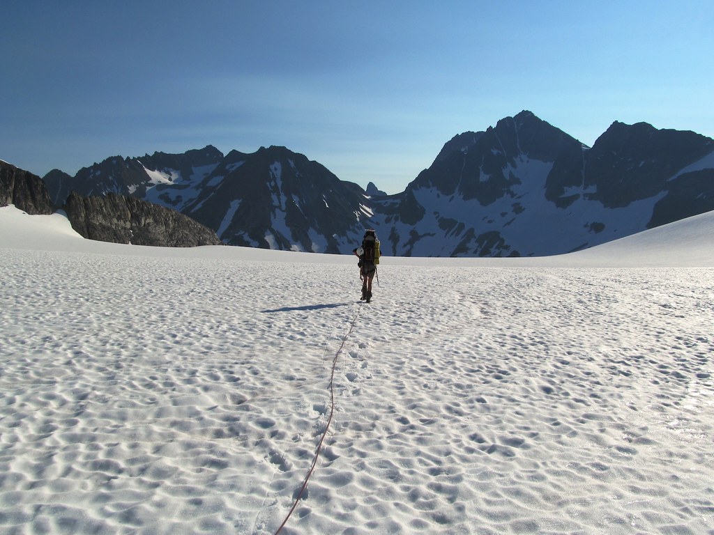
The third day we moved camp 1500' higher up to the head of the Redoubt Glacier (at about 7200'). This took 2 hours. We established camp on a rocky knoll with sweeping views to the south. Then we headed off for the summit of Redoubt via the standard South side route. The photo on the left shows our general route to our 7200' camp and to the south side of Redoubt.
Hauling our gear up the broken buttress SW of Lake Ouzel.
Slogging up the Redoubt Glacier.
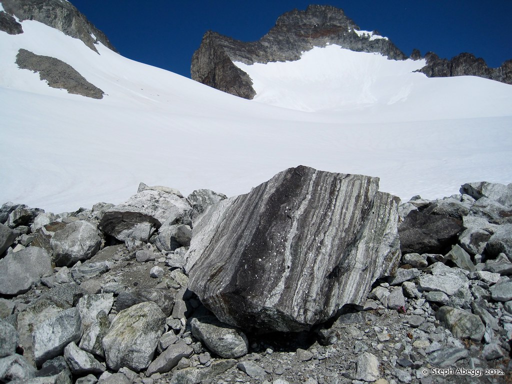
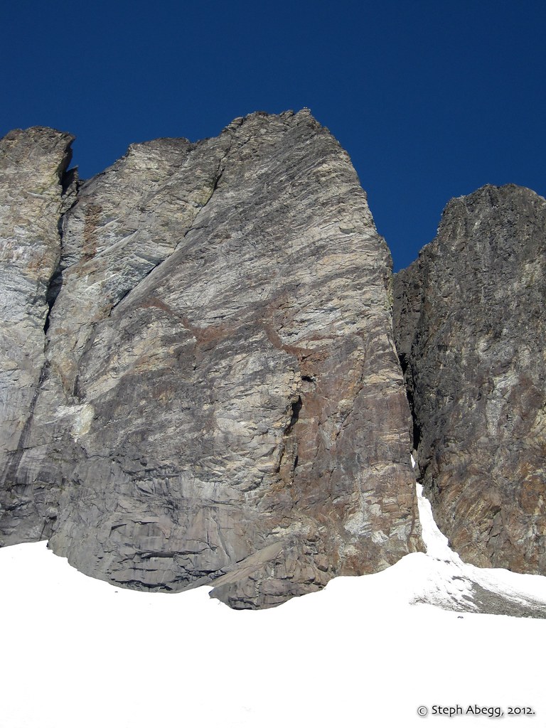
This photo was taken near camp, at the beginning of our approach to the south side of Redoubt. To get to the south side from the Redoubt Glacier, we passed through the 7800' low point in the center of the photo. Note the nice gneiss in the foreground.
The 7800' low point that accesses the south side of Redoubt. This might be a 5th class step in later season.
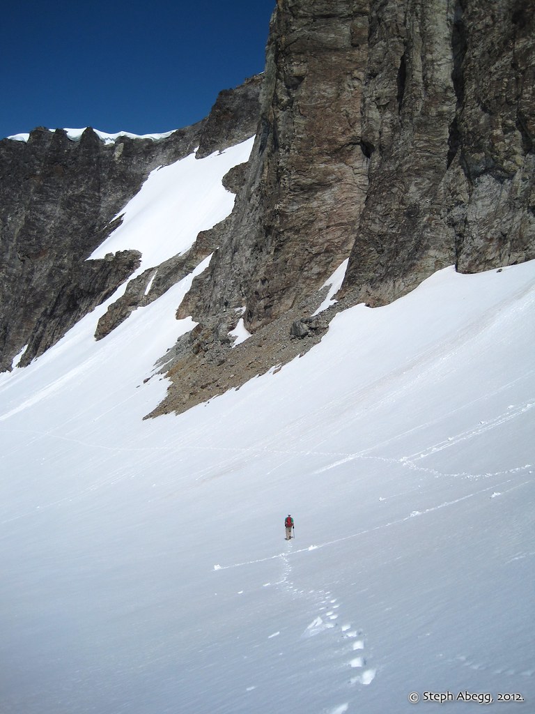
Contouring west across the south slope. We headed rightward and up just after passing below the toe of the flying buttress.
The north side of Bear Mountain across the valley, one of the great north faces of the North Cascades.
Kicking up the south slopes of Redoubt.
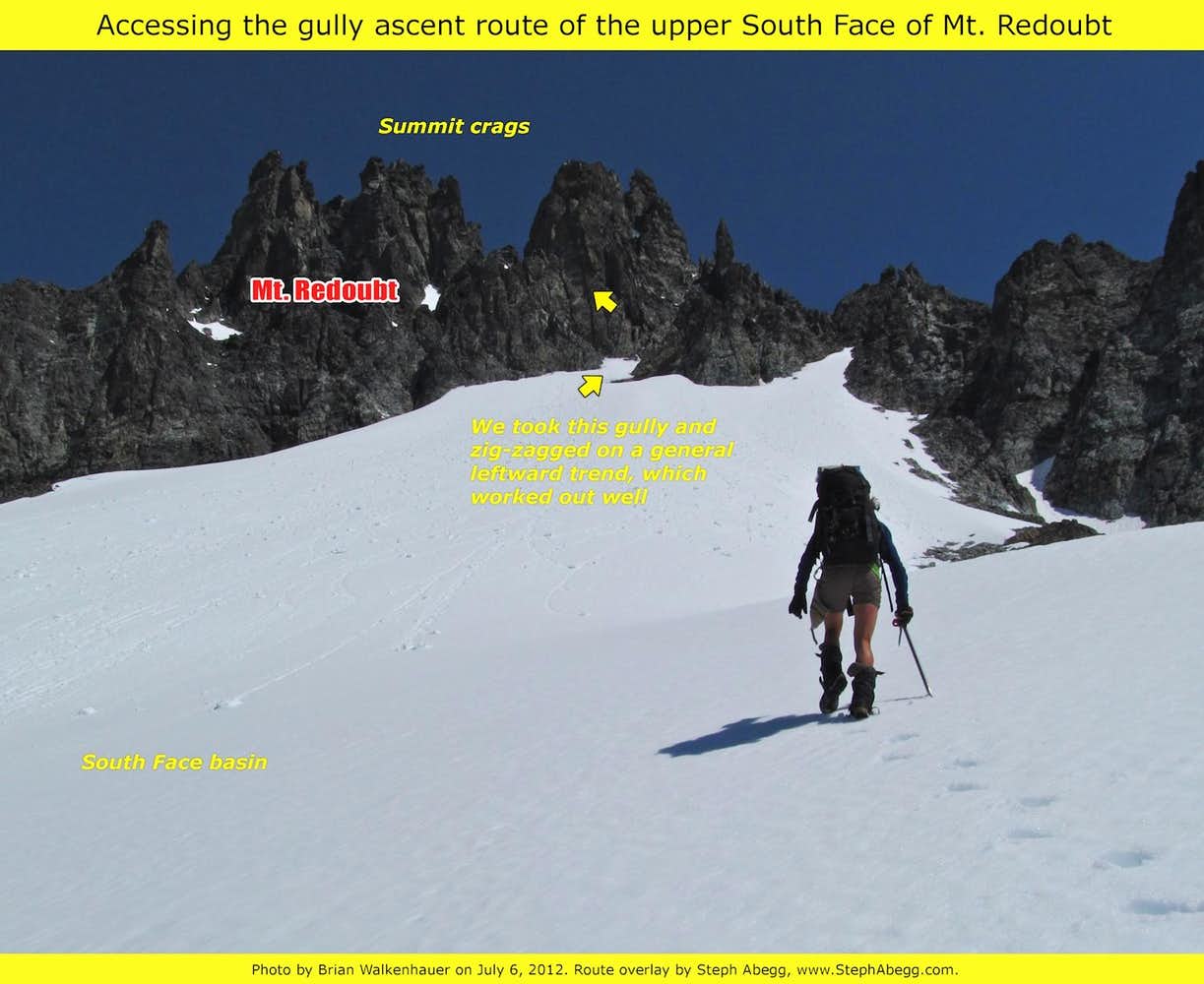
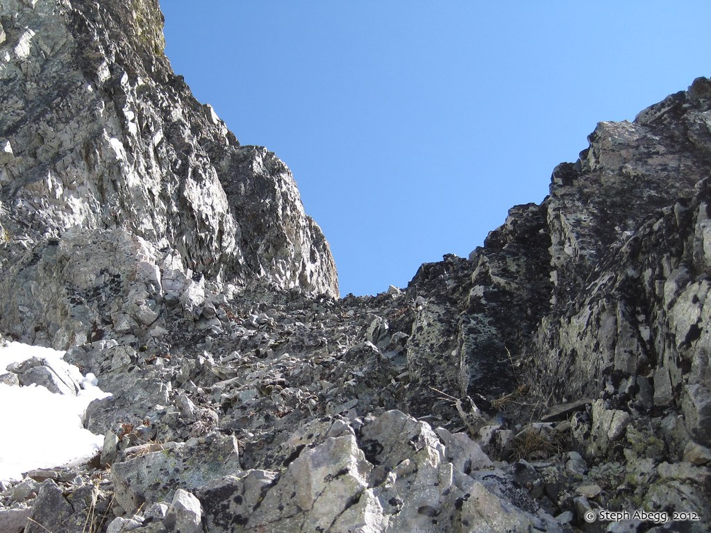
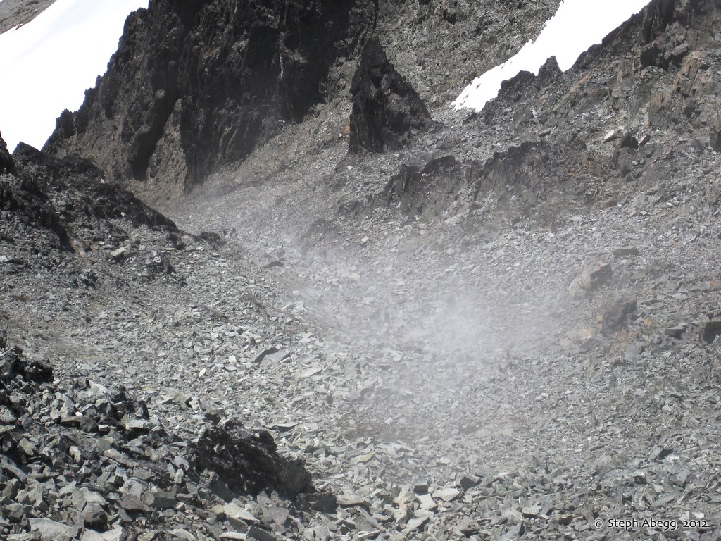
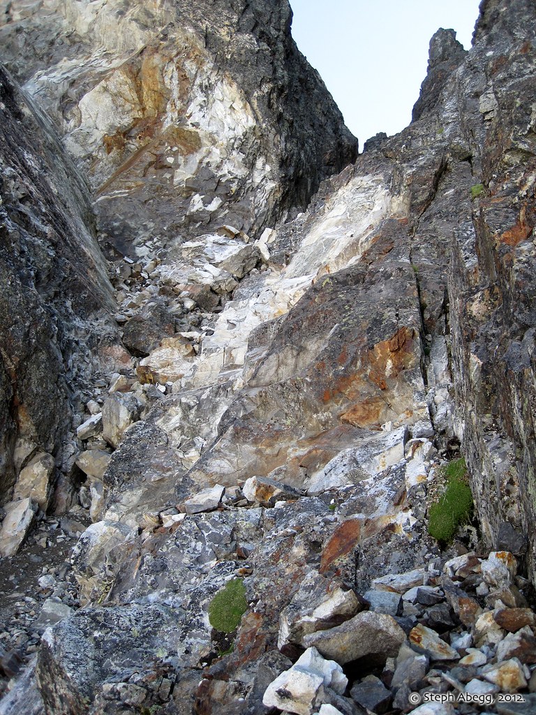
Ascend the slopes into the high left side of the South Face basin. The route description mentioned getting on a rocky ramp which ascends gently from left to right. The arrow in the photo shows what we determined to be the correct rocky ramp.
Once on the rock, we followed the gully system, tending left when there were choices. The presence of cairns and lack of skeletons indicated that we were probably on route.
The gullies were Class 3, except for a few times where ice forced us into 4th class moves.
(Photo by Brian Walkenhauer.)
At the top of the gullies, we stepped left into a major gully with a cannon hole at its top. The gully was filled with hard and steep snow, which gave it more of an alpine flavor.
Per the route description, we slid through the cannonhole onto the North Face, dropped a few feet onto a good ledge, and then climbed directly up 50 feet to the summit on mostly solid 4th class rock. We were glad that the recent dusting of snow had by now melted off the rock.
On the summit of Mt. Redoubt. 2.5 hours from our camp at the head of the Redoubt Glacier.
We downclimbed the route apart from a single rappel to get past a particularly icy gully.
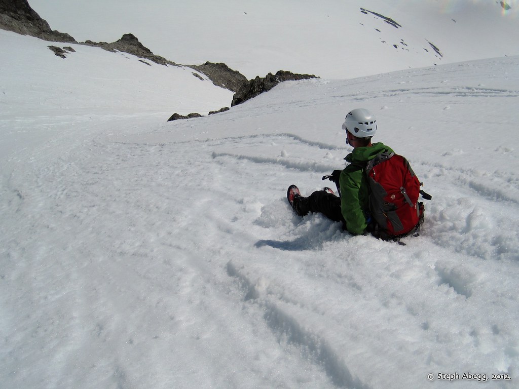
A quick descent down Redoubt's south slopes.
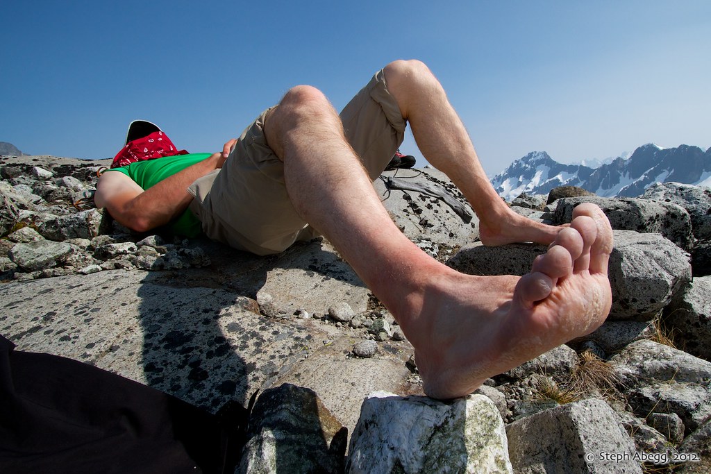
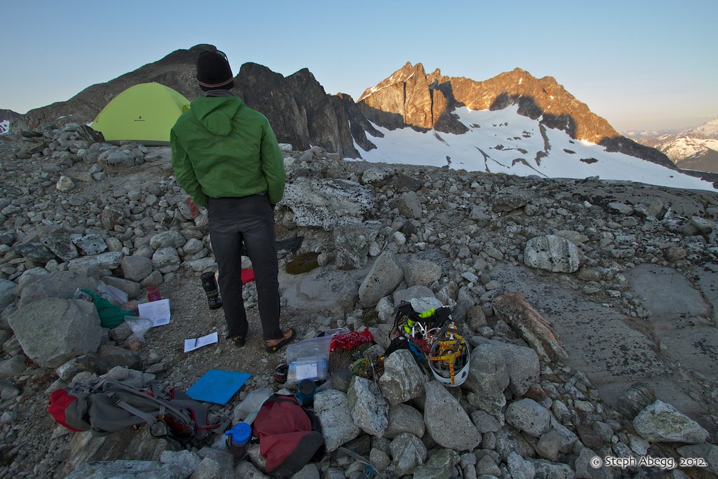
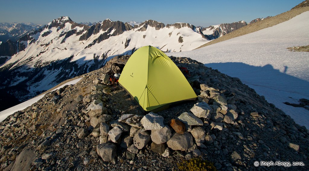
Brian relaxing in the afternoon sun back at our beautiful high camp while I have fun with my wide angle lens.
Several hours worth of tentbound or sunny afternoon fun....
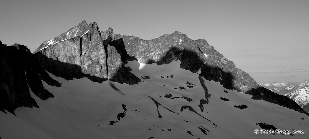
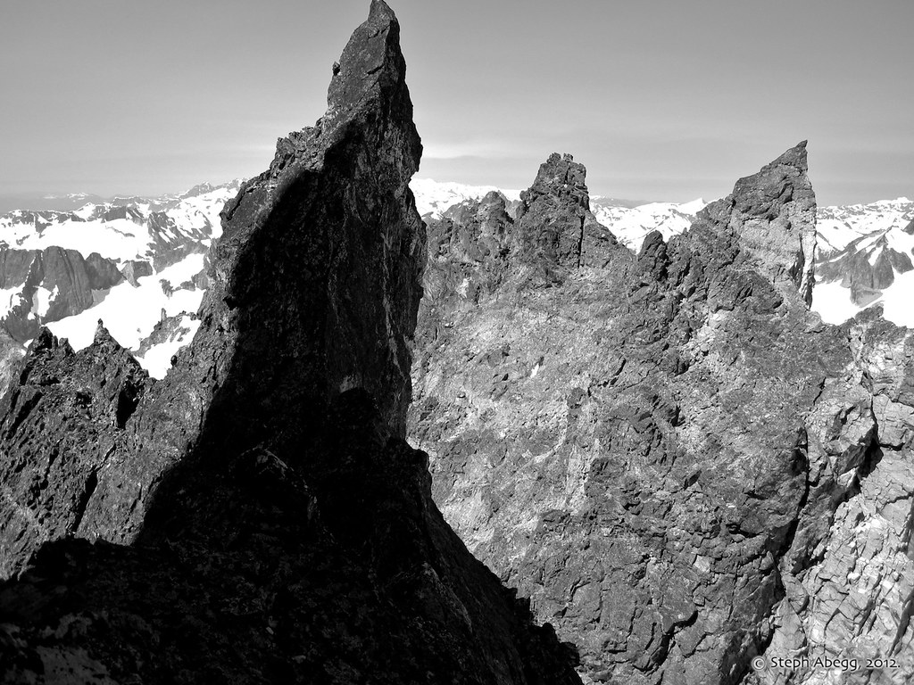
Evening shadows on Mox Peaks as seen from our high camp. NW Mox is in front, while the summit of SE Mox pokes out behind and furthest left.
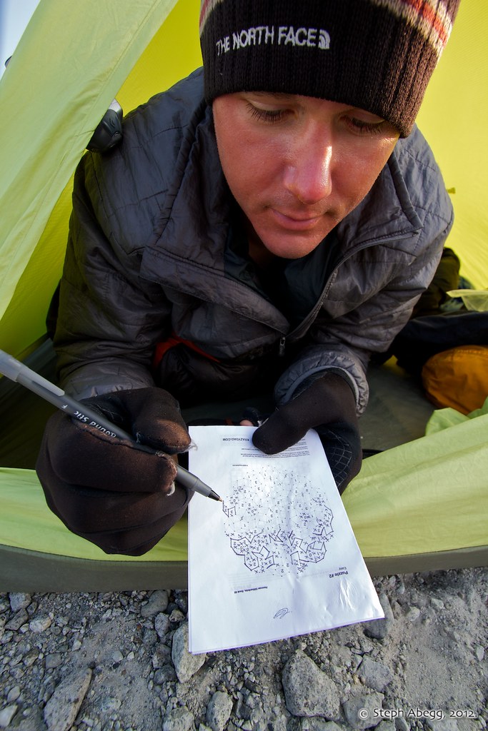
Researching the next day's objective: the revered SE ("Hard") Mox.
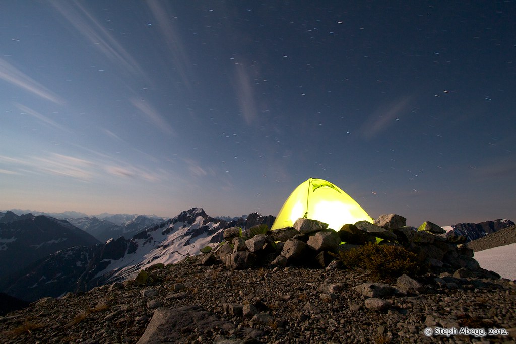
A glowing tent and moonlit night. (Exposure: 2 min, f/7.1, ISO 400)
DAY4:
Climb SE Mox(8509 ft, #56, from West)4000+ ft elev. gain/loss, 5:30 Camp to Summit, 3:00 Summit to Camp, (6:00 r.t. from Col of the Wild)
6:30am. Now that's dedication!
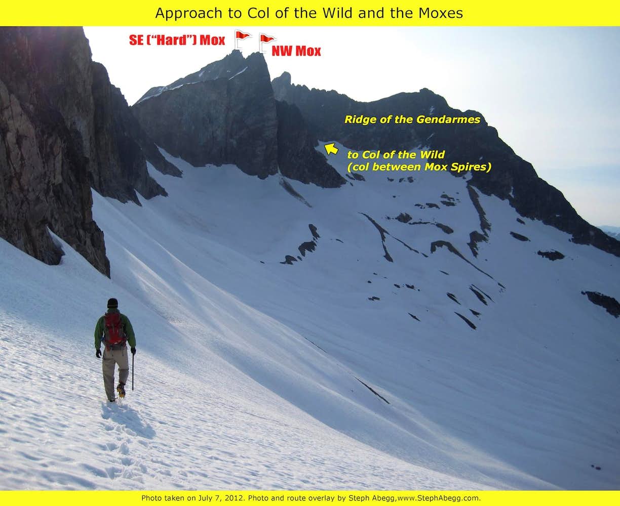
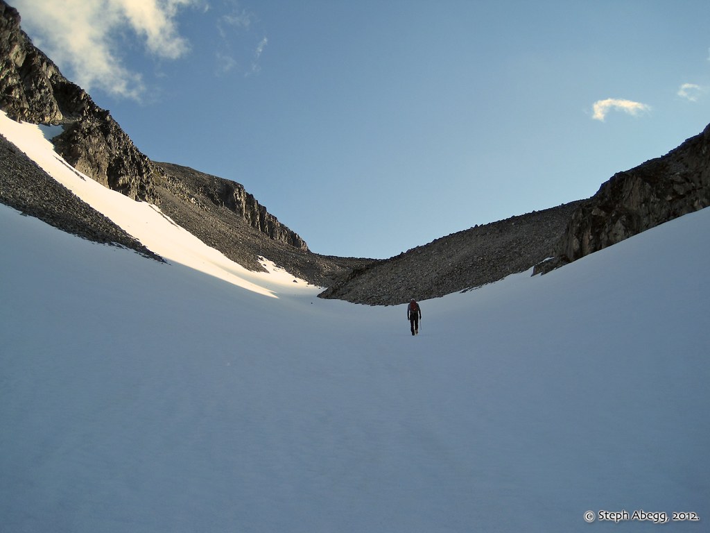
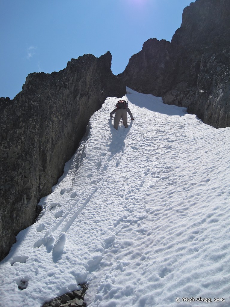
From our high camp, it was an easy traverse to the Col of the Wild between the Moxes. Apparently this slope is onerous scree in later summer.
The Col of the Wild between the spires.
From near the col between the Twin Spires, ascend obliquely S on ledges c. 200 ft towards the Ridge of the Gendarmes.
(Photo by Brian Walkenhauer.)
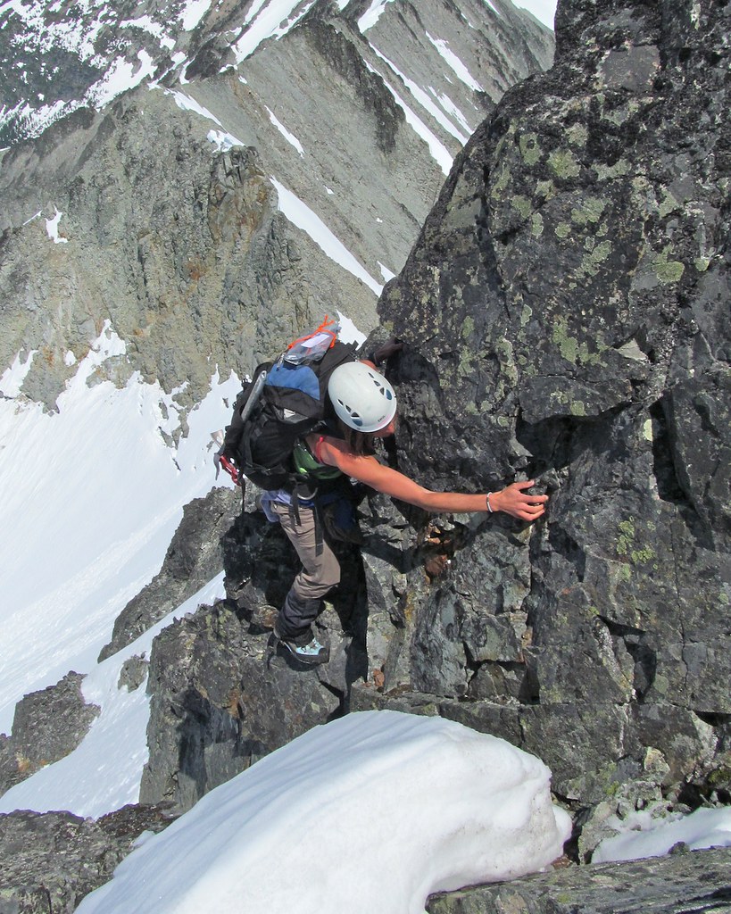
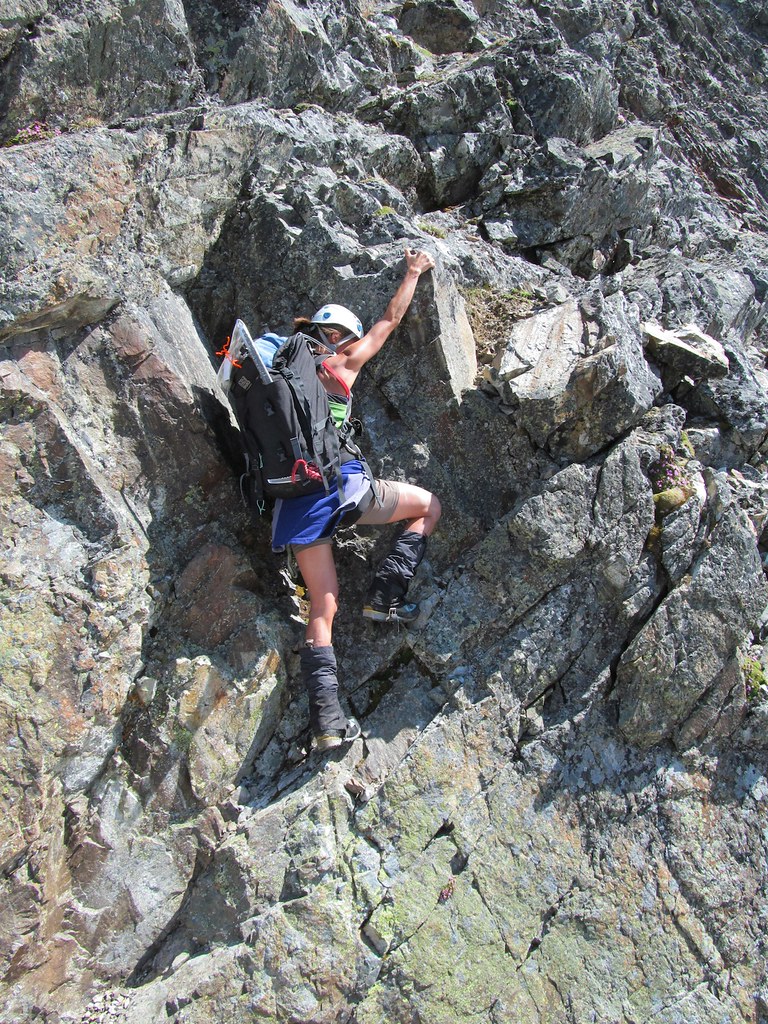
Ascending obliquely S on ledges towards the Ridge of the Gendarmes. Nothing is solid on this peak, so we tested every hold.
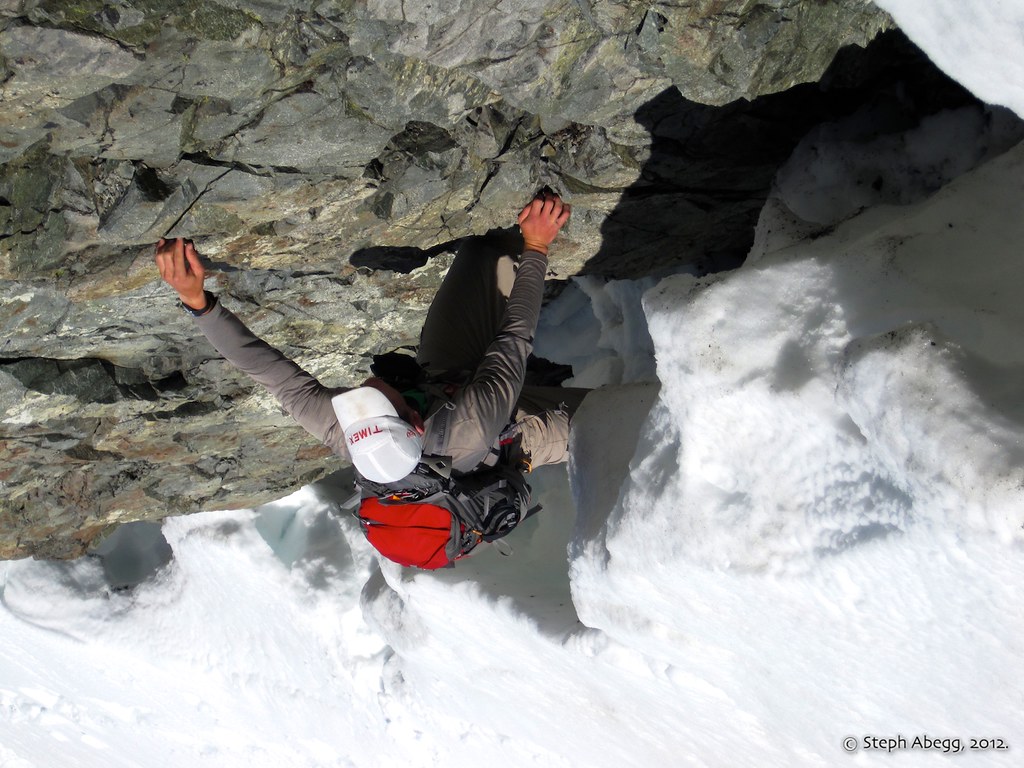
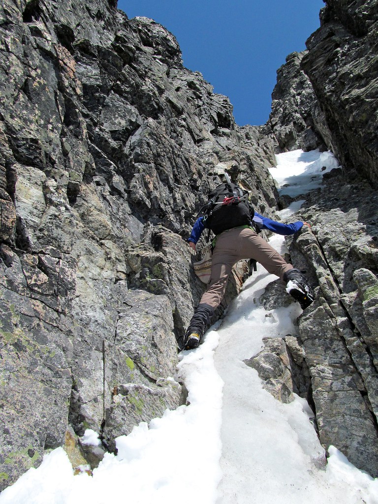
After ascending a major E-W gully, we encountered a 10-ft vertical step. This was an easy boulder problem.
(Photo by Brian Walkenhauer, taken on the descent.)
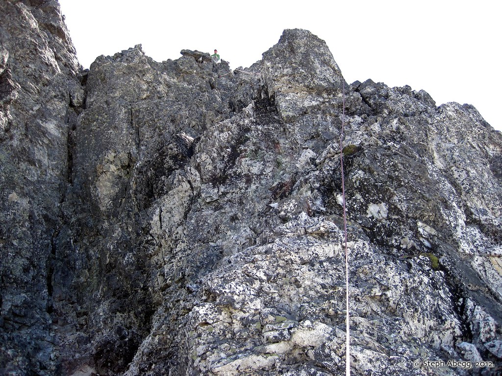
Next we headed up Class 3 terrain toward the most prominent notch in the Ridge of the Gendarmes.
(image removed, replaced with non-overlay)
From the notch is a good view of the massive summit tower. The annotated photo on the left shows the general route. In general, we found the route to be pretty straightforward. In short: "Ascend the gully that is just below the W walls of the spire. From the top of the gully follow the ridge to the summit. Never more than 5.5. Descend route with 3 single-rope rappels."
IMAGE REMOVAL: I removed the route overlay image (and replaced it with just the photo without the overlay) to respect those who felt I was giving away too much route information. I agree, there are some routes that derive their character because of the allure of the unknown. This is one of those routes.
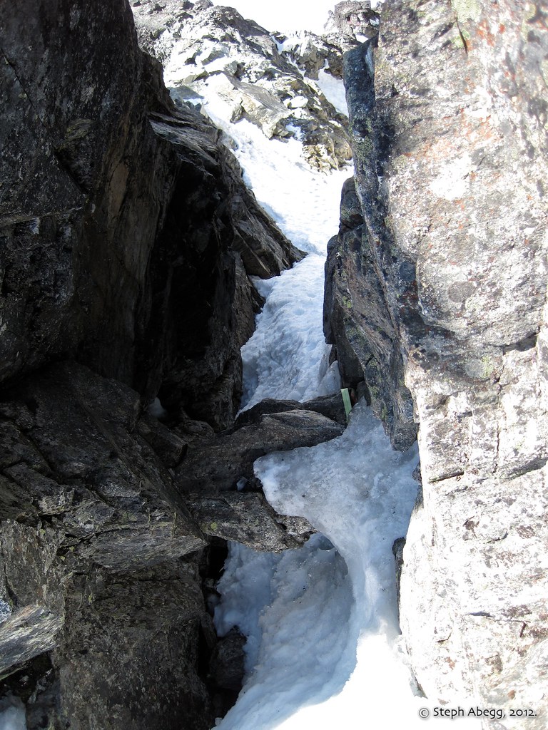
From the notch in the Ridge of the Gendarmes, the route description calls for working obliquely down and E towards a snow-filled gully.
Descend the gully to a ledge that puts one at the base of two additional
SE-trending gullies from the ridge.
It seems that when parties get off route, it is often because they do not find the correct gully. Basically, the correct gully is the one furthest right, against the western walls of the spire. Ascend the 4th (then 3rd) class gully to a notch beyond the last pinnacle on the Ridge at the base of the Spire's W face. (Note: On the descent we took a slightly lower route on the section before where the dotted line meets the solid line.)
IMAGE REMOVAL: Image removed to make the route more fun. See note above.
Even though we were in the correct gully, we still encountered some terrain that was definitely not 3rd or 4th. We were able to work around right and get on easier terrain.(The gully in the photo is NOT the one we went up. We descended a bit and went up to the right from here onto 4th class terrain.)
Looking up the gully to the notch in the ridge at the base of the Spire's W face.
Towering pinnacles as seem from the base of the Spire's W face.
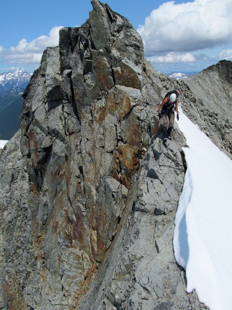
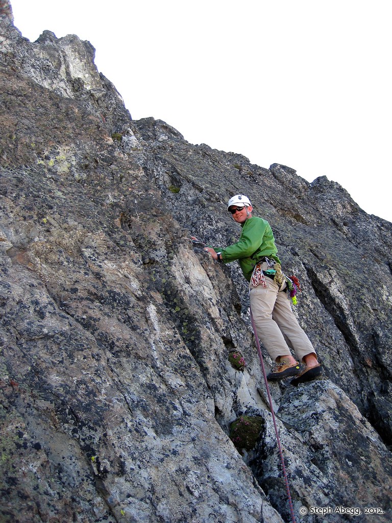
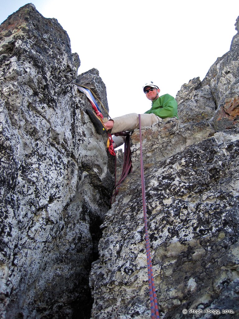
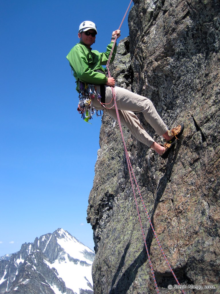
The first pitch involves a short right traverse (5.5) and then climbing loose 4th class rock for 80'.
Belay at the top of Pitch 1, at the "detached white column." The column was indeed somewhat detached (as is every rock on this route), but ti was less white than I had envisioned.
The second pitch involves about 140' of rotten-looking 5.2 rock, roughly staying on the ridge crest.
The third pitch continues on the crest, mostly class 4. From the top is an easy step/scramble to the summit.
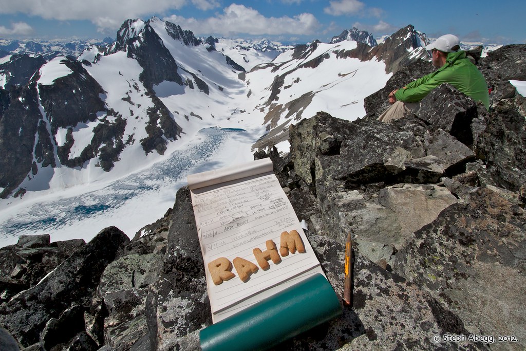
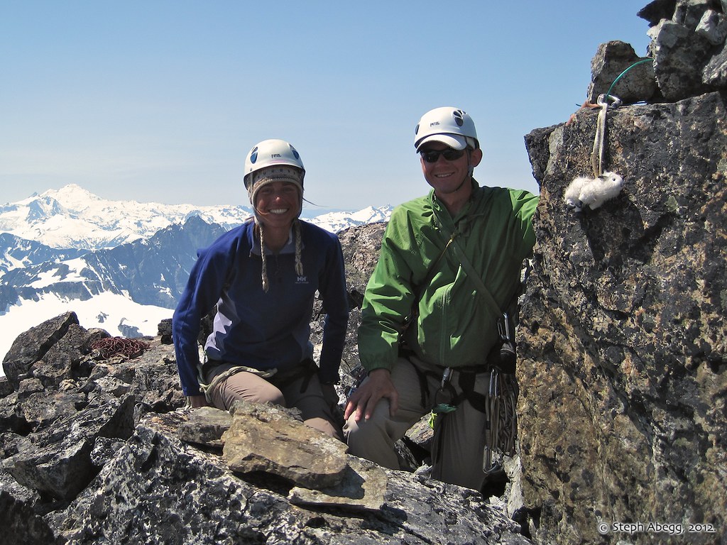
On the summit of SE Mox! 5.5 hours from high camp or 4 hours from Col of the Wild. We relaxed on the summit for a good hour.
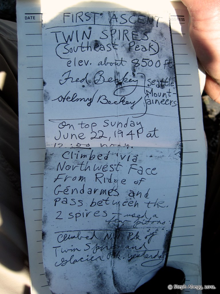
The summit register on SE Mox has photocopies of the original register. First ascent by Fred and Helmy Beckey on June 22, 1941. (Fred was born in January 1923, so this would have made him 18 at the time. Helmy was even younger.) It was not again climbed for several years after.
(Note Beckey's mention of "Glacier Peak" in the register, which was the name for Mt. Spickard at the time.)
Also, according to the register, Brian and I were the 36th party to reach the summit of SE Mox. We noticed that at least a handful of crazy souls had climbed Mox twice, so perhaps about 60 people and one tiny stuffed goat have stood on that summit.
Looking over at the top of Lemolo, aka "Hardest Mox." (Photo by Brian Walkenhauer.)
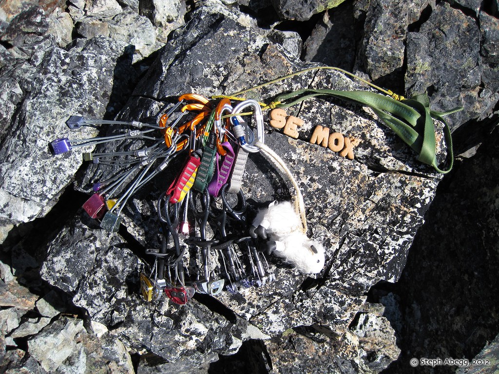
Safety in numbers I suppose. Assuming the boulder is securely attached to the mountain, which is not a given on SE Mox....
Brian rappelling the final pitch to the notch. We downclimbed the gully from there, figuring that would be safer than playing Rope Pull Russian Roulette.
The final traverse back to camp. The climb took us 8.5 hours round trip from camp, or 6 hours round trip from the Col of the Wild between the spires (which happens to also be the time given in the Cascade Alpine Guide).
Unclimbed (?) buttress on a crag west of NW Mox.
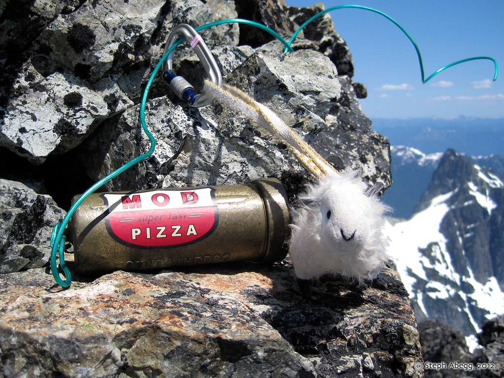
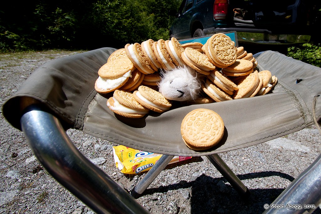
Yum!
Enjoying an alpenglow show on the Moxes.
Headlight fun. (Exposure: 2 min, f/7.1, IS0 400)
Glowing tent and moonlit night.(Exposure: 3 min, f/7.1, IS0 400)
DAY5:
Hike Out9.1 miles, 5720+ ft elev. loss, 5:50 Camp to Car
Morning light on the 7800' saddle leading to the south side of Redoubt.
Another beautiful day in the Chilliwacks. Too bad we'll be hiking out!
Another photo of the camp. Note the shadow of the tent and me on the snow behind.
Traversing the Redoubt Glacier on the way out. We decided to cut the corner and descend snow into the Depot Creek Valley rather than retrace our route to Lake Ouzel. This worked out well with the early season snowpack.
(Photo by Brian Walkenhauer.)
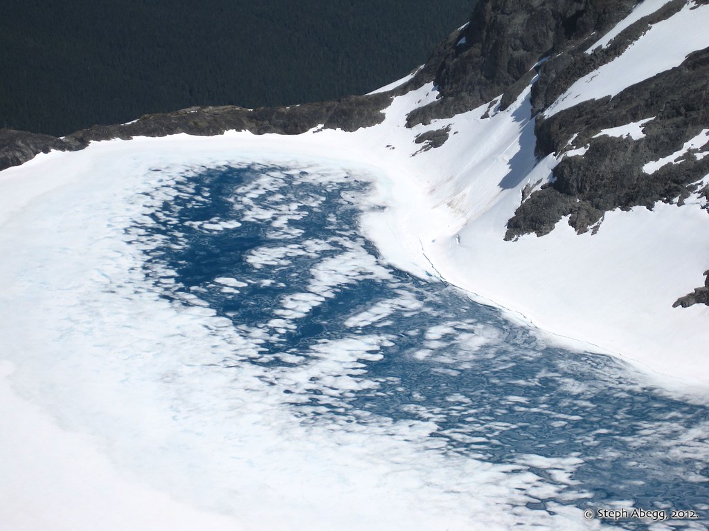
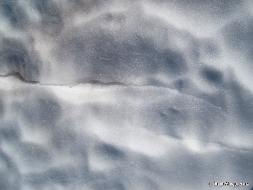
Telltale crack on Redoubt Glacier.
A snow ramp into Depot Creek Valley.
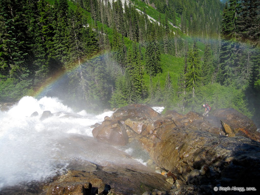
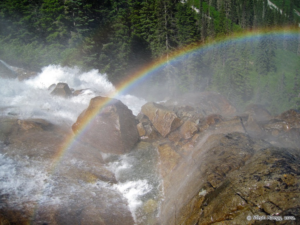
With the warm weather, the Depot Creek Falls were really raging now.
A rainbow over the falls. Brian is in the process of getting soaked.
Another photo of the rainbow. We noticed that when we were in the wettest part of the mist (too wet to safely take a camera out), we could see a full circle of rainbow rather than just an arc.
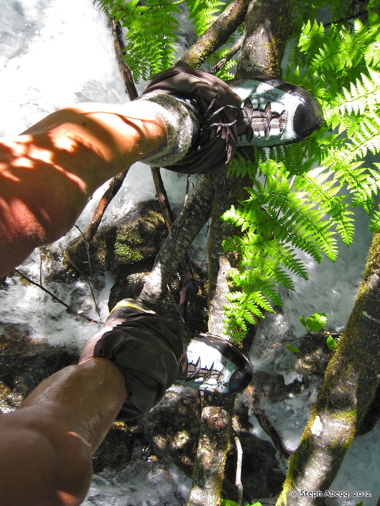
Crossing the swollen "creek" on a branch.
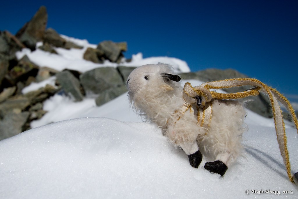
ADVENTURES OF CHILLIWACK BILLY (AKA CHILL BILL):
I couldn't resist...
Eager for some peak-bagging, Billy summits the border obelisk.
Billy reaches the top of Spickard the first day. Summit count: 1 for 1.
On the second day, Billy soaks in the views on the summit of Mt. Rahm. Summit count: 2 for 2.
Now consumed with his summit count, Billy heads straight for Custer. He nearly gets buried alive in choss, but he pushes through and makes it to the top! Two summits in one day! 3 for 3.
On the third day, Billy pops through a cannonhole and onto the summit of Redoubt. 4 for 4.
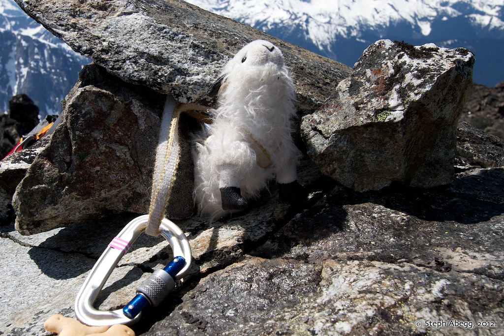
On the fourth day, Billy reaches the summit of SE Mox and anchors into the most solid looking object he can find on the peak. 5 for 5.
Now with 6 Top 100 summits under his stuffing (Billy summited Mount Baker the week previous), Billy asserts himself as an essential part of the climb.
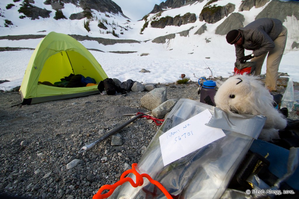
Although he does a lot of peak-bagging, Billy's primary job is to guard the permit at camp. (Yes, you need a permit since this area is in the National Park, but fortunately you can call it in.)
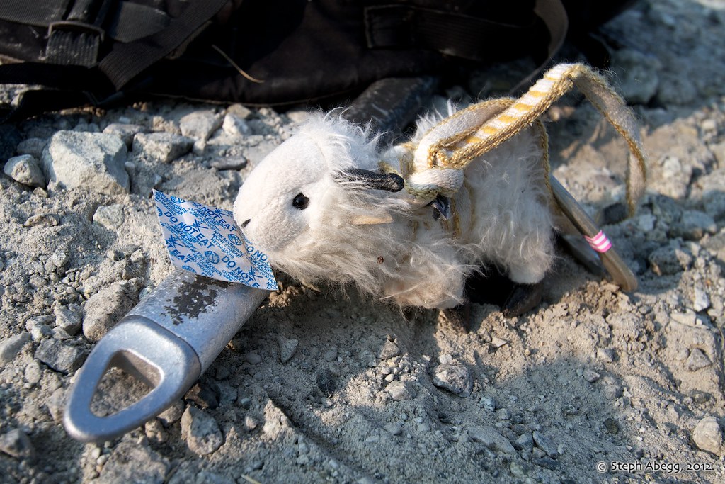
But we have to watch out, since goats don't care if things are edible or not.
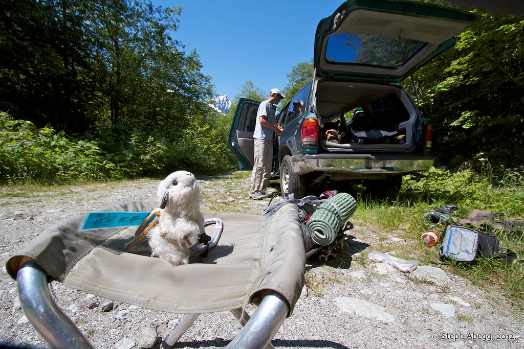
Back at the car! What a trip! Billy claims the camp chair.
Useful beta. Updated route information. Corrections. Historical notes. Interesting facts. No fluff please. Please do not put links in your comment, as my spam filter will filter those comments out.