THIS TRIP REPORT IS STILL MOSTLY IN THE EMBEDDED HTML FORMAT OF MY OLD WEBSITE. MOBILE Tip: Try Landscape mode. It is generally more mobile friendly.
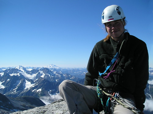
On August 16, my friend and I set out to do an alpine climb we had been talking about for awhile: the narrow West Ridge of Forbidden Peak, one of the "Fifty Classics." This was Joleen’s first alpine climb, and bound to be a great adventure.
We picked up our camping permit at the Marblemount ranger station (they only allow 6 parties to camp in Boston Basin each night, but they rarely fill up midweek; however, on summer weekends you may as well replace "classic" with "crowded"…). From Marblemount, it was an 21.7 mile drive along the well-maintained Cascade River Road to the trailhead (3,200 ft).
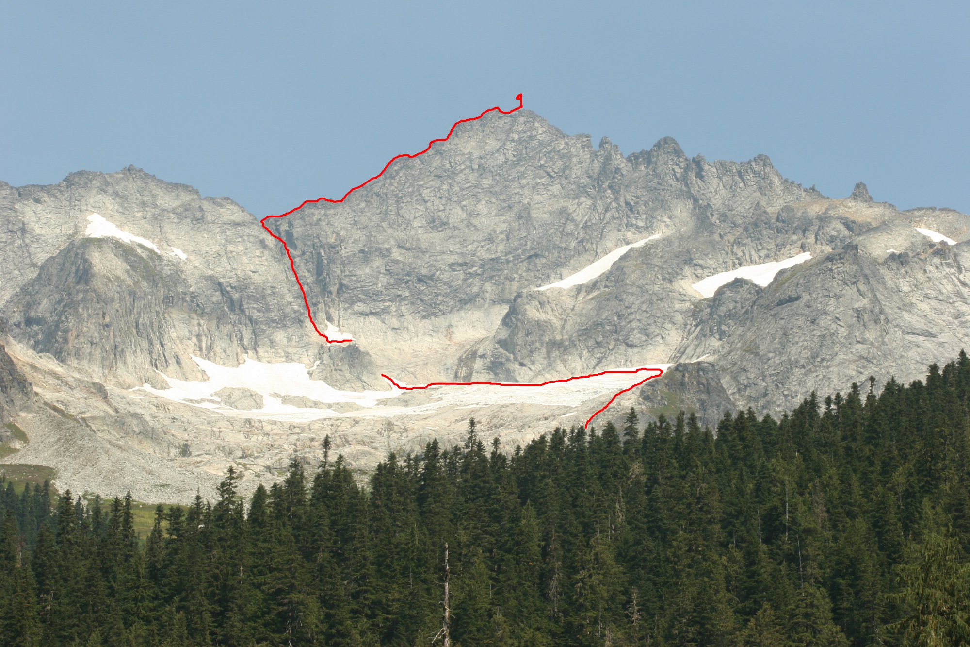
The trail up to Boston Basin is a rather steep trail (it gains 3,000 ft in 3 miles), and there is a section that crosses through an avalanche path, but it is clearly well-traveled. After a few hours of hiking, we were in Boston Basin. Here we got a good view of Forbidden and the route we would be taking the next day.
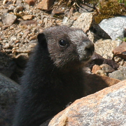
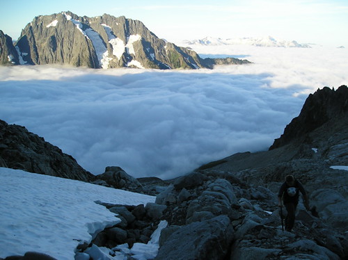
We spent the afternoon relaxing at the high camp (6,200 ft) doing Suduko, drinking iced tea, and taking photos of the marmots and flowers. We were a bit worried by the clouds that moved in towards evening (especially since we did not bring a tent), but during the night the clouds dropped into the valley, leaving cloudless blue skies for the climb. In the morning, we enjoyed a view across the cloud-covered valley toward the sun-capped Johannesburg.
By 6:40am, we were on our way, having stashed our extra stuff underneath a big boulder. The first 1,400 ft was pleasant hiking up granite slabs and flower-lined stream gullies.
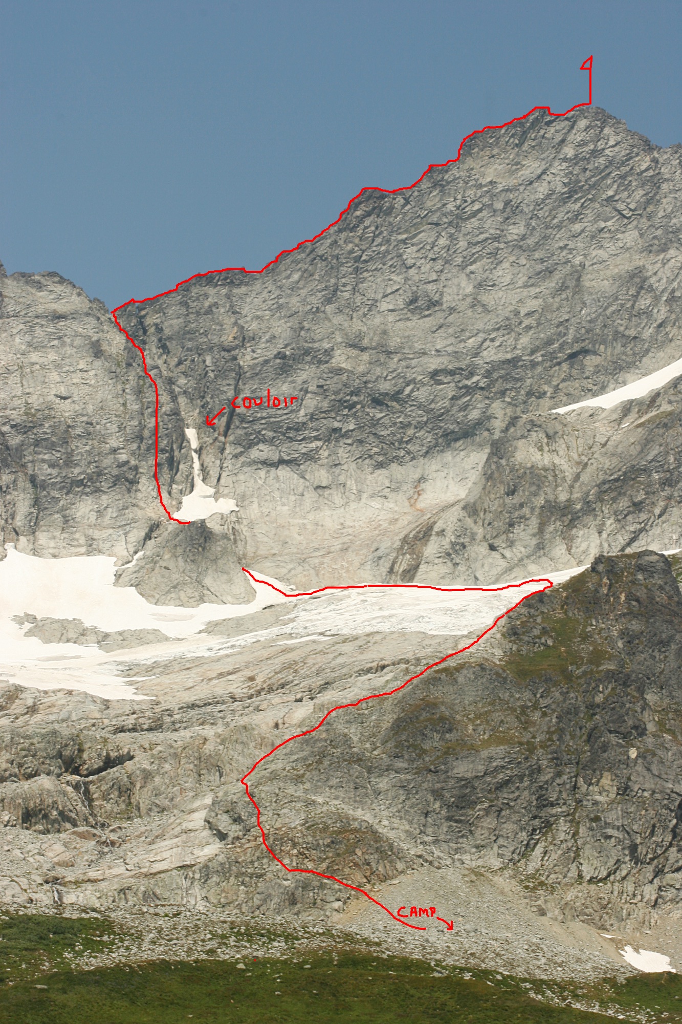
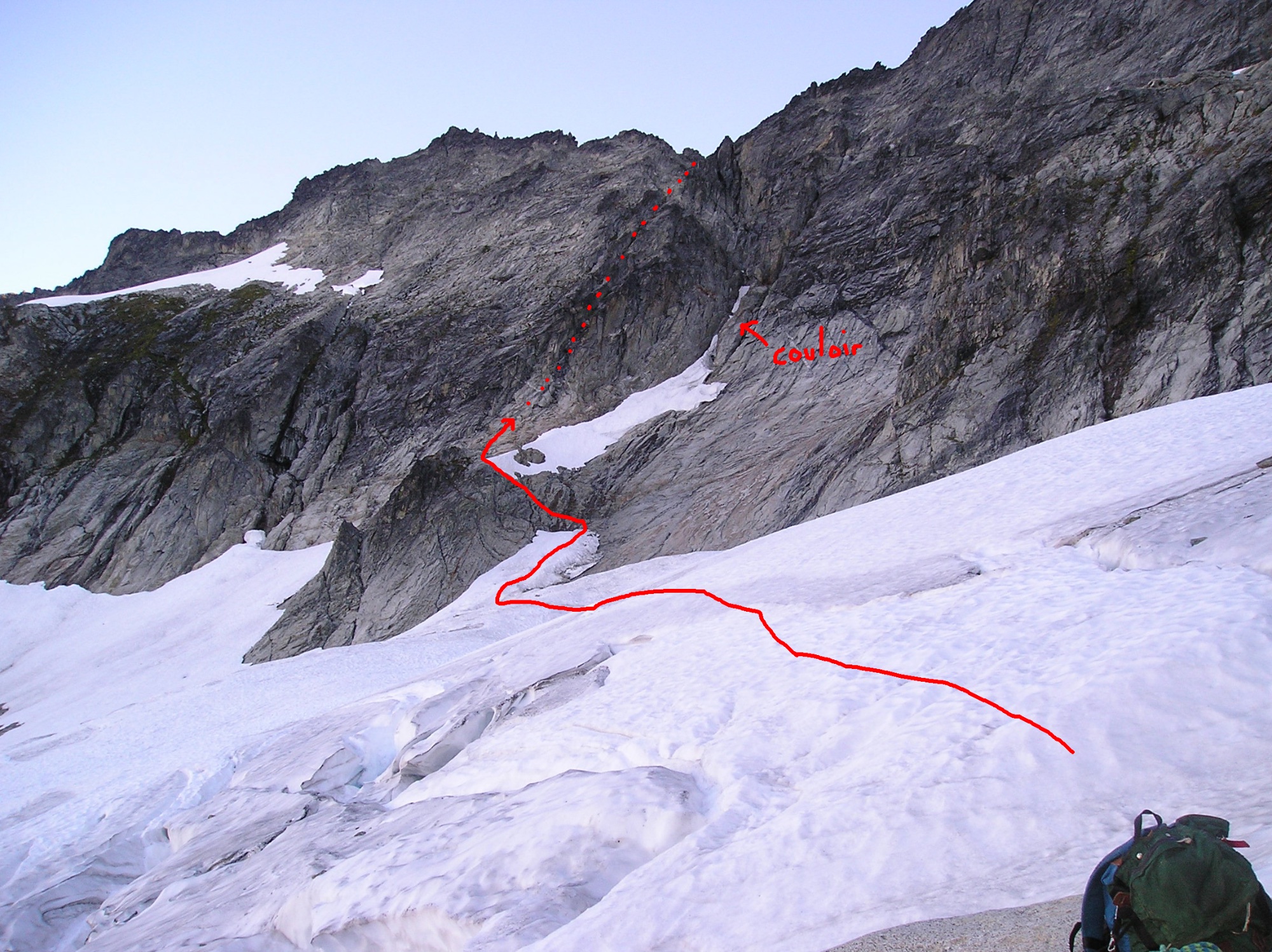
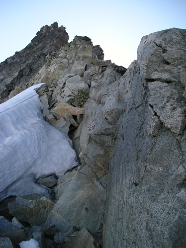
After about an hour, we arrived at the high east side of the small glacier, since we saw we could bypass crevasses by traversing the glacier at around 7,600 ft. (By the way, it looked possible to bypass the glacier by climbing up the basin further to the west.) The traverse was straightforward, and just after 8am we arrived at the base of the prominent 500 ft couloir leading up to the ridge. We decided that because of the low amount of snow in the couloir it would be best to ascend the gully to the west (this is the couloir bypass route that Beckey mentions). The photos below show our route across the glacier and the couloir bypass (red arrow).
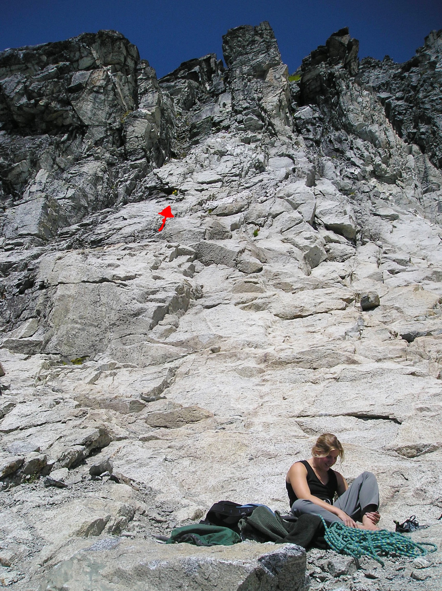
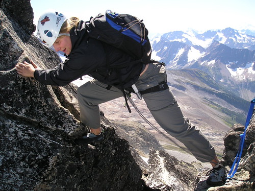
We stashed our crampons, ice axes, boots, and rain gear (it was not going to rain we decided!) under a rock, and began to make our way up the easy slabs towards the entrance of the gully. We simulclimbed the gully, which was Class 4 for the first 200 ft easing off to grassy Class 3 for the final 200 ft to the notch. The gully was pretty loose though, and fortunately Joleen survived the constant pummeling of rocks. The photo below shows Joleen just before she reached the notch at the top of the gully.
We reached the notch (8,265 ft) at 9am, and were treated to a great view to the north of Eldorado and Klawatti Peak. From the notch we could look up and see the 1,500 ft West Ridge stretching out ahead of us. It looked fantastic! Only 550 vertical feet from here!
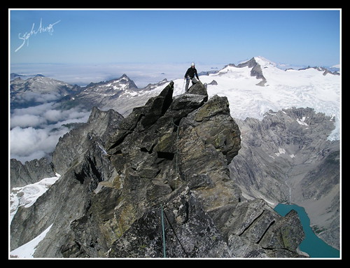
We decided to simulclimb the ridge. The rock was solid, the exposure was great, and in no time we were at the "crux" 5.6 section of the tower 175 ft below the summit. I clipped a sling to the fixed piton, belayed Joleen up so I could resupply my rack, and headed up the tower and to the summit. The climb went much too fast, and we arrived at the west summit only an hour after leaving the notch. The east summit is slightly higher (8,815 ft), so after an airy downclimb move and a short traverse I was on the east summit in no time (however, when I started to belay Joleen, I realized the rope was stuck, so had to climb back to the west summit to fix the problem). The photos below show Joleen on the west summit and me on the east summit.
Overall it took us 3.5 hours from our camp to reach the higher east summit. We had planned on 6 hours, so we enjoyed a relaxing lunch on the top of the peak. We had an amazing 360° view of the North Cascades. I pointed out the route that I had climbed on the nearby Eldorado a few weeks previous (the first photo above shows Eldorado on the right side of the photo).
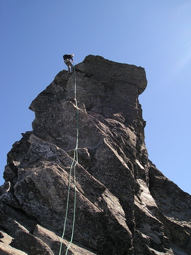
At 11am, we began our descent, downclimbing the west ridge route and using a few of the rappel slings we had encountered on the way up. In general, we could bypass difficult moves by downclimbing on the north side of the ridge (climbers can always bypass problems by north-side traverses, but we found it ideal to maintain the wonderfully exposed ridge as much as possible on the way up). The photos below show (1) Joleen rappelling down the tower 175 ft from the summit and (2) Joleen making the airy step just east of the ridge notch.
From the notch, we descended down the gully we had come up (there were some rappel slings here too), and retraced our path across the glacier and down the granite slabs back to camp. We arrived back at camp just before 3pm. Overall, the descent back to camp took 4 hours, just a little longer than the ascent. It had taken 8 hours to climb the peak, which is much shorter than we had anticipated.
After an hour of lying in the sun, sharing a Snickers bar, and working some more on the Sudukos we had started the day before, we began the hike back to the car. After 2 hours of a knee-aching descent, we arrived at the car. By 9pm we were crossing the border back into Canada.
Overall, the trip was a success, since I think I have found another person to alpine climb with (but who wouldn’t think alpine climbing is great if their first alpine climb is Forbidden!?!). Joleen and I are already discussing our next adventure…Slesse, perhaps?
Beta on climbing gear:
Our rack consisted of 6 cams (BD Camelot Size .3 to 3), a set of nuts, 10 slings (3 longer slings), and a sufficient number of carabineers. It is probably possible to safely protect the route using only slings, so only a minimal rack is needed. I used the #.3, #.5, #1, and #2 cams the most, and am almost ashamed to say I never placed a nut.
We used a 45 m rope (the rope used to be 50m, but was sliced pretty badly—luckily near the end of the rope—while climbing Mt. Stuart in July…). This was just sufficient for the rappel stations on the west ridge and in the descent gully. However, all of the route can be downclimbed without rappelling.
Wear helmets for the loose ascent/descent gully!
I can never resist adding a few more macro photos …
Useful beta. Updated route information. Corrections. Historical notes. Interesting facts. No fluff please. Please do not put links in your comment, as my spam filter will filter those comments out.