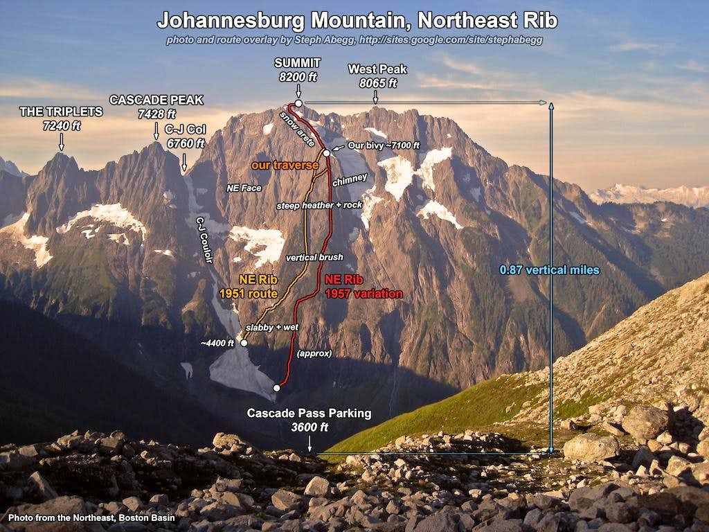
The massive northeast face of Johannesburg rises about 5000' above the popular Cascade Pass parking lot. Its hanging glaciers, couloirs, steep rock, and prominent NE Buttress are simply impossible to ignore. Representing the epitome of North Cascades ruggedness, this was a summit I've long wanted to climb.
Tom Sjolseth was the perfect partner for this route. Masochists like us actually enjoy vertical brushwhacking with heavy overnight packs.
Although the NE Rib of Johannesburg is by no means an easy route and it has epic potential, we somehow navigated a relatively straightforward and quick route to the summit, and only had to rope up for the first pitch. We enjoyed an amazing bivy below the final glacier arete. The entire car-to-car climb took us only 17.5 hours of climbing, which was much less than we had expected.
Below is a photo trip report from our 2-day climb of the NE Rib (1951 route) of Johanneburg. Below that is Tom's trip report, which gives more verbal details than presented in my photos.
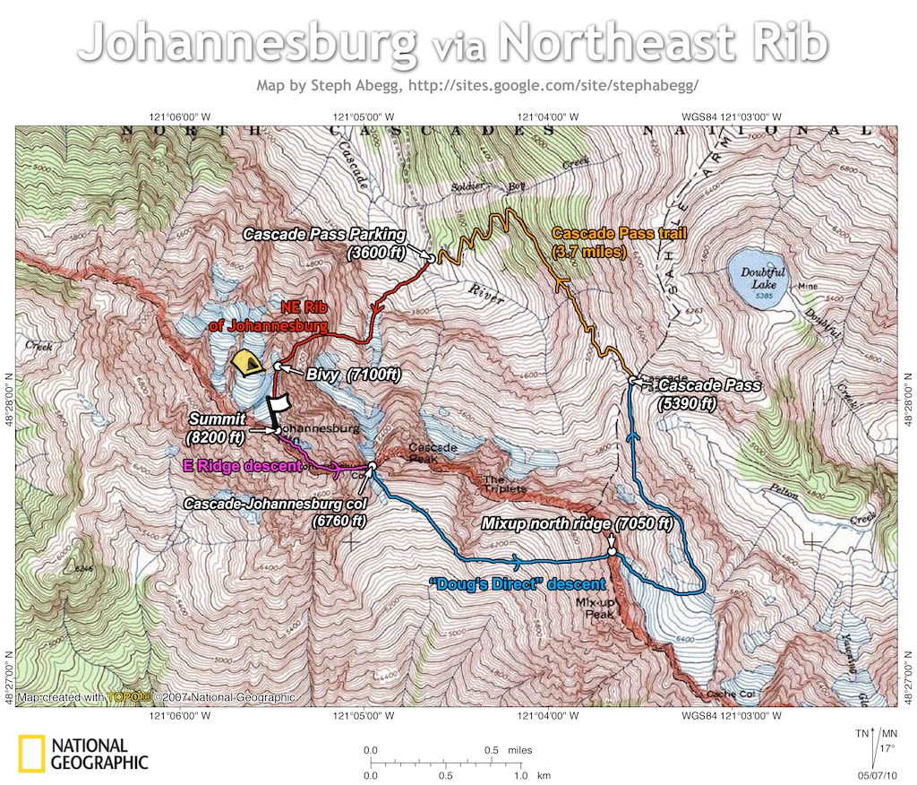
Day 1 - Cascade Pass parking lot (3,600ft) to bivy (7,100ft) on NE Rib of Johannesburg
TH to bivy: 1 mile, 3,500' up, 8 hours
Short route detail:
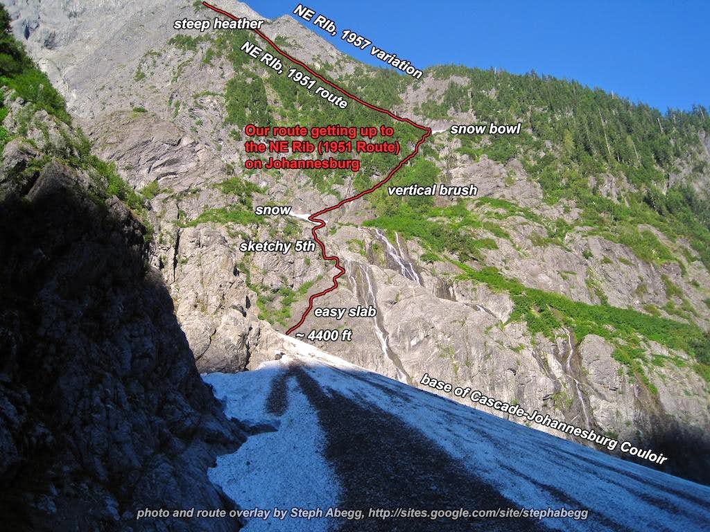
From the Cascade Pass trailhead at the end of Cascade River Road, descend and cross the Cascade River. Climb up and over the terminal moraine. For the 1951 route, gain the rock just before the C-J couloir narrows (1957 route shown in my photo overlays, but not described here). Navigate around waterfalls up sketchy slabs to the base of the glacier. Bushwhack and climb up rightwards to a bowl on the NE Rib. Once on the ridge crest, climb steep heather slopes leading to 4th class rock. Continue up the Rib (rock steepens) until you get to the bottom edge of the snow arete. You can also traverse over to the western NE Rib to gain the 1957 route just above the chimney. Scramble up to the snow arete. There is an amazing bivy at the base of the snow arete.
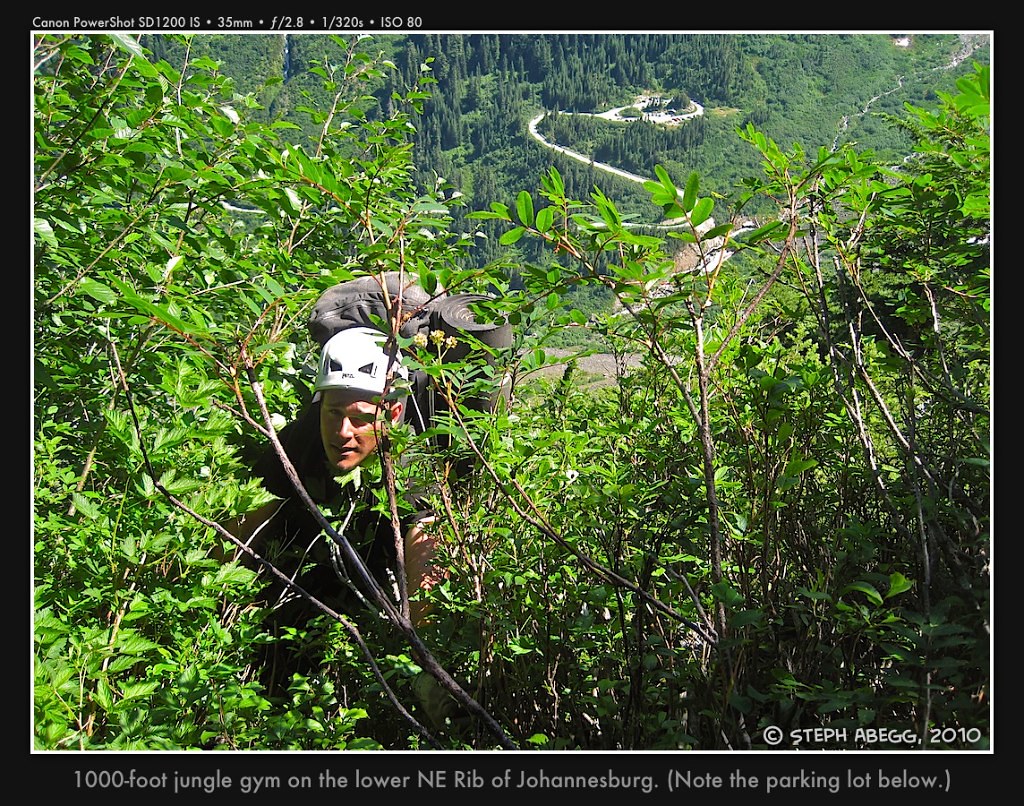
Photos from climb up NE Rib to bivy
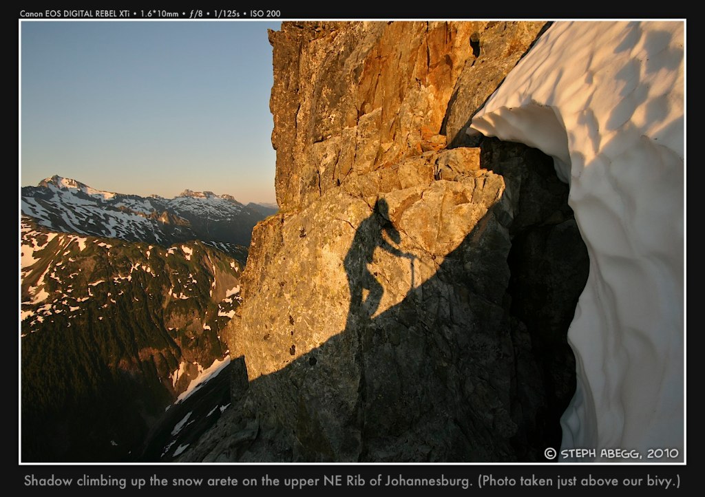
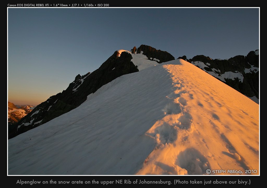
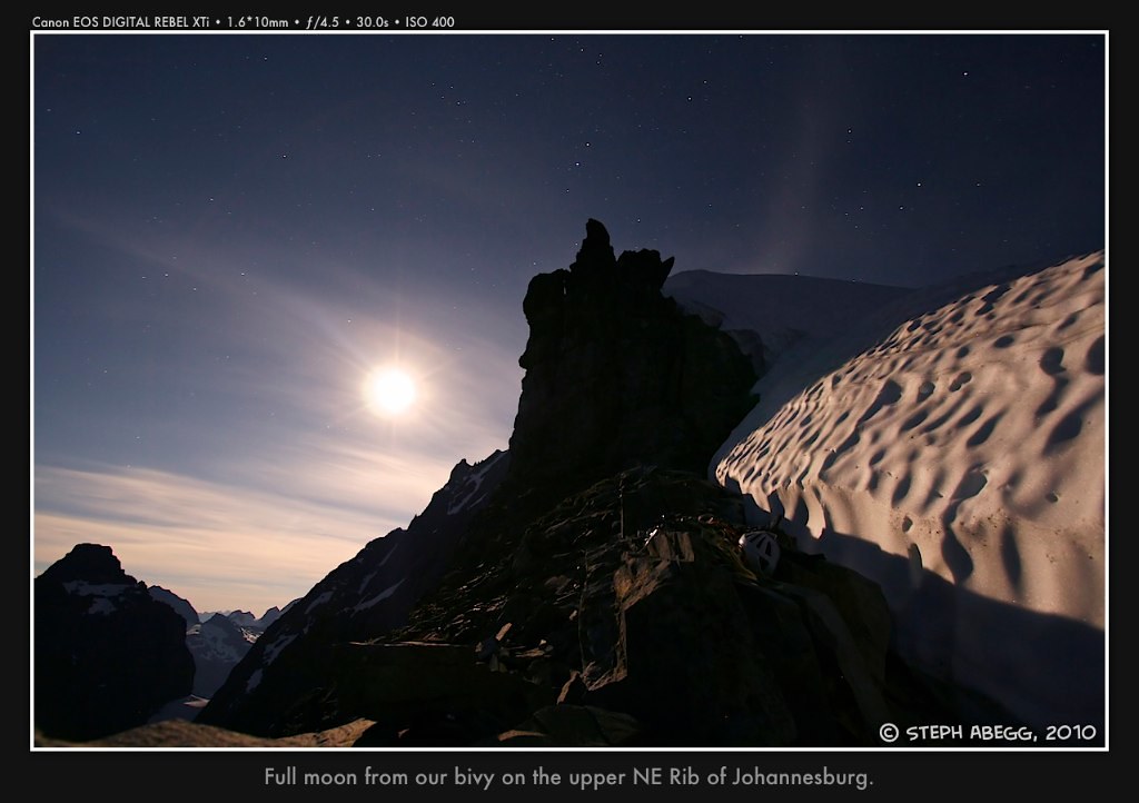
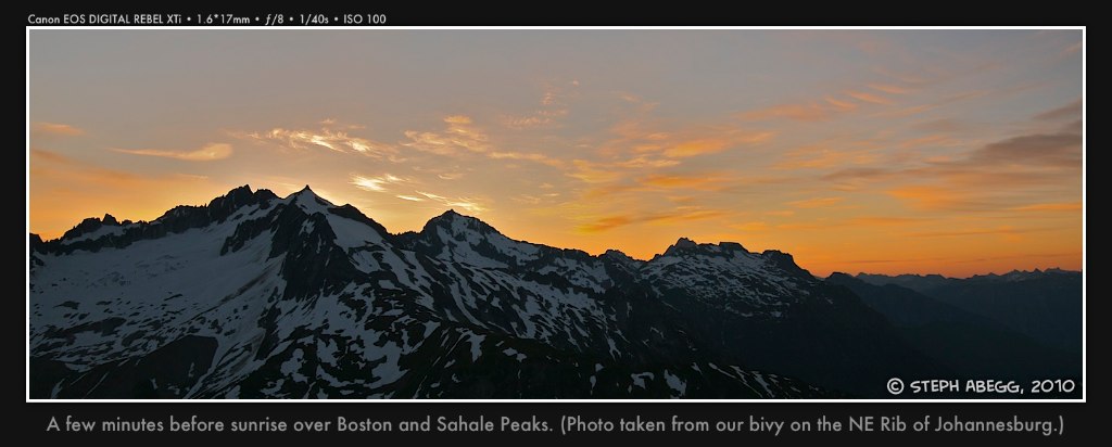
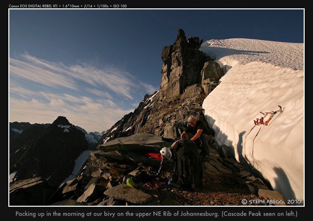
Photos from bivy on the NE rib
Day 2 - Bivy (7,100ft) to summit (8,200ft) and descent to car (3,600ft)
Bivy to summit: 0.3 mile, 1,100' gain, 1 hour
On summit: 0 miles, 0' gain, 1 hour
Summit to C-J Col: 0.5 mile, 1,440' loss, 3 hours
C-J Col to TH: 7 miles, 4500' loss, 1500' gain, 4.5 hours
Short route detail:
Ascent to summit:
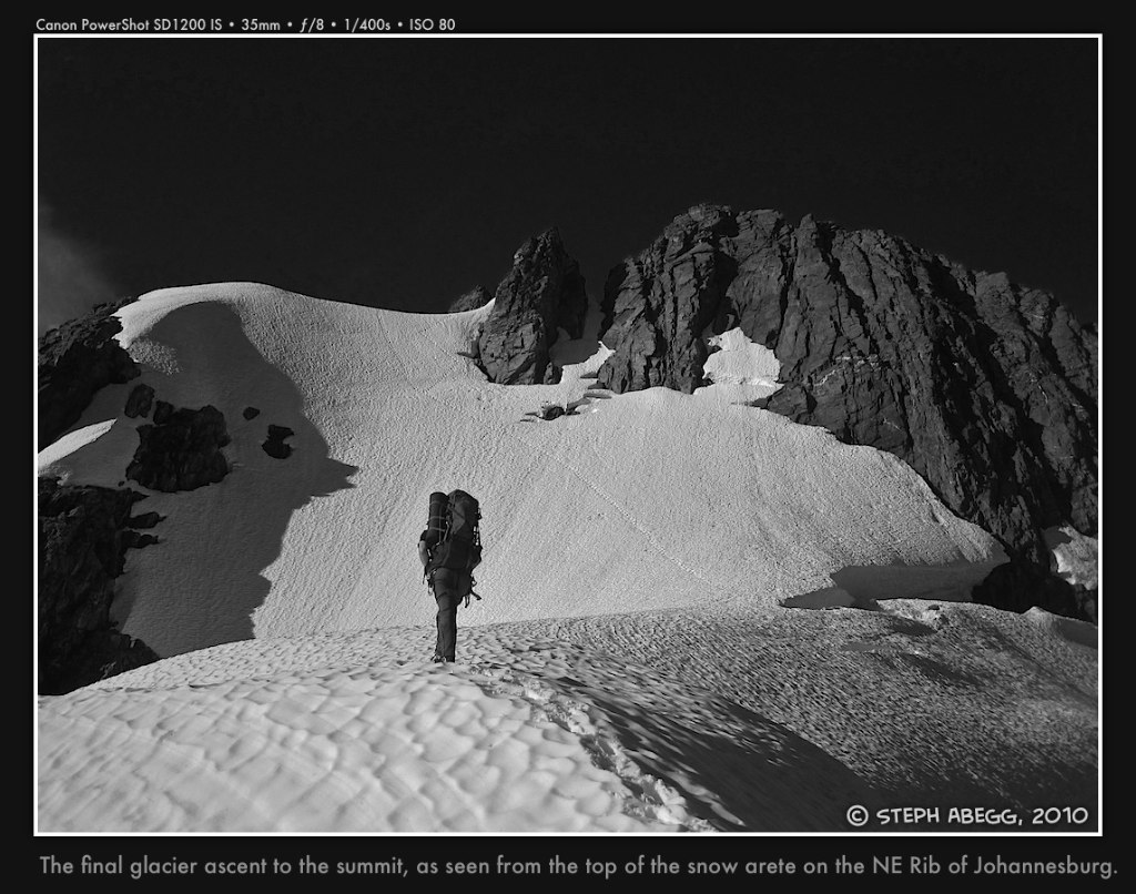
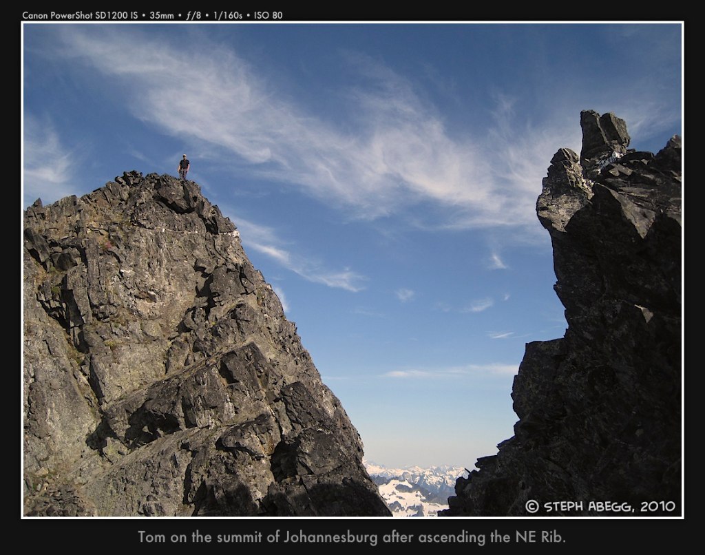
From the toe of the snow arete, climb the fantastic snow arete to the snow headwall and the summit ridge. Once on the summit ridge, scramble rightward (class 3) to the summit.
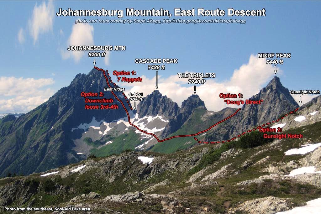
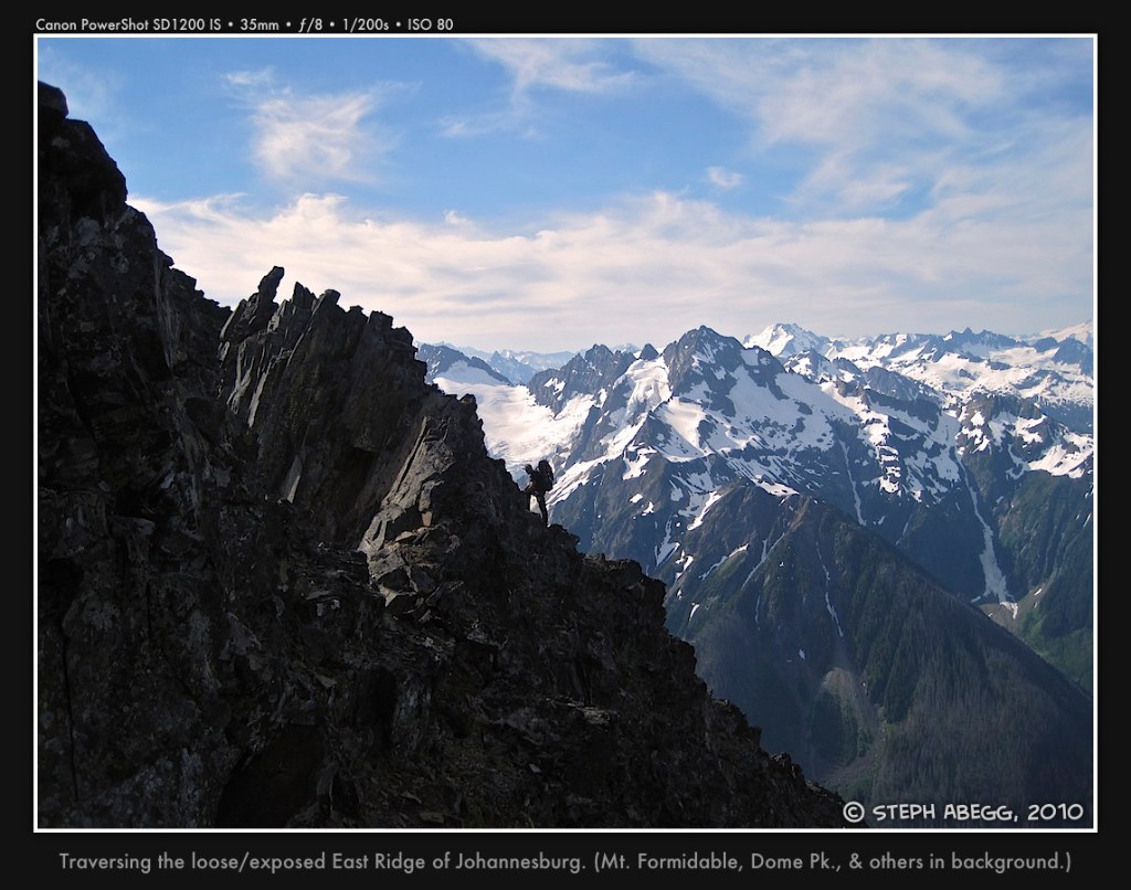
Descent via the East Ridge route:
Traverse the gendarmes of the east ridge by connecting loose 3rd/4th class ledges, staying about 75' down from the ridge crest. From the east end of the ridge, to get down to the C-J Col you can either rappel a series of rap slings (about 7 raps on the crest) or downclimb the loose gully to the climbers' right of the rappels.
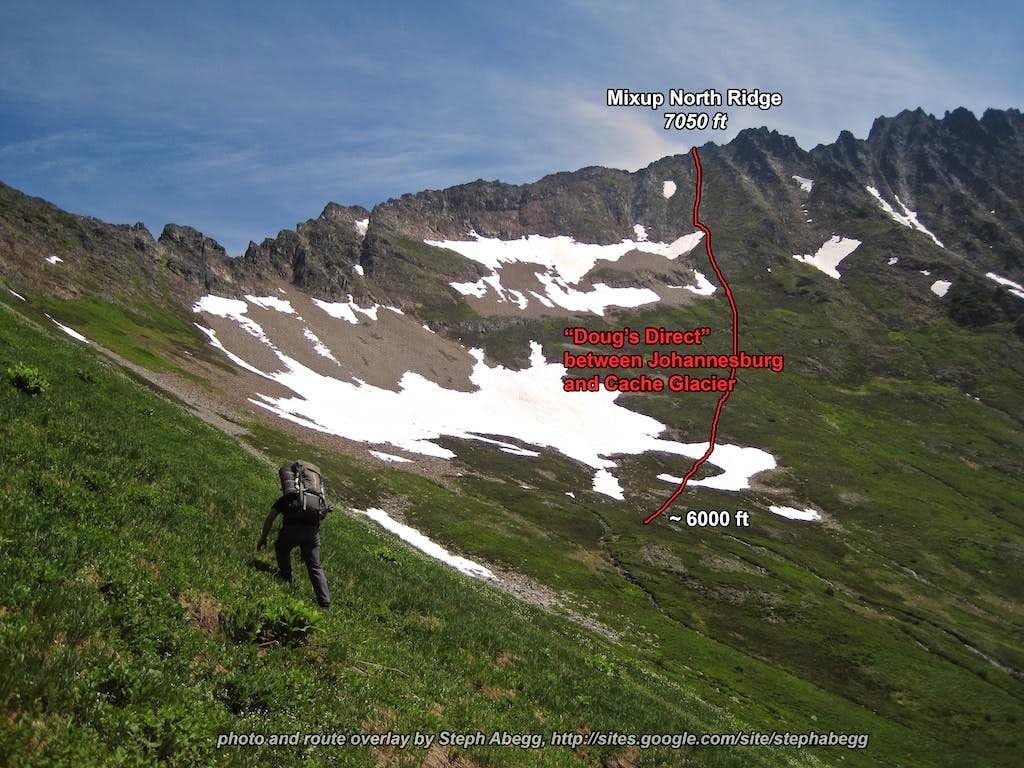
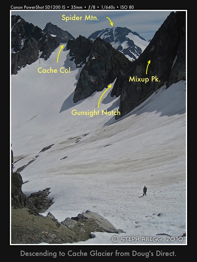
Doug's Direct descent:
From the C-J col, you can look directly down on the parking lot. It is tempting to want to descend this way, but it's sort of like playing Russian Roulette with rock and icefall and not recommended. Instead, take the circuitous traverse around to Cache Glacier. The popular way to do this these days is via "Doug's Direct,": traverse under the base of the Triplets buttress (~6000'), sidehill the steep meadows up and right, climb up to the ridgecrest (1500' gain from Triplets buttress) to the north ridge of Mixup Peak, descend 3rd/4th class slabs/blocks to Cache Glacier, traverse left to the climber's trail on Mixup Arm, gaining a climber's trail that leads to Cascade Pass, and arrive at the car about 5 hours after you left the col.
Photos from climb from bivy to summit
Photos from descent of East Route + Doug's Direct
Tom's Trip Report
Tom's trip report gives a lot of the route details shown in my photos....
WOW.
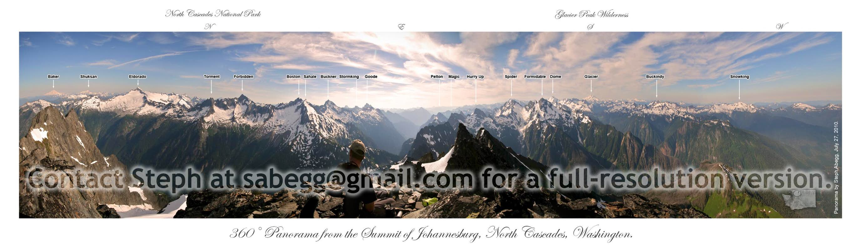
For anyone who has gazed up in amazement at Johannesberg Mountain from the Cascade Pass parking lot, it is a sight to see. Waterfalls and glaciers cascade down 5000' of sheer cliffs in a chaotic display of objective hazard. Booms and thunks from falling rock and ice comprise the soundtrack of Cascade Pass. It is a sheer, massive, intimidating mountain - no doubt, the epitome of N Cascades mountaineering.
A prior trip into climb the NE Buttress had us reconsidering our options not 5 minutes out of the parking lot. On that day, wet brush forced us to go to plan B, and we wound up summiting via the C-J Couloir. When it comes to vertical brush, I prefer mine dry.
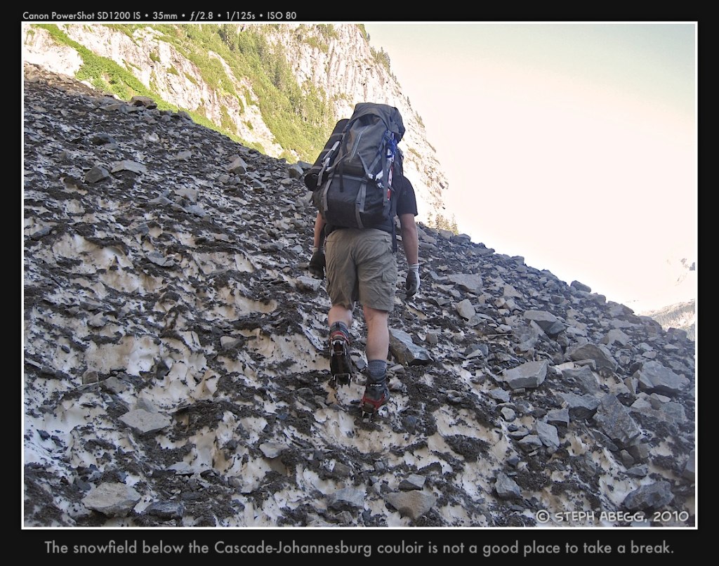
Fast forward to Monday when Steph Abegg and I connected for what would become a fabulous trip into the mountains. We arrived at the relatively empty Cascade Pass TH at 7AM, and embarked on the 30 minute approach shortly thereafter. We ascended the C-J Couloir for ~800' before trying to find the best route up dirty slabs to gain the route. After our first attempt fell short due to ugliness, we backed off and reconsidered. Eventually, we found another way that worked. Barely. I led up on some super sketchy, jungle slab with downward sloping holds and abundant lichen. Pro was sparse, and I had to be creative to find it. After about 30 tense minutes, I was able to pull through and belay Steph up. From here, it looked like a steep brush bash with good green belays, so we decided to put the rope away. It never came out of our packs again the entire trip.
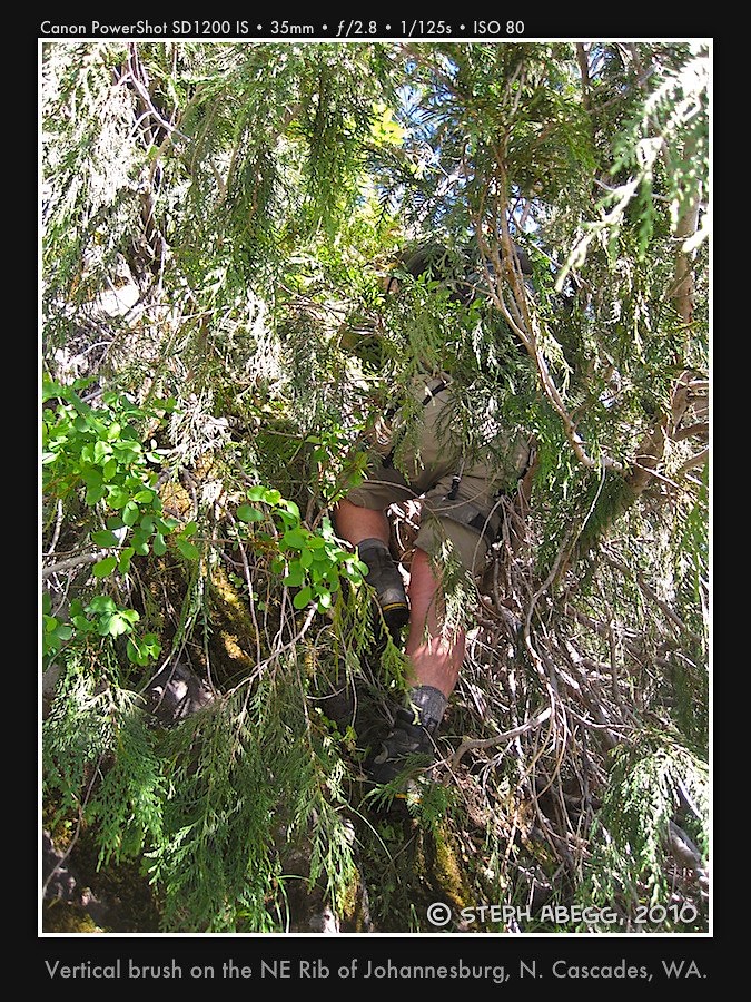
Lots of steep (vertical) bushwhacking ensued. It was hot, and carrying a full pack made it quite strenuous. Routefinding was tricky, but we managed to find a great, direct line through the dense brush and cliffbands. About 1500' later, we emerged from the vegetable abyss onto steep but sublime heather slopes and class 4 rock. The rock was solid, and we felt entirely comfortable climbing without the rope. After about 500' of this, the buttress steepened even more, to some vertical walls. This is where we had heard (from prior trip reports) of loose chimneys and sketchy snow couloirs. We crossed a gully to our right, gained the 1957 (western) rib and proceeded to climb straight up the crest on surprisingly good rock. Could this be our bivy site? It was!! We were amazed.
The position of our bivy site was unreal. 3500' below us was the parking lot. I could see my car and people walking around. Across the valley, peaks like Forbidden, Boston, Eldorado, and Buckner beckoned. Being in camp so early (3PM), we had plenty of time to relax and enjoy the views. We melted snow in Steph's pack cover, taking advantage of the sun's energy to supply us with the vital fluid. By 8:30PM, Steph's camera was operating at warp speed, as the sunset cast an array of beautiful colors on the surrounding peaks. This is what mountaineering is all about!!
We awoke at the leisurely hour of 6AM this morning to finish the climb. By 7:20, we were cramponing up the beautiful snow arete that leads almost directly to the summit. An hour later, we were on the summit, enjoying excellent views into the heart of the rugged N Cascades. Upon signing the register, we noticed two parties had climbed the route in the past 4 days. This is a mountain that rarely gets climbed by any route, and here we were looking at three ascents in four days of the NE Buttress – one solo.
We spent about 30 minutes on the summit before heading back down. Since I had already done the descent down the E Ridge before, I had the descent dialed. Less than 3 hours later, we had downclimbed the entire ridge and were standing on terra firma below C-J Col.
The hike out to the TH via Doug's Direct was long, but we eventually made it, returning to the cars at 4:30, 9 hours after we left our bivy site.
There are trips into the mountains that are great, and then there are those that are perfect. This trip was definitely perfect – one of the best trips I've ever been on. Thanks again to Steph for being such a strong partner.
Total climbing time: 17.5 hours