Northern Pickets 2: Access Creek (climb Luna Peak)

Northern Pickets 2

Routes:

Access Creek (incorrect one) - Access Creek (correct one)
Climb: Luna Peak (3rd/4th)

I first attempted a N-S Pickets traverse in the pack-ditching adventure of July 2007. The following page details another ultimately unsuccessful but nevertheless unique and exciting adventure in the Pickets, involving pioneering a new route up the bushy drainage north of Access Creek, seeing Luna Peak from a rare angle, descending a rather treacherous wet and cliffy gully, soloing Luna Peak and getting some tantalizing views of the Northern and Southern Pickets (see the panorama at the top of this page, which was worth the adventure in itself), and retreating out of Access Creek when my partner decided he was officially Picketed.

(In August 2008, I revisited my plans to complete the north to south Pickets traverse, and a phenomenal adventure this turned out to be.)

Region: Washington
Elev: 8,311 ft (Luna)
Rock type: Gneiss
Type: 
Date(s): August 21-24, 2007 (Tue-Fri)
Partner(s): Douglas Ray

Map

CLICK TO ENLARGE

Labeled Panorama

CLICK TO ENLARGE

Intro

THIS TRIP REPORT IS STILL MOSTLY IN THE EMBEDDED HTML FORMAT OF MY OLD WEBSITE.

The Plan

I was quite disappointed when the first attempt was not a success, so I soon began to make plans for a second attempt at a Pickets traverse before the summer was over. The plan now was to enter via Access Creek, traverse to Luna, and from there continue on to Fury, Picket Pass, Terror, and Goodell Creek. My friend Douglas was eager to join this second attempt.

We began the ambitious adventure on August 21. Unfortunately, yet again I found my partner and I doing all the arduous trail slogging and bushwhacking to get into the Pickets only to turn around and bushwhack and trail slog back out, with little more than tantalizing views of the Pickets dancing in our heads.

The following page details our adventure, including a description of a successful climb of Luna Peak (which has one of the best summit views in all of the North Cascades). Of course, there are several photos. At the bottom of the page I have compared some of my photos from this trip with some photos my parents took during their traverse of the Northern Pickets in 1981.

Trip Summary

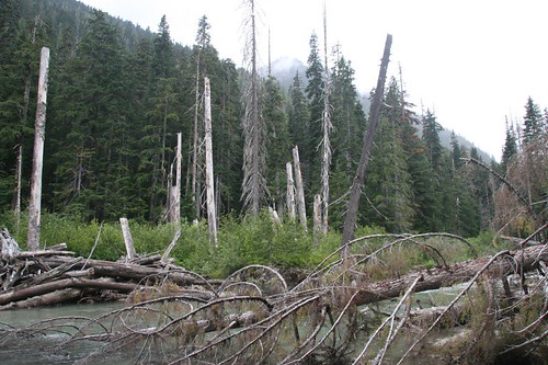
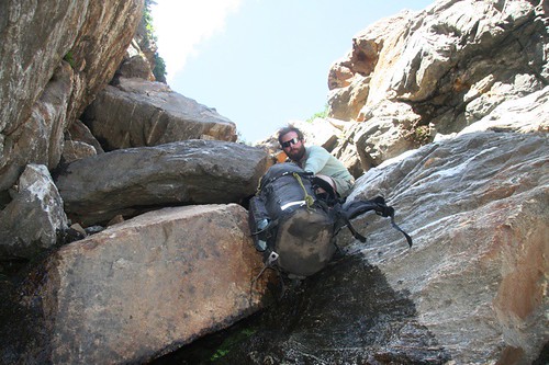
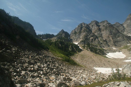
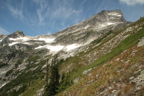
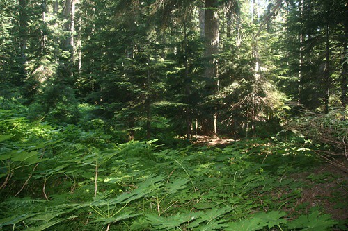
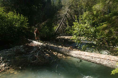
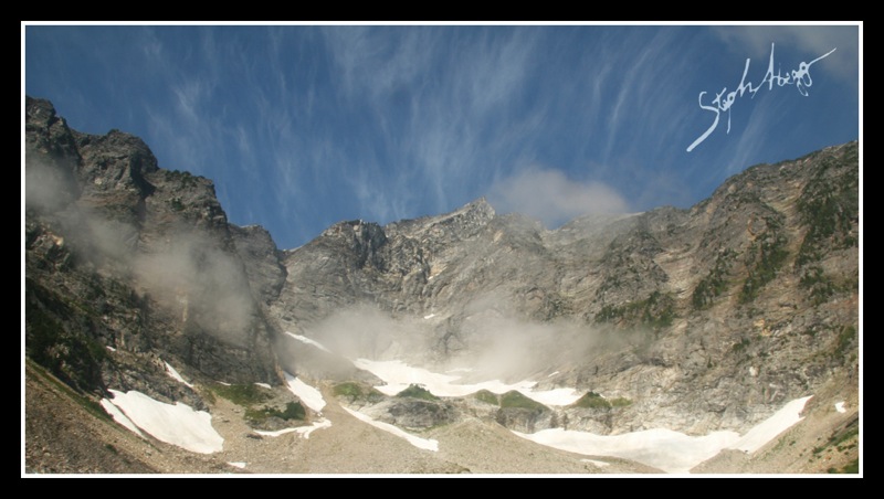
We began at Big Beaver trailhead after paying $35 to take a water-taxi to cut off a few hours of hiking. After hiking about 10 miles to Luna Camp, we hiked along the trail for 1.5 miles and then turned off to cross Big Beaver Creek, as described in the Access Creek approach notes in the Beckey Guide. After crossing Big Beaver Creek, we started up the drainage ahead of us. Visibility was poor, but we assumed this was the Access Creek drainage. After a little longer and tougher bushwhack than expected (but nothing too heinous), we made it to the headwaters and set up camp the first night. The next morning we ascended to the ridge via a gully that vaguely resembled the gully described in the Beckey notes. Visibility was still poor, but improving. Soon enough, we noticed a giant peak at the end of the ridge extending to the southwest of us. After a few moments of confusion, we came to the conclusion that this was Luna Peak, and we had come up the wrong drainage, and were standing on the NE shoulder of Luna looking down into where we though we had been the night before: the headwaters of Access Creek!

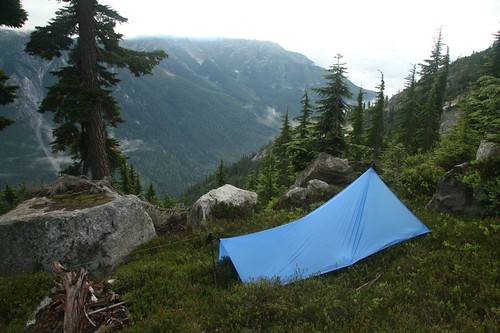
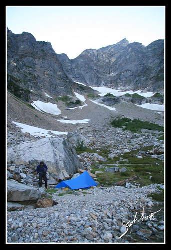
So down a gully we went, hoping to cross over the headwaters and continue over to the next ridgeline to Luna Col (fortunately, we had planned a short second day, so it was possible to still end up where we wanted to be by that evening). As gullies usually are, it was a tedious few hours before we arrived in the drainage. I was up for continuing on, but Douglas was feeling pretty beat up by the gully and wanted to stop at the headwaters of Access Creek for the night. Admittedly, there was nice camping here, and we did have an extra day built into our trip.

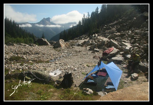
However, when we woke up the next morning, Douglas had decided that he was still feeling the effects of the gully and he did not want to continue the planned traverse. Douglas felt bad about causing a second Pickets failure for me, and was considerate to suggest that we stay another night at the headwaters of Access Creek while I climbed Luna Peak.

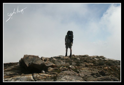
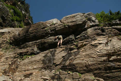
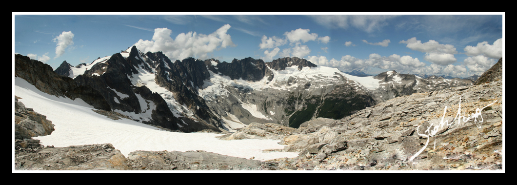
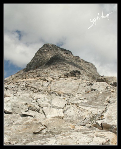
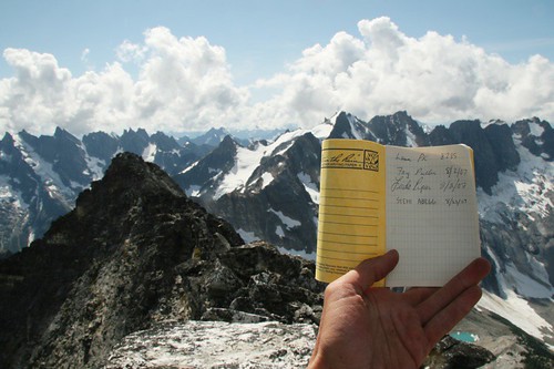
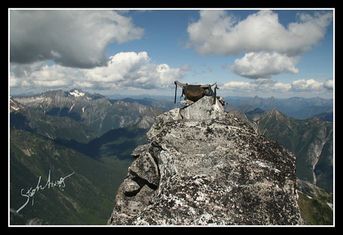
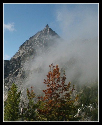
So, I climbed Luna Peak via the SW ridge, which was a fun Class 3 route with great views of the Southern and Northern Pickets.

The next day, we headed out via Access Creek, which was a pretty mellow three hours of bushwhacking with the occasional bootpath. It was much easier than our approach via the unnamed drainage just north of Access Creek, and compared to Luna Creek it was an open meadow!

Overall, I was quite disappointed that the grand Pickets traverse I had planned did not work out as planned, for the second time. However, Douglas and I both came out in one piece with some more off trail experience, I still have my rope and tent, and I got some good photos and made a successful climb of Luna Peak.

Scroll down for some photos and more detailed commentary. 

Trip Report by Day

CLICK ON DAY TO DROP DOWN CONTENT

DAY 1 - AUG 21
Ross Lake to the headwaters of the unnamed creek just north of Access Creek (water taxi + 12 miles on trail + 3 miles bushwhacking)
Doing the first 6 miles of trail the easy way. We paid $35 to take a water taxi to the Big Beaver Trailhead on Ross Lake, since this would allow us to hike all the way to the Access Creek headwaters the first day.
Looking across Big Beaver Creek towards the Access Creek drainage. This is the drainage we should have taken, but we did not think we had hiked the 1.5 miles north of Luna Camp (as detailed in the Beckey guide) so we made an incorrect assumption that the correct drainage was the one to the right. Also, visibility was poor and we had made a bad decision not to bring a map of the approach with us.
Looking toward the next drainage north of the Access Creek drainage. We ascended up this drainage, which was not overly heinous, but was more difficult than Access Creek and resulted in our having to drop down to the headwaters of Access Creek the next day.
Our camp at the headwaters of the unnamed drainage just north of Access Creek.

DAY 2 - AUG 22
Headwaters of unnamed creek to headwaters of Access Creek (~2 miles of cross country travel)
Confusion on the NE ridge of Luna….When we got to the ridge above the headwaters of the unnamed drainage, we realized our mistake (visibility had been poor enough thus far that we had not clued into our mistake until the clouds cleared and we got a view of Luna, from an angle we should not have seen it from!).
We had to descend a gully down to the Access Creek headwaters. As gullies are, it was tedious, involving a lot of cliffy downclimbing….
….pack-lowering….
….rappelling.
The gully we came down is the one extending up from the snowfield on the left-center of the photo. It was a tedious 4 hours.
Nice camping at the headwaters of Access Creek. The east side of Luna Peak is at the head of the cirque.
Nice camping at the headwaters of Access Creek.
Extra protein!

DAY 3 - AUG 23
Climb of LUNA PEAK from Access Creek headwaters (~2 miles and 4000ft elevation gain from camp to the summit of Luna)
The northern and southern Pickets from the summit of Luna Peak. What a view!
To continue the traverse to Luna, you ascend the green dirt-filled gully on the left-center of the photo to the 5800ft col. It took me just over 1 hour from our camp to get to the col.
Luna Peak is on the right and Luna-McMillan col is on the left. It is a pretty easy traverse to the Luna-McMillan col, about 1.5 hours from the 5800ft notch at the head of Access Creek to the col.
Southern Pickets from the traverse over to Luna Col.
Northern Pickets from Luna Col. Fury dominates on the left.
Looking up the SW ridge of Luna from Luna Col. 1000ft of Class 3 scrambling from here to the summit (I did not find any of the Class 4 mentioned in the Beckey guide). It took me 30 minutes to get to the first summit and 6 more minutes to get to the second (higher) summit.
Lunch at Luna Col….
A new summit register on the top of Luna. The last people who had climbed Luna (and found and signed the register) were on August 2.
My reliable climbing companion on the summit of Luna Peak.
Luna Peak has one of the best summit views in all of the Cascades! Someday the Pickets Traverse will work out for me and I will get to Fury, across Picket Pass, and to the Southern Pickets.
Looking down at the Access Creek drainage (left) and McMillan Creek drainage (right), which join into the Big Beaver Drainage.
Night view over Luna from our camp at the headwaters of Access Creek.

DAY 4 - AUG 24
Headwaters of Access Creek to Big Beaver Trailhead (~3 miles of bushwhacking, ~18 miles along the trail)
The descent down Access Creek is pretty straightforward. We stayed on the north side of the creek on talus fields until around 3700ft, then crossed over to the south side and bushwhacked down to the Big Beaver Creek. It took us 3 hours to get from the headwaters to the Big Beaver trail. Compared to Luna Creek, Access Creek is an open meadow.
Bushwhacking on the north side of Access Creek. A bit brushy, but not too bad.
We found a nice log crossing just north of where Access Creek meets Big Beaver Creek.
Colorful mushroom in Access Creek.
We built a cairn on the trail where we thought would be a good location for other Picketeers to cut off towards Access Creek. Having a cairn here would have saved us the hassle of ascending the wrong drainage.
Where Big Beaver Creek meets Ross Lake. Since we had no water taxi reservations this time, we hiked the 6 extra miles along Ross Lake back to the parking lot.
There is a really nice bridge at the crossing of Big Beaver Creek where it enters Ross Lake.

Photos from my Parents' Traverse of the Northern Pickets in 1981 

Twenty-six years ago (2 years before I was born), my parents did a traverse of the Northern Pickets. They hiked up Access Creek to the Luna-McMillan Arm, climbed Luna and Fury, descended down into Luna Basin and then up the other side to the Challenger Arm, climbed Challenger, and then hiked out via Wiley Ridge.

It is interesting to compare some of the photos I took with the photos they took during their trip in 1981. To see more, go to my photo comparisons page

My Next Attempt at the North to South Pickets Traverse


August 2008 Sometimes the best trips take more than one attempt. A trip of a lifetime.

Luna Peak from Various Angles

The following six photos show Luna Peak from various angles. The typical view of Luna is from the north to west.
Luna Peak from the NORTH on Wiley Ridge.
Luna Peak from the WEST near the summit of Challenger.
Luna Peak from the SOUTHWEST as seen from Luna Col.
Luna Peak from the SOUTHEAST on the approach above the McMillan drainage.
Luna Peak from the EAST at the headwaters of Access Creek.
Luna Peak from the NORTHEAST on the NE rib north of the headwaters of Access Creek.

Comments Pertaining to this Page / Trip Report

Useful beta. Updated route information. Corrections. Historical notes. Interesting facts. No fluff please.
Leave a Reply

Your email address will not be published. Required fields are marked *