Complete Pickets Traverse North to South (climb Whatcom, Challenger, Fury North Buttress, Outrigger)

Complete Pickets Traverse

Route:

North to South

Climbs:
- Whatcom Peak, North Ridge (3rd)
- Mt. Challenger (glacier+mid-5th rock)
- Mt. Fury, North Buttress (5.8)
- Outrigger Peak (5th)

A complete traverse of the Picket Range from the North to South. 3 nights in a snowstorm on the summit of Mt. Fury.

Region: Washington
Elev: 7,600-8,300 ft
Rock type: Gneiss / Granodiorite
Type: 
Date(s): August 5-12, 2008 (Tue-Tue)
Partner(s): Jason Schilling, Donn Venema

Route Overlays

CLICK TO ENLARGE

Map

CLICK TO ENLARGE

To make the labeled poster of the Pickets (see also my labeled poster of the North Cascades), I used an illustration by Heinrich Berann (1915-1999), father of the modern panorama map. Berann was known for his unorthodox habits of landscape manipulation, such as rotating mountains, widening valleys, and vertically exaggerating features. Berann painted four panoramas for the U.S. National Park Service (NPS) that demonstrated his genius for landscape visualization: North Cascades National Park (1987), Yellowstone National Park, Yosemite National Park, and finally Mt. McKinley National Park (1994). His work is now in the public domain and can be found here.

Labeled Panoramas

CLICK TO ENLARGE

Intro

THIS TRIP REPORT IS STILL MOSTLY IN THE EMBEDDED HTML FORMAT OF MY OLD WEBSITE.

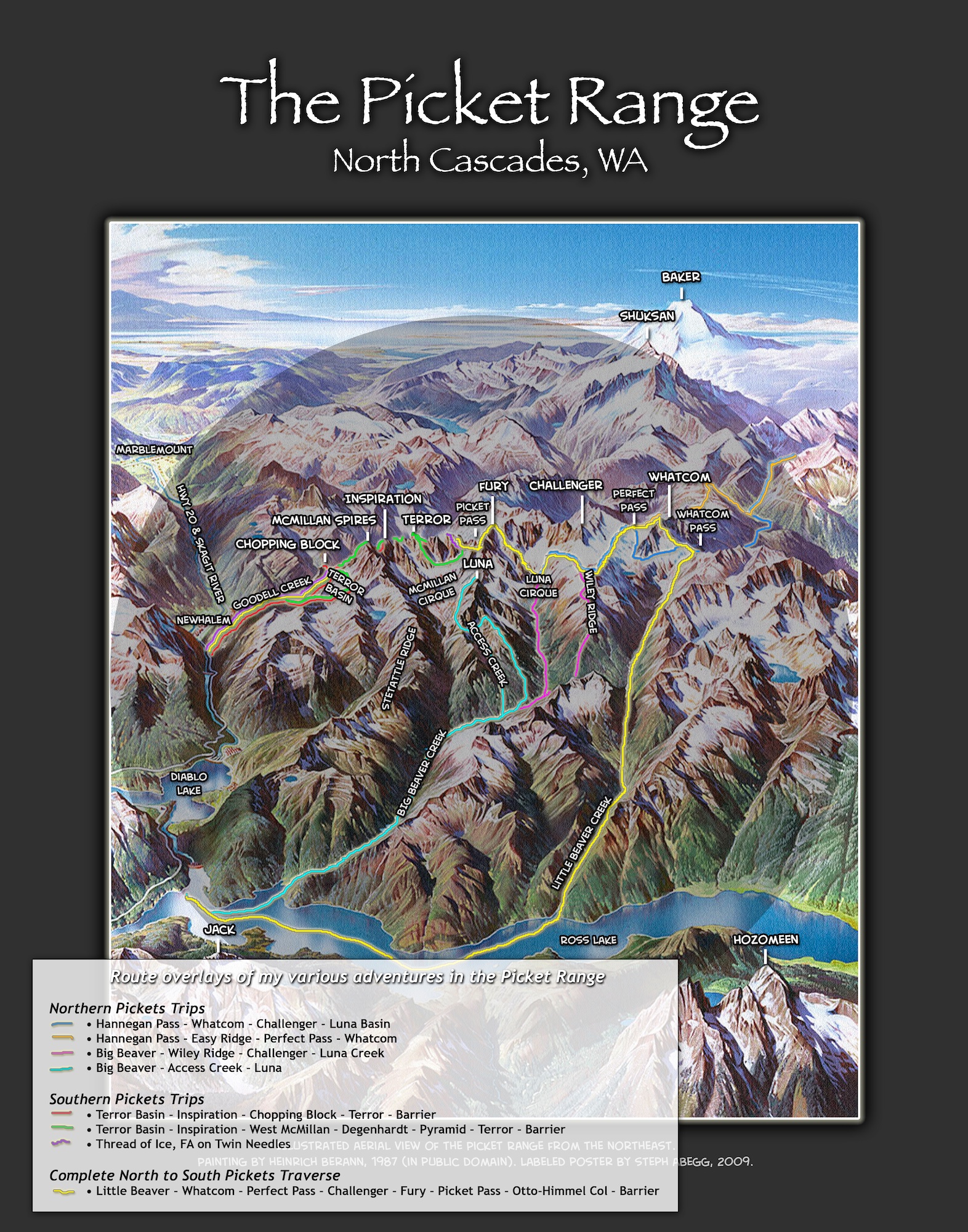
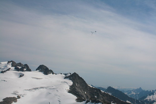
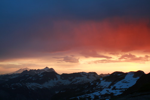
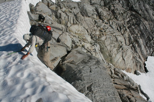
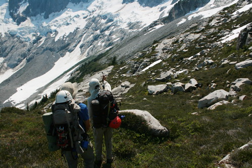
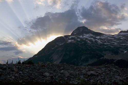
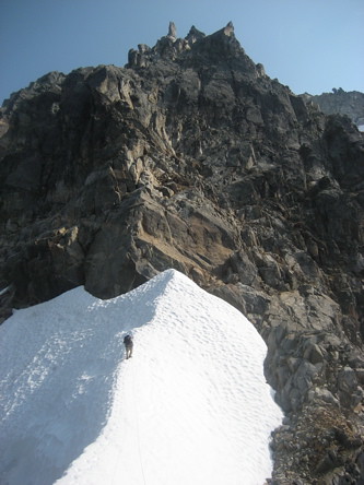
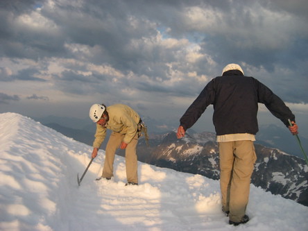
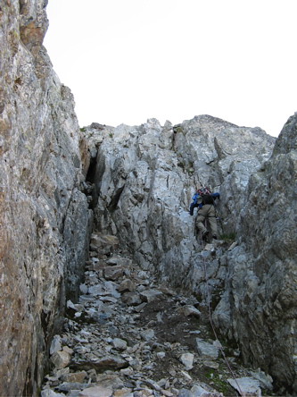
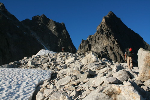
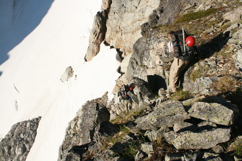
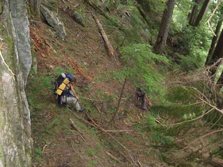
Because of its rugged terrain, the Picket Range has remained the wildest and most unexplored region in the North Cascades. Its isolated brushy valleys, jagged ridges, long and steep climbs on mixed terrain, and variable conditions present an array of mountaineering challenges and spectacular scenery. Just the kind of adventuring I love to do!

In the summer of 2007, I twice attempted to make a complete North to South Pickets traverse. However, both times the trip was "Picketed." (Links to Pickets Adventure July 2007 and Pickets Adventure August 2007.)

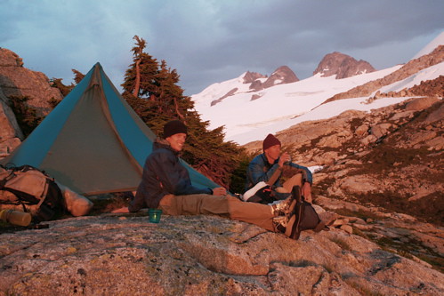
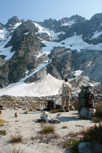
However, it is the challenge and ruggedness that are the essence of the Pickets, and keep me coming back time and time again. It wouldn't be fun if it were easy! So, In August 2008, I set out on the trail with Donn Venema and Jason Schilling for my third attempt of the North to South Pickets traverse. After a successful 
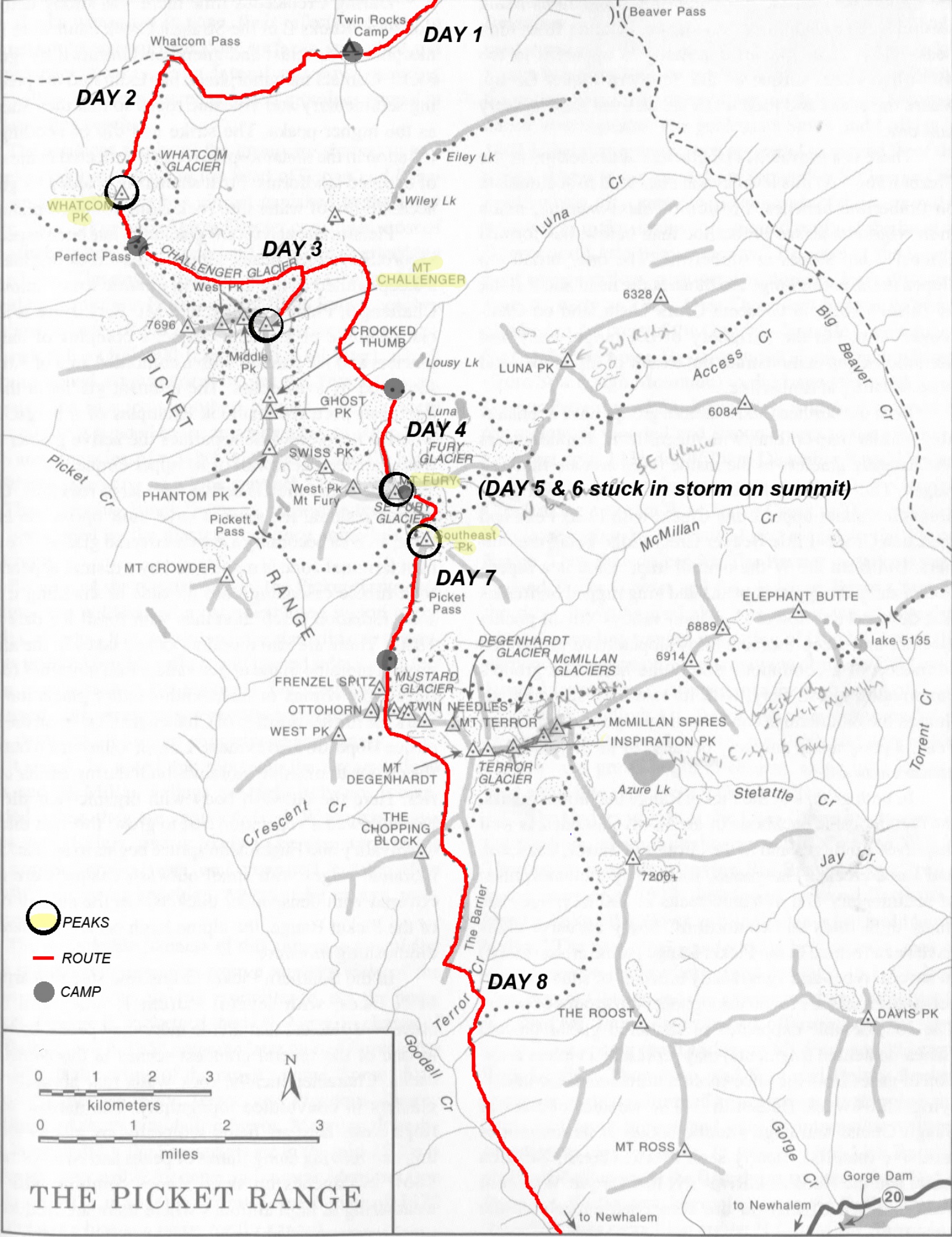
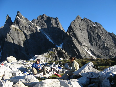
5-day "pre-adventure" in the Southern Pickets in July 2008, it was with anticipation that we set out on a complete Pickets traverse on August 5, 2008, at the beginning of what we knew would be a great adventure.

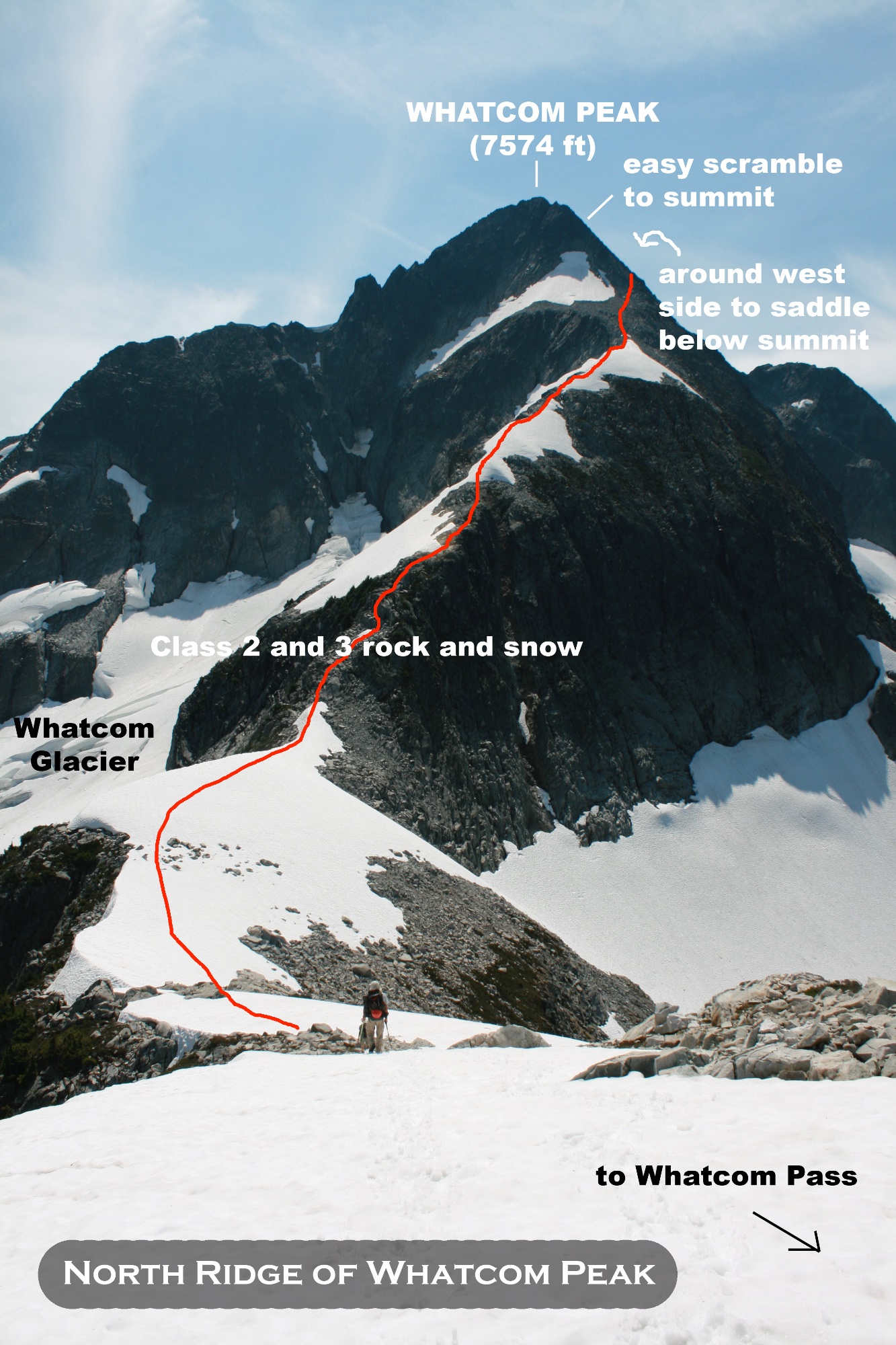
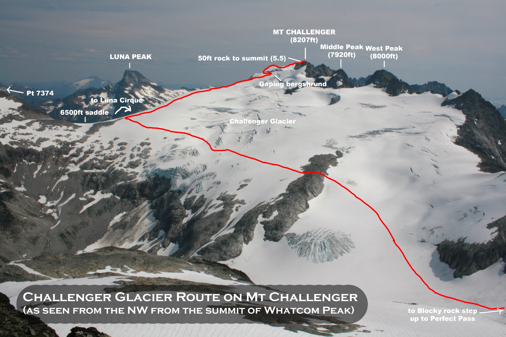
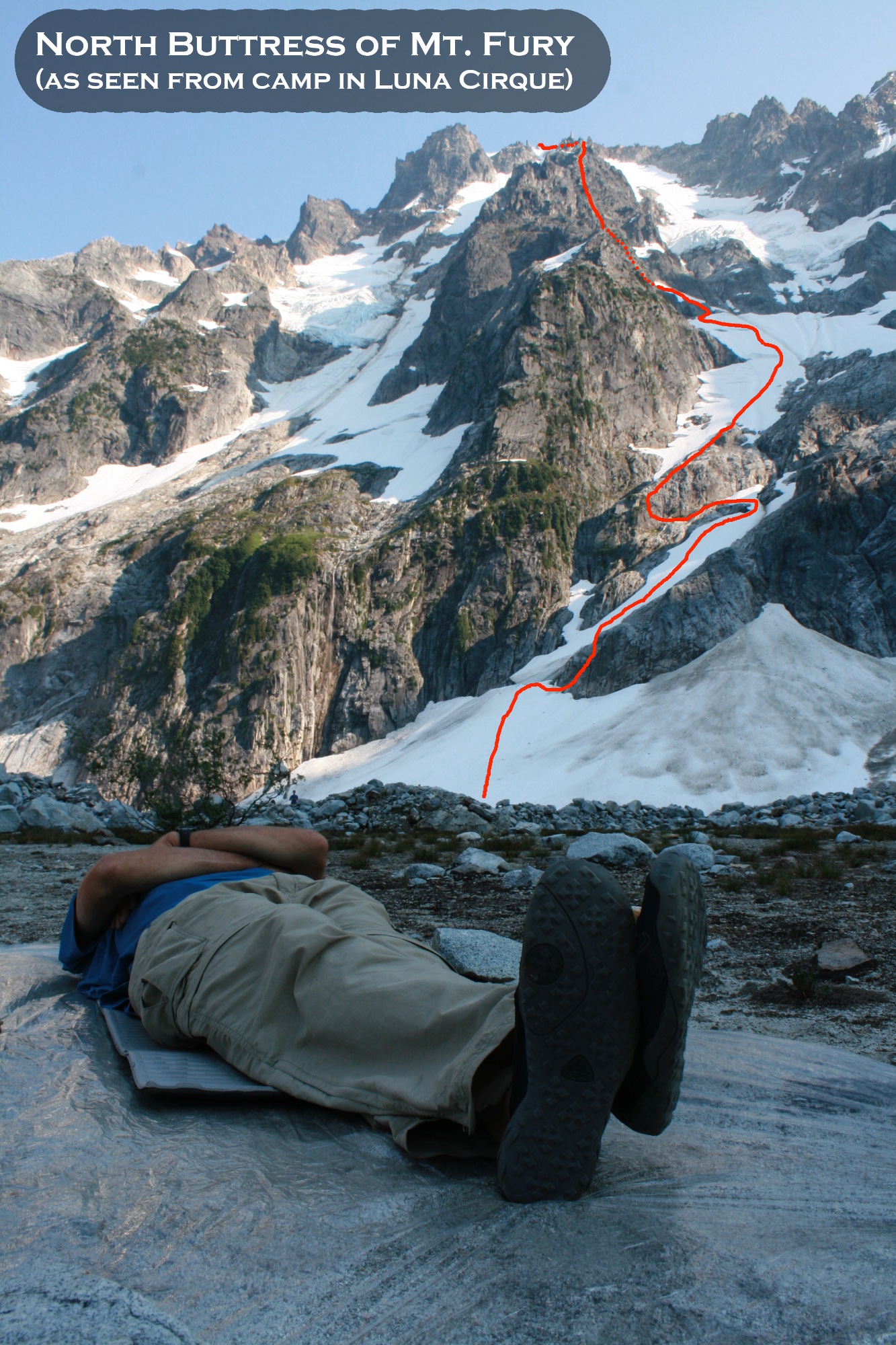
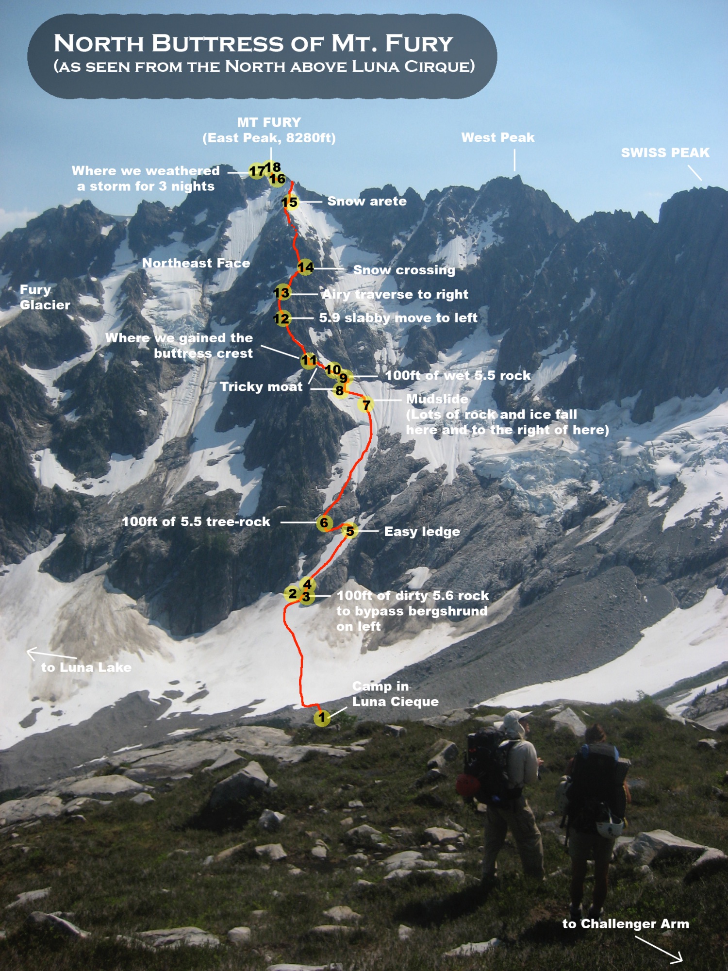
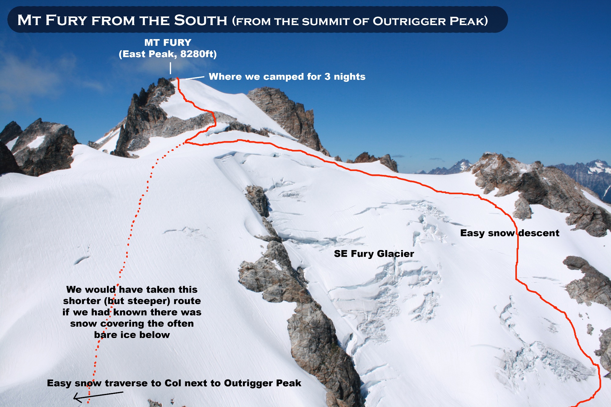
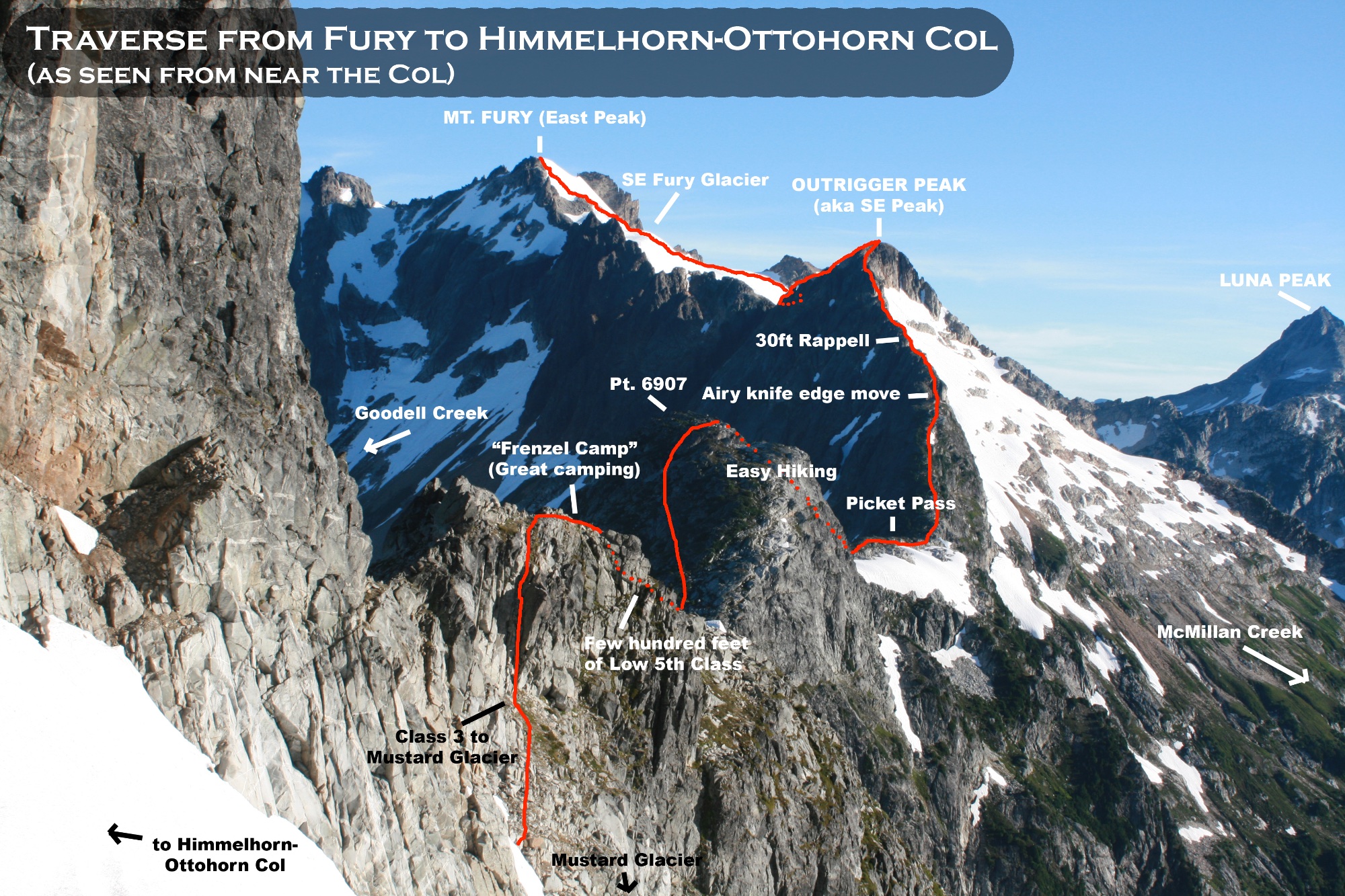
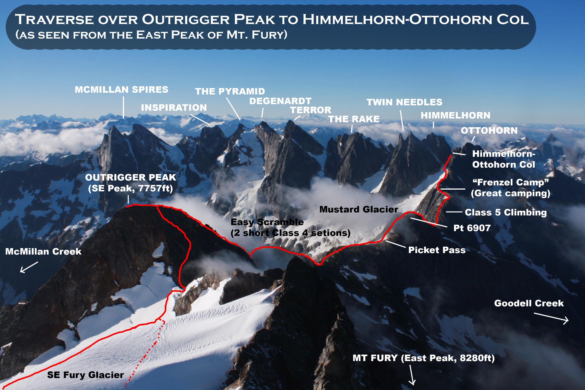
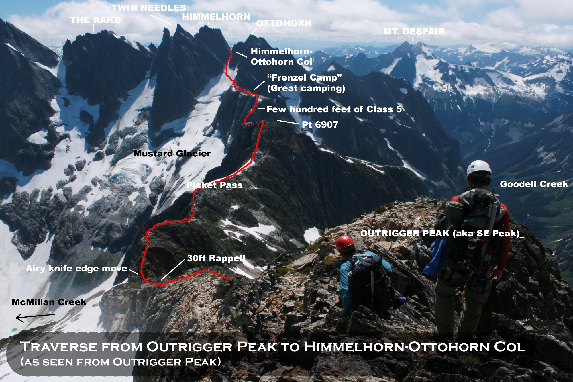
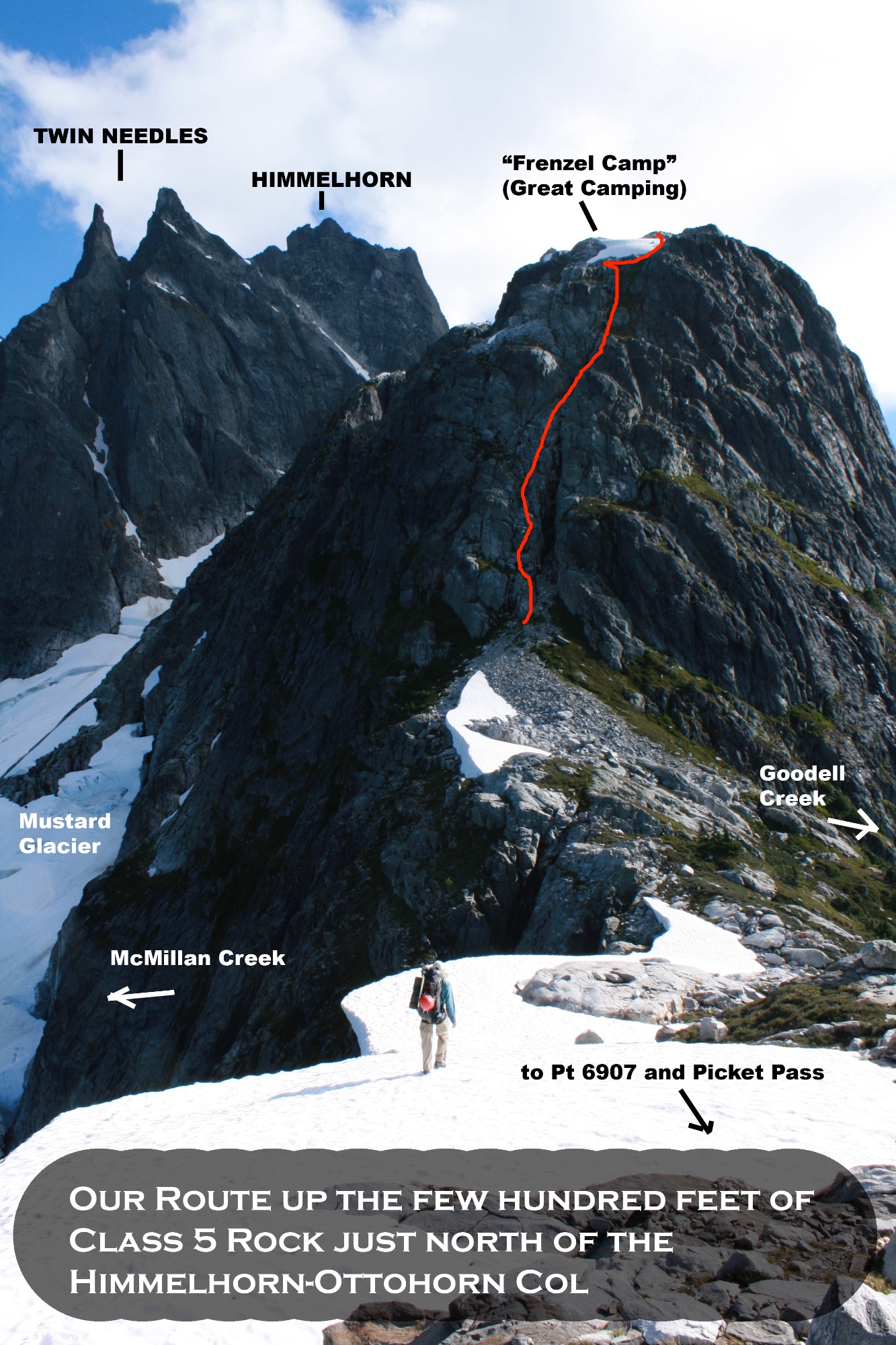
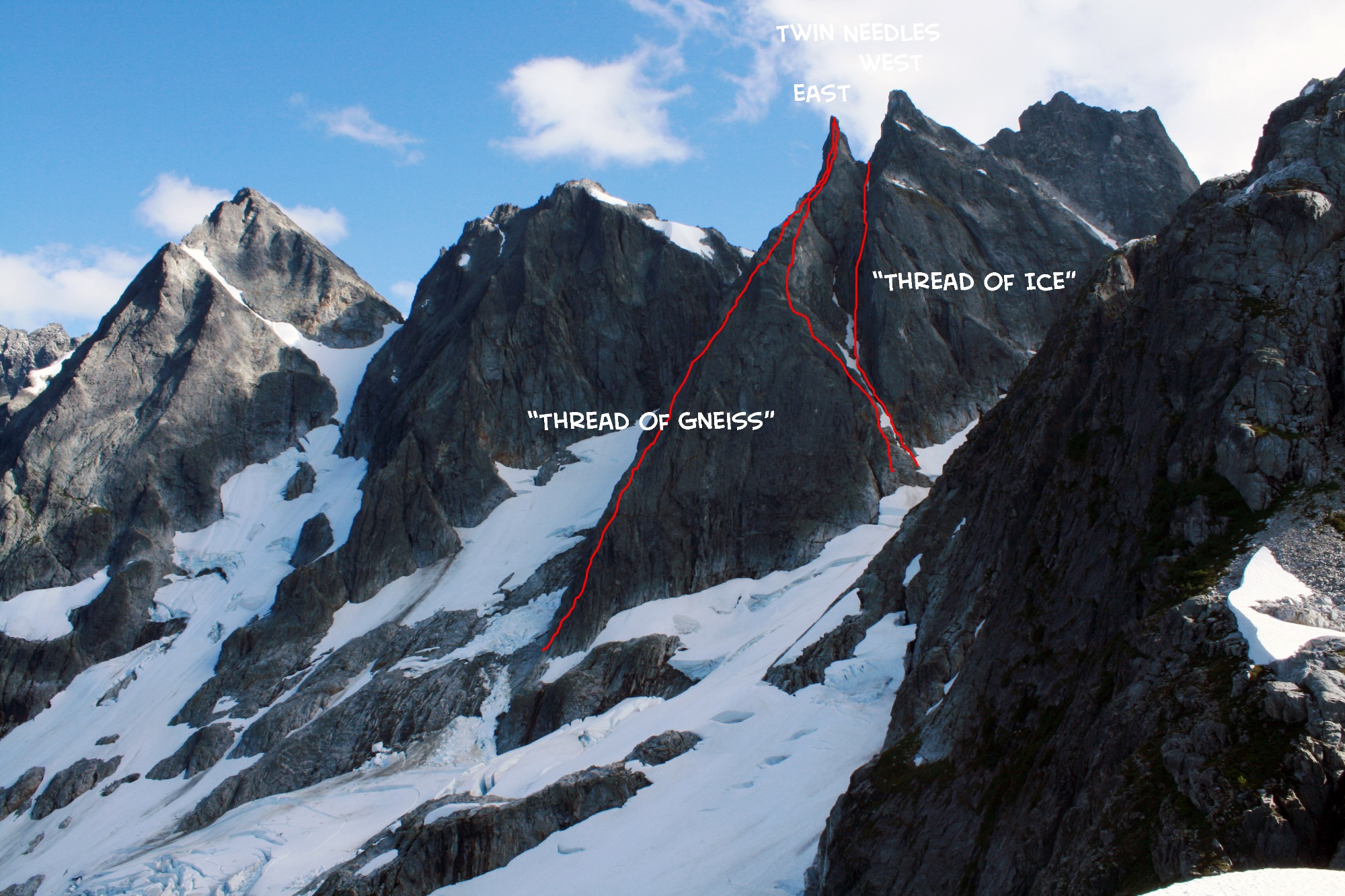
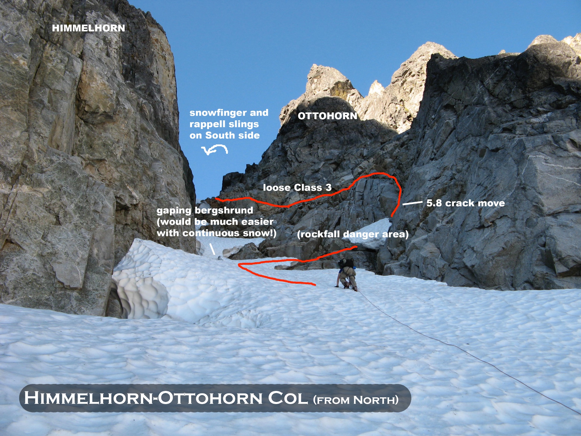
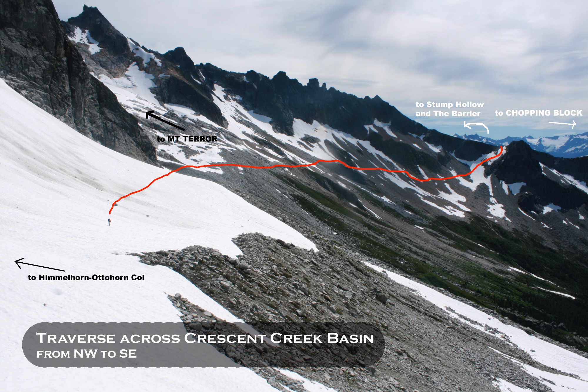
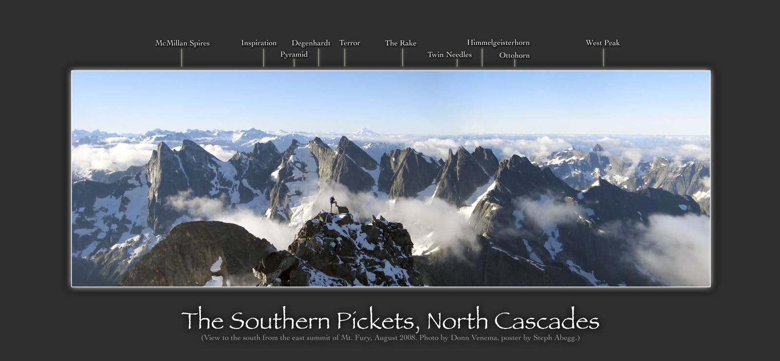
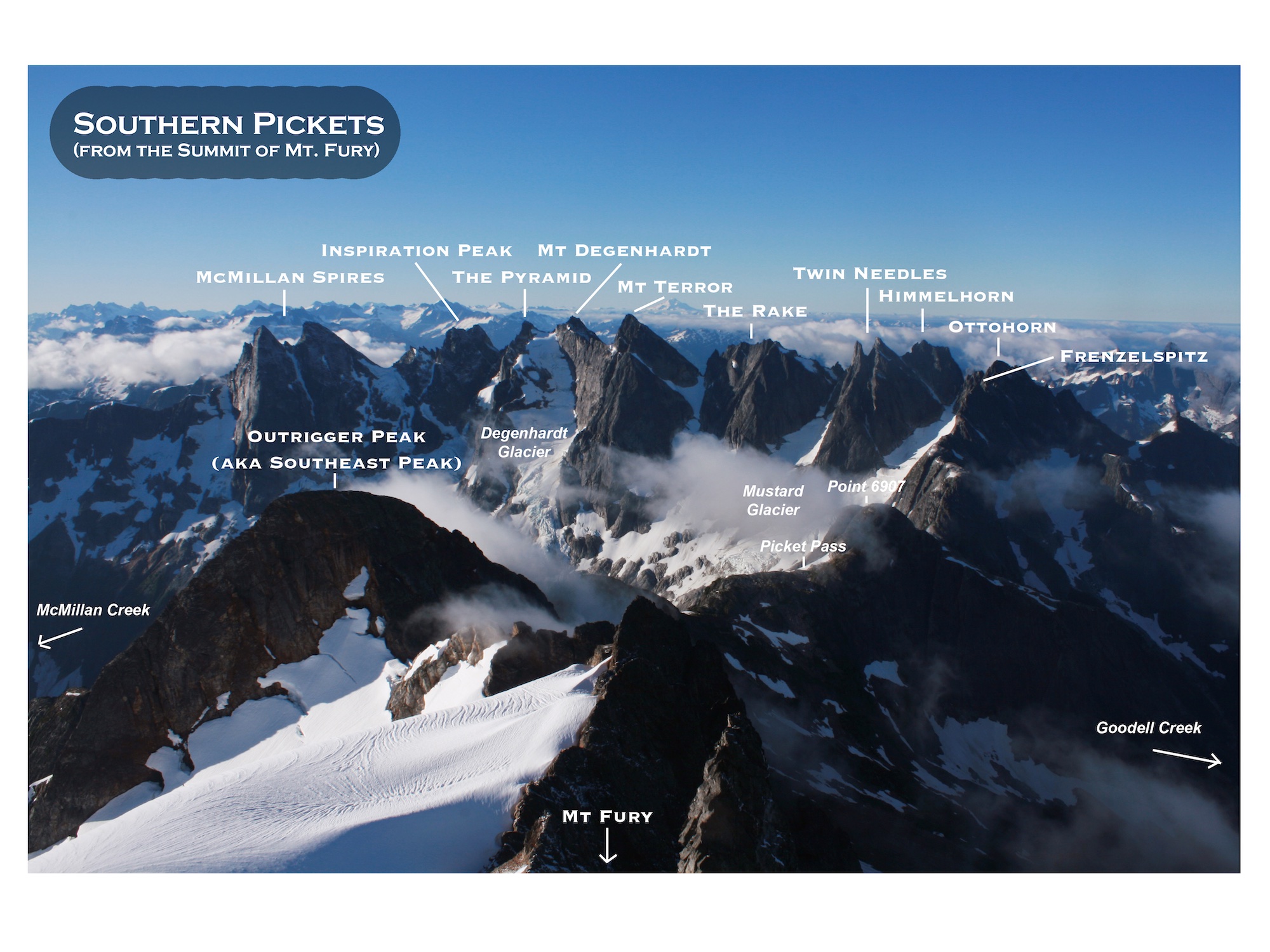
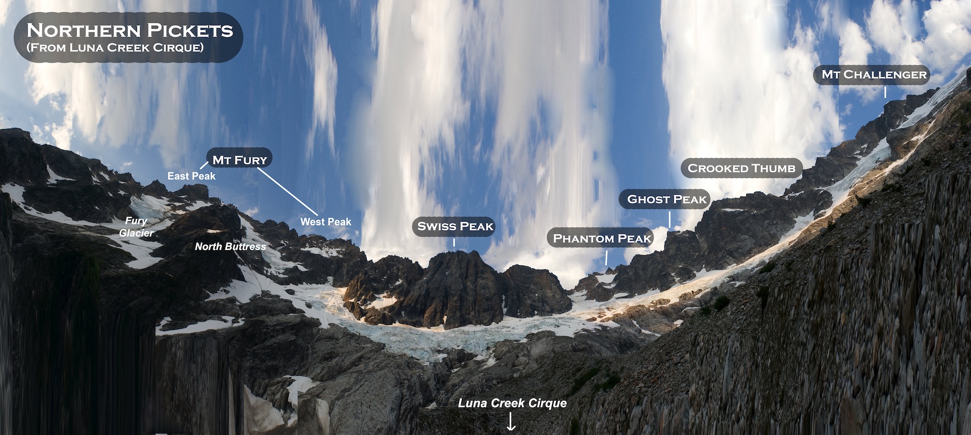
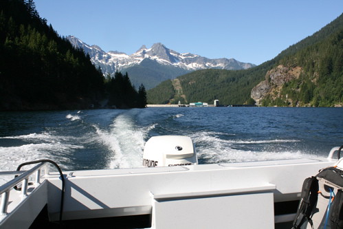
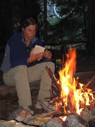
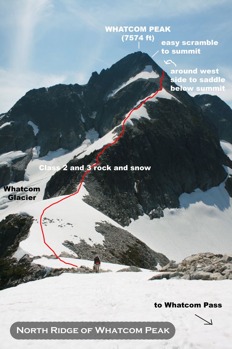
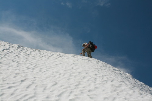
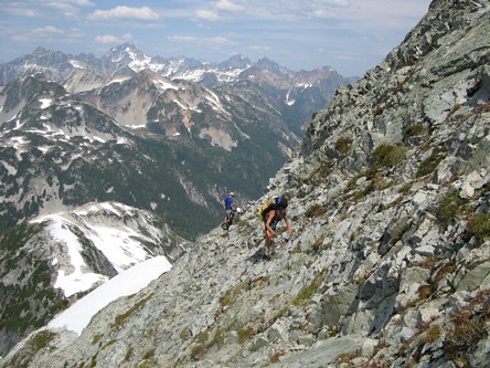
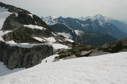
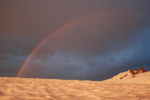
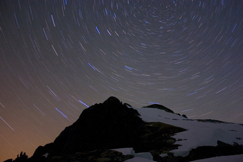
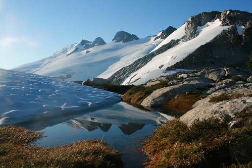
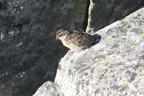
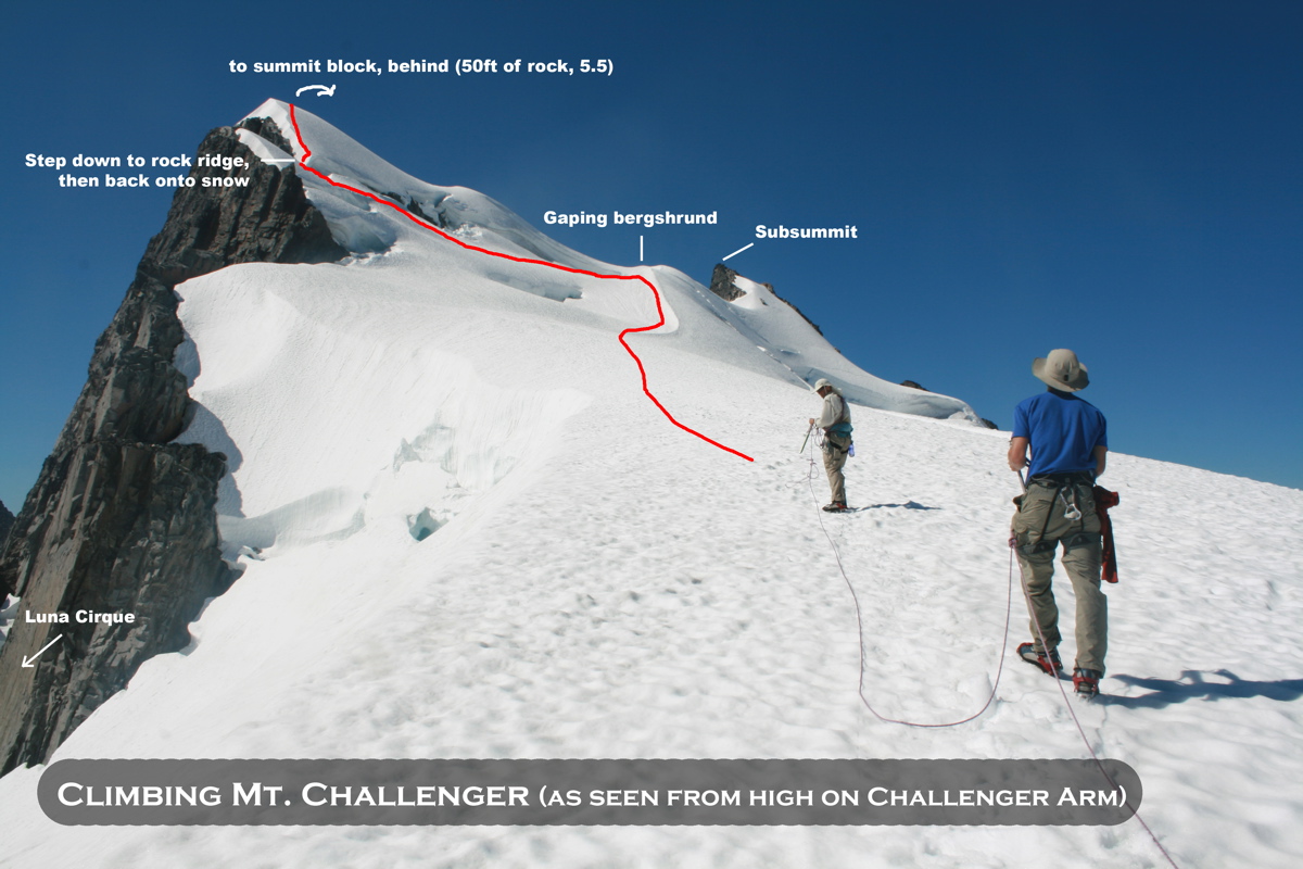
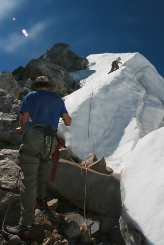
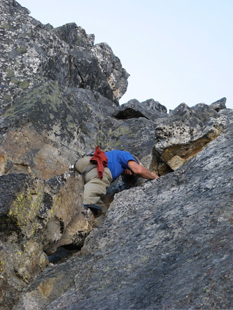
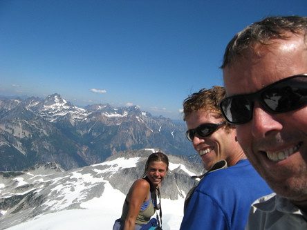
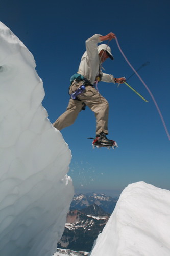
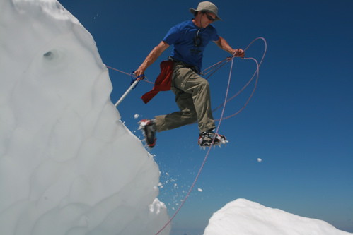
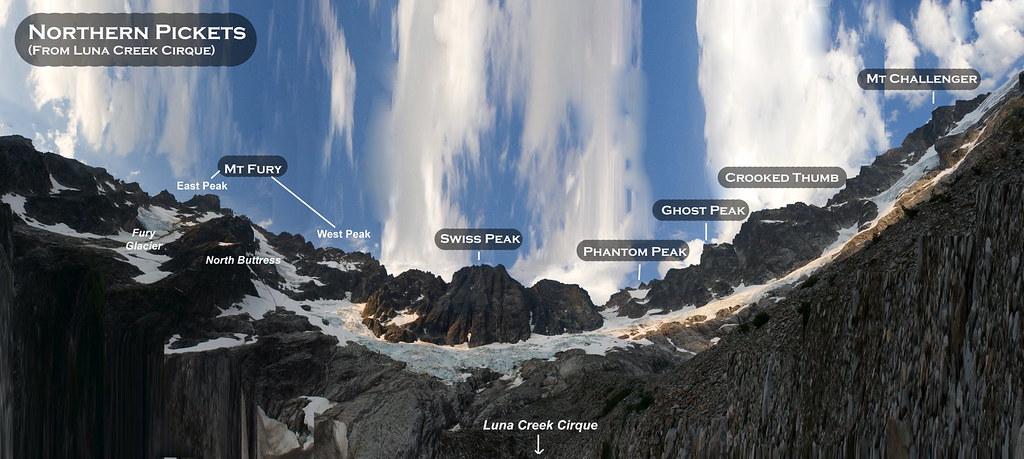
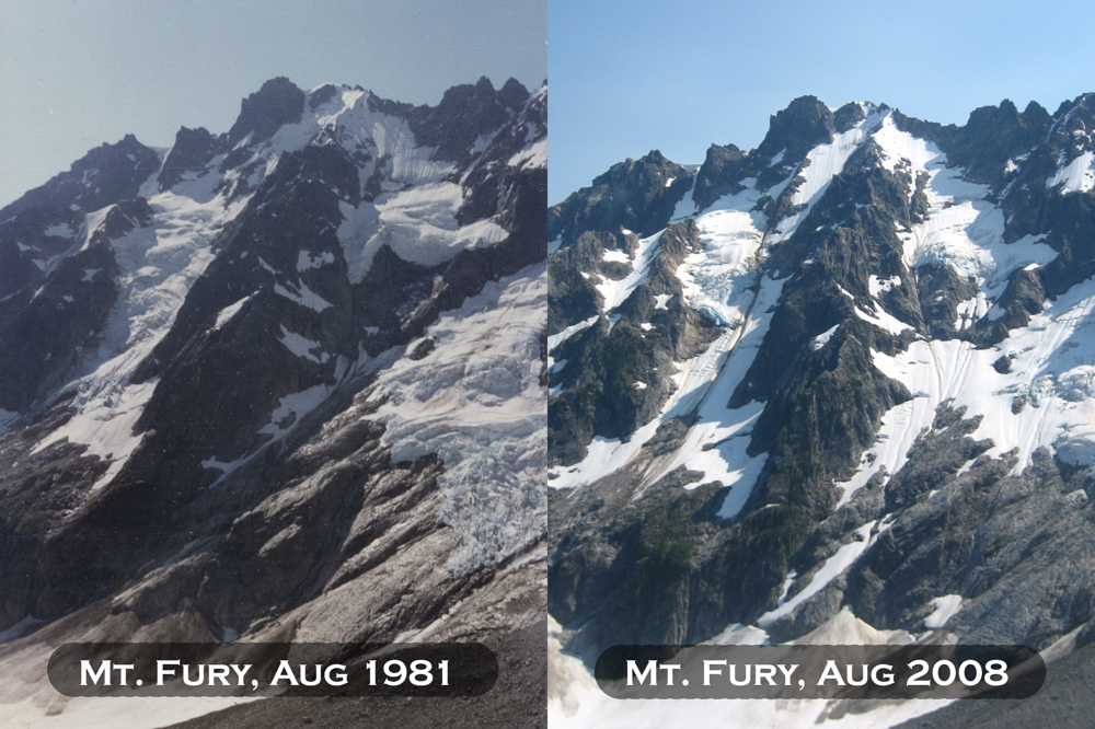
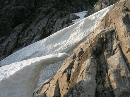
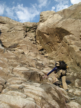
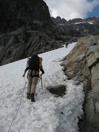
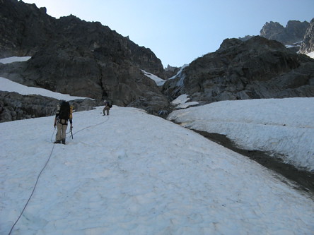
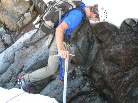
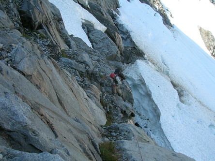
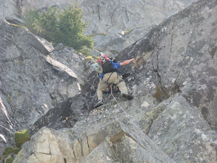
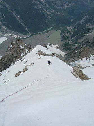
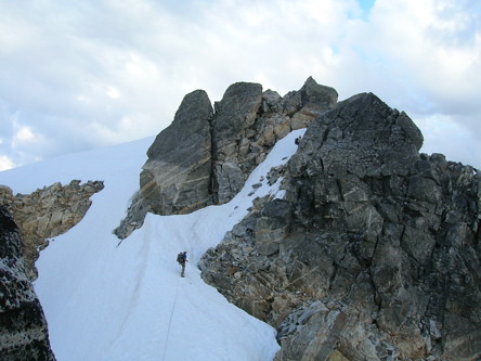
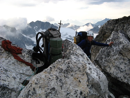
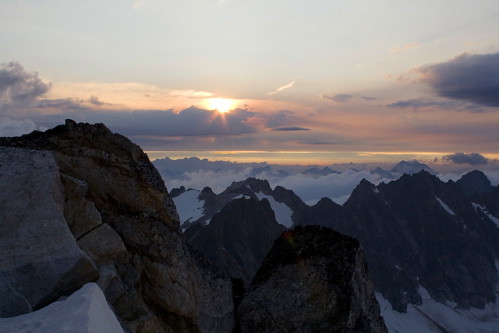
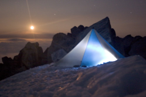
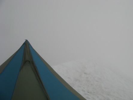
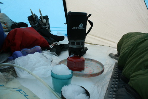
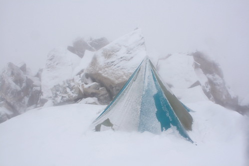
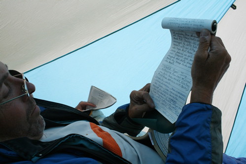
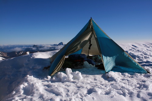
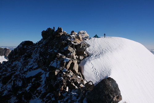
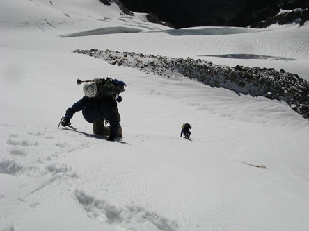
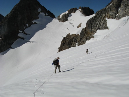
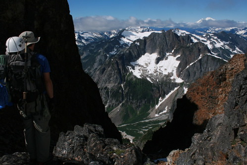
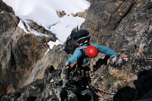
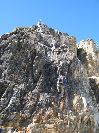
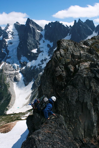
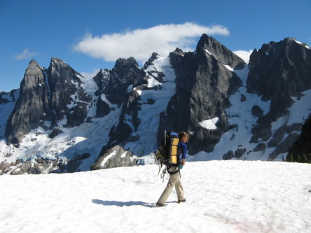
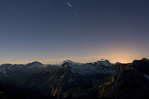
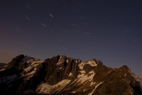
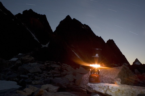
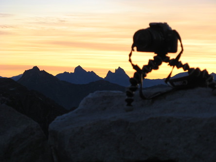
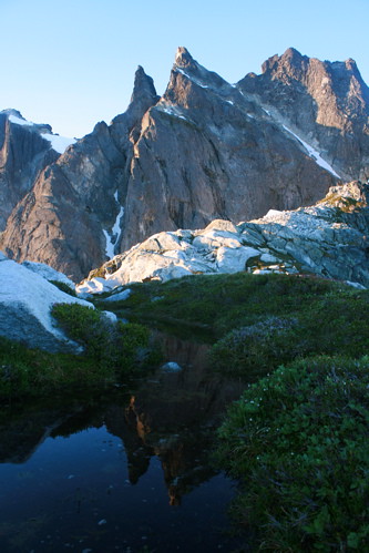
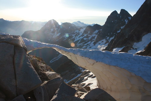
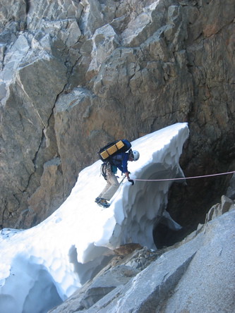
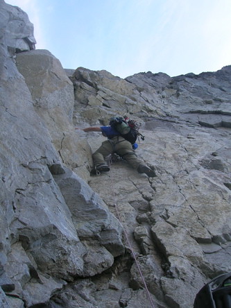
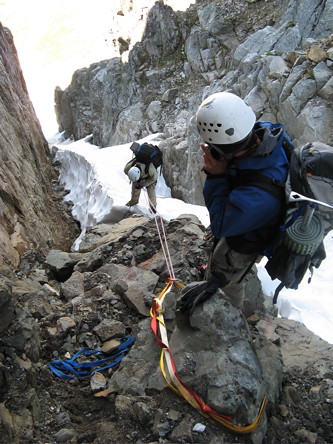
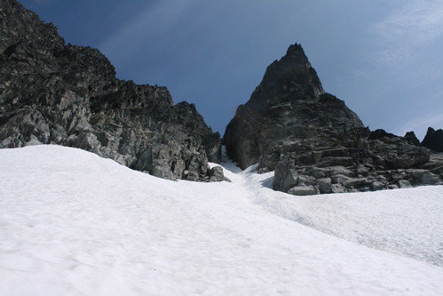
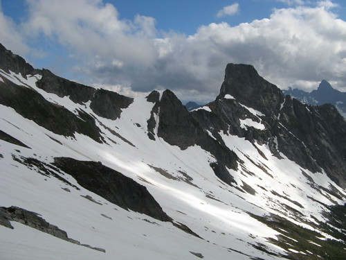
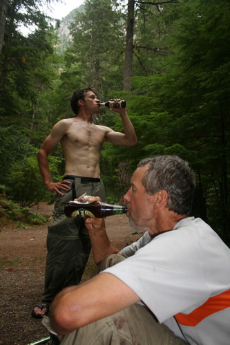
And a memorable adventure it was! We successfully completed the traverse, climbed 4 major summits, dealt with unexpected route finding and weather issues, finished a bottle of bourbon, spent an unforgettable 3 nights stuck in a snowstorm on the top of Mt Fury (which unfortunately caused us to have to bypass our planned ascent of the NR of Terror), developed bedsores, were treated to jaw-dropping scenery, and ran out of food by the final long day out. The following page gives several photos from our adventure.

Trip Report by Day

CLICK ON DAY TO DROP DOWN CONTENT

DAY 1 - AUG 5
Water Taxi on Ross Lake to Little Beaver Trailhead, and 14 miles of trail to Twin Rocks Camp
KEY ELEVATIONS: Little Beaver Trailhead: 1600ft, Twin Rocks Camp: 2700ft
To get to the Little Beaver Trailhead, you have to take a 30 minute water taxi across Ross Lake from the Ross Lake Resort.
$125 for the water taxi….
Crossing Redoubt Creek, about 4 hours into the hike up Little Beaver Trail.
Twin Rocks Camp (14 miles up the Little Beaver Trail) is right on Little Beaver Creek, so I enjoyed taking some long exposures of the creek.
Steph reading by the fire. (Photo by Donn.)

DAY 2 - AUG 6
3.5 miles on trail to Whatcom Pass, then a climb over the North Ridge of Whatcom Peak (Class 3) to Perfect Pass
KEY ELEVATIONS: Twin Rocks Camp: 2700ft, Whatcom Pass: 5200ft:, Whatcom Peak: 7574ft; Perfect Pass: 6240ft
Approaching Whatcom Peak from Whatcom Pass. The Little Beaver Trail ends at Whatcom Pass, but a path continues on a little ways towards Whatcom Peak.
We climbed over Whatcom Peak via the North Ridge to get to Perfect Pass on the other side. The ridge is Class 2 and 3 snow and rock.
Donn kicking steps up snow on the ridge.
Class 3 scrambling around the upper west side of Whatcom Peak. (Photo by Donn.)
We arrived on the summit of Whatcom in the early afternoon, so we relaxed in the warm summit breeze for awhile, enjoying the sweeping views of the Challenger Glacier (behind in photo).
When we were on he summit of Whatcom, some fighter planes flew over Mt. Challenger (maybe from the Abbotsford Air Show?).
A 10 minute descent to Perfect Pass via a snowfield on the south side of Whatcom Peak. We camped at Perfect Pass for the night.
Rainbow above Mt. Challenger. There were some rain clouds on the horizon, but fortunately the storms passed by without hitting us.
Another rainbow photo. It's not too often one is treated to a rainbow in the mountains.
Enjoying the evening at Perfect Pass.
Colorful evening light over Baker and Shuksan. There were some rain clouds on the horizon, but fortunately the storms passed by without hitting us.
Star streaks above Whatcom Peak.


DAY 3 - AUG 7
Climb of Mt. Challenger (Class 2 glacier, 50ft of 5.5 rock to summit) and traverse into Luna Cirque to a camp at the base of Mt Fury
KEY ELEVATIONS: Perfect Pass: 6240ft; Saddle on east side of Challenger Glacier: 6500ft; Mt. Challenger: 8207ft; Luna Cirque: 4000ft
Above: My dad on Mt. Challenger in August 1981, and Donn and I near the same spot in August 2008. Not much has changed in the last 27 years except the length of the shorts.
Reflection of Mt. Challenger in a tarn at Perfect Pass.
A baby White-tailed Ptarmigan at Perfect Pass.
Donn at the top of the Class 3 descent from Perfect Pass to Challenger Glacier. The trickiest part was negotiating the moat at the base.
Our route across the Challenger Glacier and then up the Challenger Arm to the summit. After the climb, we continued on to Luna Cirque where we would set up camp for the night.
Traversing the long and gentle Challenger Glacier. We dropped our packs near the saddle on the east end of the glacier, and headed up to the summit via Challenger Arm.
Our route up Challenger as seen from high on Challenger Arm. A gaping bergschrund cut into the standard route, so we had to drop onto the ridge on the left and then regain steep snow to get to the summit block.
To bypass a gaping bergschrund, we wrapped around to the ridge on the left.
Jason leading the fun 50 ft rock pitch (5.5) to the summit. There are 3 or 4 old pitons that we clipped slings to. (Photo by Donn.)
One of the old pitons on the final rock pitch. I wonder how old these are?
Bouldering onto the summit. (Photo by Jason.)
On the summit o Mt. Challenger. (Photo by Donn.)
Donn jumping the gaping bergschrund on the descent from Challenger (we had avoided this bergschrund on the way up, but jumped it on the way down).
Jason jumping the gaping bergschrund on the descent from Challenger (we had avoided this bergschrund on the way up, but jumped it on the way down).
Beginning the 2 hour traverse/descent into Luna Cirque.
The traverse down into Luna Cirque. The trick is to stay high until you get past the cliff bands and then you can easily descend on a snowfield.
1. There is a great flat and sandy camp spot in Luna Cirque below the North Buttress of Fury. The closest water is about 8 minutes to the west.
We brought a Frisbee to toss in Luna Cirque. The Frisbee was quite handy during the trip, especially for collecting snow and acting as a stove platform at our snowy camp on the summit of Fury.
The Northern Pickets towering above camp in Luna Cirque.
Star streaks above Fury.
Star streaks around Polaris. /font>

DAY 4 - AUG 8
North Buttress of Mt Fury (mixed snow and rock, mostly Class 3, 4, and low 5th, with a crux 5.9 move)
KEY ELEVATIONS: Luna Cirque: 4000ft; Mt. Fury: 8280ft
Above: A comparison of Fury from Luna Cirque, 27 years apart (photo on left from when my parents were in the Pickets in 1981 two years before I was born). The glaciers and snow arête near the summit have definitely gotten smaller. However, 2008 was a high snow year, so there is more snow lower down on the mountain than in 1981.

Above: The route up the North Buttress of Fury. There are several routedfinding challenges - a classic alpine route that sort of captures the essence of the Pickets! The numbers in the photo correspond to the numbered photos below.
We were hit by a wild thundershower during the night, and we had to scramble to set up the tent. But the storm passed and the sun came out in the morning.
2. A bergschrund forced us onto some rock to the right to regain the snow higher up.
3. Due to a bergschrund, we had to ascend a short section of rock (dirty 5.6) to regain the snow. (Photo by Donn.)
4. Ascending the snowfield near the base after bypassing the bergschrund. (Photo by Donn.)
6. At the top of the first snowfinger, we had to cross rock to get to another snowfinger. This required traversing an easy ledge and then doing 100ft of 5th Class tree climbing.
7. We quickly ascended the snowfield, since this snow finger lies under the hanging glacier where there is high rock and ice fall danger (note the rock slide area to the right). (Photo by Donn.)
8. A tricky moat. A couple of the moats were kind of tricky.
9. Some wet low 5th Class to the final snowfield.
10. The final easy snowfield before a short rock pitch to the buttress crest. (Photo by Donn).
11. Finally, the ridge crest! It took us 4.5 hours to get here from camp.
12. Jason on the crux (5.9?) slabby step to the left. We wondered if perhaps most climbers bypass this area by traversing ledges we saw to the left? The terrain got easier right above this. (Photo by Donn.)
13. Jason making the airy (but easy) traverse around the right side of the ridge. (Photo by Donn.)
14. Donn ascending a snowfield mid-climb. (Photo by Jason.)
15. Climbing the snow arête towards the summit. I really enjoyed kicking steps.
16. The final rock and snow scramble to the summit.
Steph arriving on the summit of Fury. (Photo by Donn.)
Clearing a flat spot in the snow for the tent. Our tent had no floor, so it was never quite warm and cozy on the summit. (Photo by Jason.)
18. Sunset from the summit.
17. A moonlit night on the summit.

DAY 5 - AUG 9
Stuck in a snow and rain and wind storm on the summit of Mt. Fury. We finish our books and our chocolate and bourbon supplies reaches dangerously low levels.
KEY ELEVATIONS: Mt. Fury: 8280ft
We woke up to a cold drizzle and poor visibility, and decided to spend a day in the tent since we didn't want to descend into unfamiliar terrain riddled with crevasses and steep ice we couldn't see.. (Photo by Donn.)
Melting snow for water. It was pretty cold on the summit, and since we were camping on snow it was difficult to stay warm and dry, but making hot tea and coffee helped, as long as we could spare the fuel….
Summit photo in our 8x8 unheated blue and white triangular jail cell.


DAY 6 - AUG 10
Second day stuck in a snow and rain and wind storm on the summit of Mt. Fury. The bedsores and butt-grooves deepen.
KEY ELEVATIONS: Mt. Fury: 8280ft
The second night was quite cold and windy and snowy, and conditions were even worse for descending the glacier, so we had to spend a second day on our summit bivy. The bourbon and chocolate supplies began to reach dangerously low levels. Wonder if 3 nights on the summit of Fury is a record…?
The summit register provided some entertaining reading when we finished our books and had to find some distraction from the bedsores and deepening butt-grooves (by some twist of gravity, Donn and Jason's butt-grooves began to slope together, and they would often wake up in the middle of the night practically on top of one another; my butt-groove, on the other hand, began to send me on a slow-motion slide out of the floorless tent).
We got to know the inside of a Mega Light tent pretty well. We had initially planned on climbing the North Ridge of Terror, but the 2 extra nights stuck in a storm on the summit of Fury imposed time and food constraints and we had to leave the climb of the North Ridge of Terror for a future trip.


DAY 7 - AUG 11
Traverse from Fury over Outrigger Peak (Class 3, 4, and low 5th) to Frenzel Camp (on ridge past Picket Pass)
KEY ELEVATIONS: Mt. Fury: 8280ft, Outrigger Peak: 7757ft; Picket Pass: 6400ft; Frenzel Camp: 6800ft
And the third morning we woke up and unzipped the tent door to….clear blue skies above and clouds blanketing the peaks below! A beautiful morning in the heart of the Pickets.
Wonder why no one's in the tent?
Steph striking the classic pose on the knoll just south of the summit of Fury. (Photo by Donn.)
The traverse from the summit of Fury to Himmelhorn-Ottohorn Col, as seen from the summit of Fury. We had initially planned on climbing the North Ridge of Terror, but the 2 extra nights stuck in a storm on the summit of Fury imposed time and food constraints and we had to leave the climb of the North Ridge of Terror for a future trip.
Looking back towards our camp on the summit where we spent 3 nights. Wonder if that's a record?
Our descent route down the SE glacier on Fury toward Outrigger Peak. We did a longer and more gradual descent than necessary, since we assumed that the steep glacier on the left in the photo would be steep bare ice (as it usually is in the summer) but when we got below it we saw that it would have been a quicker line of descent.
Descending steep snow on the SE Glacier just below the summit. (Photo by Donn.)
Donn enjoying a cigar on the easy glacier descent.
Approaching the col just north of Outrigger Peak (left in photo) from the SE Glacier on Fury. (Photo by Donn.)
We had initially decided to get to Picket Pass by descending toward Goodell Creek and then making a level traverse to Picket Pass, but when we looked at the steep and loose descent on the other side of the col, we decided we would rather climb over Outrigger Peak.
Donn climbing the low 5th Class rock toward the summit of Outrigger Peak.
The three of us enjoying good weather (finally!) on the summit of Outrigger Peak.
The traverse from Outrigger Peak past Picket Pass and to Himmelhorn-Ottohorn Col. We had initially planned on climbing the North Ridge of Terror, but the 2 extra nights stuck in a storm on the summit of Fury imposed time and food constraints and we had to leave the climb of the North Ridge of Terror for a future trip.
The first non-Class 2/3 section of the traverse between Outrigger Peak and Picket Pass: A short 50ft rappel. (Photo by Donn).
The second non-Class 2/3 section of the traverse between Outrigger Peak and Picket Pass: A short exposed knife edge section of the ridge.
Great views of the Southern Pickets from Picket Pass. The striking North Ridge of Terror beckoned us and loomed ever closer as we traversed the ridge, but due to our 2 extra nights stuck in a storm on the top of Mt. Fury, we had to leave this climb for later. (Photo by Donn.)
Shortly after hiking over Picket Pass and Point 6907, we had to climb up a few hundred feet of Class 5 rock, which we simulclimbed. We planned to camp just above this step in the ridge, at a place referred to as "Frenzel Camp" in one trip report we had come across.
Jason ascending the Class 5 hump we simulclimbed. (Photo by Donn.)
Enjoying the soft heather and warm boulders at "Frenzel Camp". Sure beats being stuck in a tent sleeping on snow! (Photo by Donn.)
Sunset behind Baker and Shuksan.
Star streaks and night colors over Baker and Shuksan.
Star streaks over Terror, The Rake, and Twin Needles.
Star streaks over Mt Fury.
Making a cup of coffee to enjoy the starry night and burn extra fuel. Himmelhorn-Ottohorn col in background.

DAY 8 - AUG 12
Traverse through Himmelhorn-Ottohorn Col (loose Class 5), across Crescent Creek Basin, and a steep and brushy descent along the crest of the Barrier, across Terror Creek, and to Goodell Creek trailhead
KEY ELEVATIONS: Frenzel Camp: 6800ft; Himmelhorn-Ottorhorn Col: 7400ft; Where we crossed Chopping Block ridge: 6400ft, Timberline on Barrier crest: 5600ft, Leave Barrier crest to descend towards Terror Creek: 3600ft, Cross Terror Creek: 2000ft, Intersect Goodell Creek Trail: 1700ft, Trailhead: 600ft
My camera and tripod all set for sunrise photos. (Photo by Donn.).
Packing up in the morning sun. Baker and Shuksan in the distance.
Twin Needles in morning sun at our water source near camp.
Snow Arch overlooking the Mustard Glacier.
Approaching the Himmelhorn-Ottohorn Col from Frenzel Camp.
An easy Class 3 descent from the ridge down to the snow leading up to the Himmelhorn-Ottohorn Col.
Looking back at the traverse from Fury to the Himmelhorn-Ottohorn Col.
The ascent up to Himmelhorn-Ottohorn Col from the north. Due to a bergschrund, we had to do some climbing on the rock, which was not trivial (loose Class 5). (Photo by Donn.)
Steph negotiating the moat below the bergschrund. (Photo by Jason.)
Jason leading the loose fifth class section we had to climb because of the bergschrund. In this photo he is at the crux move, which seemed like 5.8….
Rappelling down into Crescent Creek Basin from the Himmelhorn-Ottohorn Col. There were 3 rappel anchors, after which we just kicked down the snowfinger that ran most of the way up the notch on the south side. (Photo by Donn.)
Looking back up at the snowfinger ascent up to the Himmelhorn-Ottohorn Col from Crescent Creek Basin.
Traversing Crescent Creek Basin. A lot less snow now than there was when we were here in mid-July!

Here is a photo of Crescent Creek Basin taken in mid-July. The snow made for quicker travel.
Descending the path along the crest of the Barrier. (Photo by Donn.)
Balloon marking the turnoff off the Barrier crest at 3600ft to begin the descent down to Terror Creek.
Despite the balloon on the tree, we couldn't find the "trail" down to Terror Creek…. (Photo by Donn.)
The Goodell Creek trail. Only 4 more miles to go!
Celebration at Goodell Creek trailhead.


Comments Pertaining to this Page / Trip Report

Useful beta. Updated route information. Corrections. Historical notes. Interesting facts. No fluff please.
Leave a Reply

Your email address will not be published. Required fields are marked *