Prusik Peak
Route:
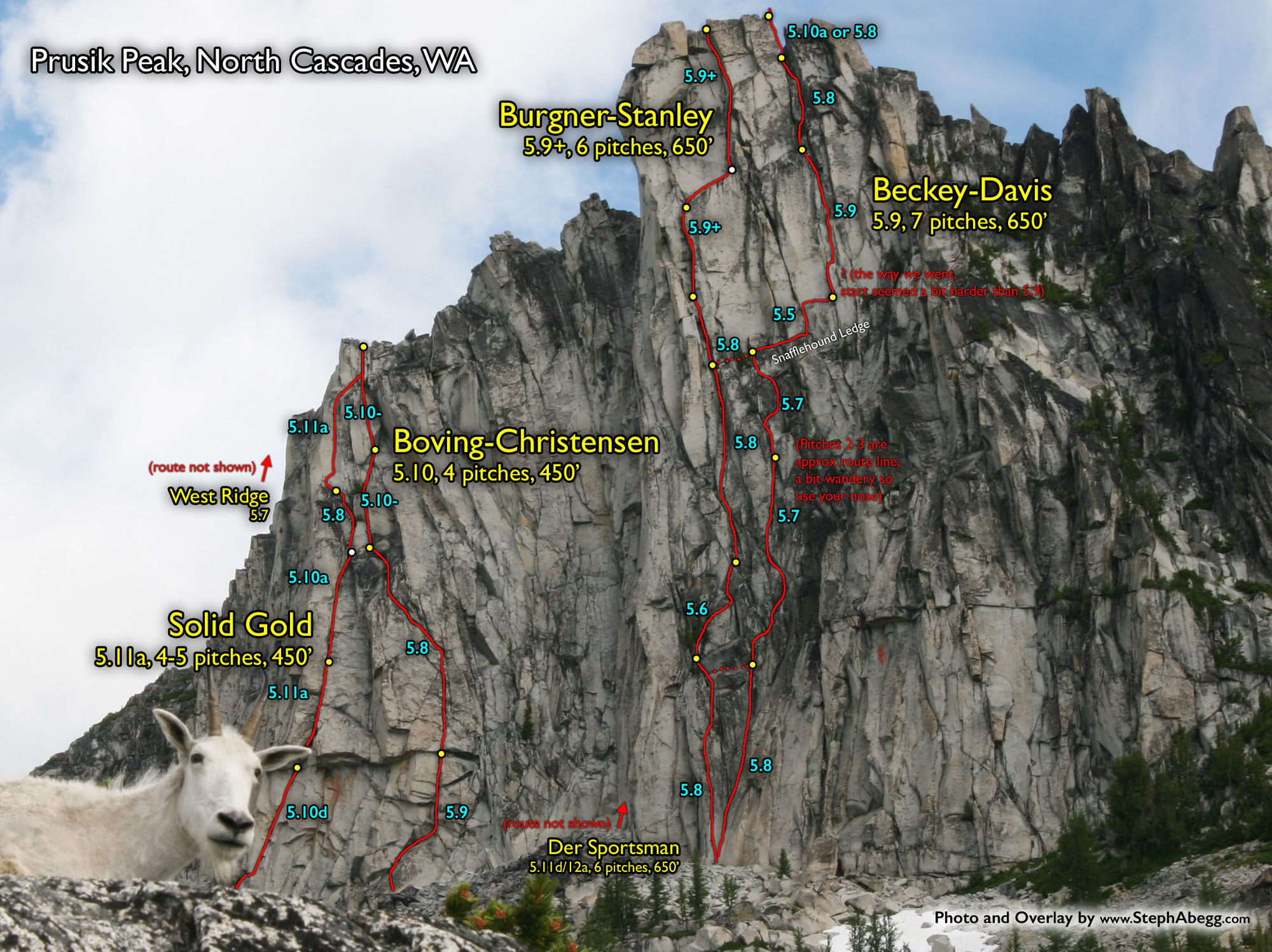
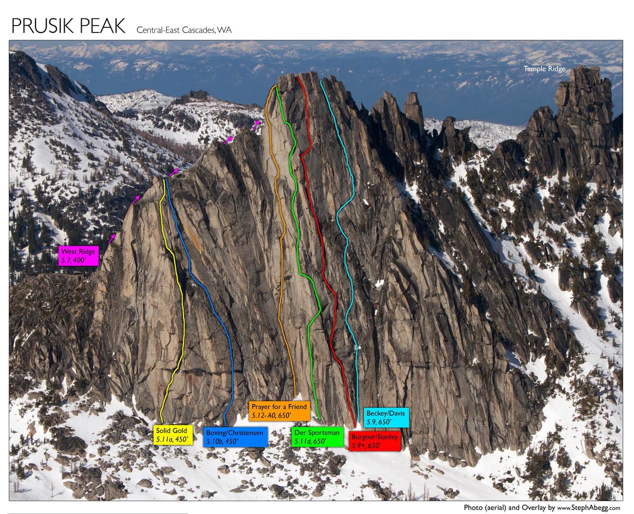
Beckey-Davis
5.9, 700', 6p
The original route up the towering south face of Prusik Peak.
Region: Washington
Elev: 8,000 ft
Rock: Granodiorite
Mode:

Date(s): September 10, 2017 (Sun)
Partner(s): Todd Anderson
| Photos: |
Photo descriptions: | ||
|
Approach
|
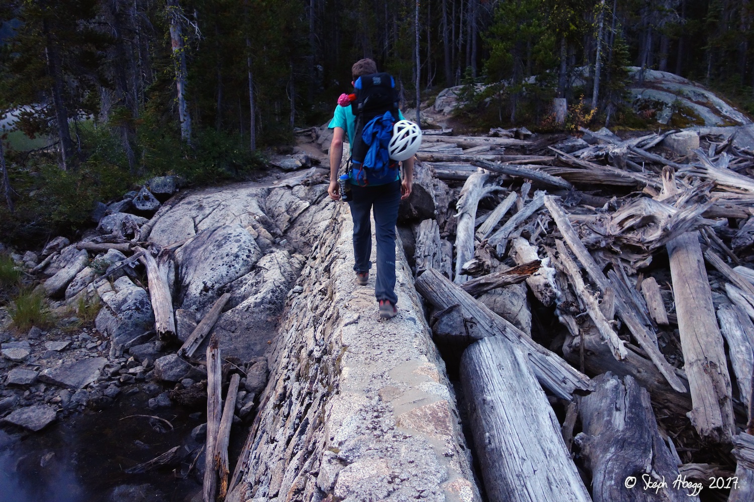
Hike in via Snow Lakes, 5 hours 44 min. |
1.
 2.
 3.
 4.
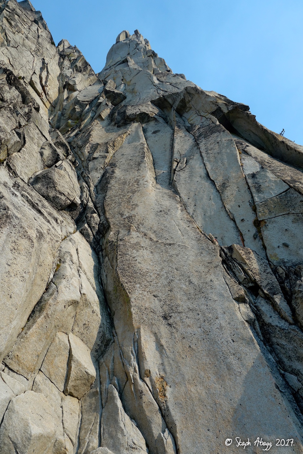 |
1. Crossing the dam at the outlet of Snow Lakes. In late summer, the water level in the lakes is low. When I was last here (June 2015), water was rushing over the top. 2. Morning "steam fog" on the lake. (Photo by Todd.) 3. Prusik Peak above Lake Viviane. 4. Looking up Der Sportsman (11d/12a) from the base. We had originally planned on climbing this route, but after over an hour fighting the crux stembox on Pitch 1, we decided to bail and climb another route....I will have to come back, Der Sportsman looks amazing! |
|
Pitch
1
|
5.8 |
5.
 6.
 7.
 8.
 9.
 |
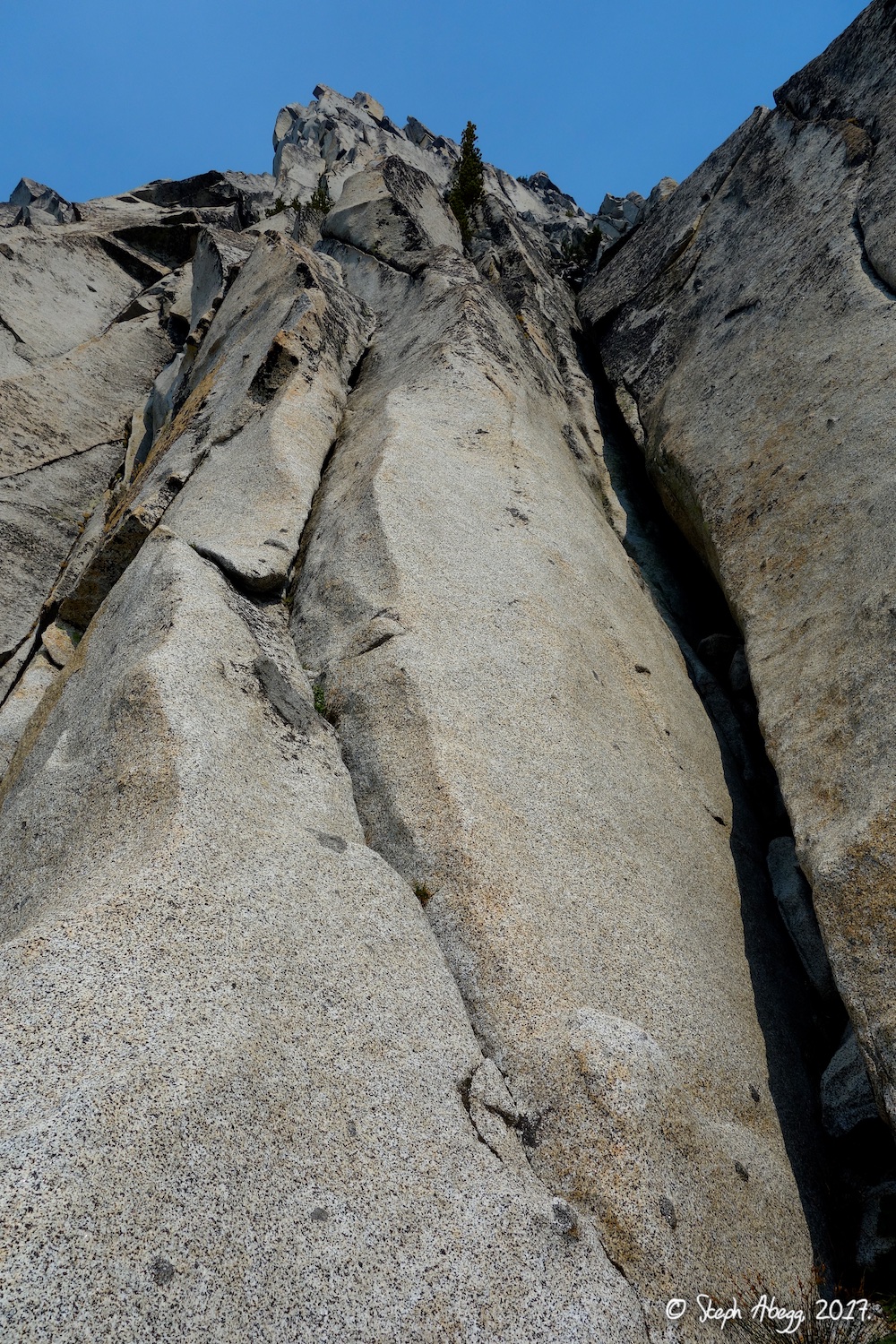
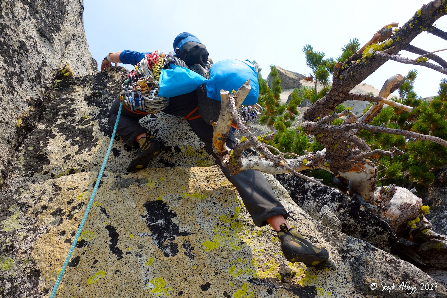
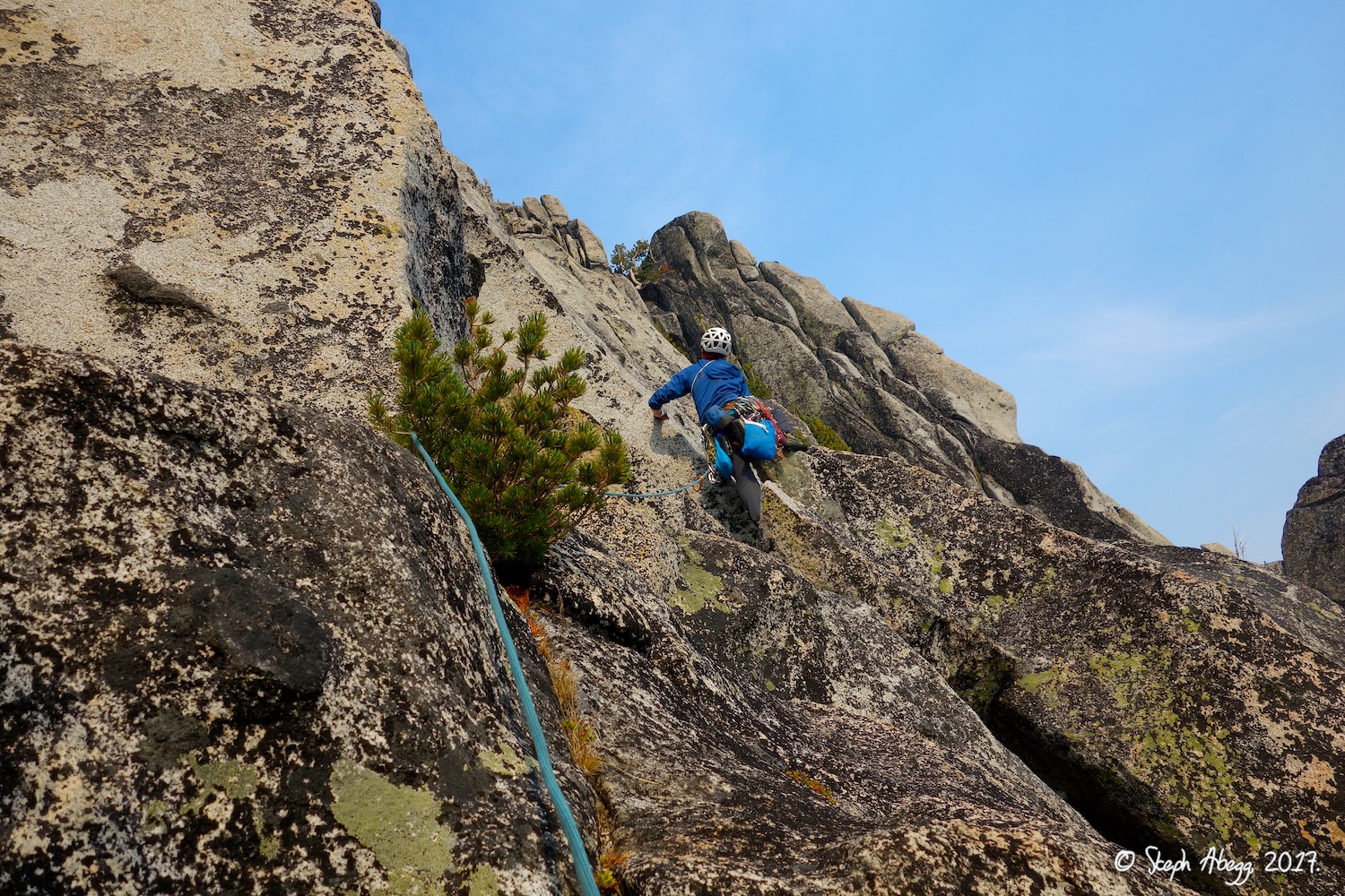
5. Warning, this is NOT the start of the Burgner-Stanley and Beckey-Davis routes, even though it sort of fits the route description (wide hand crack and chimney, respectively). There was a fixed rope hanging from the chockstone on the right. Project or off-route bail? 6. Pitch 1 of Burgner-Stanley climbs the wide hand-crack on the left, while Pitch 1 of Beckey-Davis climbs the chimney on the right. Both are rated 5.8, but the chimney is sparsely-protected, so we chose to climb Pitch 1 of Burgner-Stanley and intersect the Beckey-Davis route above the chimney. 7. Looking down while leading Pitch 1 of Burgner-Stanley route. 8. Traverse at top of Pitch 1 of Burgner-Stanley to the top of the chimney on Beckey-Davis. (Based on other photos I've seen, I am not absolutely positive we stopped/traversed into the "treed ledge" at the top of the chimney noted in the route description, but there was a tree there and a ledge there and it was at the top of the chimney so it seemed correct. Perhaps you can traverse in higher or lower too, I'm not sure.) 9. Looking down the chimney which is the original Pitch 1 of the Beckey-Davis route. |
|
Pitch
2
|
5.7 |
10.
 11.
 12.
 |
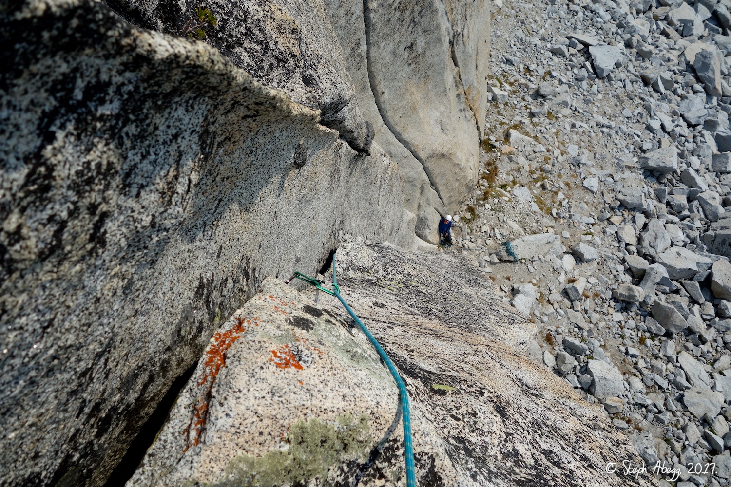
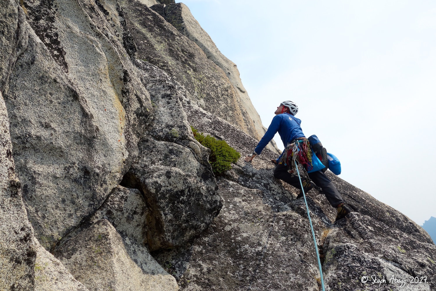
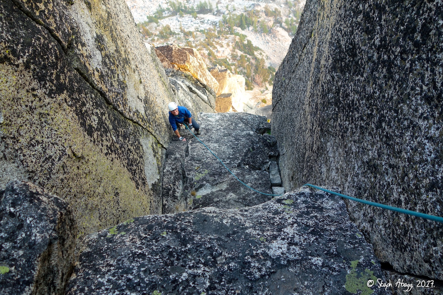
10. Our Pitch 1 belay was at this tree at the top of the chimney. So our Pitch 2 started off with a steep move on jugs up to the ledge above. Other route descriptions do not mention this steep move but it seemed to be on route, probably at the end of Pitch 1 instead of start of Pitch 2. Or maybe there is a way to avoid the steep move by traversing in higher or going right of the tree? Either way, this move is no harder than 5.8ish and on positive holds. 11. When Todd got above the steep move in the previous photo, he was not quite sure where to go, so he set a belay and brought me up. Here he is starting off Pitch 2b, on the knobby face and slabs to the right. According to most route descriptions I have read, this is the usual start of Pitch 2. 12. Pitch 2 is a bit in-obvious but follows the knobby face, slabs, and cracks towards a gully/chimney system above (where the rope goes in the photo). |
|
Pitch
3
|
5.7 |
13.
 14.
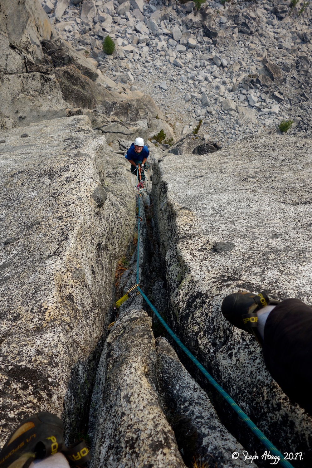 |
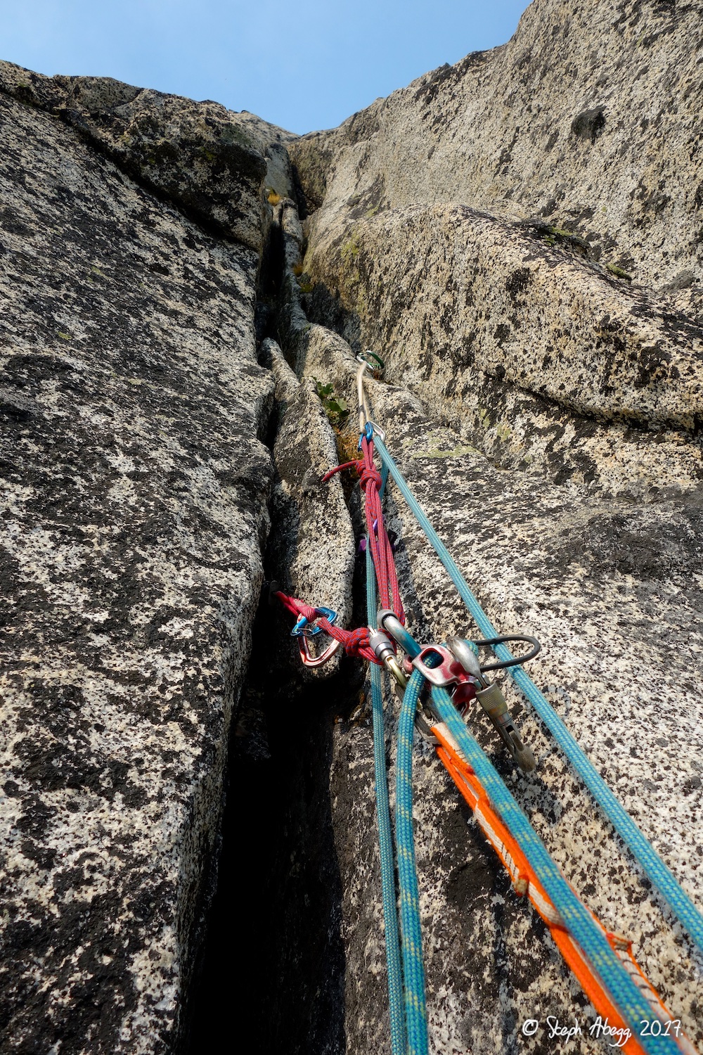
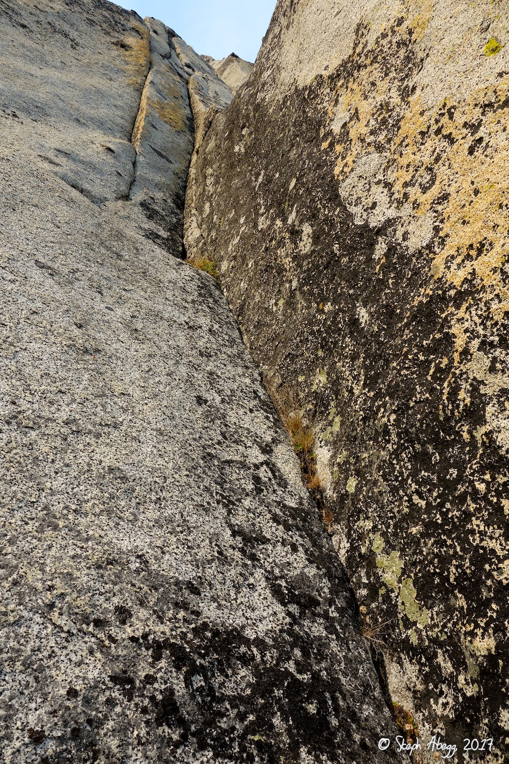
13. Looking up the continuation of the crack system which was our Pitch 3. 14. Looking down shortly after leaving the belay at the base of Pitch 3. |
|
Pitch
4
|
5.5 |
15.
 16.
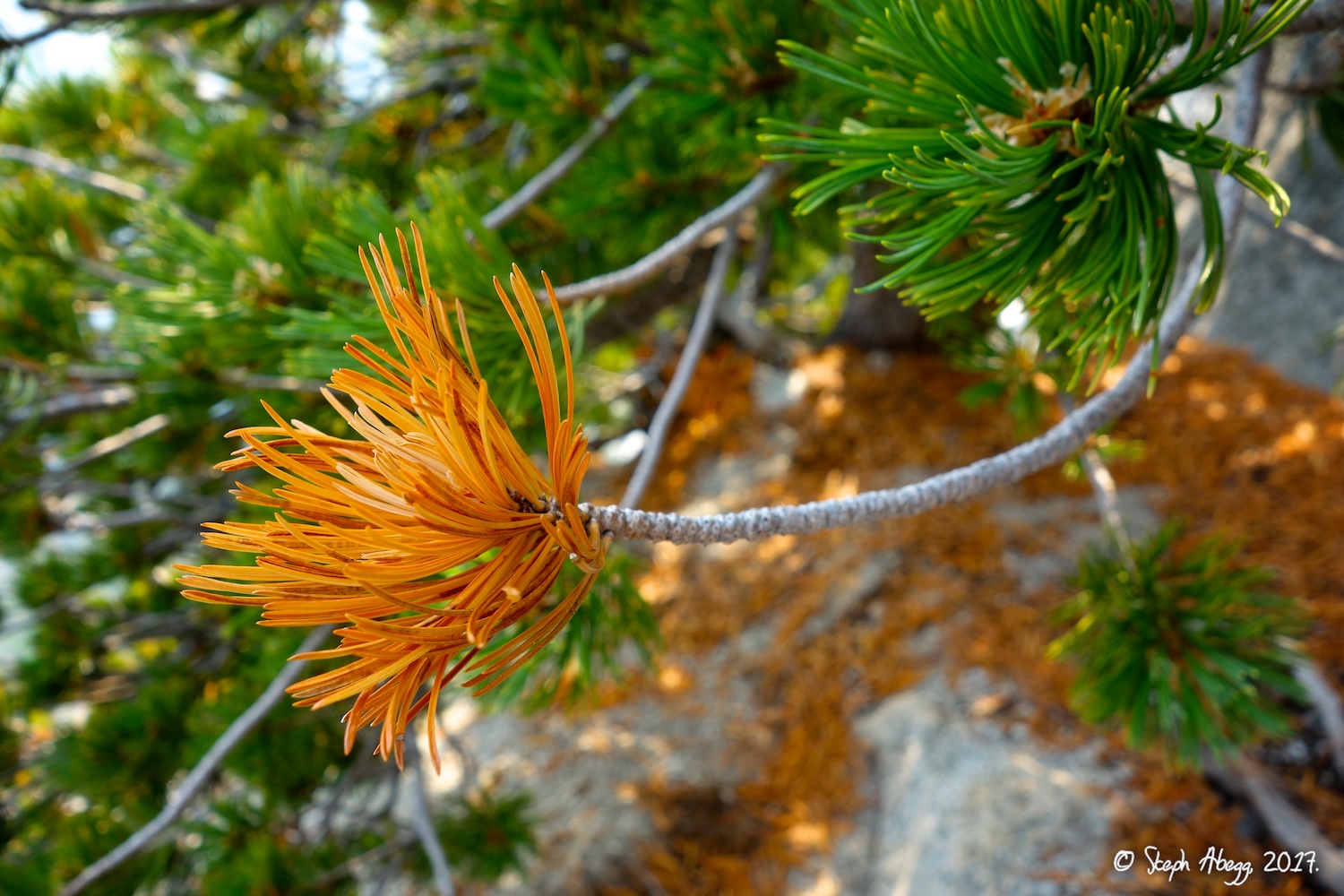 |
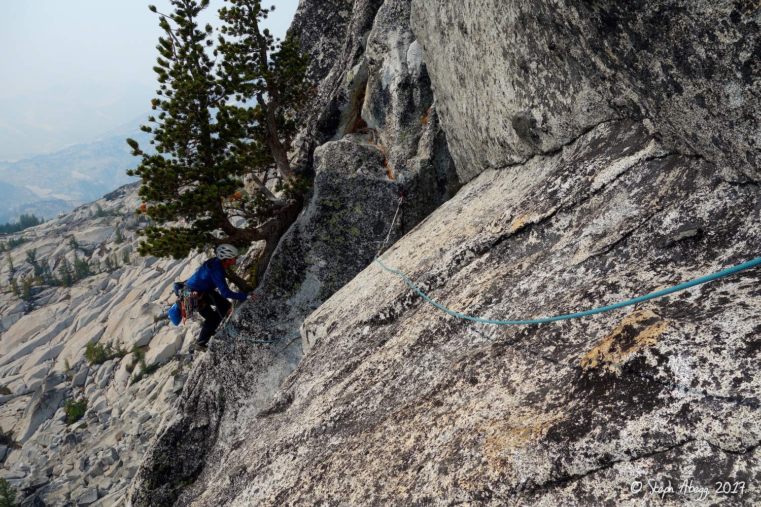
15. Todd starting the traverse across the ledge ("Snafflehound Ledge") which comprises Pitch 4. 16. I thought this was a larch tree starting to turn yellow for the fall, but turns out it is just a sun-damaged pine tree.....Regardless, in about a month the entire Enchantment plateau will be a sea of yellow larch trees. |
|
Pitch
5
|
5.9 |
17.
 18.
 19.
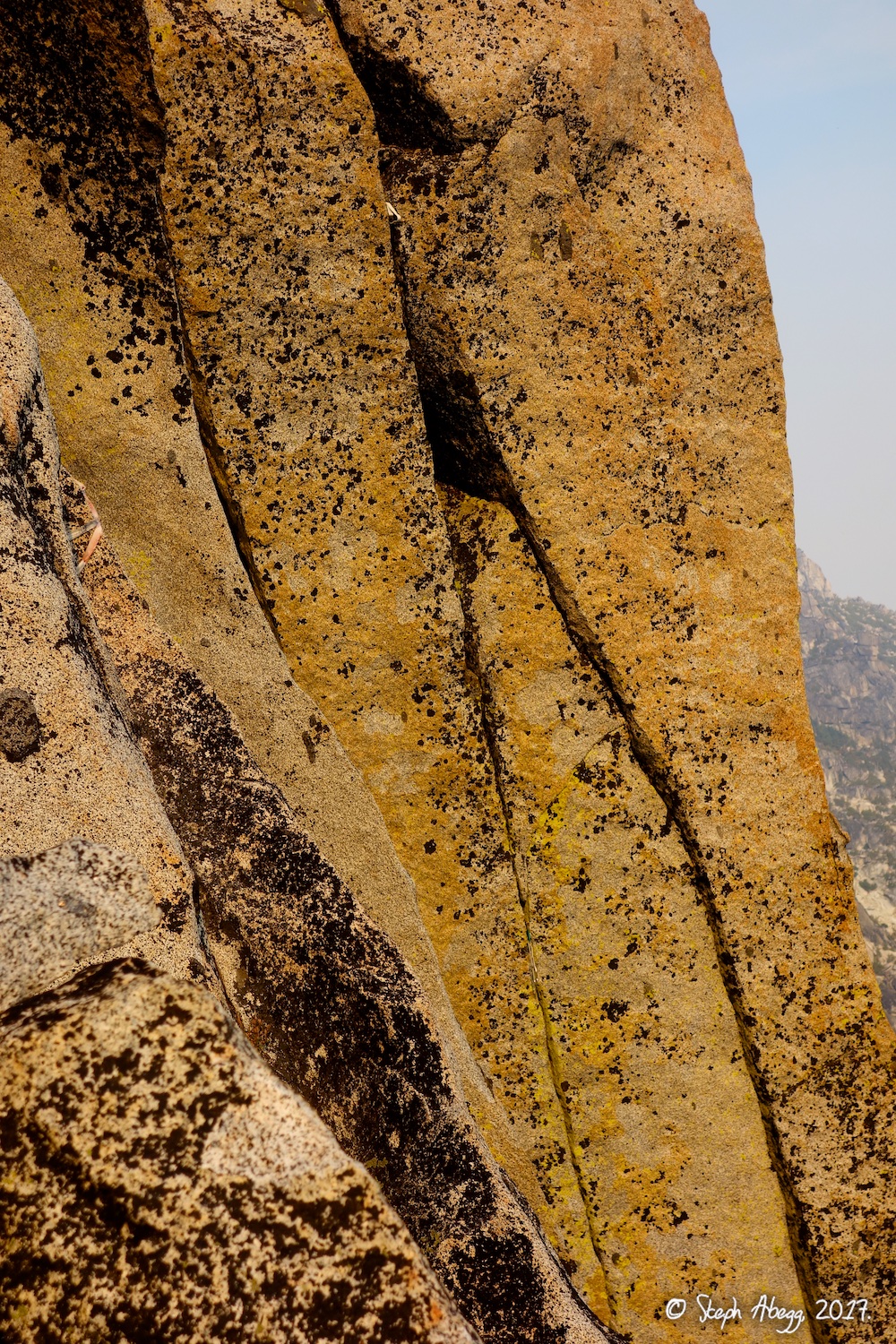 |
17. Pitch 5 starts in a shallow dihedral with a crack on the left. This may or may not be it. It seemed a bit hard for 5.9 but it worked and was in line with the finish of the route high above. 18. Higher on Pitch 5. 19. Some fixed gear and tat on the steep walls to the right of our route. Probably some abandoned projects. Looks kind of hard. But there seems to be lots of possible lines all over Prusik's towering south face walls. |
|
Pitch
6
|
5.8 |
20.
 21.
 22.
 |
20. Somewhere near the end of Pitch 5 or start of Pitch 6. There is a nice belay ledge at the tree above (which would make Pitch 5 long and Pitch 6 short). 21. Nearing the notch at the top of Pitch 6. 22. Looking down from the belay at the top of Pitch 6. |
|
Pitch
7
|
5.10a (or 5.8) |
23.
 24.
 |
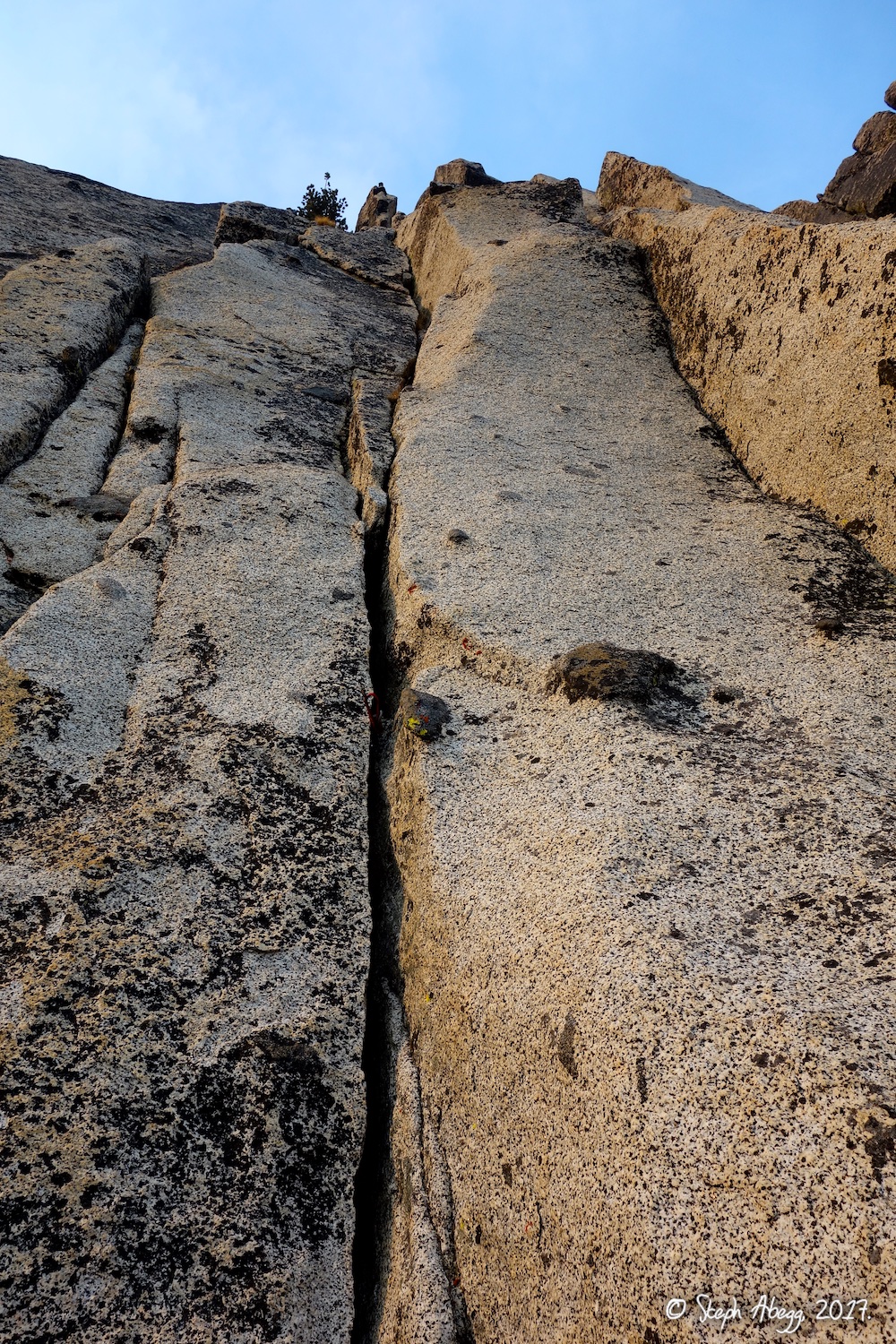
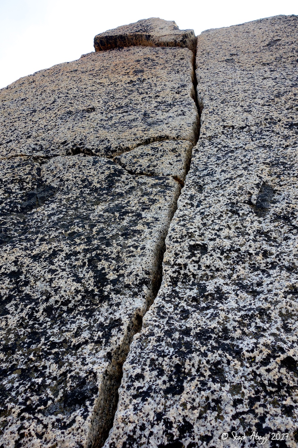
23. The 10a splitter to finish off the route. (There are two options to finish: a 10a splitter directly above the belay, or traversing around right to the north side and climbing up (5.8?). There was no way I was going to pass up the splitter!) 24. Todd enjoying the splitter, one move from topping out. It's not every route where you get to pull a 5.10 move and pop out right onto the summit. |
|
Top!
|
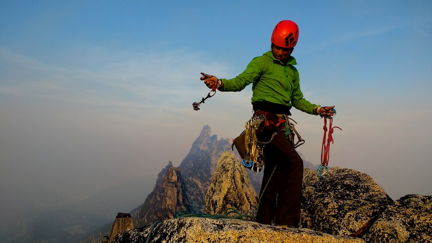
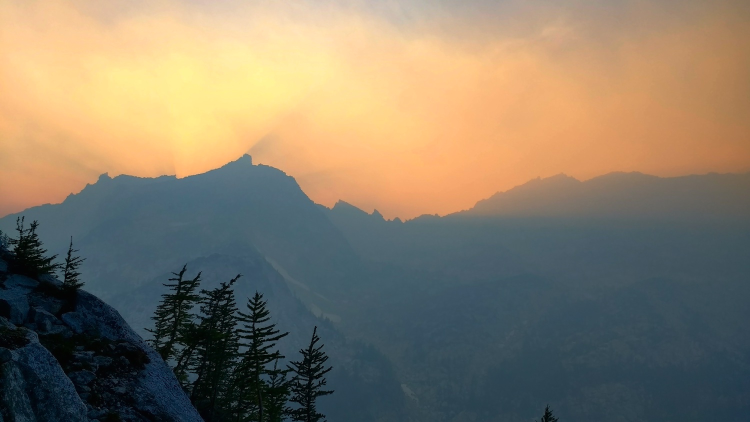
Smoky! |
25.
 26.
 27.
 |
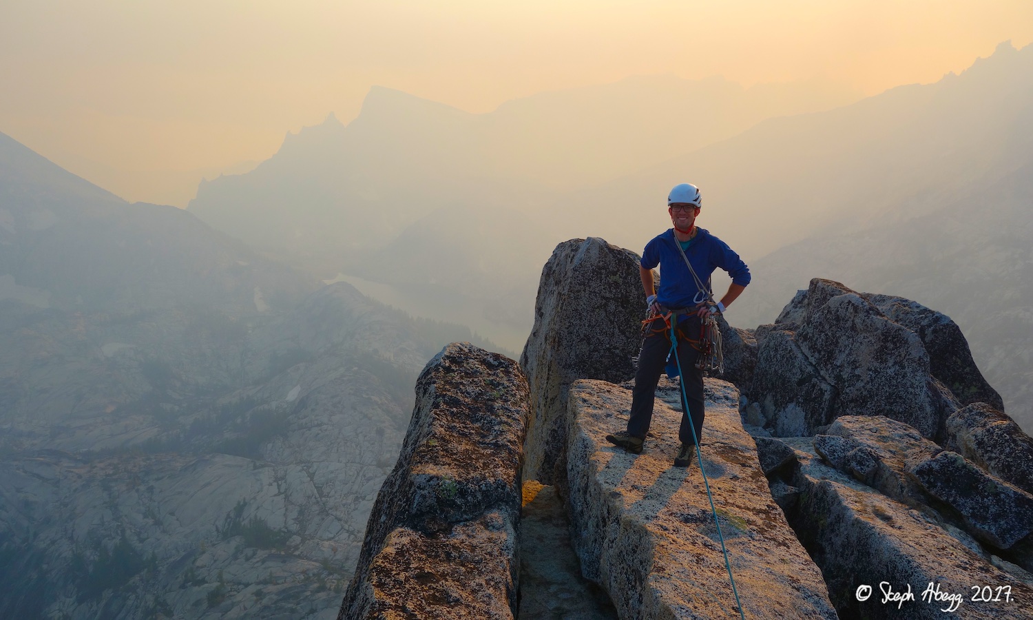
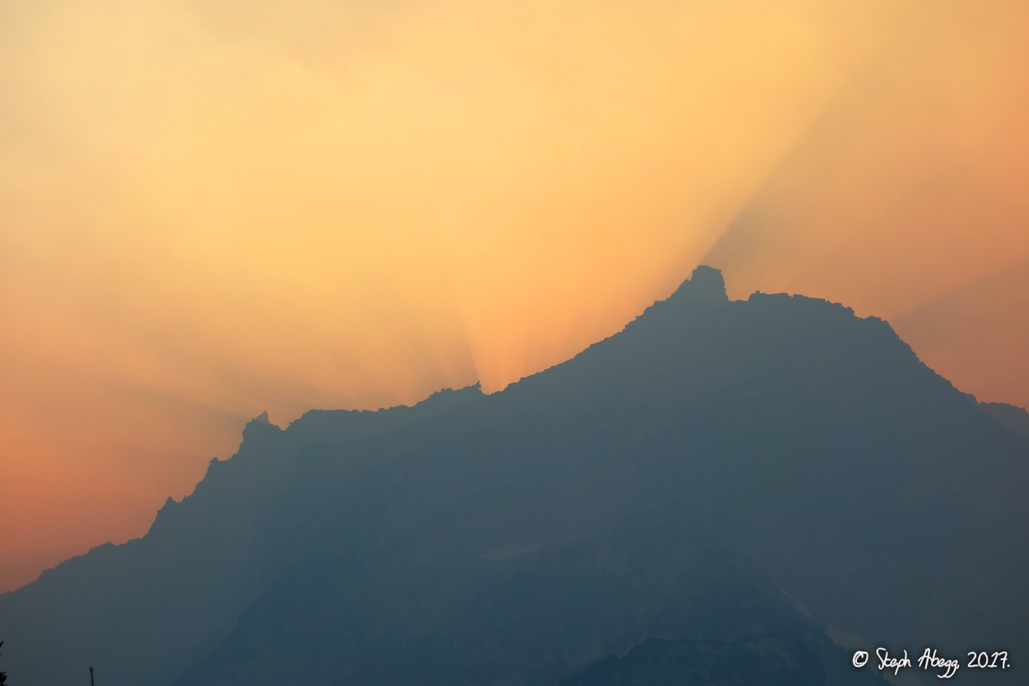
25. Me on the summit, Temple Ridge behind. (Photo by Todd.) 26. Todd on the summit. By late afternoon, the smoke from nearby forest fires had really increased. The Colchuck Lake zone was actually closed due to a small forest fire. 27. Looking down Temple Ridge from the summit. |
|
Descent
|
6 single-rope rappels down N side, scramble around back to base of route. |
28.
 29.
 30.
 31.
 32.
 33.
 34.
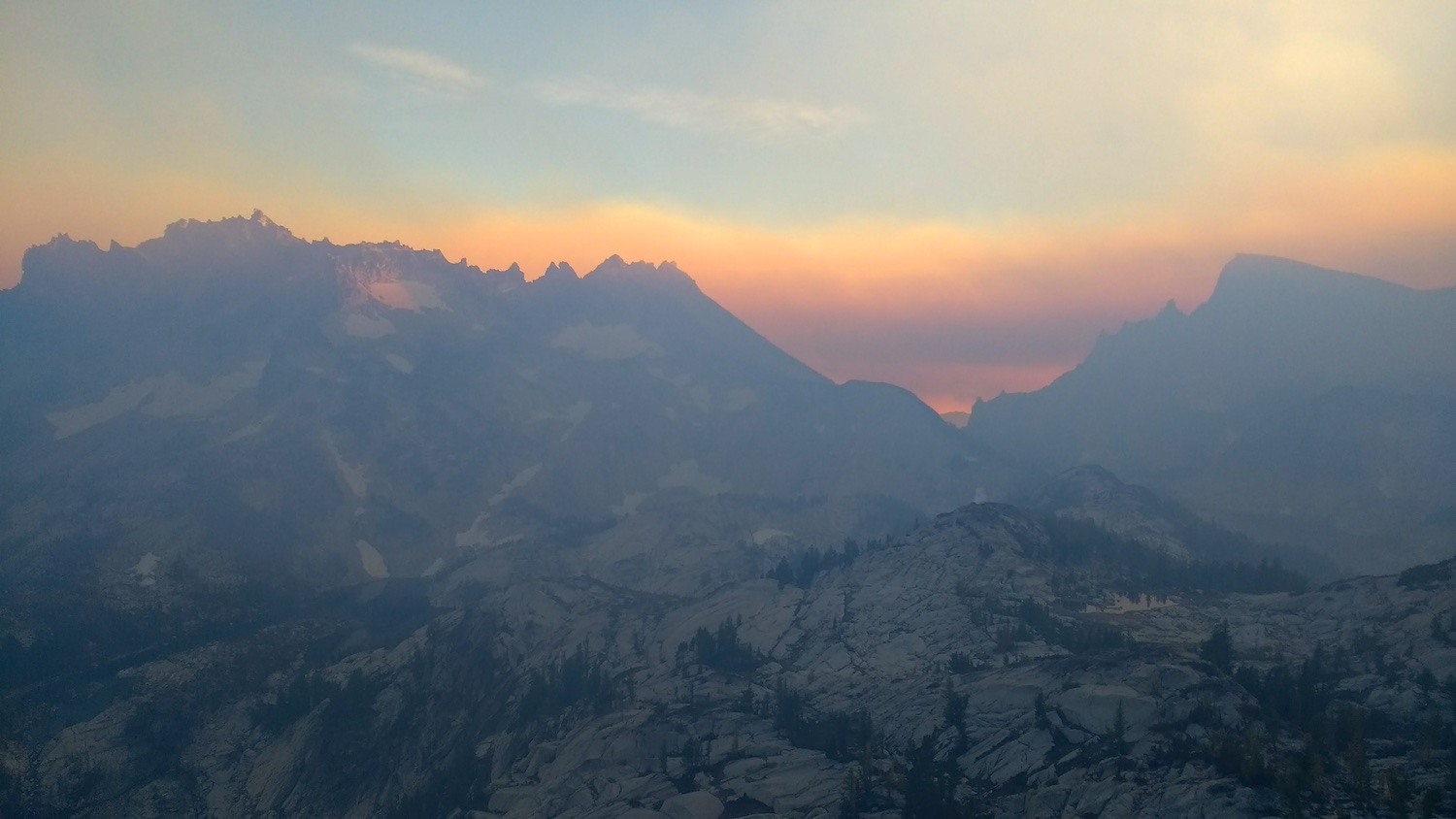 |
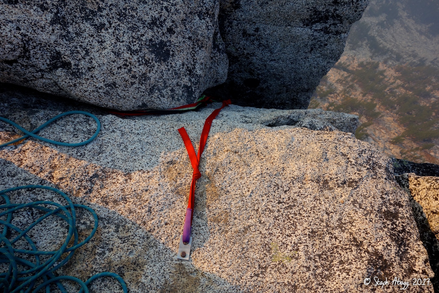
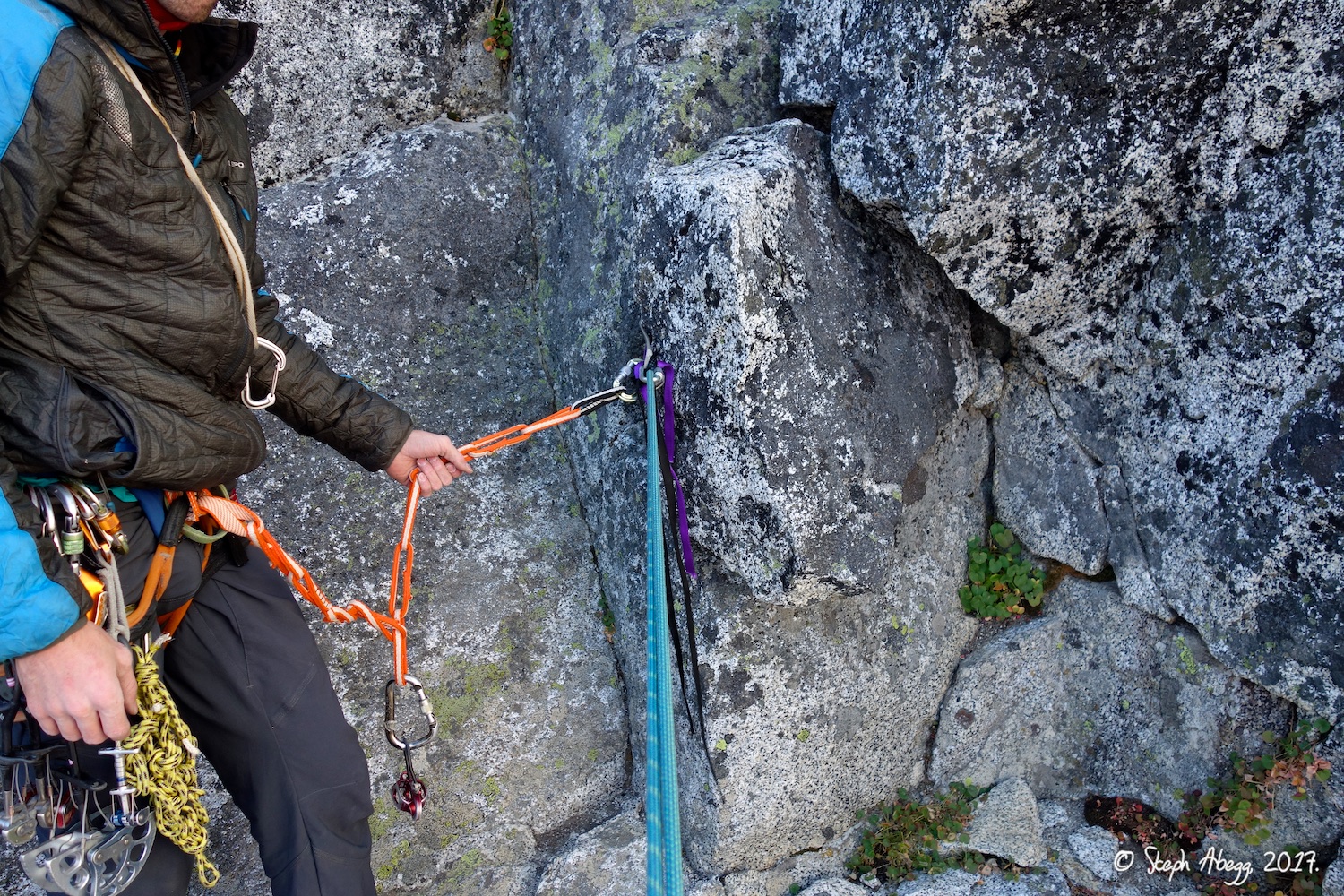
28. The rap station at the summit. This old bolt was probably there when my parents climbed Prusik in 1979. 29. The second rappel is off a rather sketchy looking wedged block. It stayed wedged in place when I rapped on it in 2005, 2006, 2009, and 2015, so we trusted our lives to it yet again. 30. Rappelling into the haze. (Photo by Todd.) 31. Smoky. Walls of Temple Ridge on the right. 32-33. Shadows of Enchantment Peak on the smoky sky. 34. More smoke. At least it is uniquely pretty. (Photo by Todd.) |