Mt. Rainier, Ptarmigan Ridge (steep snow/ice, short sections of 5th class rock)

Mt. Rainier

Route:

Ptarmigan Ridge

steep snow/ice, short sections of 5th class rock

Perfect weather and conditions + fun partners + classic ridge on Rainier's north side = one great climb!

Region: Washington
Elev: 14,411 ft
Type: 
Date(s): July 16-18, 2010 (Fri-Sun)
Partner(s): Jason Schilling, Steve Trent

Route Overlays & Map

CLICK TO ENLARGE

Poster of Climbing Routes on Mt. Rainier

This full-resolution image file of this poster is available in my online store.

CLICK TO ENLARGE

Summit Panorama

CLICK TO ENLARGE

Trip Report

THIS TRIP REPORT IS STILL MOSTLY IN THE EMBEDDED HTML FORMAT OF MY OLD WEBSITE.

General Overview

Route Info

Location: Mt. Rainier, Washington
Route: Ptarmigan Ridge
Difficulty: IV, steep snow and ice, 5th class rock
Summit elevation: 14,411 feet
Elevation gain: 11,400 feet
Max grade: 55 degree ice, short sections of 5th class rock
Approach: White River (an alternative is via Mowich Lake)
Time: 2-5 days (3 for us)

Elevations

White River Campground: 4,400 ft
Camp on Curtis Ridge: 7,500 ft
High Camp on Ptarmigan Ridge: 10,300 ft
Summit (Columbia Crest): 14,411 ft
Liberty Cap: 14,112 ft

Gear

60m 8mm rope, 7 ice screws, a few nuts and a cam (never used), 4 pickets, a few slings, 2 tools each, crampons


Our Itinerary

Day 1:
  • Drive from Seattle to Rainier, get permits at White River Ranger Station
  • White River Campground (4,400ft) to lower Curtis Ridge (7,500ft)

Day 2:
  • Curtis Ridge to high camp on Ptarmigan ridge just below Pt. 10,310 (10,300ft)
Note: Many parties approach from Mowich Lake, which is a shorter approach, but involves separate entrance/exit trailheads, and hence a car plant.

Day 3:
  • High camp (10,300ft) to Liberty Cap summit (14,112ft)
  • Liberty Cap to true summit Columbia Crest (14,411ft)
  • Descend to Camp Schurman (9,510ft) and via Emmons glacier
  • Camp Schurman to White River Campground (4,400ft)
  • Drive back to Seattle
Note: Some parties begin descent after the summit of Liberty Cap rather than tagging the higher summit. As we did, it is possible to descend all the way to the trailhead and not camp at Camp Schurman, and hence make it one long day between the ridge high camp and the car.

Comparisons 1 week apart

I had climbed Liberty Ridge exactly 1 week before Ptarmigan Ridge. It was interesting to see the amount of melting that occurs over the course of 1 week of normal warm summer weather. As you can see from the photos in the trip report, the crevasses are starting to open up as the summer melting continues.

 
Photos from my parents' scrapbooks

My parents climbed Rainier on several occasions in the 1970s (my mom climbed it more than my dad, since before they met she was part of the Tacoma Mountaineers; Rainier was and still is common destination for the Mountaineers). My parents climbed a few different routes (Emmons Glacier, Disappointment Cleaver, Ingraham Glacier, Sunset Ridge, Kautz Icefall) on Rainier, but they never did climb Liberty or Ptarmigan Ridges, although these were on their list. Then I was born, and the list was passed on to me.

Here are a few photos from my parents' scrapbooks. The people and gear have changed greatly over the years, but Rainier is much the same now as it was when my parents were climbing it over 30 years ago.

Camp Muir and Gibraltar Rock; 1974.
Final Assault of the Emmons Glacier, 7am; July 1974.
My mom on the summit of Rainier after climbing Emmons Glacier;  Liberty Cap and Olympics in the background; July 1974.
Hut at Steamboat Prow (Camp Schurman); climb of Emmons Glacier, July 1974.
My mom on the lip of a crevasse on the Disappointment Cleaver route, 1975.
My mom trudging on as Little Tahoma fades in the clouds; Mt. Rainier via Disappointment Cleaver, 1975.
Camp in the crater rim near a sulfur cave;  Mt. Rainier via Disappointment Cleaver, 1975. (The tent in the photo is an old REI Crestline tent, which was later blown apart in heavy winds on a winter attempt on Mt. Rainier.)
My dad and John Skirving on Liberty Cap after climbing Sunset Ridge, June 1980. (Following this photo was a debate over which way to head down....white out conditions don't make the decision easy!)
My sister (20 months old) hiking above Paradise on Mt. Rainier, August 1986.
 
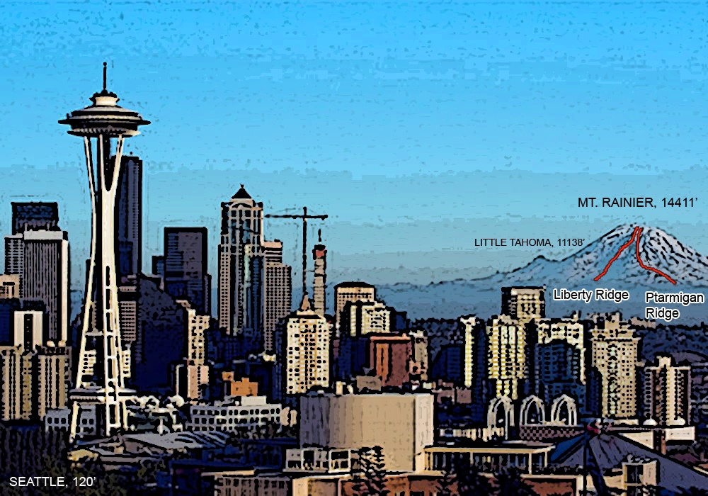
Jason and I had such fun and great conditions on 
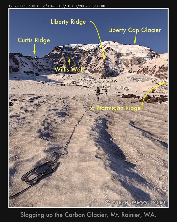
Liberty Ridge that we decided to climb Ptarmigan Ridge the following weekend. Ptarmigan Ridge is another north-side route that is often considered along with Liberty Ridge as one of Rainier's "best" routes.

Steve Trent joined Jason and I for the climb of Ptarmigan Ridge. This was the first climb the three of us had done together since the previous year's near-fatal accident on 
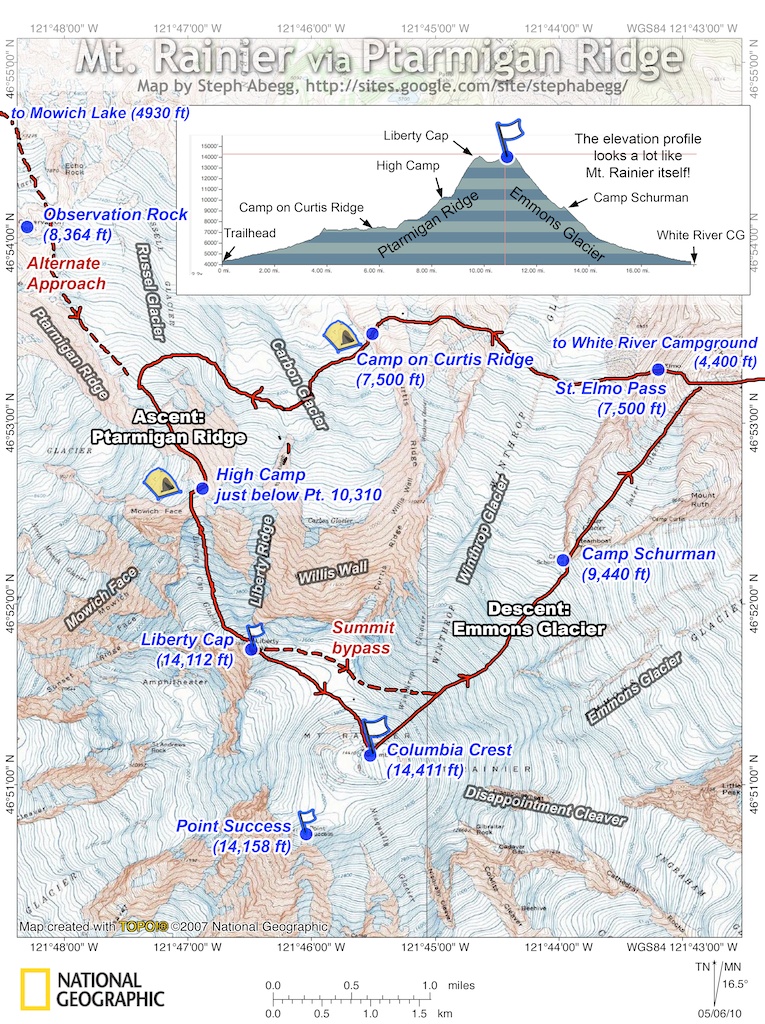
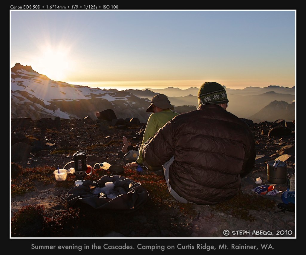
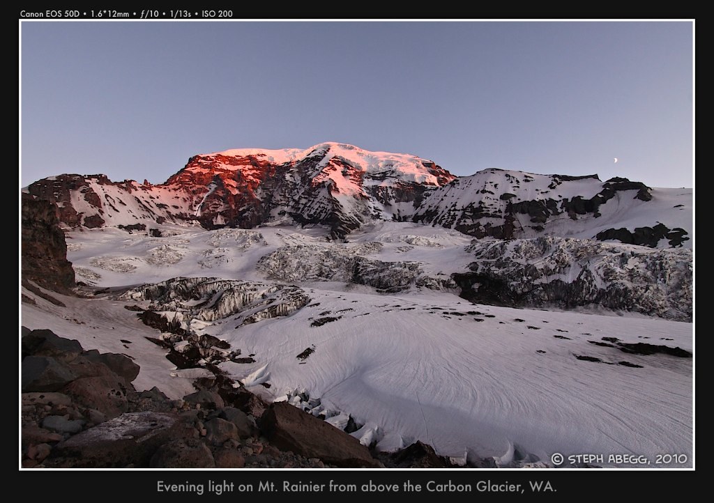
Mt. Terror (click for trip report). We decided to approach Ptarmigan Ridge via White River to avoid a car plant, and also so we could enjoy the spectacular camp on Curtis Ridge. The second day we ascended to the equally spectacular high camp on Ptarmigan Ridge, which sits underneath the towering ice cliff of the end of the Liberty Cap Glacier.

We had ideal snow conditions and weather on Ptarmigan Ridge, and we all highly enjoyed the route and each other's company. The verdict: Both Ptarmigan Ridge and Liberty Ridge are stellar and unique routes — Ptarmigan Ridge offers a more challenging and varied climbing experience, while Liberty Ridge boasts a classic route line and ridgeline position.

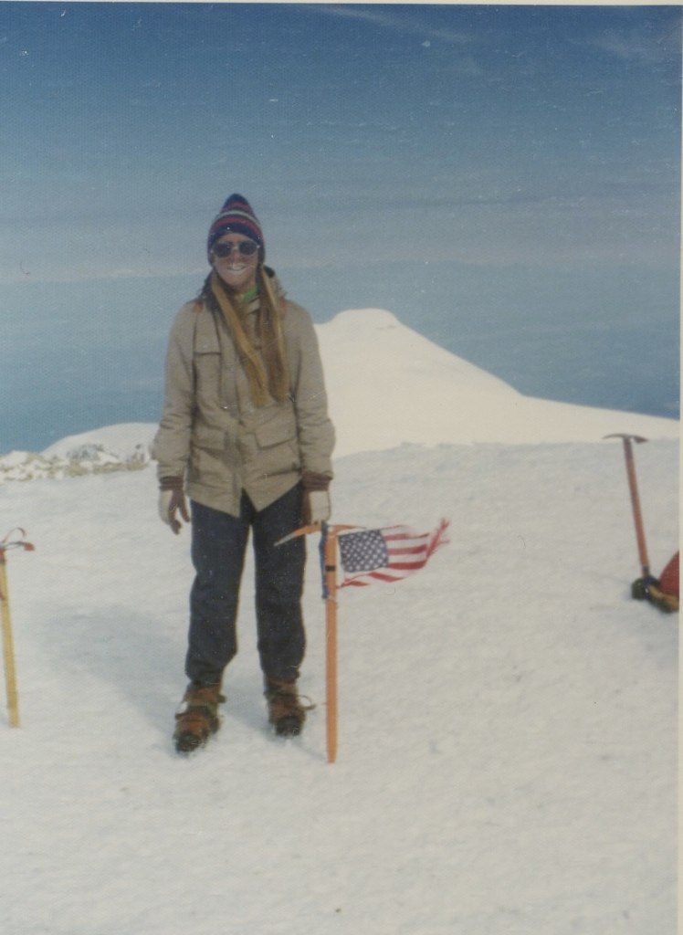
The following page provides a photo trip report for my climb of Ptarmigan Ridge with Jason and Steve. Since much of the climb was done in the darkness, and since the camps and views were gorgeous, many of the photos are from the approach and camps. I took lots of night photos to make the weight of the 6 batteries I packed worth it!  Click the photos for descriptions.


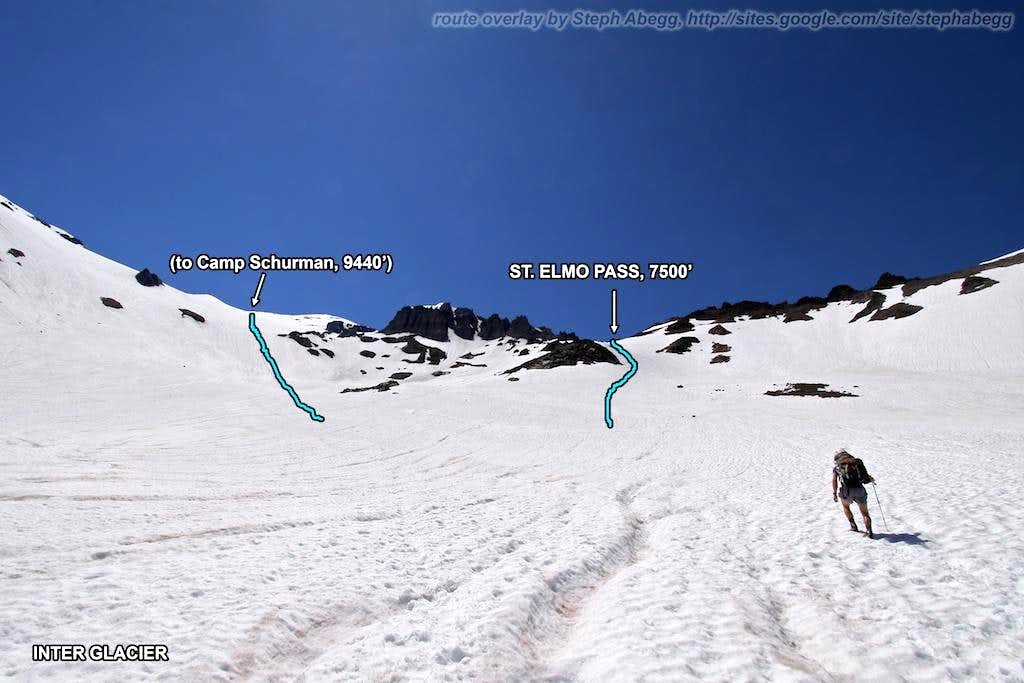
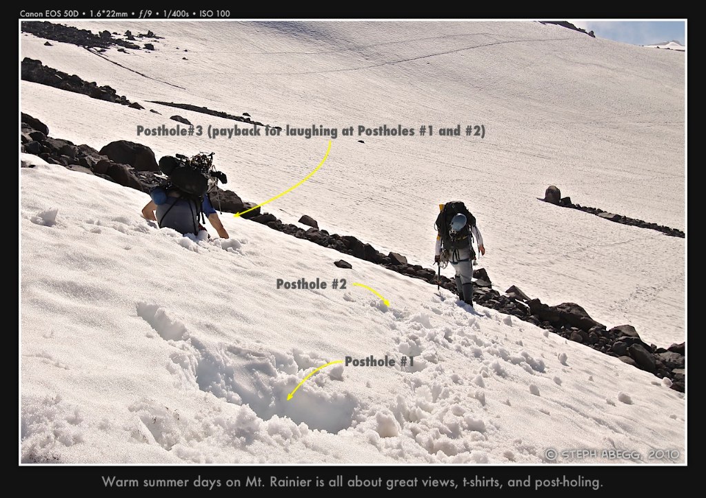
Day 1 - White River Campground (4,400 ft) to camp on lower Curtis Ridge (7,500 ft)
elevation gain: 3,100 feet
time: 5.25 hours

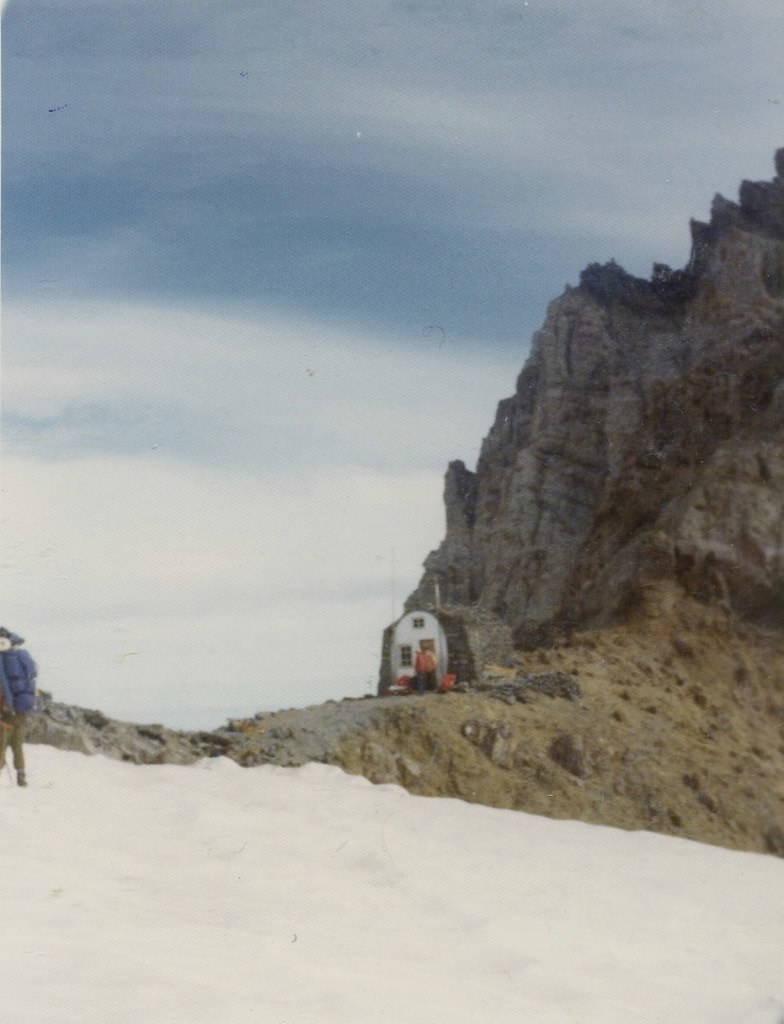
Photos from approach to camp on Curtis Ridge

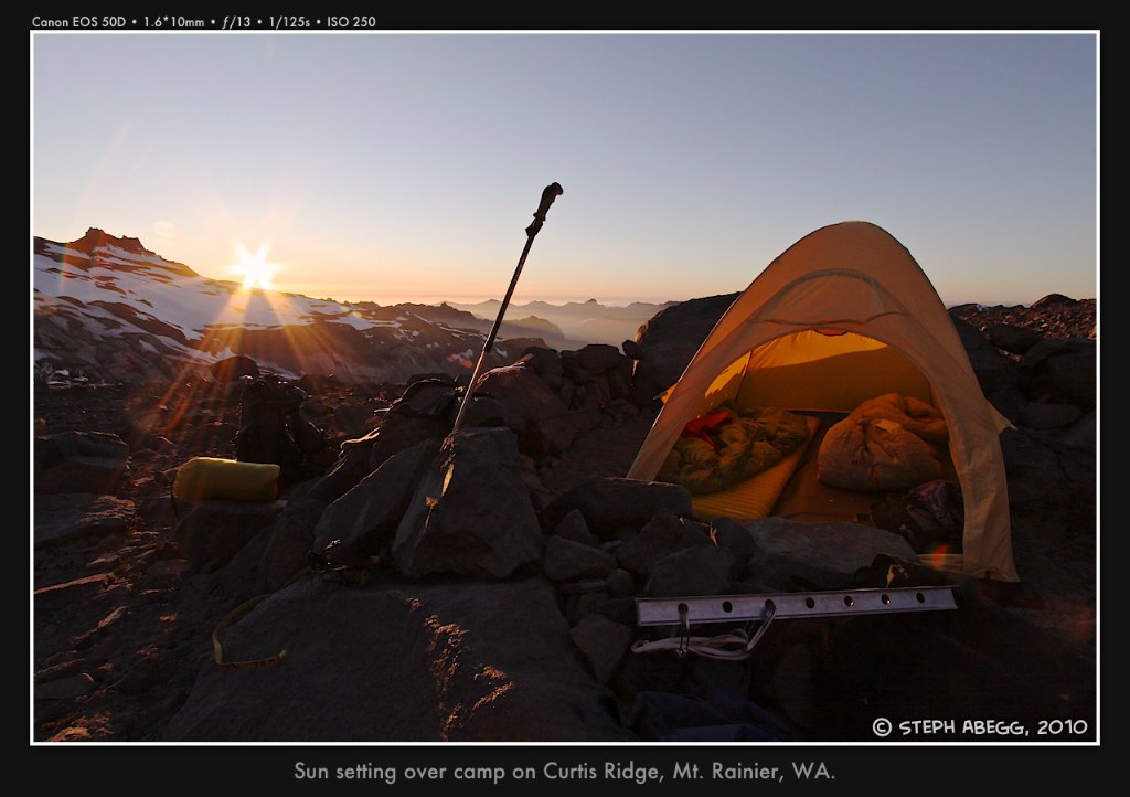
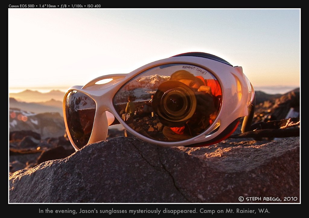
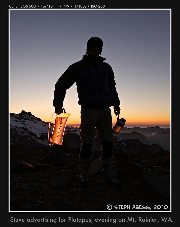
Photos from camp on Curtis Ridge


Day 2 - Lower Curtis Ridge (7,500 ft) to high camp on Ptarmigan Ridge (10,300 ft)
elevation gain: 2,800 feet
time: 4 hours

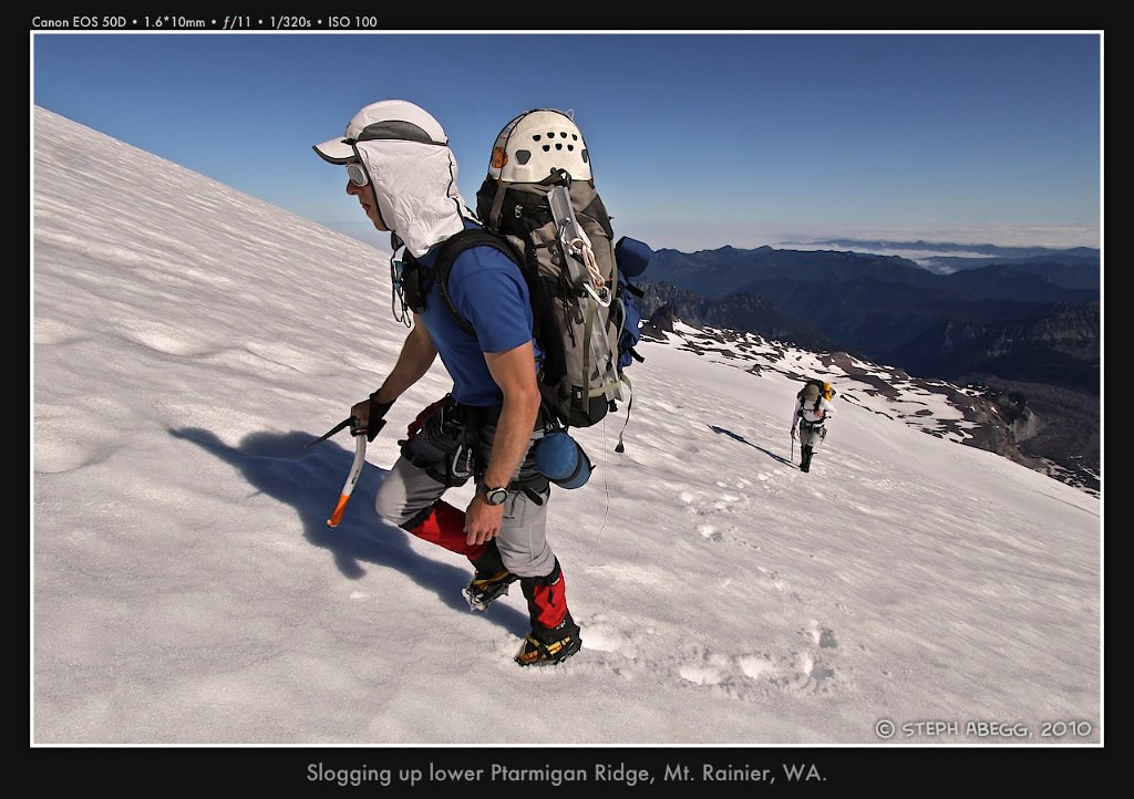
Photos from climb of lower Ptarmigan Ridge


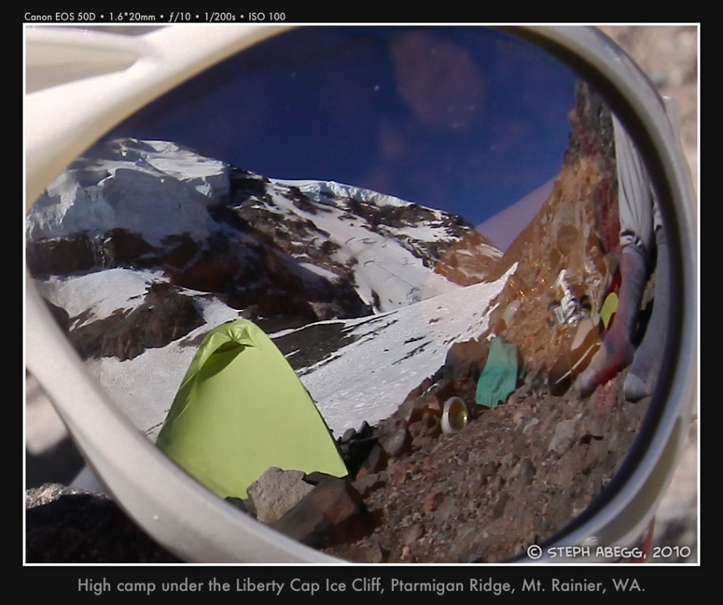
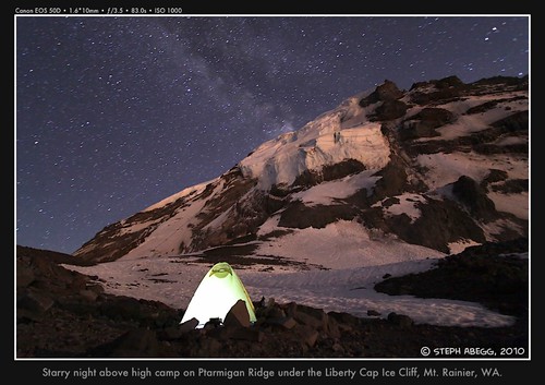
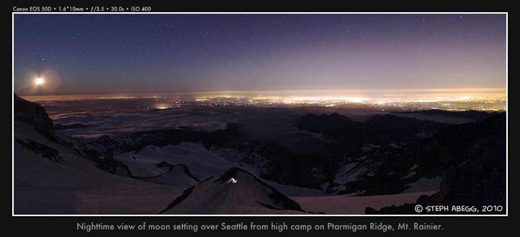
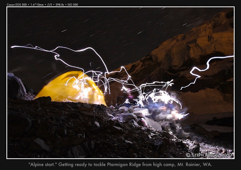
Photos from high camp on Ptarmigan Ridge


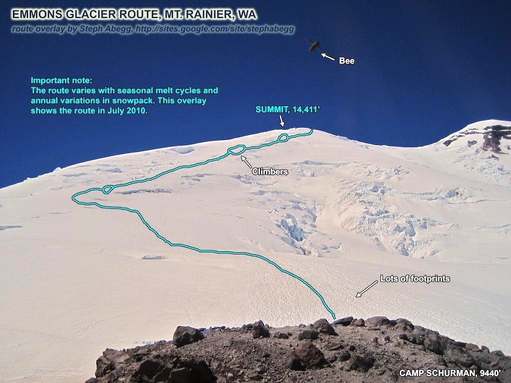
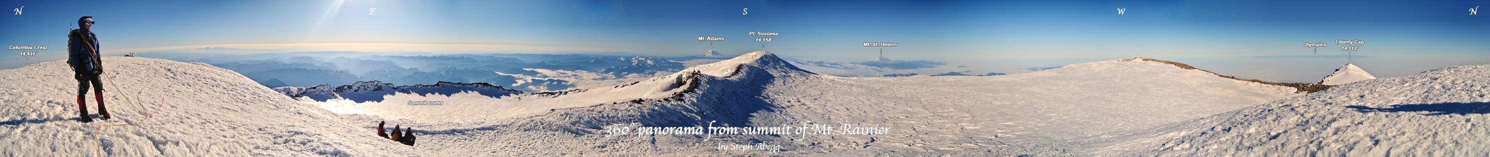
Day 3 - High camp (10,300 ft) to Liberty Cap (14,112 ft) to summit (14,411 ft) and descent of Emmons Glacier back to White River Campground (4,400 ft)
elevation gain: 4,100 feet
elevation loss: 10,000 feet
times: 8 hours from high camp to Liberty Cap, 2.5 hours from Liberty Cap to Camp Schurman, 2.5 hours from Camp Schurman to car

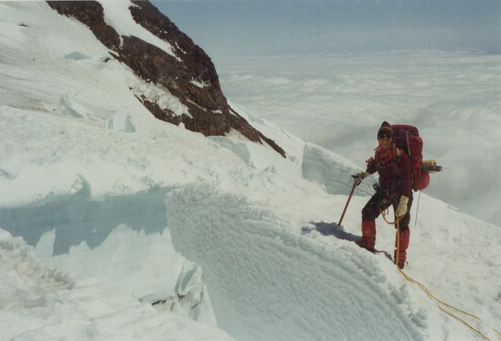
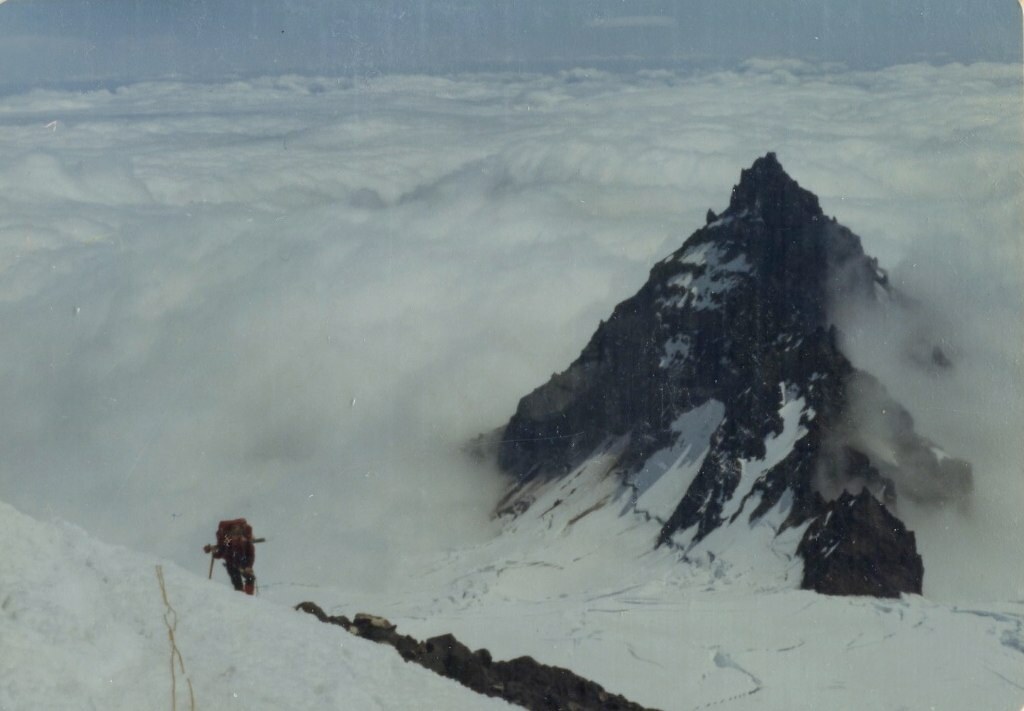
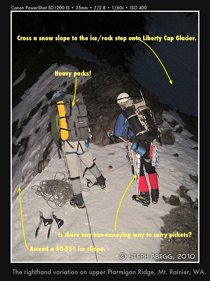
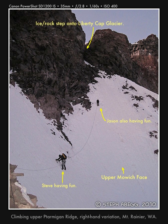
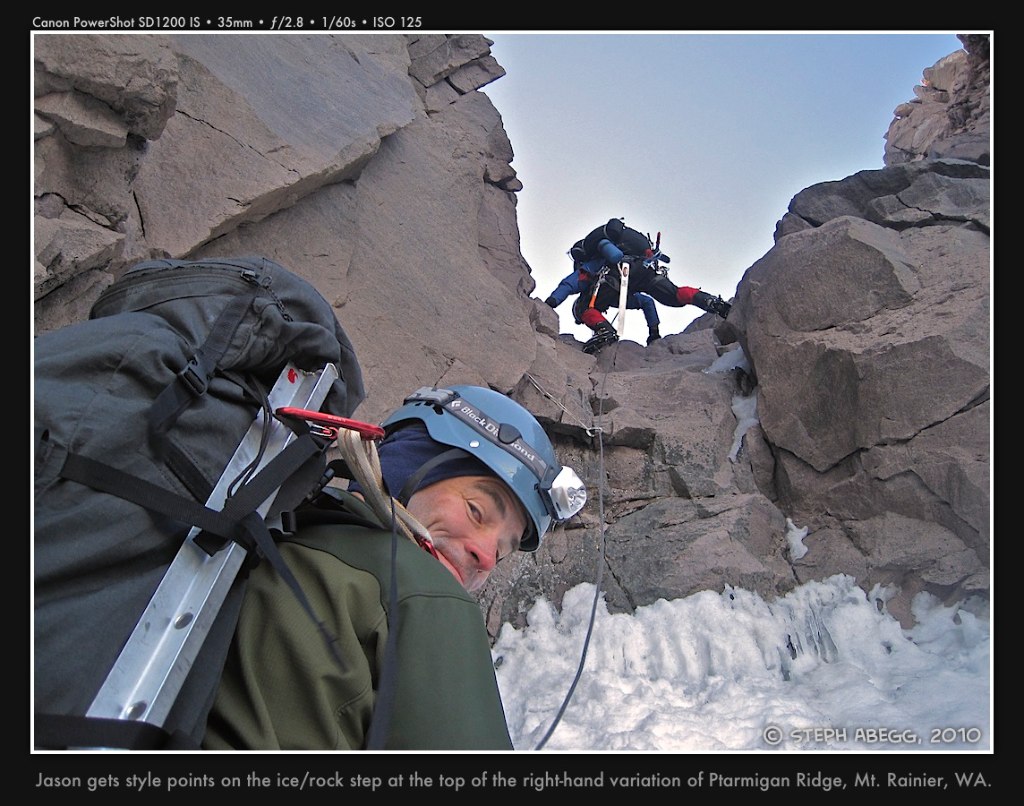
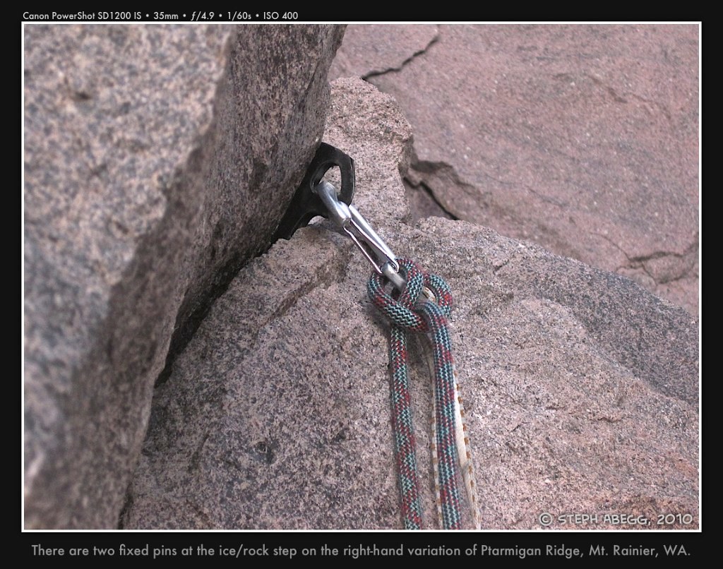
Photos from climb of upper Ptarmigan Ridge


Photos from descent of Emmons Glacier

Glissading down Mt. Rainier

Comments Pertaining to this Page / Trip Report

Useful beta. Updated route information. Corrections. Historical notes. Interesting facts. No fluff please.
Leave a Reply

Your email address will not be published. Required fields are marked *