• • • The Climb • • •
So, what to slog to the top of this weekend? It seems that every time I plan a weekend adventure, I end up with about five more summits on my to-climb list. But in the end you can only choose one. And hope that it’s a gem.
So it was that dark and early on Saturday morning, I was one of 10 embarking to tackle the Northwest Ridge of Ruby Mountain: Scott, Steve, Holli, Gabriel, Lindsay, Kevin, Carla, Tom, 4-legged Bodie, and me. It was bound to be a fun day.
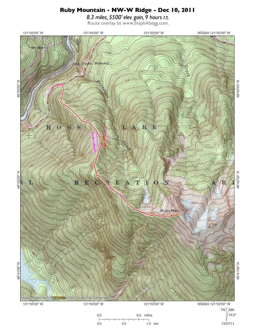
In the summer, Ruby Mountain is most commonly summited via the Ruby Mountain trail on the south side. In the winter or when snowy, most parties either climb the NW Ridge or the Happy Creek Route on the north side of the mountain. We had chosen the NW Ridge, hoping to maximize our views. (To be correct, I would say that the NW Ridge designation only applies to the first haft of the climb; at 5400', the ridge takes a distinct east-west turn and is thereafter a West Ridge.)
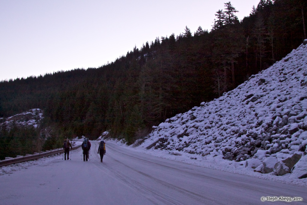
At 6:55 am, we arrived at the scene of the climb. As suggested by previous trip reports, we parked at a turnout located across the highway from a large boulder field on the northwest side of Ruby Mountain (this is on HWY 20 about 12 miles east of Newhalem and 0.4 miles west of Horsetail Creek, at an elevation of about 1900’). This start of the climb is also only shortly before the winter closure gate at MP 134, making Ruby one of the last accessible climbs along HWY 20 in the snowy season.
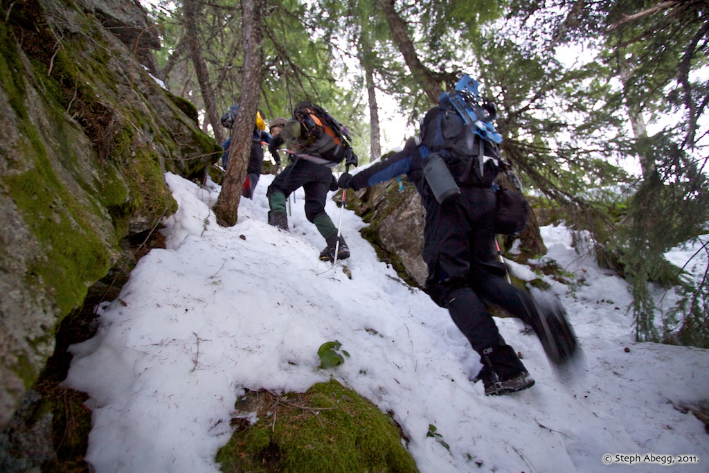
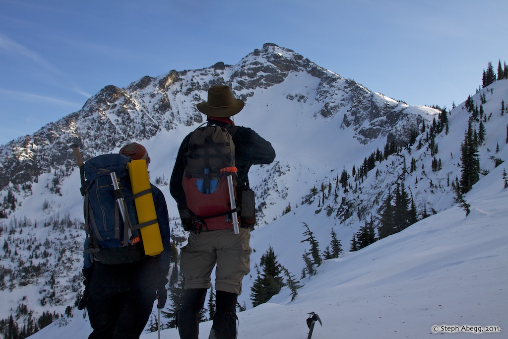
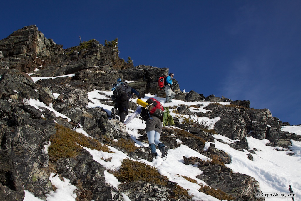
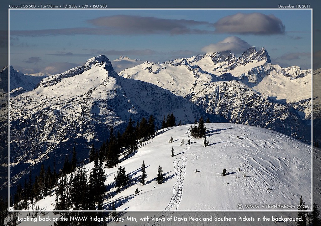
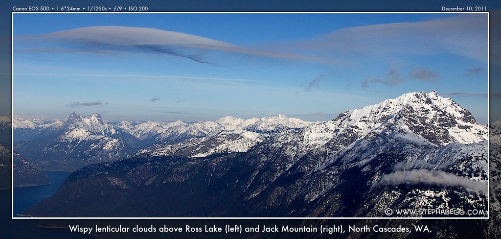
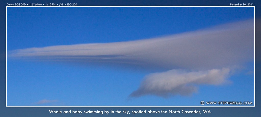
The NW Ridge route starts just left of the large boulder field. We began hiking straight up the timbered ridge. The route is straightforward, and we were able to navigate cliff bands via snow ramps. We put on snowshoes at about 4000', took them off a few minutes later to negotiate a cliffy area, and then put them back on. After a few hours we popped up onto Point 6315, and from there headed up the open ridge to the summit. The snow on this open ridge was composed of a crust that would hold your weight for a split-second, then break and drop you into a layer of cold powder that would flow under your feet. It was a good workout! There were some wispy lenticular clouds creating pictures in the sky to entertain us as we grunted upwards.
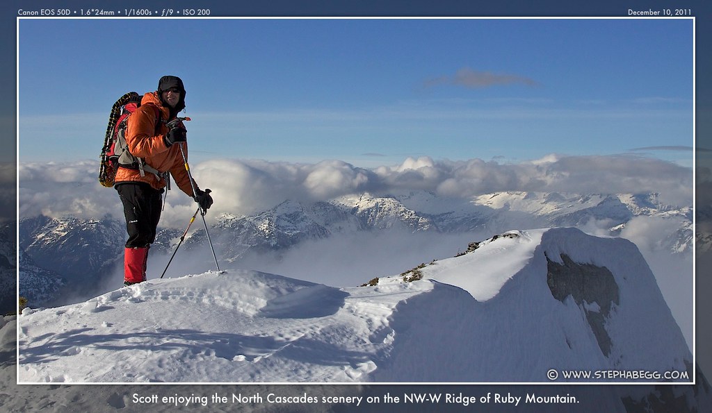
Between 12:13 and 12:45 pm, all of us summited except Bodie, who was left anchored to a tree, deemed too rambunctious to handle the final scramble over exposed mixed rock and snow to the summit. The 7,408-ft summit of Ruby Mountain is open with a unique views looking directly down onto Ross Lake, as well as far-ranging 360-degree views of other peaks in the North Cascades National Park. There is also an antenna/repeater station on the summit.
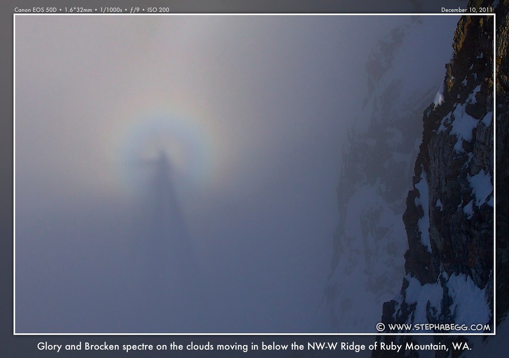
Then we headed down. Clouds started to move in a we descended (giving rise to some really cool glories and Brocken spectres), and soon we were enveloped. We were lucky to have had such a beautiful ascent. The vertical mile of descent was long and tedious, but we made it out just before dark. Carla's light sabers will have to wait until another time.
Below are some route photos, showing the route in order from trailhead to summit.
• • • Our Canine Component • • •
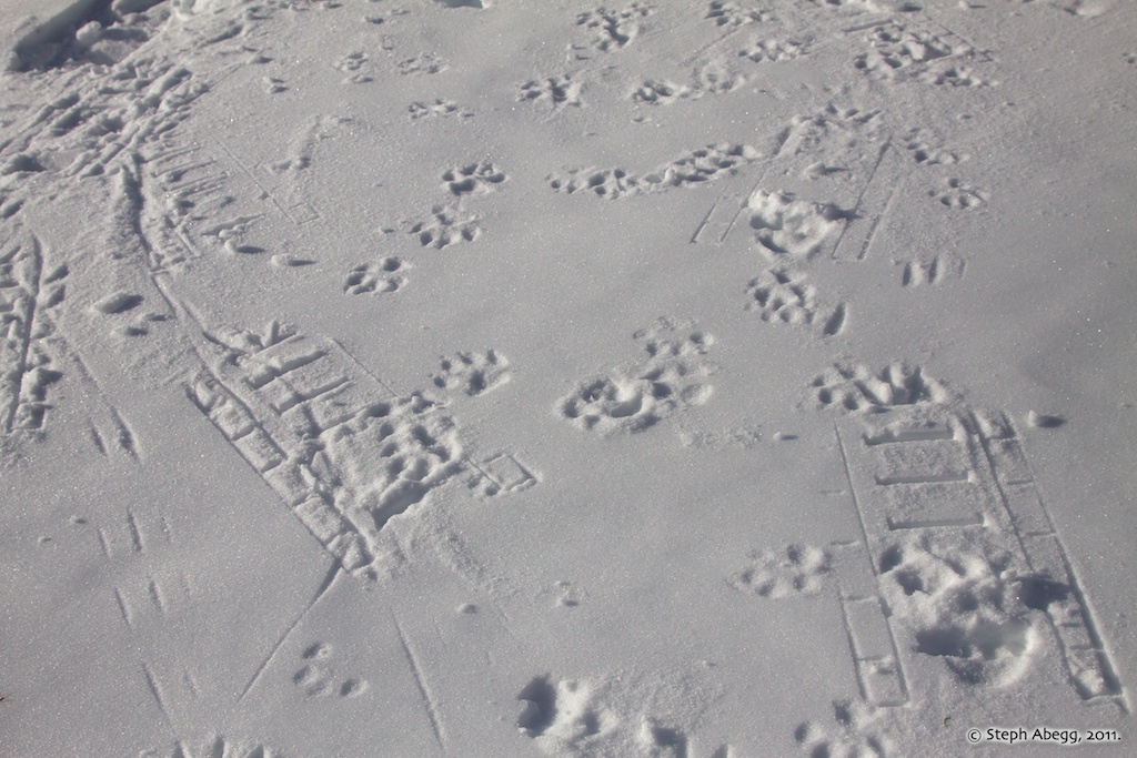
Even though Bodie's straight legs are ideal for post-holing and his toes were bare to the frozen snow, he kept in great spirits. Judging from the footprint evidence, Bodie probably climbed 3 Ruby Mountains in the time we climbed once (which makes up for the fact that he was not allowed to ascend the final exposed rocky-snow ridge to the summit, a decision he is protesting in the photo below).
• • • Interesting Facts about Ruby Mountain • • •
Interesting note #1:
Ruby Mountain is almost an island. The mountain is bordered by Ross Lake on its north side, Diablo Lake on its west side, Thunder Creek wrapping around the southwest side, Panther Creek wrapping around the east and southeast side, and minor streams flowing from Fourth of July Pass on the south side of the mountain. Ruby Mountain just barely avoids being an island by only approximately 0.5 miles (i.e along Fourth of July Pass).
Interesting note #2:
In the 1960’s and early 1970’s, there was a plan to build an aerial tramway to the summit. However, due to high project costs and political issues, the tramway plan was eliminated by the mid-1970s. The tramway certainly would make getting to the summit easier, but also much less rewarding.