Mt. Shuksan, Fisher Chimneys (Class 4, snowy early summer conditions)
Mt. Shuksan
Route:
Fisher Chimneys
Class 4, snowy early summer conditions
My sister had been disappointed I had not climbed Rainier with her, so we climbed this the next week. The summit pyramid was a bit icy, so I climbed the last couple hundred feet alone. I also found a lonely ice axe in the summit gully.
THIS TRIP REPORT IS STILL MOSTLY IN THE EMBEDDED HTML FORMAT OF MY OLD WEBSITE. MOBILE Tip: Try Landscape mode. It is generally more mobile friendly.
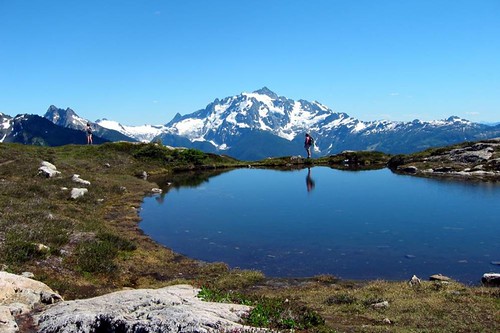
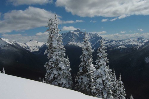
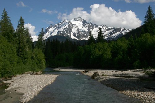
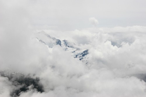
On June 25 my sister and I decided to take advantage of the unusually nice weather forecast and go on an overnight trip in the North Cascades. "Let's go to Lake Ann, check out Shuksan--some day I want to climb that mountain," I said. Every time I have skied or hiked near Mt. Baker, Shuksan's grand walls have beckoned me. It has always looked like such a fun mountain to climb. Here is a small sampling of the photos of Shuksan I have taken over the years, ranging throughout all the seasons.
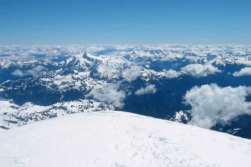
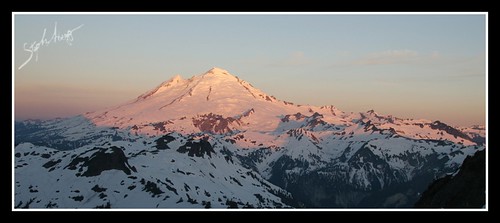
June 15, 2004. Looking down on Mt. Shuksan from the summit of Mt. Baker.
July 22, 2004. Shuksan from Yellow Aster Butte.
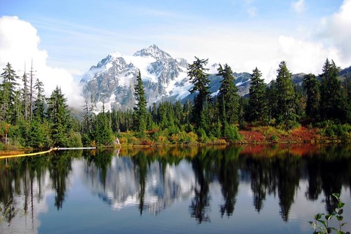
Sept 23, 2004. Shuksan and Picture Lake.
Dec 12, 2004. Shuksan from Artist Point in winter.
Dec 23, 2004. Shuksan from Welcome Pass.
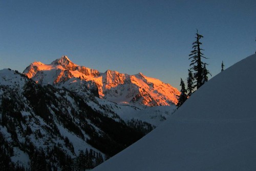
Dec 27, 2004. Wintertime Shuksan in alpineglow.
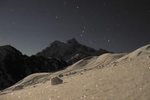
Dec 27, 2004. Wintertime Shuksan and Orion.
March 22, 2005. Shuksan from Welcome Pass.
June 19, 2005. Shuksan from Goat Peak.
June 19, 2005. Shuksan from Hannigan Trailead Road.
Aug 19, 2005. Shuksan at sunrise from Yellow Aster Butte.
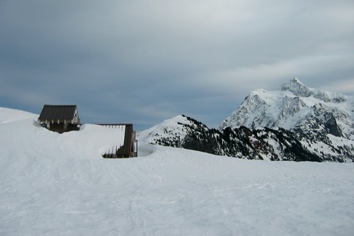
Feb 9, 2006. Shuksan from a snowshoe at Mt. Baker Ski Area.
Feb 19, 2006. Shuksan from a snowshoe at Mt. Baker Ski Area.
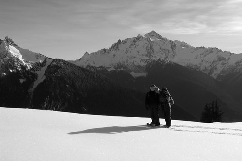
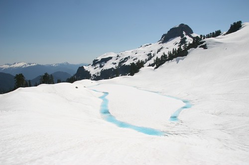
June 5, 2006. Shuksan from Yellow Aster Butte trail. This was taken 3 weeks before the climb!
"Let's bring our climbing gear and Beckey's guide and check out the Fisher Chimney route," became the plan. My sister was still a bit disappointed that I had not invited her on my climb of Rainier, and looking for something to climb.
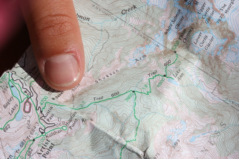
So, we hiked into Lake Ann. There was snow covering the trailhead, but we knew that the trail descended 800 ft into the valley leading towards Shuksan and then ascended again to a ridge above the lake, so we managed to hike to the lake without many problems (besides some nasty bushwhacking and some questionable snow-bridge jumping and some slogging through slushy snow). It took us 5 hours to hike the 5 miles from the Upper Parking lot (est. 4,400 ft) at Mt. Baker Ski Area to Lake Ann (est. 4,600 ft).
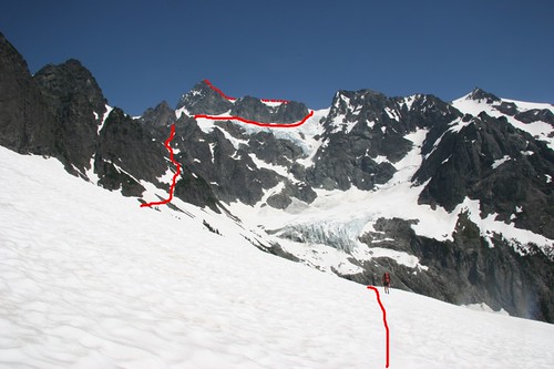
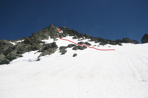
The lake was completely snow-covered but we managed to find a dry spot on the hill to the north of the lake (4,800 ft), complete with a small stream of snowmelt. We spent a few minutes surveying the Fisher Chimneys route and then escaped into the shade. Here is a photo of Shuksan from the shoulder just north of Lake Ann. The Fisher Chimneys route is drawn in red.
The verdict: "We are definitely climbing that tomorrow."
June 27 we woke up at 3:30am and began our traverse across Shuksan Arm by 3:50am. The snow had not hardened much during the night due to the unusually warm weather, but we used crampons anyway. The traverse to the start of the chimneys was straightforward. Finding the entrance to the chimneys route was potentially difficult, but we were lucky to find the steep trail leading up the rock. The photo below shows the start of the chimneys (sorry Jenny, didn't have another photo).
We began our climb up the chimneys around 5:25am. There was a pretty distinct trail, and besides one awkward move in crampons (shown below), it was relatively easy. Throughout the chimneys we wore our crampons since there was a steep snowfield in the upper half of the chimneys. While we climbed we were treated to a great view of the sunrise colors on Mt. Baker.
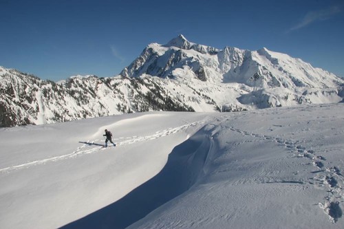
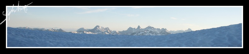
We reached the top of the chimneys (est. 6,720 ft) at around 6:10am. The route here was a bit unclear and we were surprised to see no tracks from other climbers since it had been such a nice weekend. But we traversed northeast and arrived at a crampon-scarred rock outcrop with a nice bivy site. Beyond this was the beginning of Winnies Slide, a 40° snow slope leading up to the Upper Curtis Glacier. We roped up here and I took some photos of the Canadian peaks to the north.
We reached the Upper Curtis Glacier at 7am. Following the description in Fred Beckey's ubiquitous guide, we climbed up the left side to avoid steep ice and crevasses, and 20 minutes later we were beginning the relatively level traverse (est. 7,350 ft) south across the Upper Curtis Glacier towards Hell's Highway. The Hourglass leading up to the summit at the beginning of the traverse was a tempting option since it eliminated quite a bit of distance, but it looked difficult so we stuck to the standard route.
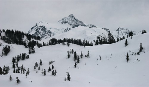
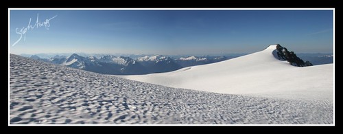
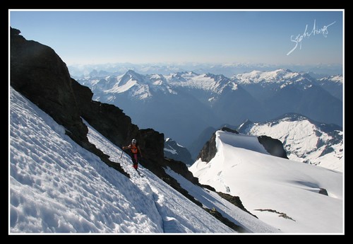
At 8:10 am, we reached the top of the rather steep but secure Hell's Highway and were standing at 7,520 ft looking onto the snowy expanse of Sulphide Glacier. This made for some good photos....
It took 35 minutes of slogging up the blistering snowfield, and we were at the base of the summit pyramid, about 600 vertical feet below the summit. Undaunted, we headed for the gully shown in the photos below. (The snow was pretty soft on the lower pyramid and we punched through into hollow areas a couple of times, making the going a bit slow.)
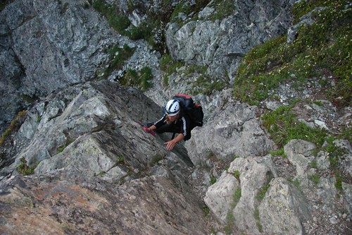
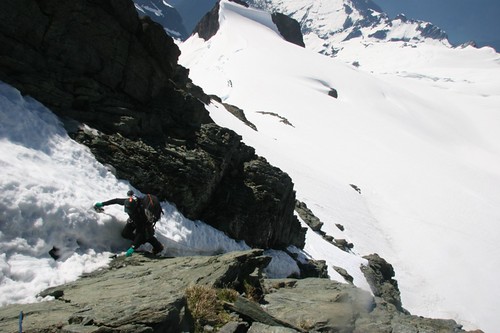
Where the gully narrowed, the route got interesting. The snow was either icy or too soft to hold pressure, and I ended up stemming across with one foot on smooth rock and the other foot wedged on a loose ice/rock/snow mixture. In retrospect, I should have gotten my sister to set a belay rather than continuing to climb together with a rope between us, but we climbed slowly and made it past the tricky sections. I finally made it to the rappel sling I had spotted from below, and anchored in and belayed my sister up the pitch. The photo below (taken on our descent) shows another climber ascending the summit gully (he and his partner were the only other climbers we saw the whole day, and were also climbing the Fisher Chimneys route).
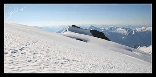
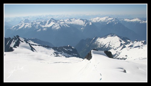
At this point, my sister decided that she had had enough. It was 9:30am. I didn't want to have climbed for five and a half hours only to turn around 300 ft from the summit, so after making sure my sister was anchored in and okay with the situation, I took the rope, 2 slings, my ice axe, and my camera, and headed up the final snowfield to the summit. The snow was steep and soft, but was not as difficult as the previous pitch. I was surprised to find a Black Diamond ice axe just lying in the snow, and added it to my meager ration of gear. I took my crampons off for the final rock scramble to the summit, and just before 10am, I arrived on top of Shuksan (9,131 ft). The ascent had taken 6 hours. The conditions on the summit were pleasant--warm with a light breeze and great visibility. The photo below shows the view from the summit looking south onto the Sulphide Glacier below.
I carefully downclimbed back to my sister, finding having the extra ice axe quite helpful. My sister and I took advantage of the fixed rappel sling and lowered down as far as our 75 ft rope would allow, although this was not far enough to get past the sketchy section we had climbed up. I was able to downclimb the rock on the left of the snow (perhaps climbing up this would have been easier than the route we took), but my sister didn't feel comfortable doing that; fortunately, the only other 2 climbers on the mountain were coming up the gully at that time, and offered to lower my sister down to the next rappel sling. After one more rappel we were on easier ground. We reached the bottom of the summit pyramid by 11:30am.
There is not much to say about the rest of the descent back to Lake Ann, other than it followed the same route as the ascent and took just as long (6 hours). It was by now incredibly hot, especially on the long snow field traverses, and by the time we got back to our camp at 4:15pm we were quite tired, but pleased with our success (even though only one of us summited, we both made it down safely and without incident).
We didn't feel like making the hike back to the car, but I had plans to climb with a friend the next day so we packed up and began the slog through the soft snow. I won't go far into the details, but the way out involved soft snow, collapsing snow bridges, terrible bushwhacking, sketchy gullies, soaking ourselves as we climbed up a stream to a trail that didn't exist, retracing our steps to find the trail 20 feet below where we had started up the stream, finally getting to the car only to realize somewhere along the way my snowshoes had fallen off my pack, grabbing my headlight and heading back up the trail to find my snowshoes, ....
Needless to say, I was not in the mood to take pictures.
The end result was that we got home pretty late. I had to wake my friend up at 3:30am to tell him I was in no shape to climb the next day (sorry!), and then I fell into a deep sleep.
Another successful climb of a true North Cascades classic! And an unsolved mystery of a lonely ice axe to add to the memory of the day. Wonder which summit will be the next to check off my list: Challenger, Forbidden, Stuart, Prusik, Formidable, Fury, Triumph, and the list goes on....
Useful beta. Updated route information. Corrections. Historical notes. Interesting facts. No fluff please. Please do not put links in your comment, as my spam filter will filter those comments out.