Three Fingers Peak / Fire Lookout (summer & winter overnights)
Three Fingers Peak / Fire Lookout
Route:
Trail via Goat Flats
rugged hike or snow-covered trail
September 2008: In September 2008, summer finally arrived in the North Cascades. It was the perfect time to climb Three Fingers, and stay overnight in the precariously-perched old fire lookout on the south summit. I had begun my summer with a fun night of night photography in the Hidden Lake Lookout, and so I bookended my summer with another night of Lookout night photography.
March 2010: The Three Fingers Lookout in the winter definitely makes a 5***** snowcave.
This page contains two trip reports for overnight stays at the Three Fingers Lookout.
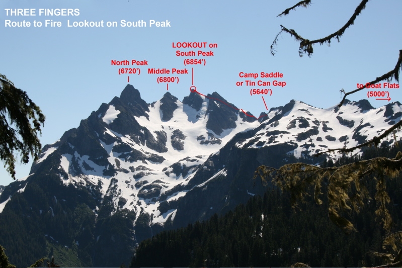
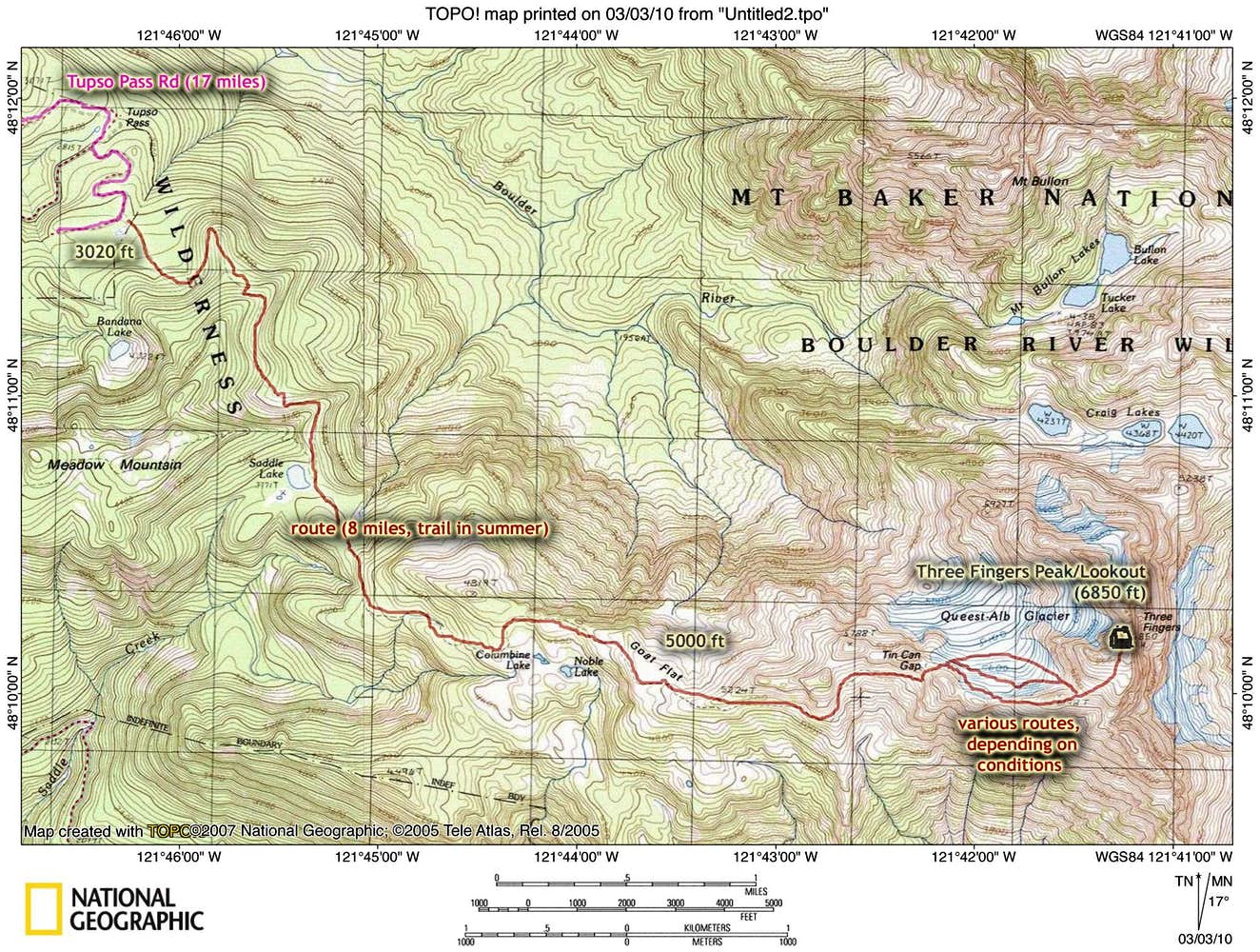
Lookout Location & Route Overlay (Summer)
CLICK TO ENLARGE
Route Overlay (Winter)
CLICK TO ENLARGE
Map
CLICK TO ENLARGE
Fire Lookouts of Washington
While I lived in Washington, I tried to visit as many of the remaining standing fire lookouts scattered about the mountain ranges of Washington as I could. Click the following link to go to my webpage on fire lookout structures of Washington, which gives a bit of history of fire lookouts as well as a complete listing of the remaining standing lookout structures in the state.
CLICK TO ENLARGE
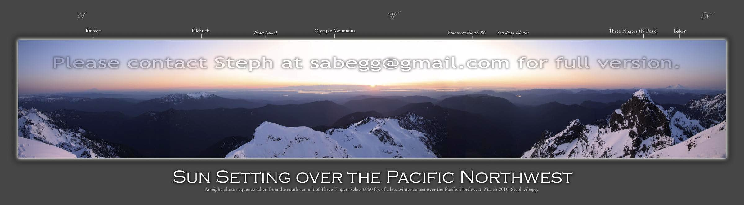
Labeled Panorama
CLICK TO ENLARGE
Aerial Footage
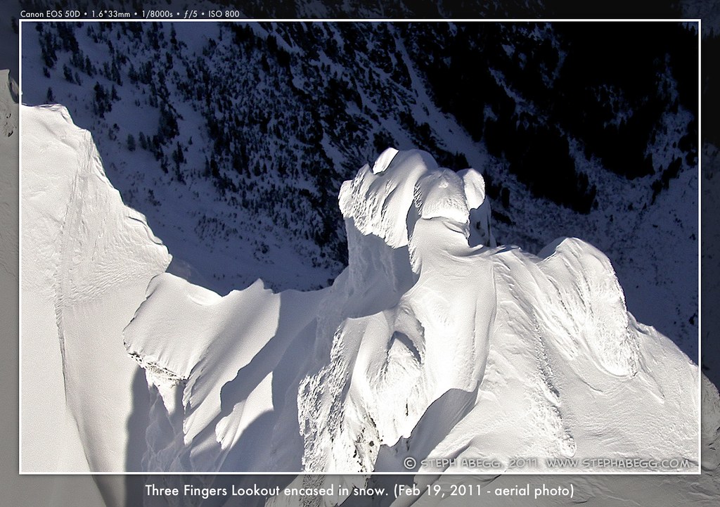
VIDEO FOOTAGE I TOOK FLYING AROUND THE SNOW-ENCASED THREEE FINGERS LOOKOUT ON JAN 3, 2013.
Intro
THIS TRIP REPORT IS STILL MOSTLY IN THE EMBEDDED HTML FORMAT OF MY OLD WEBSITE. MOBILE Tip: Try Landscape mode. It is generally more mobile friendly.
SUMMER
WINTER
An aerial photo I took of the lookout the following winter. Also see the video above, which really puts a winter ascent in perspective!
Overview of Lookout
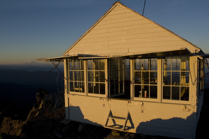
The Three Fingers Lookout
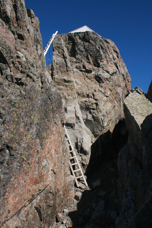
THE LOOKOUT: When Darrington District Ranger Harold J. Engles and trail foreman Harry Bedal decided to construct a lookout in 1931, they picked a high rock spire overlooking thousands of acres of old-growth timber on the Snoqualmie National Forest to the east of Seattle, Washington. This high rock spire was the south peak of Three Fingers. All the materials for this gabled L-4 cab had to be lifted the last 1,000 feet via a windlass made from telephone wire. The top 15 ft of the summit block was blasted to make room for the fire lookout cabin. The only way to get up to the lookout was (and still is) via a series of ladders on the final exposed summit perch.
The Three Fingers Lookout was staffed for only ten years and abandoned in 1943. It was restored in the 1980s, and is maintained by volunteer hikers and kept open to any hikers who can get there. It is listed on the National Historic Lookout Register.
The Route
TRAILHEAD: Three Fingers/Goat Flats/Saddle Lake Trail No. 641. To get to the trail, drive 17 miles up the Tupso Pass Rd. No 41, which branches left off the Mountain Loop HWY 6.5 miles east of Granite Falls (the turnoff is unmarked until a small HWY 41 sign about 100ft down the road, so make sure to pay attention!) NOTE: Goat Flats and the lookout are quite popular, especially in the fall when the route becomes more straightforward. If you want to spend a night alone in the lookout, your best bet is to go midweek.
ROUND-TRIP DISTANCE: 16 miles if you are luckly enough to start at the trailhead
TIME: On my summer 2008 hike to the lookout, it took us a little under 5 hours to get to the lookout. On my winter 2010 trip getting up to the lookout took about 7-8 hours at a mellow pace and a few short breaks. On both trips, the descent times were about equivalent to the ascent times.
TRAILHEAD ELEVATION: 3,020 feet
SUMMIT ELEVATION: 6,854 feet (used to be 6,870 ft before 15 feet were blasted in 1931 to make room for the fire lookout cabin).
NOTE: Goat Flats and the lookout are quite popular, especially in the fall when the route becomes more straightforward. If you want to spend a night alone in the lookout, your best bet is to go midweek (or in the winter!).
Trip Reports for Three Fingers Lookout
CLICK ON TRIP REPORT TO DROP DOWN CONTENT
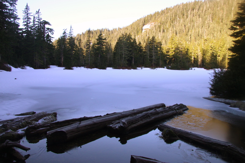
Three Fingers as seen from about 1 mile up the trail, This photo was taken in mid-July 2008 when there was considerably more snow on the mountain than when Doug and I climbed it in September 2008.
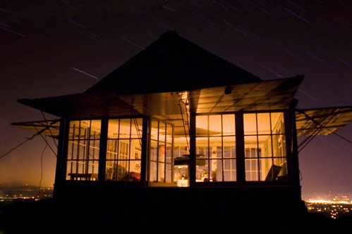
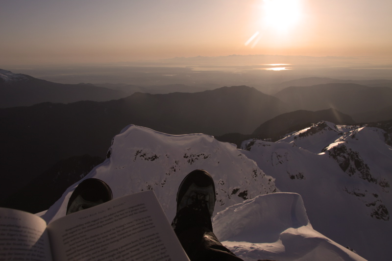
A moonlit night at the precarious perch in the old fire lookout on the summit of Three Fingers. It was a perfect night, warm and calm with a waning moon for the first half of the night, and starry skies for the early morning hours. I hope Douglas managed a few hours sleep amongst my all-night antics.
Photo Trip Report
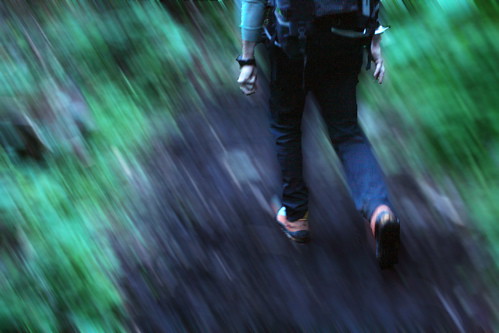
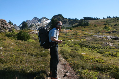
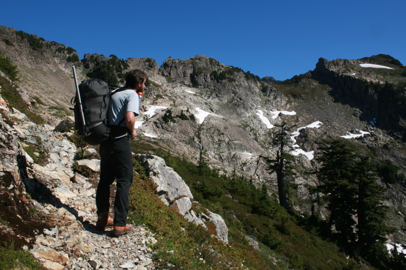
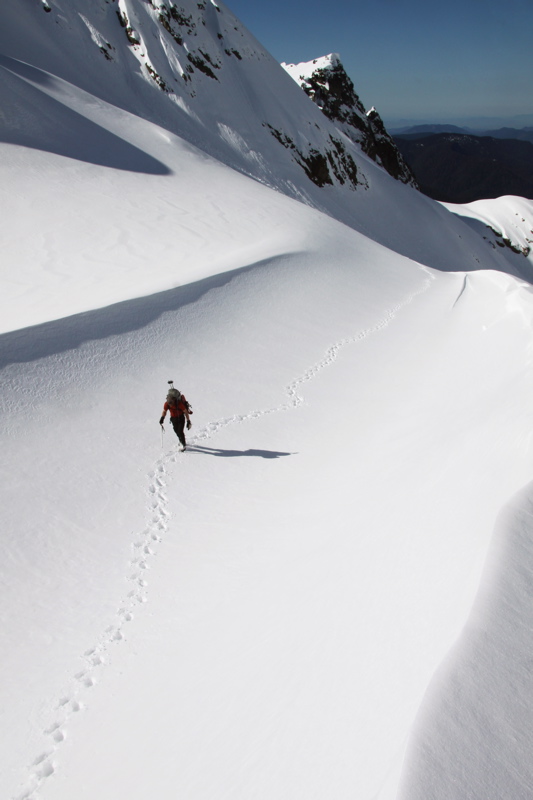
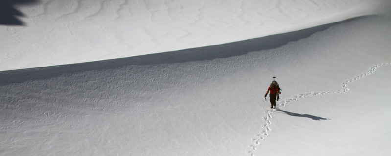
Douglas hiking up the trail. The 5 miles and 2000ft elevation gain from the trailhead to Goat Flats is over-traveled, and in the early season the trail is synonymous with a stream.
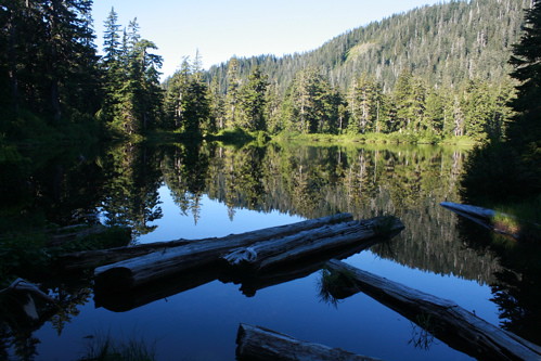
Saddle Lake, which is 2.5 miles from the trailhead.
Doug at Goat Flats. It took us 2 hours to hike the 2000 ft and 5 miles between the trailhead and Goat Flats. Several people actually camp at Goat Flats and dayhike up to the lookout from here.
The easy trail traverse to Tin Can Gap (saddle on the right). There seems to be some ambiguity in the Cascade Alpine Guide that suggests that the saddle that everyone refers to as Tin Can Gap is called Camp Saddle.
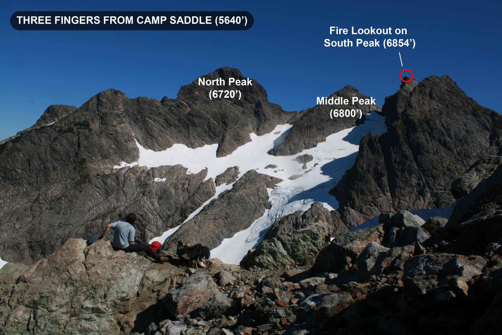
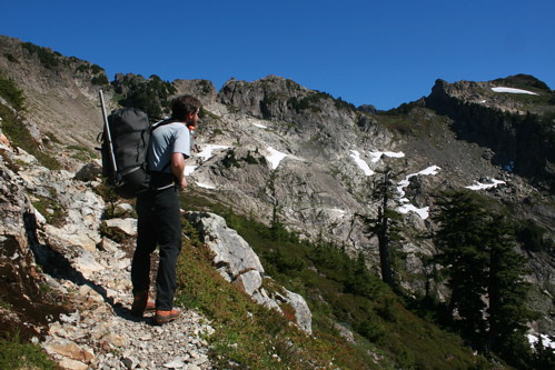
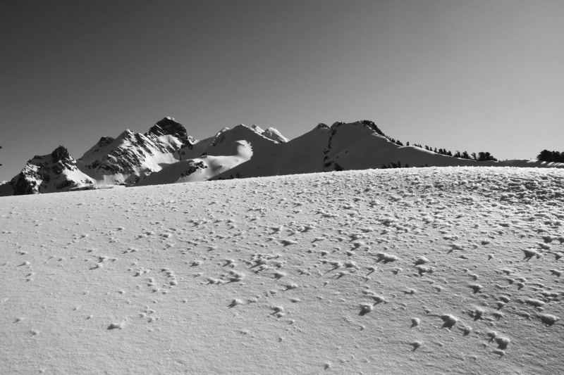
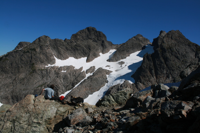
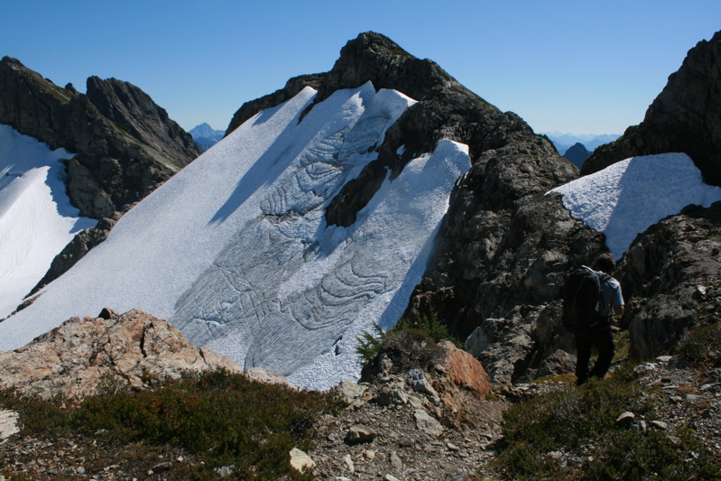
The view of the three summits of Three Fingers from Camp Saddle (or Tin Can Gap). Depending on the conditions and time of year, the route from here to the lookout can involve some steep traversing of the upper Queest Alb Glacier or an easy hike on a trail to the summit. Usually September and October yield the easiest conditions, and from here it took us an easy 90 minutes to the lookout.
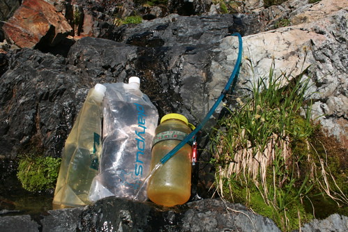
We collected water about 300 ft below the lookout.
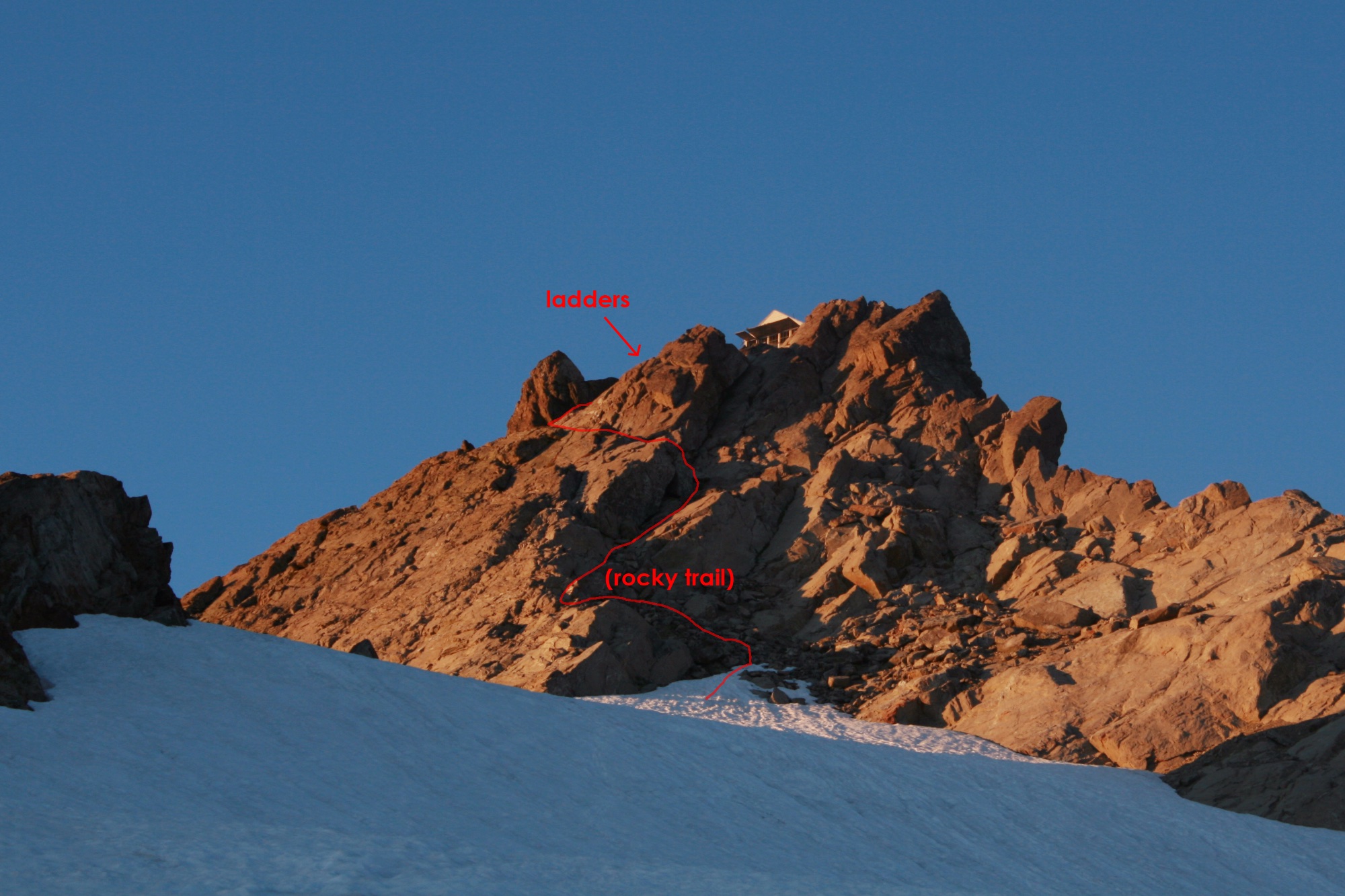
The final climb up to the lookout is a short snowfield and an easy rocky trail to the ladders (at least under Sept. 2008 conditions).
Three ladders to the summit.
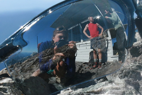
I found that Douglas's sunglasses were excellent reflectors and snatched them when he was talking to another guy who had hiked up for the day….
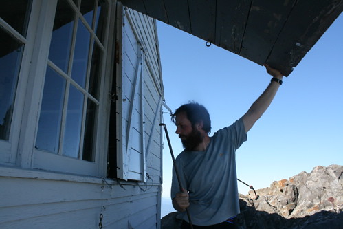
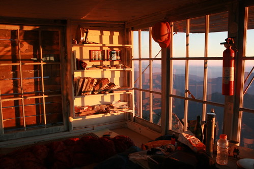
We had fun traversing around the airy lookout and propping open the shutters with metal rods. The lookout was built in 1932-3, and is showing some wear, although it has held up quite well under the maintenance of the Everett Mountaineers.
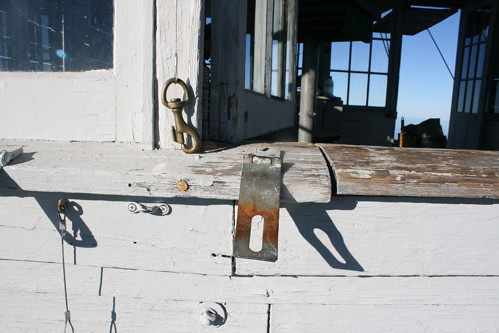
An old latch to batten down the windows.
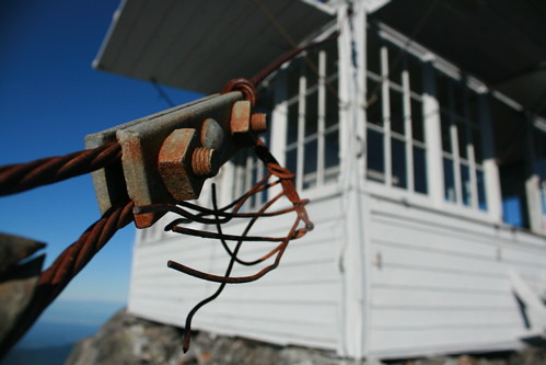
The lookout is tightly wired down to the mountain. I imagine this place has weathered some pretty severe winds and storms since it was built in 1932-3.
There is some interesting reading in the lookout, including some old newspapers from the '30s. This ad boasts the amazing efficiency of what we finally figured out was a calculator. "To subtract, merely touch the subtract bar. It's just as simple and fast as touching the adding bar." Hmm…what about logarithms and square roots….
Despite the nice textbook library (including books on Mathematics, College Physics, and Pharmaceutical Measurements), we were disappointed to find the library lacked a Thermodynamics textbook. This would have been useful to figure out how much longer we needed to cook some carrots due to the decrease in boiling temperature at altitude….
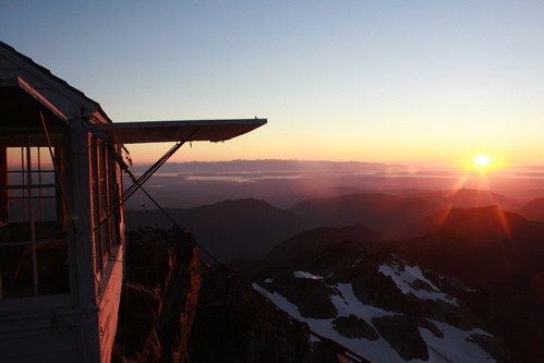
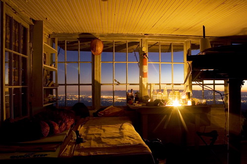
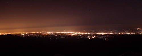
Sunset over Puget Sound. From our perch, we could see Saturna Island (a beautiful non-mountain destination where I love to spend my time) and the rest of the San Juan and Gulf Island chains.
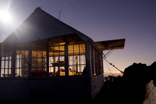
Evening light in the lookout.
A cozy candle-lit evening in the lookout, with the city lights towards Puget Sound far below. I spent the night hours taking photos of various permutations of candlelight, stars, moon glow, and city lights. Click here to open my page devoted to night photography.
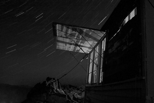
Moonlight in the lookout (20 minute exposure). Click here to open my page devoted to night photography.
Orion. To me, seeing this constellation always means that fall must be approaching…. Click here to open my page devoted to night photography.
Candlelight and star streaks (20 minute exposure). Click here to open my page devoted to night photography.
Now a black-and-white photo of candlelight and star streaks (20 minute exposure). Click here to open my page devoted to night photography.
Candlelight, star streaks, and city lights (20 minute exposure). Click here to open my page devoted to night photography.
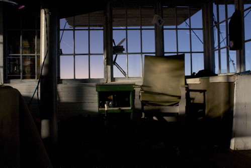
What a great place to wake up! That's Mt. Baker on the skyline.
Morning in the lookout (taken just before Douglas noticed that I knew where his sunglasses had been all along….).
Photo Trip Report from out Winter Ascent
Earlier in the winter I had found the Winchester Fire Lookout
to be the perfect place to not study for a midterm. So, with finals
looming, I decided to head to the Three Fingers Fire Lookout on the
summit of Three Fingers in order to perfect my studying techniques.
In
the wintertime, this summertime hike becomes an advanced mountaineering
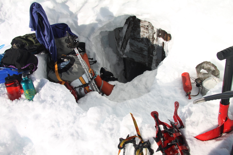
challenge, including many dangerous snow slopes and digging through about 5 feet of hard snow to reach
the door of the lookout, which is buried under an impressive coating of
rime. Most years, it would not even be feasible to reach the lookout in the winter, as the 17 mile dirt road to the trailhead would be buried under snow (I suppose you could skin up it, but that's adding quite a lot of mileage to the trip). The winter of 2010 was definitely the winter to attempt the Three Fingers Lookout, as the unusually high snow line kept many approach roads free of snow to the trailheads.
Below is a series of photos from my overnight adventure with Dave
Chase to the 5-star snowcave on the summit of Three Fingers. I've given
some comparison shots from my hike to the lookout in Sept 2008 to show
how the conditions are wildy different in the winter.
Saddle Lake, 2.5 mi up the trail.
(Compare to Sept 2008)
View of Three Fingers from Goat Flats.
Trees at Goat Flats.
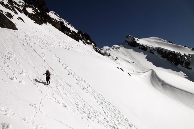
The route follows this ridge above Goat Flats until it steepens, and then heads right to traverse a south-facing slope.
(Compare to Sept 2008)
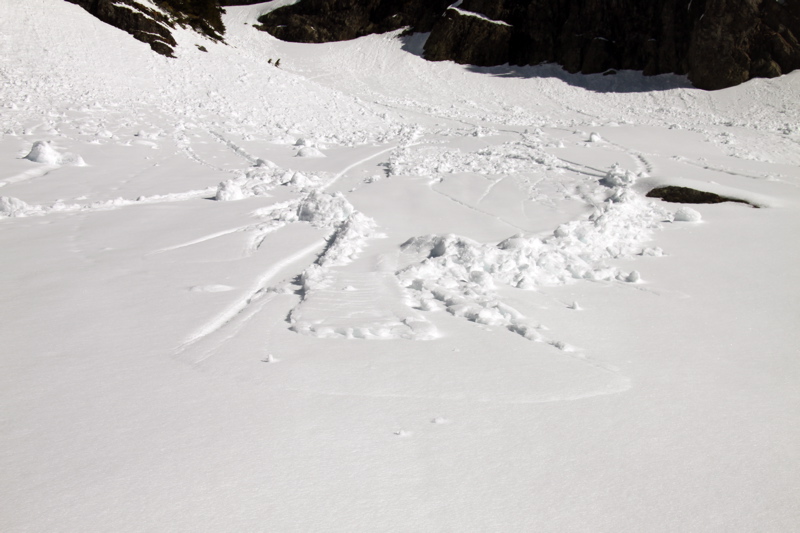
We crossed a lot of wet slides. Most of these slides had happened the day before, which had also been uncharacteristically warm.
Track of a rolling rock.
Dave on the traverse between Goat Flats and Tin Can Gap.
Dave traversing towards Tin Can Gap. The south facing slopes were a bit soft, and there were several wet slides that had occurred, but a week of fair weather had consolidated the slopes enough that slide potential was low. Slide potential is definitely something you have to consider in spring-like conditions such as these.
(Compare to Sept 2008)
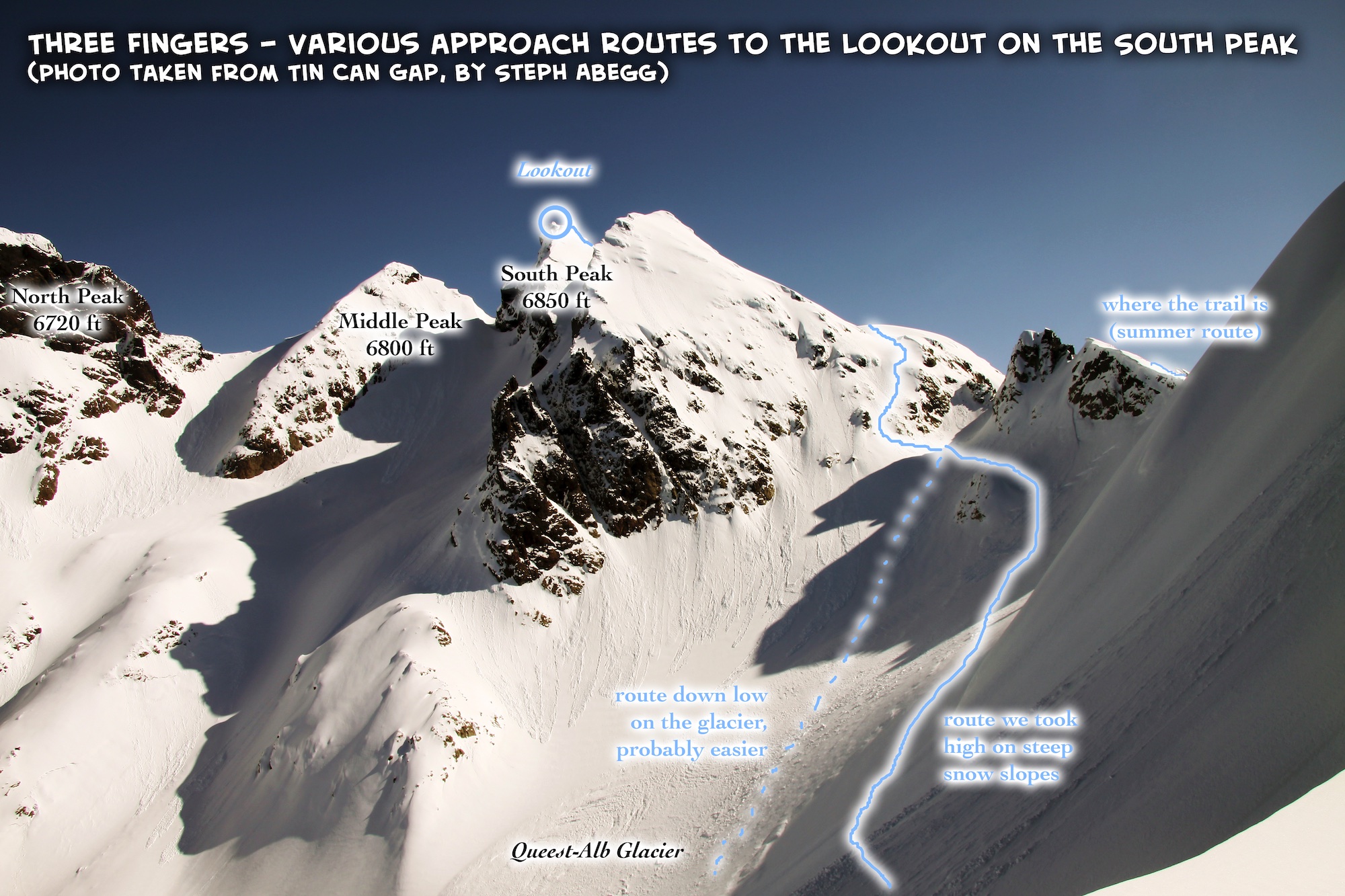
The view of Three Fingers as seen from Tin Can Gap. The photo on the left shows a route overlay for the possible approaches from here (on glacier if enough snow, or on ridge above if late summer).
I was a bit concerned about crossing the steepish north-facing slopes due to avy potential, and we actually turned back at one point and descended around one of the first upper slopes since I just didn't have a good feeling about it (it was pretty wind-loaded). But most of the north-facing slopes had already slid, and the snow conditions were feeling stable, and certainly less sloppy than the south-facing slopes we had just crossed, so we felt the risk was worth taking.
(Compare to Sept 2008)
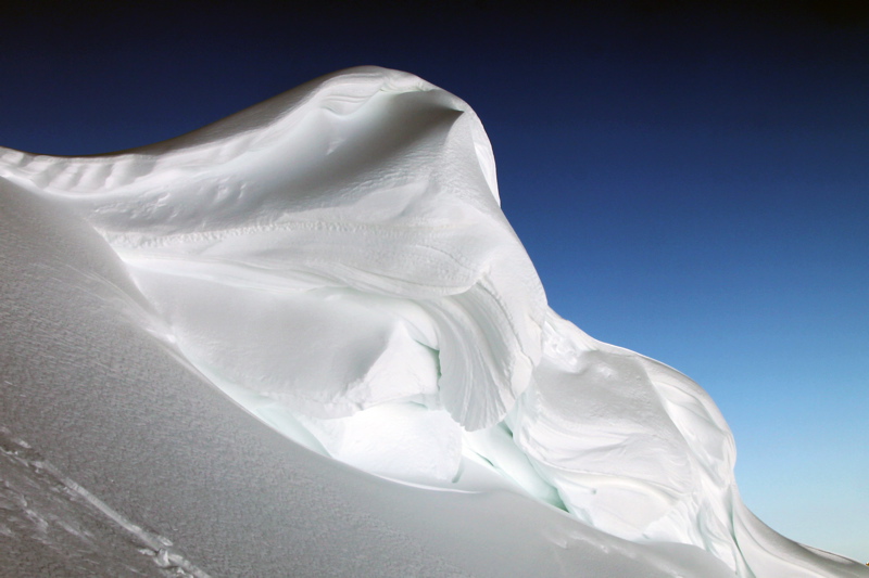
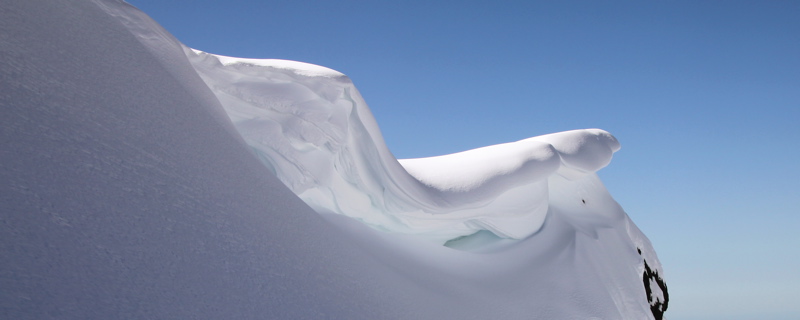
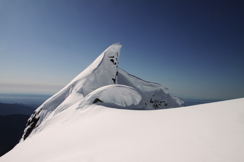
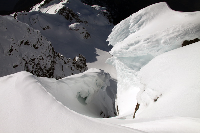
A cool cornice above Tin Can Gap.
Another cool cornice above Tin Can Gap.
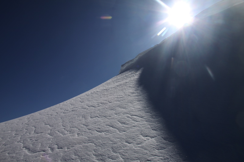
Sun and snow.
Traversing the upper Queest-Alb Glacier. Tin Can Gap is in the background.
(Compare to Sept 2008)
Dave in a cool wind-formed valley on the upper Queest-Alb Glacier.
Looking back at the traverse across Queest-Alb Glacier. We chose a high route, but depending on snow conditions it might be easier to drop lower on the Queest-Alb Glacier.
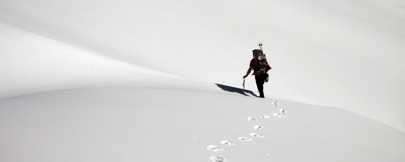
Zig-zagging up and up.
The final slope to the lookout.
(Compare to Sept 2008)
Cornices near the summit.
(Compare to Sept 2008)
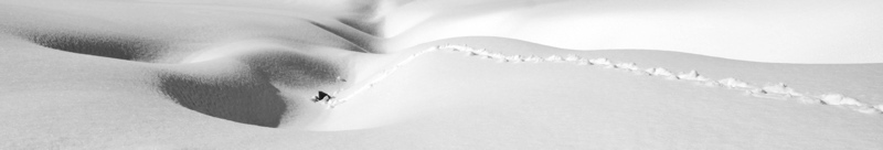
In the summer the lookout can only be reached by a series of ladders. The ladder gullies were full of snow, so we just climbed up steep snow to the lookout. This photo is taken looking down where the ladders are.
(Compare to Sept 2008)
The buried Three Fingers Lookout. The door is below where Dave is in the photo.
(Compare to Sept 2008)
I wouldn't let Dave have the shovel, I was having too much fun reliving my snowfort building days.
It took only an hour to dig ourselves to the door. It probably would have taken a bit longer, but some skiers had been at the lookout 4 weeks previous so the snow in this area was not as compact as it could have been.
What a place to not study!
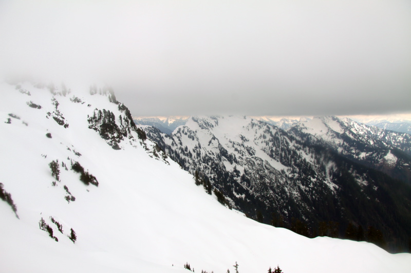
The summit of Three Fingers has a unique 360° view: Mt. Baker to the north, Glacier Peak to the east, Mt. Rainier to the south, and the Puget Sound and Olympics to the west.
Alpenglow on the buried lookout.
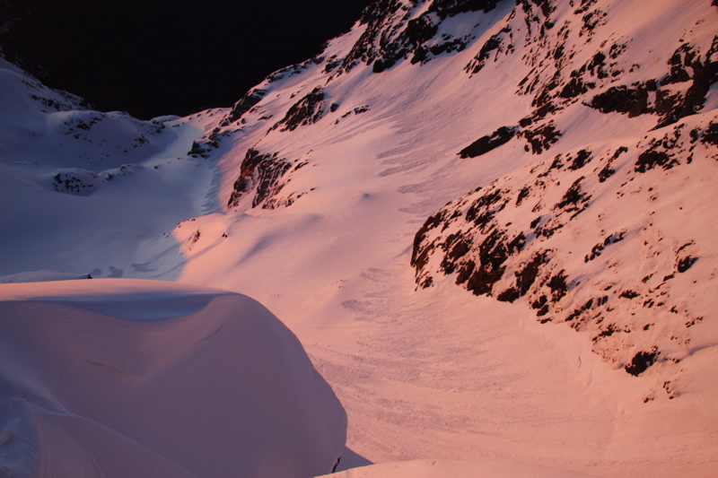
Alpenglow on the slopes below. Note all the wet slides from the warm weather.
(Compare to Sept 2008)
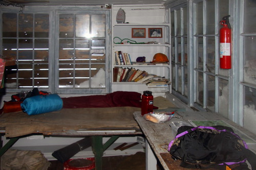
Inside the buried lookout. A 5-star snowcave.
(Compare to Sept 2008)
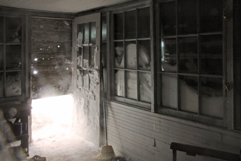
How we got in. Fortunately, the shutter over the door on the lookout does not go all the way to the ground.
An "Osborne Firefinder", an instrument that would aid the firefinder in plotting the exact location of a spotted fire on a map.
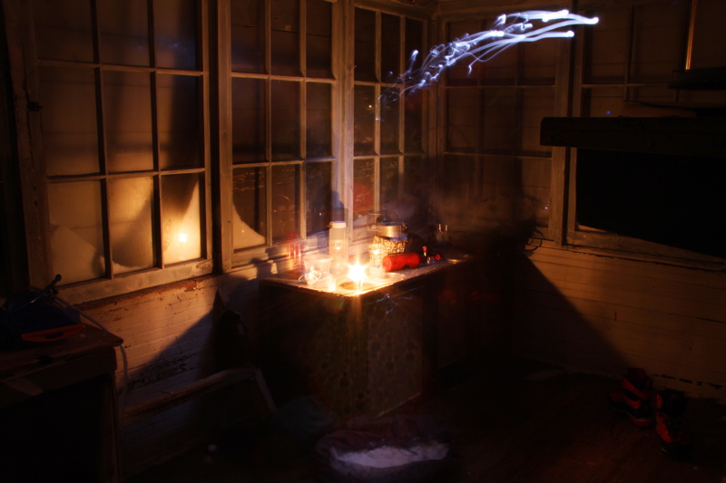
Cooking dinner by candlelight.
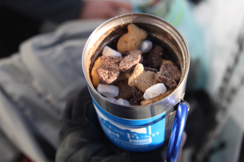
Hot chocolate "with marshmallows."
City lights below. I didn't do much night photography, since clouds moved in overnight, and the lookout was cozier than the steep precipices on all sides
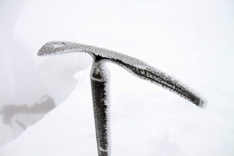
Rime on my ice axe the next morning.
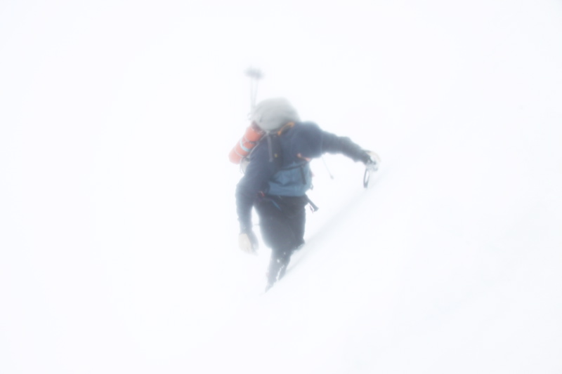
Traversing the upper Queest-Alb Glacier in a whiteout on the way out the next day. Our tracks from the day before had been obscured by the wind, but we made sure to maintain the relatively level traverse we had made the day before, as well as note certain landmarks (like the wind-sculpted valley) along the way to keep ourselves oriented. You can quickly get lost on this sort of terrain in a whiteout, so it pays to pay attention on the approach.
Useful beta. Updated route information. Corrections. Historical notes. Interesting facts. No fluff please. Please do not put links in your comment, as my spam filter will filter those comments out.