Fremont Peak (& Titcom Basin)
Route:
SW Slope
3rd
Two trip reports 18 years apart.
Region: Wyoming
Elev: 13,745 ft
Mode:


Date(s): September 11-13, 2012 (Tue-Thu)
Partner(s): "Titcomb Bill'
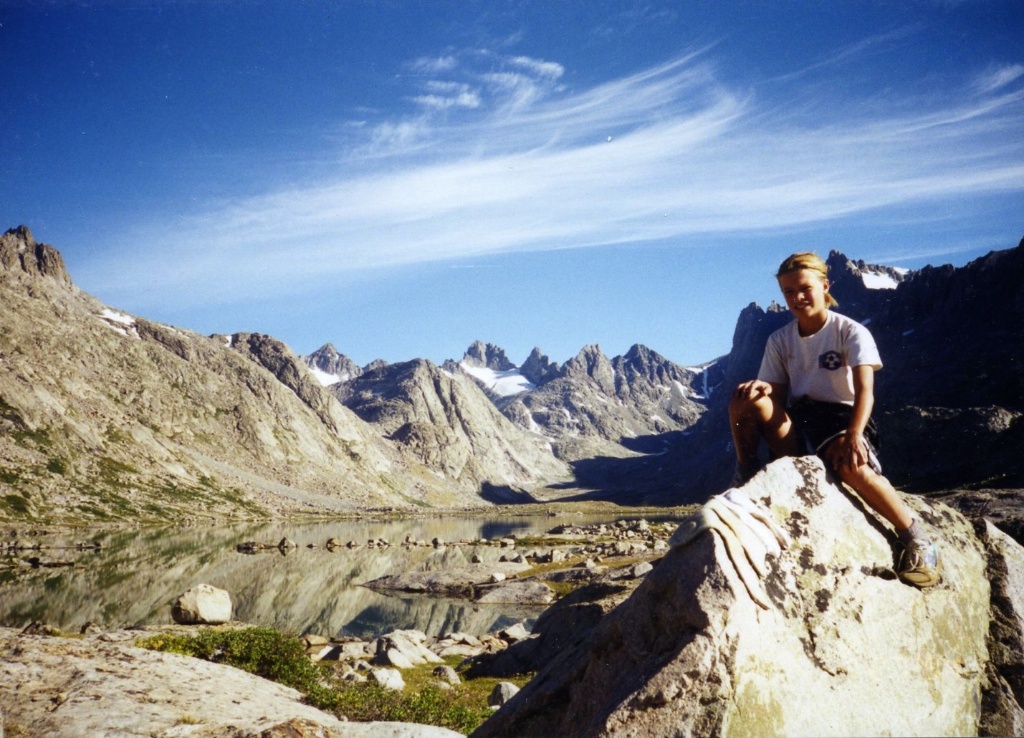

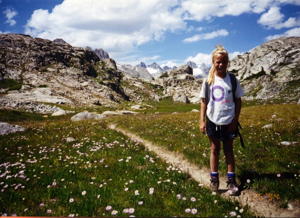
Me sitting on a rock in Titcomb Basin, 11 years old and 29 years old.
|
• INTRODUCTION •
A majority of my childhood was lived in the Midwest. My parents — having spent nearly a decade living and mountaineering in Washington until my dad's PhD studies took him eastward — still felt the draw of the mountains, so for a few weeks every summer we packed up the family minivan and headed west.
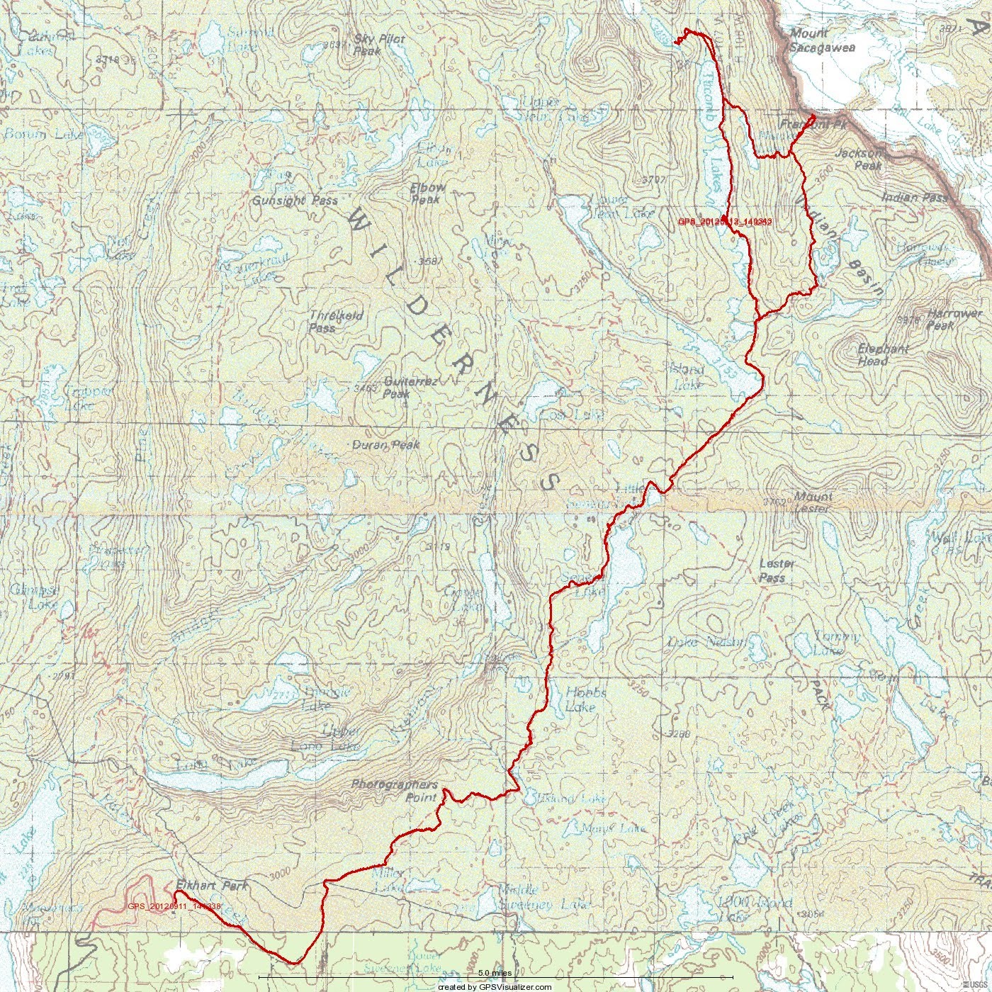
• ITINERARY / MAP FROM 2012 TRIP •

|
|
• TWO TRIP REPORTS 18 YEARS APART •
| July 1994 | Captions | Sept 2012 |
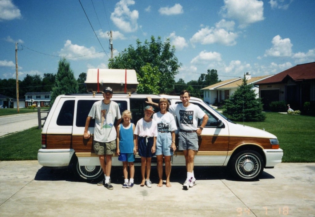 |
L: Pre-trip photo in front of the fully-loaded white-with-brown stripe (they don't make them like this anymore!) 1992 Dodge minivan. Not sure why I have only one shoe on. We certainly had a full load, as my parents had also invited along two friends (Matt, standing on left in photo; and Sheryl, taking the photo). R: 2012 and on another climbing roadtrip....
|
|
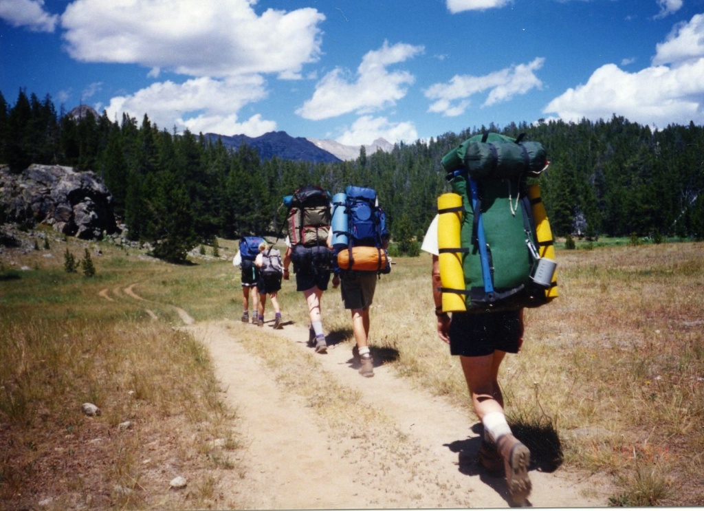 |
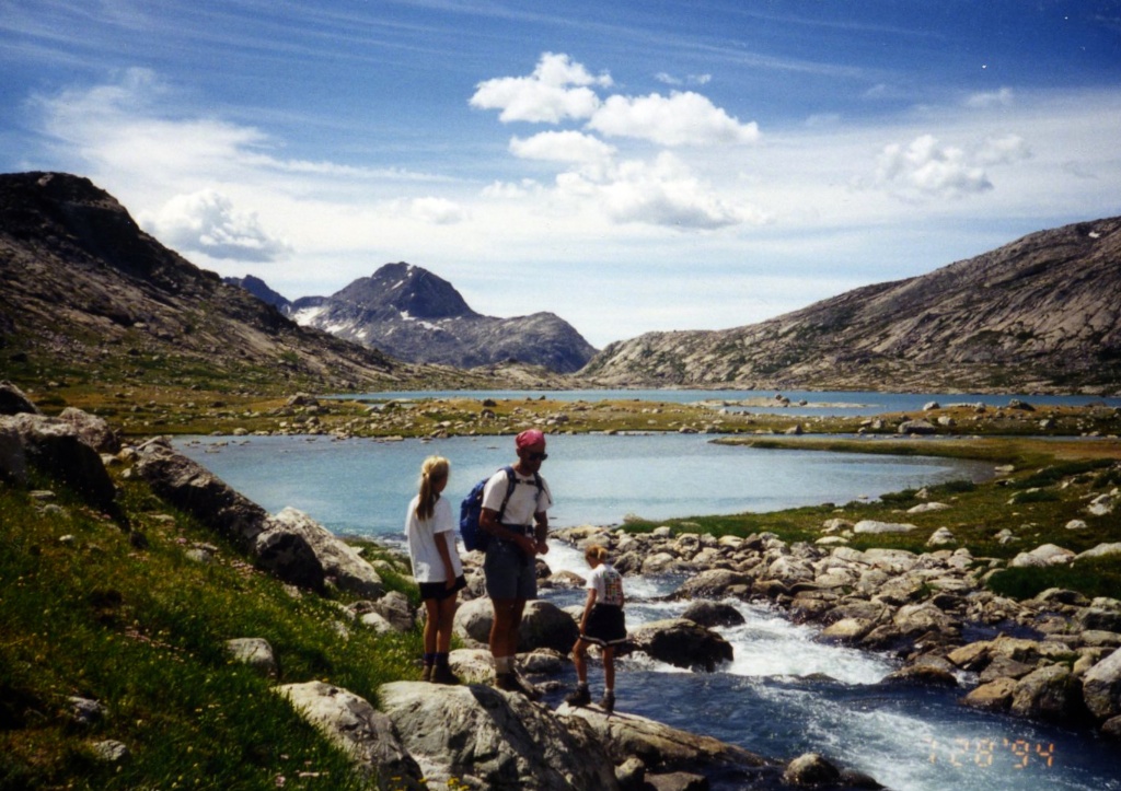
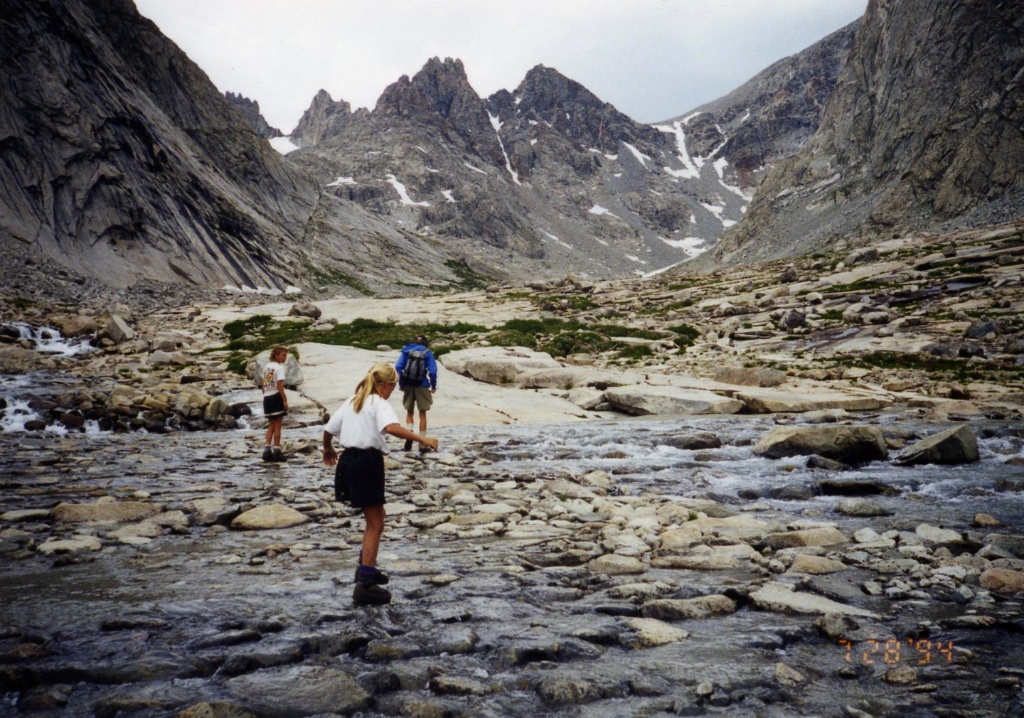
L: On the trail! R: Along the trail: pretty green grass in the late-summer light. Like most hikers, I reached Titcomb Basin from the Elkhart Park trailhead by combining
the Pole Creek, Seneca Lake, and Indian Pass trails. |
 |
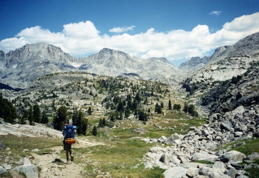 |
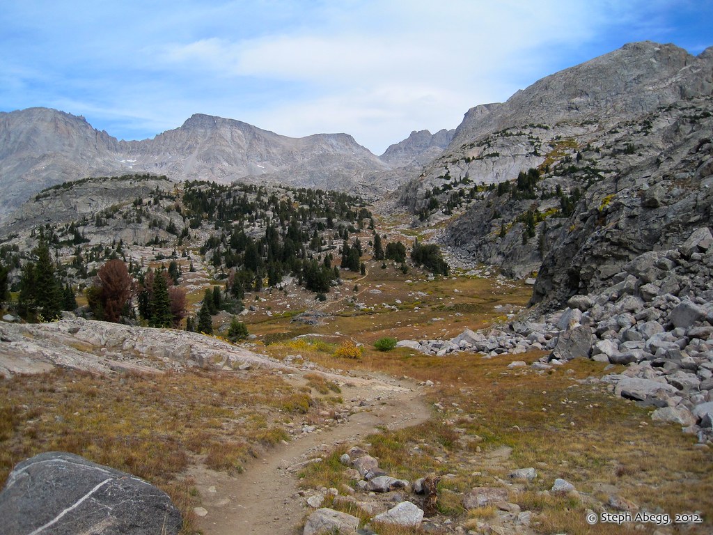
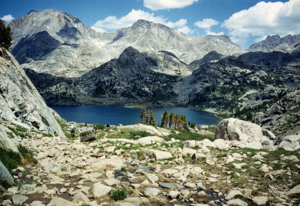
L: Matt hiking northward between Seneca Lake and Island Lake. Fremont Peak (which towers above Titcomb Basin) is in the distance on the left. R: Hiking through the same area 18 years and 2 months later. No Matt.
|
 |
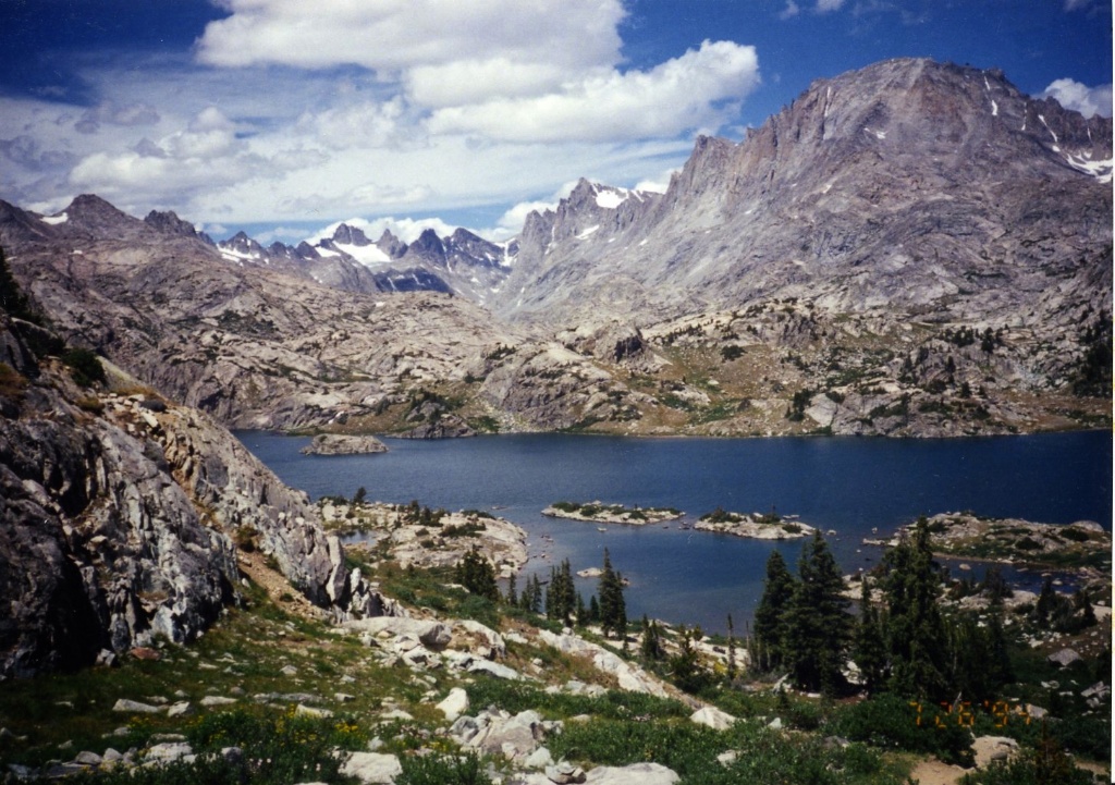 |
L: A couple of photos of the beautiful Island Lake. This lake is nearly 12 miles from the Elkhart Park Trailhead, so many people camp here. R: Island Lake and the oranges of the oncoming fall.
|
 |
 |
L: Approaching the mouth of Titcomb Basin. I remember the wildflowers were in full bloom when we were there. The lower photo shows my sister Jenny, who was 9 years old at the time of the trip. R: Definitely looking and feeling a lot more like fall.
|
 |
 |
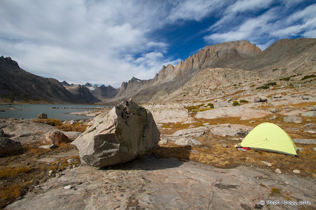
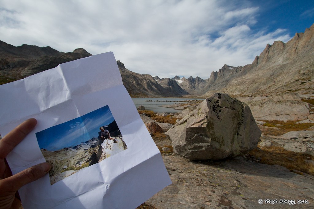
L: Our camp midway up Titcomb Basin. That REI dome tent served us well. R: I had brought with me an old photo of my 11-year-old self sitting on top of a boulder near our 1994 camp; I was able to identify this boulder and pitch my tent at the very same spot I had slept 18 years previous.
|
 |

 |
L: Up until the Wyoming trip, all of our mountain adventures had been in Washington's Olympic Mtns and the North Cascades, so I remember being fascinated by the horses we saw in the Wind River backcountry. Both of these photos show Fremont Peak which towers above Titcomb Basin. R: A bunch of photos of Fremont Peak, the third highest summit in Wyoming....
|


 |
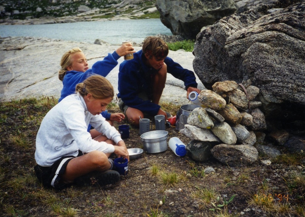 |
L: Our "kitchen." R: I did not have the photo on the left with me on the trip, but afterward I discovered that I had taken a photo of the 1994 kitchen; for whatever reason, the rocks of the windblock have since been carried somewhere else.
|
 |
| |
R: Pretty cold in September! Yay, no bugs or crowds!
|
 |
 |
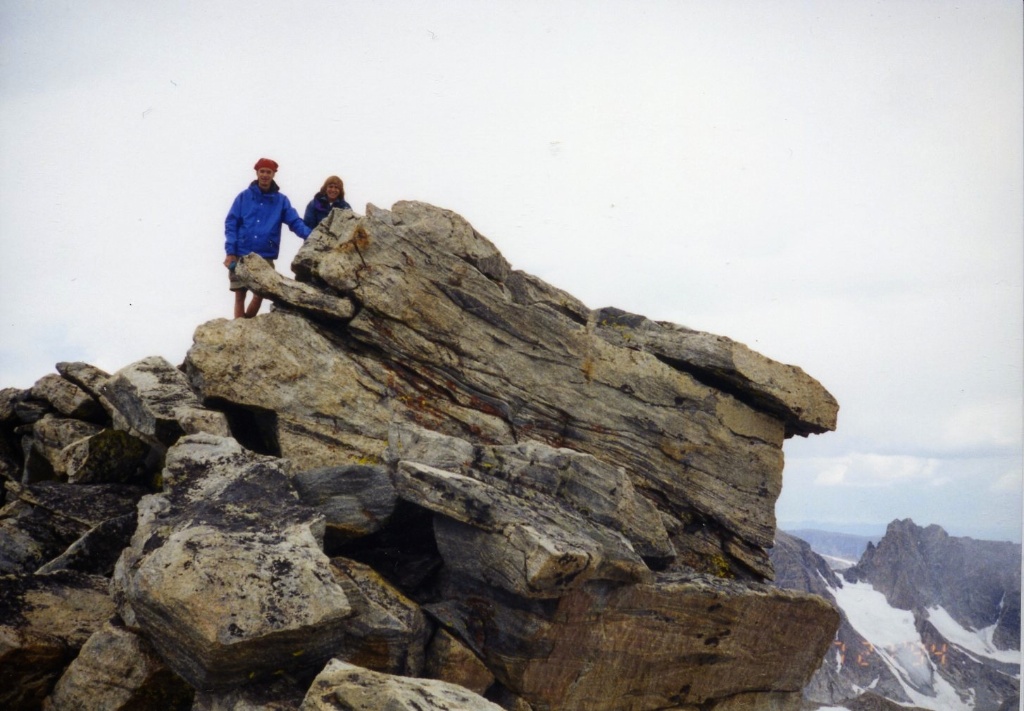
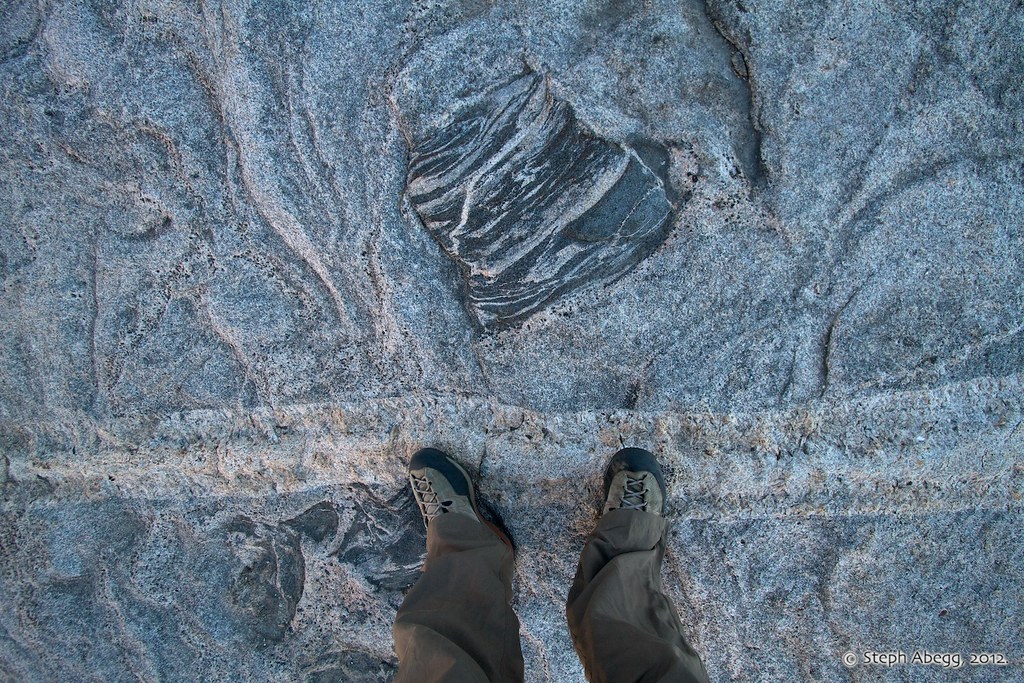
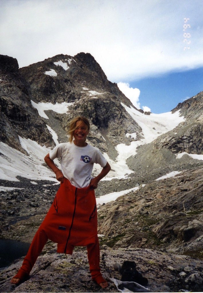
L: There was a rock near camp that I apparently spent much of my time climbing on. R: I had a printoff of this photo with me (this was the only photo I brought along), and was able to identify the rock I was sitting on. I marked out exactly where my mom had stood to take the photo, and then waited for someone to pass by so I could enlist his/her help to take the photo. The friendly couple who I enlisted did a pretty good job at getting the perspective right.
|
 |
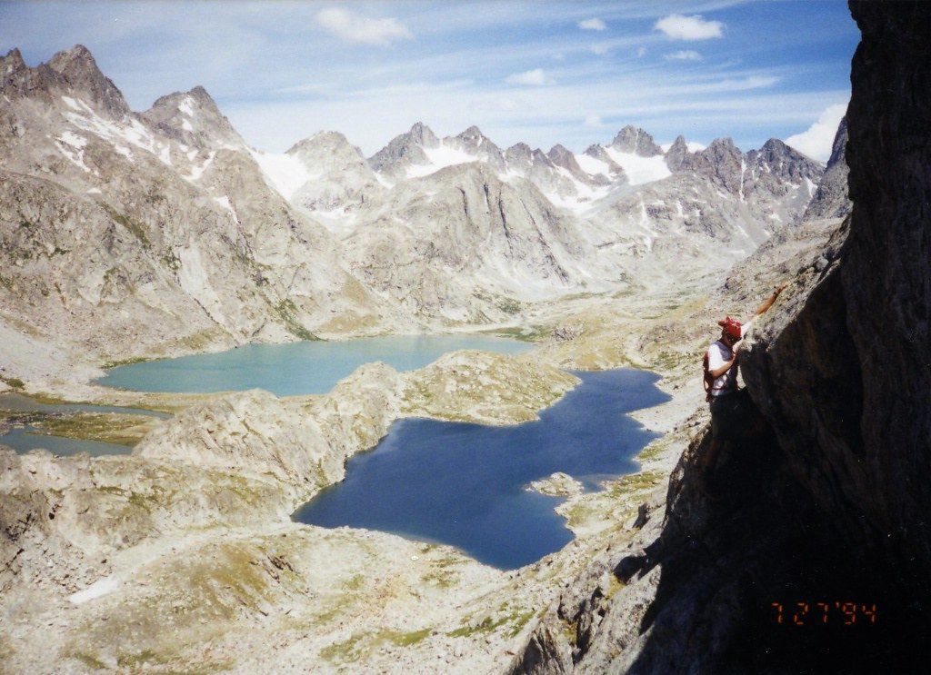 |
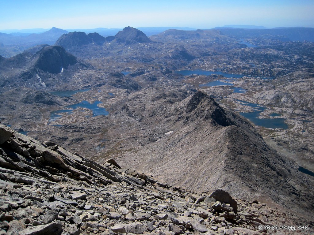
L: My parents and Matt climbed Fremont Peak on our 1994 adventure, while Sheryl stayed with my sister and me at camp. From the steepness of the rock and the rope on Matt's back in the photo, I'm guessing they climbed something a bit harder than the Class 3 Southwest Slope, yet not hard enough to rope up the entire time. Mistake Lake and the upper Titcomb Basin is in the background, so it appears that Matt is somewhere on the west side of the peak. R: Since I was alone, I figured that the best route choice was the Class 3 Southwest Slope to Fremont's summit. I decided to do a loop by approaching via Indian Basin (pictured in top photo), gaining the saddle where the ridge steepens (middle photo), climbing the SW Slope, and then descending into Titcomb Basin via Mistake Lake (pictured in the 1994 photo). This was a great way to see a lot of terrain. The third photo on the right shows the view looking down the long SW ridge of Fremont that separates Indian Basin (left/east) from Titcomb Basin (right/west).
|

 |
 |
L: Matt and my mom on the summit of Fremont Peak. R: Billy in the summit register on Fremont Peak. I hoped to find my parents' names in the register, but all of the entries previous to August 1994 (our trip was July 1994) were on loose pieces of paper and due to the gale-force winds I couldn't pick through them without risking half of them blowing away.
|
 |
| |
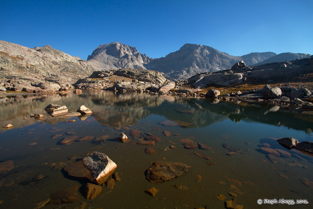
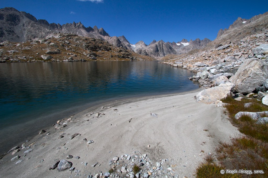
R: From the summit of Fremont, I descended to Mistake Lake in Titcomb Basin. Mistake Lake—separated from the main part of the basin by a hill—is quite deep and really quite pretty with its deep blue color. The descent from Fremont Peak to Mistake Lake involves linking a bunch of steep 3rd class ledges.
|
 |
 |
L: I've always remembered the little funeral service we had for this poor mouse we found while exploring Titcomb Basin in 1994. R: I looked for the mouse bones and found these. Wow, I didn't remember that mouse being so big!
|
 |
| |
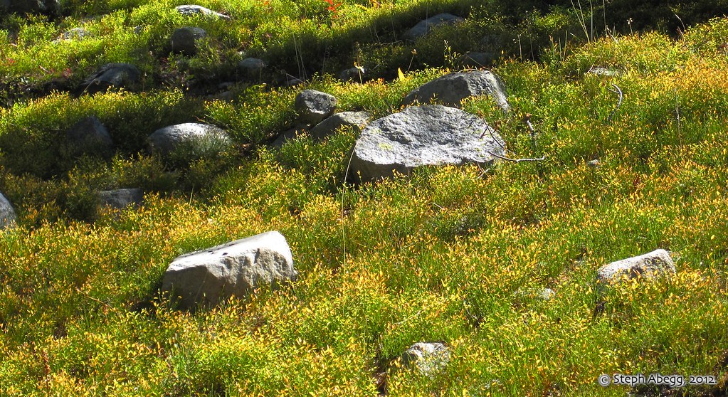
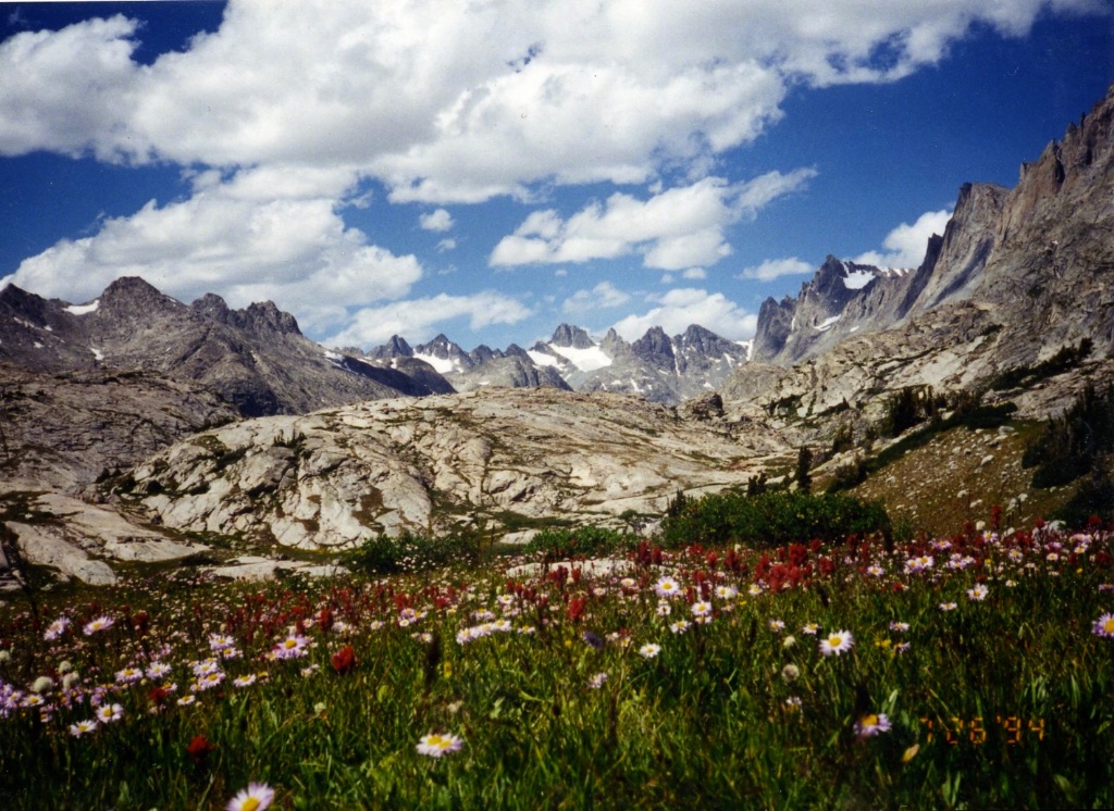
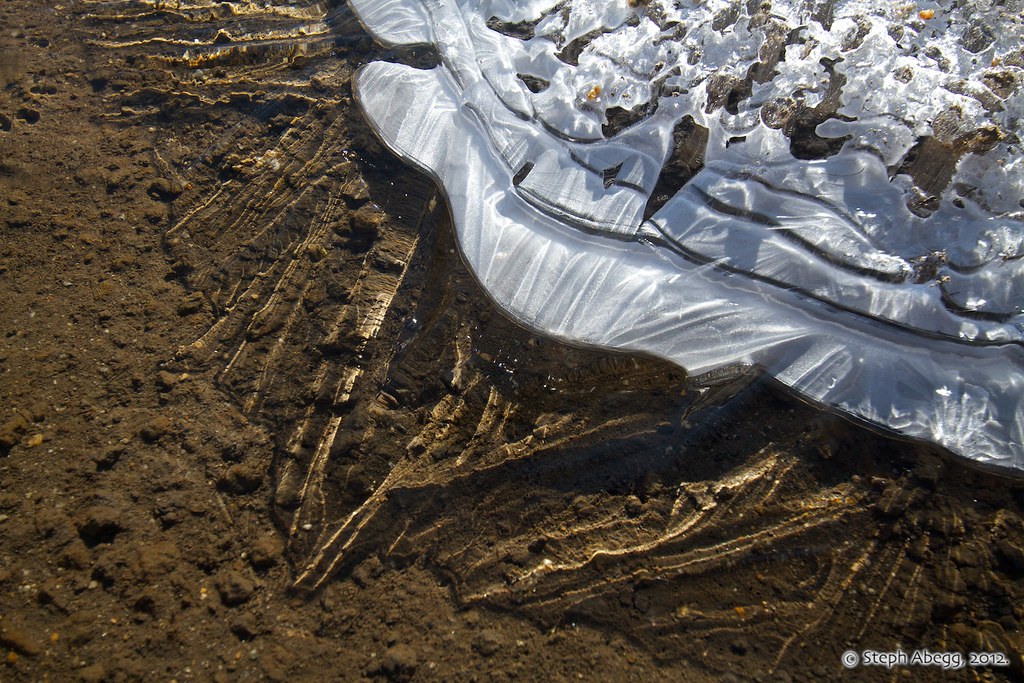
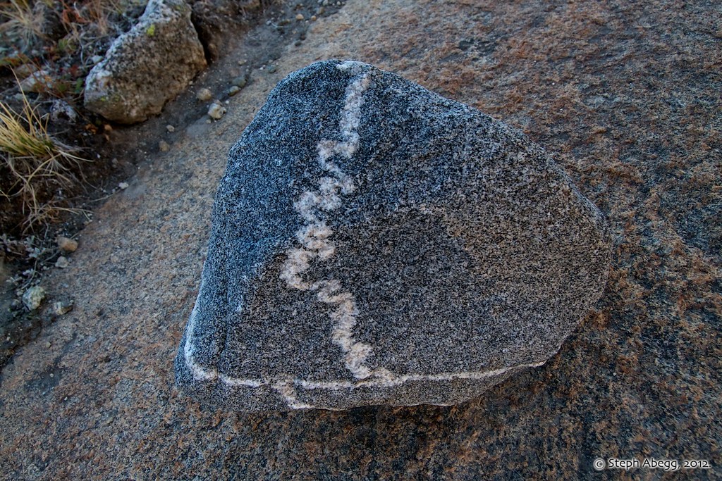
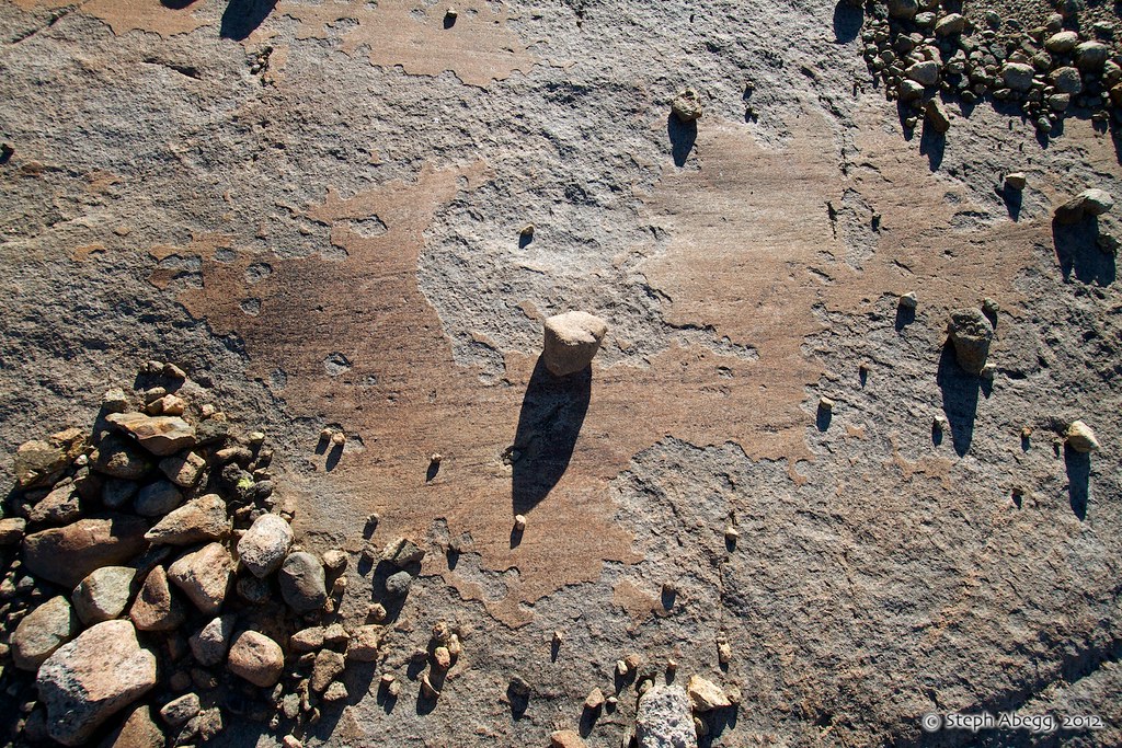
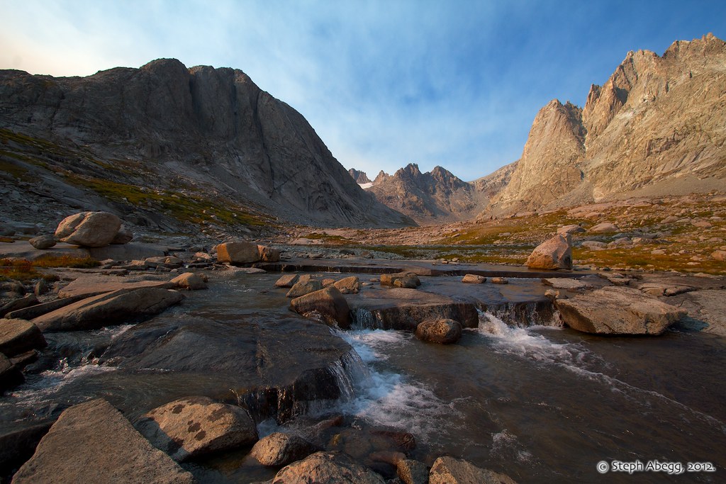
R: Titcomb Basin would be a good place for a Geology 101 field trip. Here are some photos of metamorphic folds, intrusions of some sort, and glacier-smoothed slabs.
|
 |
 |
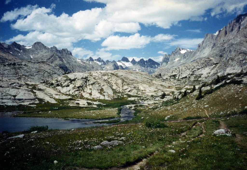
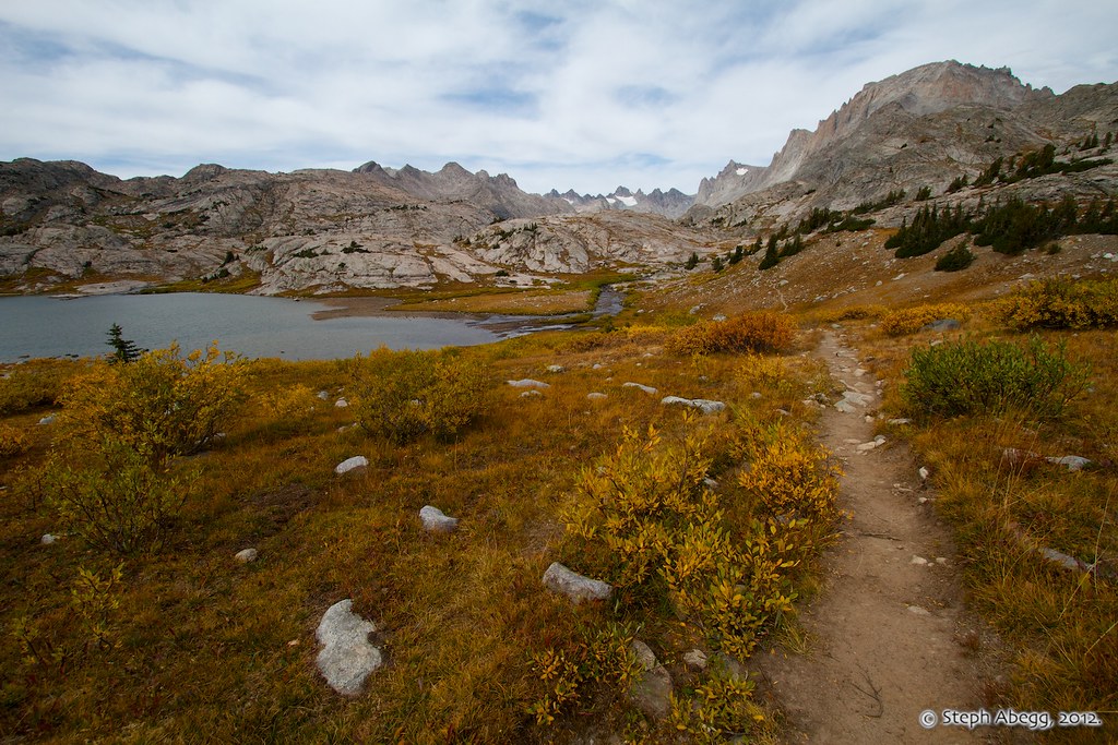
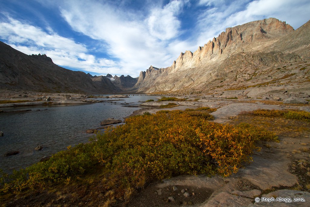
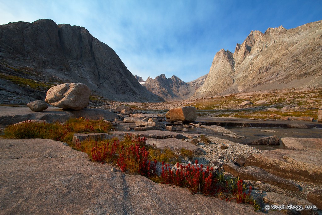
L: We spent a day exploring Titcomb Basin from camp. This photo was taken from the head of the highest lake, looking south. R: Some photos of upper Titcomb Basin 18 years later.
|
 |
 |
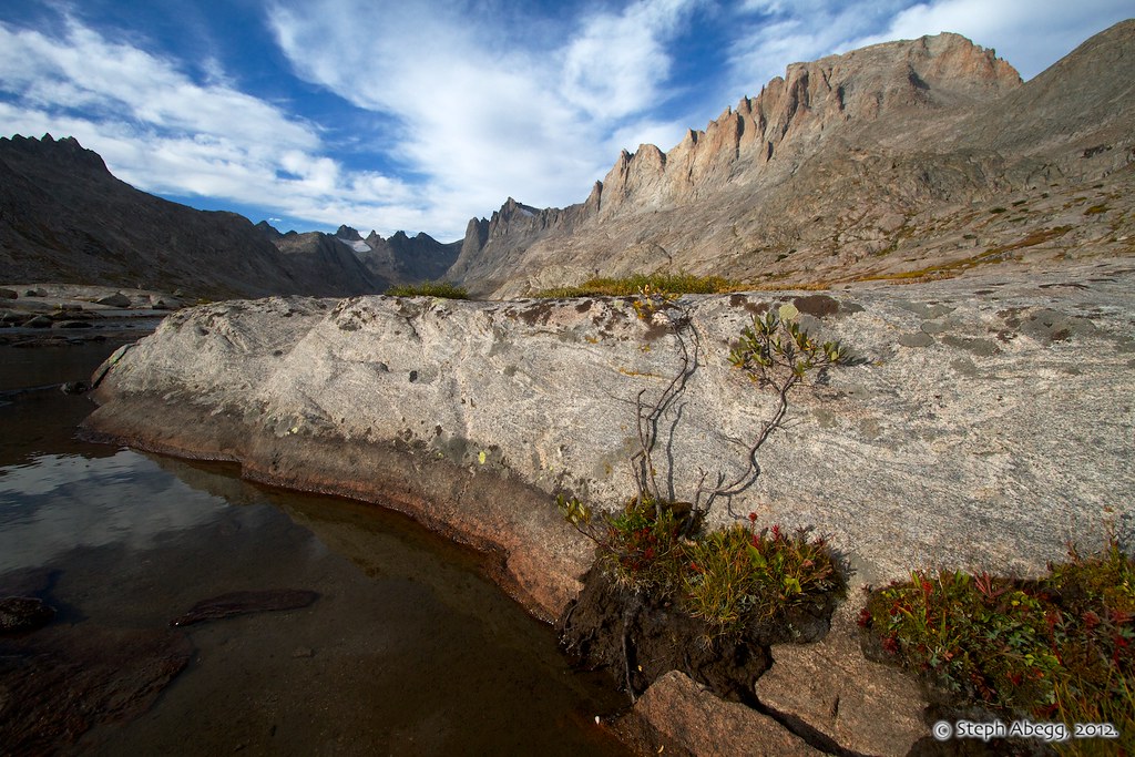
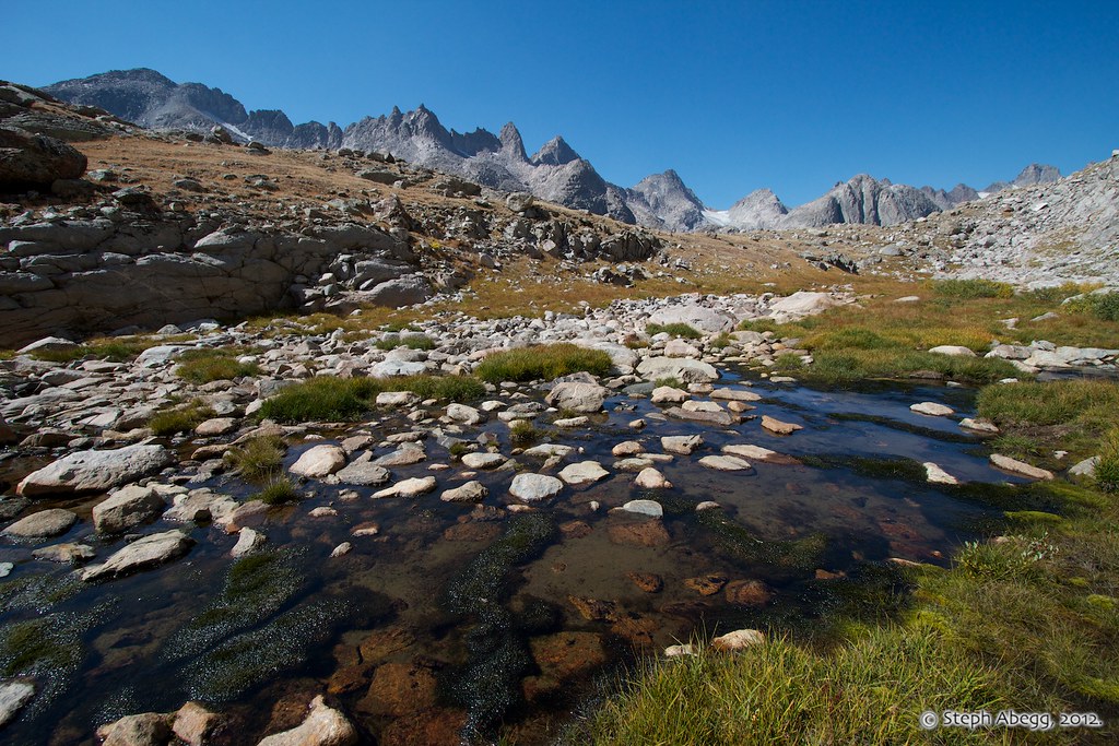
L: Exploring upper Titcomb Basin, looking north towards the head of the basin. R: Some photos of upper Titcomb Basin 18 years later. The stone terraces on the stream are really quite photogenic.
|
 |
 |
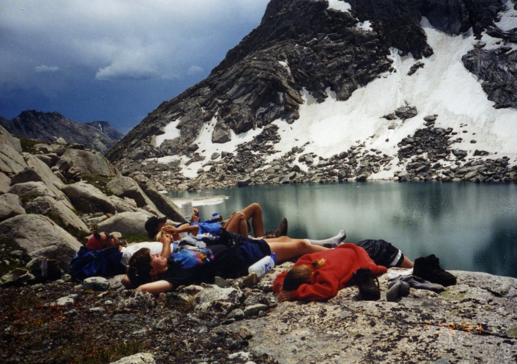
L: In 1994, our explorations of the upper Titcomb Basin took us to Summer Ice Lake, where I remember we enjoyed a nice nap. R: I had a few hours after climbing Fremont Peak to make my way to Summer Ice Lake and relax there for old time's sake. But I decided to forgo walking around in my fleece jacket sleeves this time.
|
 |
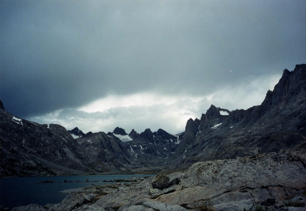 |
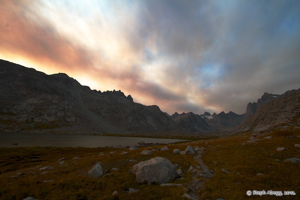
L: Ominous afternoon clouds during our 1994 trip. R: I had good weather on my 2012 trip, but forest fires near Jackson caused some smokey clouds to pass through on the second night.
|
 |
 |
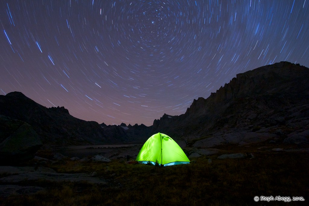
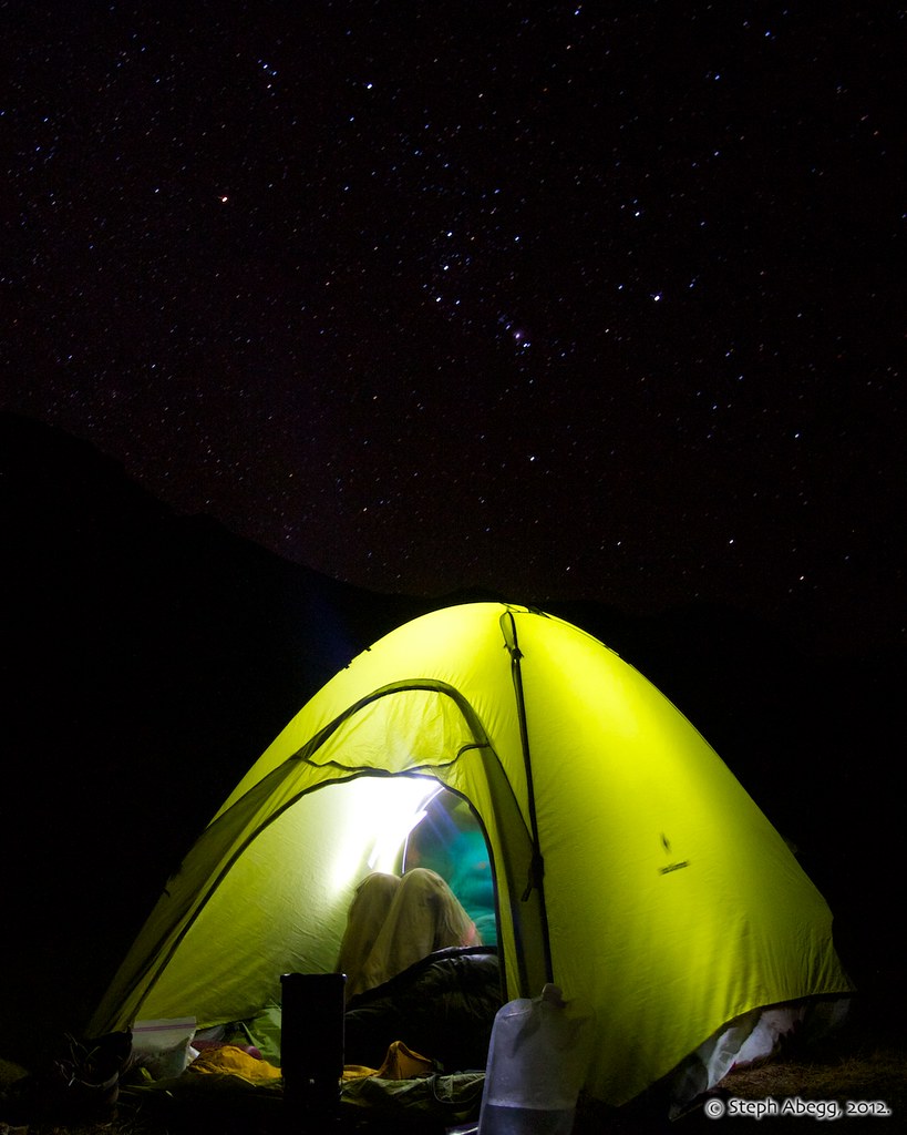
L: This photo was taken with my little cardboard 24-frame disposable camera I had begged my parents to get me at a gas station pit stop. I remember thinking these clouds were pretty cool. R: Over the years, my disposable cardboard camera has been upgraded to an SLR. One kind of photography where the SLR shines is night photography. The first photo is a 20 minute exposure of stars over the tent. The second photo shows me standing on my special rock near camp. The third photo shows Orion above the tent (to me, seeing Orion—a "winter constellation" in the Northern hemisphere—signals the coming of fall and the end of summer).
|

 |
| |
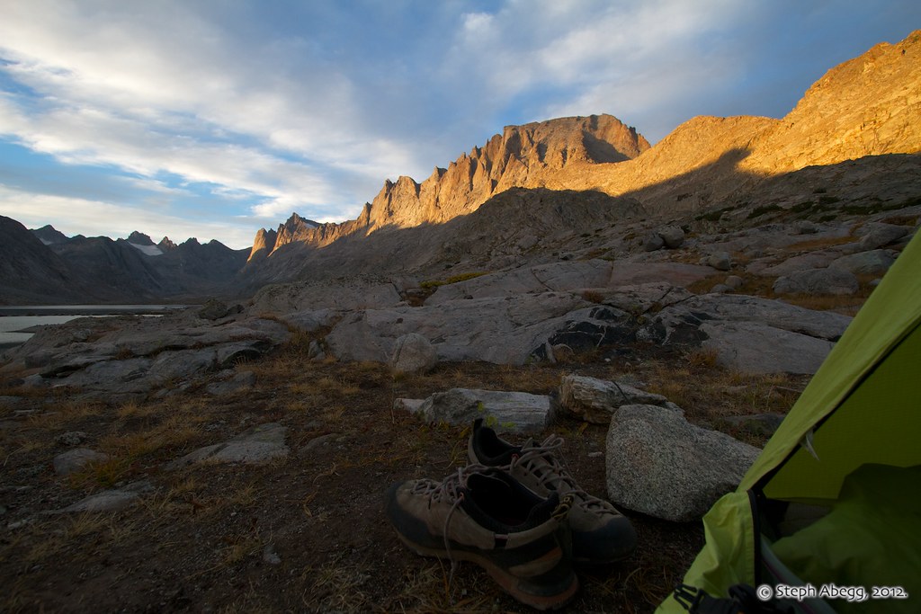
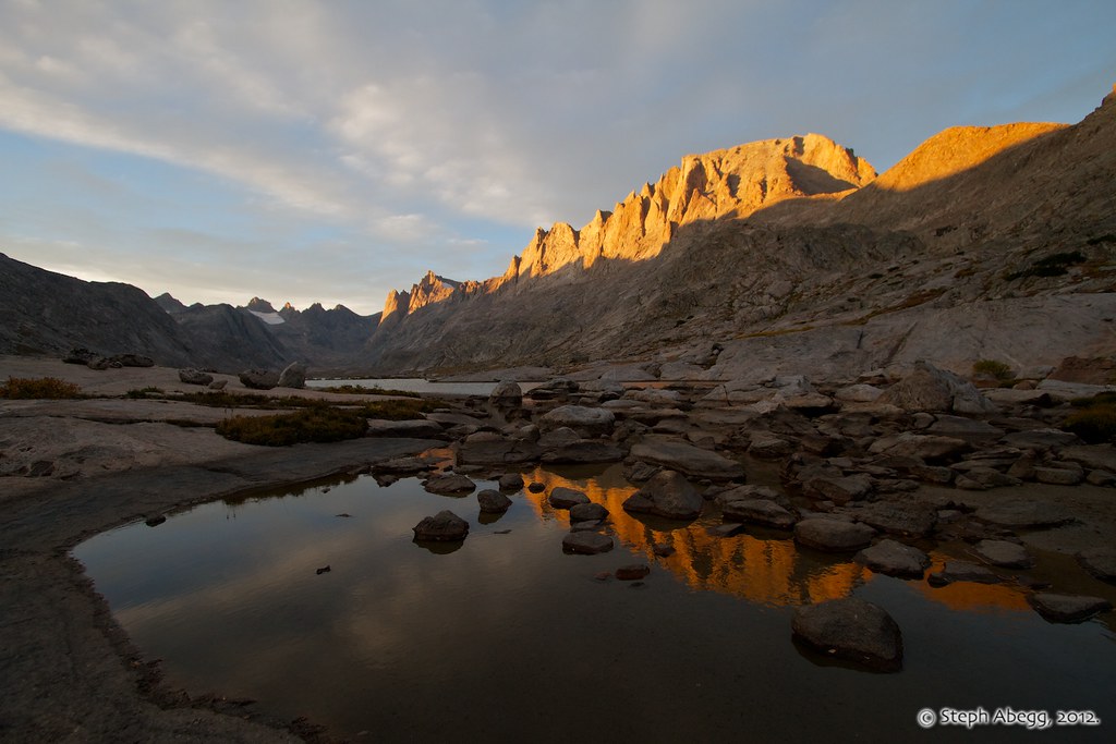
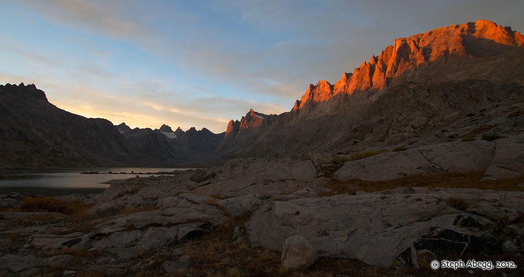
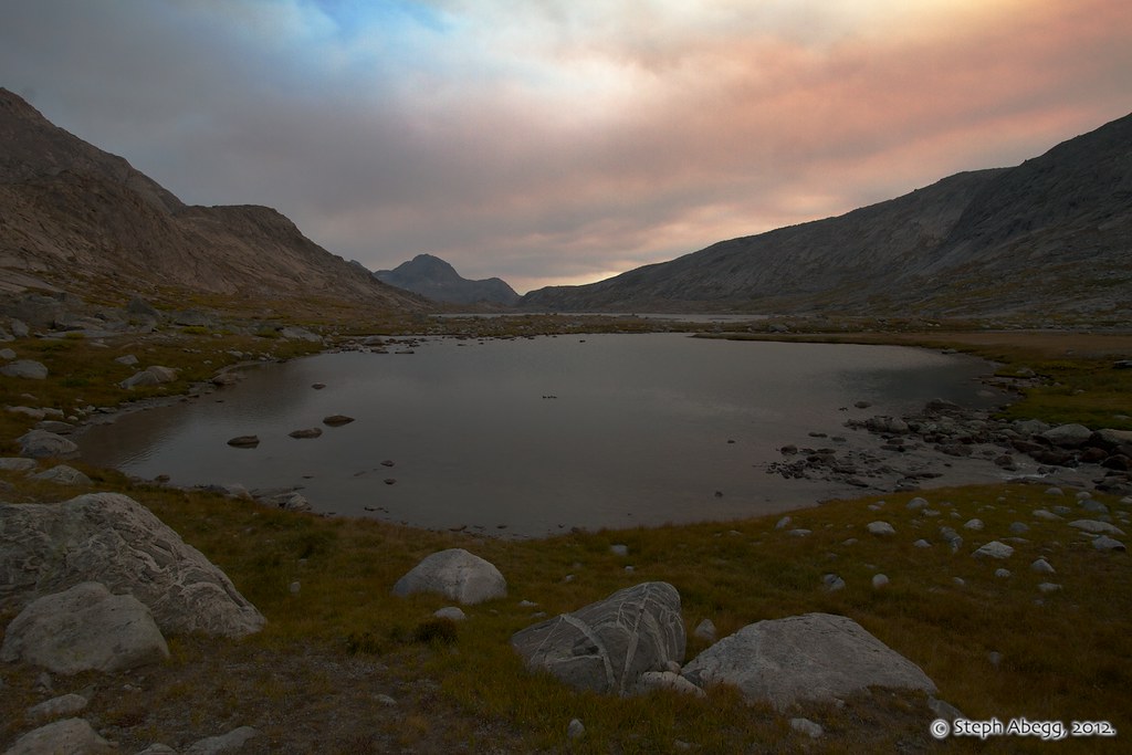
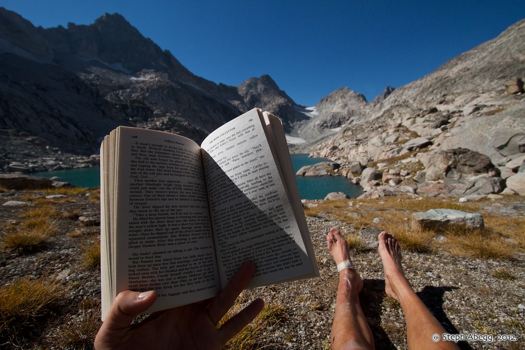
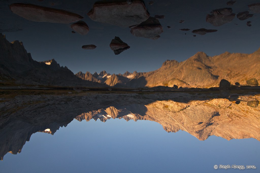
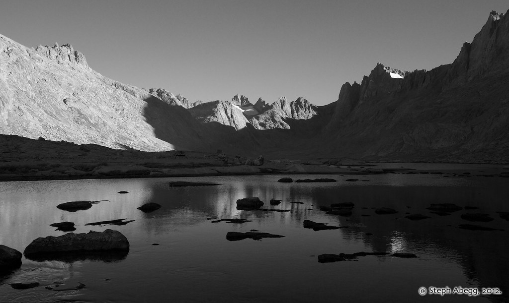
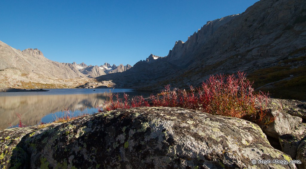
R: Some morning reflection and lighting photos I took as I said farewell to the beautiful Titcomb Basin on my third day.
|
 |
| |
R: I'll be back, there's some climbing to be done here, like Tower 1's sheer 1500-ft face....
|
 |