THIS TRIP REPORT IS STILL MOSTLY IN THE EMBEDDED HTML FORMAT OF MY OLD WEBSITE.
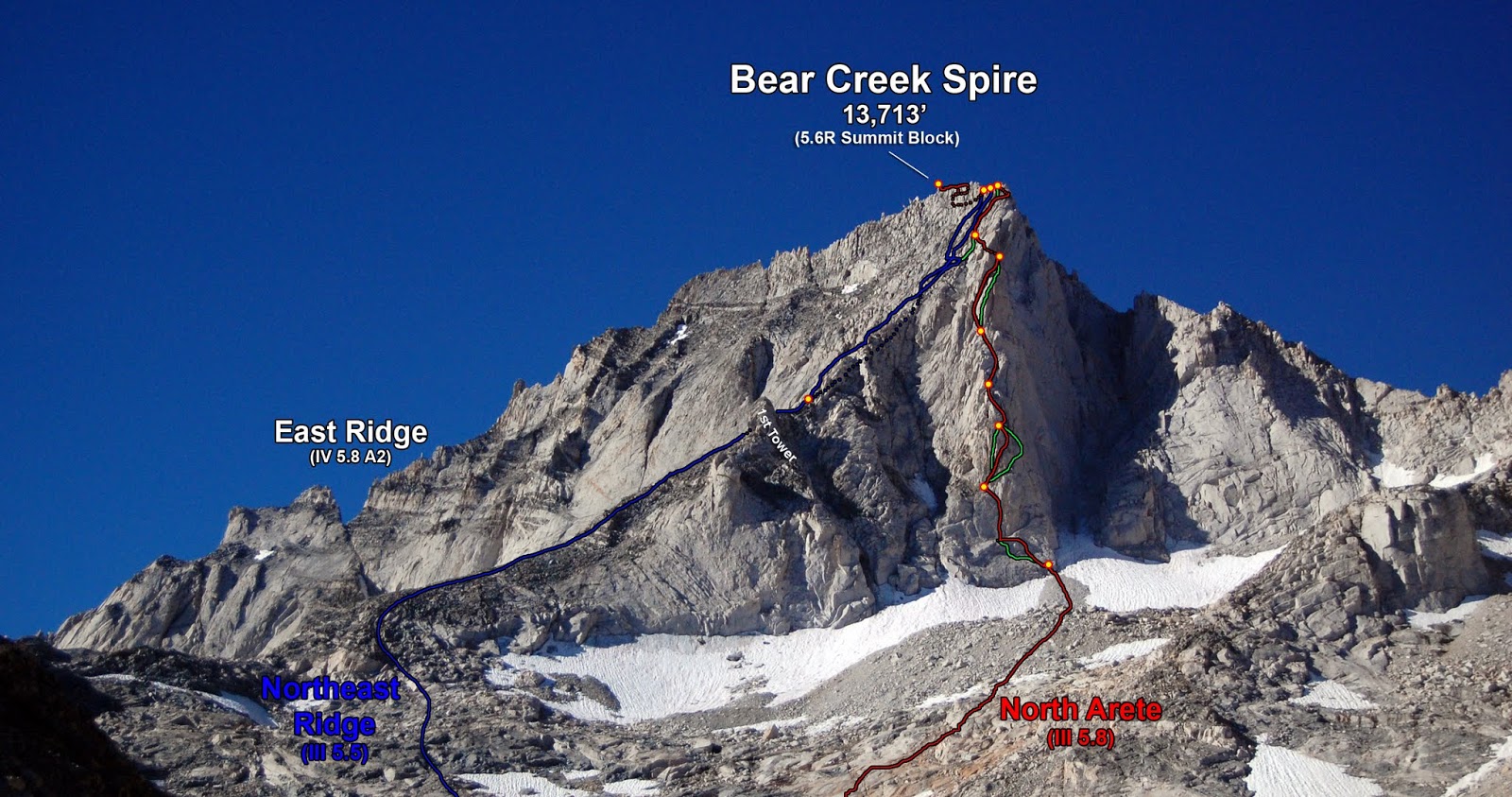
Of the 100 best Sierra alpine rock climbs listed in John Moynier and Claude Fiddler's "Sierra Classics", Bear Creek Spire claims three of them: the East Arête (5.8), the North Arête (5.8), and the Northeast Ridge (mostly 4th, some low 5th). Of these three, the North Arête takes the most compelling line, so this is the route we decided to do. The climb is typical for a Sierra route: lots of cracks, broken rock, and mostly face climbing and stemming with a few mandatory hand jams. Both cruxes involve steep stemming on awkward large flakes. The climb is easily divided in two halves. The first half climbs a striking arête/pillar with steep 5.7 and 5.8 sections separated by fourth class. The second half ascends an exposed 4th class ridge. Because only the first half is visible from the base, many climbers underestimate the length of the climb.
The following page provides a trip report for our climb of the North Arête. It was a super fun outing in the mountains.
Time Stats
We climbed the North Arête in a day from the car. The entire adventure from start to finish took us just under 12 hours, broken down as follows: Approach: 6:38-9:48am (just over 3 hours) Climb: 10:00am-2:55pm (just under 5 hours) Descent: 3:11-6:33pm (just under 3.5 hours)
Photos
On this trip, everyone brought a camera. It can be really fun after a trip to put everyone's photos into one folder and do a slideshow recap of the trip. It's best when the camera's time stamps are in synch. In this photo I am taking a photo with Sarah's camera (left) and my camera (right), while Chad is taking a photo with his camera and Dan's. Then I could easily figure out the timestamp offset between cameras and do a batch timestamp change to synch everyone's cameras with mine.
In this trip report, I use everyone's photos and give appropriate credit. Unfortunately Dan's camera malfunctioned so I did not get to use any of his photos.
(This photo was taken by Chad Kellogg.)
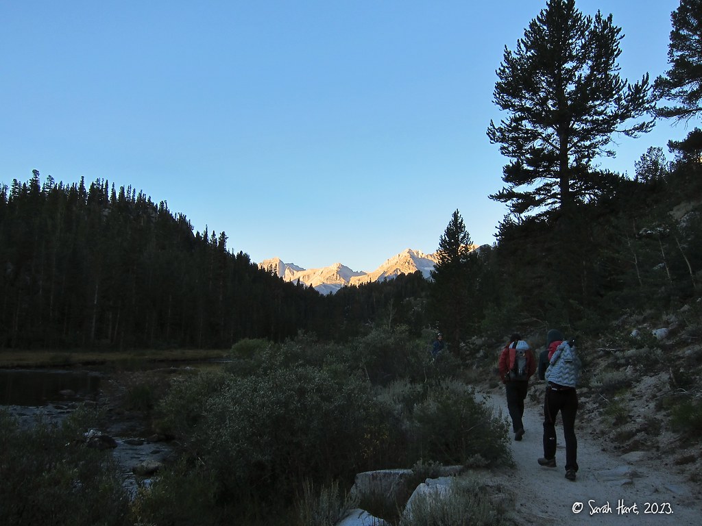
Starting off the hike from Mosquito Flat, Bear Creek Spire in distance. The approach from trailhead to the base took us just over 3 hours.
SuperTopo beta for the approach: "The approach takes most climbers 3-4 hours from Mosquito Flat to the base of the climb and involves 3.5 miles on the main trail, 2.5 miles on climbers' trails and cross-country travel, and gains about 2,500 feet in elevation. The trailhead is located at 10,260 feet making it the highest access point in the Sierra Nevada and one of the highest public access roads in the US. From Mosquito Flat, hike the Little Lakes Valley Trail for about 3.5 miles and 1 hour to just before Morgan Pass. Turn off the main trail after a wooden footbridge that crosses a creek and follow a well-worn climbers' trail for 5 minutes to Gem Lakes. From here, the climbers' trail appears intermittently. Hike up left (southeast) a steep talus drainage to an unnamed lake and continue southwest to Dade Lake (last water) and then walk directly toward Bear Creek Spire."
(This photo was taken by Sarah Hart.)
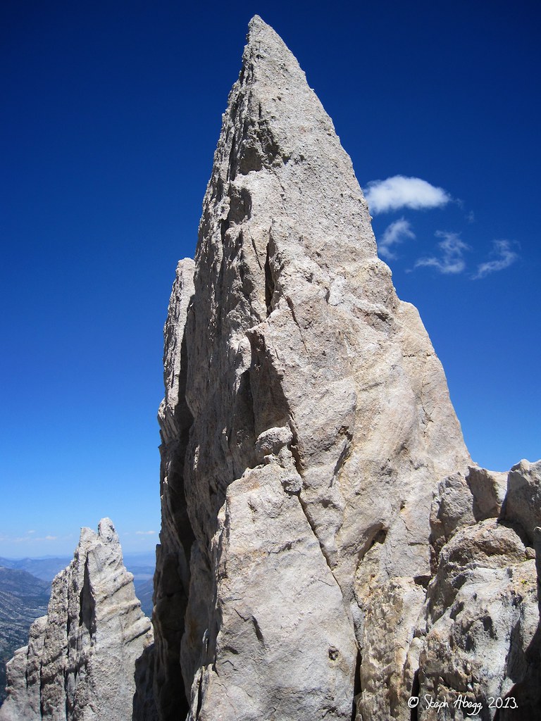
Bear Creek Spire in the morning sun, as seen from near the beginning of the trail approach. The striking North Arête faces us straight on. The East Ridge (IV, 5.8) is on the left skyline while the NE Ridge (mostly 4th, some low 5th) is the one in the foreground that is in profile as a shadow against the sunny East Face.
(This photo was taken by Chad Kellogg.)
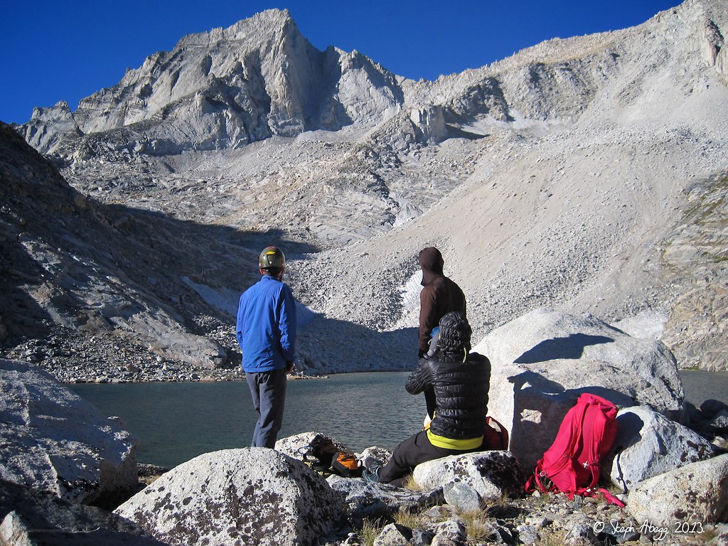
Rest stop at Dade Lake. Bear Creek Spire is at the head of the basin. We had a snack and filled up on water since Dade Lake is the last water. From Dade Lake, it took us about an hour to the base of the North Arête. We did not have any snow on the approach, but earlier in the season or during a less dry year there can be some steep snow getting up to the toe of the route.
(This photo was taken by Steph Abegg.)
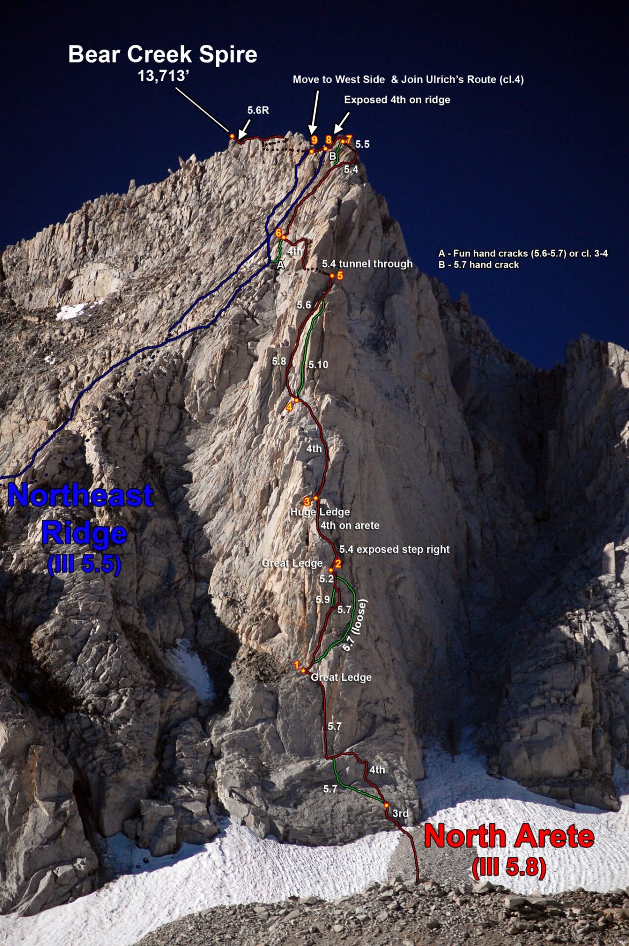
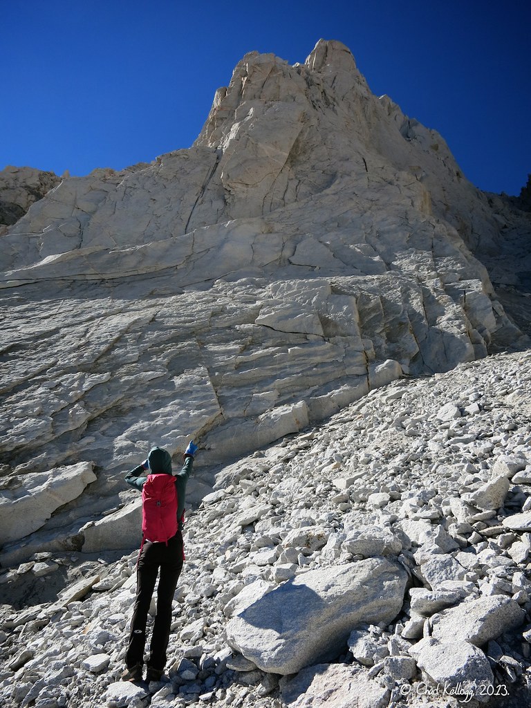
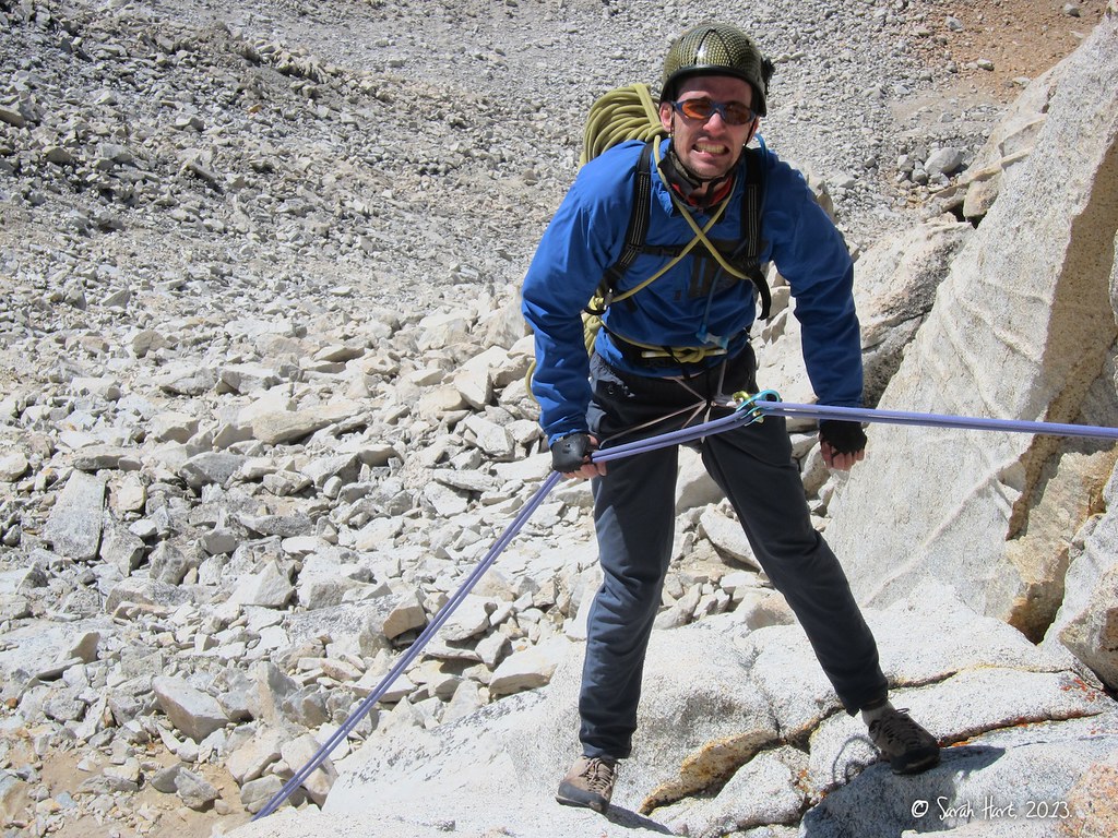
Looking up from the base of the North Arête on Bear Creek Spire. We scrambled unroped up a 4th class option on the right to just below the crescent-shaped ledge, where we roped up and moved the belay to the base of the obvious crack system (5.7) just left of middle in this photo.
(This photo was taken by Chad Kellogg.)
Taking the route by siege! Here we are scrambling up the 4th class section to where we roped up just below the crescent-shaped ledge.
(This photo was taken by Steph Abegg.)
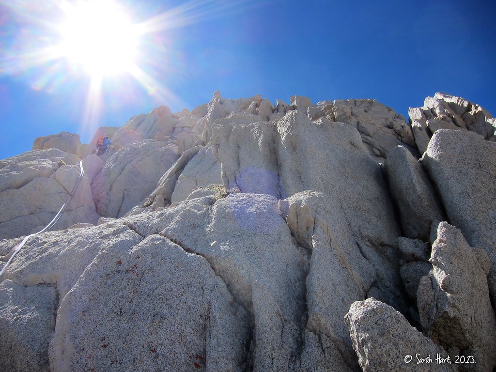
Looking up the 5.7 crack of Pitch 1. This is a fun pitch, but the thing we all remember the most was how cold our hands got jamming them into the cold rock. Being on the north side, the route tends to be mostly in the shade, so it can be quite cold. We had a pretty brisk wind too.
(This photo was taken by Steph Abegg.)
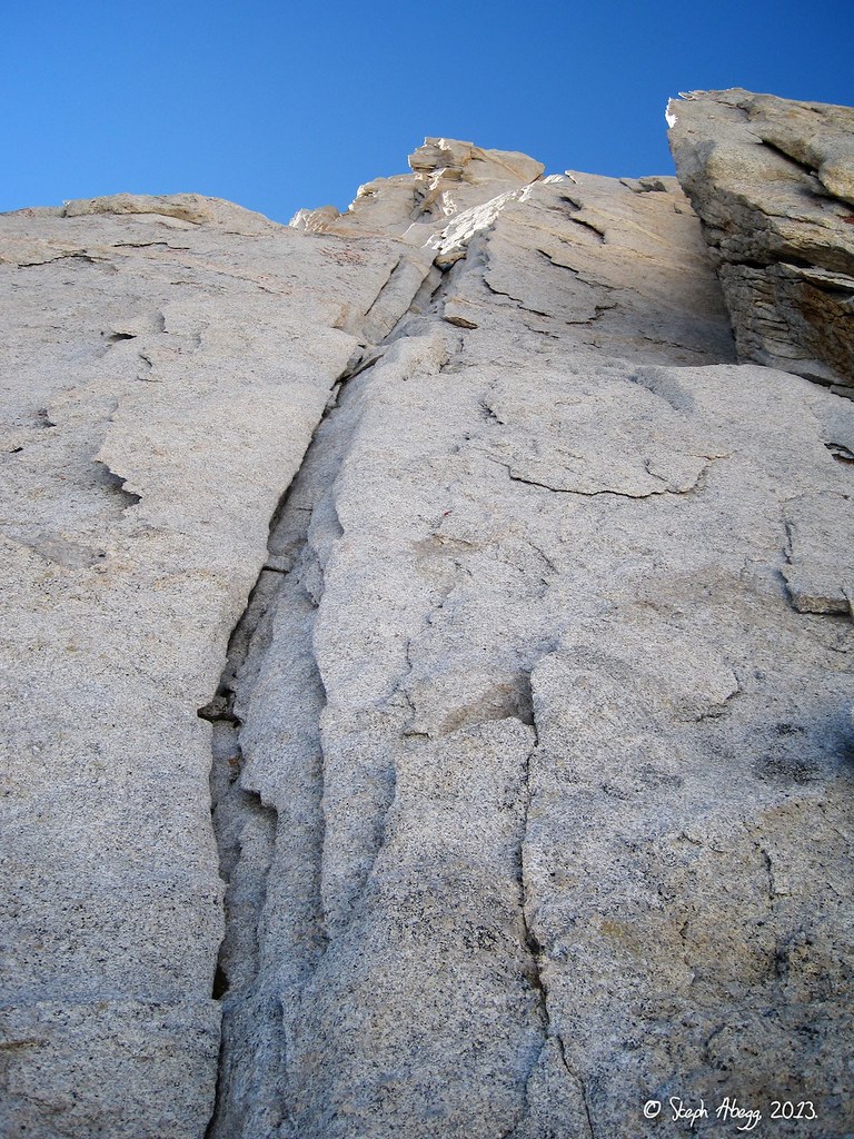
The first half of Pitch 2 takes a series of steep 5.7 flakes.
(This photo was taken by Chad Kellogg.)
In the second half of Pitch 2, the climbing eases to 5.2.
(This photo was taken by Steph Abegg.)
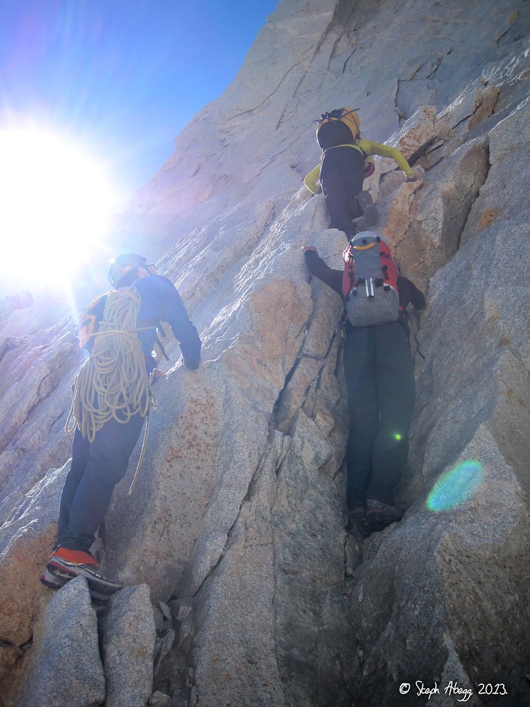
On Pitches 3 and 4, the climbing eases to mostly 4th class on the arête. We simulcimbed this section of the route.
(This photo was taken by Sarah Hart.)
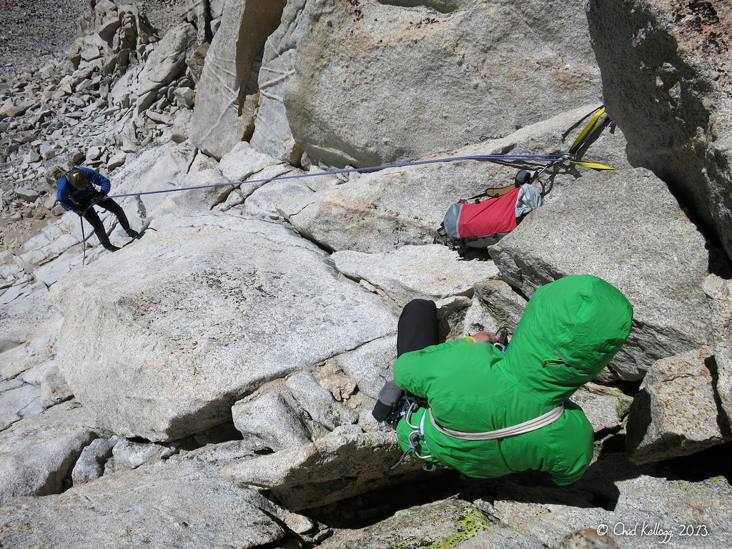
The 5.8 crux of the route is on Pitch 5, up a series of steep flakes in a chimney with a mixture of stemming, crack climbing, and chimneying. Here is Chad climbing up this section.
(This photo was taken by Sarah Hart.)
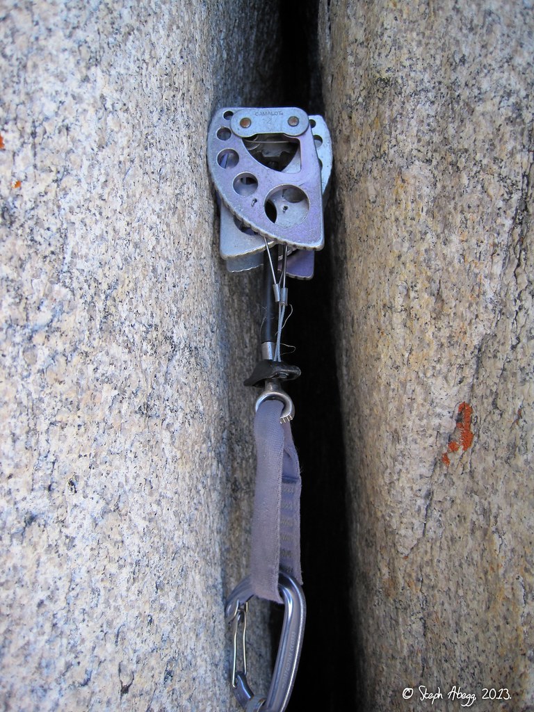
A fixed #4 cam in the crux Pitch 5. I worked on it a bit but it was pretty stuck.
(This photo was taken by Steph Abegg.)
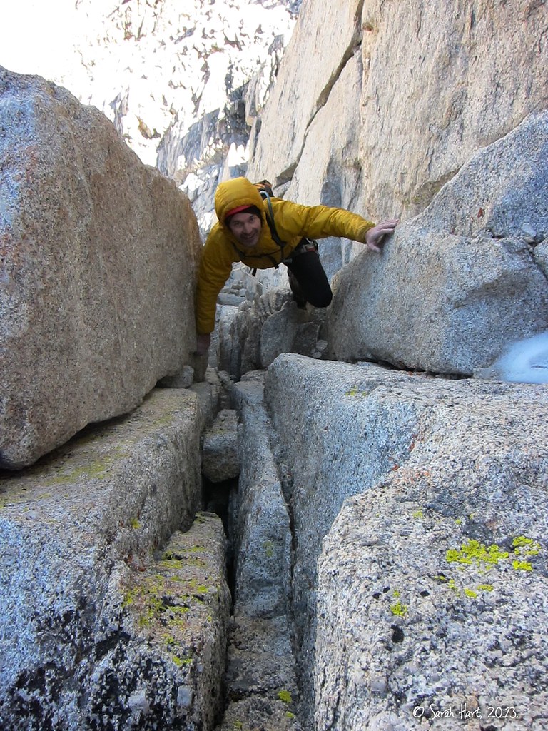
Pitch 6 involves a 5.4 tunnel-through from the west side to the east side of the arête. Here is Sarah coming through the tunnel-through. Notice that in most of the photos we are wearing jackets and gloves. Being on the north side, the North Arête route is shady and has a tendency to be windy.
(This photo was taken by Steph Abegg.)
Sarah at a belay just after the 5.4 tunnel-through of Pitch 6.
(This photo was taken by Steph Abegg.)
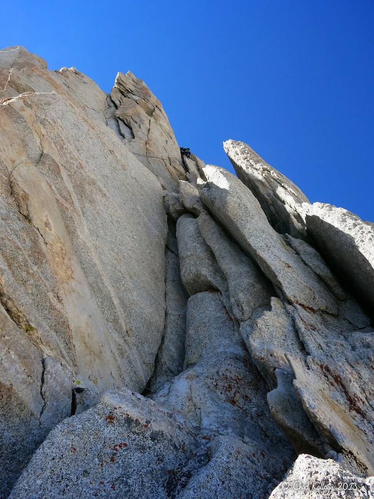
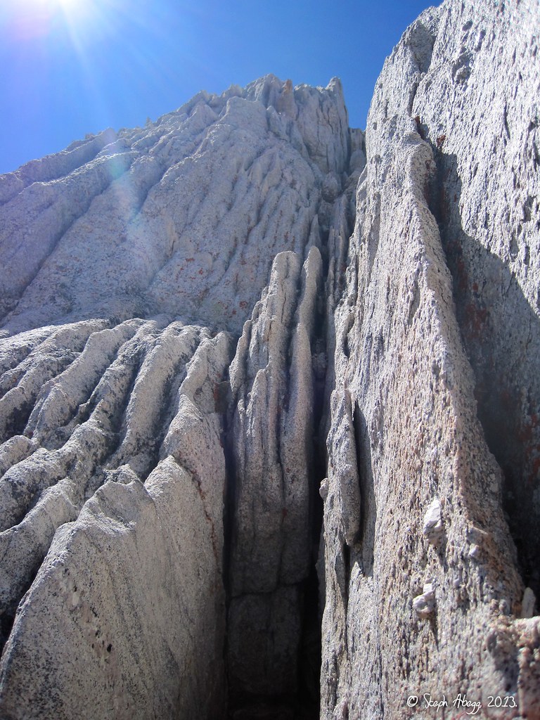
Beta photo: this cool tower is just before the tunnel-through of Pitch 6.
(This photo was taken by Steph Abegg.)
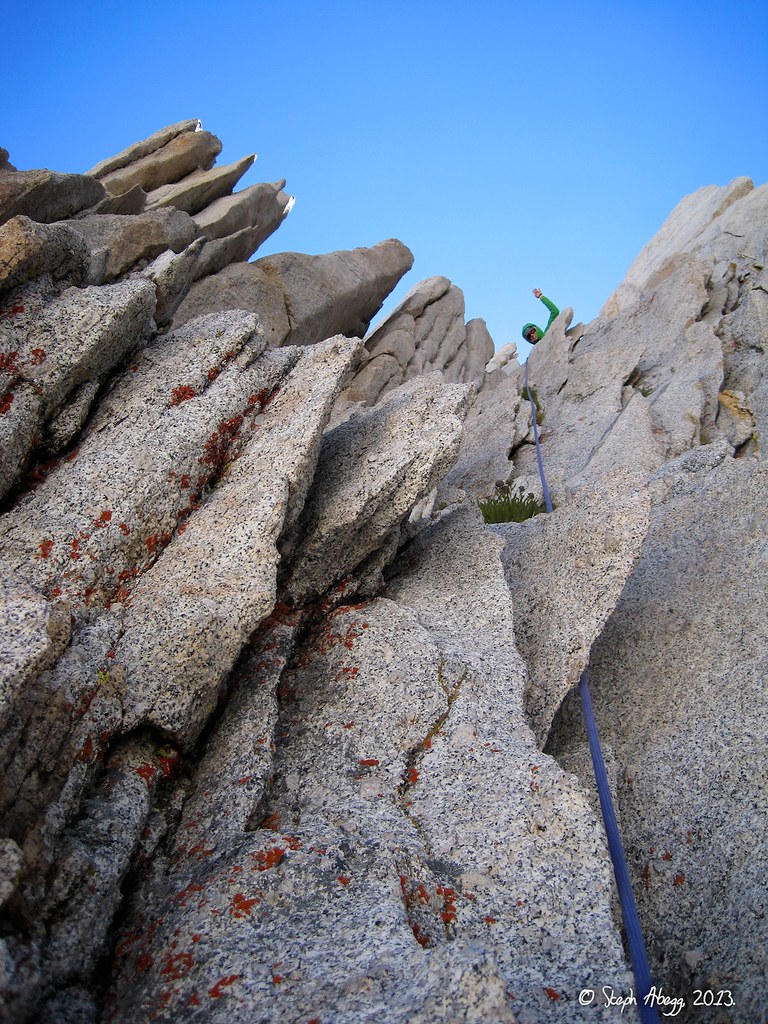
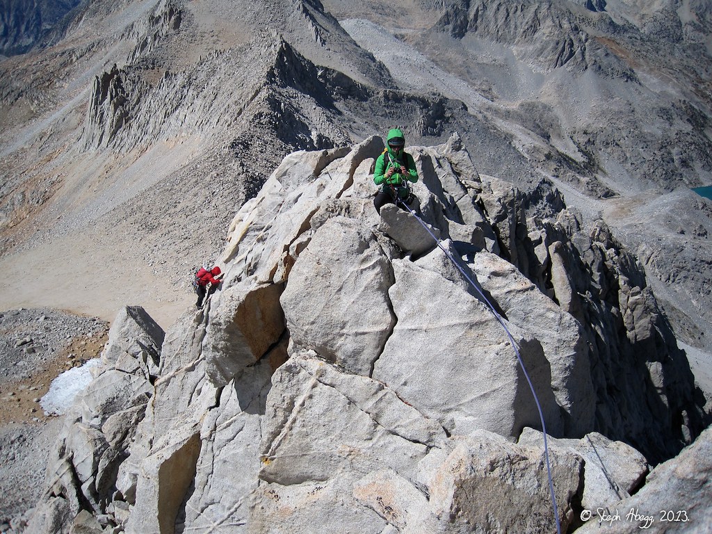
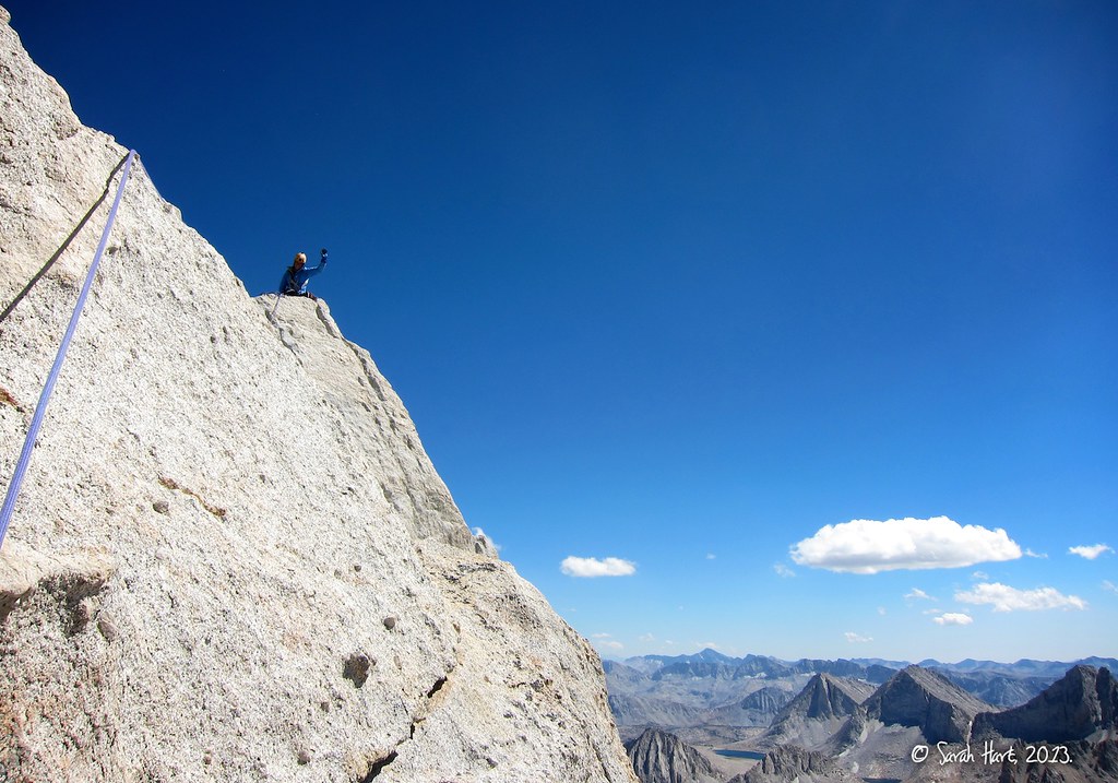
The second half of the climb (after the tunnel-through) involves mostly 4th class and low 5th class climbing. We simulclimbed Pitches 7-10 to the summit, which stayed high on the east side for Pitches 7-9 and high on the west side for Pitch 10. Much of the climbing is on the arête so it has great exposure.
(This photo was taken by Sarah Hart.)
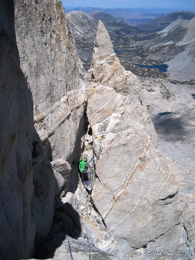
The NE Ridge merges with the North Arête near the top of the spire. I think I might have been on a short section of the upper NE Ridge here, which I climbed up onto the arête.
(This photo was taken by Steph Abegg.)
This photo was taken while simulcimbing on the arête during the latter half of the climb. The valley far below contains the approach trail from Mosquito Flat via the Little Lakes Valley Trail and Dade Lake.
(This photo was taken by Steph Abegg.)
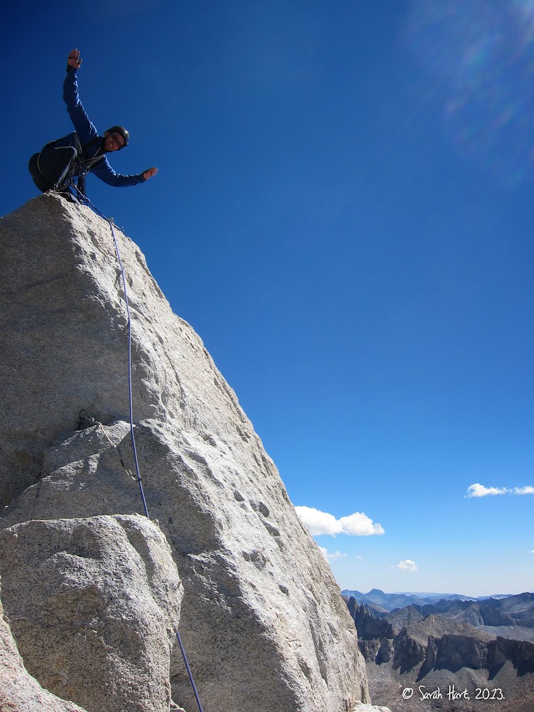
The final pitch took the west side of the arête to the summit. Here I am looking down from the summit at Sarah and Chad coming up.
(This photo was taken by Steph Abegg.)
Steph on the summit of Bear Creek Spire. (I led all the way to the top, having read the route description wrong and assuming there was a rap anchor on the top of the block. I set a marginal toprope with a nut and .5 cam in a flaring crack, along with a better cam a bit below the top, and downclimbed to establish a belay.)
SuperTopo beta for the summit block: "It is possible to follow the true ridge all the way to the summit but the last section is 5.9 and most climbers traverse onto the west face for an easy scramble to the top. The final move onto the summit block is unprotectable 5.6. Using a rope for this section won't keep you from injury but may offer some 'psychological protection.'"
(This photo was taken by Sarah Hart.)
Sarah on the summit of Bear Creek Spire.
(This photo was taken by Chad Kellogg.)
Dan on the summit of Bear Creek Spire. Hand's up was the summit photo theme.
(This photo was taken by Sarah Hart.)
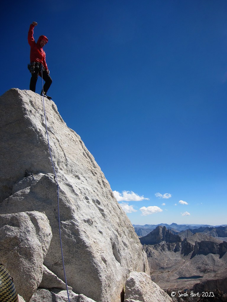
Chad on the summit of Bear Creek Spire.
(This photo was taken by Sarah Hart.)
From just below and northwest of the summit, we made a single rappel down the west side to get to the 3rd class terrain below. Here Dan is grimacing because he had forgotten his harness (and climbing shoes) and is using a thin sling for a harness.
(This photo was taken by Sarah Hart.)
Another photo of the rappel down the west side from just below the summit.
SuperTopo beta for the descent: "It takes 3-5 hours to get from the summit back to Mosquito Flat. From the summit, make a 50-foot rappel from slings or downclimb the way you came up. Hike to the northwest, first downclimbing 3rd class, then walking on talus and a sandy trail, and finally walking on sand to a low point in the northwest ridge. From here walk through a notch then downclimb 3rd and 4th class or rappel down to the snow. The snow is steep, but usually soft in the afternoon and perfect for glissading. [We had no snow.] Head toward Dade Lake and reverse the approach."
(This photo was taken by Chad Kellogg.)
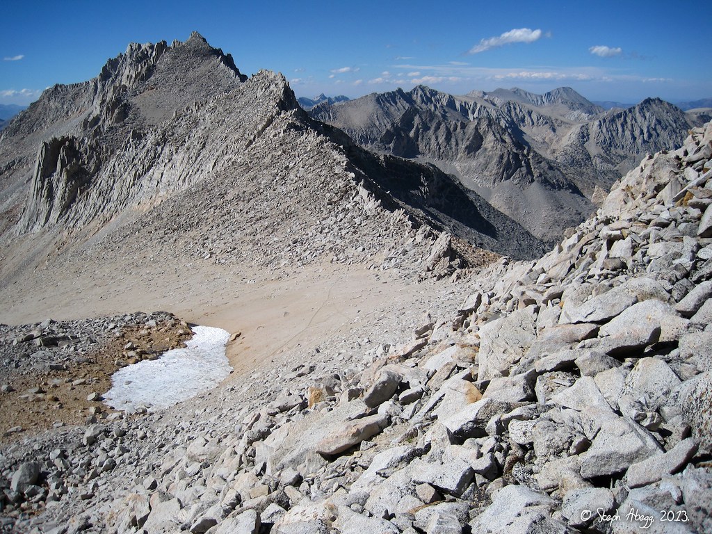
After the rappel from just below the summit, the descent involves just easy scrambling and hiking. This photo is taken looking north from the talus fields on the west side of the spire. The descent route passes through the low point on the right to get back into the basin above Dade Lake. The descent from summit to trailhead took us just under 3.5 hours.
(This photo was taken by Steph Abegg.)
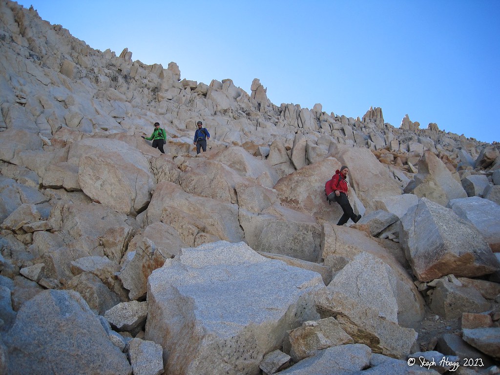
Descending the 3rd class back into the basin above Dade Lake.
(This photo was taken by Steph Abegg.)
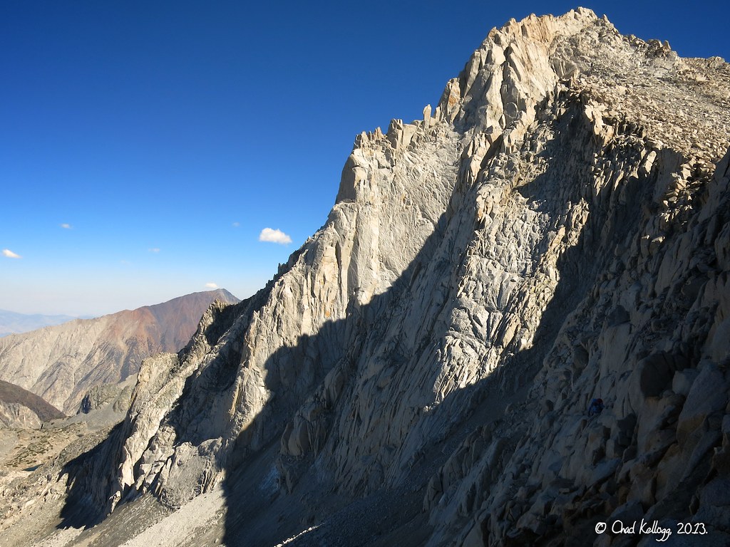
Afternoon light and shadow on Bear Creek Spire during the descent route. The North Arête is on the skyline. This photo shows how the summit is much further south than can be seen when viewing the spire more straight on from below.
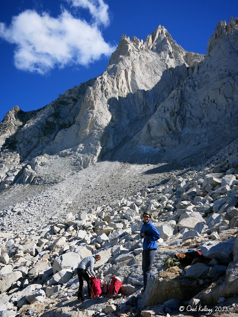
(This photo was taken by Chad Kellogg.)
We had left our poles and some extra water below the spire where the ascent route intersects the descent route. Here we are collecting our gear and enjoying one last view of Bear Creek Spire before heading out to the car, arriving back at the trailhead just under 12 hours since we had left that morning. It certainly was a beautiful area to spend a day.
Useful beta. Updated route information. Corrections. Historical notes. Interesting facts. No fluff please. Please do not put links in your comment, as my spam filter will filter those comments out.