Russell, Fishhook Arête (5.9, 700′, 7-8p)

Mt. Russell

Route:

Fishhook Arête

5.9, 700', 7-8p

An aesthetic arête climb of a California fourteener.

Region: California
Elev: 14,094 ft
Rock type: Granite
Type: 
Date(s): August 23, 2013 (Fri)
Partner(s): Dan Aylward, Sarah Hart, Chad Kellogg

Route Overlays

CLICK TO ENLARGE

Map

CLICK TO ENLARGE

Intro

THIS TRIP REPORT IS STILL MOSTLY IN THE EMBEDDED HTML FORMAT OF MY OLD WEBSITE.

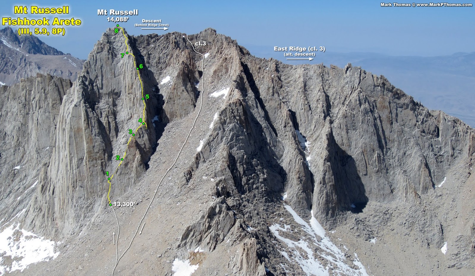
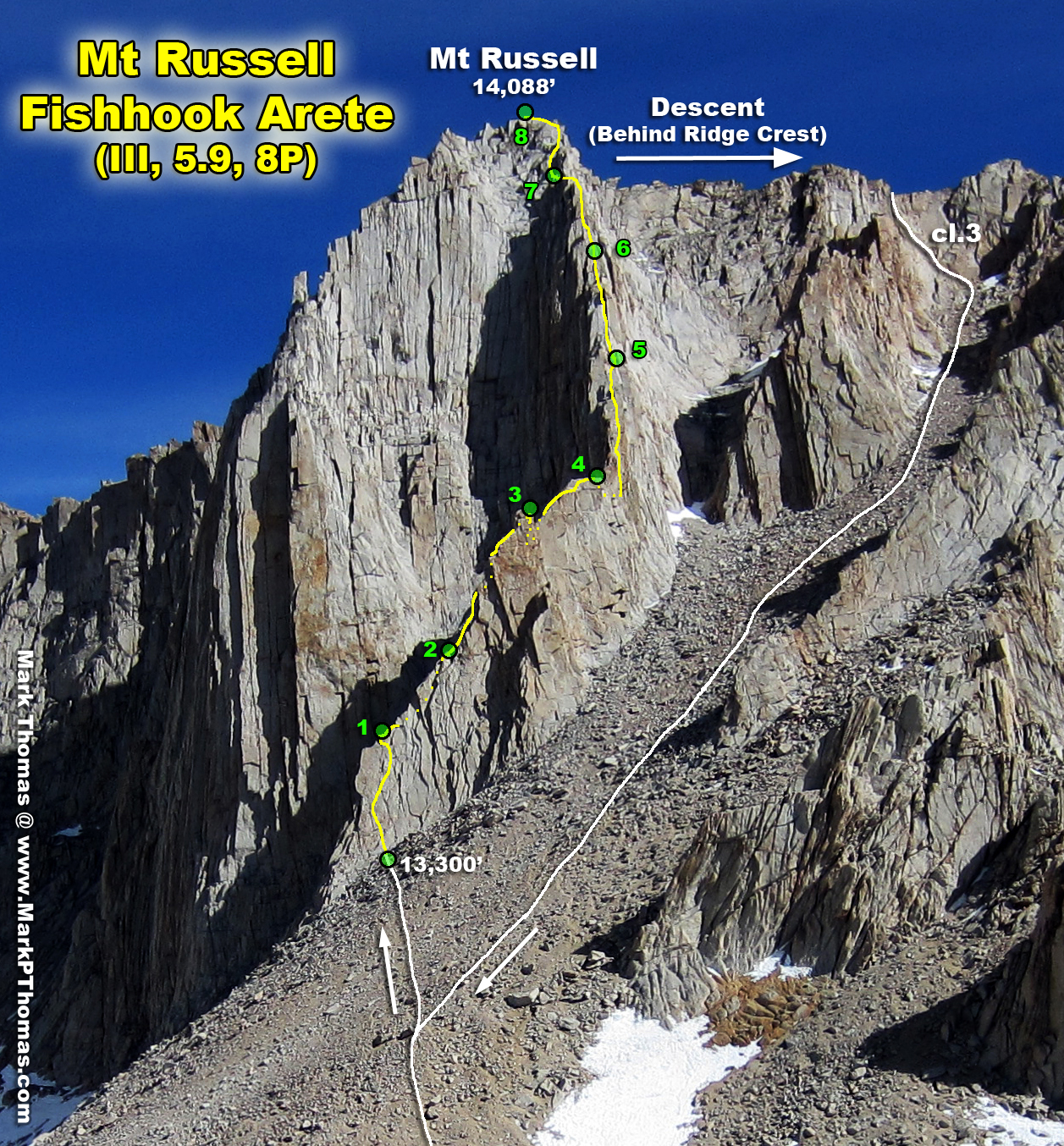
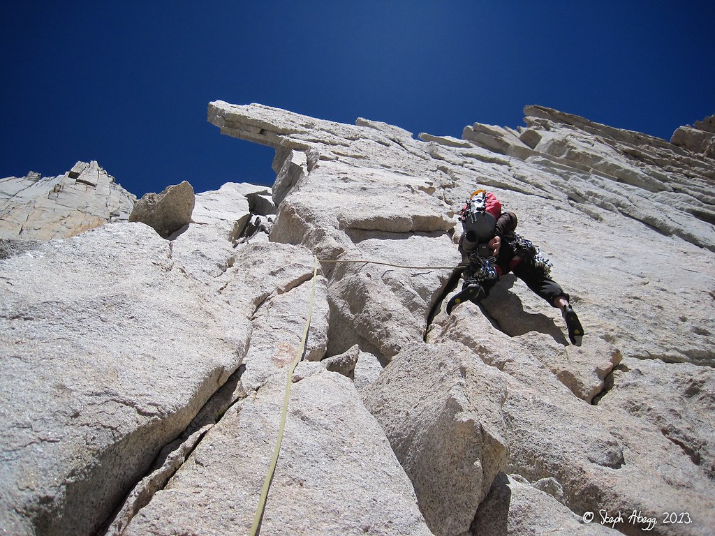
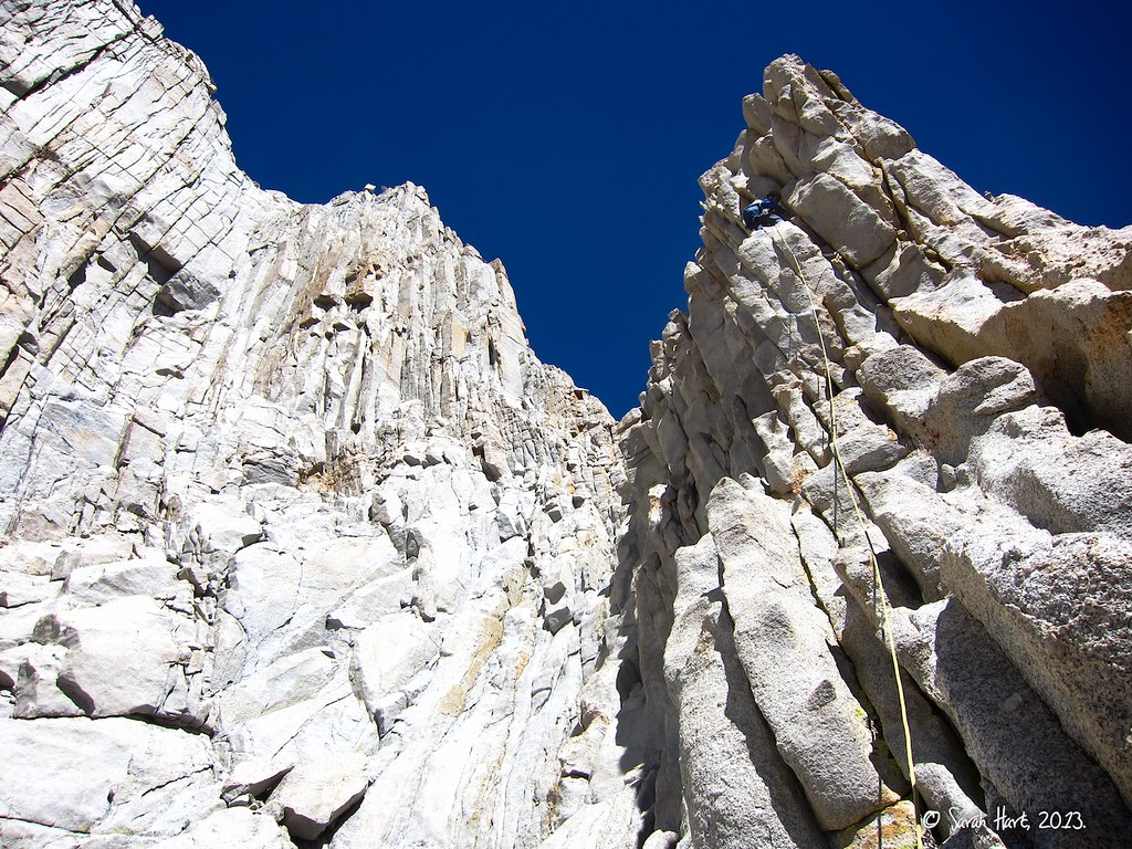
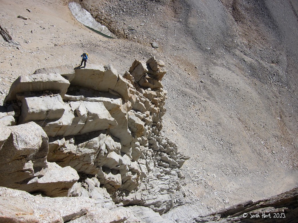
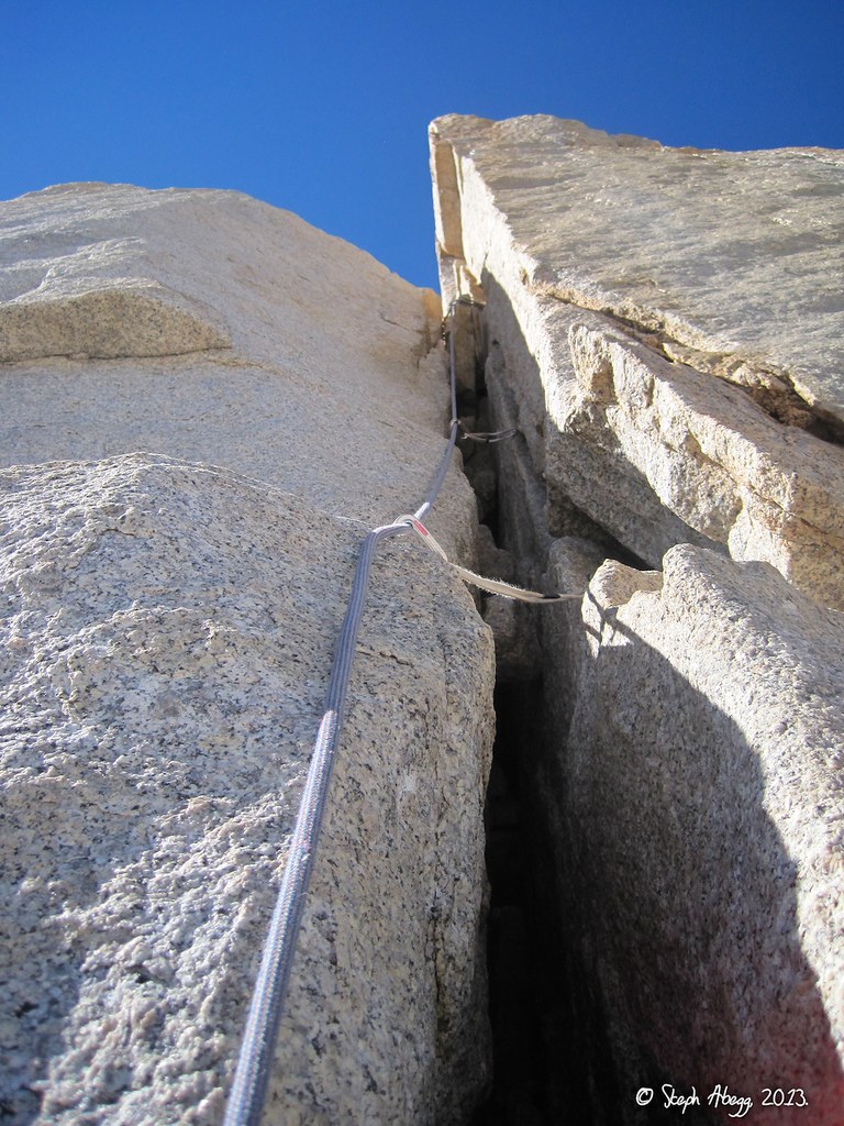
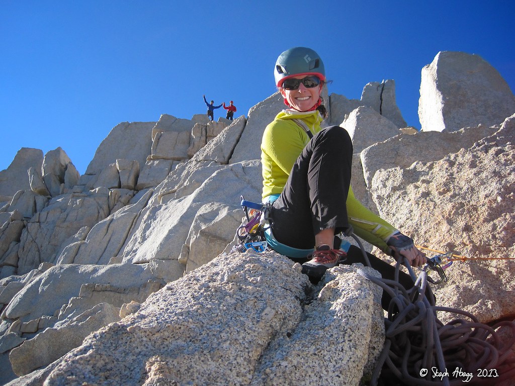
Following a sharp crescent-shaped spine on the southern aspect of Mt. Russell, 
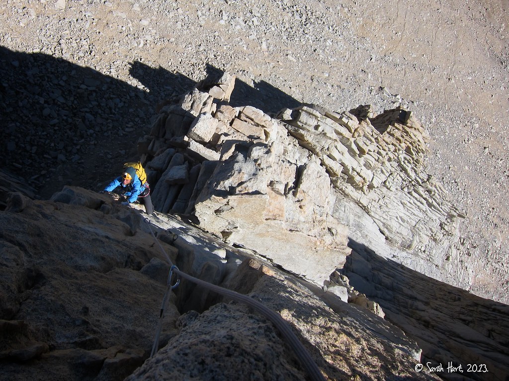
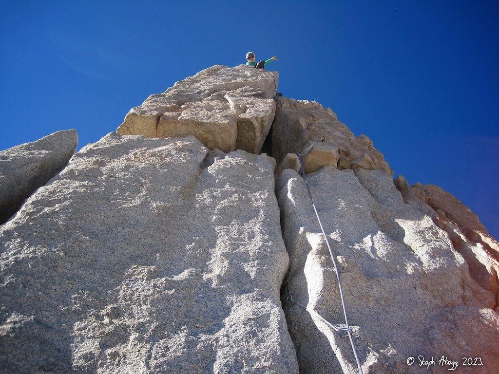
Fishhook Arête is one of the most aesthetic routes in the High Sierra. Nearly the entire length of the 8-pitch route is exposed and on perfect golden granite. The climb is easily divided into two distinct arêtes separated by a notch. The lower arête is thin, exhilarating, and diagonals up mostly moderate terrain with a few stout 5.9 sections. The upper arête ascends steep rock that gradually lessens in angle and has incredible belay ledges every 50 feet. Plus, the route tops out on a 14,000+ foot summit. It is no surprise that Fishhook Arête is named as one of the 100 best Sierra alpine climbs in John Moynier and Claude Fiddler's "Sierra Classics."

So of course 
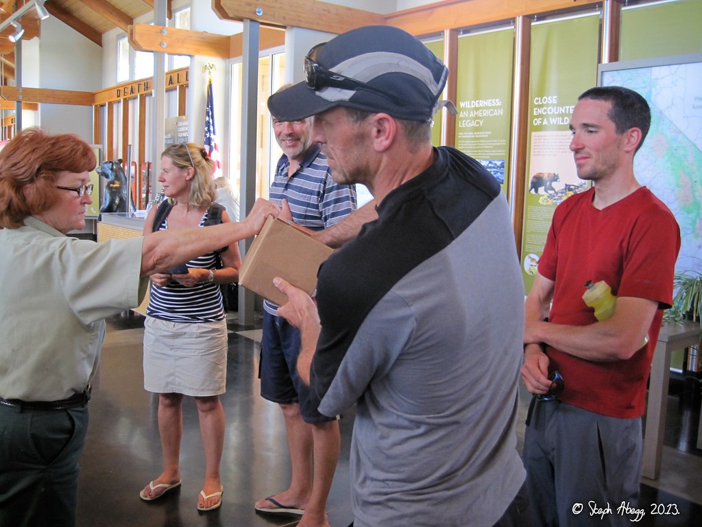
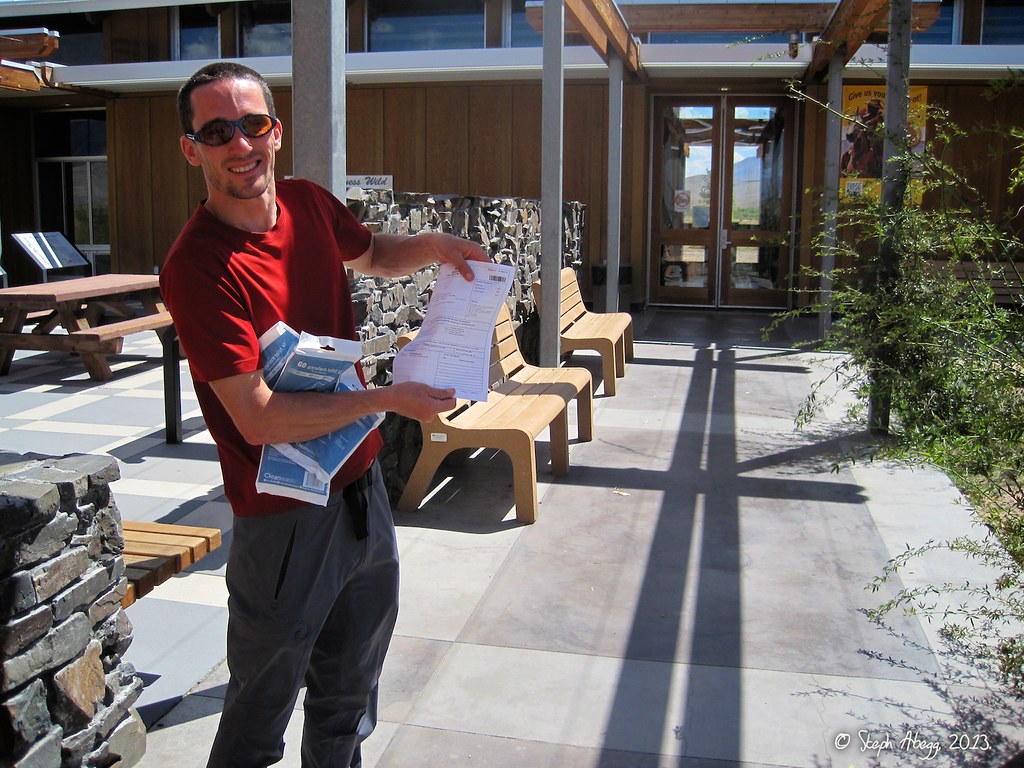
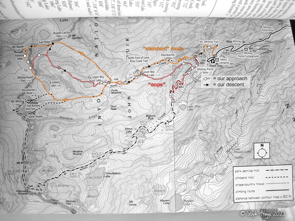
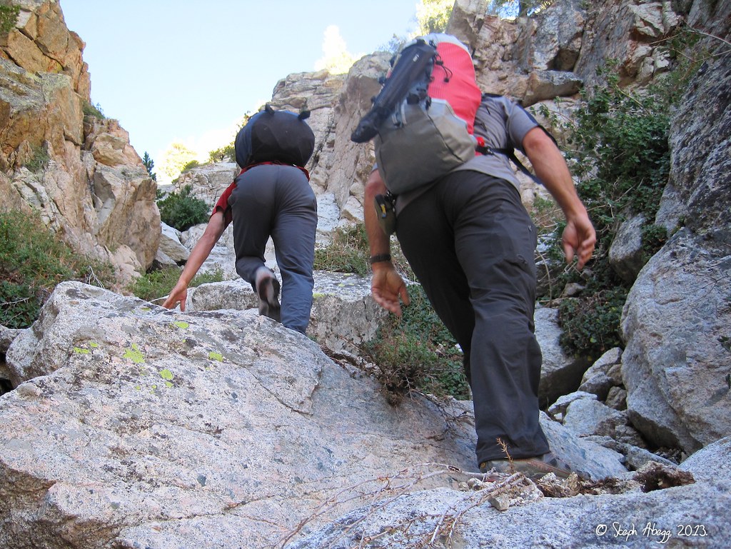
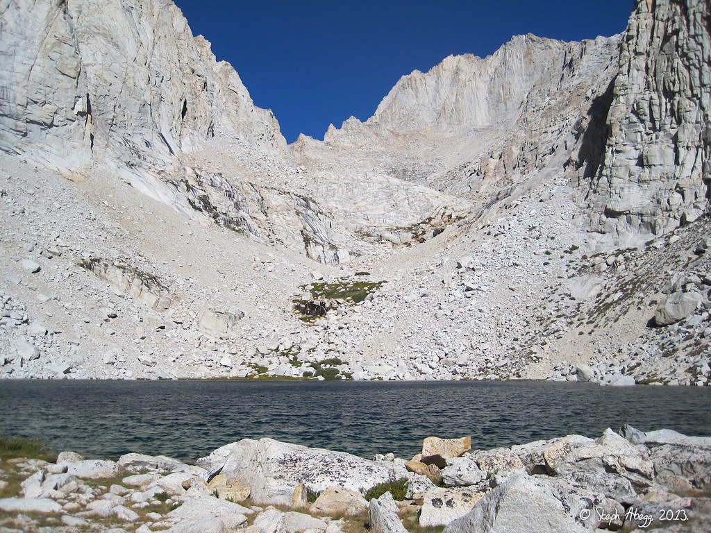
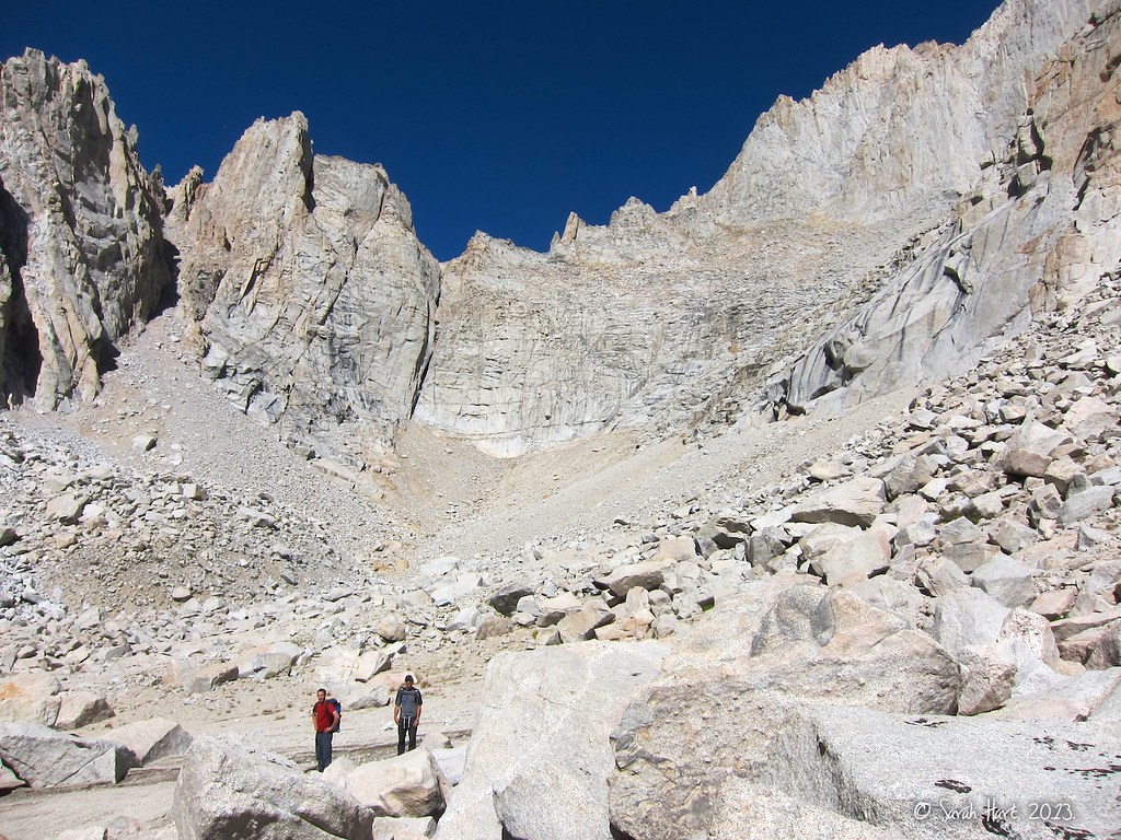
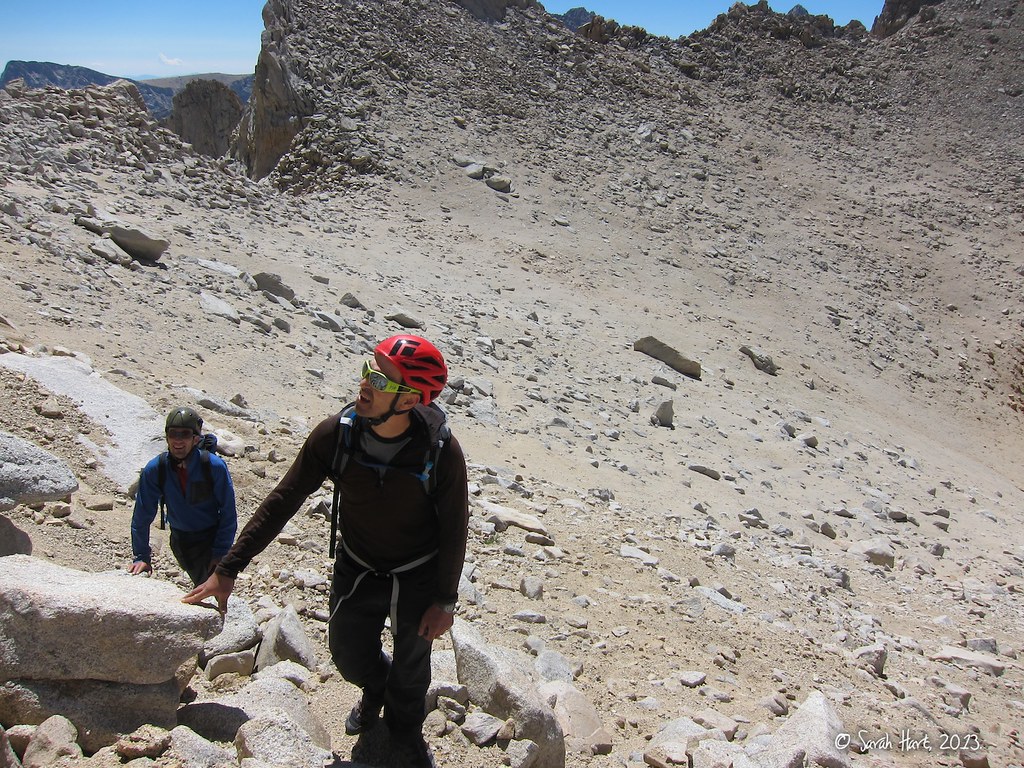
Fishhook Arête was high on the tick list when I joined friends Sarah, Chad, and Dan on a climbing road trip to the High Sierra in August 2013. But when we arrived at the Visitor Center in Lone Pine the day before we wanted to climb Russell, we were dismayed to discover that we needed a permit to climb the route (any hike or climb involving the Whitney Portal trailhead requires a permit), and that permits for that area are almost always all reserved a few months before the summer even begins. However, we were told that there was a chance that some permits would go unclaimed, but we would have to return the next day and join a lottery with the daily crowd also wanting permits. We decided that the opportunity to climb Fishhook Arête was worth the risk of a totally wasted sunny day. So we showed up at the Visitor Center at 8am the next morning. No permits were available. We got worried. We were told to come back at 11am and check to see if any overnight permits had gone unclaimed. At 11am, four overnight permits were unclaimed. We got excited. But then we drew the #2 position in the lottery and the overnight permits went to #1. We got worried again. We were told to come back at 2pm and check to see if any day-use permits had gone unclaimed. At 2pm, twenty day-use permits were unclaimed. We did a head count of all the others in the lottery for permits. Fortunately, there were just less than twenty of us. Whew! Climb on!

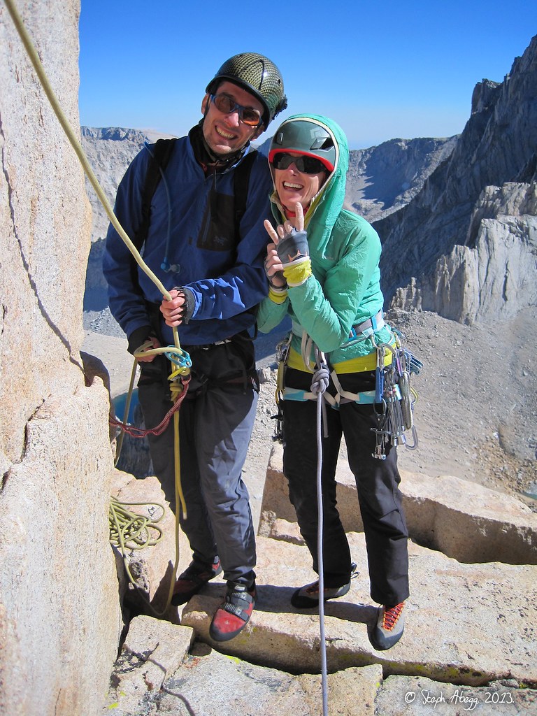
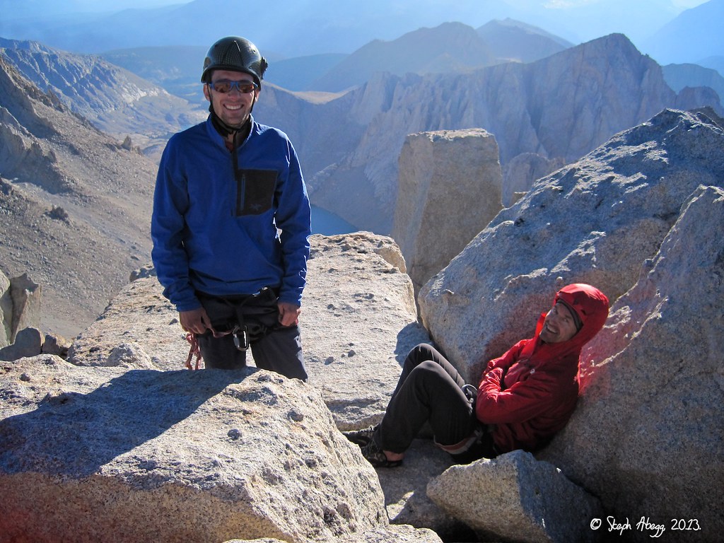
The following page provides a trip report for our climb of Fishhook Arête. It was a super fun day in the mountains, and we all agreed that Fishhook Arête is indeed deserving of its status as a Sierra classic.

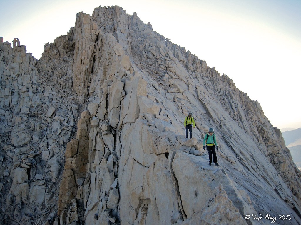
Update (Aug 2015): The rock on Russell is some of the best alpine granite I've climbed, and over the next couple of seasons I returned to climb several other routes on Russell, including Mithral Dihedral (5.9+, 700') (July '15), Western Front (5.10+, 900') (July '15), and East Ridge (3rd, 800') (as a downclimb, Aug'13 and July '15), Star Trekkin' (5.10-, 700') (Aug '15), and Bloody Corner (5.10+, 800') (Aug '15) (click links for trip report). All are excellent routes.

Time Stats

Since we did not have an overnight permit (negating our idealized plans to basecamp and climb the East Buttress of Whitney too), we climbed Russell car-to-car. The entire adventure took us roughly 16 hours, broken down as follows:

Approach: 5:45-11:45am (6 hours, perhaps 2 hours due to routefinding errors)
Climb: 12:57-5:52pm (just under 5 hours)
Descent: 6:10-10:04pm (just under 4 hours)

Photos

Entering the daily lottery for unclaimed permits for the Whitney Portal area. The unclaimed permits are free at least.
Success!
The approach to the base of the Fishhook Arête is about 4 miles and gains about 5,000 feet in elevation. The climb itself gains about 700 feet to the summit of Mt. Russell. The typical approach involves hiking the Whitney Portal trail for about a mile and then turning off on climbers' trail that  heads up the North Fork of Lone Pine Creek. The trail climbs past Lower Boy Scout Lake, Upper Boy Scout Lake, and Iceberg Lake before passing through the Whitney-Russell Pass and then traversing to the base of the Fishhook Arête. This "standard" route is shown in orange on the map on the left, which is a photo of the map in the SuperTopo guide. The white arrows represent our approach while the black arrows represent our descent.

Explanation of the red line on the map route overlay: In our eagerness to get to the climbing route, we missed the turnoff for the climbers' trail up the North Fork of Lone Pine Creek (it's not quite obvious although there is a sign that names the creek, just not the trail). We hiked a few miles up the Whitney Portal trail before realizing our mistake. (This mistake ended up plaguing us the entire approach route.) We turned around and hiked back down the trail a ways, and then did a bit of cross-country travel to get over to the North Fork of Lone Pine Creek valley. But instead of descending to the climbers' trail we knew was in the valley bottom, we stayed on a ridgeline above the south side. When we finally dropped down at a lake we figured it was Upper Boy Scout Lake, assuming (incorrectly) we had bypassed Lower Boy Scout Lake. So, when we arrived at the next lake, we assumed (incorrectly) this was Iceberg Lake, and headed into the basin beyond to access what we assumed (incorrectly) was the Whitney-Russell Pass. All the while we were getting more and more confused that things just didn't look "right". When we finally had our ah-ha moment and realized that our assumptions had been a lake offset the entire approach, we figured out a reasonable way to get to the base of Fishhook Arête. It took us 6 hours to get to the base of the arête, rather than the 4 hours we had predicted. Most of the time was lost in backtracking and constant hesitation rather than the actual route we took, since our approach route above Upper Boy Scout Lake was perhaps more direct than the standard approach via Iceberg Lake.
This photo shows Dan and Chad on our cross-country route on the ridge above the left (south) side of the North Fork of Lone Pine Creek valley. The climbers' trail is actually on the right (north) side of the valley. When hiking out after the climb, we took the trail, and decided that our ridge approach was a bit more enjoyable than the trail.
Here we are hiking up the upper North Fork of Lone Pine Creek valley towards Upper Boy Scout Lake (which we were at the time incorrectly assuming was Iceberg Lake). Mt. Whitney is the peak in the distance. Mt. Russell is to the right of Whitney and out of view.
Upper Boy Scout Lake. The Mt. Russell massive is at the head of the basin (to the right of the notch) above the lake. We headed up into this basin, thinking (incorrectly) that we were at Iceberg Lake and that what we were seeing at the head of the basin was Whitney-Russell Pass.
In the basin above Upper Boy Scout Lake. Hmm...that doesn't really look like Whitney-Russell Pass....

After an ah-ha moment, we figured out that we were in the wrong basin, just north of the Iceberg Lake basin below the Whitney-Russell Pass. Fortunately, we were able to easily traverse through the pass in this photo and get to the west side of Mt. Russell where we needed to be. 

(This photo was taken by Sarah Hart.)
On the final approach to the base of Fishhook Arête. That's the Whitney-Russell Pass behind Chad and Dan, where most people come through to access the west side of Mt. Russell.

(This photo was taken by Sarah Hart.)
Looking up at Mt. Russell from the southwest. The steep walls of the Mithral Dihedral route are on the left. Fishhook Arête is a separate ridgeline in front of this but it is difficult to distinguish in this photo. The South Face descent route (which we did not take but is a popular 3rd class option) comes down the gully in the middle-right of the photo.
Chad leading off the first pitch of the Fishhook Arête route. This is perhaps the crux pitch of the route, containing the longest section of 5.9 climbing. It is very fun climbing on crack and knobby rock. We linked Pitches 1 and 2 in the SuperTopo guide.

SuperTopo guide: "There are many different ways to start the route. Starting outside the arête on the face is the most challenging, but it is also the easiest to protect and offers the best climbing. If you ignore the topo and start inside the arête you will be faced with about 20 options up different ramps. While a few of these options, if you can find them, may be easier than the 5.9 route shown in the topo, the majority of the options are awkward, difficult to protect, and just not that much fun. A third starting options is the hike up the outside of the arête and do an 80-foot 5.7 pitch to the notch at the base of Pitch 5. This option eliminates most of the routefinding, hard sections, and fun of the route."
Dan leading our second pitch (which is Pitch 3 in the SuperTopo guide). The view of Fishhook Arête is pretty cool from here. It arcs above and to the left.

SuperTopo guide: "Pitch 3 is the routefinding crux of the route. You must move to the left and ascend ramps. Move too far left and you will be lost in a maze of ramps and rope drag. Move too little and the climbing may be steeper and more difficult."

(This photo was taken by Sarah Hart.)
Sarah starting off our third pitch (where we linked Pitches 4 and 5 in the SuperTopo guide). The arête towers above. Look at all that granite!

SuperTopo guide: "Pitch 4 ends above a notch. The downclimb into the notch is hard, especially with a pack. The first person down sets gear and then belays the second who downleads. Pitch 5 is spectacular and surprisingly easy considering its steepness."
Here I am midway up our third pitch (where we linked Pitches 4 and 5 from the SuperTopo guide). I am standing just after the notch with the tricky downclimb. Fishhook Arête stretches below. This arête really does have an amazing position.

(This photo was taken by Sarah Hart.)
Near the top of our fourth pitch (Pitch 6 in SuperTopo). This is the "5.8 chimney" but it was more of a crack than a chimney and pretty friendly.

SuperTopo guide: "Pitch 6 ascends a few wide cracks including a 25-foot long chimney. Wearing a pack makes this section awkward. Be very careful of pulling on loose blocks in the chimney and, if you want to communicate with your second, set an intermediate belay right at the top of the chimney on a large ledge."
Dan and Sarah at the belay on a nice ledge at the top of our fourth pitch.
Climbing a wonderfully exposed arête section on our fifth pitch (Pitch 7 in SuperTopo). 

SuperTopo guide: "Pitch 7 has at least three variations. Stay mostly on the true arête for the best climbing or move to the right (east) to escape some of the exposure. If you stay mostly on the true arête, after 80 feet, you move left and stem across a wide crack."

(This photo was taken by Sarah Hart.)
Sarah at the belay at the top of our fifth pitch (Pitch 7 in SuperTopo). This photo was taken by me from where I am in the previous photo. Here we climbed the straight up these cool blocks. The alternate Pitch 7 traverses Class 4 ledges to the right of the crest, ending in a short 5.8 corner.
Sarah at the belay at the top of our sixth pitch (which for us was the last part of Pitch 7 and the first part of Pitch 8 in SuperTopo). Dan and Chad are behind on the summit.
Dan and Chad on the summit of Mt. Russell, one of California's dozen fourteeners (with a summit elevation 14,094 feet). It took about five hours from base to summit for each rope team.
Beginning our descent via the East Ridge (3rd) of Mt. Russell. This involved traversing over the east summit of Russell in the distance. The East Ridge is a super fun exposed ridge walk on solid rock, highly recommended over the South Face descent if you don't need to return to Iceberg Lake. The descent from summit to car took just under four hours (6:10-10:04pm) and had an elevation loss of about 6000 feet.
On the descent via the East Ridge (3rd). The east summit of Russell is behind.
We had left our hiking poles in the basin above Upper Boy Scout Lake, so when we got to near the end of the East Ridge we descended this gully back into the basin to retrieve them. The scree was just the right consistency for a quick descent. After picking up our poles, we descended to Upper Boy Scout Lake and then intercepted the climbers' trail into the North Fork of the Lone Pine valley.
On the descent, we enjoyed views of Mt. Whitney basking in the evening sun.
It got dark just as we arrived at Upper Boy Scout Lake (at 8pm). Even though the trail down from here is well-travelled, we did enjoy a few short episodes of darn-it-where'd-the-trail-go-'schwacking over the course of the descent. 
One hazard of a southwest-facing route and a sunny day were Chad's sunburned ankles. Ouch!

Comments Pertaining to this Page / Trip Report

Useful beta. Updated route information. Corrections. Historical notes. Interesting facts. No fluff please.
Leave a Reply

Your email address will not be published. Required fields are marked *