THIS TRIP REPORT IS STILL MOSTLY IN THE EMBEDDED HTML FORMAT OF MY OLD WEBSITE.
A few years ago, Michael (who moved to Munich in 2005) had mentioned in passing: "If you are ever in the area we should climb in the Dolomites." (Although the Dolomites are in Italy, they are just a beautiful evening's drive from Munich.) So in the summer of 2013 when my parents invited me along as their unofficial guide on the Walker's Haute Route (a two-week hike from Chamonix to Zermatt that I had done with my sister in 2005), I figured this was a perfect time to take Michael up on his offer.
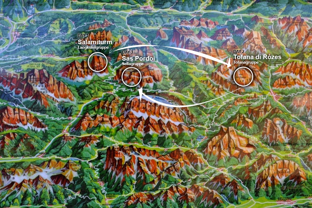
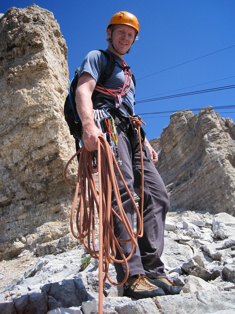
So after a memorable fortnight on the Walker's Haute Route with my parents, I jumped on a train to Munich. Over the next few days, Michael and I climbed three stellar Dolomites routes. I had never climbed on dolomite before, and I enjoyed how the featured and juggy nature of dolomite allows nearly vertical rock to maintain a moderate grade. This kind of climbing is fun and exhilarating for pitch after pitch. The Dolomites is a much bigger range than I had envisioned, and over the course of the trip I accumulated a lifetime list worth of climbs I wanted to do in the area. I will definitely be back someday.
The following page gives a trip report for our three climbs. Thanks Michael for the fun adventures!
Michael's TR: Michael has posted his version of our trip here. Check it out, it's a really fun read, contains some extra beta, and gives an insight of what my partners have to put up with when they climb with me....
Climbs We Did
CLICK ON ROUTE TO DROP DOWN CONTENT
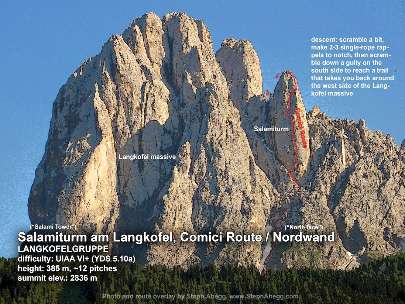
Day 1: Salamiturm, Comici Route / Nordwand (LANGKOFELGRUPPE)
Difficulty: UIAA VI+ (YDS 5.10a) a note about UIAA to YDS comparison in the More tab of this trip report
Length: 385 m, 12 pitches
Elev.: 2836 m
Route overlay for Salamiturm, Comici Route / Nordwand.
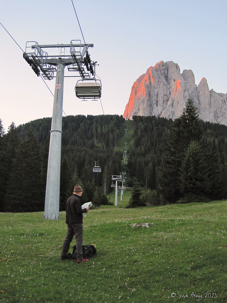
The approach ("Zustieg") to Salamiturm starts at some chairlifts at a ski area. We just hiked easily up the ski run clearings. It took 2.5 hours to reach the base of the route on Salamiturm.
We had to ascend a snowfield to get to the base of the route. With the aid of rocks to carve out steps, we managed to ascend the snow in our approach shoes relatively easily.
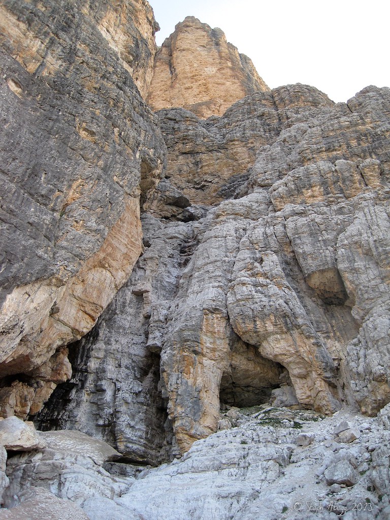
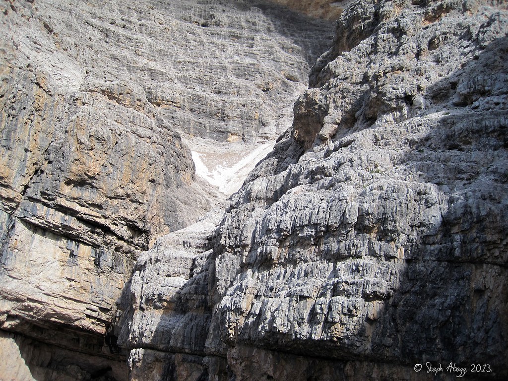
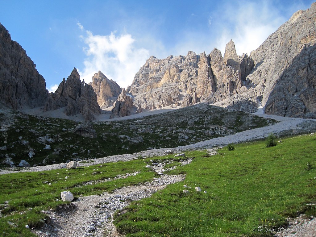
After the snowfield, there was a long scramble of 4th class rock rock to the base of Salamiturm. Salamiturm looms above in this photo.
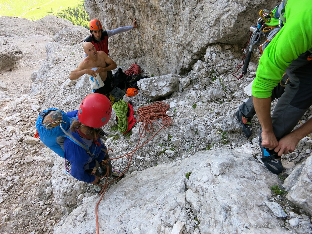
There were at least 5 parties on the route that day. We all arrived at the base at about the same time, and we ended up securing the third spot in the lineup. Fortunately all of the parties were about the same speed so there was not too much waiting at the belays after the initial wait at the bottom of the route.
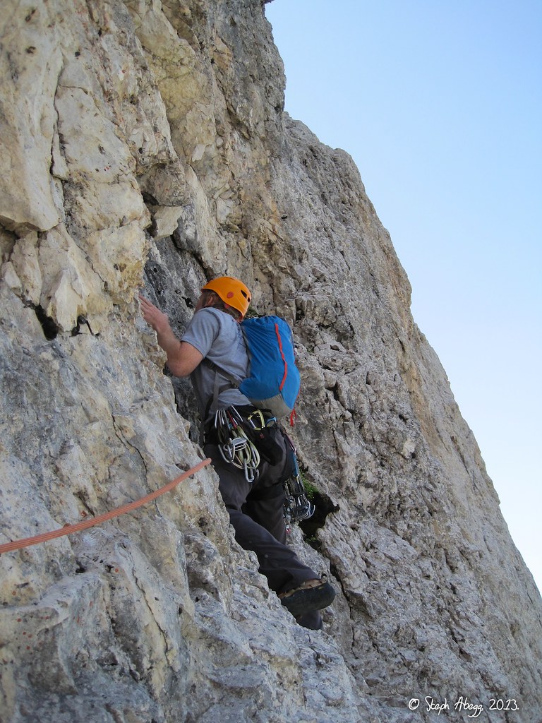
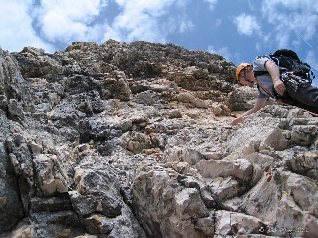
Michael starting up Pitch 1, just left of the "Rinne"="channel".
Michael starting up Pitch 2. Hard to believe the climbing is only UIAA V+ = YDS 5.7!
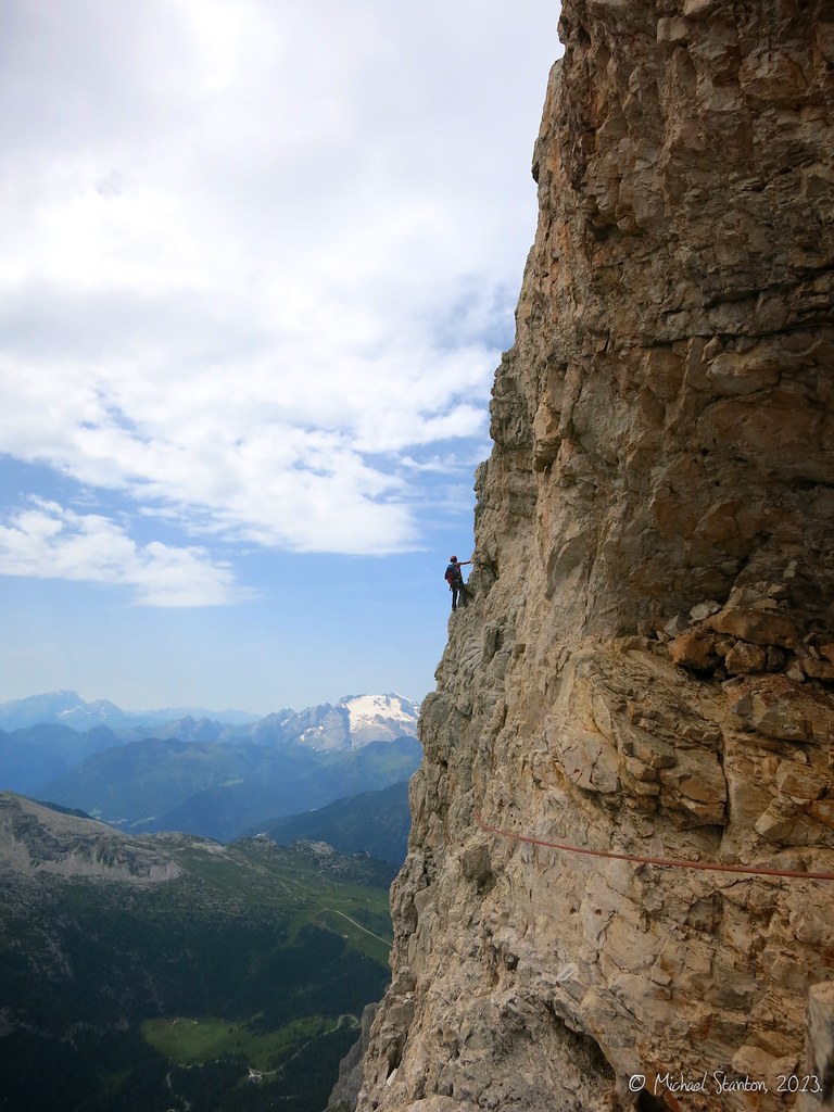
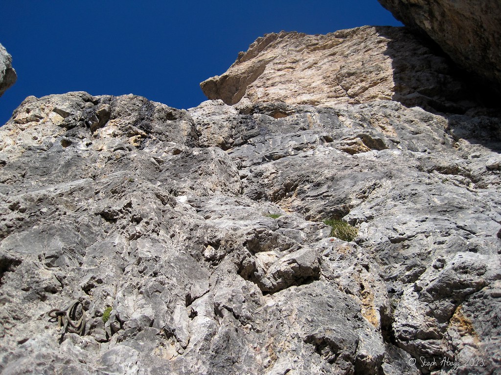
This photo was taken about halfway through the route (looking up Pitch 6). More steep and juggy climbing ahead. The crux (UIAA VI+ = YDS 5.10a) of the route is at the "gelber Überhang"="yellow overhang" that looms ahead.
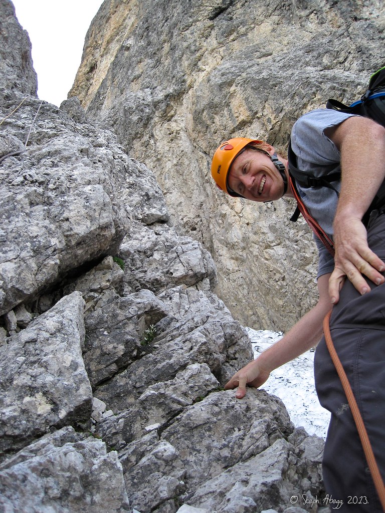
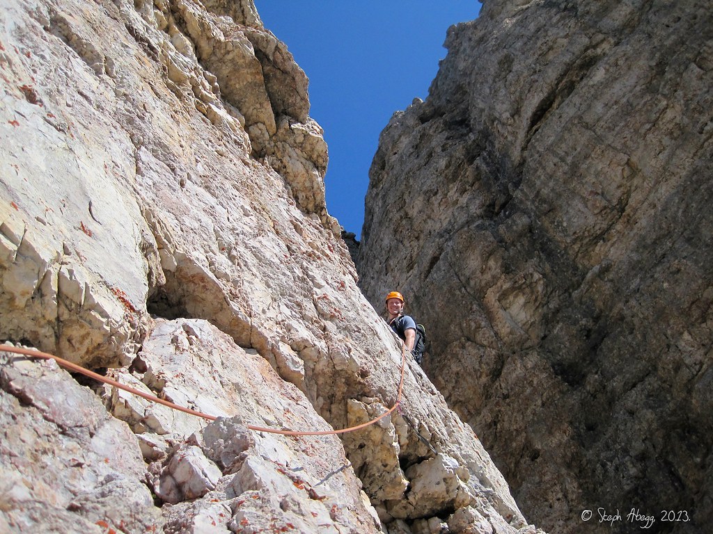
Looking down at Steph climbing the crux (UIAA VI+ = YDS 5.10a) of the route on Pitch 6. The shadow of the "salami tower" that we are on can be seen below. A dramatic place!
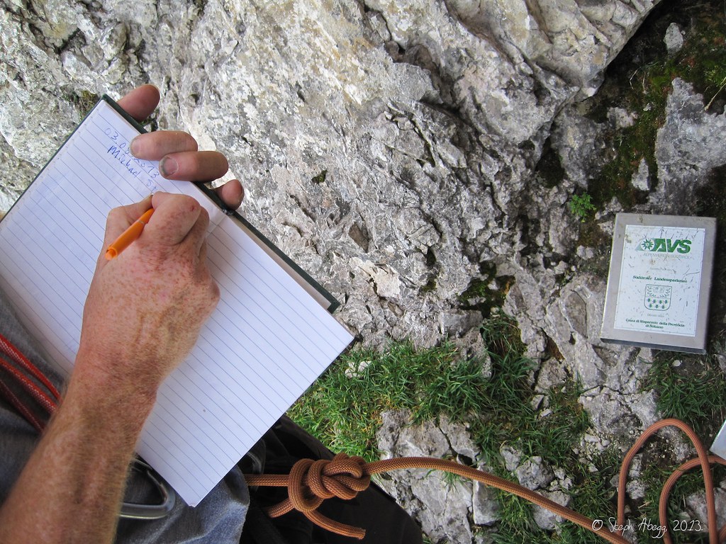
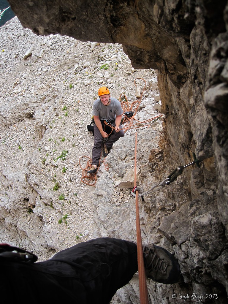
Signing a register book ("Gipfelbuch") at top of Pitch 7. This was the first time I had ever encountered a register book en route, but it seems rather common in the Dolomites since it occurred on two of the routes we did. This way, the book contains only climbers' entries, rather than those of tourists who walked up the back side of the peak to the summit.
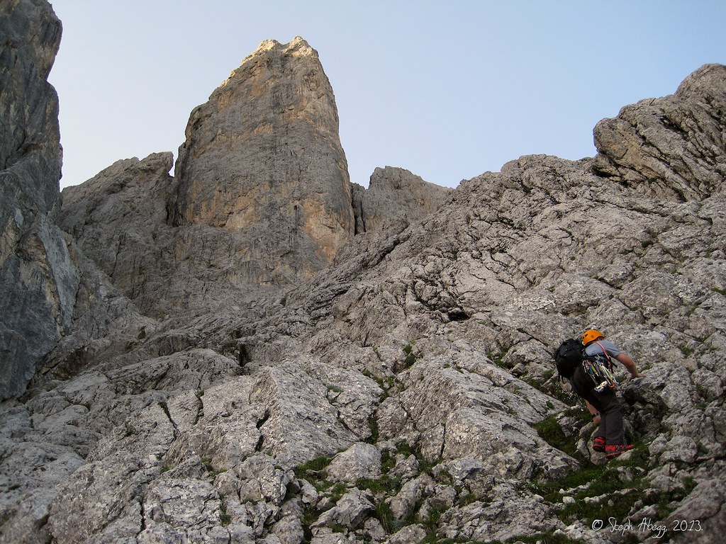
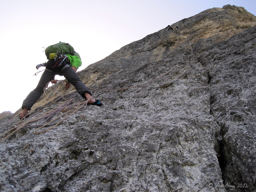
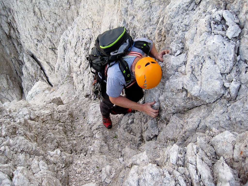
Michael starting up Pitch 9. The topo noted "brüchiger Fels"="brittle rock".
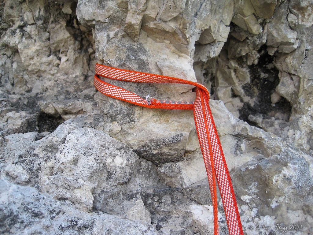
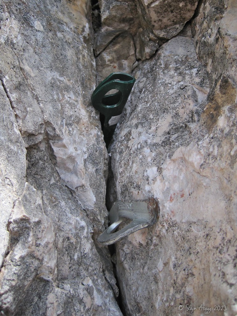
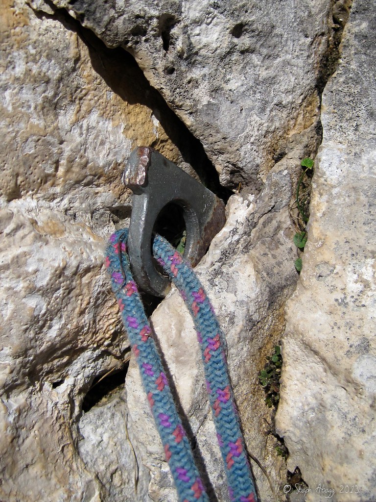
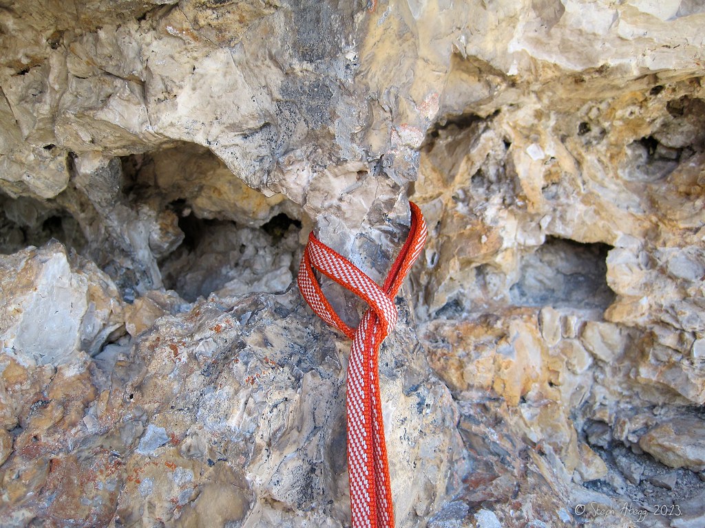
A "Sanduhr"="hourglass" is a common feature in the Dolomite rock. They make for great natural protection, and there are times when you can practically protect a whole pitch using just slung Sandhurs.
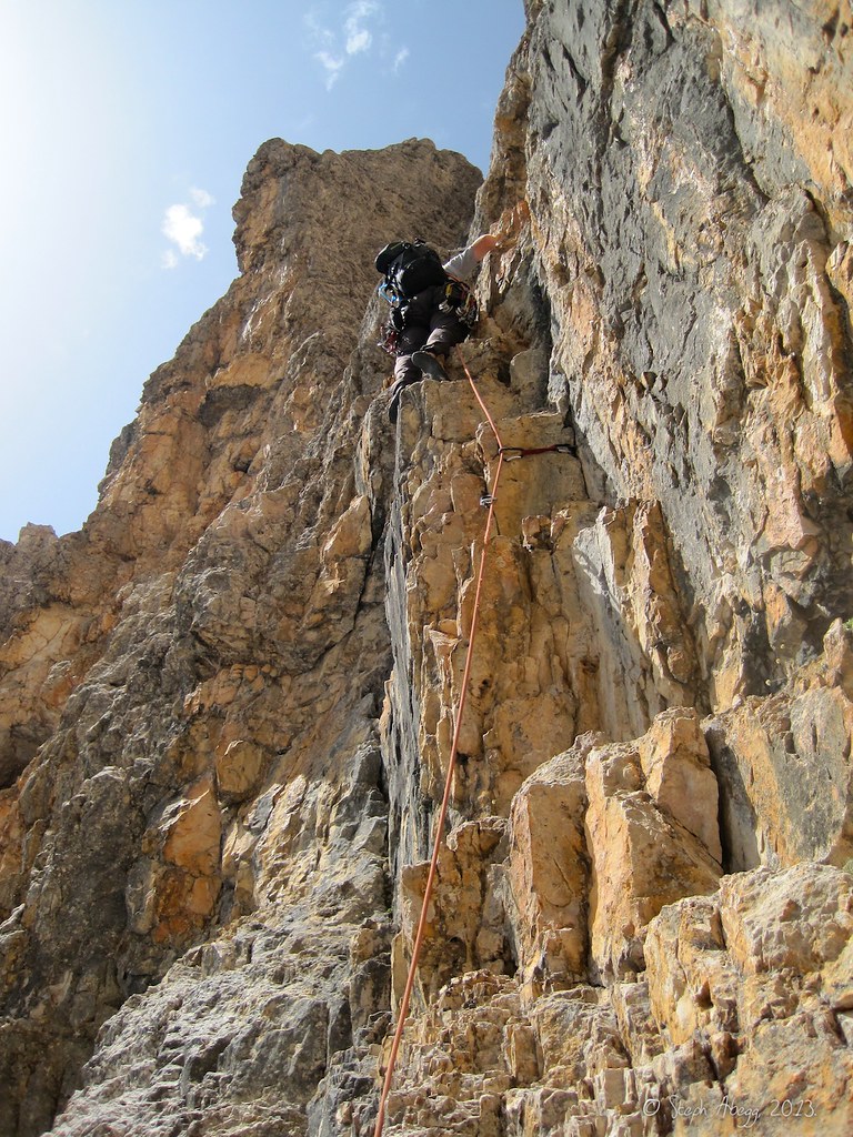
Steph near the top of Pitch 11.
Steph climbing the final pitch (Pitch 12 by our count) to the summit.
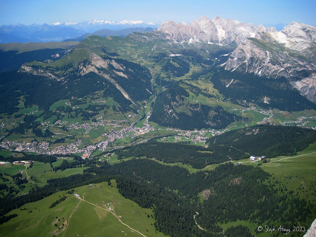
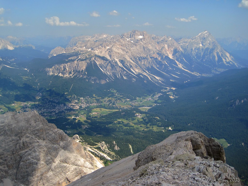
Views from the summit ("Gipfel"): St. Christina below and more Dolomites in the distance.
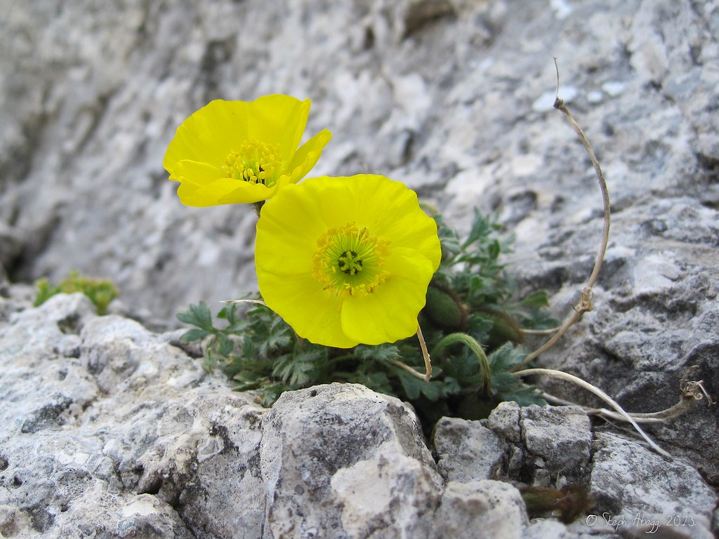
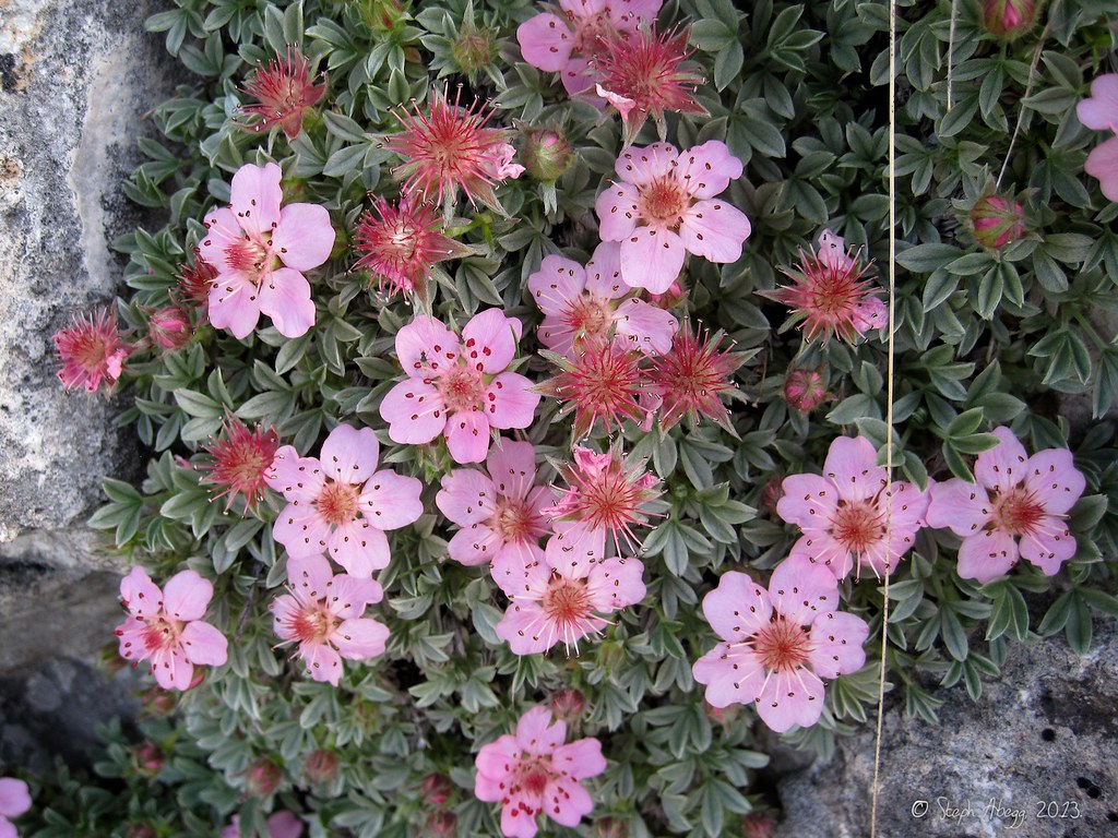
Yellow poppies near the summit.
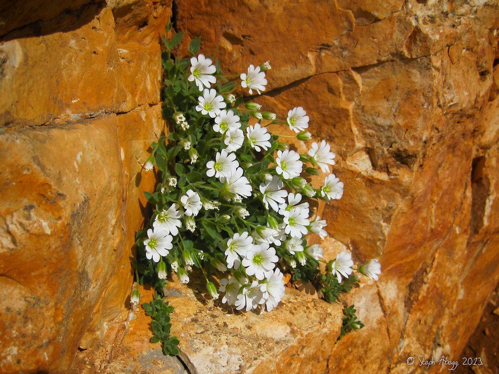
Alpine mouse ear (cerastium alpinum) near the summit.
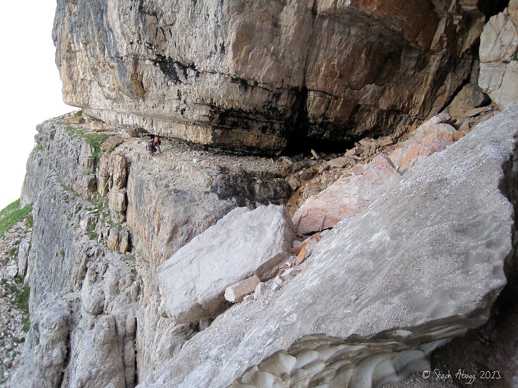
The descent ("Abstieg") begins with about 100-200 feet of scrambling to some rappel slings.
Then we made three rappels to the notch (the guide book noted two 25m rappels, but we could not reach the top of the second with our 50m rope so we had to make 3 rappels using an intermediate anchor we found).
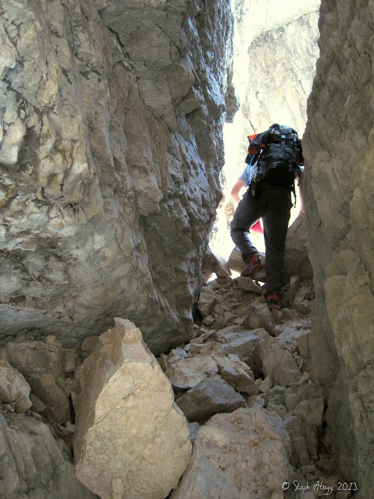
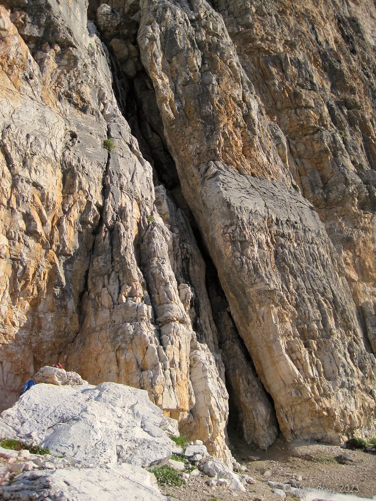
A cool tower above the notch we needed to pass through.
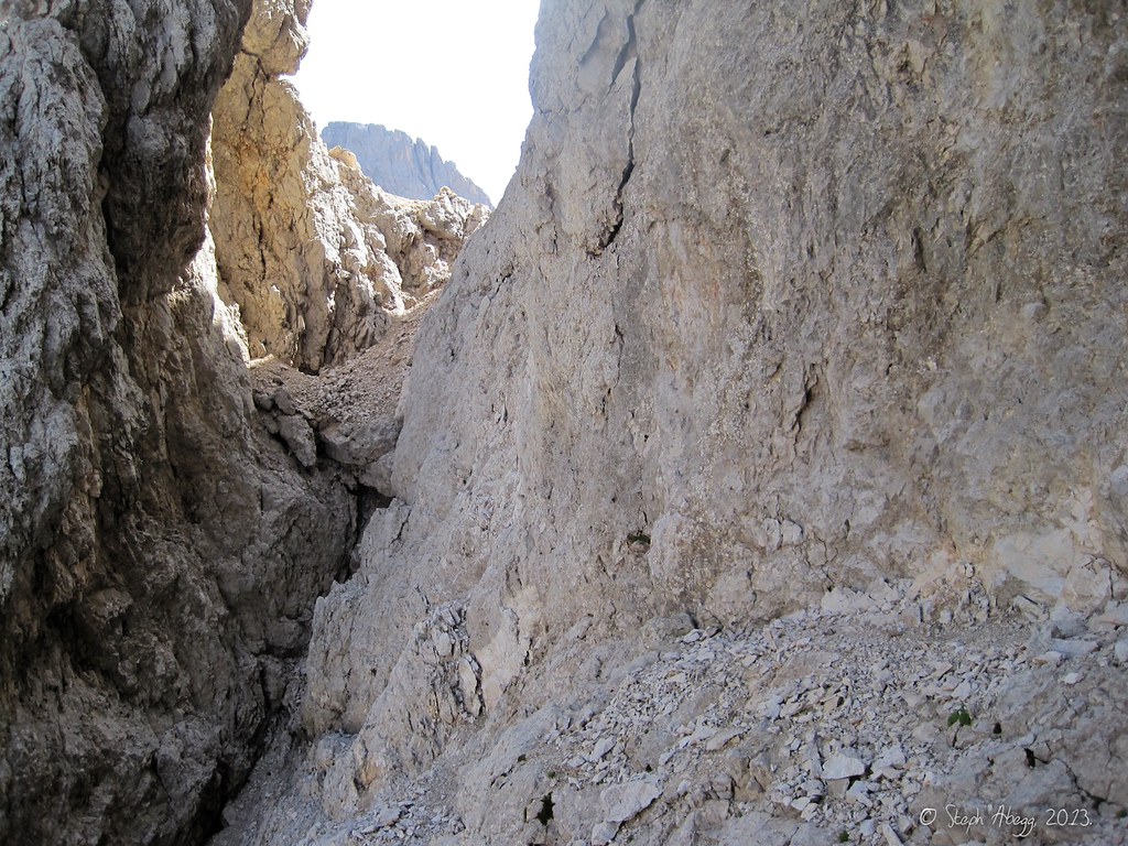
After the rappels, we passed through this notch, which brought us to the scramble route down a broad gully on the south side.
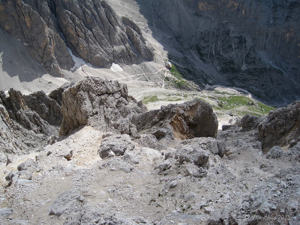
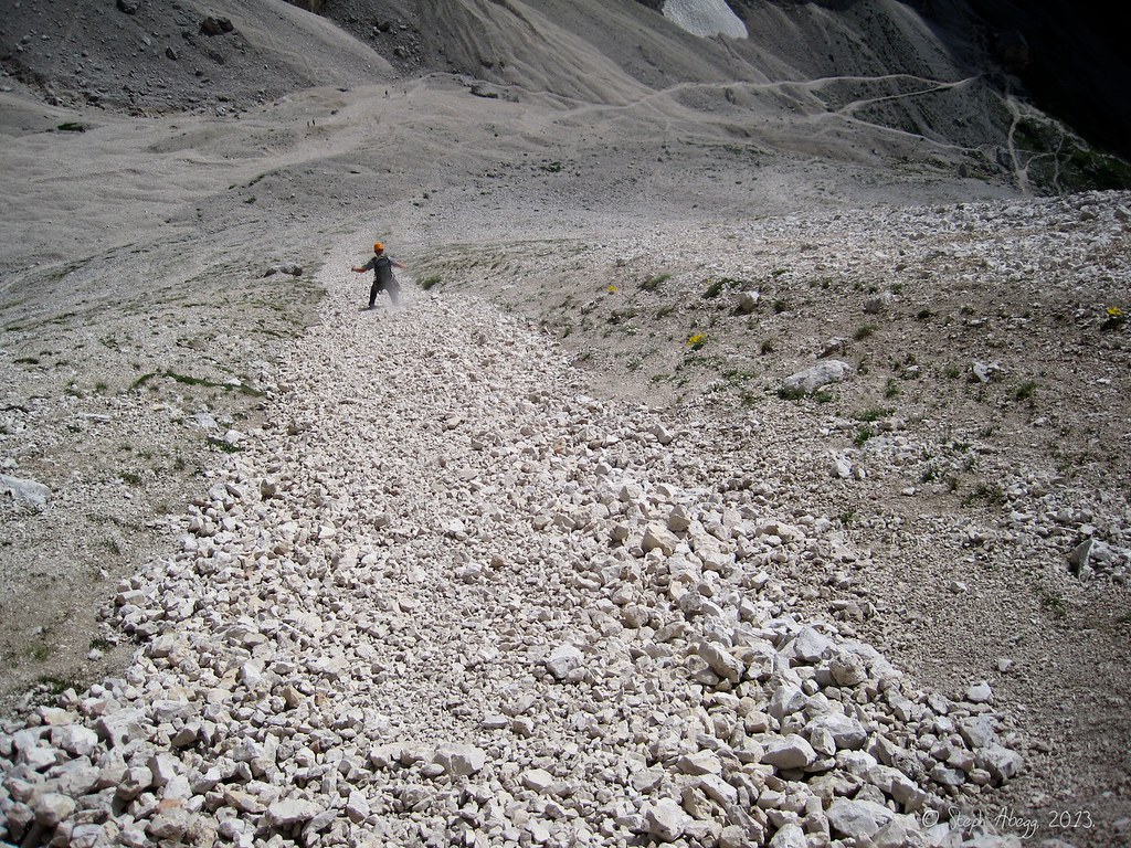
Our next task was to descend the broad gully. Our destination is the Langkofelhütte far below.
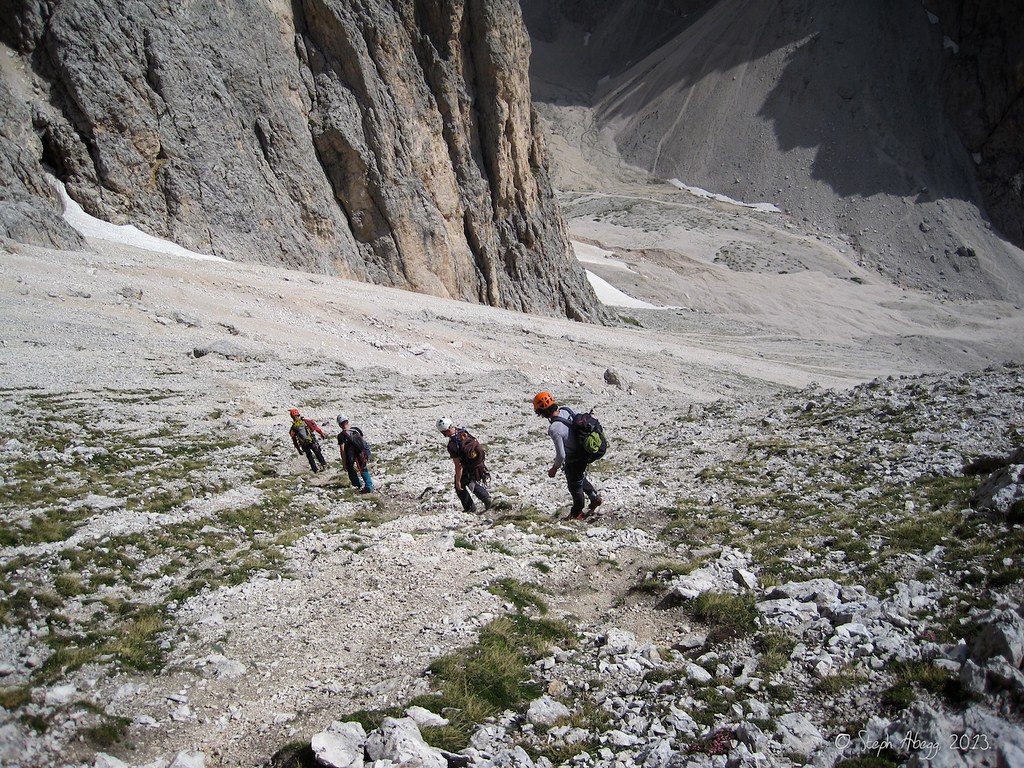
Descending...
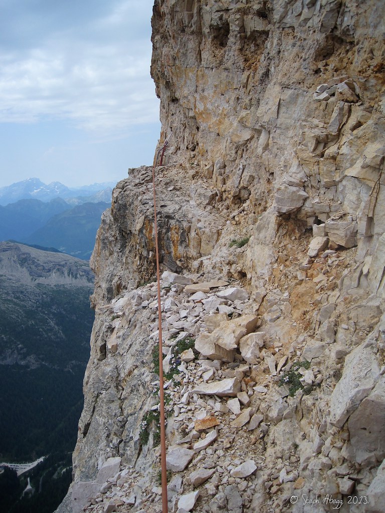
"Geröll"="scree". This band expedited the descent.
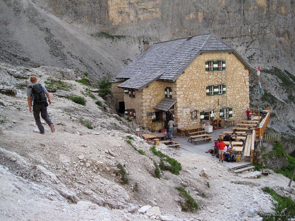
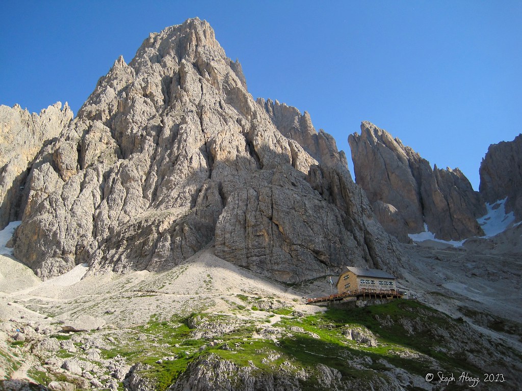
Finally we arrived at the Langkofelhütte.
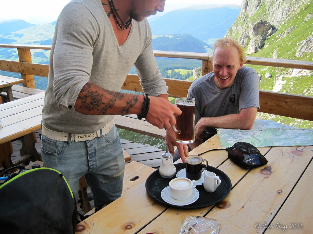
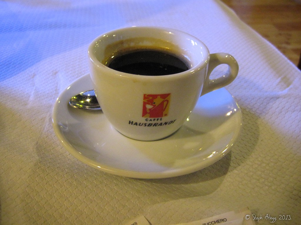
We stopped at the Langkofelhütte and ordered drinks. A Spezi (=Fanta+coke), a Cappuccino, and an Caffè Americano. A very Italian way to end a day of climbing. We discussed our theories on the differences between Americanos, regular coffees, Cappuccinos, Lattés, Macchiatos, ..., but alas, it ended up requiring too much thinking after a day of climbing so the mystery was postponed for a later date.
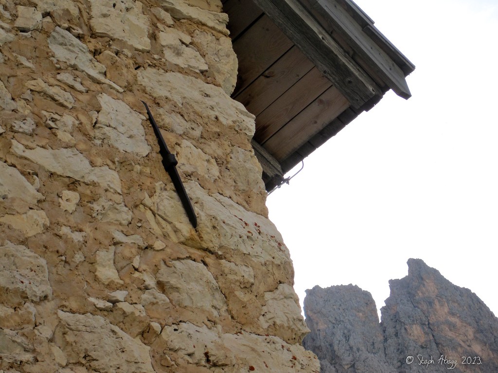
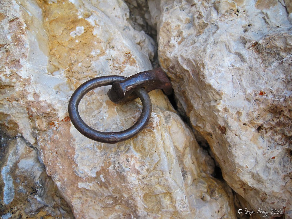
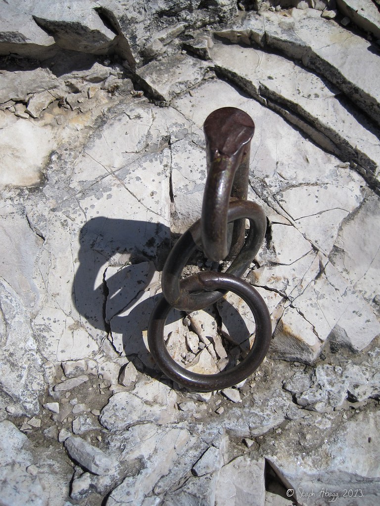
I noticed these metal bars placed at random on the hut walls. I think the purpose is to prevent bowing out of the structure.
Looking back towards the rather idyllically-situated Langkofelhütte as we descended on trail that wrapped back around the Langkofelgruppe to the trailhead.
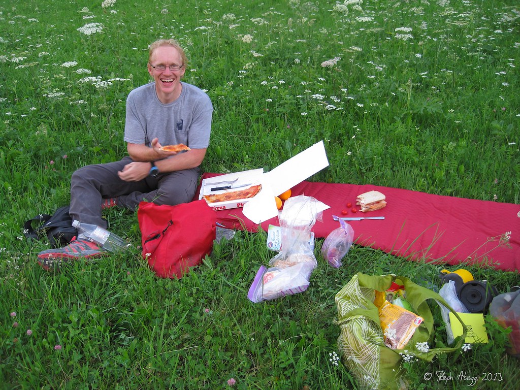
Dinner the Italian way.
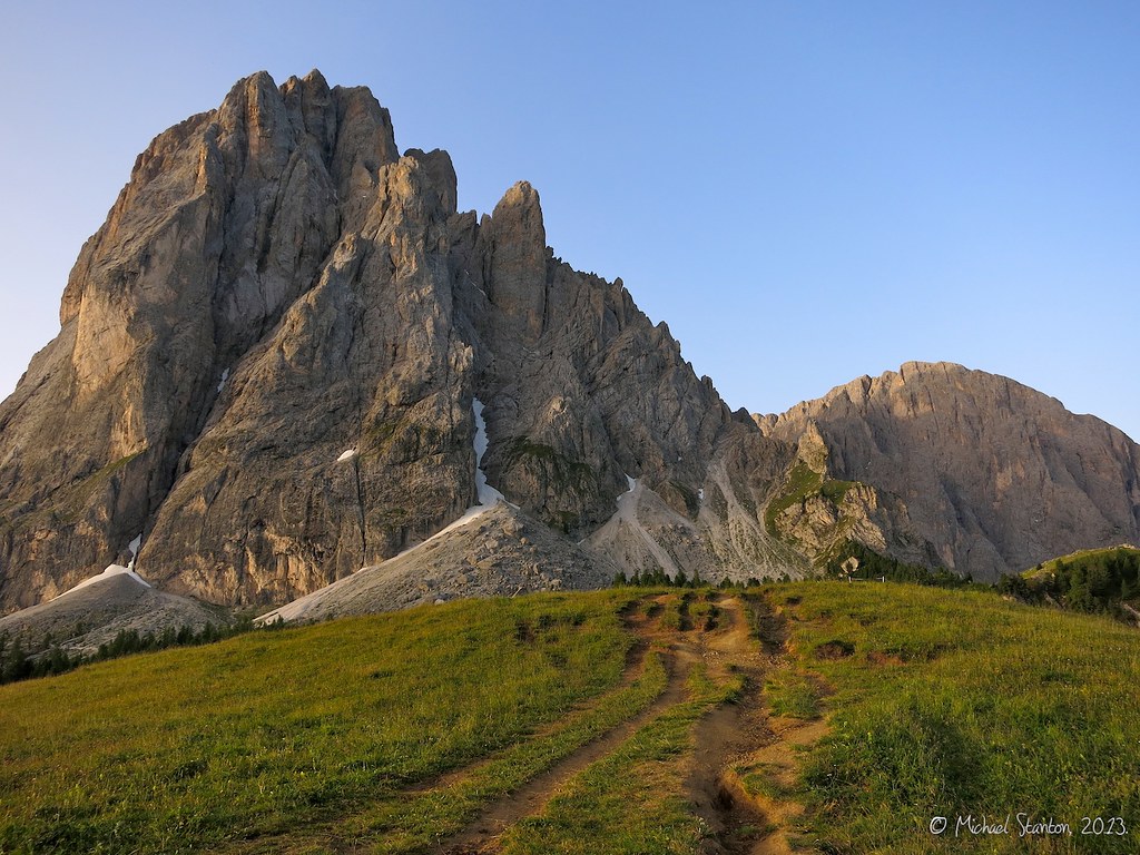
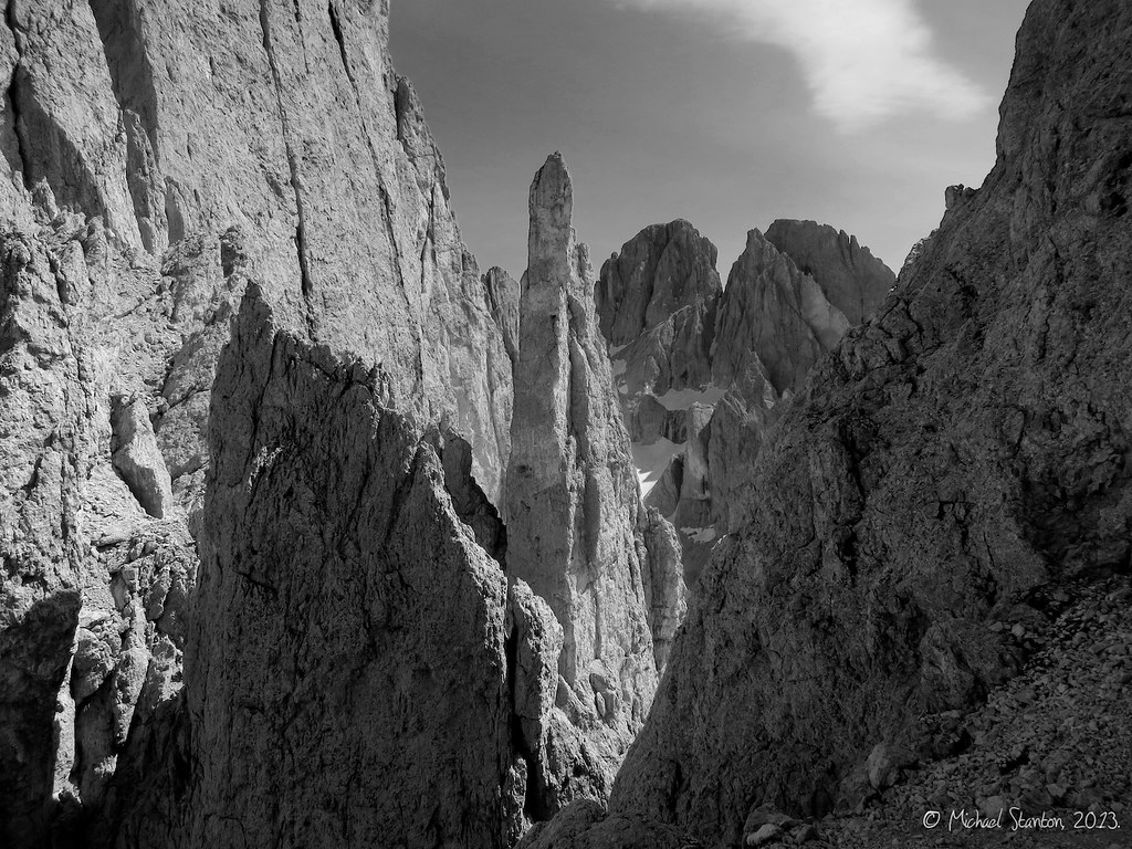
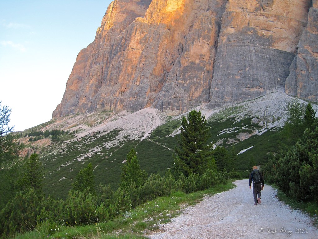
It's usually a fun day when you climb the cover photo.
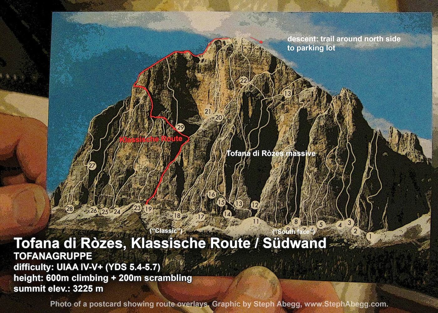
Day 2: Tofana di Ròzes, Klassische Route / Südwand (TOFANAGRUPPE)
Difficulty: UIAA IV (YDS 5.4) (although we did some climbing that was about UIAA V+ = YDS 5.7) a note about UIAA to YDS comparison in the More tab of this trip report
Length: 800 m
Elev.: 3225 m
Route overlay for Tofana di Ròzes, Klassische Route / Südwand.
Approaching Tofana di Ròzes. The Klassische ("classic") route is on the left end of the formation.
Looking up the start of the route. The annotated photo made by Michael notes a good way to identify you are in the right place.
There was some snow in the Schuttrinne ("rubble chute") that created a large moat, but we were able to cross a Schuttband ("rubble band") higher up to access the start of the route.
The route starts by going into an opening behind some rocks.
Dwarf Alpenrose near the start of the route.
There are two large amphitheaters on the route. Pictured in this photo is the first amphitheater. We quickly simulclimbed up to here; the grade is UIAA II-IV (YDS 5.1-5.4) up to the amphitheater.
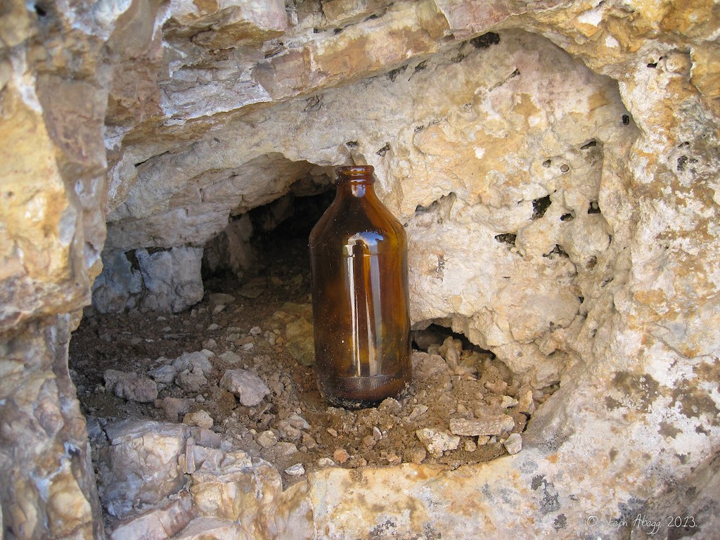
An unusual idea for a route marker: a glass jar with a dead rodent in it.
Exiting the first amphitheater. I climbed the route in my more comfortable approach shoes, which worked quite well with only a few moments when I wished for a bit more delicate footwork.
Traversing into the second large amphitheater on the route. We are roughly headed for the low point on the skyline.
Alpine mouse ear (cerastium alpinum) en route.
Exiting the second amphitheater. The route description/topo calls to go right here to a "Schuppe"="flake", but when the flake wobbled under my grip I backed off. We spotted two pitons in the "direkt"="direct" variation above. It was a burly yet straightforward crack. I'd call it UIAA V+ (YDS 5.7/5.8). Since the actual route is rated at IV, this would be the crux of our route.
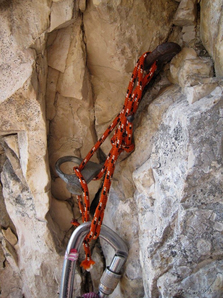
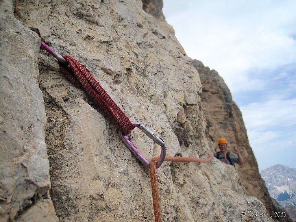
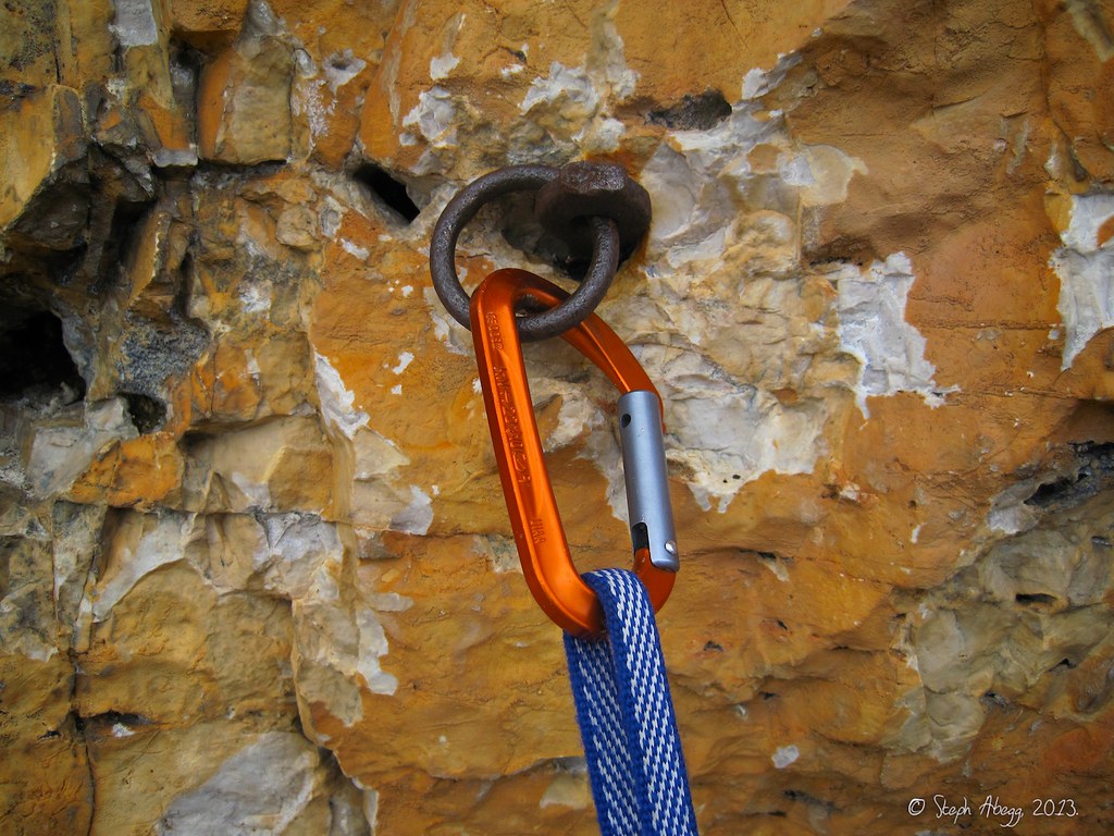
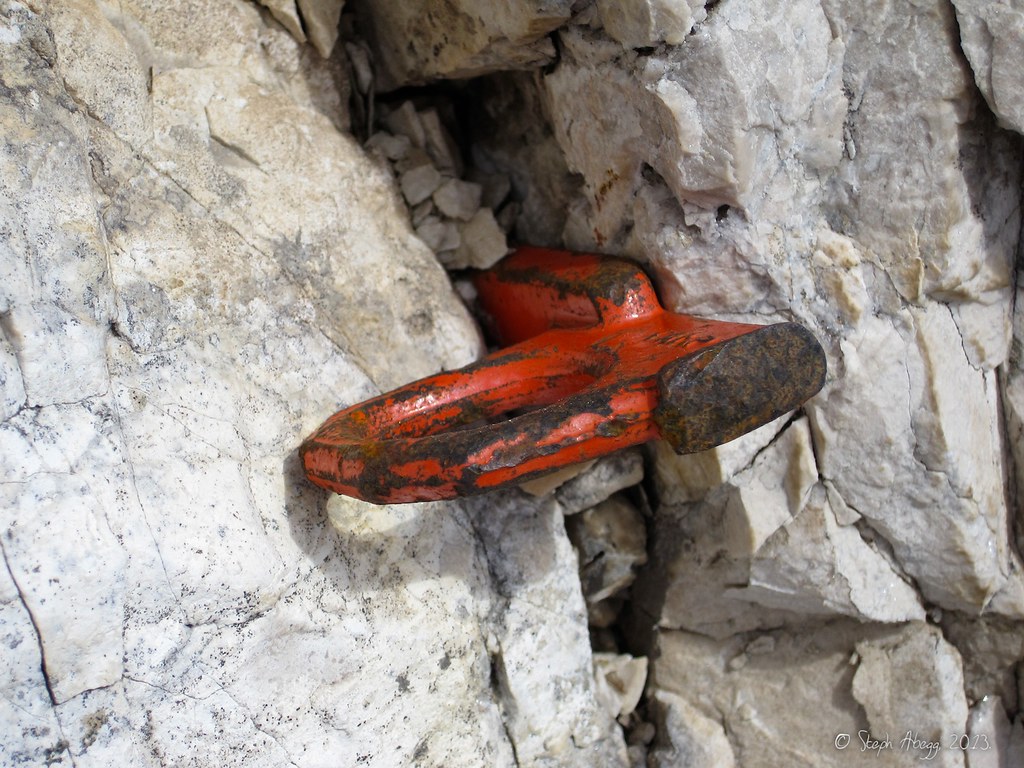
Protection in dolomite rock is tricky since there are few good cracks. Pitons, however, work quite well so most routes are riddled with fixed pitons.
Climbing up a UIAA IV (YDS 5.4) chimney above the second amphitheater, with Michael belaying below.
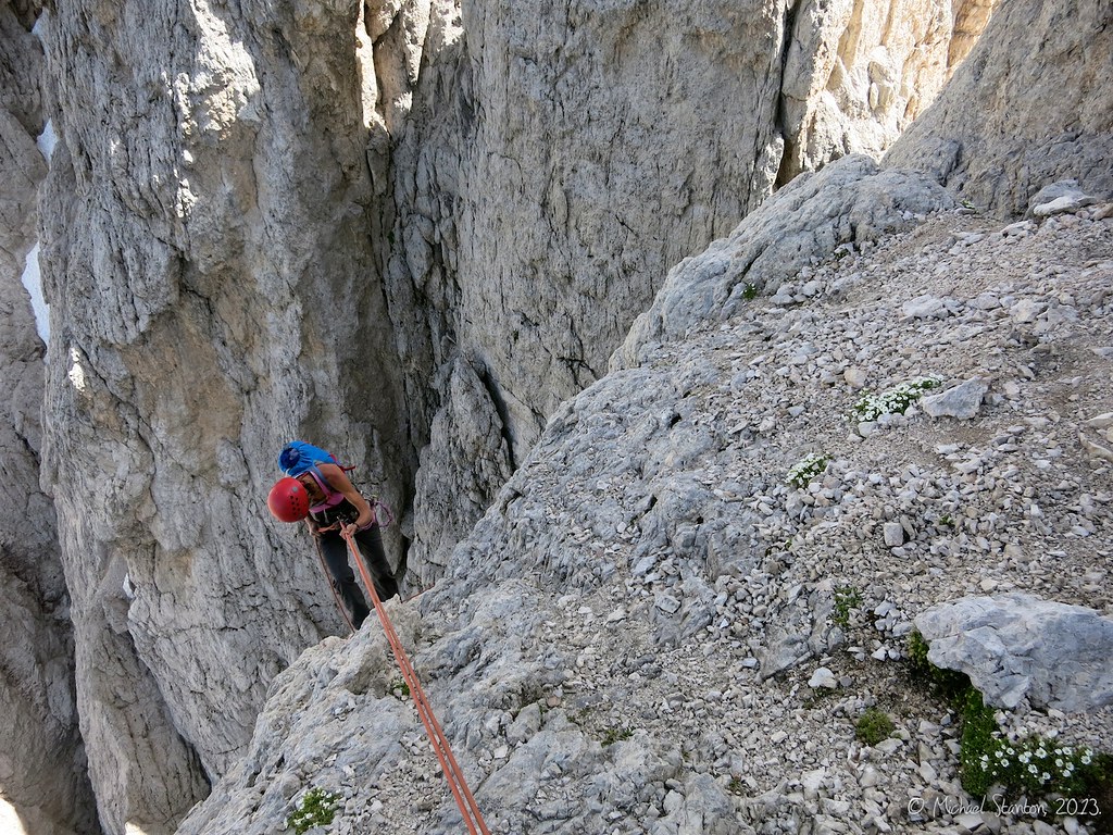
This shows the beginning of a cool exposed traverse to the crest.
The topo reads "Expo!" for this section.
As with the previous day on Salamiturm, we found a "Gipfelbuch"="route register" book en route.
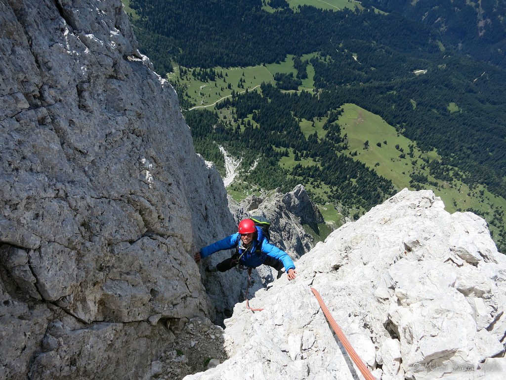
Looking back at Michael on the traverse.
It was nice to have a few fixed pins along the traverse.
Steph near the end of the wildly exposed traverse, which ends at the "Grat"="ridge". Marmolata is in the background.
Okay, time to climb back up. It's hard to believe that climbing this steep can be only UIAA IV = YDS 5.4.
More juggy-steep-fun climbing ahead.
More pitons. Sometimes you can climb a pitch and use nothing but draws.
More upwards progress....
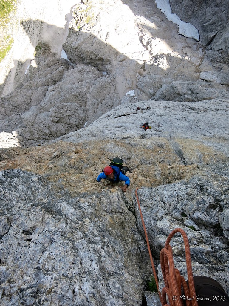
The final chimney before the scrambling to the summit. "hinter Klemmblock vorbei"="pass behind the chockstone". We found this to be one of the more difficult pitches of the route, and it seemed harder than the topo's UIAA IV = 5.4.
Looking up the final scramble "am Grat zum Gipfel"="on ridge to summit", which gains 200 m and takes about 45 minutes.
There is a cross on the summit of Tofana di Ròzes.
Summit views of Cortina d'Ampezzo and more Dolomites in the distance.
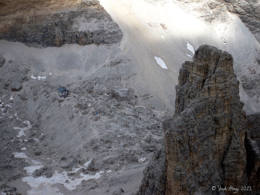
From the summit, we could see a refuge/hut far below on the north side of Tofana de Ròzes. We would pass by this on the trail back to the car.
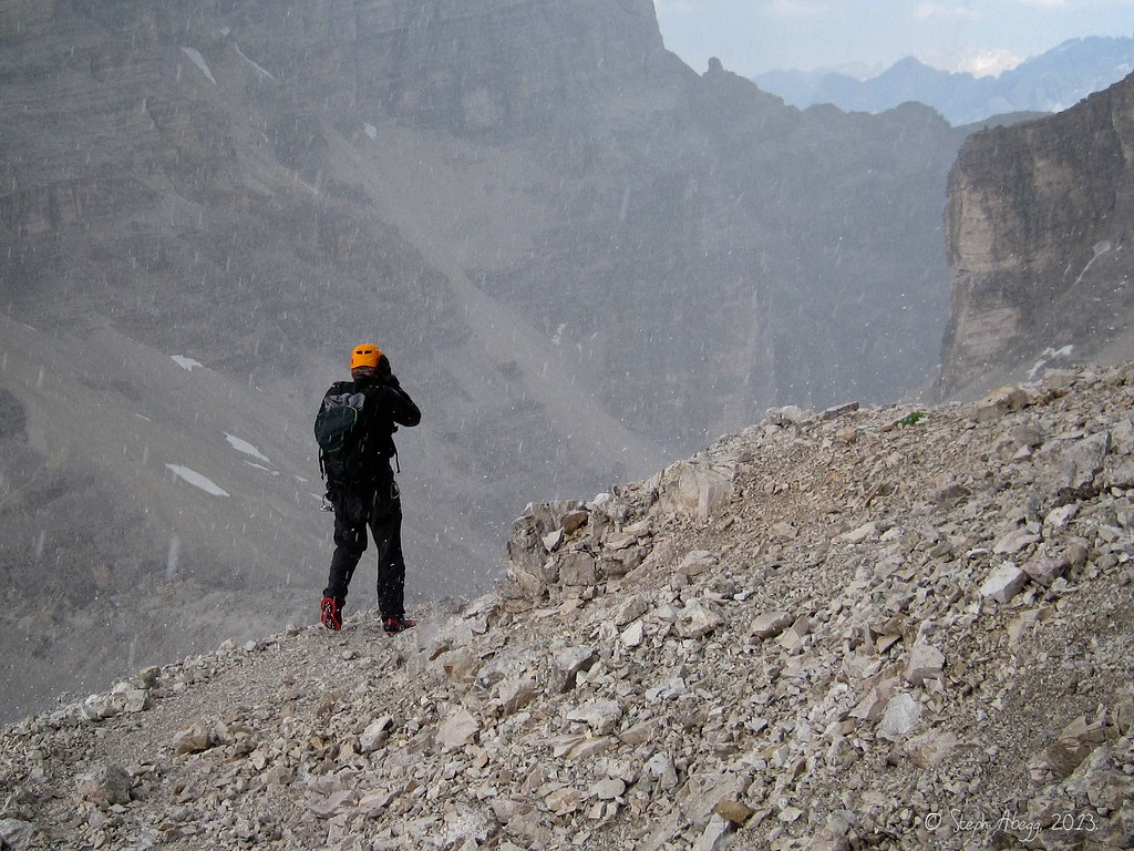
The forecast had predicted a chance of afternoon thundershowers, so we had started the climb early. We were glad we had done so when it began to pepper us with painful bullets of hail on the descent. Helmets on!
And 30 minutes later it was like nothing ever happened. Helmets off!
A parting shot of the Dolomite peaks just north of Tofana di Ròzes. It is a beautiful area.
When we went into Rifugio Dibona (located where we had parked the car) to fill up with water and grab a coffee, we discovered they had the magical trio of plugs, wi-fi, and food/coffee. We established camp for a few hours...
By this time I am thoroughly spoiled by the readily available post-climb Caffè.
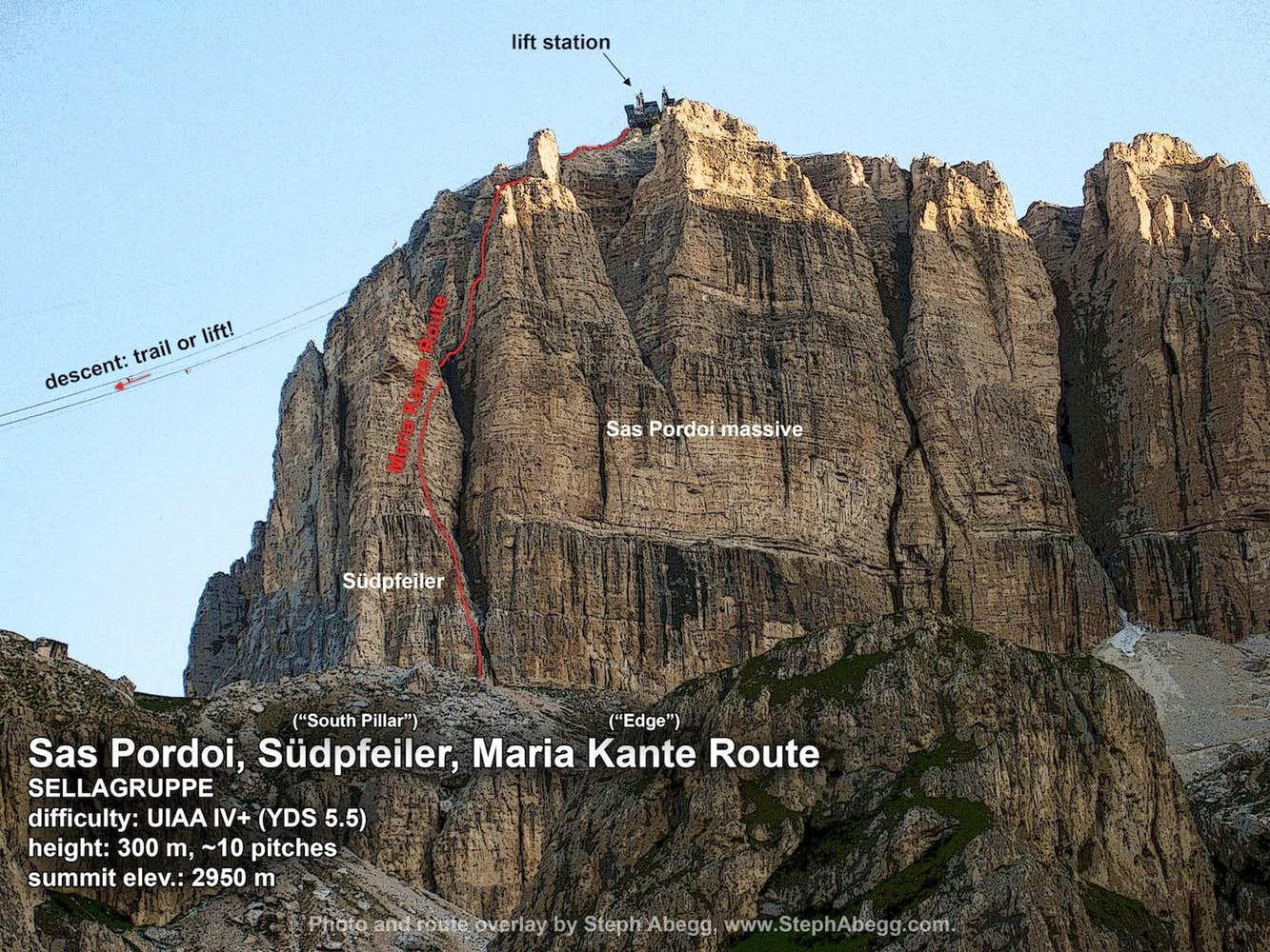
Day 3: Sas Pordoi, Maria Kante Route (SELLAGRUPPE)
Difficulty: UIAA IV+ (YDS 5.5) a note about UIAA to YDS comparison in the More tab of this trip report
Length: 300 m, 10 pitches
Elev.: 2950 m
Route overlay for Sas Pordoi, Maria Kante Route.
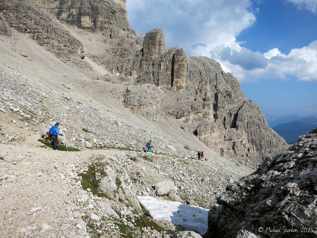
For our final climb, we decided to climb the Maria Kante Route on Sas Pordoi, which has a lift to the summit. This was a good choice as it would allow us a quick descent via the lift so we could be back in Munich at a reasonable hour that evening. This photo is taken from the trailhead/lift station parking lot. Sas Pordoi is the biggest massive in the background, and the route we climbed (Maria Kante) goes up the pillar left of center.
Looking up the first pitch of Maria Kante. The route goes up the wall just left of the "Rinne"="channel".
Michael starting up Pitch 1. This pitch is rated at UIAA IV (YDS 5.4) but it was a bit polished by traffic which made it a bit more insecure and challenging.
Looking up Pitch 2, which is the crux (UIAA IV+ = YDS 5.5) pitch of the route. The crux section was pretty wet too.
Fortunately, there were some fixed pins near the crux to add extra security.
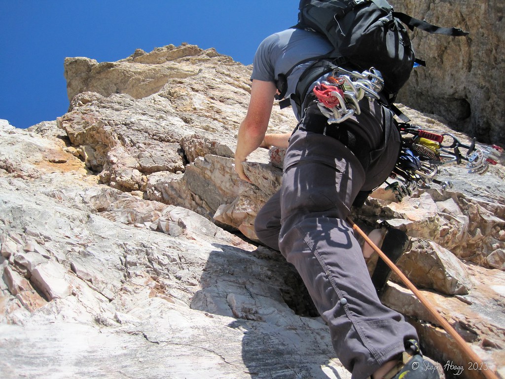
Michael starting up Pitch 3 of Maria Kante. Steep-juggy-fun climbing ahead.
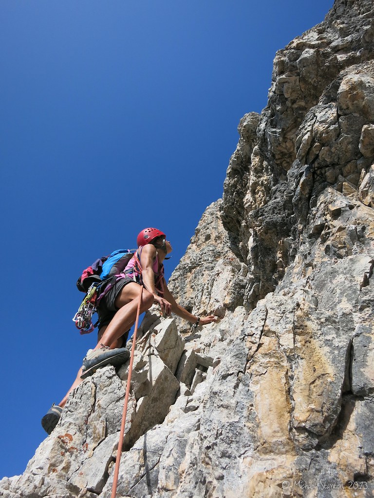
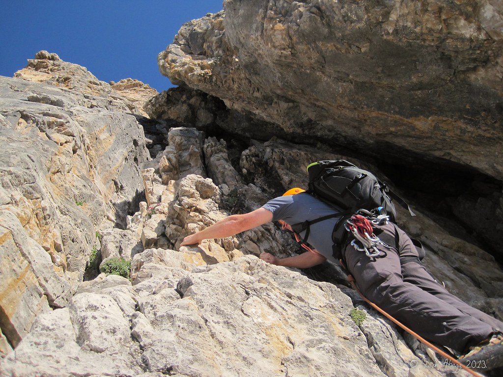
Steph leading Pitch 4 of Maria Kante. The topo noted several pitons on this pitch, but they were a bit difficult to find and I wandered up over 30 feet of poor-pro terrain before finding one. Even though the climbing was easy, I didn't like the fact I was facing a 60 foot (2x30 foot) factor 2 fall on the anchor.
Michael on Pitch 4.5 of Maria Kante (a short traverse pitch that was linked with Pitch 4 on the topo).
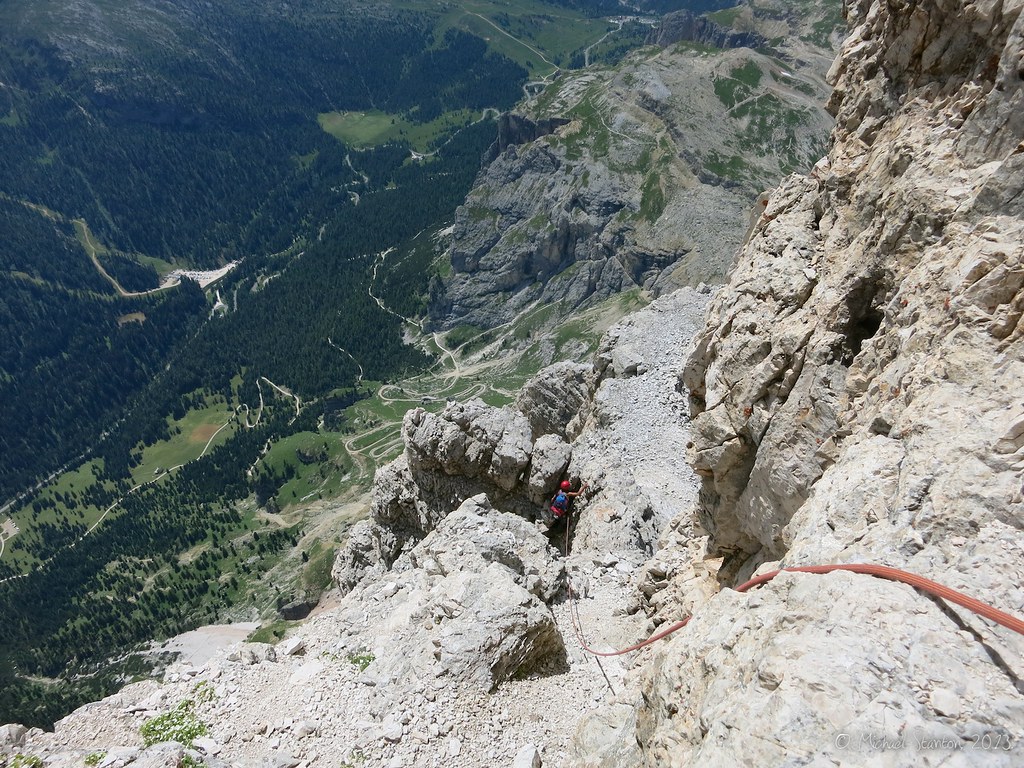
Every five minutes, we had an audience of people. Marmolata is in the background.
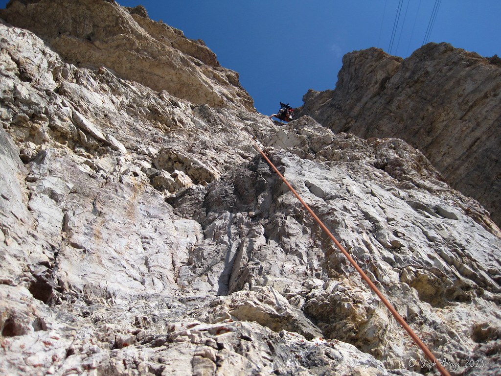
Michael high on Pitch 6 (left hand corner of the photo). Vertical 5.4 (UIAA IV) is quite fun.
With all the Sanduhrs ("hourglass"),...
...fixed pins,...
and cemented belay anchors on this route, slings were often more useful then cams on this route.
Michael enjoying a nice belay seat, Marmolata in background.
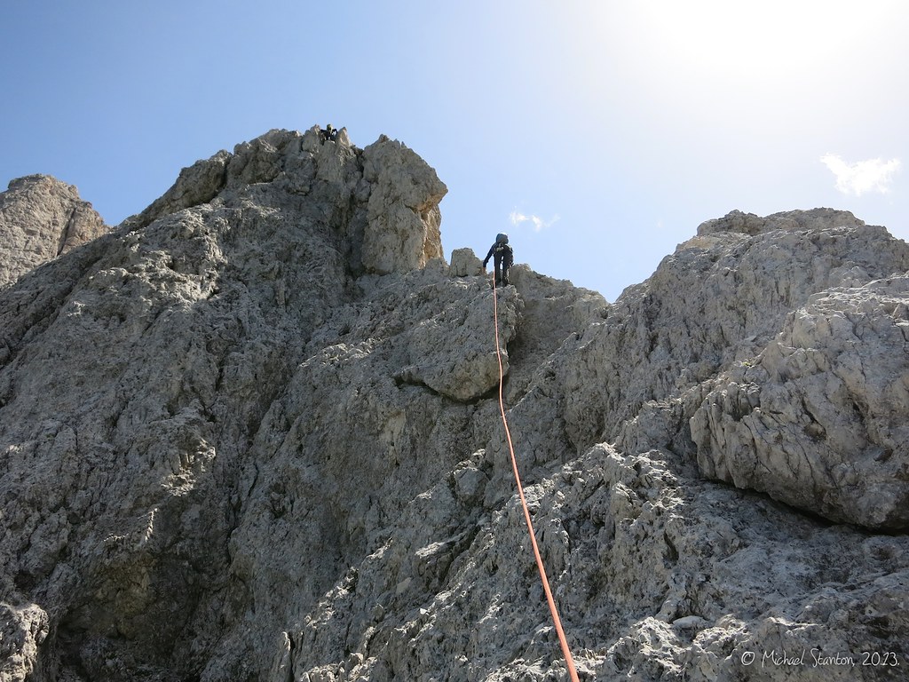
Michael at the top of Pitch 7. This is where the Maria Kante Route intersects with the Südkante Route. Above this the climbing is pretty easy.
From here, we scrambled around the left side of the "Turm"="tower" in the background.
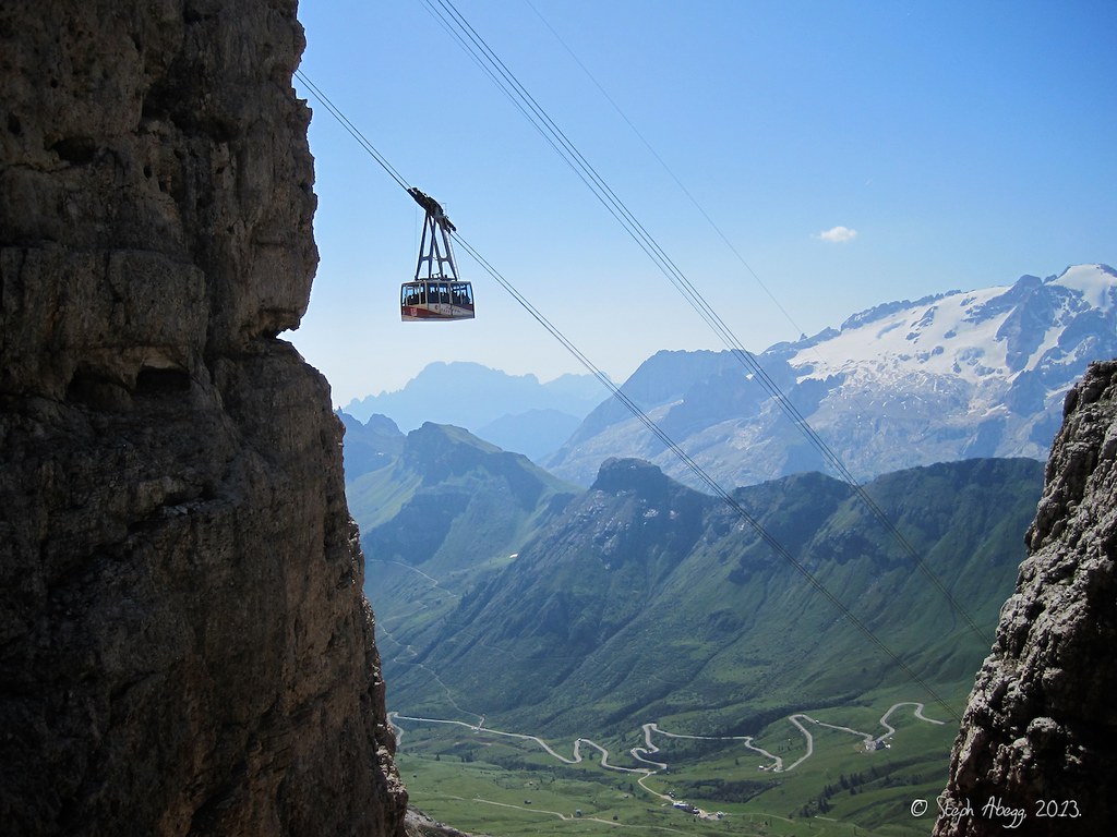
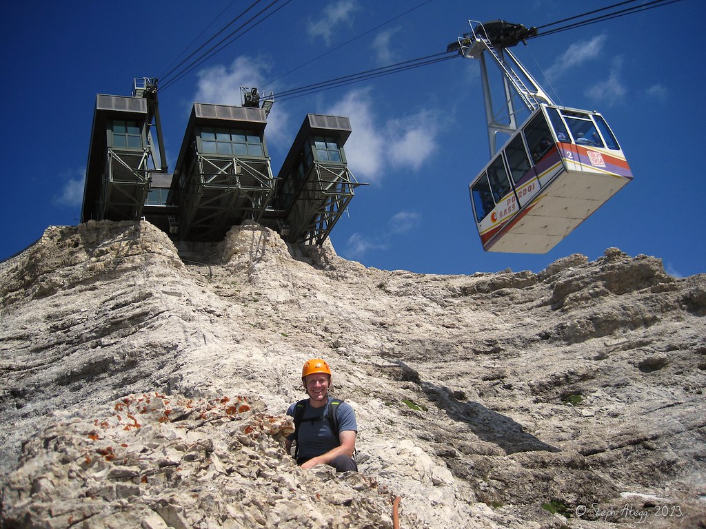
Almost at the summit now. We topped out just under the left end of the cable car structure in the background.
This was the first time I had experienced climbing as a spectator sport.
Michael belaying from the lift station framework at the top of Sas Pordoi.
"Summit" views. It was kind of a surreal experience to top out on a climbing route into a platform with a restaurant and hundreds of people.
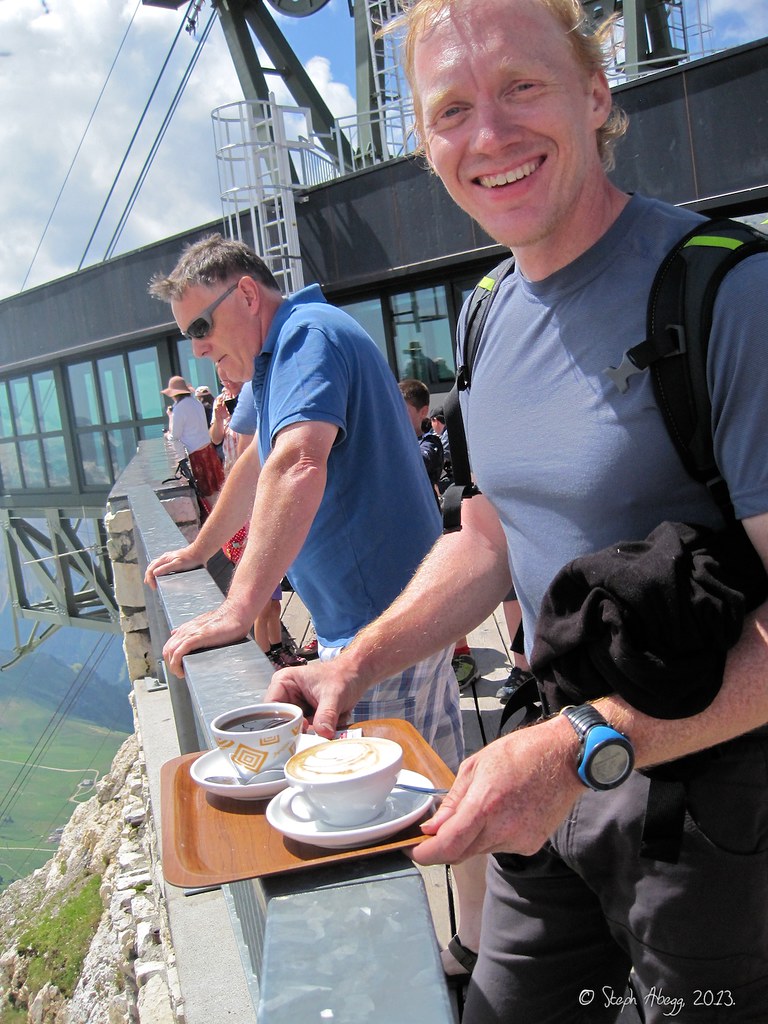
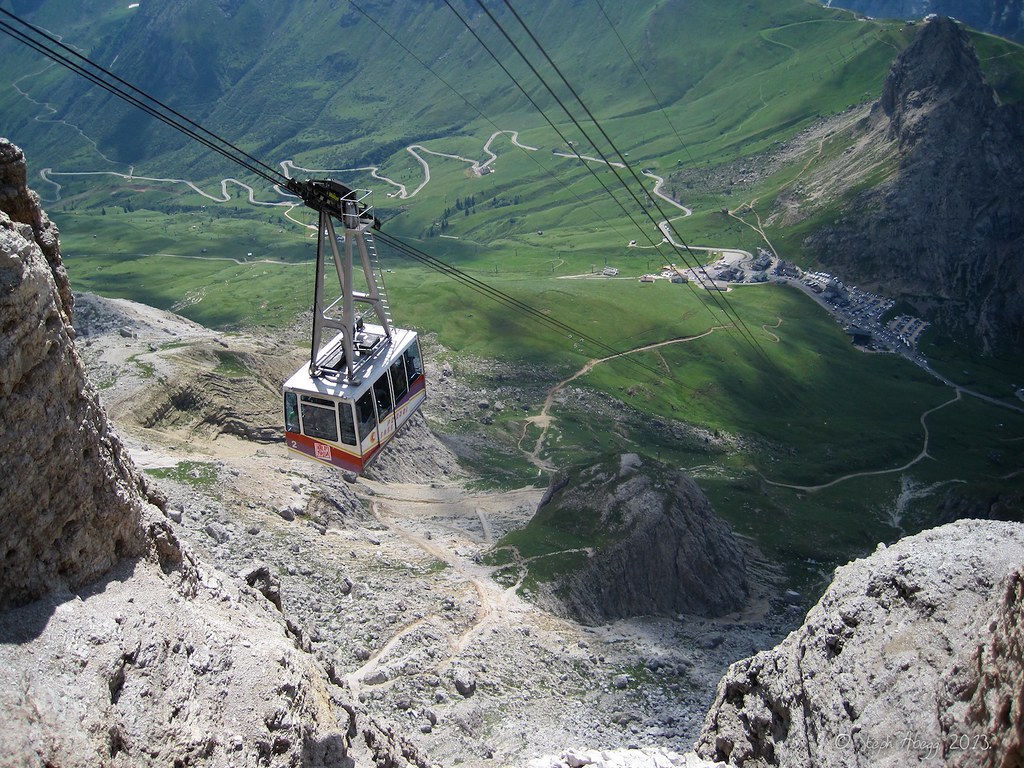
A post-climb Cappuccino and Caffè Americano before taking the lift down.
"Mit der Sas-Pordoi-Seilbahn zum Pordoijoch"="Take the cable car to Pordoi Pass". I am thoroughly spoiled by the Dolomites by now.
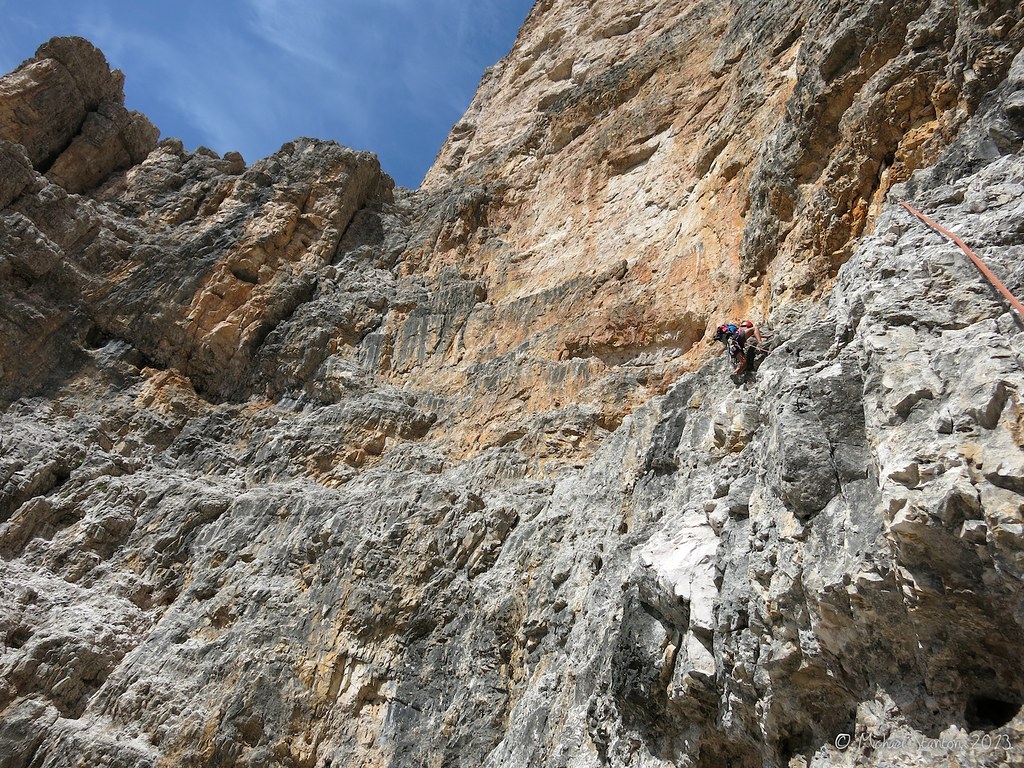
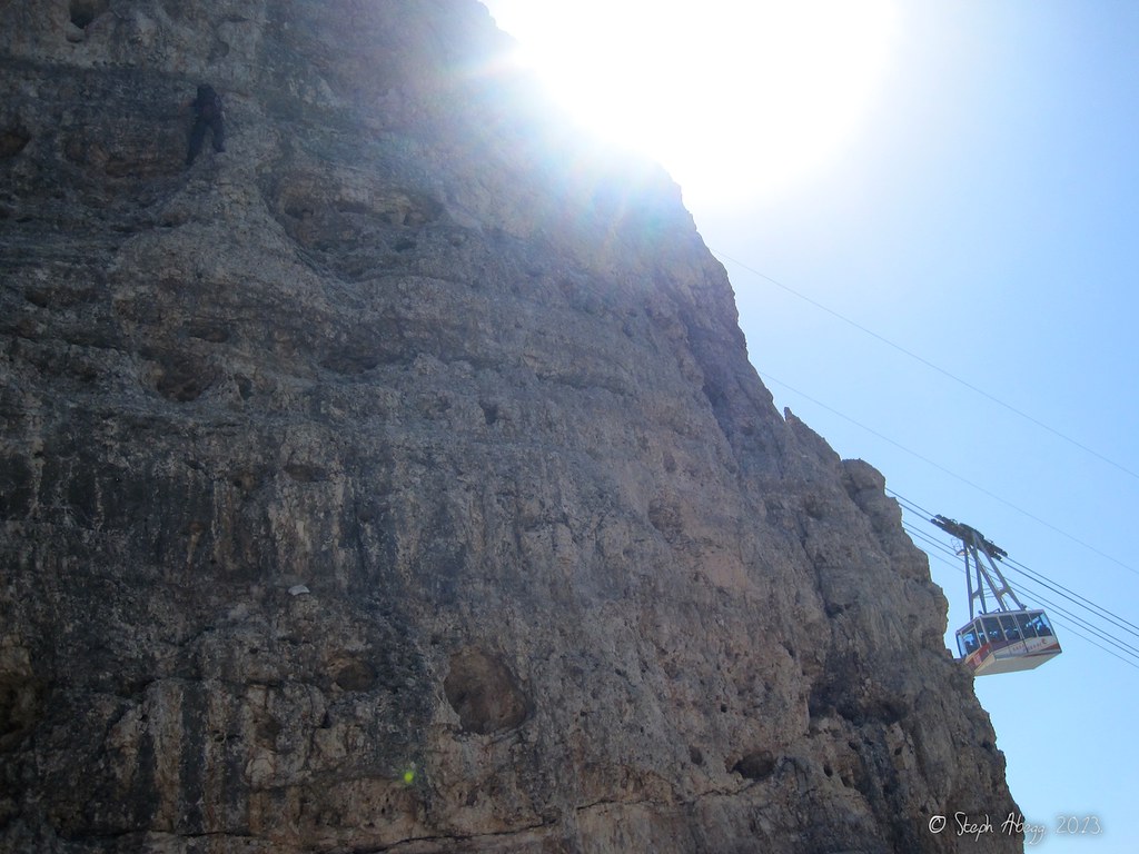
The view of climbers on the Maria Kante Route from the lift ride down. Notice the groups of climbers further down too.
Note about climbing grades in the Dolomites:
Climbs in Europe are often rated using the UIAA (Union Internationale des Associations d’Alpinisme) grading system which uses Roman numerals, often accompanied by +'s and -'s to more finely differentiate between climbs. As a climber from the US, I was pretty unfamiliar with how this system compared to the Class 1 to 5.x of the YDS (Yosemite Decimal System). There are several comparison charts available online, but there is some disagreement between charts. One of the better resources I have found is Michael's page on summitpost.org comparing UIAA to YDS. Note that I used a different resource (wikipedia, actually) when translating the UIAA to YSD for my trip report, so by Michael's grade chart the YSD ratings of the climbs we did are actually a bit higher than I have quoted in my trip report.
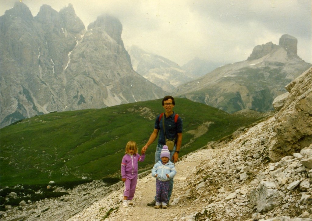
My first Dolomites adventure, 1987:
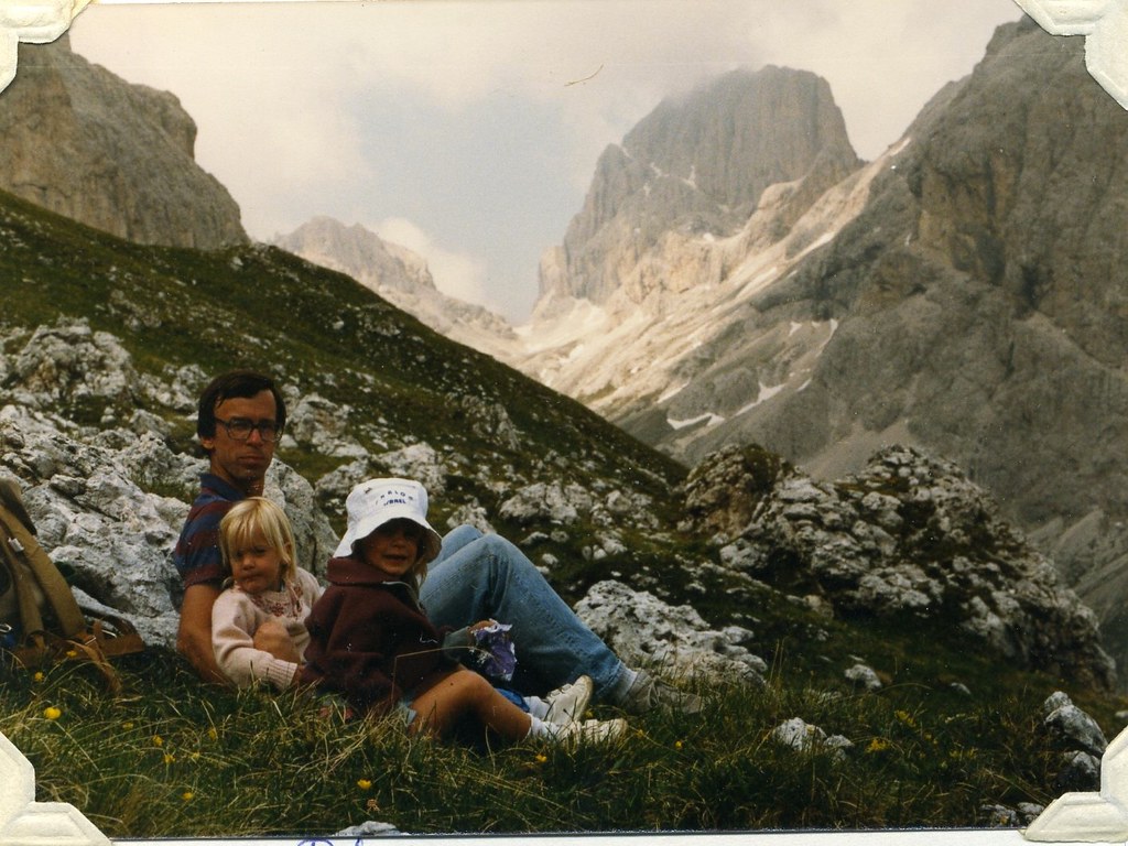
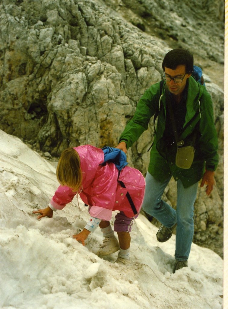
In 1987, my parents took a family vacation to the Dolomites. I was four years old and my sister was two. I don't remember much about it but my parents have a story of me kicking steps up a snow slope chanting "I love this. I love this." the whole way. I guess my addiction to the mountains began early. Below are some photos from our 1987 trip to the Dolomites. The captions are copied from the family photo albums.
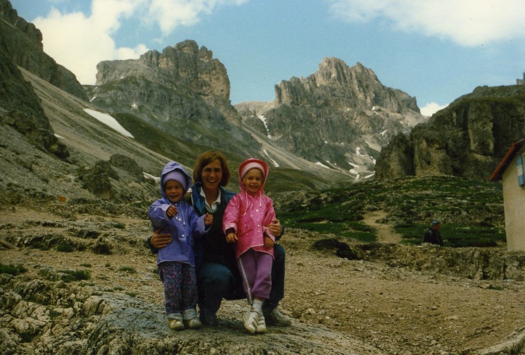
My dad, sister, and me (in pink) hiking in the Tre Cime di Lavaredo area of the Dolomites.
My mom, sister, and me (yep, in pink again) at Rifugio Vajolet Gruppo Del Catinaccio.
My dad, sister, and me above Rifugio Stella Alpina at Gardeccia Rosengarten area.
A four-year-old me kicking steps to the Rifugio Vajolet.
My sister and me (on right) near Sassolungo.
A German Lesson:
Michael's route topos were in German. I found that describing features of a route in German is a great way to make 5.5 sound like formidable 5.11.
Block = block
Dach = roof
Eisenhaken = piton
Fels = rock
Felsblock = boulder
Geröll = scree
Gipfel = summit
Grat = ridge
Grotte = grotto
Gruppe = group
Kamin = chimney
Kante = edge
Klemmblock = chockstone
Laufsteg = catwalk
Querung = traverse
Pfeiler = pillar
Platte = slab
Rampe = ramp
Rinne = channel
Riss = crack
Route = route
Sanduhr = hourglass (used to denote feature of rock that forms an imbedded pillar you can wrap a sling around; there are lots of these in the Dolomites)
Scharte = notch
Schuppe = flake
Schuttband = rubble band
Schuttfeld = scree
Schuttrinne = rubble chute
Seil = rope
Seilbahn = cable car
Turm = tower
Übergang = passage/junction/intersection
Überhang = overhang
Wand = wall
Wasserrinne = gully
Abstieg = descent
Gestein = rock (type)
Gipfelbuch = summit log
Höhenunterschied = difference in altitude
Kletterstrecke = climbing route
Parkplatz = parking
Qualität = quality
Schwierigkeit = difficulty
Seillängen = rope lengths
Stunden = hours
Zeit = time
Zustieg = approach
klettern = climb (v)
abseilen = rappel (v)
schwarz = black
weiß = white
graue = grey
braun = brown
gelb = yellow
rot = red
gut = good
fester = solid
brüchiger = brittle
lockere = loose
ausgesetzte = exposed
steil = precipitous
kleiner = small
große = large
kurzer = short
lang = long
angelehnter = detached
breites = wide
direkt = direct
Nord = north
Süd = south
West = west
Ost = east
Michael's Trip Report:
Michael has posted his version of our trip here. Check it out, it's a really fun read, contains some extra beta, and gives an insight of what my partners have to put up with when they climb with me....
Useful beta. Updated route information. Corrections. Historical notes. Interesting facts. No fluff please. Please do not put links in your comment, as my spam filter will filter those comments out.