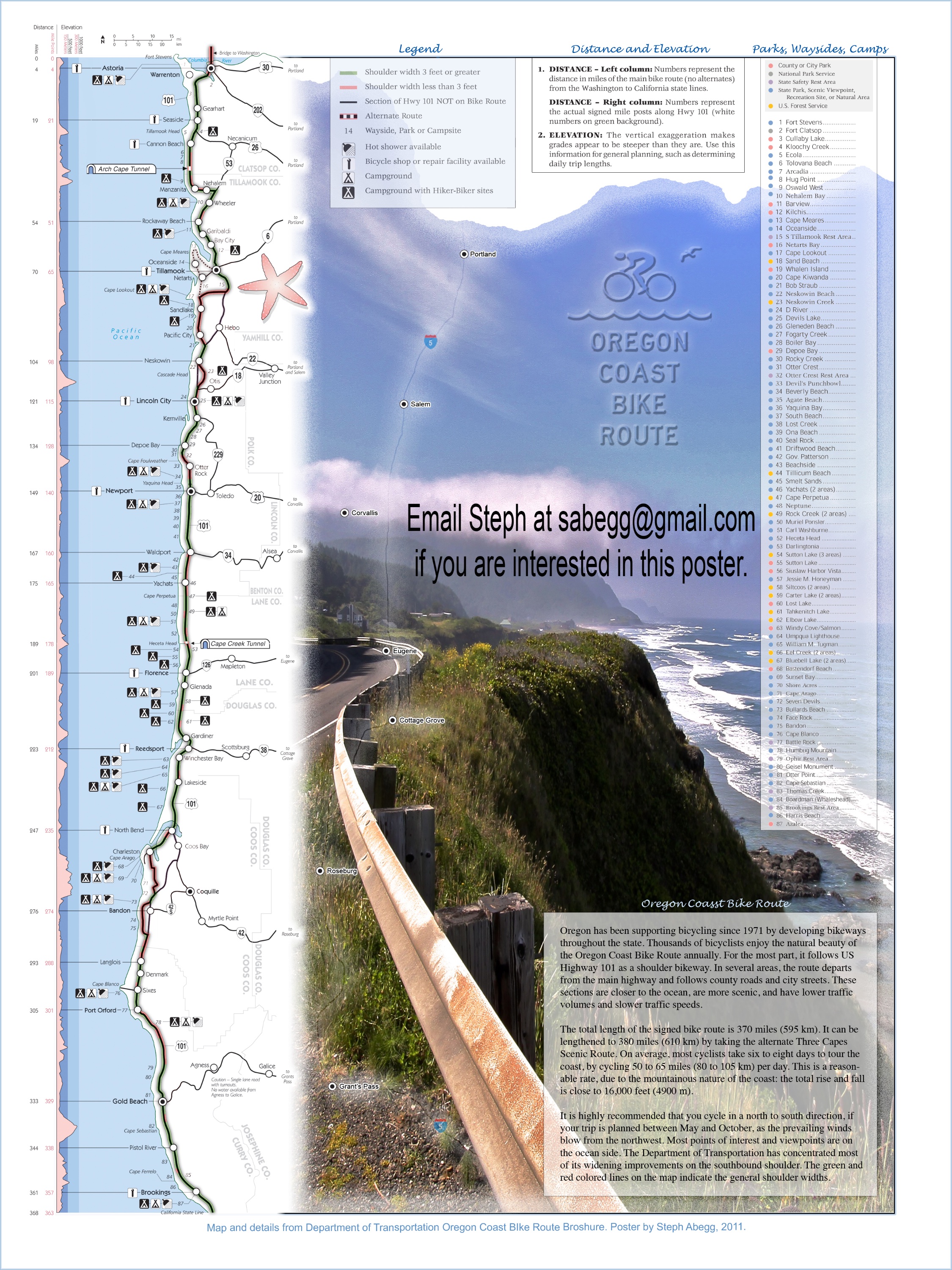
Oregon Coast Bike Trip: North to South along Oregon Coast (431 mile, 7 days)
Oregon Coast Bike Trip
Route:
431 mile, 7 day bike trip
(non-climbing)
Doesn't always need to be mountains or climbing to be a fun adventure!
Region: Oregon
Elev: 0 ft
Mode:
Date(s): August 10-16, 2011 (Wed-Tue)
Partner(s): bike and camera
Duration: 7 days
Riding Distance: 431.1 miles (375.6 on route, 55.5 on sidetrips, average of 61.6 miles/day)
Riding Time: 41.25 hours (includes sidetrips, average of about 5.9 hours/day)
Total Rise & Fall: 16,000 ft (more including sidetrips, average of about 2,290 ft/day on route)
Direction: North to South (recommended direction due to north winds and wider southbound shoulders)
North End: Astoria, OR (on HWY 101)
South End: Brookings, OR (on HWY 101)
Photos Taken: 1,930 photos + 5 videos from "bike cam" mounted on handlebars (average of ~276 photos/day)
THIS TRIP REPORT IS STILL MOSTLY IN THE EMBEDDED HTML FORMAT OF MY OLD WEBSITE. MOBILE Tip: Try Landscape mode. It is generally more mobile friendly.
Intro
It had been nearly a year since I nearly lost my foot in a serious climbing accident in September 2010. Early on in the recovery, I had figured that surely I would be climbing—or at least hiking—by now. But a series of setbacks had forced me to reassess my expectations for the summer of 2011. One thing I had been able to do for several months (since February, when I started to be 25% weight-bearing) was bike. I'd never biked much previous to the accident, but it had become my primary form of exercise. As motivation to keep myself pedaling I started planning a bike adventure down the Oregon coast.
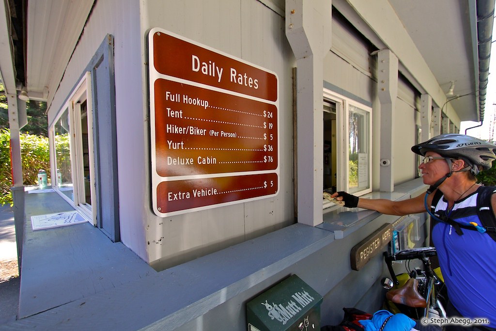
Of the Pacific Coast Bicycle Route—which in its entirety stretches 1987.3 miles from Vancouver, BC to the Mexican border—the 370 odd miles along the Oregon coast boasts some of the most beautiful coastline of the entire route. It is also reputed to have some of the most well-established and biker-friendly sections of the route. The route through Oregon mostly follows HWY 101, with a few detours onto quieter country roads or rugged coastal roads. Although there are numerous state parks and camping options along the way, there is a fairly established seven-day itinerary which averages between 50-60 miles a day between seven State Park campgrounds (which all offer $5 hiker/biker sites). Vicky Spring and Tom Kirkendall's Bicycling the Pacific Coast is a great source of information for the bike route, parks, and scenic highlights along the Pacific Coast. I also purchased the Oregon section of the Pacific Coast Bicycle Route maps put out by the Adventure Cycling Association. Both the guidebook and maps were very useful to have with me at all times during my trip. I perused them every night, making notes on all the things I wanted to see the next day. There was no way to see all of the scenic highlights and parks along the
coast, but I gave it a good effort to experience as many as I could!
So, in mid-August I finally embarked on my bicycle adventure, confident that my leg was ready for pedaling a fully-loaded bike down the rugged Oregon coast. Although I had a couple of friends that would have been eager to join me, I decided to go solo. This way I could focus on photography, and enact my viewpoint-hopping style with abandon. I discovered during my trip that several people bike alone, but since the route is fairly established and all bikers stay at the hiker/biker areas of the campgrounds, you end up making friends and swapping stories with the other bikers on the route with you (although perhaps friend-making and story-swapping was not really as much a part of my adventure as it was for the other 15 or so bikers I kept seeing at camp every night; rather, I was the antisocial photographer always packed up and pedaling away just as everyone else was making morning coffee and then arriving at camp in the evening only to throw all my stuff in my tent and make a hobbling beeline for the beach).
After spending the greater part of the last year fighting the
frustrating immobility of a seriously broken leg, my bike trip down the Oregon coast was a marvelously
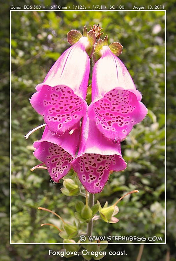
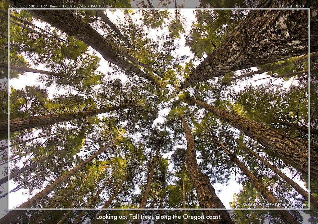
exhausting and spectacularly beautiful adventure. My days were filled with ocean views, long beaches, sand dunes, wave-sculptured sea stacks, rugged headlands, beautiful forests, friendly towns, state parks, lighthouses, bakeries, sea lions, pelicans, chipmunks, pretty sunsets, and blissful freedom. I had wonderful weather, sometimes cloudy mornings but always sunny by afternoon. To give myself plenty of time to enjoy and photograph the viewpoints and scenic highlights along the way, I was on the road by 8am every morning. The biking itself took me roughly 6 hours a day, so this gave me plenty of time to make several scenic stops along the way. Also, another feature of the trip is that you pass a number of towns and grocery stores, so each day you could stop to re-supply with whatever suited your fancy to eat that day (nevertheless, old habits die hard and I subsisted off a lot of oatmeal, tuna wraps, fruit snacks, and mashed potatoes, but I did mark almost every town I passed by an ice cream sandwich). The seven state park campgrounds I stayed at were in beautiful
locations, so after setting up camp I would head to the beach to enjoy the evening light; my seven evenings were marked by seven gorgeous peach
sunsets.
The trip was also a recovery milestone, being my first leg-powered multi-day adventure since the accident. Plus, I had never in my life biked more than a couple unburdened hours in a day. Now I needed my recovering leg to haul a heavy load over about 60 miles of rugged coastline each day. So I was pleased when over the course of the trip my leg gave me no problems whatsoever. (Along a similar vein, I was also pleased that my bike didn't give me any problems either; although I brought along several pounds of specialized repair gear, the only repair item I had any familiarity with was the duct tape.) For the most part, I didn't feel that my leg held me back at all, except that I forewent any sidetrips that involved hiking more than a mile or so. At the end of the trip, I noticed that my leg felt stronger (although the calf muscle was still looking pretty wimpy as biking doesn't do much for that) and I was no longer favoring it so much as I walked around. The bike trip did a lot of good for both my leg and soul.
Although I didn't intentionally set out to do so, I saw all nine lighthouses on the Oregon Coast. I became kind of intrigued with their history. These monuments of Oregon's maritime heritage were established by the former US Lighthouse
Board between 1870 ad 1896, with design and construction aid provided by
the US Army Corps of Engineers. Built on prominent headlands or near major estuaries, the lighthouses were constructed
long before HWY 101 existed, so they were very isolated and had to be
built and supplied via boat. Now the lighthouses are computerized, and seven are
open for public inspection and regular summer tours.
As much as it was a biking adventure and recovery milestone, the trip was also a great means to do some photography. The following page gives a day to day account of my adventures as well as a selection of my favorite photos, broken down by day. I don't give any detailed route descriptions or info—for this, Bicycling the Pacific Coast is a good guidebook—but the route is pretty straightforward. All in all, my bike trip down the Oregon coast turned out to be just as fun and unique as any climbing trip!
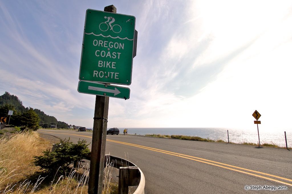
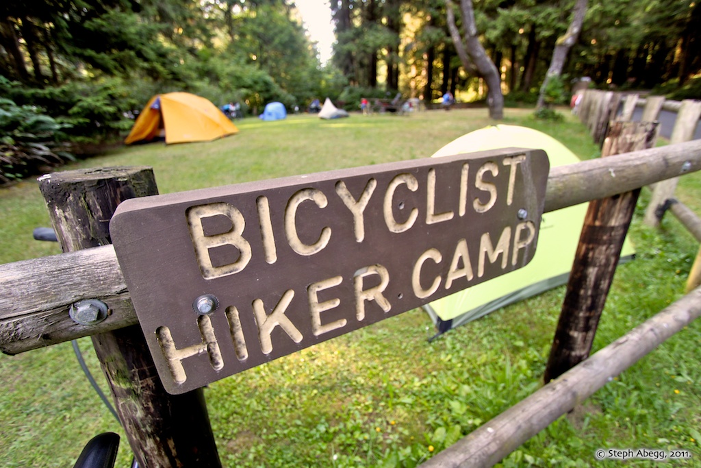
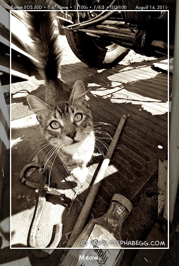
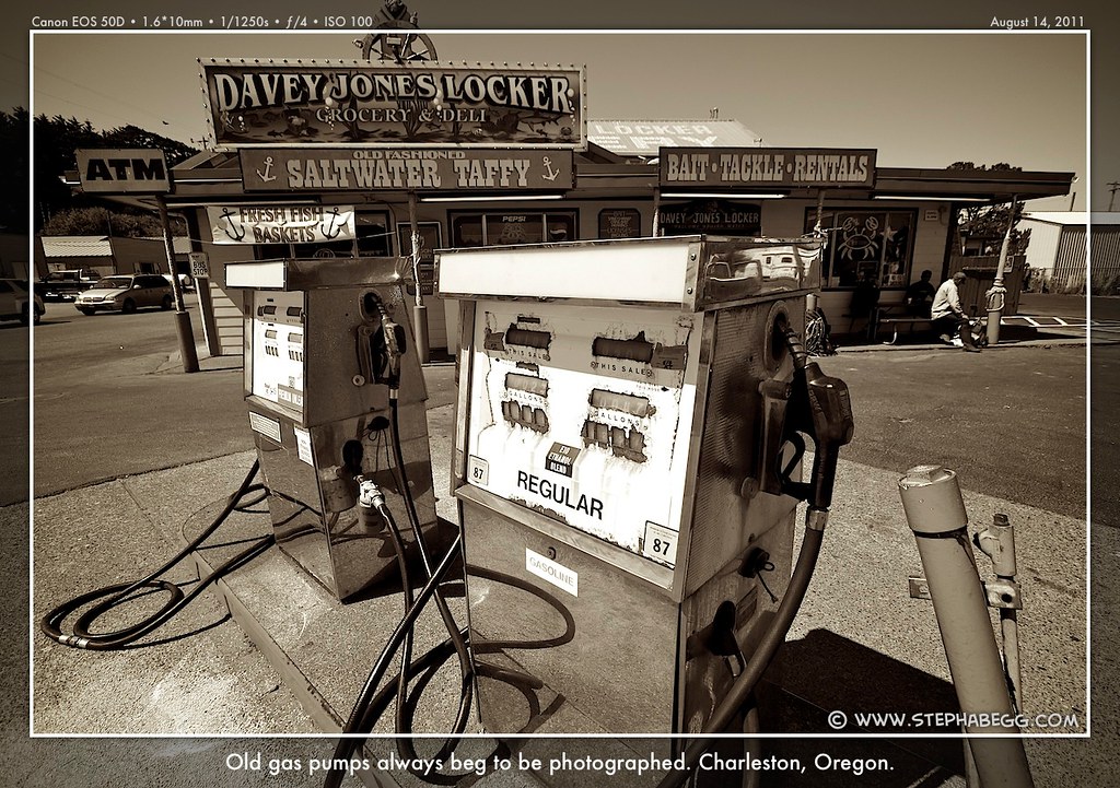
Some General Informational Photos
Guidebook, signage, shopping, and camping.
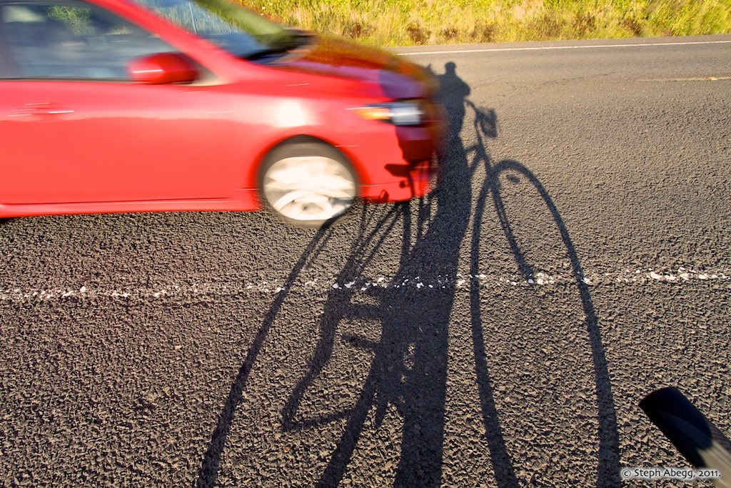
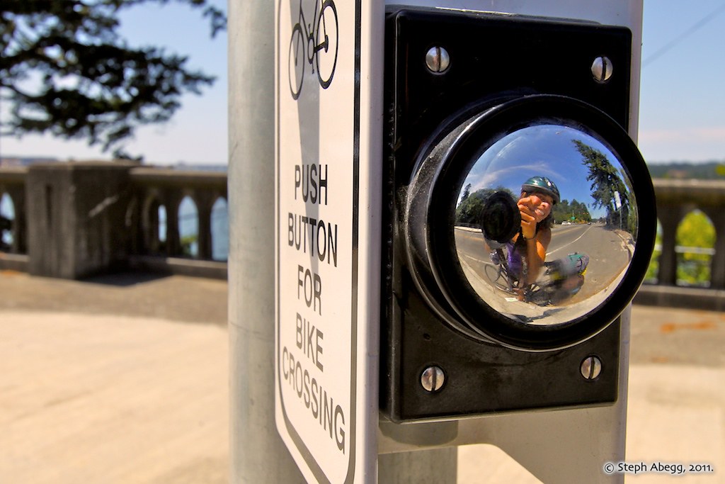
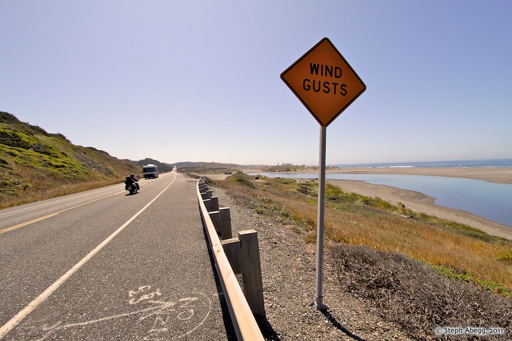
Hazards include cars, bridges, tunnels, wind gusts, and distracting scenery!
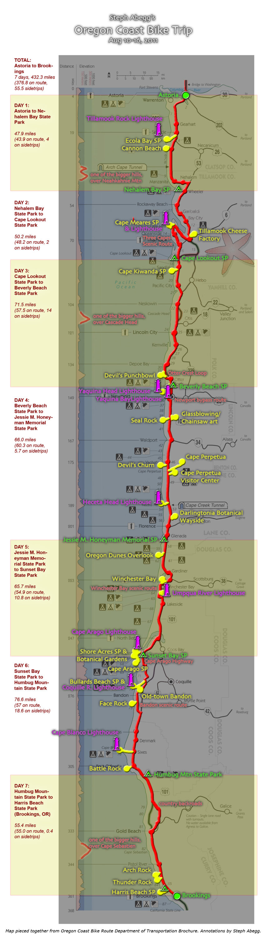
Seven wonderful days on the Oregon Coast Bike Route
The following seven panels give a day to day account of my seven days of biking and sightseeing adventure on the Oregon coast, along with a selection of my favorite photos taken en route.
DAY 1
MAP
(Click to enlarge)
Astoria (OR) to Nehalem Bay State Park Riding Distance: 47.9miles (43.9 on route, 4 on sidetrips)
Riding Time: ~4 hours (includes sidetrips)
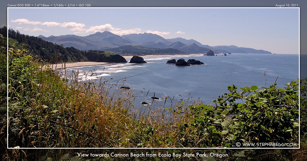
Sidetrips/Stops: Ecola Bay SP and Tillamook Rock Lighthouse (+4 miles), Cannon Beach (+0 miles)
Photos Taken: 250 photos + 1 video
Since Astoria (at the northern end of the Oregon Coast Bike Route) is a mere three hours drive from where I live in Seattle, I could drive down the morning of my first day on the route. I was on the road at 5am, with a Venti Starbucks coffee in my cupholder. The Visitor Information Center in Astoria offers free long term parking, so I parked my car there, loaded my paniers onto my bike rack, put a map and camera in my front
basket, and I was off shortly after 9am.
The first day of the bike route along the Oregon coast is the shortest, which is convenient for those starting off their trip at this point. This day also has the first of two tunnels on the Oregon coast (the short bike through these shoulderless tunnels, with semis barreling past in the dim light, is much more dangerous than any alpine climbing adventure I've ever been on). The day ends with one of the largest climbs of the route, over the shoulder of Neahkahnie Mountain.
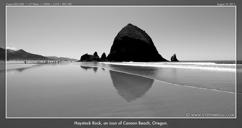
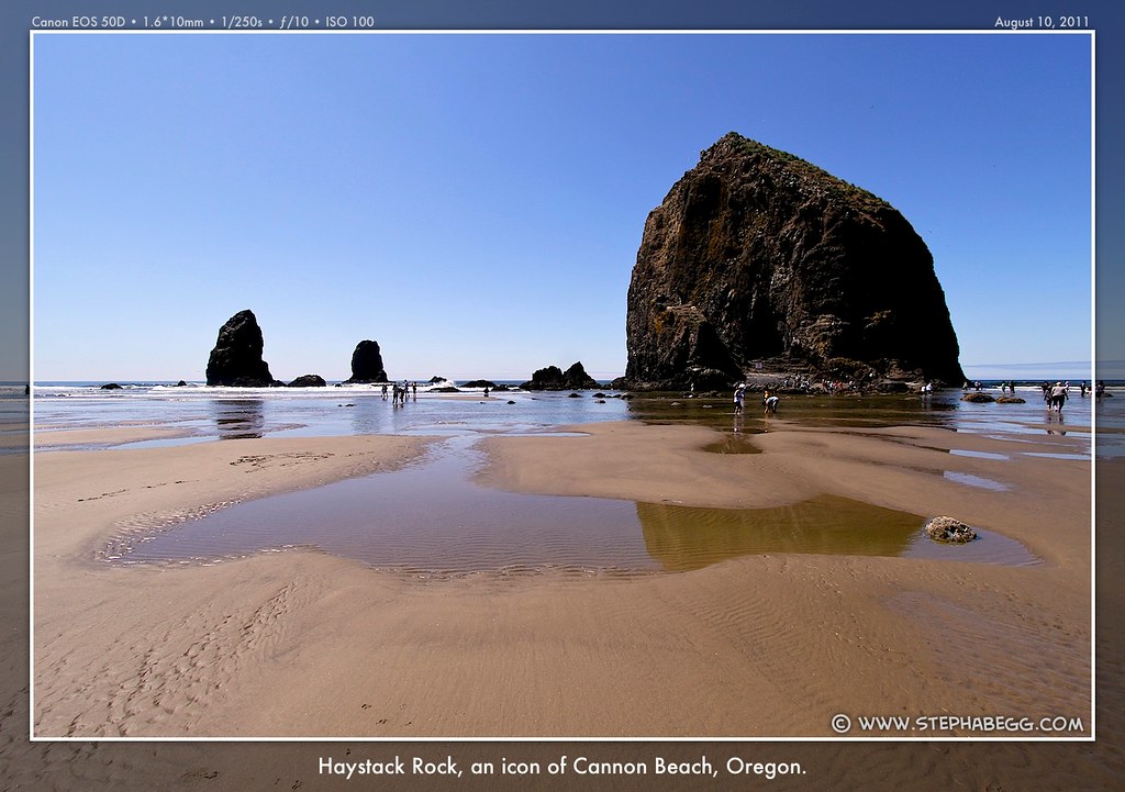
I had plenty of time to enjoy the day, so I stopped at Ecola Bay State Park and Cannon Beach. At Ecola Bay State Park, there are views of Tillamook Rock Lighthouse, the first of the nine lighthouses along the Oregon Coast. Cannon Beach is a popular resort town boasting a large beach with the iconic Haystack Rock I wanted to photograph.
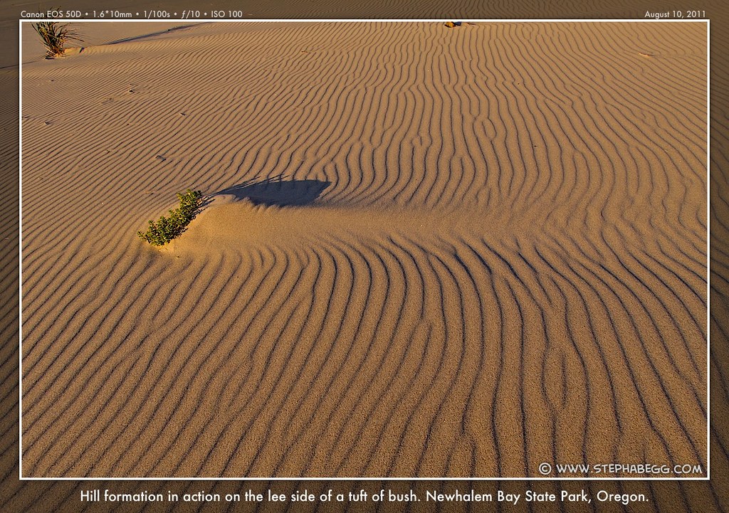
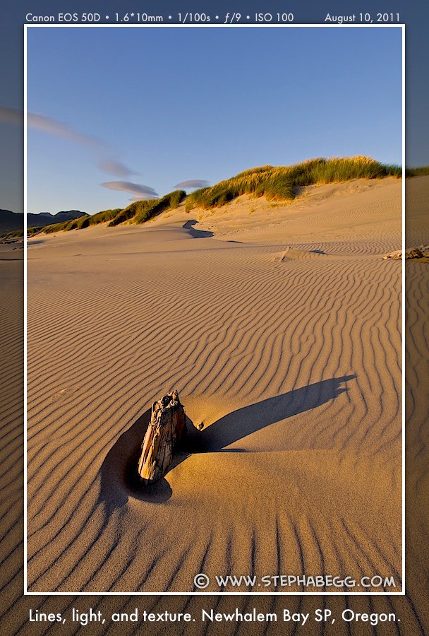
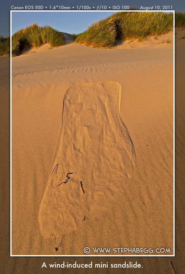
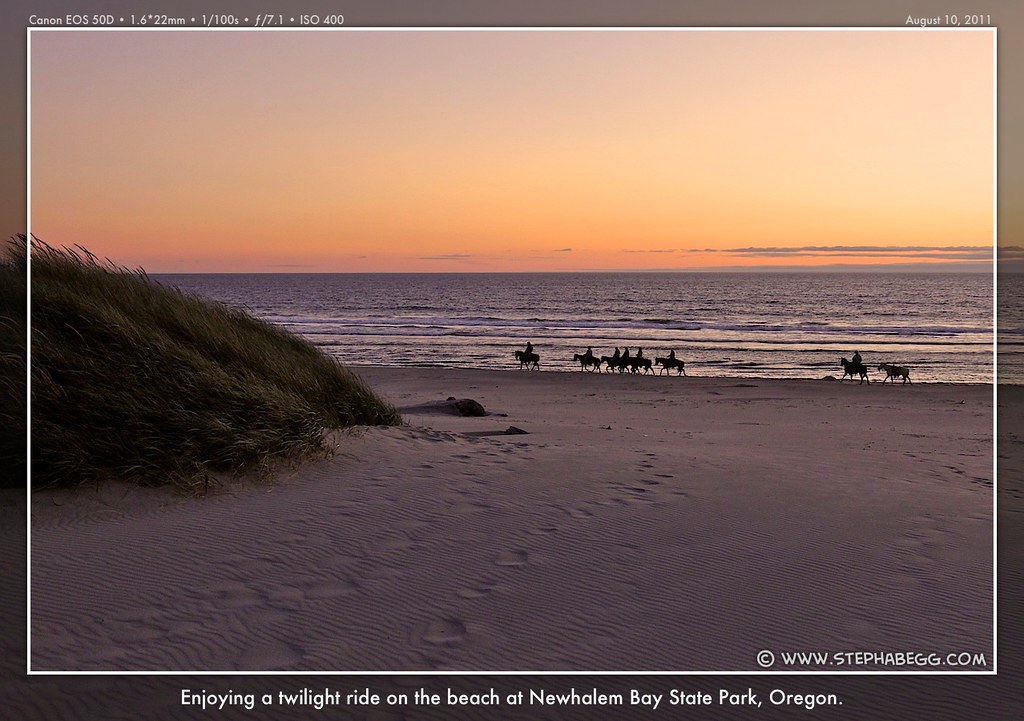
My destination for the night was the campground at Nehalem Bay State Park, which is the typical first night for bikers on the Oregon Coast bike route. I was one of the first bikers to arrive at the hiker/biker site (my first indication that most bikers did not get out of the campground until mid-morning). After securing the best spot, I headed down to the beach to spend the rest of the evening reading, cooking dinner, and enjoying sunset. The beach was quite windy, which was a tad annoying when it came to trying to keep the sand out of my mashed potatoes, but it gave rise to some pretty amazing wind ripples and formations on the sand which were great for photography. I enjoyed a beautiful cloudless sunset at 8:25pm. (I thought it would be interesting to record the time of sunset at the beginning and end of my trip, to see how much earlier it would become due to the combined effect of biking south and progressing in days.) By the time I returned to my tent, the hiker/biker camp had filled up with about 15 other bikers on the route. Since the route follows a pretty established itinerary, I would share the camp with these same people most nights.
PHOTOS
(Click to enlarge)
Note my misspelling of "Nehalem" (correct) as "Newhalem" (incorrect) on the photo captions. Guess I was biased by the Newhalem along Highway 20 in WA...
DAY 2
MAP
(Click to enlarge)
Nehalem Bay State Park to Cape Lookout State Park Riding Distance:50.2miles (48.2 on route, 2 on sidetrips)
Photos Taken: 275 photos
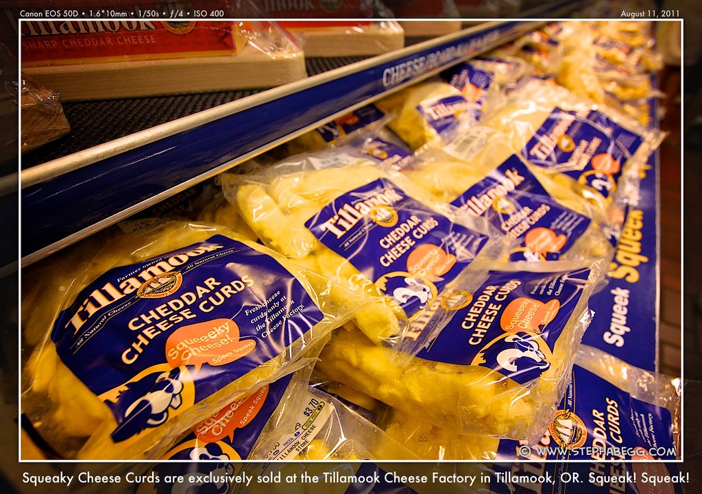
This was another fairly mellow day of biking, so I was able to enjoy a couple of long stops at the Tillamook Cheese Factory and Cape Meares State Park. I had visited the cheese factory before, but it was still fun to check out the free tour (it's kind of fascinating to watch the giant blocks of cheese be cut and then packaged into the small blocks you can buy in the store), make several passes of the free samples of factory-exclusive cheese curds, and peruse the gift shop. I escaped only having bought a coffee; as justification for the hefty price, I saved the cardboard cup and used it for my morning hot chocolate the rest of the trip.
After Tillamook, the bike route diverges from HWY 101 and takes the scenic and slightly bumpy Three Capes Scenic Route. This road passes by Cape Meares State Park, where I stopped to see the Lighthouse (the second of the nine lighthouses along the Oregon coast) and to check out the "Octopus Tree" (a large Sitka spruce that looks like an upside-down octopus since it has no central trunk but rather has a bunch of limbs that extend out horizontally before bending upward; it is not known exactly how it formed). Continuing on the Three Capes Scenic Route after Cape Meares, I had a moment of panic when I encountered a wall of road closure signs. A rather impressive section of road had slid off in a landslide. Fortunately, I was able to walk my bike through on the narrow section of road that had not peeled off the slope.
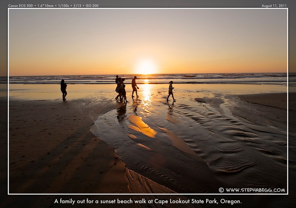
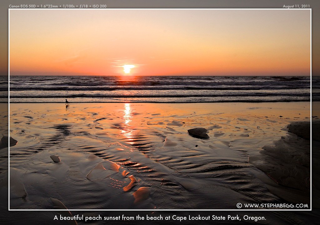
My destination that night was the campground at Cape Lookout State Park, the typical second night for bikers on the route. I had heard that the hiker/biker sites here are the best in the state, and they did not disappoint; the sites lie right on a bluff above the beach and each biker gets an individual site complete with picnic table and fire ring. After setting up my tent, I took off to the beach to read my book, make dinner, and enjoy another beautiful sunset. Antisocial photographer in action.
PHOTOS
(Click to enlarge)
DAY 3
MAP
(Click to enlarge)
Cape Lookout State Park to Beverly Beach State Park Riding Distance: 71.5 miles (57.5 on route, 14 on sidetrips)
The route continues along the Three Capes Scenic Route for the first quarter of the day. This day is marked by three large climbs: Cape Lookout, Cascade Head, and Cape Foulweather. I noticed that my sources were conflicting in how high these hills actually are (for example, my map's elevation profile showed the elevation of Cape Lookout to be 850', while my guidebook showed the profile at 750' and wrote in the description that it was 550'). Either way, being on highway grade, the three hills weren't too bad. I like hills anyway.
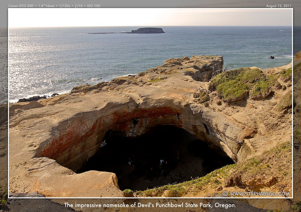
The first of my stops this day was Cape Kiwanda State Park, which lies right off the bike route. There's a cool gigantic yellow sandstone cliff formation that I hiked to the top of; in the fall and winter, people come from all around to photograph the breakers hitting the cliffs below. After this, I continued on, stopping briefly in Neskowin to make a tuna-fruit snack wrap (try it, it's actually quite good with the chewy texture of the fruit snacks) and buy an ice cream sandwich to power me up Cascade Head. A couple hours later, near the end of the day's route, the green Oregon Coast Bike Route signs directed me onto a scenic one-way Otter Crest Loop which hugs the rugged coast below HWY 101. The loop passed by a cool formation called Devil's Punchbowl (it is believed that the punchbowl was formed when the roof of two sea caves collapsed, creating what looks like a big punchbowl full of churning and foaming water at high tide).
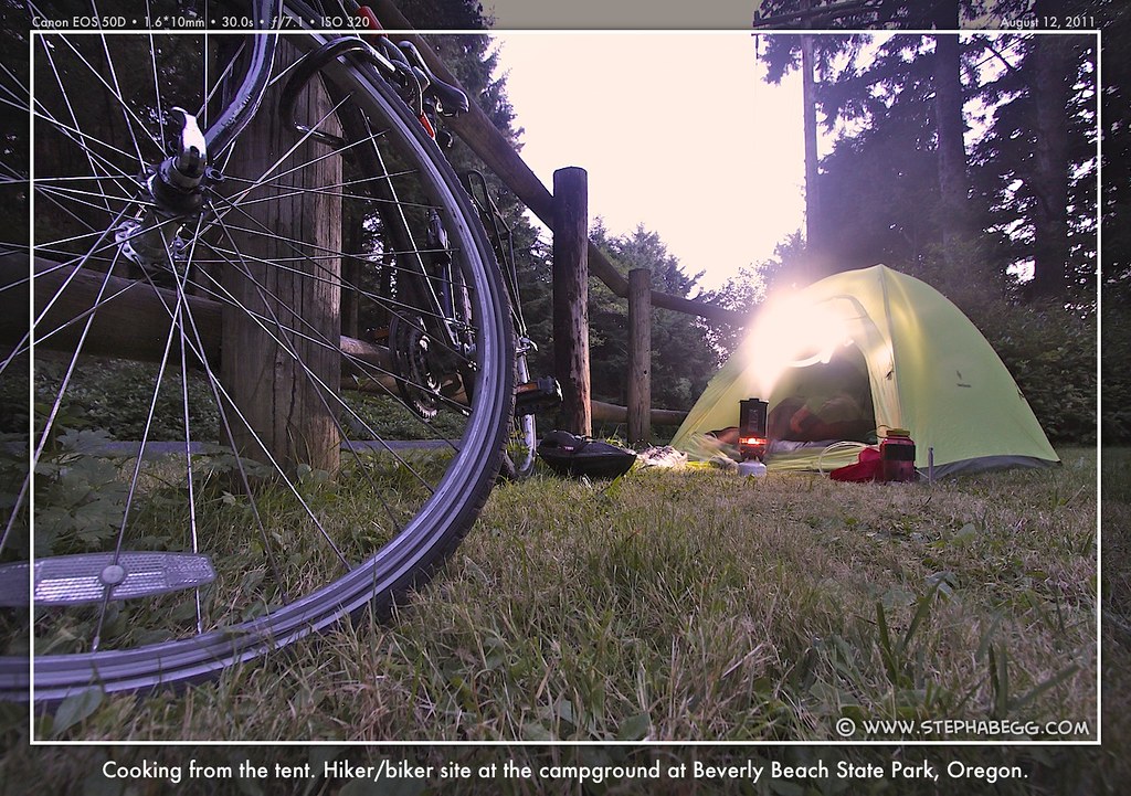
The day's route ended at the popular Beverly Beach campground. Interesting note: the hiker/biker campground at Beverly Beach was the only one along the route that was $6 instead of $5. I never did find out why.
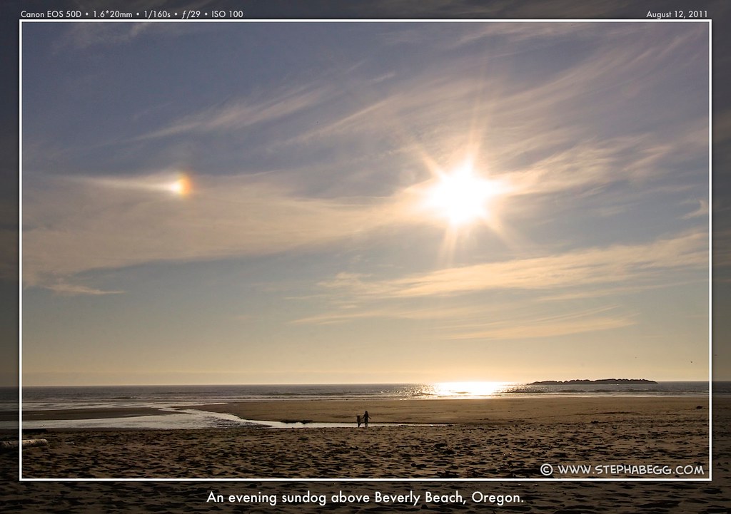
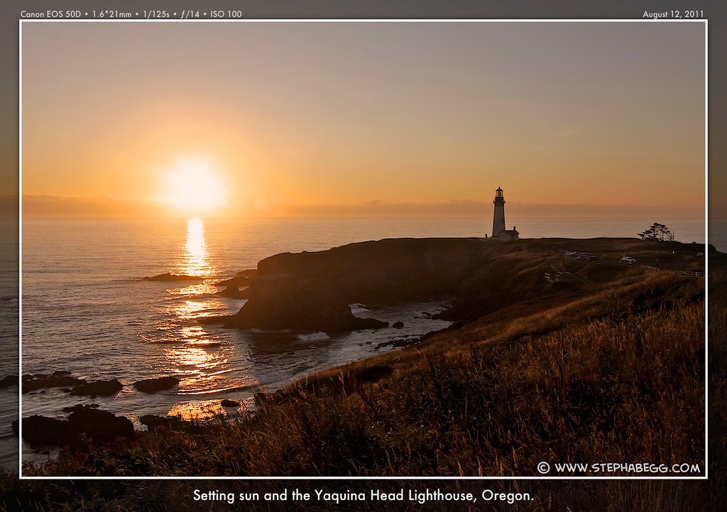
In my frequent perusals through my guidebook, I had tagged a number of stops and sidetrips I wanted to make the next day. One of the places I wanted to stop was the Yaquina Head Lighthouse, which at a lofty 93 feet is the tallest lighthouse tower in Oregon. Since it's only 5 miles south of the campground at Beverly Beach, I decided to bike there in the evening and free up some time for all my other stops the next day. I relished how easy it was to bike without all my gear loaded on my bike!
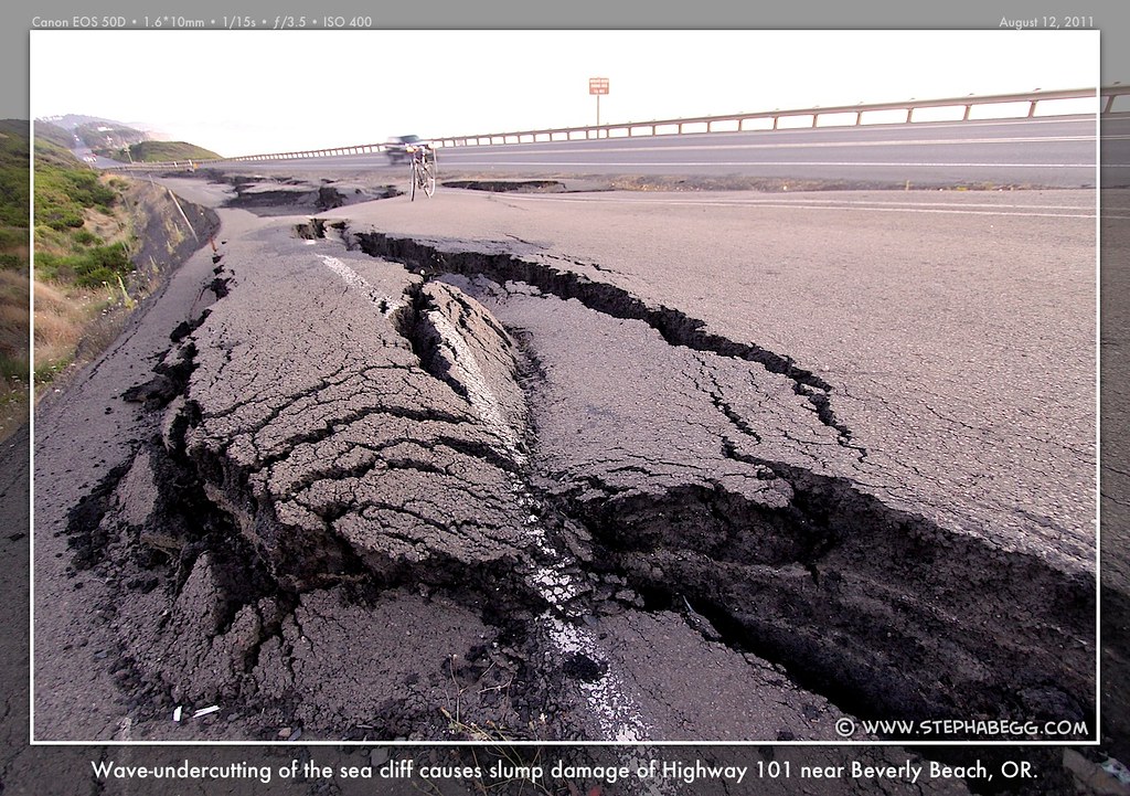
On the way back to Beverly Beach after enjoying a brilliant sunset at the lighthouse, I noticed a section of pavement alongside the highway that was buckled and cracked. A geologist friend of mine later informed me that the terrace above the sea cliff in this area is undercut by waves during storms, and has been slumping and wrecking havoc on HWY 101 for years. There has been talk of moving the highway inland a bit, but it would displace a lot of homes. Note that right now the new pavement is on the ocean side of the old pavement....the highway is doomed....
PHOTOS
(Click to enlarge)
DAY 4
MAP
(Click to enlarge)
Beverly Beach State Park to Jessie M. Honeyman Memorial State Park Riding Distance: 66.0 miles (60.3 on route, 5.7 on sidetrips)
Riding Time: ~6.5 hours (includes sidetrips)
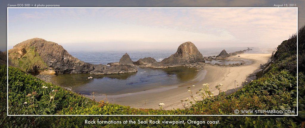
Sidetrips/Stops: Yaquina Bay Lighthouse (+0 miles), Glassblowing and Chainsaw wood art shops in Seal Rock (+0 miles), Seal Rock Viewpoint (+0 miles), Devil's Churn Viewpoint (+0 miles), Cape Perpetua Viewpoint (+4 miles), Cape Perpetua Visitor Center (+1 mile), Heceta Head Lighthouse (+0.5 miles), Darlingtonia Botanical Wayside (+0.2 miles)
Photos Taken: 240 photos + 2 videos
I was the first to leave camp in the morning, as I knew I would be stopping a lot.
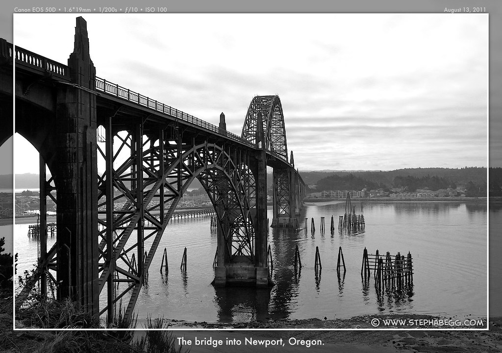
A few miles into the day, the bike route leaves HWY 101 to bypass the stoplights and traffic of central Newport. The bypass route passes the fourth lighthouse of the trip: the Yaquina Bay Lighthouse, which is the least used lighthouse on the Oregon coast, having been in service for only three years before being replaced with Yaquina Head Lighthouse just
three miles to the north.
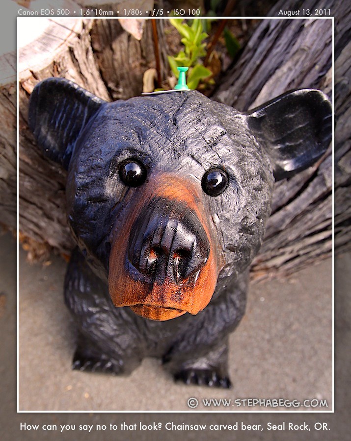
One of my highlighted stops was the glassblowing and chainsaw wood art shops in Seal Rock, which like they would be fun to check out. One of the chainsaw bears would have made a great addition to my parents' cabin out on Saturna Island, but strapping a 60lb chunk of wood onto my bike rack would have been quite a challenge. It would have made for a good photo though.
After stopping at a couple of more viewpoints just off the highway, I reached the turnoff for the steep 1.8 mile road up to the highly recommended Cape Perpetua viewpoint. It's hard for me to pass by a recommended viewpoint, so up I pedaled. From here, I was treated to sweeping views of the coast before bombing back down to HWY 101. I made my ride even longer by detouring to the visitor center twice in order to charge a camera battery while I rode up to Cape Perpetua.
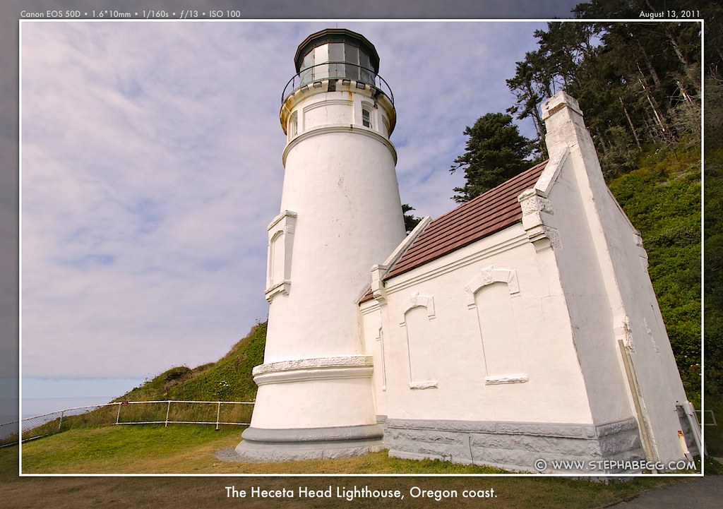
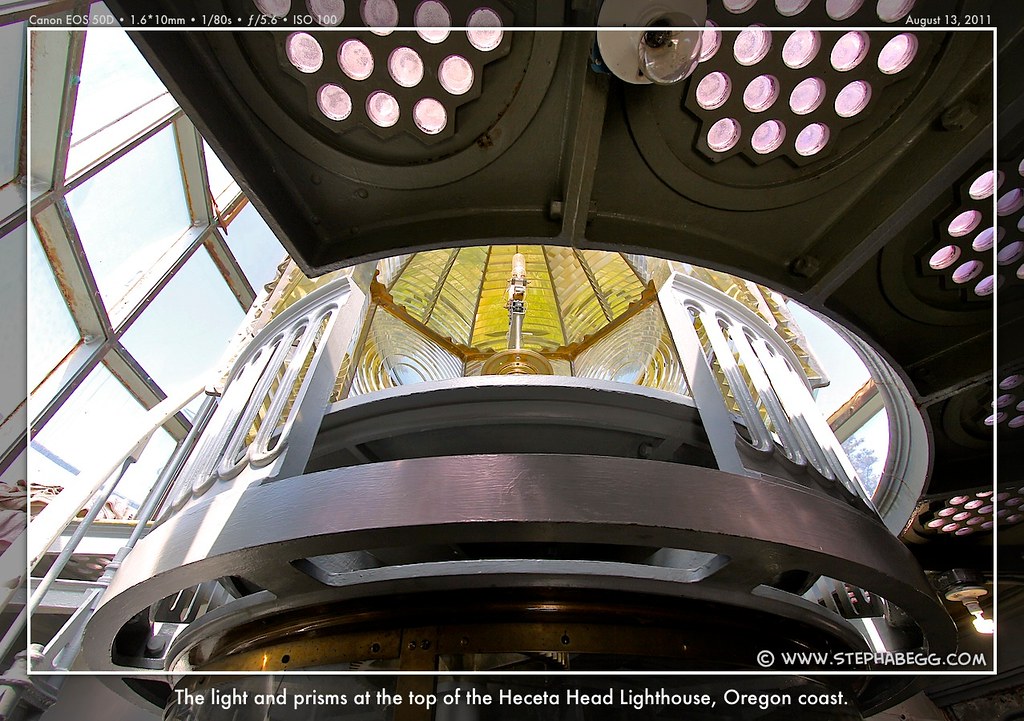
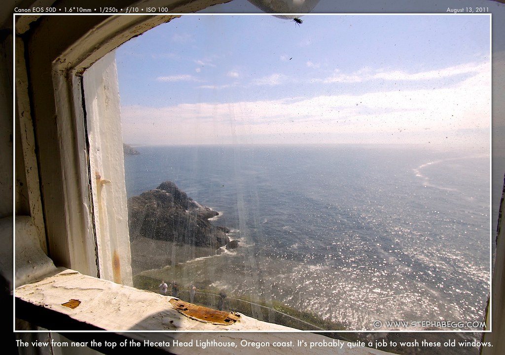
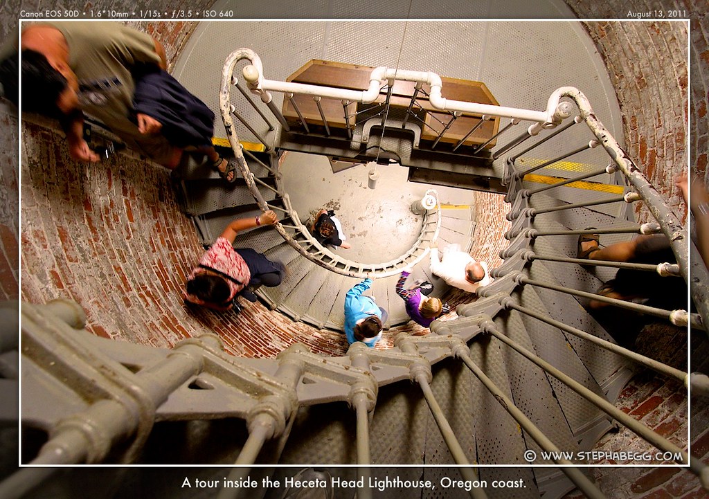
Next stop was the fifth of nine lighthouse along the route, the Heceta Head Lighthouse. I arrived just in time to take the last (free) tour of the day, which was pretty fascinating. I'd never thought much about the concept of lighthouses before, so it was neat to learn that each lighthouse has it's own distinct signal (the Heceta Head is three flashes of white light, for example), which allows boats to know where they are along the coast.
Shortly after the lighthouse was the second of the two tunnels on the route. Whew, I survived that one too!
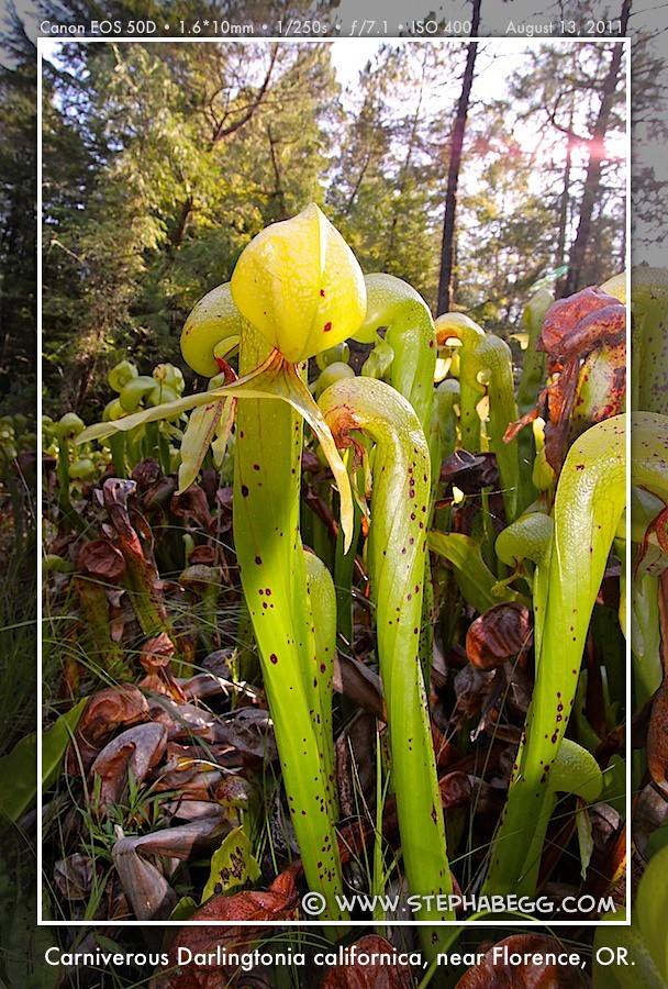
My last planned stop of the day was perhaps the most interesting. This was a botanical wayside of some rare and unusual California pitcher plants (Darlingtonia californica). These plants—whose tubular and forked leaves resemble a rearing cobra—are carnivorous and thrive in nutrient-deficient soil by digesting insects that get lured into and then trapped in their fluid-filled cavities.
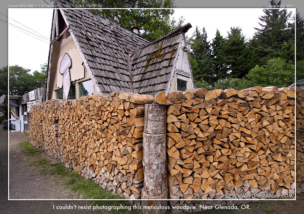
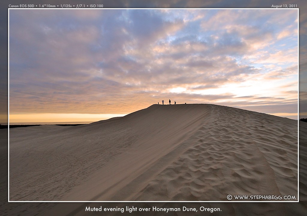
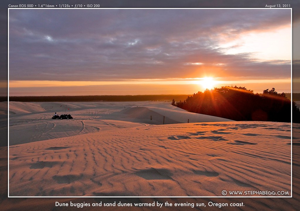
Finally I arrived at Honeyman Dune State Park, after being delayed by a woodpile I just had to photograph (I've never seen wood so neatly stacked, and the owner told me that had I passed through a few years ago I would have seen the stacks completely surrounding his two-story house!). I snagged the last available flat spot for my tent (I noticed that as my viewpoint-hopping style had come into full swing, most of the other bikers were arriving at camp before me), and headed off to find the top of Honeyman Dune to watch another beautiful sunset. Due to dune formation in action, dinner on the top of the dune ended up containing more than its fair share of sand.
PHOTOS
(Click to enlarge)
DAY 5
MAP
(Click to enlarge)
Jessie M. Honeyman Memorial State Park to Sunset Bay State Park Riding Distance: 65.7 miles (54.9 on route, 10.8 on sidetrips)
Riding Time: ~6.5 hours (includes sidetrips)
Sidetrips/Stops: Oregon Dunes Overlook (+0.6 miles), Winchester Bay residential backroads (+0.2 miles), Umpqua River Lighthouse (+0 miles), Shore Acres SP and Botanical Gardens + Cape Arago SP and Lighthouse (+10 miles)
Photos Taken: 340 photos + 1 video
I figured with the highway passing by several miles of coastal dunes, I would have ample opportunity to photograph dunes lit in the morning sun. However, all of the dunes had to be accessed by side roads, and I was not impressed with the views I got from the Oregon Dunes Overlook I chose as my dune-photography sidetrip. Oh well, next time. I didn't mind too much though, since I knew I'd want ample time later in order to explore the concentration of state parks in the area I would be staying that night.
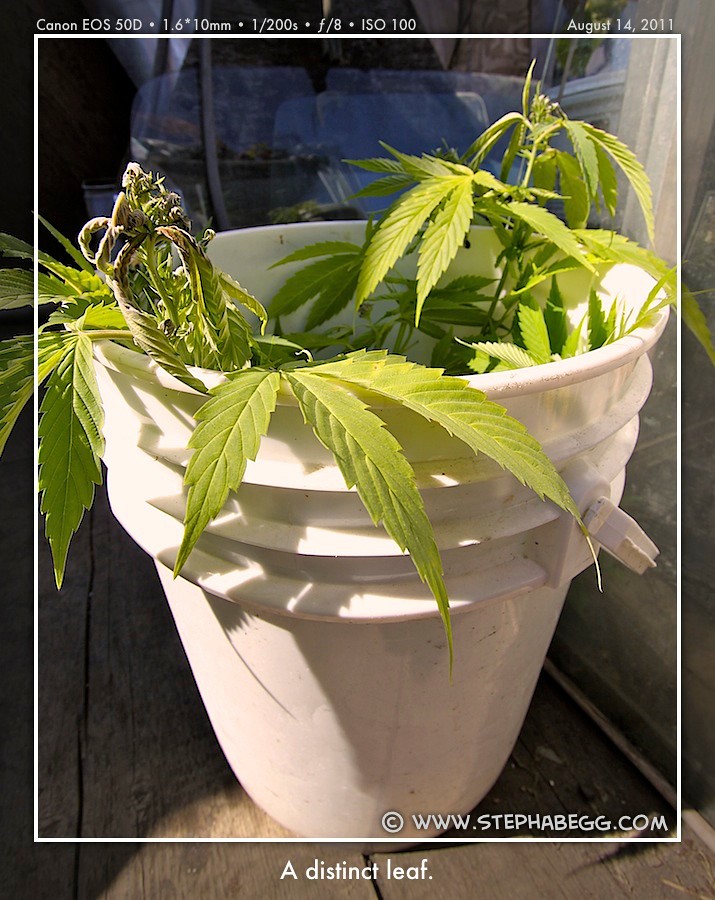
At the town of Winchester Bay, the bike route leaves the highway to take some backroads around the quaint area (and it also goes right past the Umpqua River Lighthouse). Just a few minutes into Winchester Bay came an impromptu and one of the more memorable stops of my trip. I noticed a house surrounded by a motley collection of old junk; the way the junk was haphazardly arranged was almost done with an artful touch, and it just begged to be photographed. As I was pulling out my camera, the owner invited me to see his even "better" back yard; he seemed trustworthy in a quirky sort of way, so I followed him and snapped away as he showed off his grow-op of 10-ft tall marijuana plants arranged amongst an even more eclectic array of rusted old items. I think the owner was happy to find someone who actually enjoyed looking at his rusty collection.
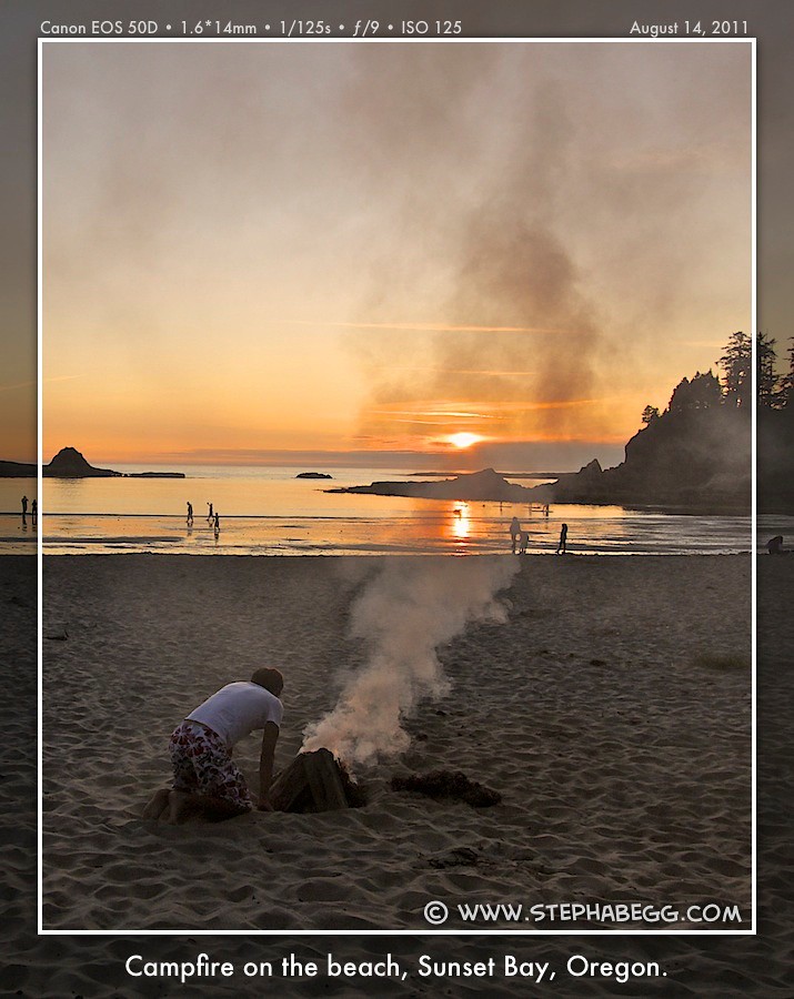
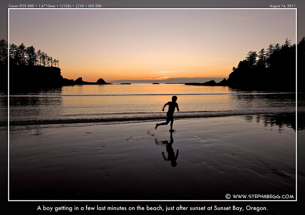
After that, my only stop for the remainder of the day was to pick up some groceries at a supermarket in Coos Bay. As usual, already parked outside the store were several other pannier-laden bikes from other bikers gathering their daily foodstuffs (part of the nice thing about a bike trip is that you don't have to carry a whole week's worth of food at once). The bike route then left HWY 101 (at Coos Bay, HWY 101 turns inland for awhile), and took me to my coastal destination at Sunset Bay State Park.
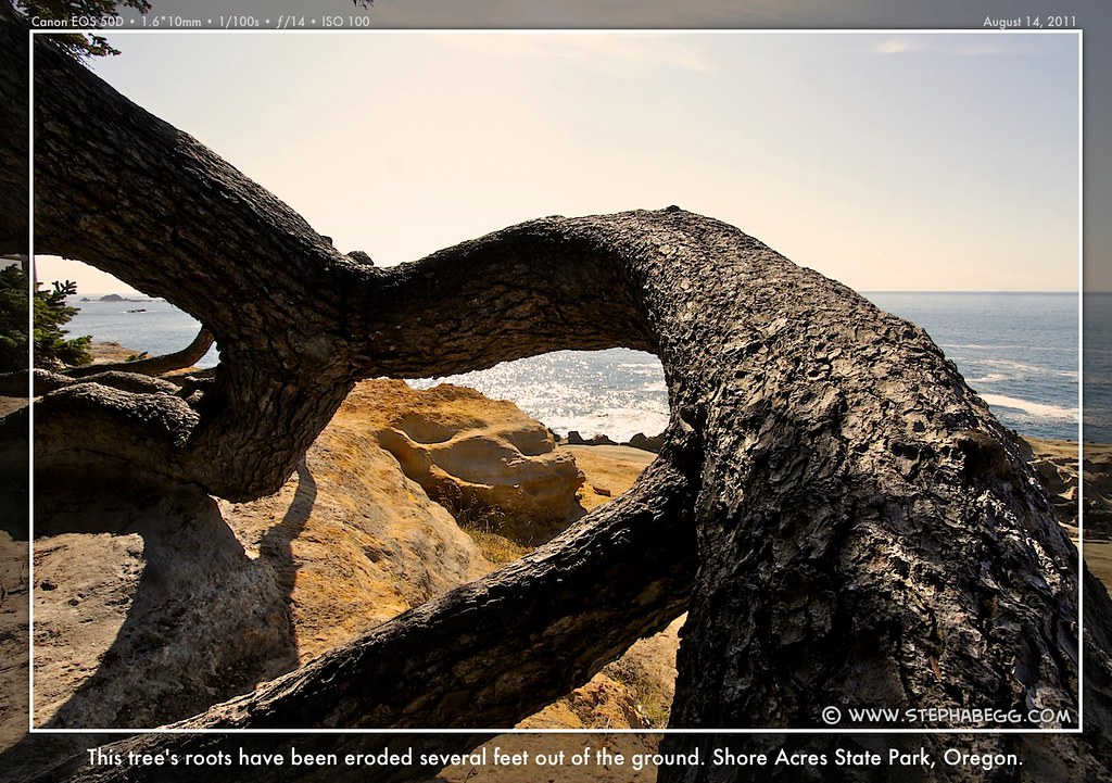
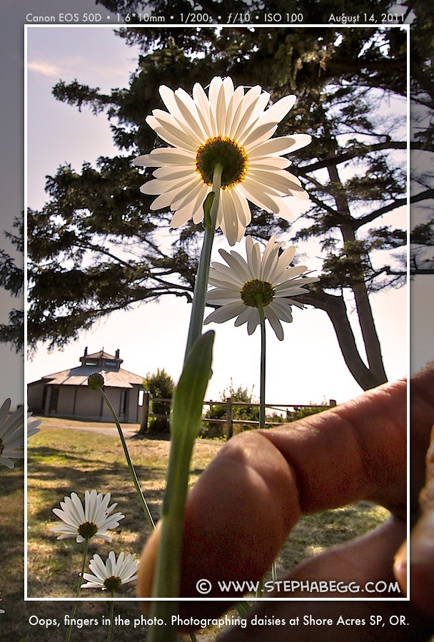
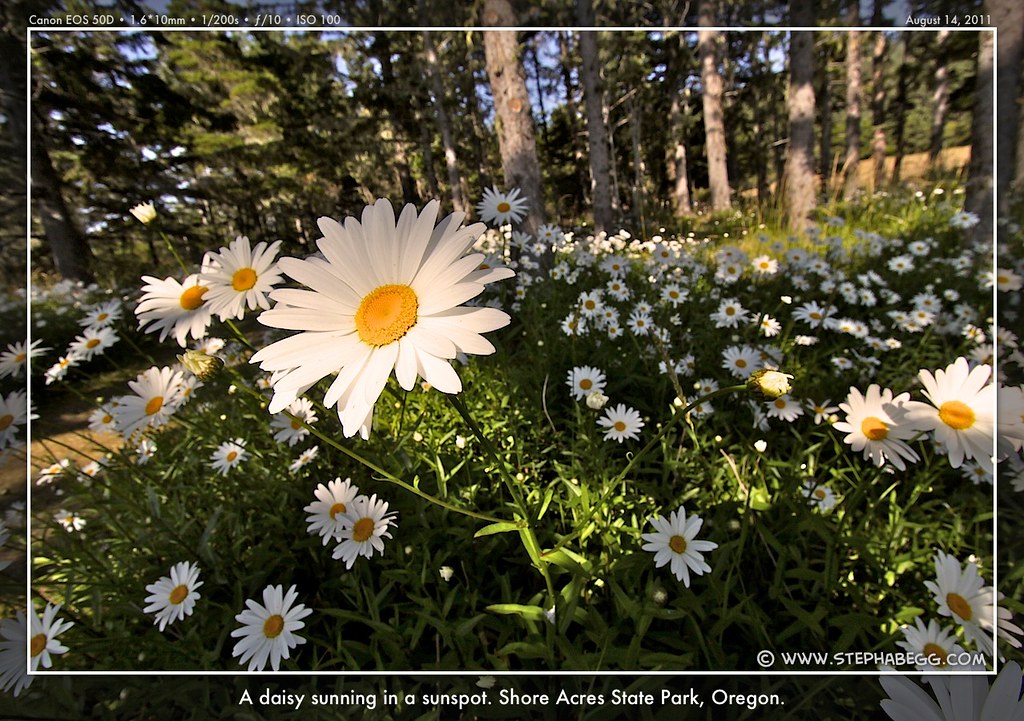
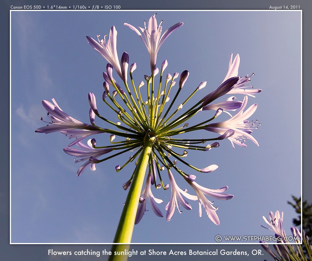
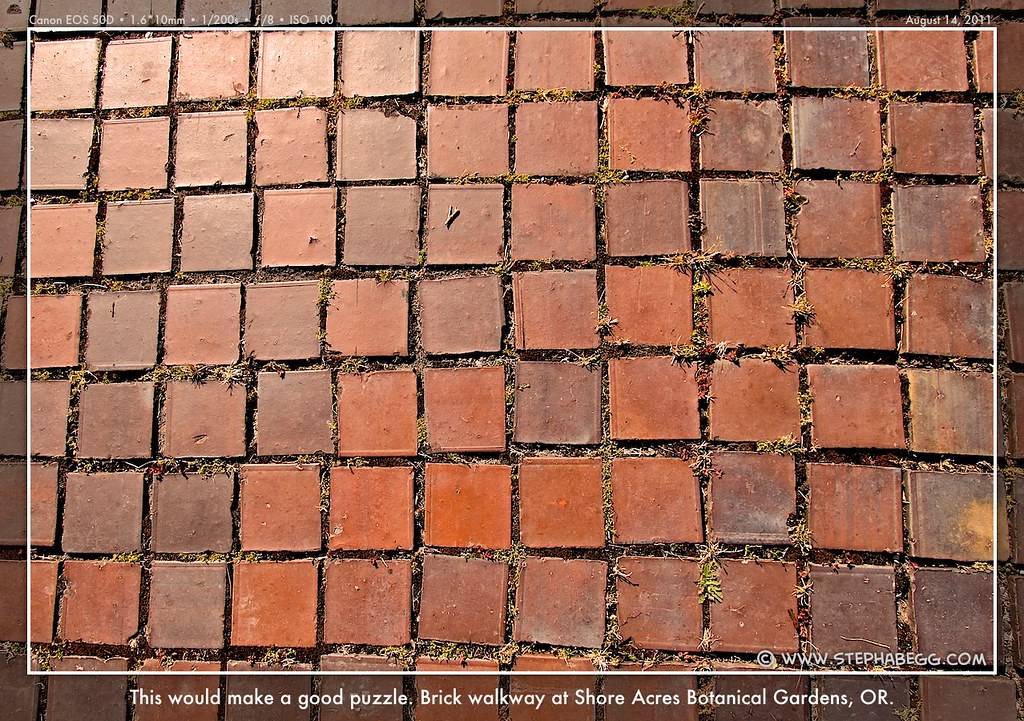
This time, I was the first biker to arrive at the hiker/biker campground. I unloaded my gear and then jumped back on my bike to go explore the botanical gardens at Shore Acres State Park, the Cape Arago Lighthouse, and the rugged point at Cape Arago State Park. I marveled at some exposed the roots of large trees lying near the coast, and I later learned that the lighthouse here (the seventh of nine on the coast) has been moved three times due to rapid erosion of the sandstone. This area must get some pretty wild storms in the winter.
PHOTOS
(Click to enlarge)
DAY 6
MAP
(Click to enlarge)
Sunset Bay State Park to Humbug Mountain State Park Riding Distance: 75.6 miles (57.0 on route, 18.6 on sidetrips)
Riding Time: ~7 hours (includes sidetrips)
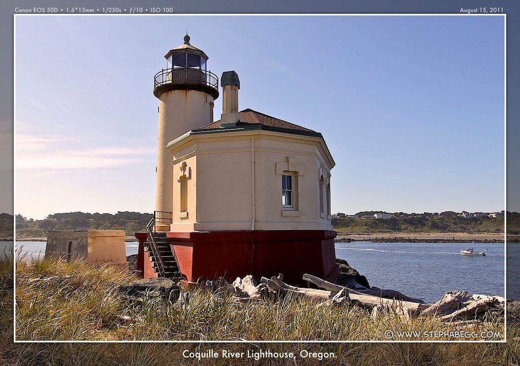
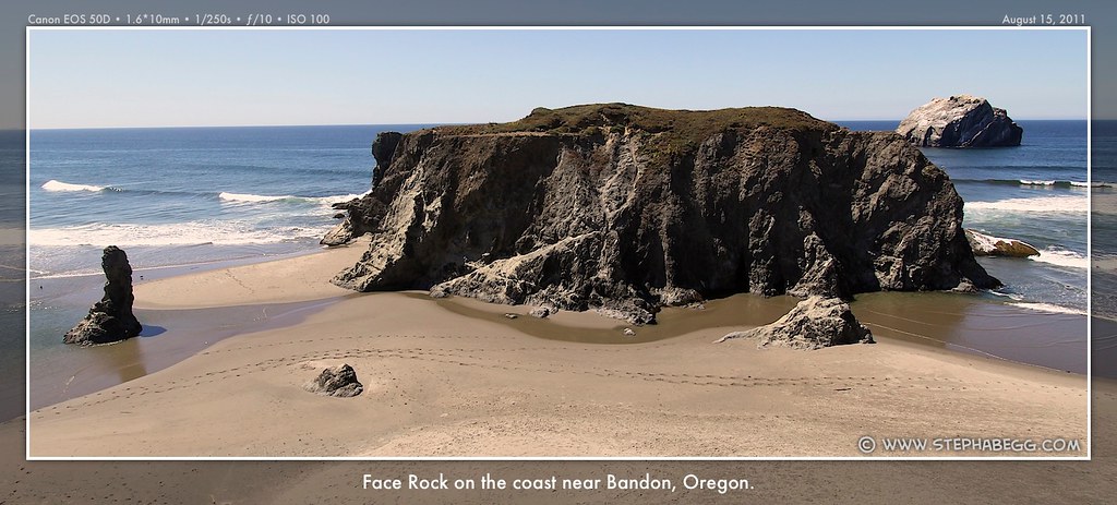
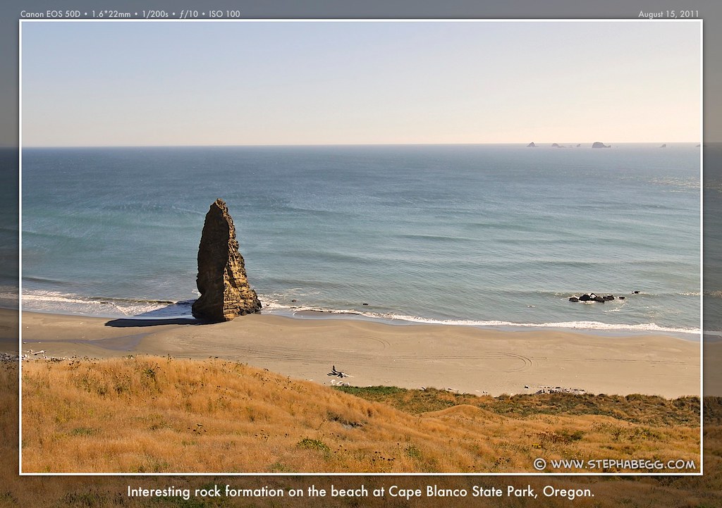
Sidetrips/Stops: Bullards Beach SP and Coquille River Lighthouse (+6 miles), Old-town Bandon (+0.5 miles), Face Rock Viewpoint (+0.1 miles), Cape Blanco Lighthouse (+12 miles), Battle Rock Wayside (+0 miles)
Photos Taken: 246 photos
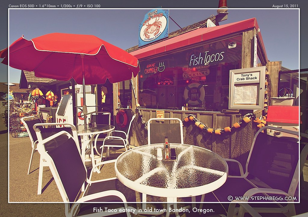
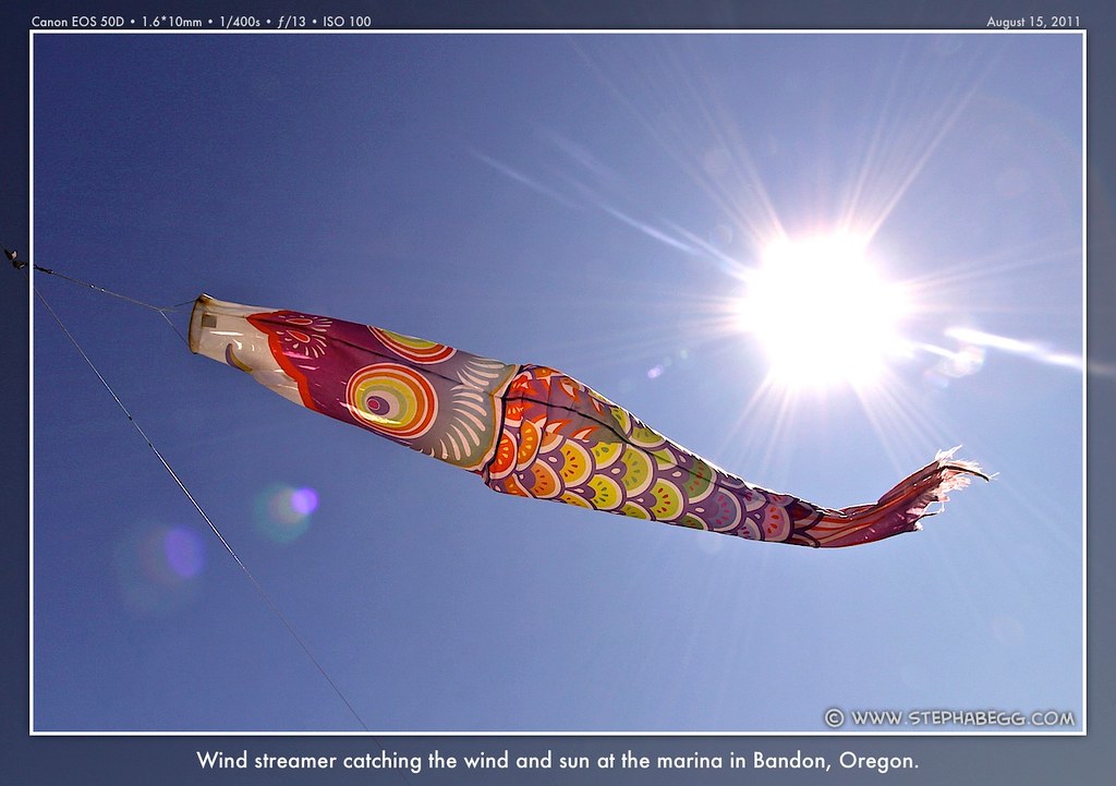
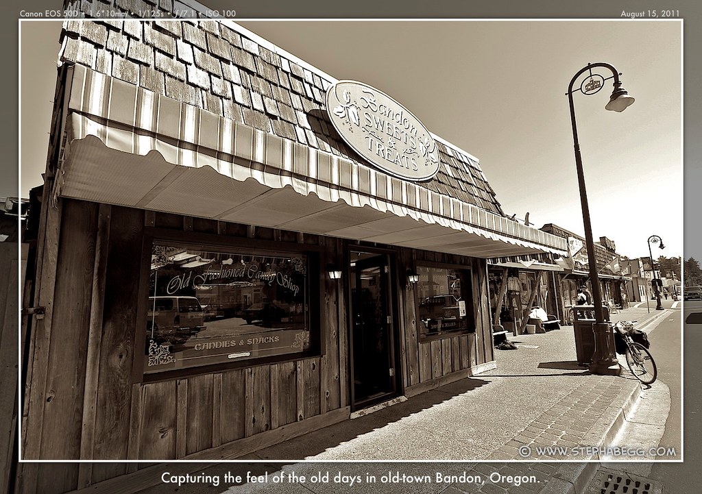
After leaving the state-park-ville of the previous night, the bike route followed quiet headland roads until it reconnected with HWY 101 shortly before Bandon. I enjoyed a couple of hours touring the marina and shops and ice-cream sandwiches of old-town Bandon.
By this time, having seen all of the lighthouses along the Oregon coast so far, I figured it'd be amiss not to tick off the last two. Two sidetrips and a total of 18 extra miles later, I had my photos of the Coquille River and Cape Blanco Lighthouses. The Cape Blanco Lighthouse—which was built in 1870—is the oldest lighthouse in Oregon and is also the highest light above sea level (the light shines from an elevation of 245 feet, for 21 miles out to sea); another interesting tidbit is that the Cape Blanco State Park is the most westerly park (although not point) in the continental US.
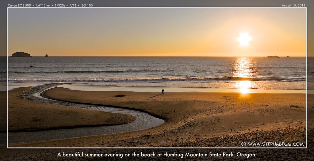
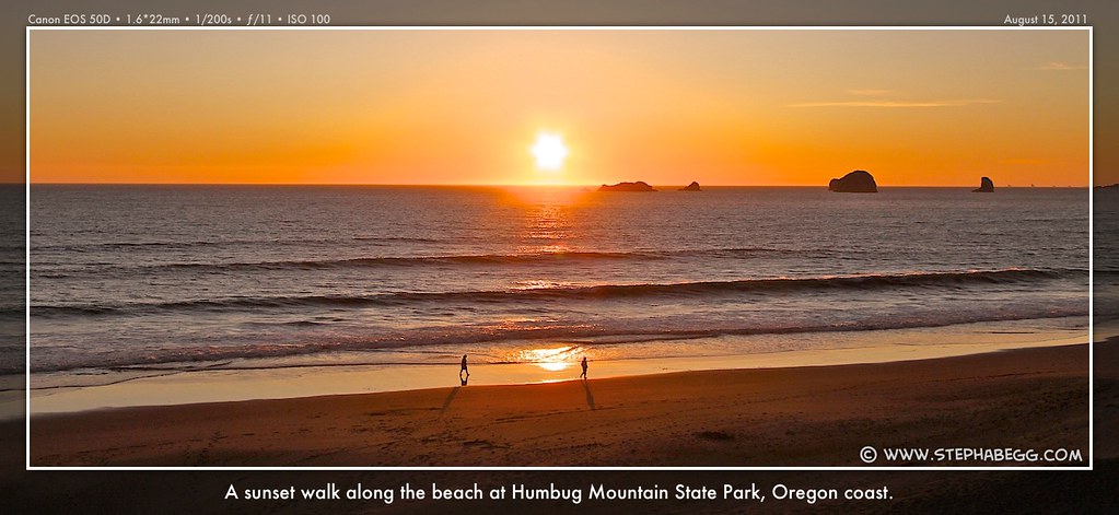
With my lighthouse ticking adventures, this turned out to be my longest day of biking of the trip. And my leg didn't even seem to notice, which was encouraging. My destination for the night was the campground at Humbug Mountain State Park. Yet another dinner on the beach enjoying a gorgeous orange sunset.
PHOTOS
(Click to enlarge)
DAY 7
MAP
(Click to enlarge)
Humbug Mountain State Park to Harris Beach State Park (Brookings, OR) Riding Distance: 54.2 miles (53.8 on route, 0.4 on sidetrips)
Riding Time: ~5.25 hours (includes sidetrips)
Sidetrips/Stops: Arch Rock Viewpoint (+0 miles), Thunder Rock Viewpoint (+0 miles), Harris Beach SP (+0.4 miles)
Photos Taken: 364 photos (about 100 of these are of sand fleas)
It was a bit saddening to think that this was the last day of my Oregon coast bike adventure. My cup from the coffee I had purchased way back at the Tillamook Cheese Factory was battered, but still had a number of days left in it. I felt the same way, and wished I were continuing the Pacific Coast Bike Route into California. But every trip must end, I suppose.
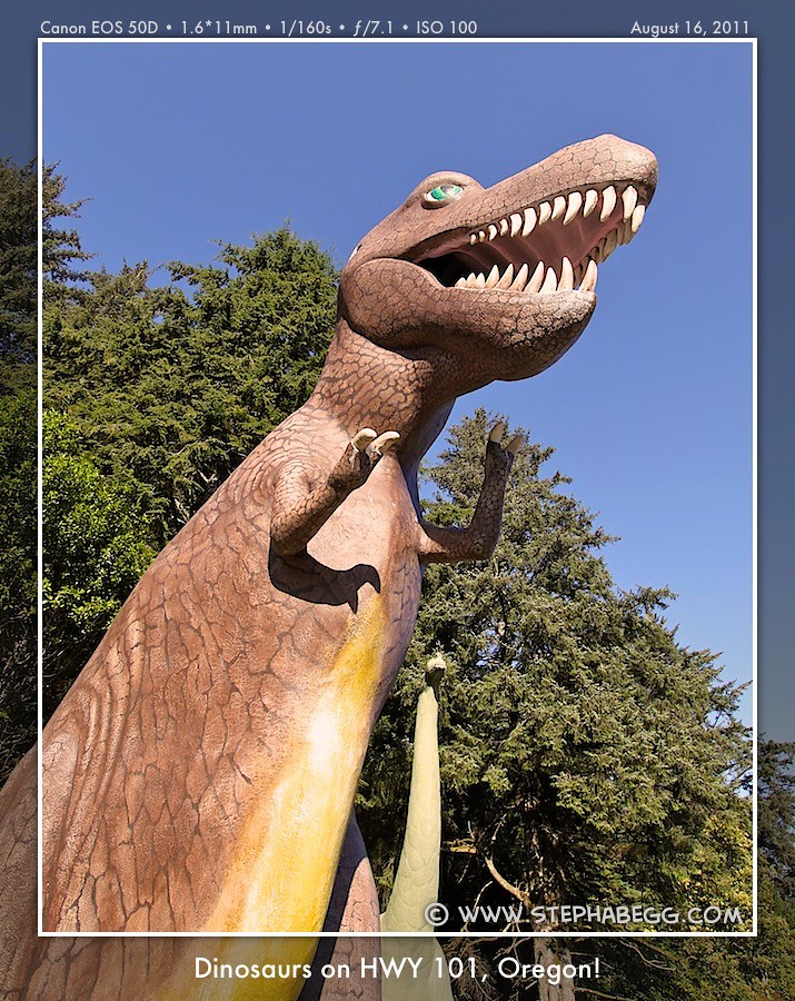
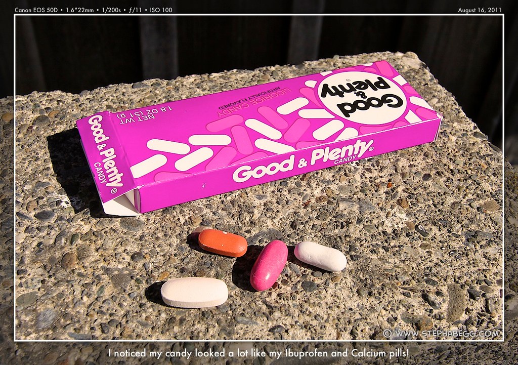
For the first 40 miles, I did not stop other than to snap a few photos of a giant fiberglass dinosaur and then of some licorice Good & Plentys that looked just like my calcium and ibuprofen tablets. I wanted to give myself time to enjoy the last 10 miles of the day's route, where my heavily-highlighted-and-by-now-quite-dogeared guidebook showed the highway hugging the coast with viewpoints spaced every half mile or so.
My map showed that the bike route took a bypass from HWY 101 via some country roads between Ophir and Gold Beach. While this highway-detour was not described in my guidebook, it was a pleasant section away from the busy and at times windy stretch of HWY 101. Back on HWY 101, I then encountered one of the larger hills along the Oregon coast as the highway climbed over Cape Sebastian.
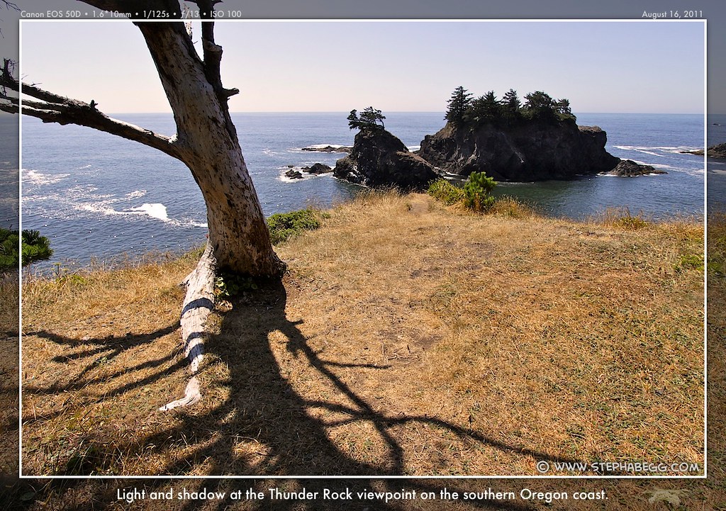
Then it was time to viewpoint hop. My favorite stop by far was the Thunder Rock viewpoint. It was not even well marked, and would be easy to miss. But it's a real gem. A 10-minute hike brings you to an exposed crest that overlooked sea stacks, natural bridges in the rock, and pounding surf. It's a great place to take a nap if you don't have a tendency to roll around in your sleep.
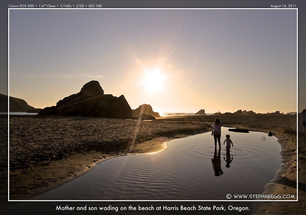
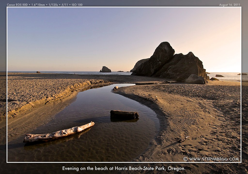
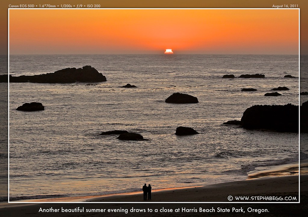
Finally, I arrived at seastack-studded Harris Beach State Park, on the outskirts of Brookings. This is the typical end point for those on the Oregon Coast Bike Route. I couldn't believe I was already finished. The week had gone so fast!
So, how was I to get back to my car nearly 400 miles up the coast in Astoria? This had been foremost on my mind as I planned my trip. I had
figured my options were: (1) Bike one day further to Crescent City, CA
and rent a car and drive north. But the rental car agency in Crescent
City (Hertz) is not the same as the one in Astoria (Enterprise), which
would make this a very expensive one-way option with lots of hassle. (2)
Go to the bike shop in Brookings and buy a bicycle box, pack it up, and
take a Greyhound back to Astoria. But there was a rumor
(unconfirmed) that the Greyhound station in Brookings had recently
closed—the closest now being 97 miles away at Grant's Pass. That's a lot
of extra biking. (3) Take a commuter flight out of Brookings. But then
it turns out that they don't take bikes, so I'd have to box up my bike
and send it home via UPS. This was becoming kind of an expensive hassle!
(4) Just turn around and bike 7 days up the coast. Heck, the ride is nice enough to be repeatable. (5) Go scope out the campground for a truck or
trailer with Washington plates and make friends with the owners. I think I liked this last option best.
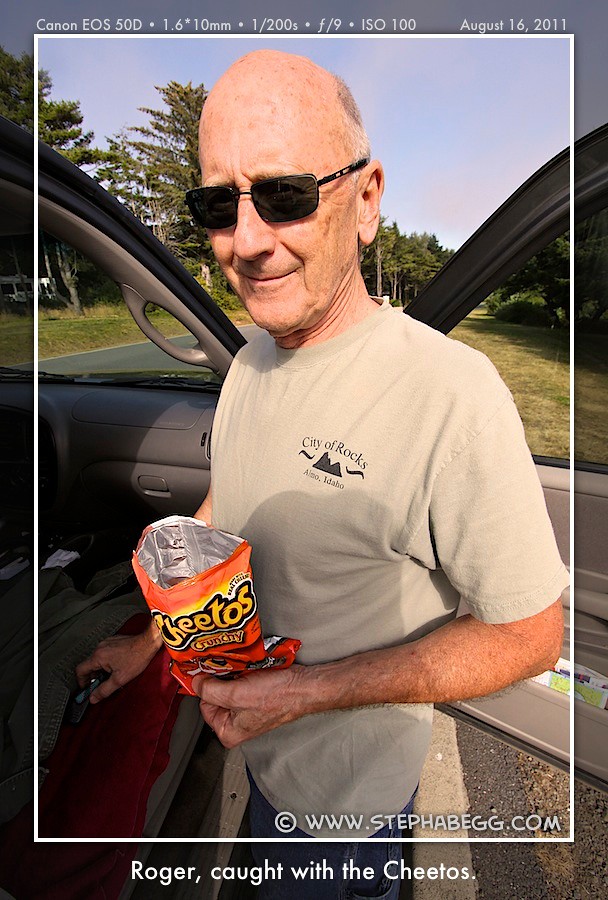
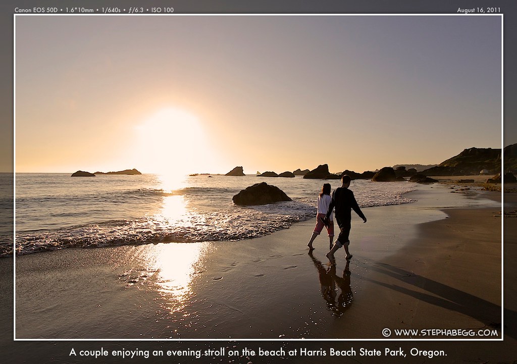
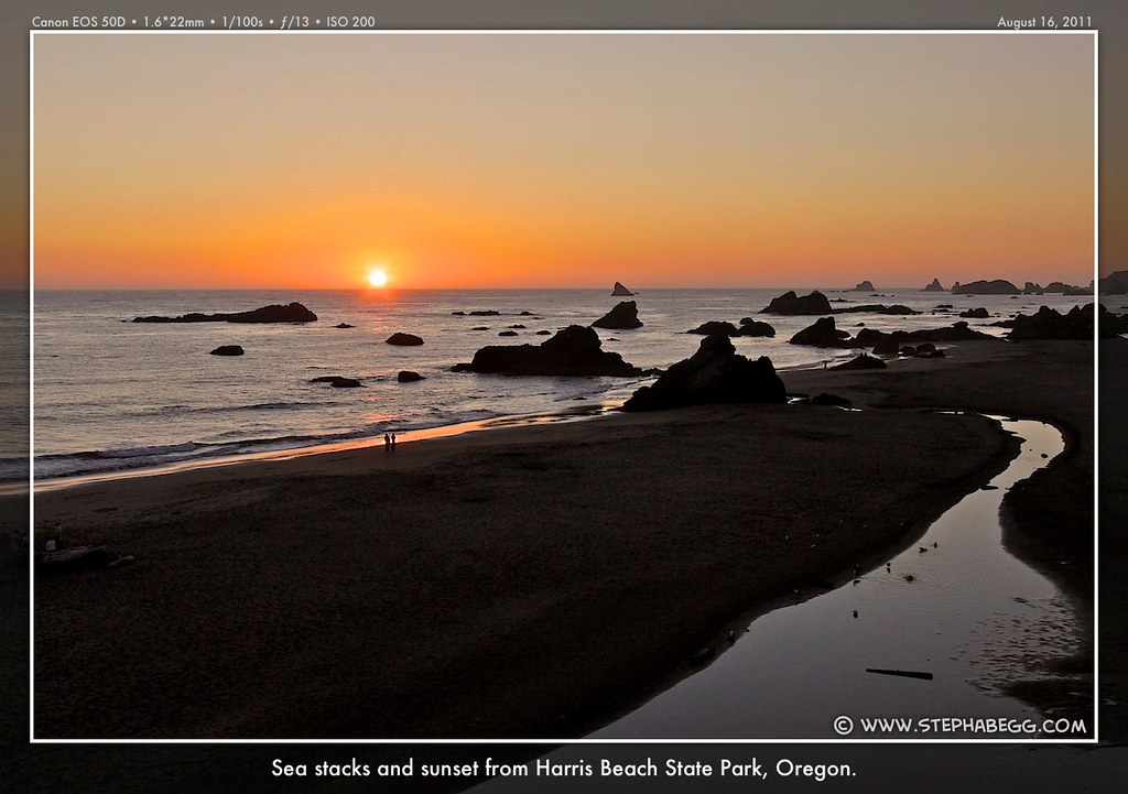
But in the end, I didn't have to enact any of these options. My friend Roger very generously offered to drive down, pick me up, and drive me back to my car. (Thanks Roger. The trip was all the more enjoyable since I didn't spend all my days worrying how I was going to get back to my ever-furthering car.) Roger had left his home in Washington around the time I had woken up at the Humbug Mountain campground that morning, and we conveniently happened to arrive at Harris Beach State Park around the same time. After securing a hotel room (I couldn't convince Roger of the merits of campfire smoke and sand) and grabbing dinner in Brookings (or the merits of mashed potatoes and tuna-fruit snack wraps), we returned to Harris Beach to enjoy spectacular sunset #7 of 7. The sun set at 8:17pm, which was 9 minutes earlier than the first sunset of the trip 6 days and 350 miles earlier.
PHOTOS
(Click to enlarge)
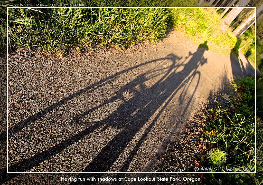
Note on Photography For me, the trip was just as much about photography as it was about biking. My viewpoint-hopping style of biking wasn't exactly the most efficient, but I wanted to fully enjoy and capture the special beauty of the Oregon coast.
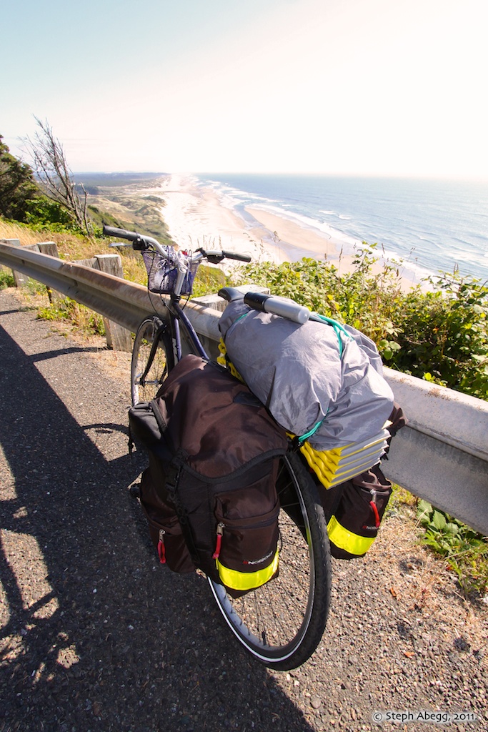
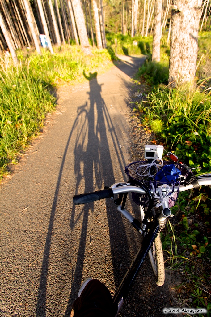
I brought two cameras. One was an old point-and-shoot (Nikon Coolpix 5600) I mounted on my handlebars to take photos and videos from my bike's perspective. The other was my faithful digital SLR (Canon 50D) for viewpoints and evenings at camp; I kept it strapped in a basket on the front of my bike so I always had it on hand. As for my lens, I used my 10-22mm lens, which is my typical choice when I can have just one lens along on a trip.
Useful beta. Updated route information. Corrections. Historical notes. Interesting facts. No fluff please. Please do not put links in your comment, as my spam filter will filter those comments out.