Moab 2014: Castleton North Chimney, Moses Dunn Route, Top of the World Cooler Than Jesus, Three Penguins Right Chimney, River Road El Segundo
4 Days & 5 Climbs near Moab
Routes:
- Castleton Tower, North Chimney (5.9, 3-4p)
- Moses, Dunn Route (5.11-, 4-5p)
- Top of the World Overlook, Cooler than Jesus (5.10, 3p)
- Three Penguins, Right Chimney (5.10+, 2p)
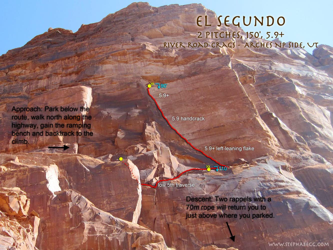
- River Road Crags, El Segundo (5.9+, 2p)
Climbing desert towers and cliffs: A little desert dessert to cap off a full summer of climbing!
Region: Utah
Elev: 4,000-7,000 ft
Rock: Wingate sandstone and Entrada sandstone
Mode:
Date(s): September 10-13, 2014 (Wed-Sat)
Partner(s): Karl Kelley (Climb 1) / Dow Williams (Climbs 2-5)
THIS TRIP REPORT IS STILL MOSTLY IN THE EMBEDDED HTML FORMAT OF MY OLD WEBSITE. MOBILE Tip: Try Landscape mode. It is generally more mobile friendly.
It had been over two months since I packed my Subaru full of climbing and photography gear and drove south out of Bellingham. My first destination had been City of Rocks in Idaho, and I had no plans after that other than to find good rock, good partners, and good weather. And hopefully make a good summer out of it. It turned out to be a spectacular summer. Over the course of three months, I strung together a series of climbing adventures: from the City of Rocks I drove down to Salt Lake City to climb for a few days in Lone Peak Cirque, then it was back up to Idaho for a week at Elephant's Perch, then to wild Wyoming for a week in the Cirque of the Towers followed by a few days at Devil's Tower, then an impromptu trip to Colorado to climb in Rocky Mountain National Park and Eldorado Canyon, and then back to Wyoming to climb some harder routes in the Cirque of the Towers, and finally an invitation by my Cirque climbing partner Dow to come down to his place in southwest Utah and climb "locally" with him, mostly in Zion and also a couple of days at Red Rocks. Time flew by, and soon it was a week into September, and I needed to be home soon to start preparing my lecture materials for the upcoming Fall Quarter of teaching. I put the bug in Dow's ear about climbing some desert towers near Moab on my way home....
(A little bit about climbing in the Moab area: There is a lifetime of climbing in this area. To the west are the sandstone cliffs of Island in the Sky in Canyonlands National Park. To the east are the cliffs and towers along River Road, the Wingate spires of Castle Valley, and the (in)famous Fisher Towers. To the north is the sandstone wonderland of Arches National Park. And to the south is the world-class crack climbing of Indian Creek. The rock is all sandstone, but there is a wide range of types: the splitter-crack-forming Windgate, the ultra-soft Entrada, the gorgeous Navajo, the oddly solid-yet crumbly Cutler, the interesting mid-layers of Chinle, Kayenta, and more.)
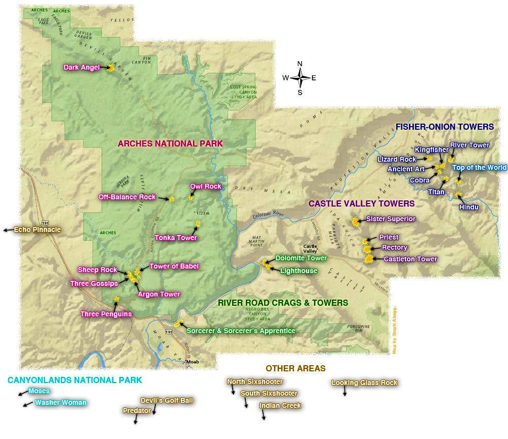
A map of Moab-area desert tower climbs I put together for the summitpost page for this area.
I had been compelled in particular by the desert towers, which are hauntingly beautiful and have unique and interesting routes to their tops. I'd never climbed a desert tower. So Dow and I made plans to climb for four days (Sept 9-12) in the Moab area before I continued my long drive back home to Washington. However, the day before we planned on beginning our Moab climbing trip, a wide-spread thundershower system passed through the West, dumping record-breaking 1-3 inches of rain in some areas and also causing flash flooding in several locations (a 50 mile stretch of I-15 north of Las Vegas sustained enough flood damage to be closed for days). Plus, the storms saturated the sandstone all over the state. We would have to wait a couple of days until the sandstone dried enough to climb. I was under a tight schedule to get home soon, so this reduced our climbing window to two days (Sept 11-12), or potentially two and a half days if I made the 20+ hour drive home in one shot instead of spread over two days. We'd just have to make good use of our two and a half days.
By the time the thundershowers started, I had actually already arrived in Moab, and the plan had been to regroup with Dow the following evening. But since we were now delayed by the rain, I had an extra couple of days in the area, which I planned to spend working away the (very nice) library in Moab. But when the rain stopped on the morning of the 9th, I got progressively antsy to be out climbing, despite the wet rock. I made a partner post on MountainProject looking for a partner for the 10th.
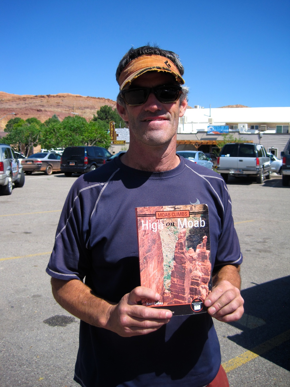
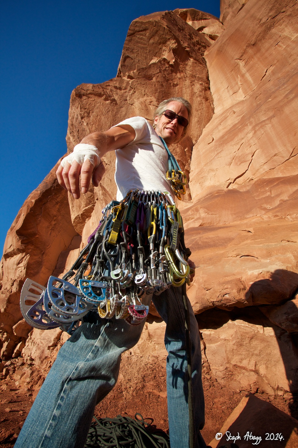
Local climber Karl Kelley responded to my post. Karl and his wife own the Desert Bistro in Moab, and he had recently published a guidebook for the area "High On Moab." In addition to this, Karl is a really nice guy. So Karl was a great partner for my first climb in the area. We climbed the North Chimney (3-4p, 375', 5.9) route on Castleton, a quintessential desert tower climb located in Castle Valley. (Amazingly, the route wasn't even wet despite the fact that that side of the tower does not get a whole lot of sun.) Over the course of the morning, I picked Karl's brain for beta on other climbs in the area, and by the end of the morning I had a tick-list of climbs several times longer than Dow and I could accomplish in the next two and a half days....
Dow arrived in Moab that evening and we proceeded to climb the next two and a half days. The first day, we drove out to Island in the Sky in the northern reaches of Canyonlands National Park and climbed the Dunn Route (4-5p, 600', 5.11-) on Moses, which is a 600' tower that looks remarkably like its namesake. It was such a wild and remote area to climb, accessible only by a couple of hours of driving along rough 4WD roads. The second day, Dow and I climbed another wild route: Cooler than Jesus (3p, 300', 5.10) on the Top of the World Overlook, accessed by driving for a few hours on an even rougher road than the day before and rappelling off the edge of the cliff into a gaping abyss and then climbing back up on some pretty steep and committing terrain. The third and final day, I could only climb the morning, so Dow and I climbed two short and fun roadside routes in Arches National Park: the Right Chimney (2p, 150', 5.10+) on The Three Penguins and the nearby El Segundo (2p, 150', 5.9+) near the canyon entrance of River Road.
This page provides a trip report for my four fun days of climbing near Moab—a little desert dessert to cap off a full summer of climbing. Thanks Karl and Dow for some great desert climbing memories.
Climbs We Did
CLICK ON ROUTE TO DROP DOWN CONTENT
Castle Valley
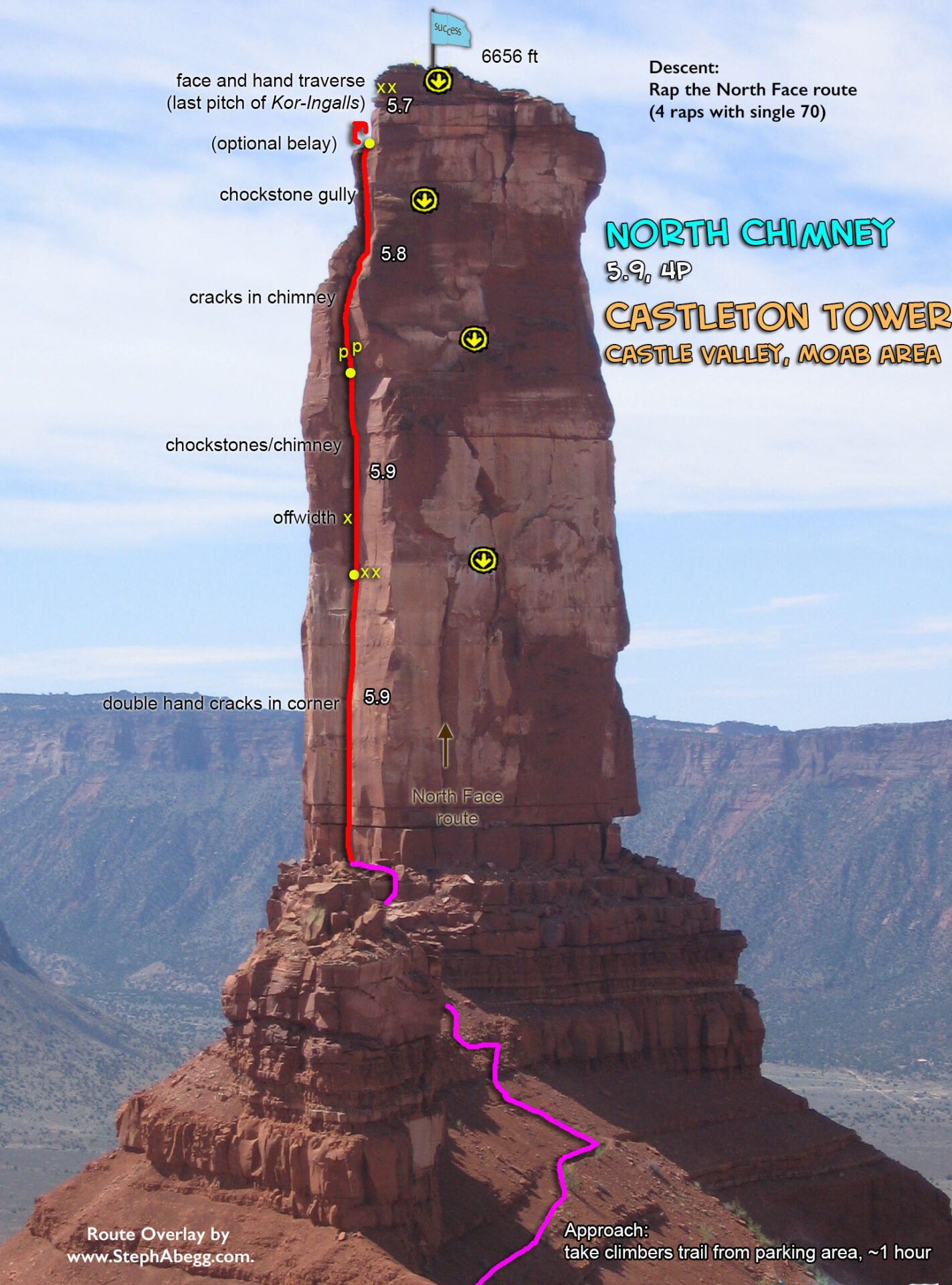
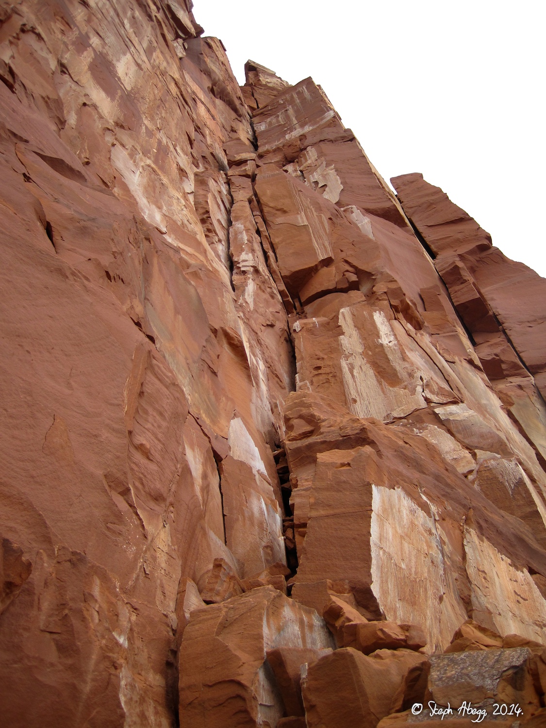
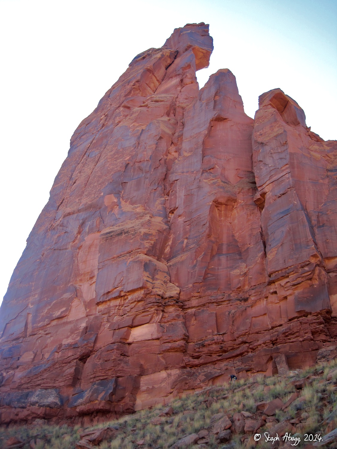
Located just east of Moab, Castle Valley is one of the best known areas for climbing desert towers. Overall, the rock as as good as desert sandstone (Wingate) gets. Most routes start at honest 5.9. The most well-known towers include Castleton Tower, The Rectory, The Priest, and Sister Superior, with Castleton (elev. 6656 ft) being the most famous desert tower in the entire area. Castleton was the first major tower climbed in the area, via the Kor-Ingalls route (5.9), which is one of the Classic Climbs of North America. However, many climbers agree that the North Chimney route on the other side of the tower—also rated 5.9—is a better and more sustained climb. Since I had never been to the area before, Castleton seemed like a good target. Karl had climbed this tower multiple times by multiple routes, but was happy to spend a morning running up the North Chimney.
The Route
The North Chimney route on Castleton is a fantastic climb, and one of the easier ways up Castleton. The first pitch may be the best 5.9 in the desert. This route climbs the obvious chimney on the north side of the tower. It is four pitches, although the final pitches can be combined to make it a three-pitch adventure. To descend rappel (double ropes for at least one rap) the North Face or the Kor-Ingalls. The approach took just under an hour, the climb took us just under two hours, the descent was a quick three rappels, and we were back in town with plenty of time for Karl to cook some gourmet fixings for the hungry tourist crowd of Moab (he mentioned something grilled sea bass with crusted with pistachio nuts topped with pineapple salsa and blueberry peach puree with wild rice pancakes and sauteed asparagus...). Thanks Karl for the fun morning!
Photo descriptions:
a. Castleton Tower from the trailhead. The north side of the tower is the left skyline. The approach from trailhead to base of route took us about 50 minutes.
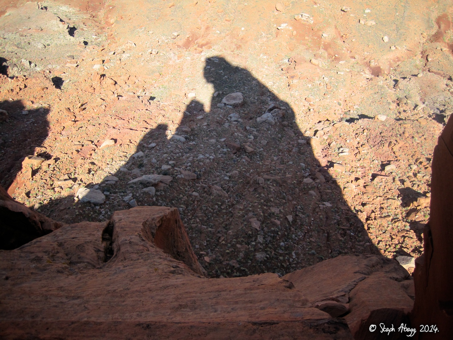
b. Shadow of Castleton on the hills below. The green Castle Valley area is below on the left.
c. Almost there. The morning clouds swirling around the tower were pretty cool.
d. Karl at the base of the route, getting ready for the climb.
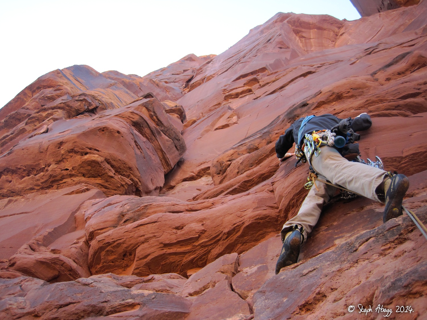
e. Karl leading up the first pitch, twin handcracks, 5.9ish.
f. A photo taken midway through the first pitch. This is reportedly one of the best 5.9 pitches in the area.
g. A potentially loose block near the top of the first pitch. Looked loose but felt solid.
h. Kar leading up the second pitch. He is at the short crux offwidth section, and above this is a chimney. This pitch felt 5.9 to me.
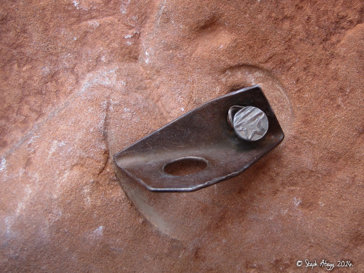
i. A bolt at the offwidth section. The bolt does not generate confidence, but you can protect the move with a #5 cam.
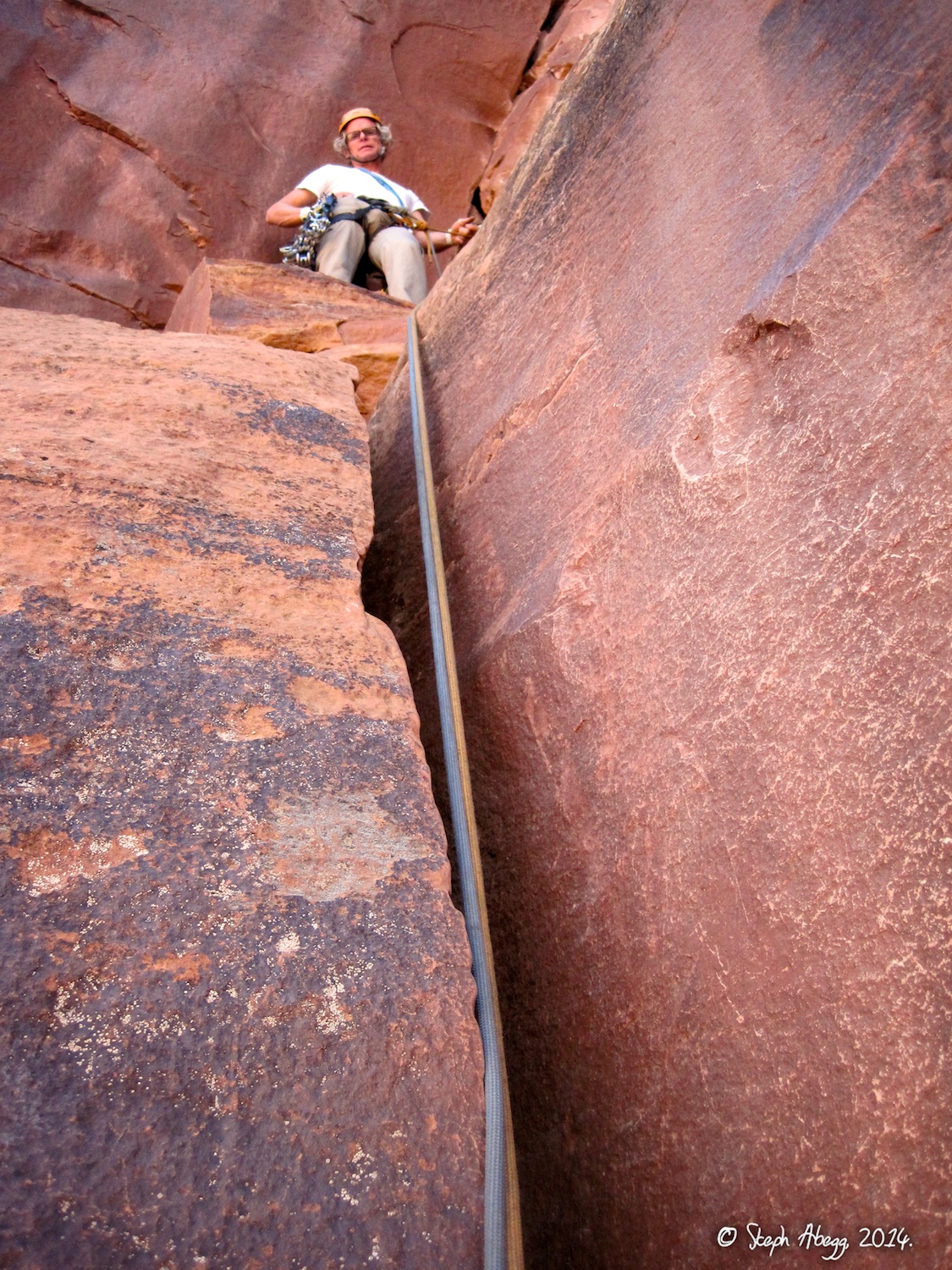
j. An old piton at the belay spot at the top of the second pitch.
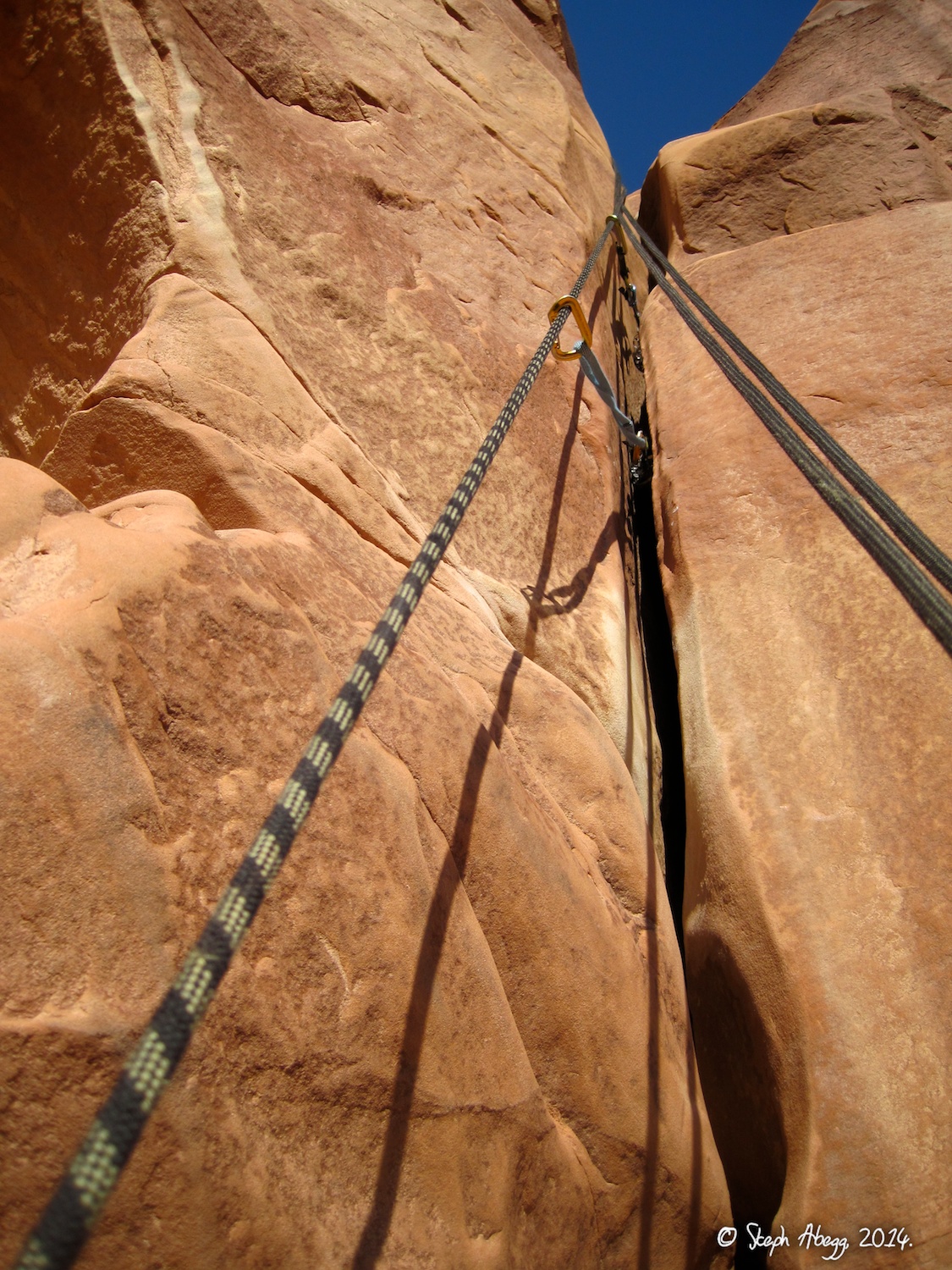
k. The view out of the chimney from the top of the second pitch. This shows the chockstone at the top of the chimney. This panorama was created by stitching together six photos.
l. The large chockstone at the top of the chimney. You climb behind this.
m. The final bit of climbing on the route, which is the same as the final portion of the Kor-Ingalls route. Many people belay where I am standing and make this Pitch 4, but Karl combined it with the previous pitch.
n. Calcite on the final pitch.
o. The summit.
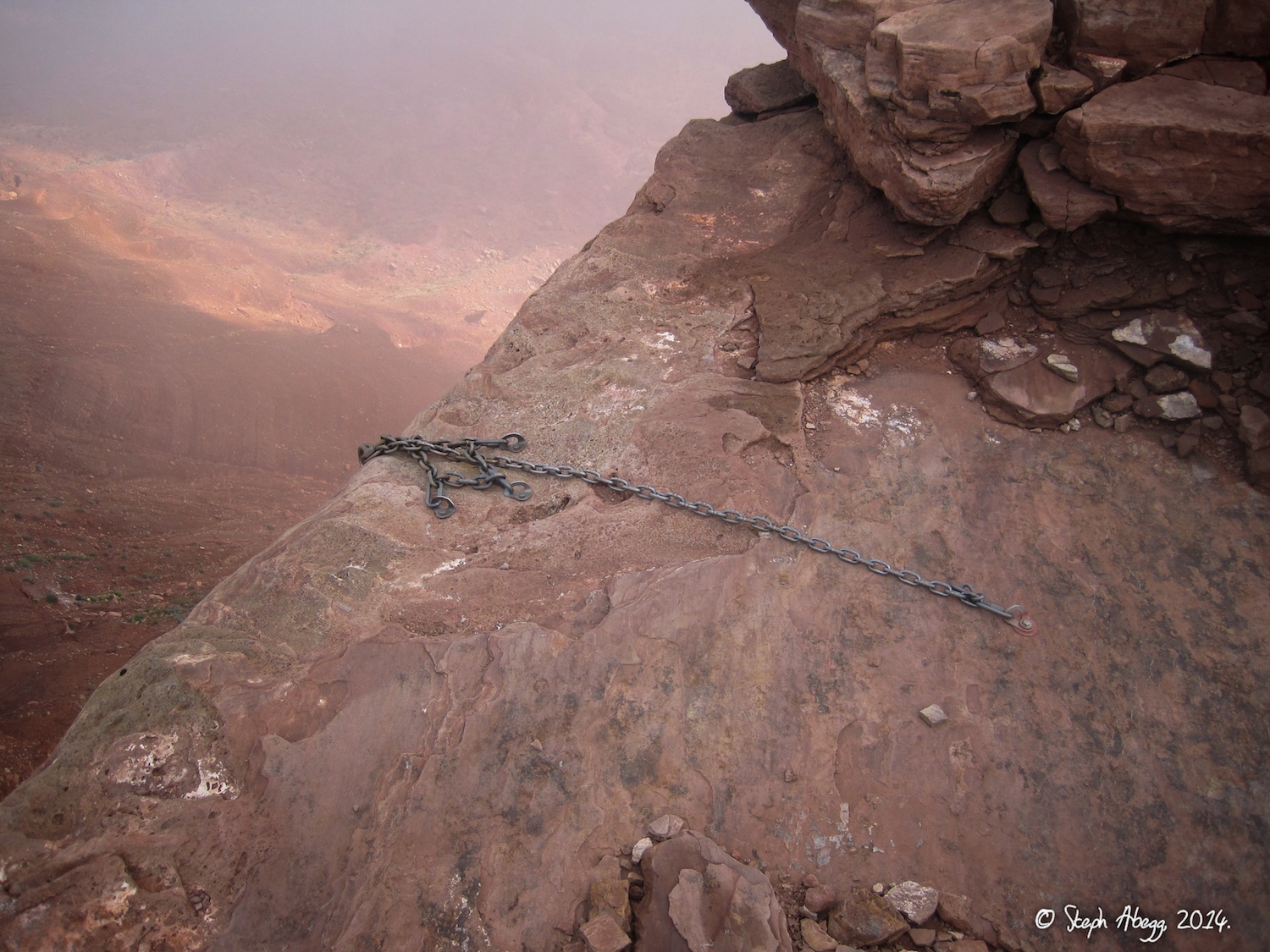
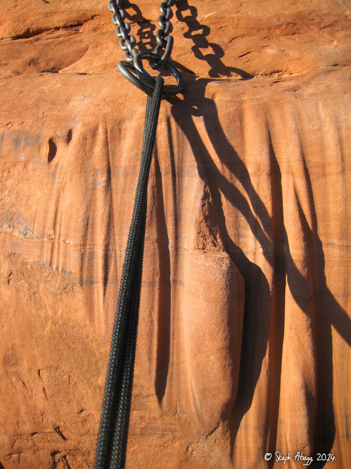
p. There are two main ways to descend: rappel the North Face or rappel the Kor-Ingalls. This photo shows the topmost of the North Face rappel anchors.
q-r. Summit view towards The Convent, Sister Superior, The Priest, The Nuns, and The Rectory.
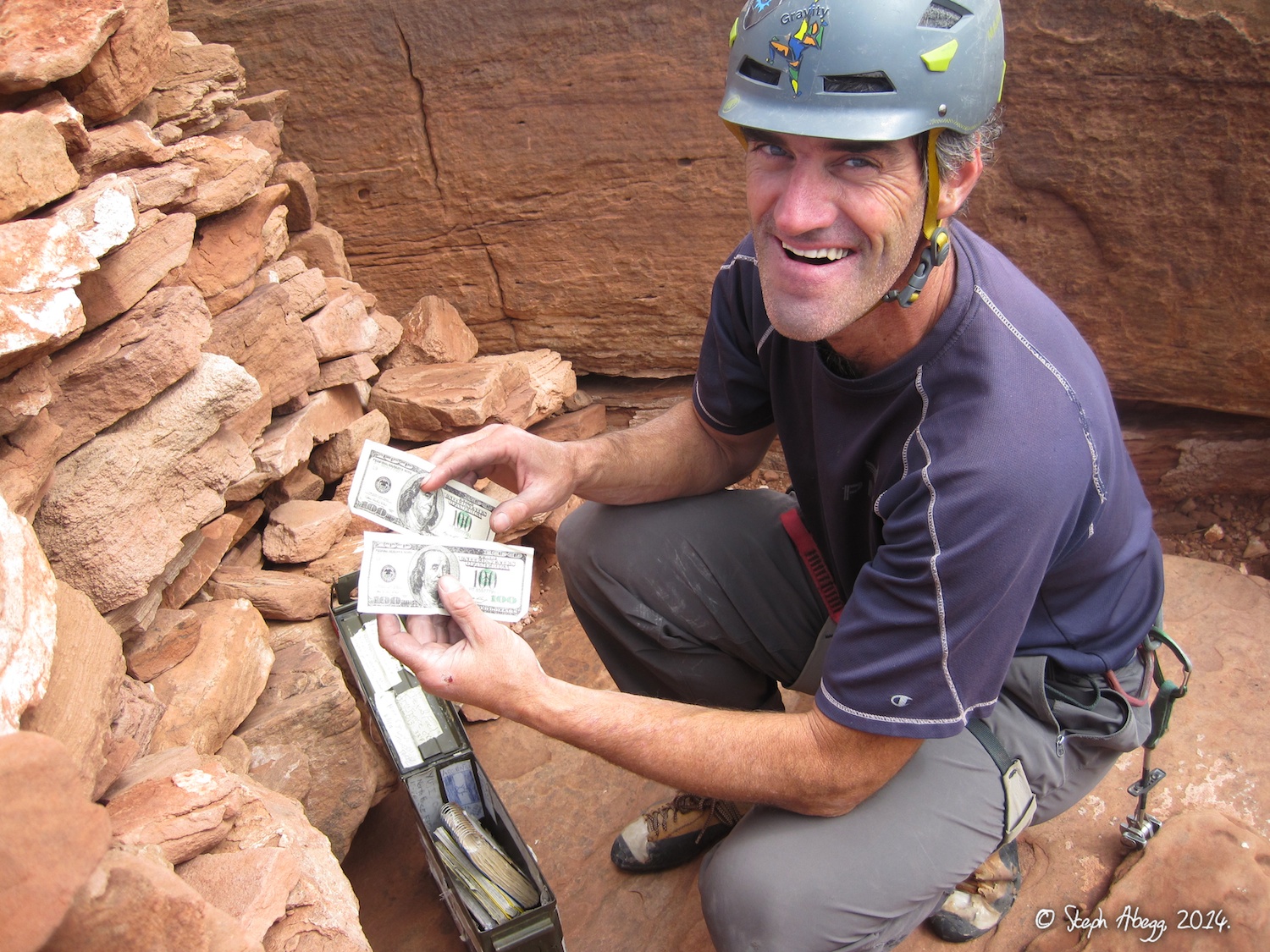
s. Karl found $200 in the summit register. We left it for the next lucky climber.
t. We rappelled the Kor-Ingalls route in three raps. THe first was a double-rope rap while the second and third were single rope raps.
u-v. The beefy rappel anchors.
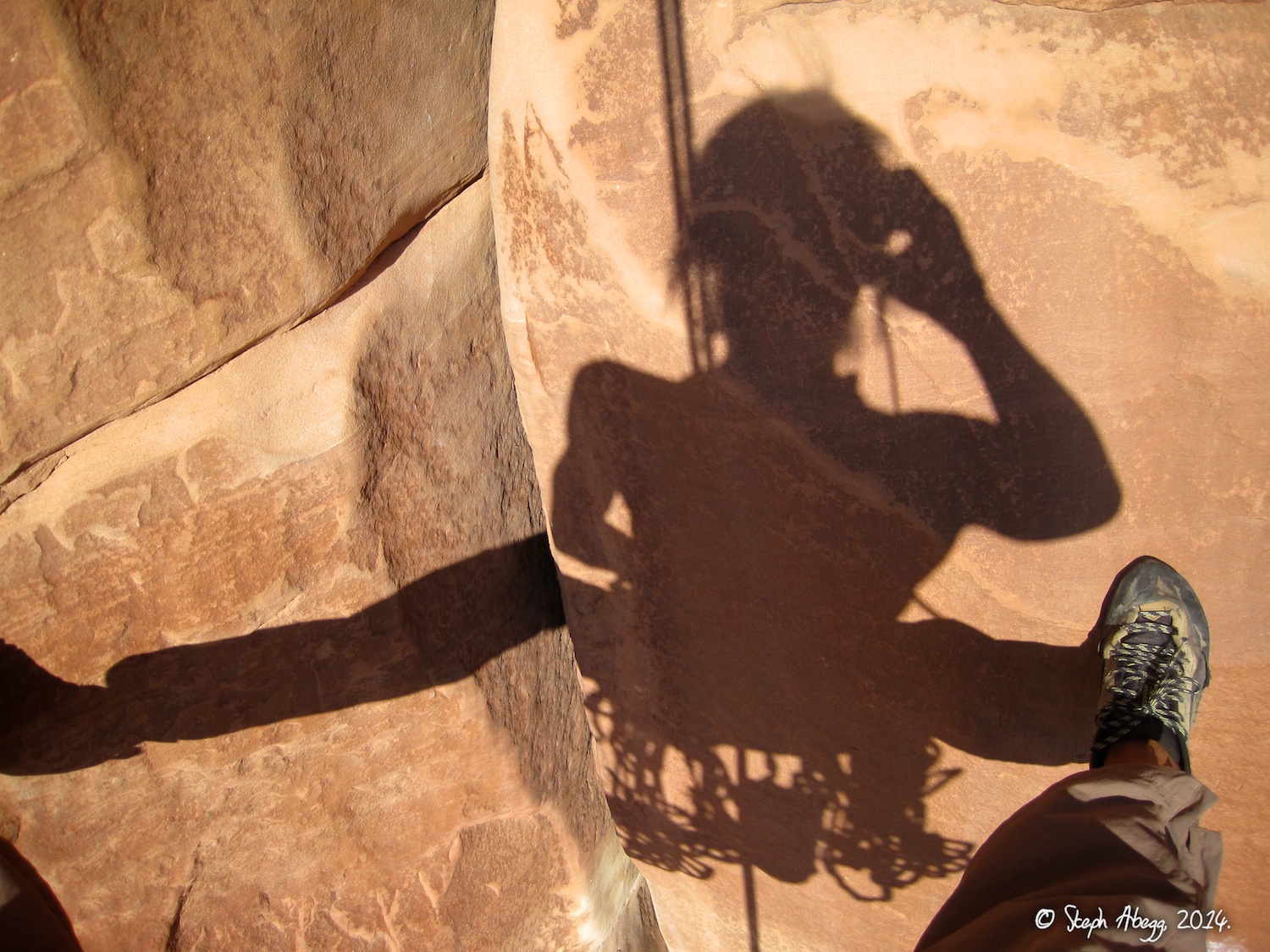
w. Shadow fun on the rappel.
x. Looking up the 2nd and 3rd pitches of the Kor-Ingalls route during the rappel.
y. A view of the Fisher Towers area. Apparently the sandstone is covered with a thick layer of mud, which makes the climbing dirty, loose, difficult, and sometimes very dangerous. There are a few good routes in the Fishers I'd like to check out some day.
z. A final view of Castleton from the parking lot. I'm hooked on desert towers now.
a2. Karl and his guidebook "High On Moab". I got a chance to skim through the guide during the drive, and was impressed with the quality of the photography and the sheer amount of routes and beta in the book. Guidebook junkie that I am (I like to have a guidebook for every place I've climbed), I might have to get one to oogle at over the long dark winter in the Pacific Northwest....
Island in the Sky, Canyonlands NP
Island in the Sky is a 6000’ high mesa in the northern sector of Canyonlands National Park west of the town of Moab. Resting on sheer sandstone cliffs over 1,000 feet above the Green and Colorado Rivers, this mesa is one of the most breath-taking places on Earth. Island in the Sky offers adventure climbing in its purest sense on some of the most impressive towers anywhere in the desert. Unlike the easy access to Castle Valley or the River Road Towers, the classic tower climbs located in Island in the Sky are quite remote, most requiring a 4x4 and a considerable amount of time to reach.
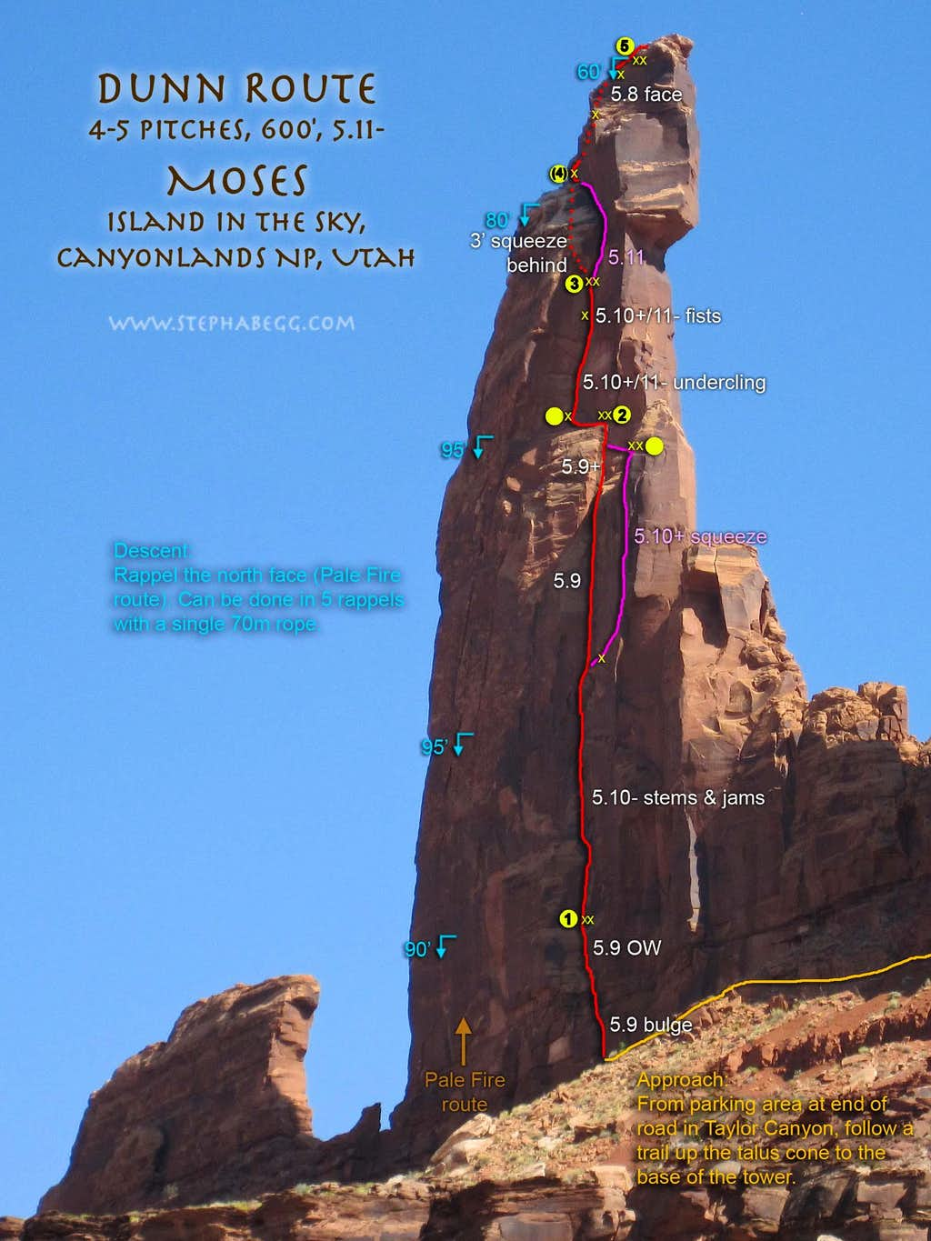
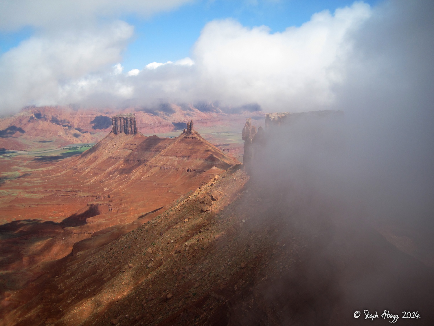
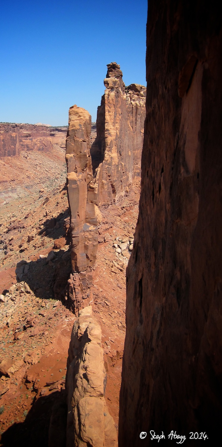
Island in the Sky is home to the most infamous of desert towers, the most notable of which are Moses, Zeus, Washer Woman, Monster Tower, Standing Rock and the Witch. These towers are composed of Wingate Sandstone and offer some fantastic crack climbing. In general, the free routes here are 5.10 or harder. Even cooler is the fact that these towers actually look like their namesakes. We climbed Moses, the tallest of the towers in Canyonlands NP. This towering figure really does resemble an old man wearing a long robe slightly hunched over as he gazes down upon the Thracian Mare (which is a man eating horse in Greek mythology, best I can tell from my wikipedia research) in front of him.
The Route
This route is less known than Primrose Dihedrals on the south side of Moses (I later climbed Primrose Dihedrals in 2024), but nevertheless is a worthy adventure. It is the easiest free route up Moses and consists mostly of 5.9 and 10- climbing with one short but burly crux 5.11- pitch. The route is on the northwest face of Moses, so it is generally shady. The climb follows a weakness straight up Moses' right side, goes left of his chin and onto his shoulder, and reaches the top via the backside of his head. There is a unique tunnel-through a narrow chimney to get onto Moses' shoulder. This is a really unique climb in an utterly spectacular location. Plus the two hour 4WD approach over rocky road and washes was really quite fun in Dow's Toyota FJ Cruiser. What a memorable day!
Note on the descent: The descent can be done with 5 single-rope rappels down the north face (Pale Face route). (As of 2014, most beta for Moses made it seem as if double ropes were needed for the descent. However, we discovered that a single 70m rope will get you down with five rappels off bolted stations. A 60m rope would also work, but a couple of the rappels were around 95', and involved a slight traverse to clip an anchor on a vertical wall, which would feel pretty dicy with only 5' of tail.)
Note on large gear for the crux pitch: We found that three #3 and three #4 was a comfortable amount of large gear for the crux pitch on this route. A #5 might be handy for the OW on the first pitch, but this is the only place it is really needed, so we opted to not bring a #5 and run this 15-ft OW section out.
Photo descriptions:
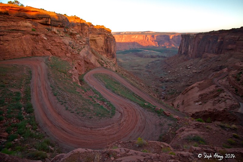
a. Getting to Moses entails about 3 hours of driving from Moab. About 2 hours of this is dirt road, much of which is quite rough. Here's a photo looking down at where the road descends about 2000' to the bottom of the canyon. This snaking switchbacking road is quite amazing. I definitely wouldn't drive it when wet! (Click here to go to Dow's detailed description of the approach to Moses on summitpost.org.)
b. This photo was taken as we drove along the Green River. This section was 2WD but there was some standing water from the recent storms that would have been difficult with a low-clearance vehicle.
c. A photo of the canyon floor along the Green River, just before the Taylor Canyon turnoff.
d. At the Taylor Canyon turnoff. The Taylor Canyon road is much more primitive and (as of Sept 2014) required a 4x4 type of vehicle as it meanders along several washes for approximately five miles up canyon to the base of Moses where it dead ends.
e. Dow's Toyota FJ Cruiser was up for the challenge.
f. Moses and his neighbors (from left to right: Aphrodite, Zeus, Unnamed (?), Moses, Thracian Mare) silhouetted against the morning sun.
g. To get to the base of the route from the parking lot at the end of the road in Taylor Canyon, follow a 1 mile trail up the talus cone to the base. About 20-30 minutes.
h. Looking up the NW side of Moses. The Dunn route goes up the weakness in the center of the photo and onto Moses' shoulder and up the backside of his head to the top.
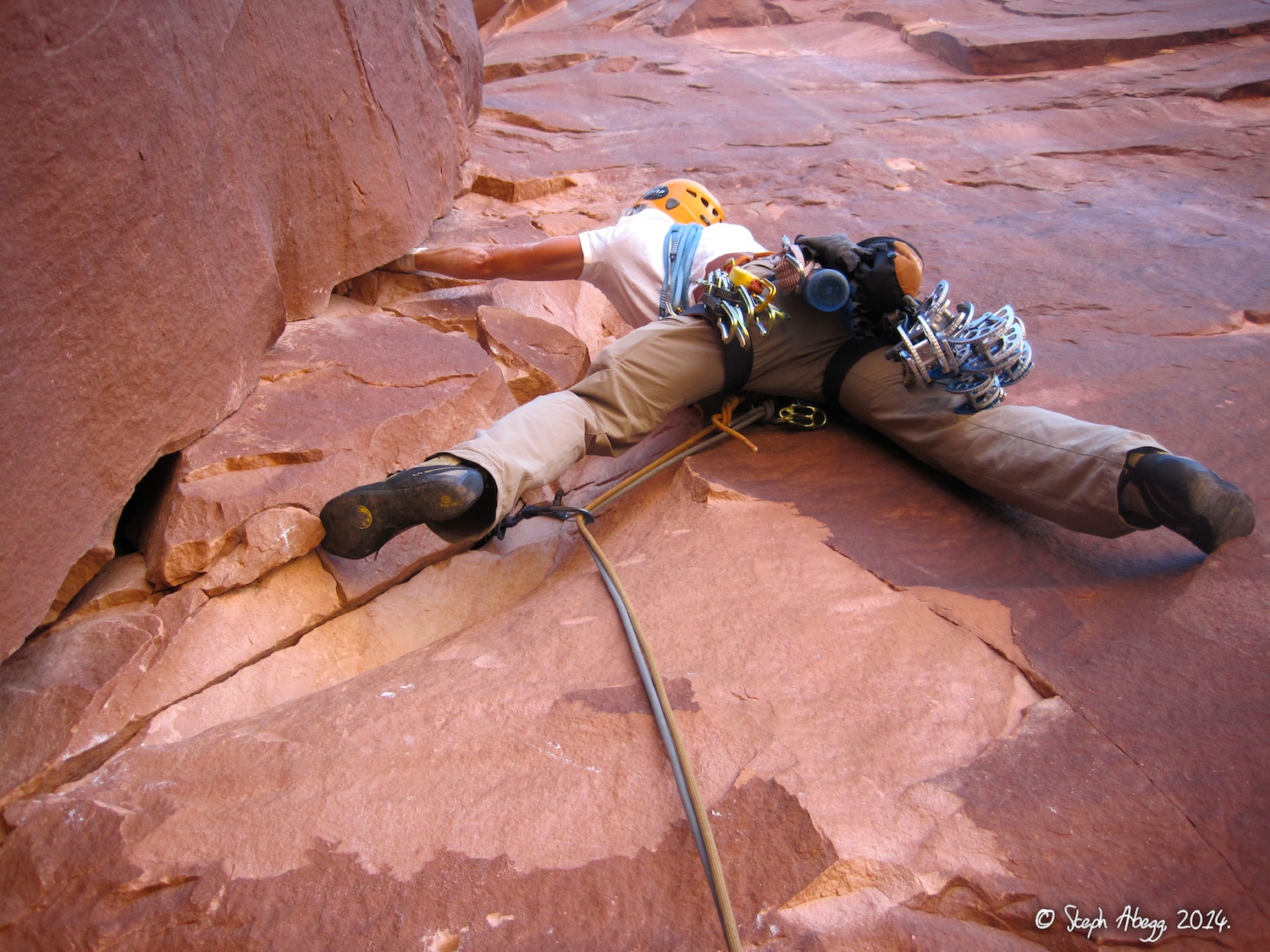
i. Dow starting off Pitch 1. This pitch starts with a cruxy bouldery move (below Dow out of view) and then continues into a 5.9 offwidth.
j. Looking up the final stretch of Pitch 1. While the offwidth of the lower pitch is protectable with a #4 cam, this section requires a #5 cam for protection. Since this 15-ft stretch is the only section of the route where a #5 is needed, we opted to leave the #5 in the car, so master-of-the-offwidth Dow ran out the final portion of the pitch.
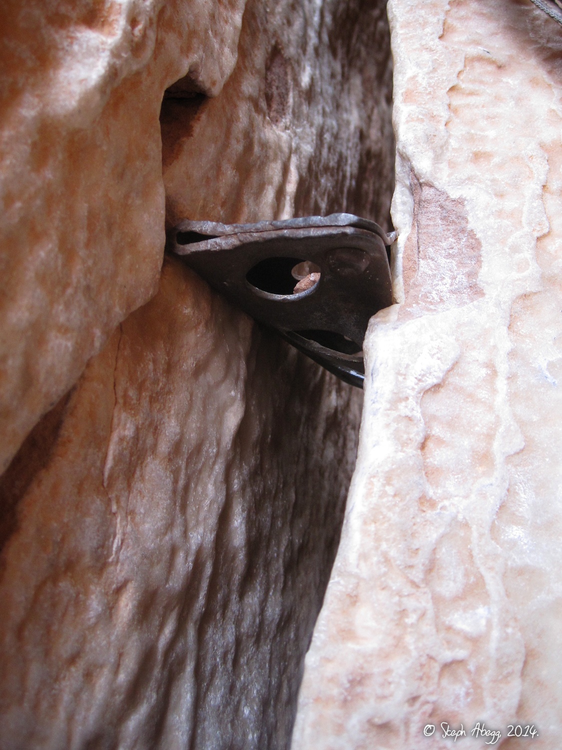
k. Drilled pitons at the belay at the top of Pitch 1. This is the typical style of many anchors on the route, although there are some more modern bolts as well.
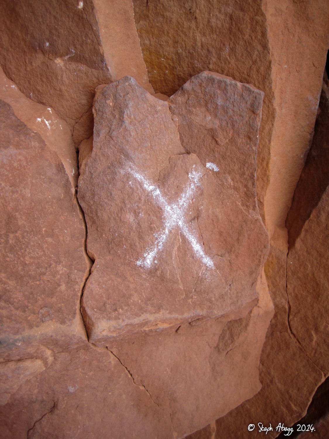
l. Dow leading off Pitch 2. This pitch goes up cracks and broken 5.9ish terrain. Supposedly there is a 5.9 R section but we did not experience it even though we followed the most obvious way up. This pitch would be great if the rock quality were better. In fact, a few seconds after I took this photo, the block Dow's left foot is on blew. It did have a chalked "x" on it....
m. Looking up the second half of Pitch 2. This section was pretty good. 5.9ish.
n. Shadow of Moses far below.
o. Looking up Pitch 3, the crux pitch of the route. This involves a 10+/11- undercling (just right of center of photo) and a 5.10+/11- burly backward leaning fist crack above the undercling. The undercling was pretty sandy and nearly impossible to grip, so we ended up aiding through this move on a #4. This was definitely a burly pitch, but rather short (25 m or so). For a comfortable lead of this pitch, we decided that three #3 and three #4 cams were a good amount of wide gear.
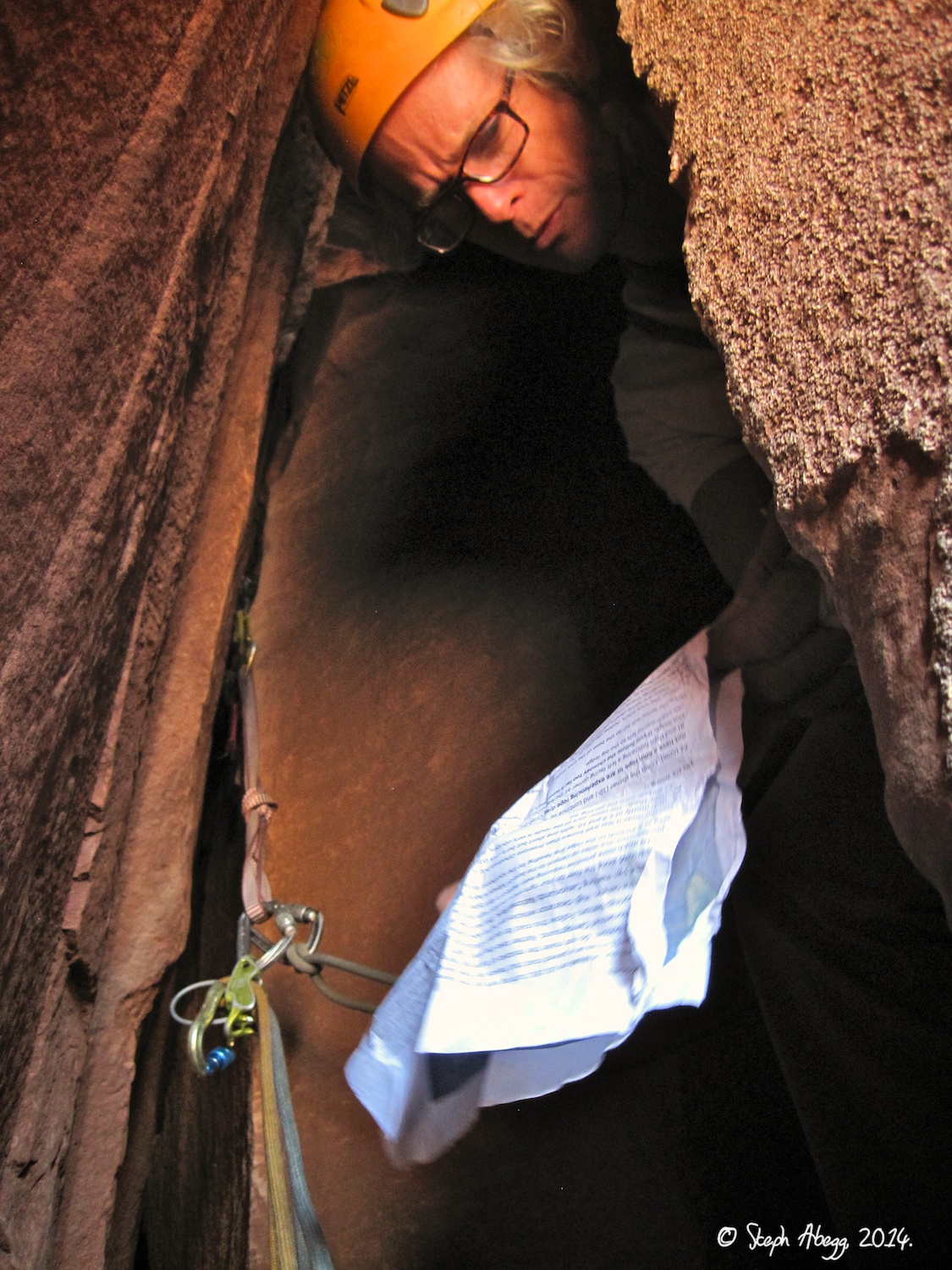
p. The third pitch tops out at a cave that is not visible from below. Here is Dow in the cave reading our route beta.
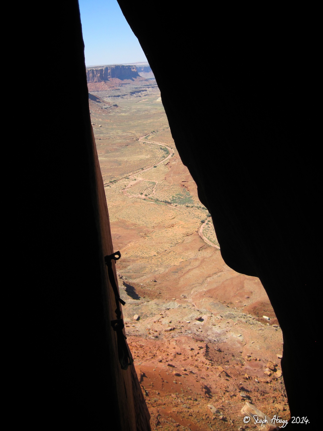
q. The view out from the cave at the top of Pitch 3.
r. Pitch 4 climbs up from the cave into a narrow (3-ft or so) squeeze. This becomes a chimney/handcrack alley that breaks out on Moses' shoulder. It's like you are climbing inside Moses' cloak. It's a unique pitch.
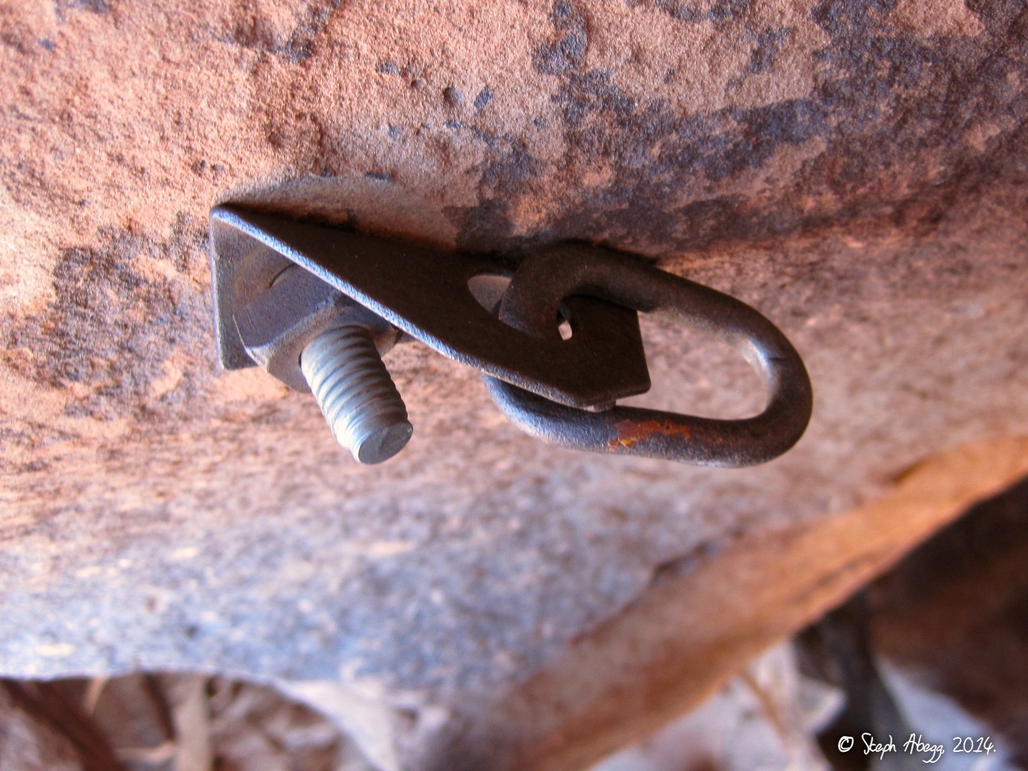
s. A bolt where Pitch 4 breaks out onto Moses' shoulder.
t. Dow on top! Pitch 5 is below him. Pitch 5 is a short pitch up the back of Moses' head, involving 5.8 face climbing protected by two bolts. Dow combined Pitch 5 with Pitch 4, which is possible to do but does create quite a bit of rope drag for the leader.
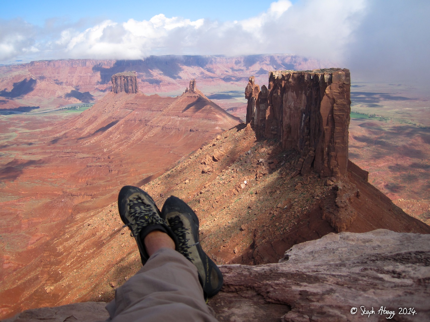
u. Relaxing on top. What a view!
v. Shadow fun on top.
w. Looking down on Zeus (front) and Aphrodite (back) from the top of Moses.
x. Looking down from the rappel anchor at the summit to Dow at the top of the second rappel. The rappel from the summit is short (~60'). The rappel route goes down the north face (Pale Fire route).
y. Grooves in the soft sandstone below the second rappel station.
z. The fifth rappel station. This one was installed after Dow climbed Moses via Primrose Dihedrals in 2009, when double ropes had been necessary for descent. Because of this rappel station, it is possible to descend with a single 70m rope in 5 rappels. a2. A view of Zeus from the descent down the north face. There's a good route called Sisyphus (5.11 R) that goes up the obvious dihedral on the left side of the south face.
b2. Unnamed (?) tower just north of Moses.
c2. From left to right: Aphrodite, Zeus, Unnamed (?), Moses, Thracian Mare.
d2. A parting shot of the towers from the dirty FJ. By the time we got back to Moab a few hours later, Dow's FJ fit right in with all the other red-crusted vehicles driving around town.
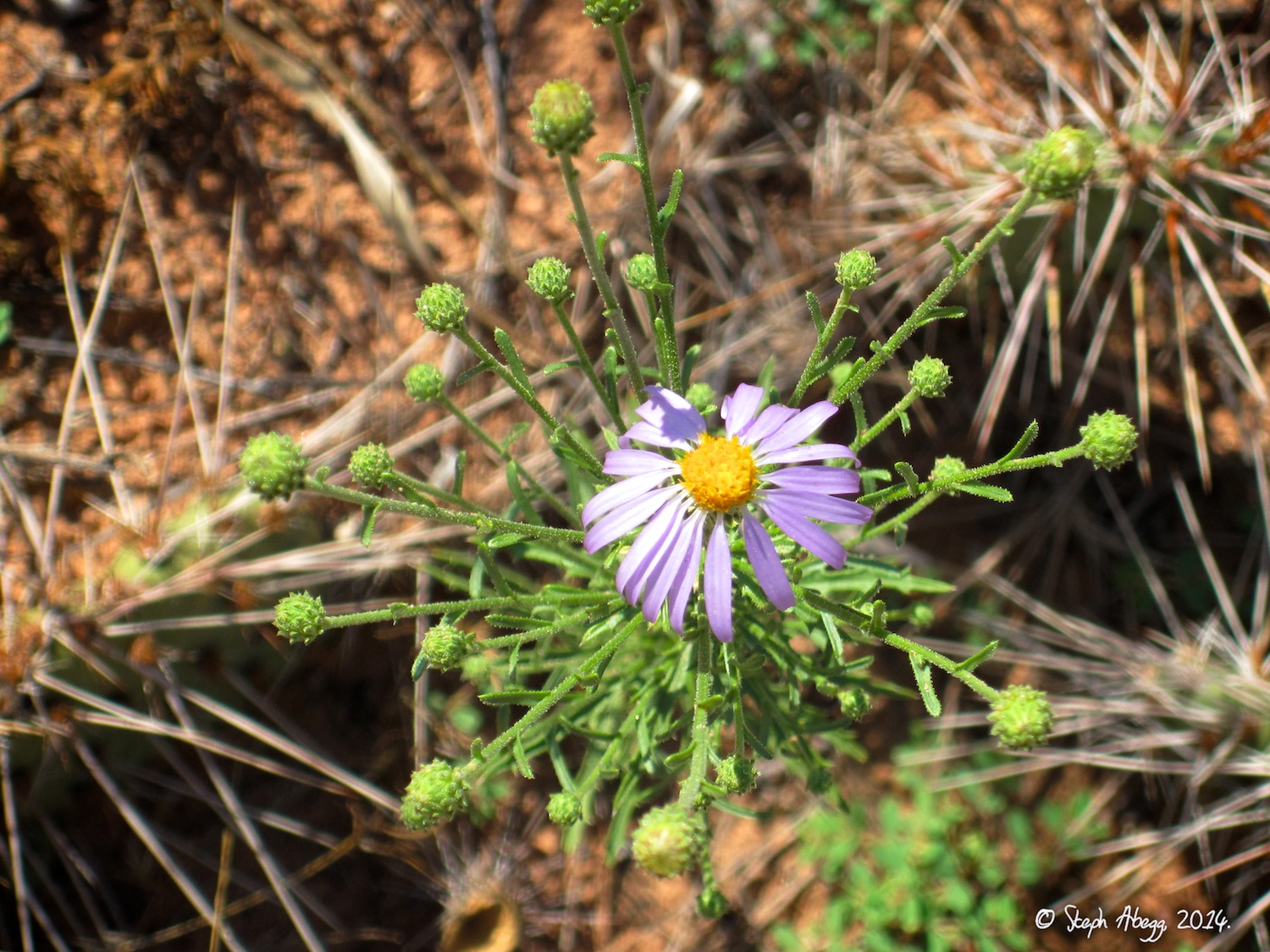
e2. A pretty flower. Looks like a daisy of some sort.
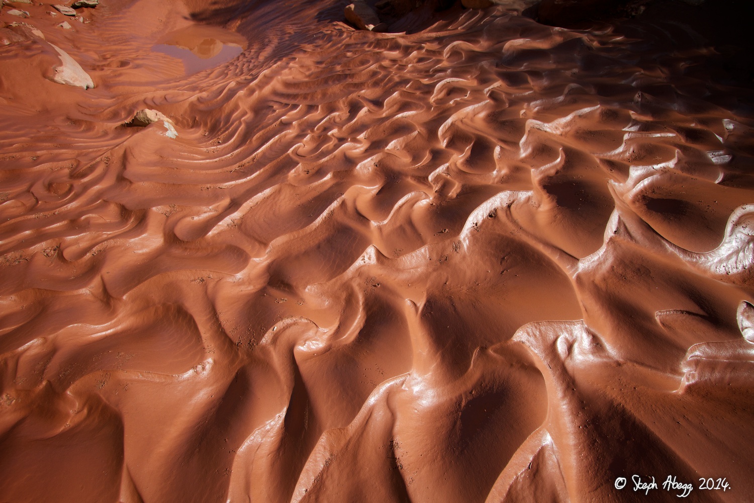
f2. Cool mud waves in the wash. Looks like chocolate mousse.
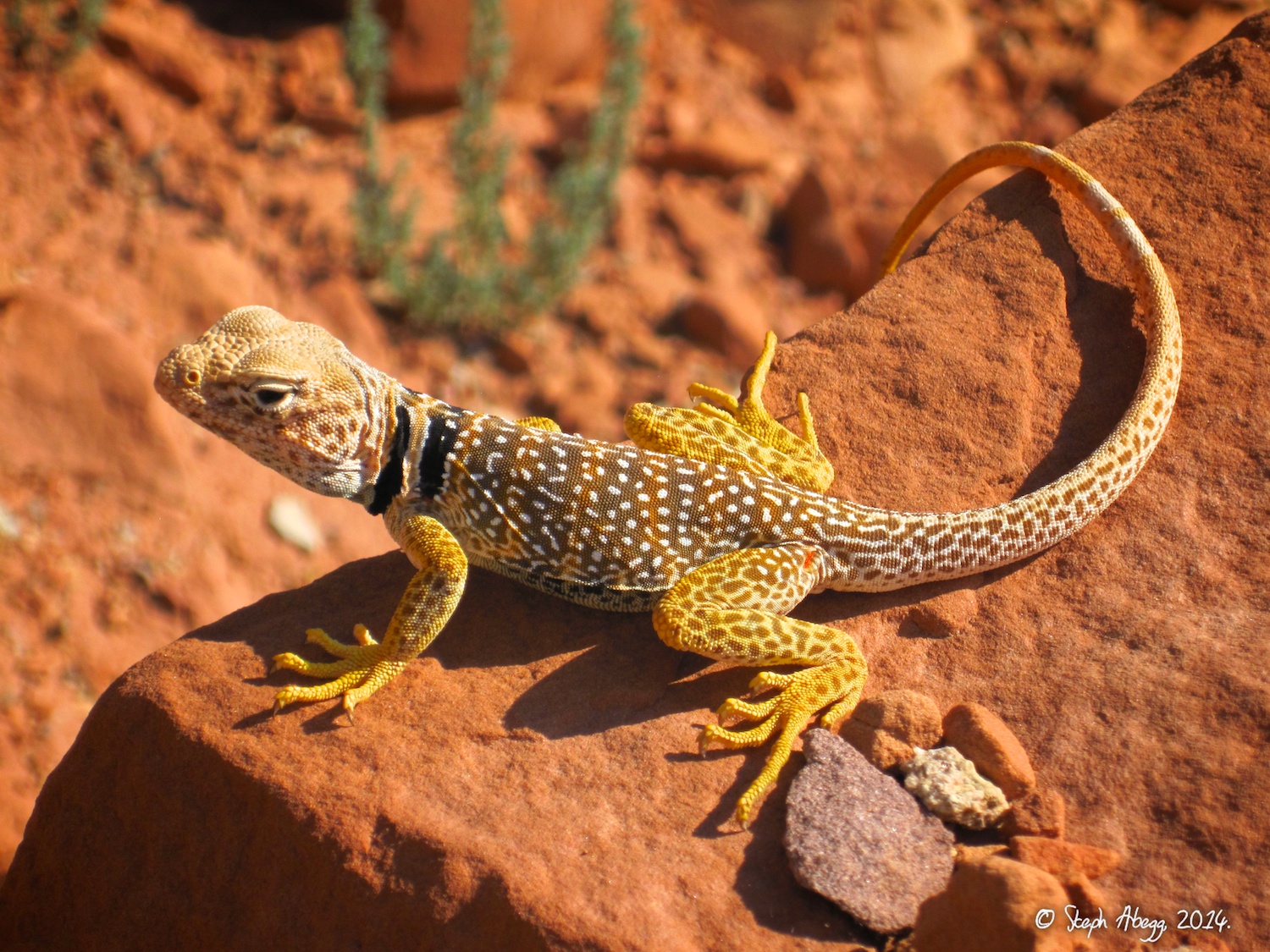
g2. I spotted this Collard Lizard sunning himself on a boulder as we drove by. I was surprised at how close he let me get before he took off.
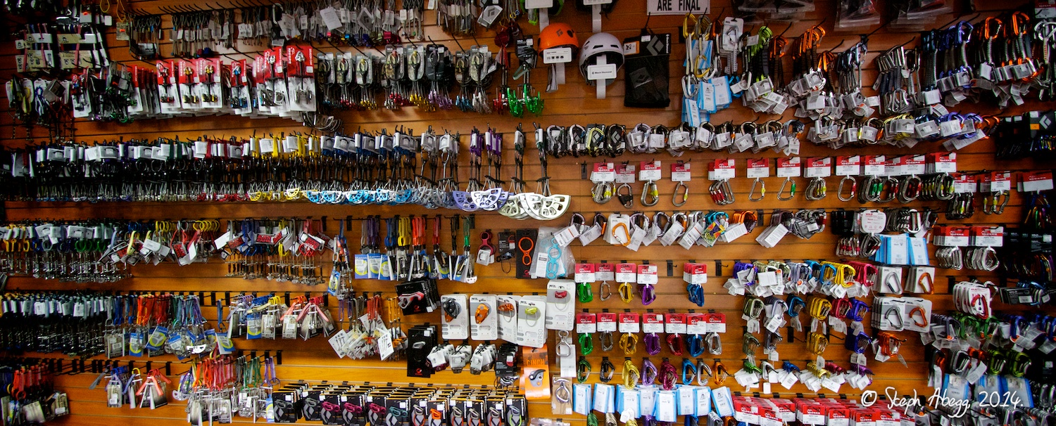
h2. We stopped by GearHeads in Moab after the climb, to drool over their near-legendary cam selection. I'm sure the fact that Indian Creek is just an hour down the road has something to do with the sheer number of each cam they have on display.
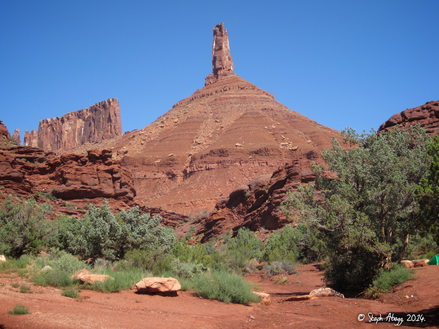
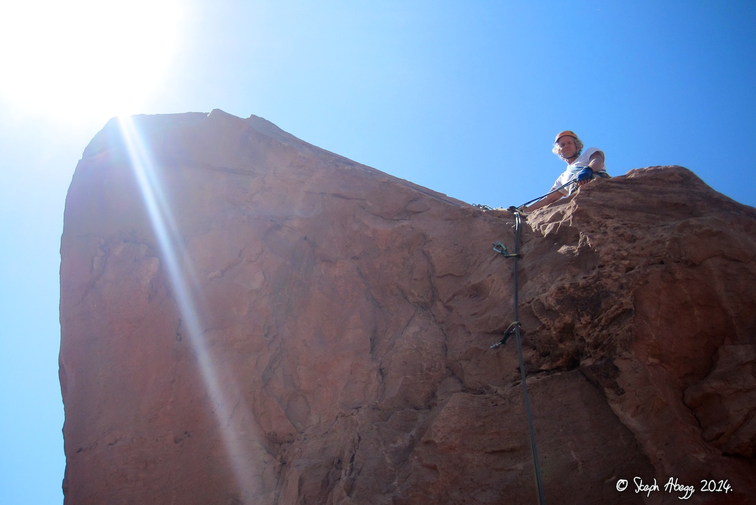
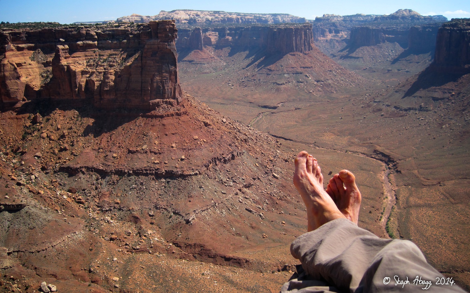
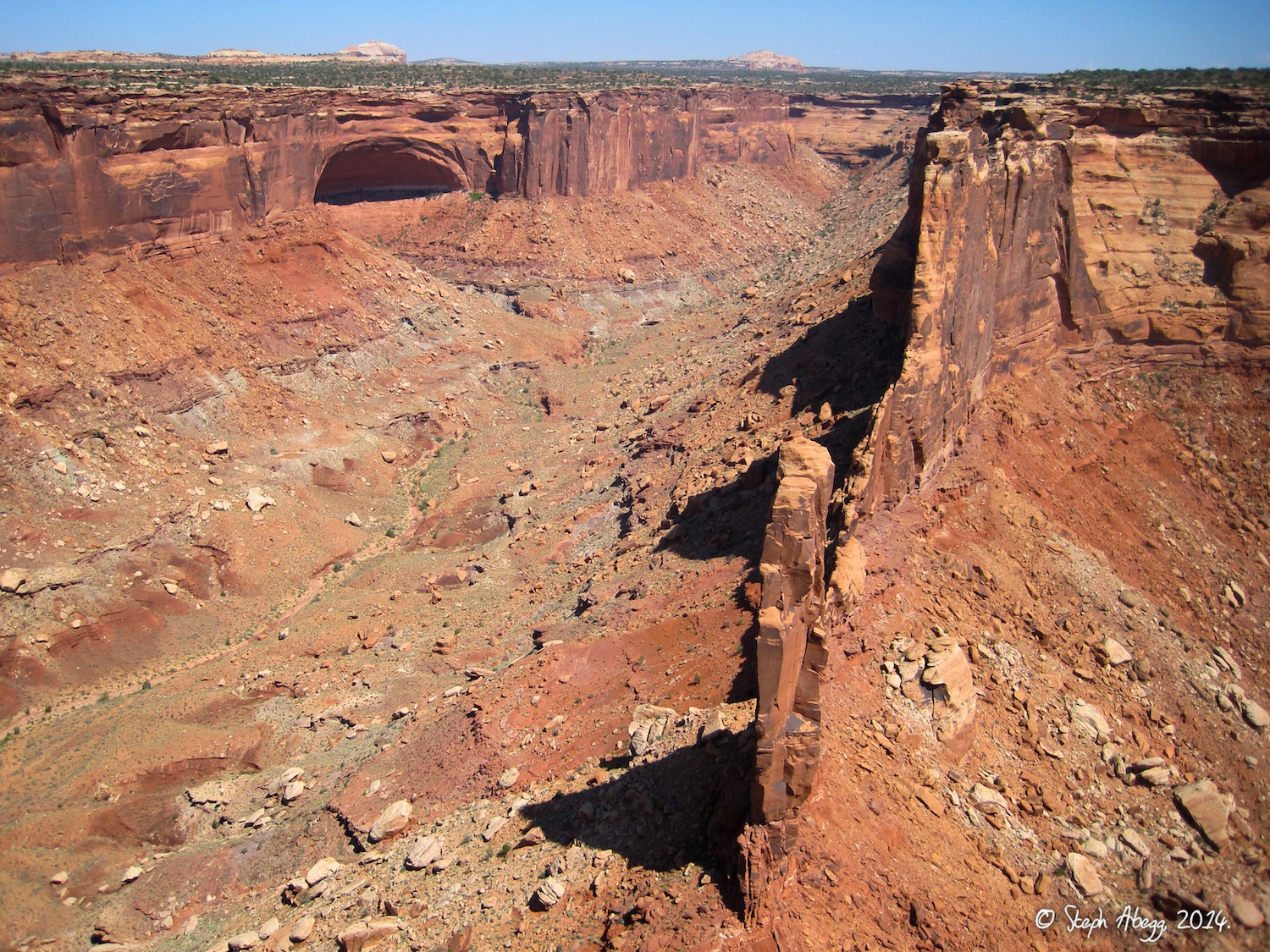
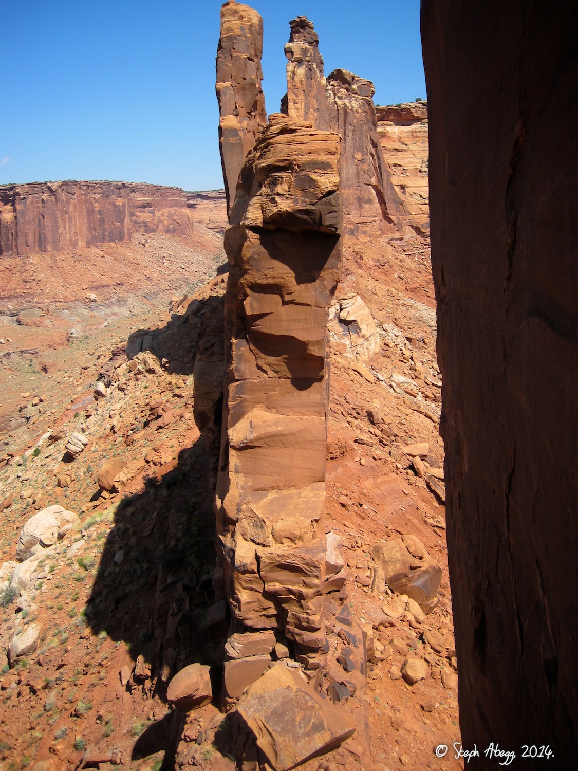
Top of the World
Top of the World is a 7000-ft viewpoint on the cliff edge of the Warning Mesa above Fisher Valley and Onion Creek, just east of the Fisher Towers area east of Moab. This is one of the most dramatic overlooks in the Moab area. On a clear day you can look out over the valley to Fisher Towers, the La Sal Mountains, the Priest and Nuns rock formations in Castle Valley, Arches National Park, and western Colorado. Getting here is one tough 4wd climb through slickrock, rock shelves, slickrock steps, and rocks.
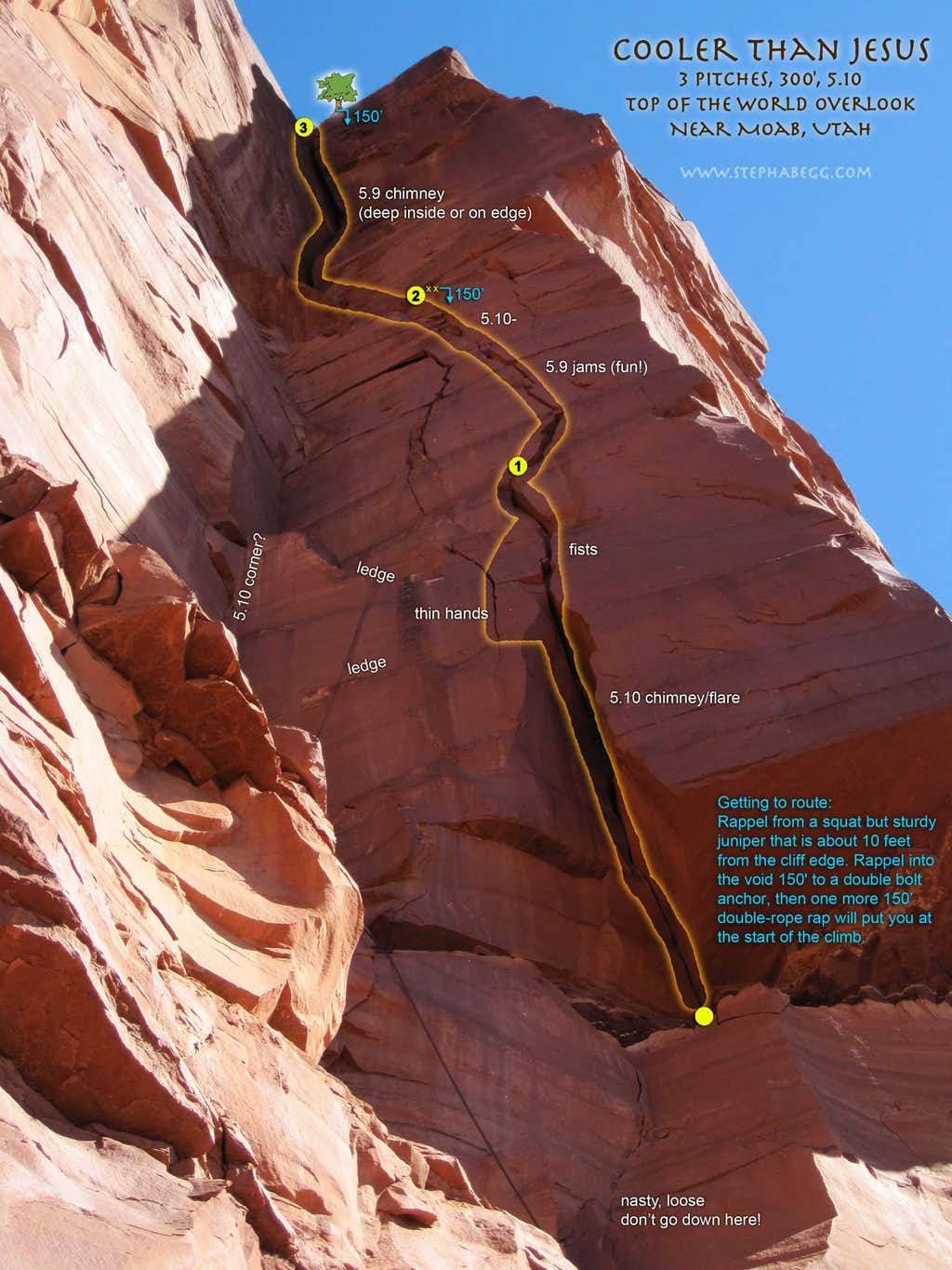
The Overlook is more of an off-roading and hiking destination, but there is one climb out here, accessed by rappelling off of the edge of the Overlook and climbing back up. Called Cooler than Jesus, this climb sounded like a cool adventure. And Dow and I enjoy a good adventure climb.
The Route
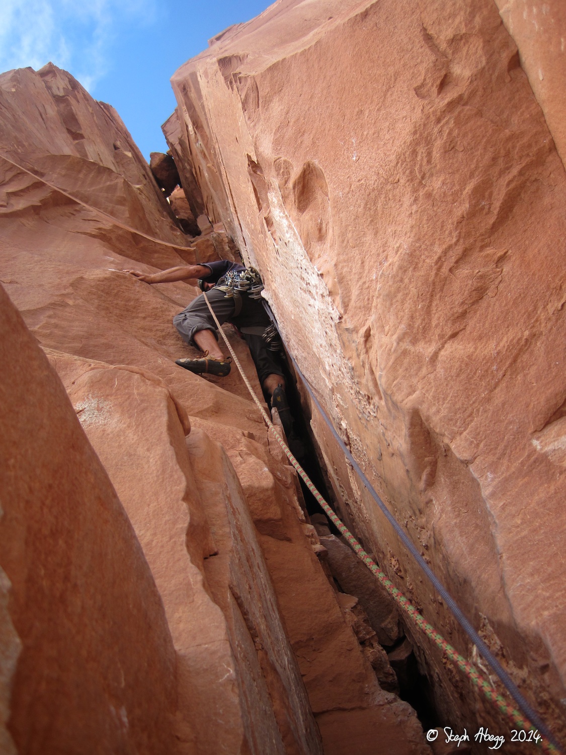
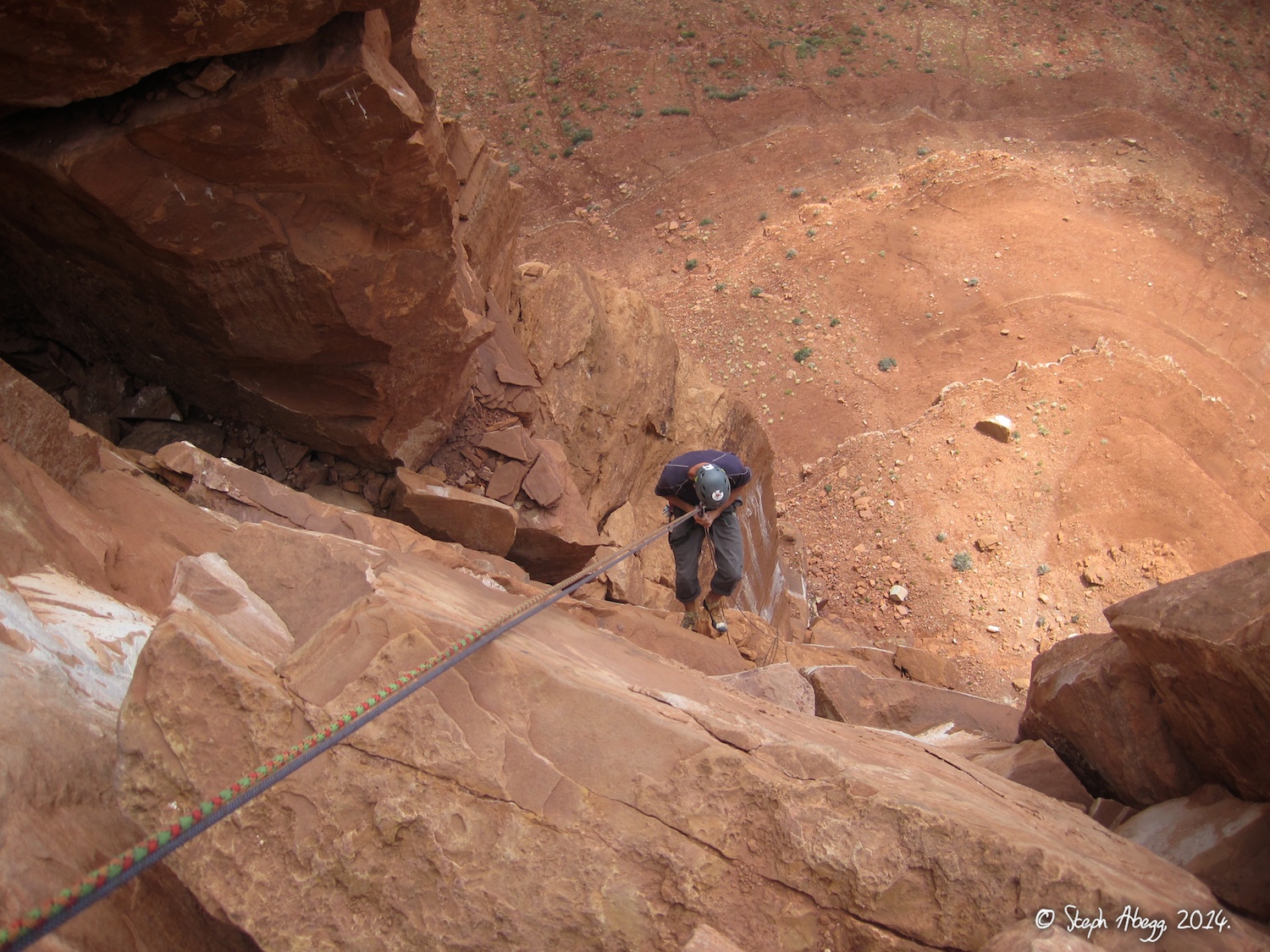
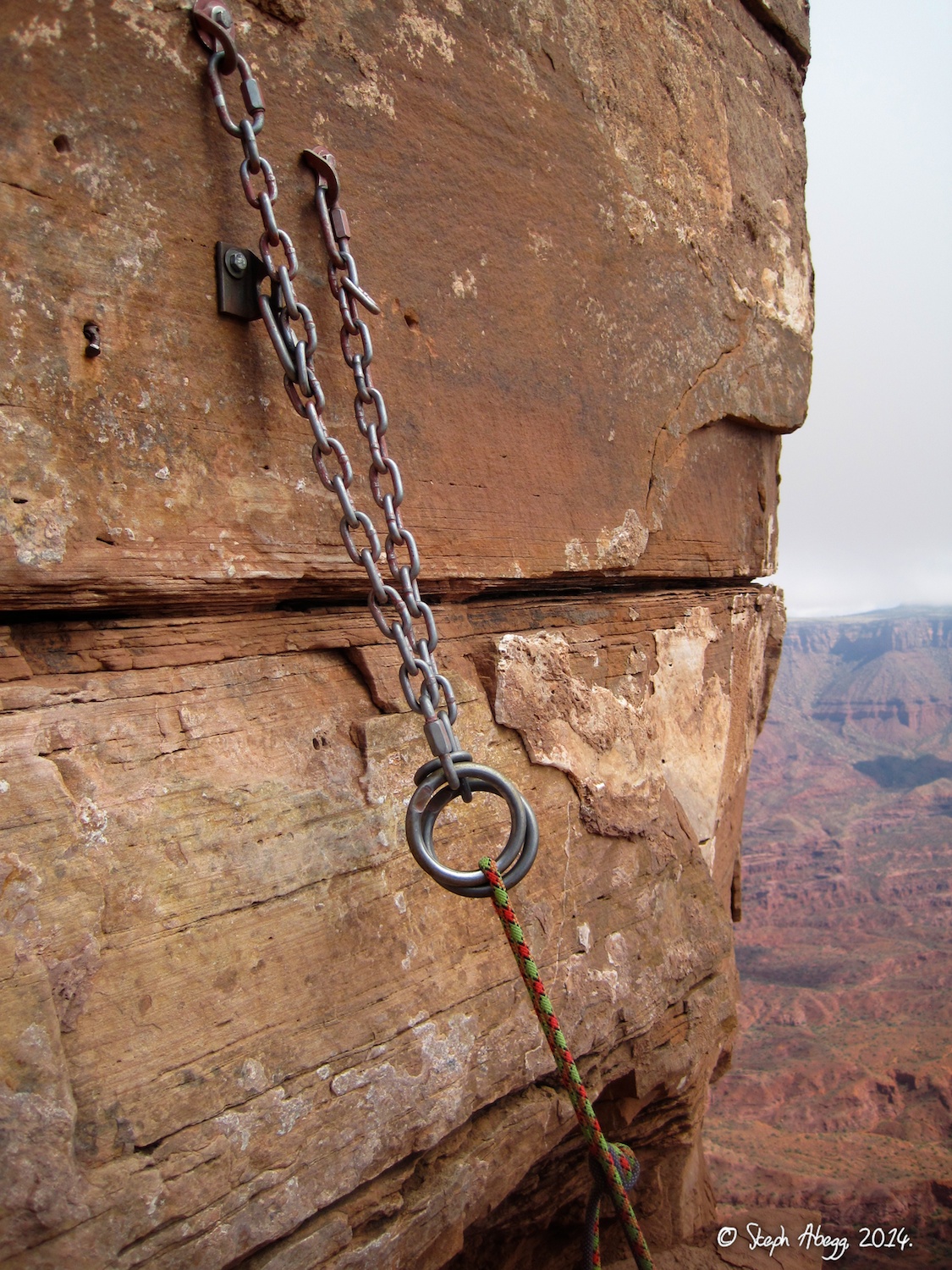
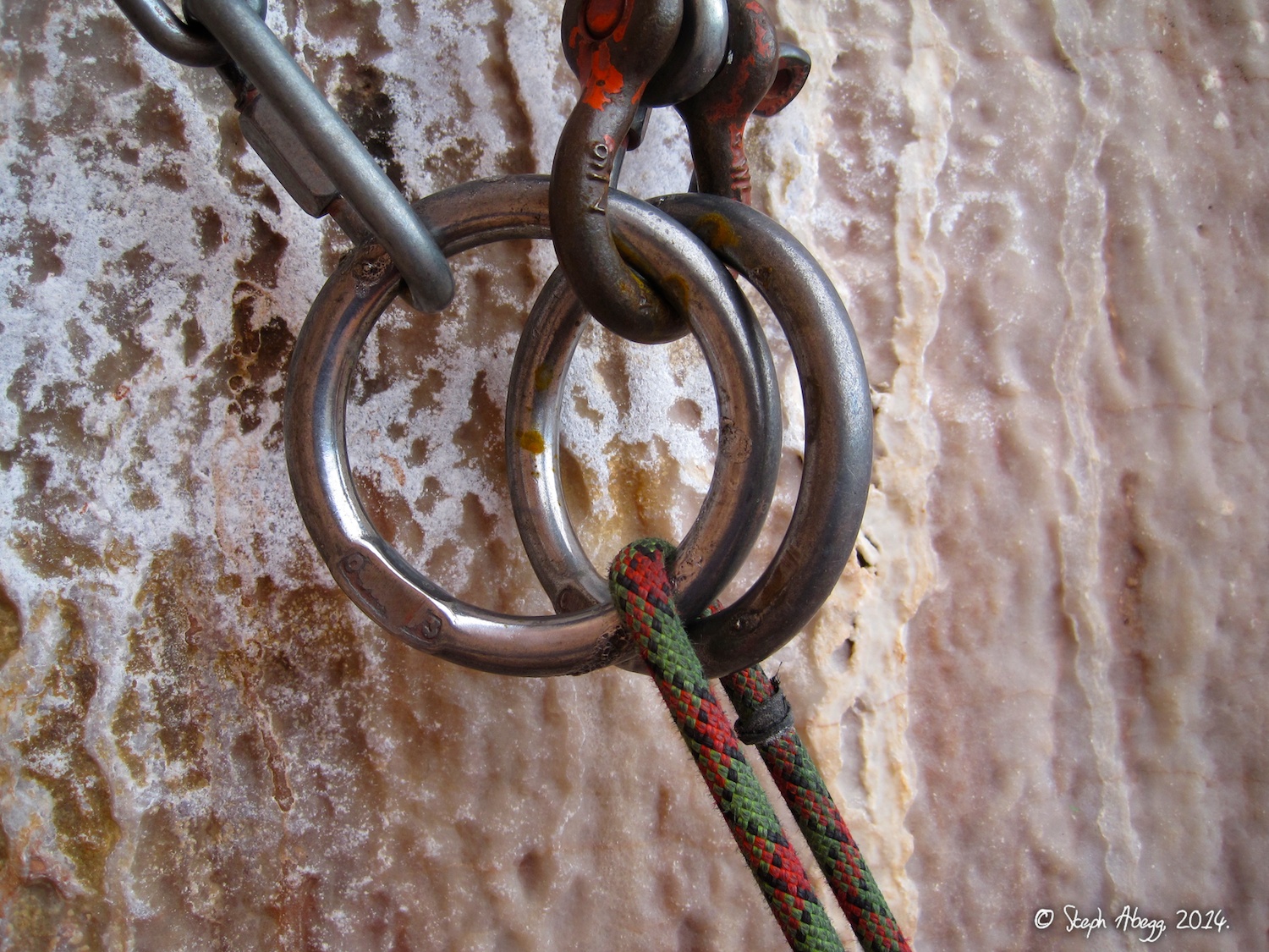
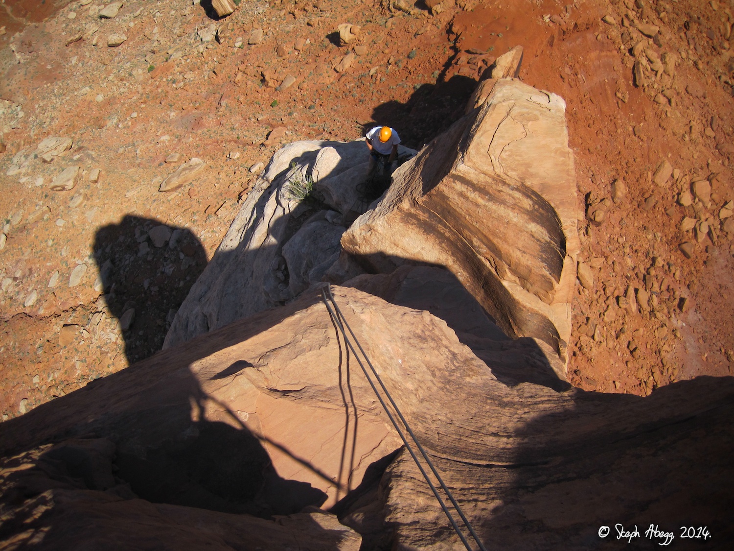
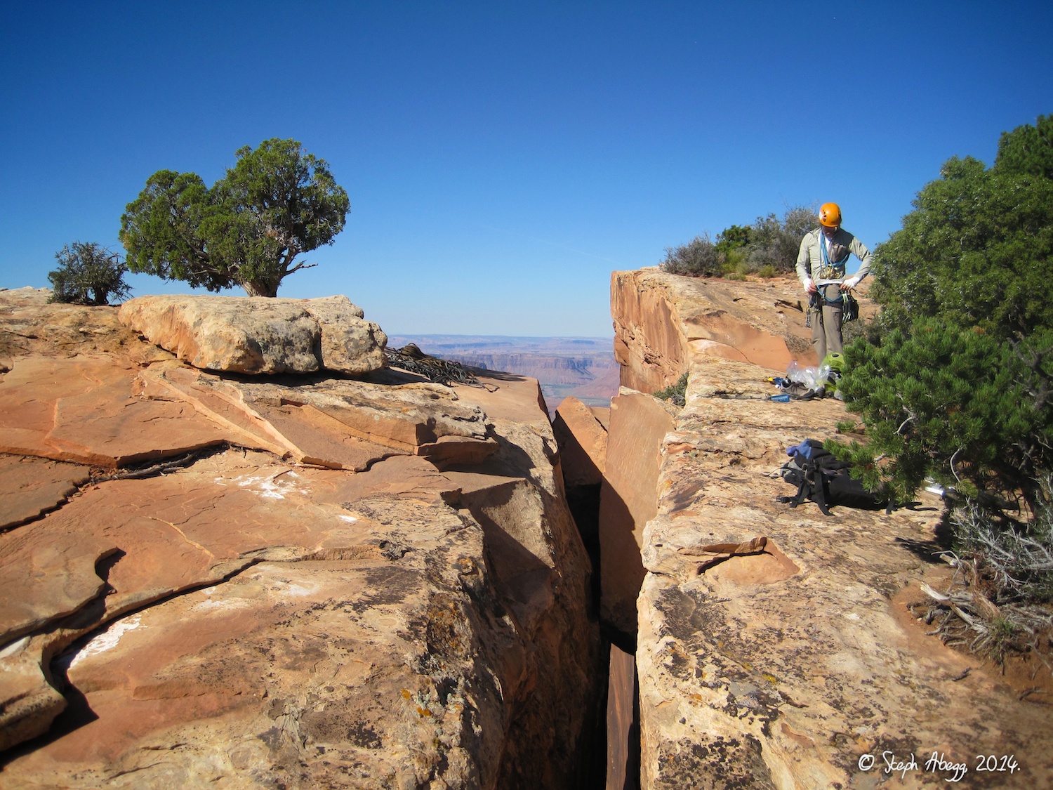
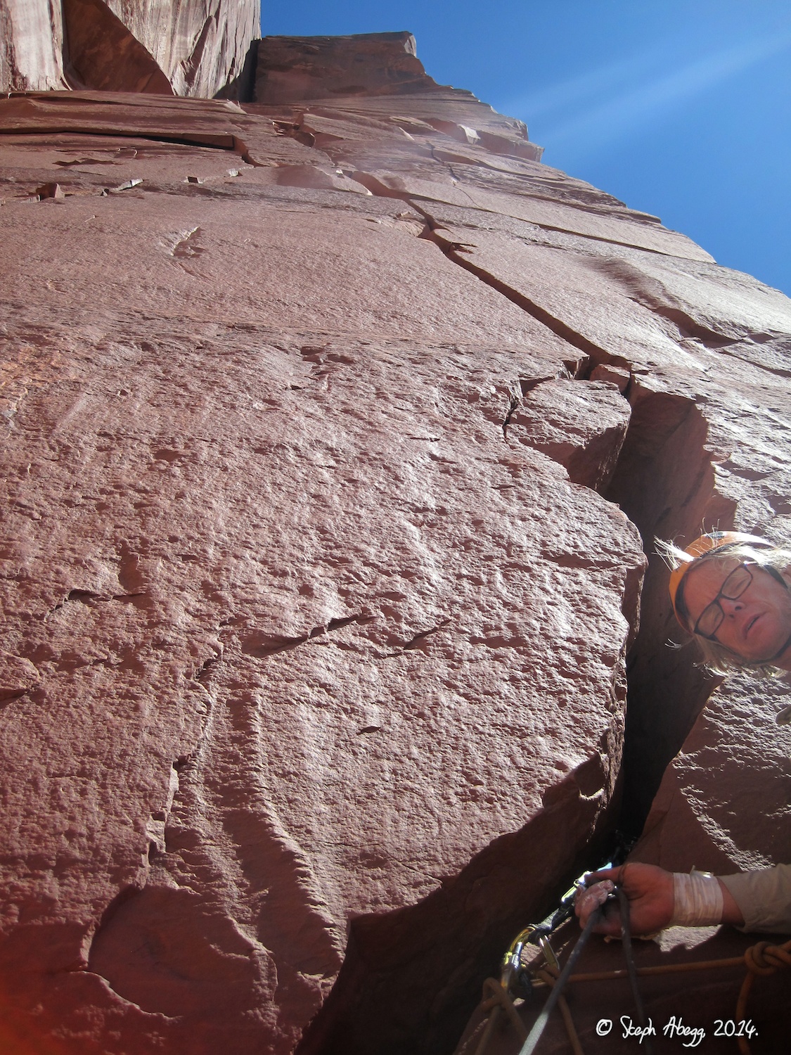
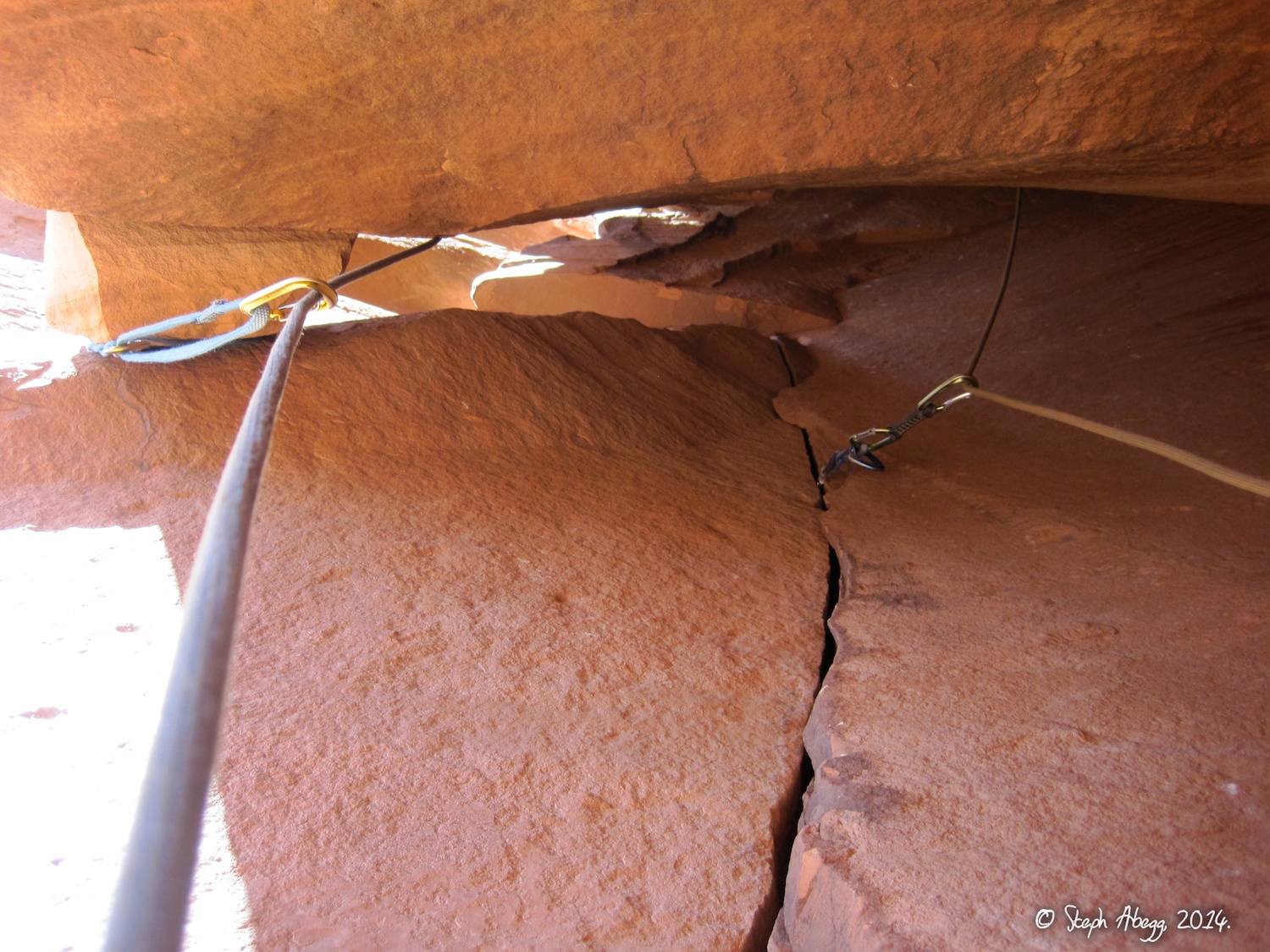
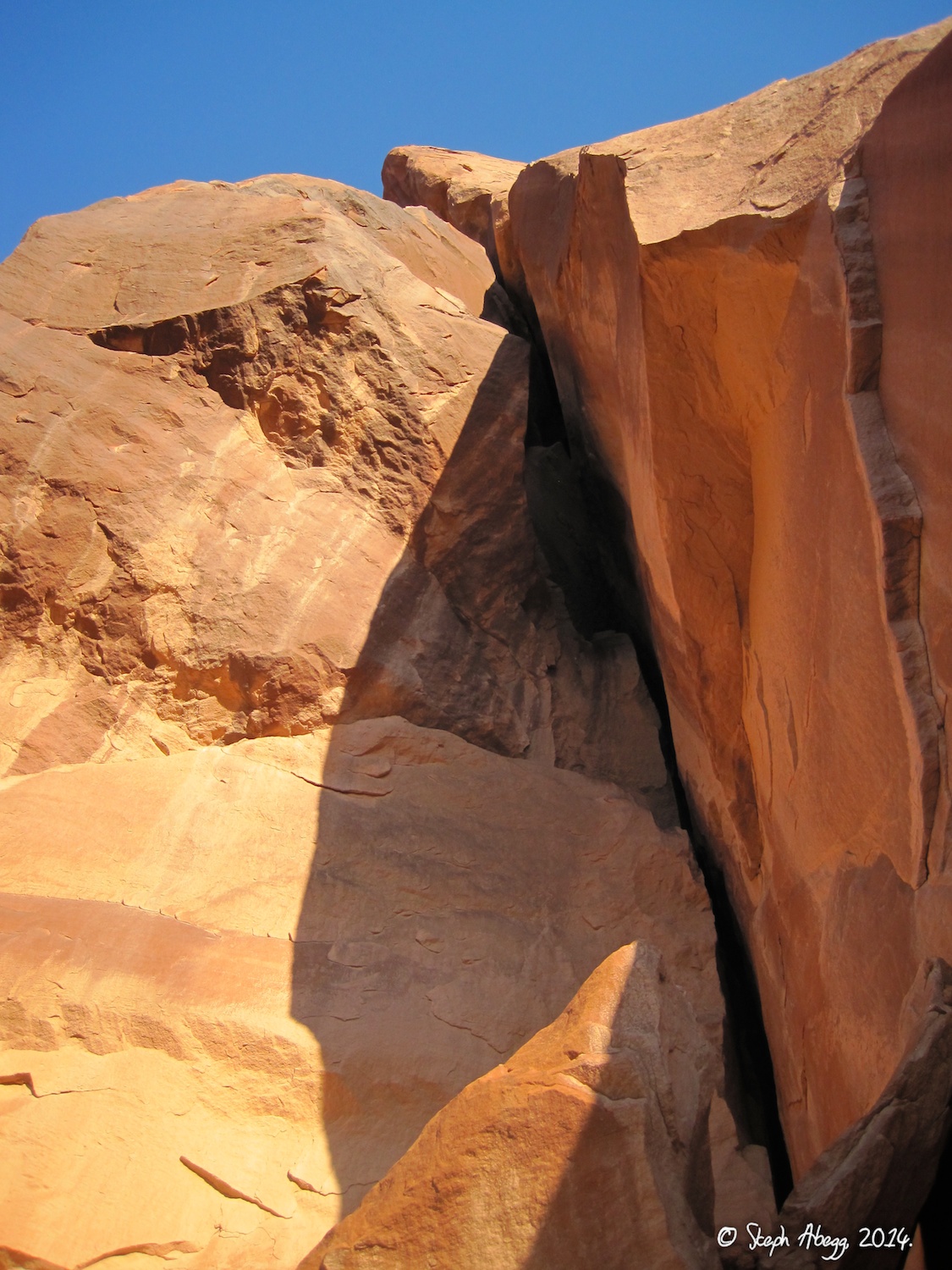
The climb doesn't live up to its moniker (what could?), but it is a very cool climb nonetheless. The coolness comes not from the quality of the climbing (the second pitch is the only really stellar climbing on the route), but from the route's remoteness, commitment level (once you rap down there you have no choice but to come up), unique access (4wd to top and rappel into the void to start), amazing top-of-the-world views, and runout chimney finish. You do two double-rope raps to access the climb. From the Top of the World Overlook, walk about 15 yards to the left (east). Here there is a deep cleft in the rock that goes from the edge way back and way down into the depths of the cliff. This is the chimney you'll climb out on pitch 3. Rap from a squat but sturdy juniper that is about 10 feet from the cliff face.
Note on the start of the route: The beta we had was pretty ambiguous for the start of the route. It is best to have the first person down go with the gear and rappel directly to the base of the chimney and set an anchor there. The anchor is somewhat hanging. Don't do what we did (i.e. don't rap to the base of the cliff or rap to the ledge 10' to the left of the chimney—see description below for details).
Note on large gear: We placed the most large gear on the first pitch. We felt that two #3 and two #4 is sufficient for this route. The chimney of Pitch 3 is too wide to protect with a #5 or #6 so these wouldn't be useful. A big bro could be useful. Dow master-of-the-chimney just ran it out.
Photo descriptions:
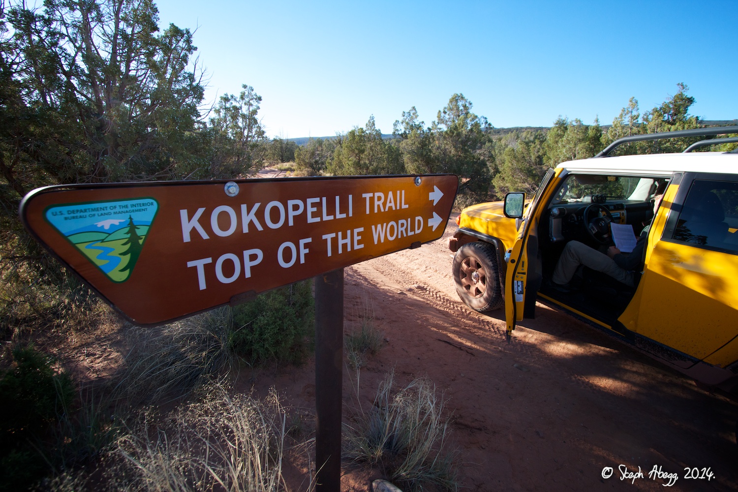
a. To get to the Top of the World Overlook, turn off HWY 128 (River Road) just before the Dewey Bridge, on the right side of the road (if coming from Moab direction).Then it's 9 miles of dirt road to the Overlook. The first 5 miles go quickly up to the Top of the World sign shown in the photo, while the last 4 miles get progressively rougher...
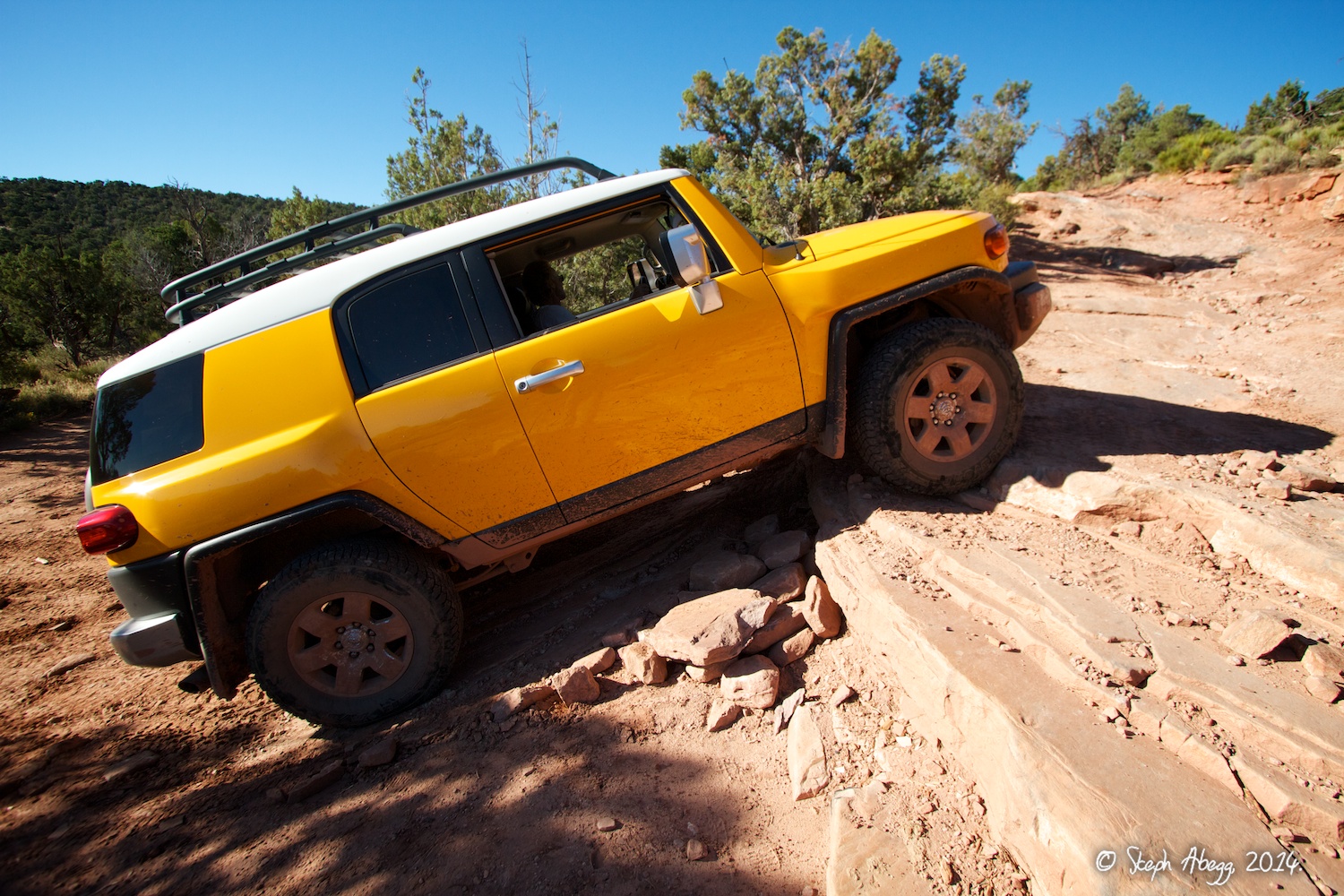
b. Driving Dow's FJ Cruiser on the rough road to Top of the World Overlook. We were definitely pushing the clearance and off-roading capabilities of the FJ. No way my Subaru could have made it the last couple of miles to the Overlook.
c. About a mile from the Overlook, we finally decided to park the vehicle and walk. It was quicker and definitely more comfortable to walk at this point, and we just wanted to get to the climb.
d. Dow looking over the edge. It's quite a wild dropoff.
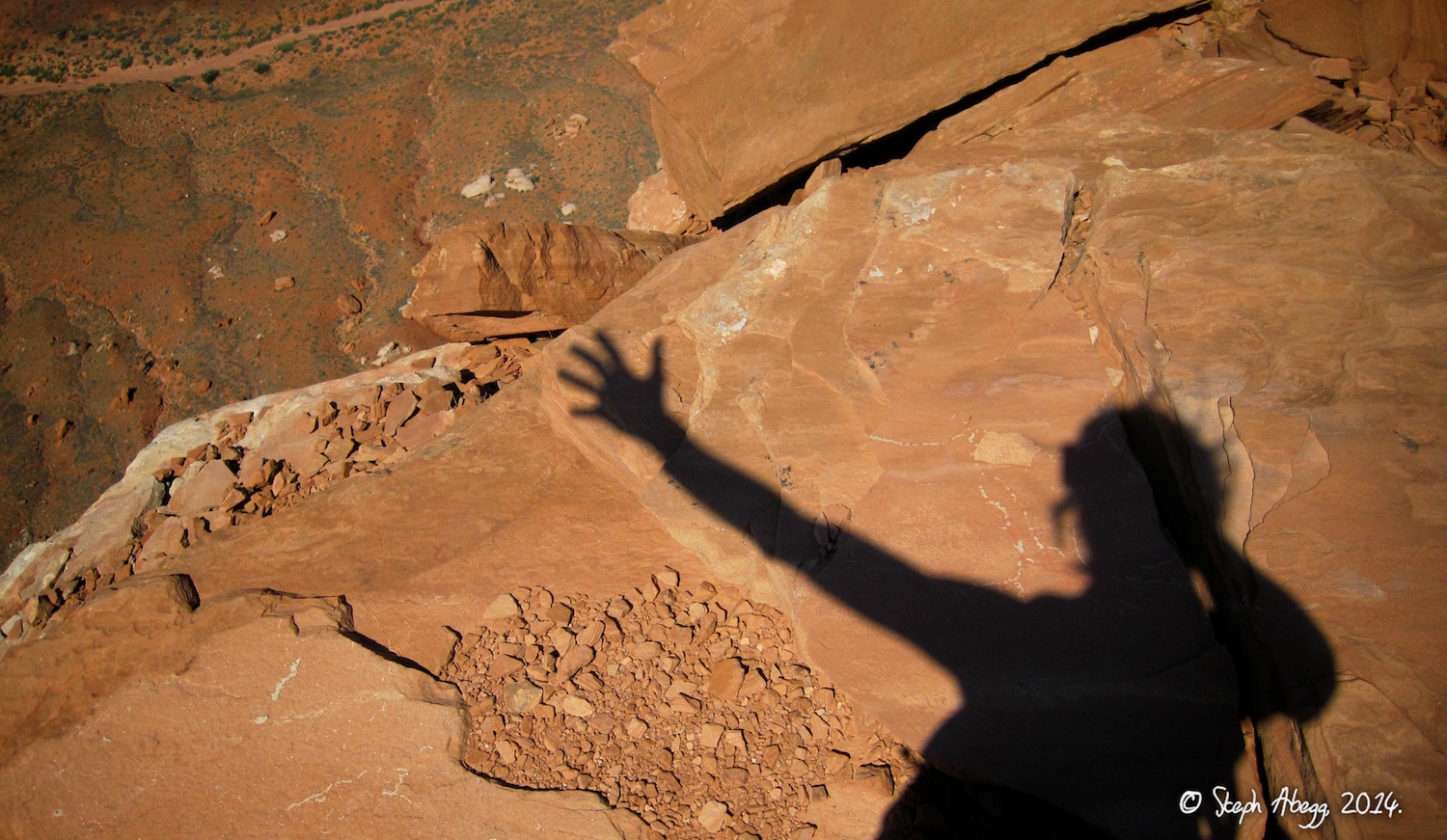
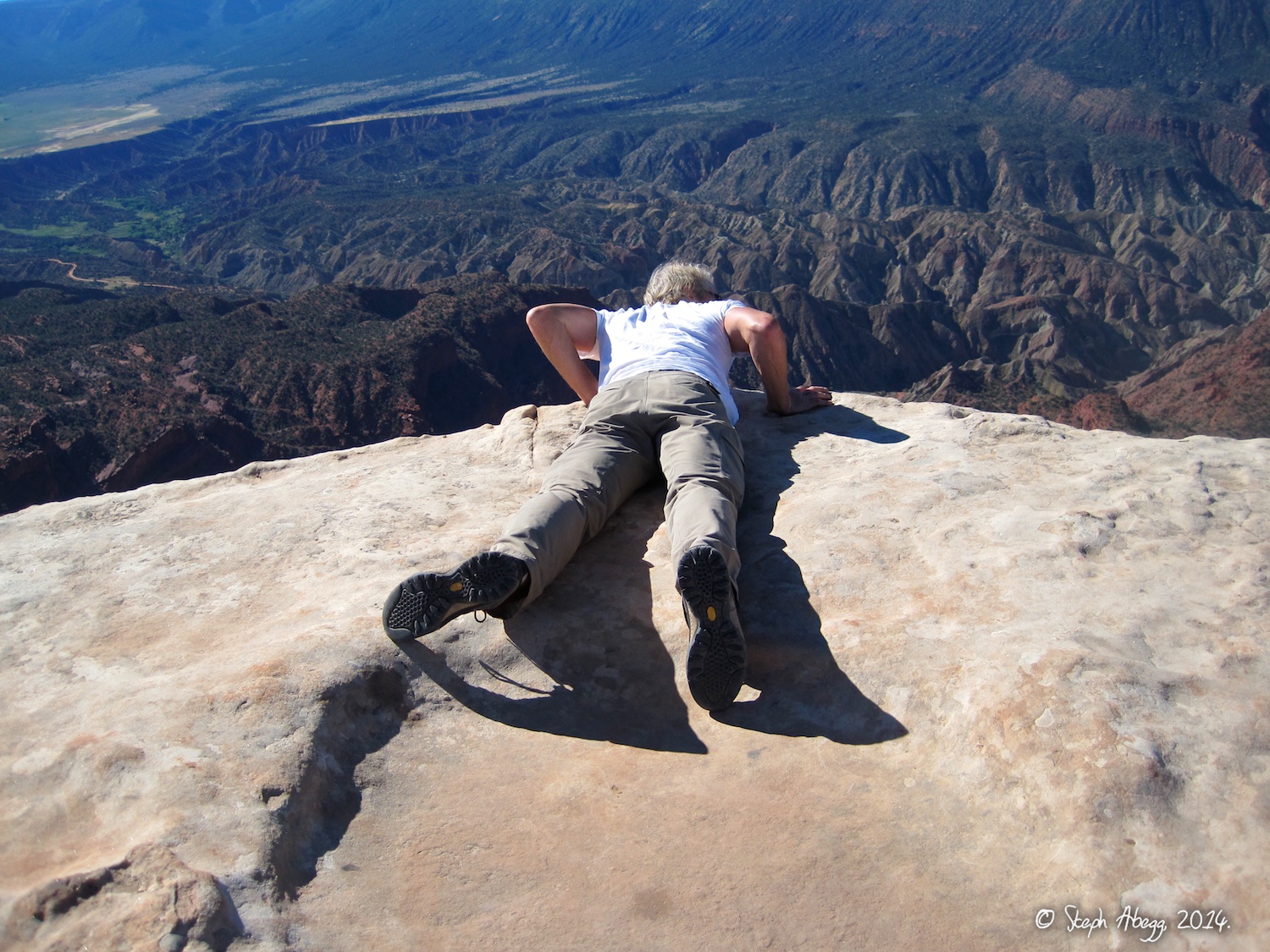
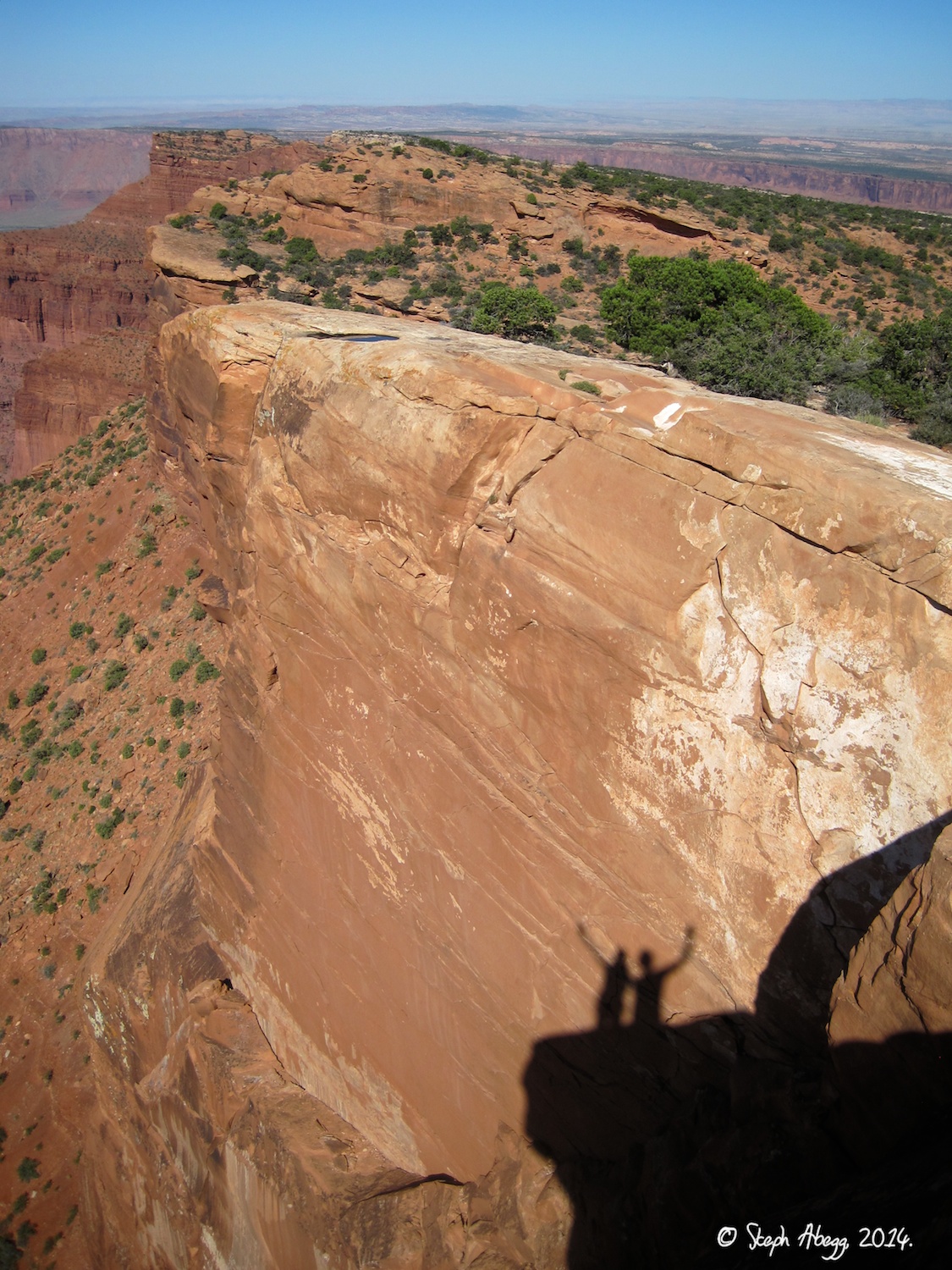
e. Shadow fun at Top of the World Overlook.
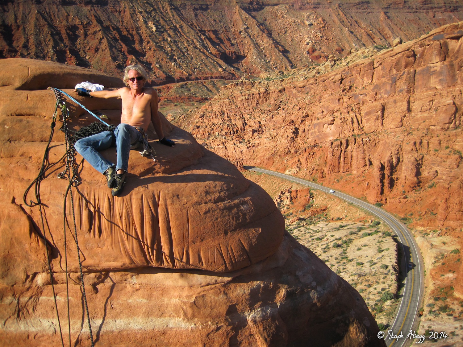
f. Me standing on Top of the World Overlook. This is a popular location for people to park their vehicle and get a photo. We could have gotten the FJ up here eventually, but our priorities were the climb rather than off-roading.
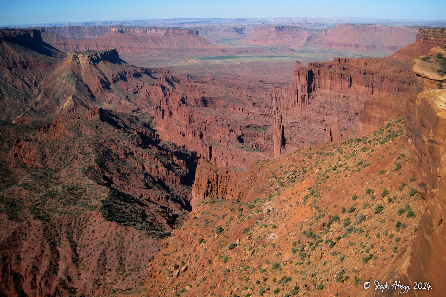
g. A view of Fisher Towers area from the Overlook.
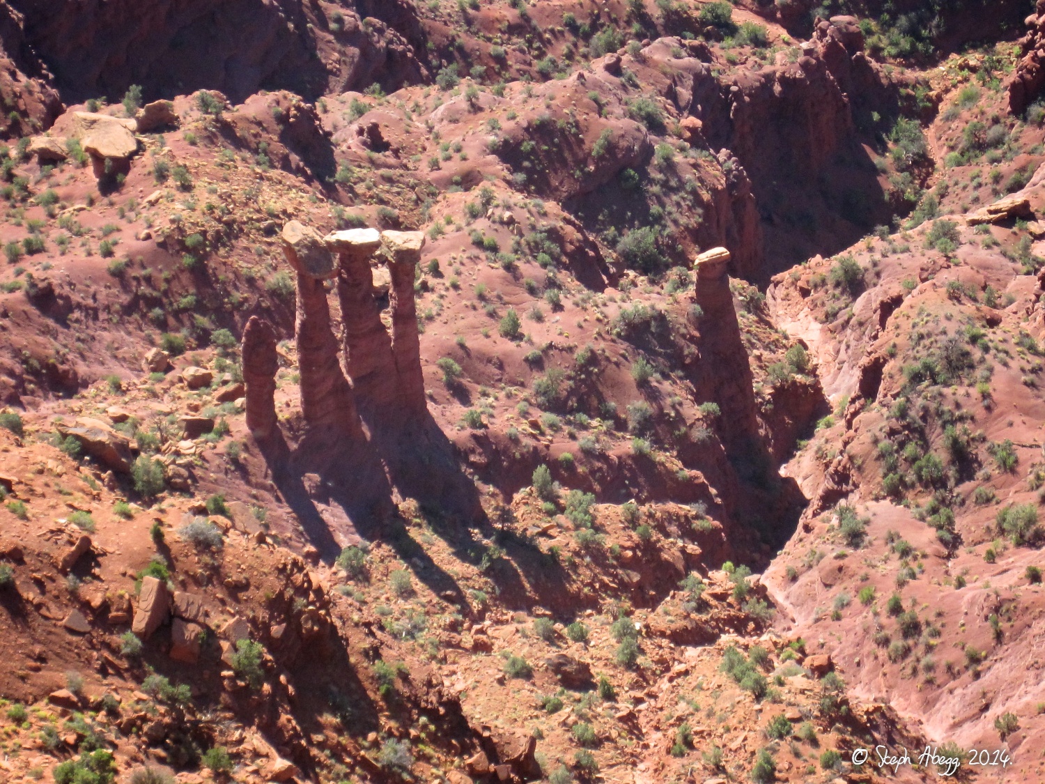
h. Some towers with boulder caps below. I imagine these formed by the eroding away of the weaker sandstone below the stronger stone of the boulders.
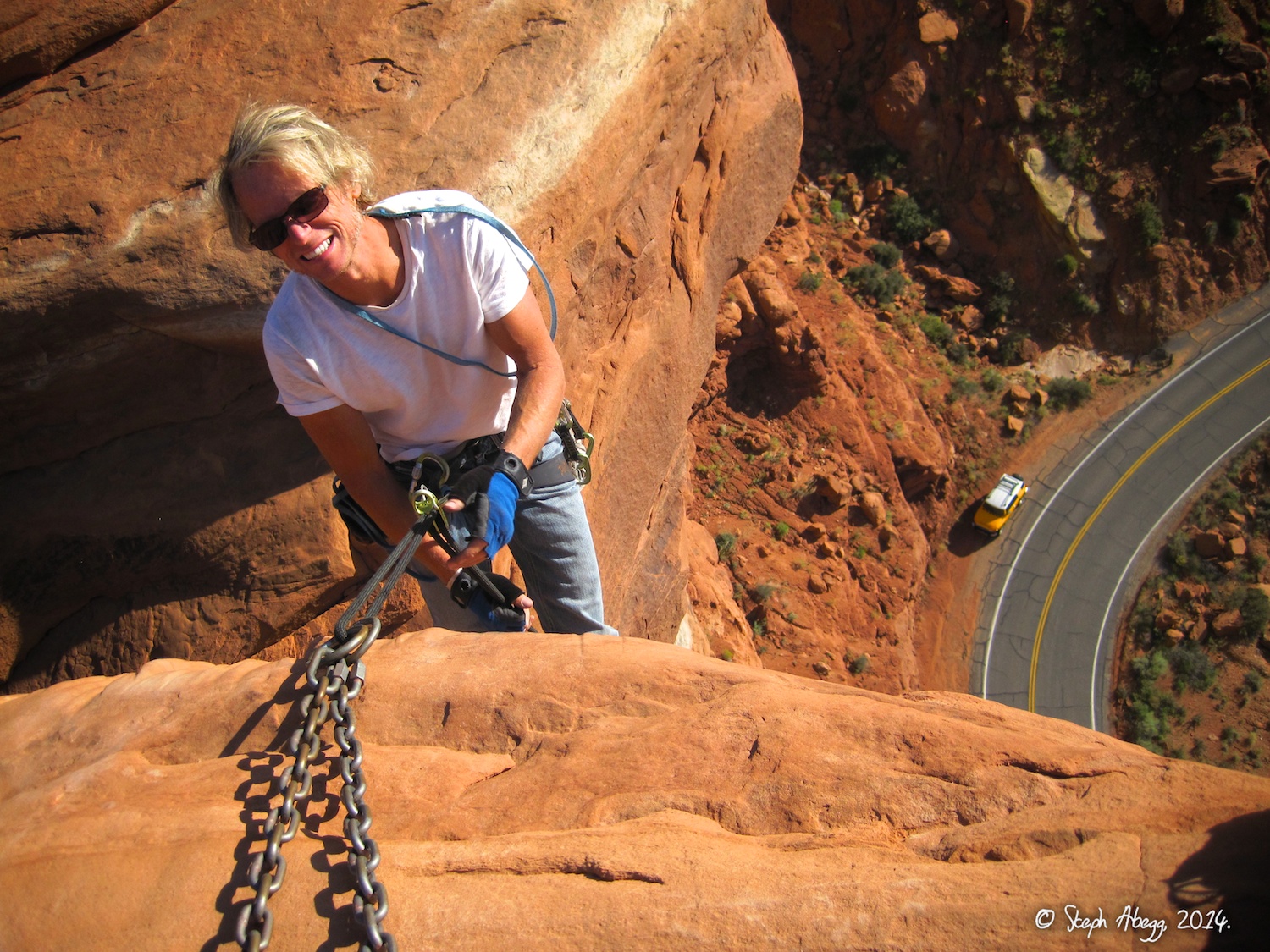
i. Getting ready for the climb. To get to the base of the route, we rappelled off the surprisingly solid juniper on the left. The chasm in the center of the photo is the chimney of Pitch 3.
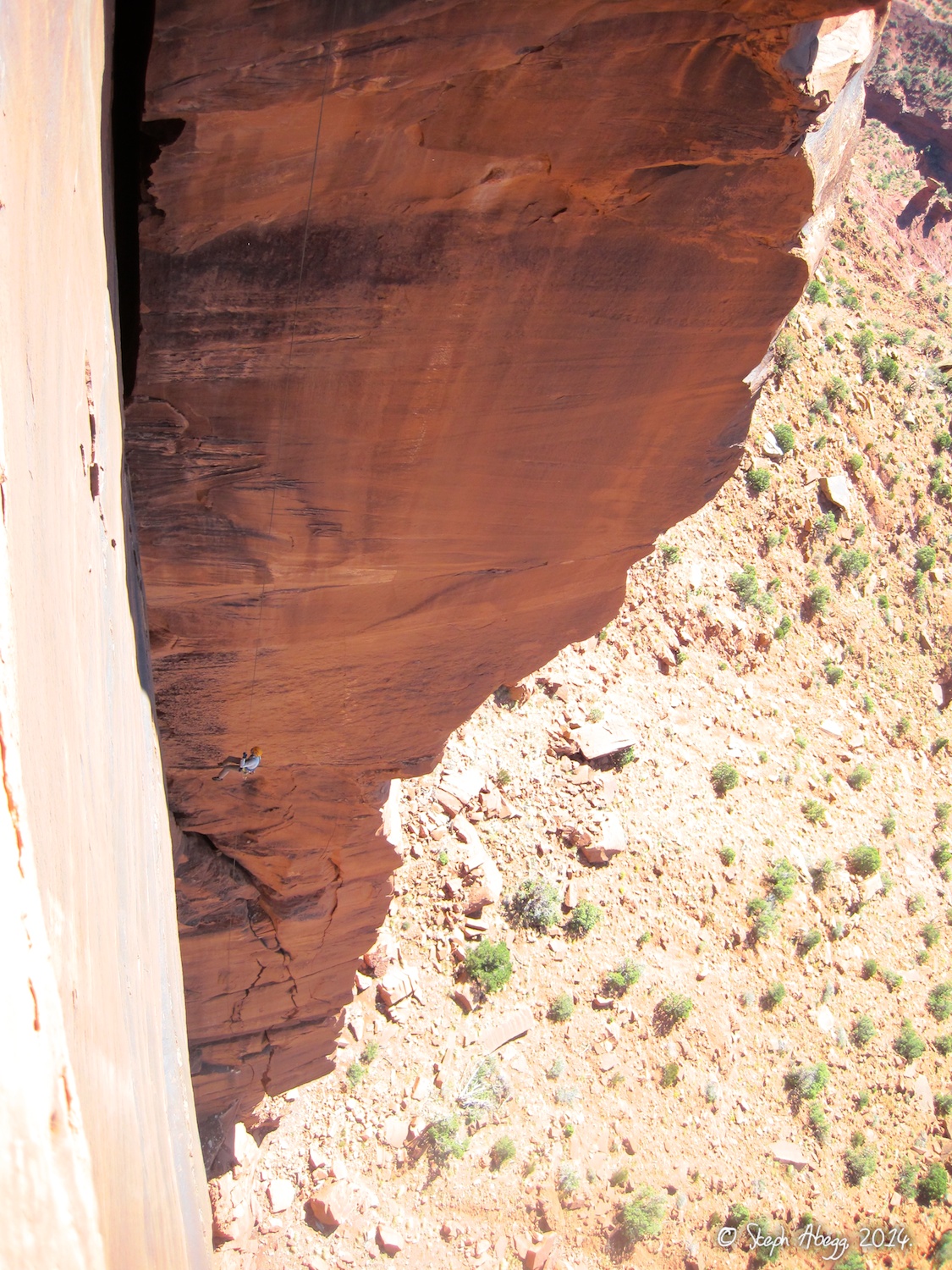
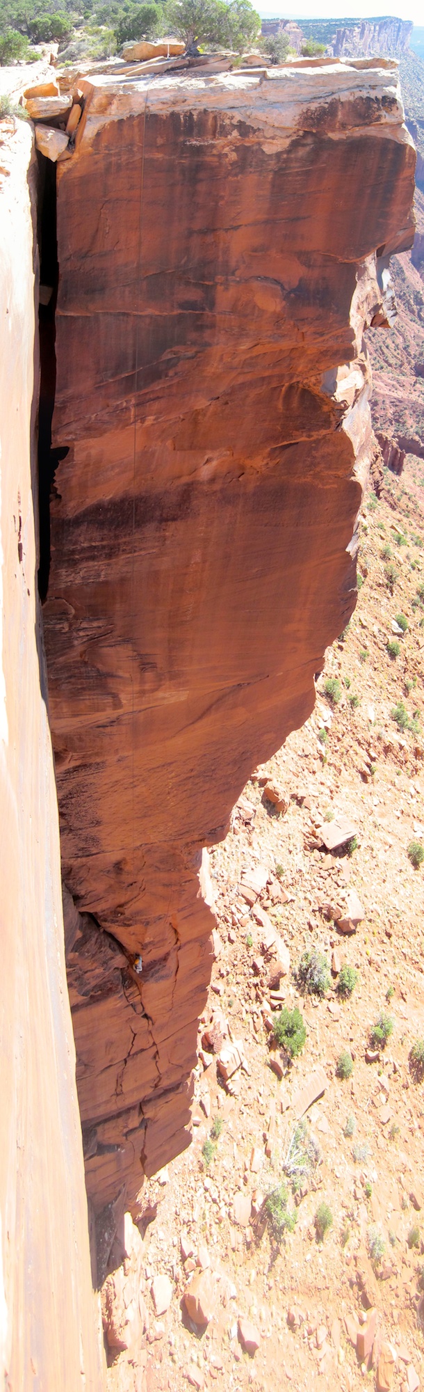
j. Looking down at Dow on the first rappel. To get to the base entails two 150' (double rope) rappels. There is a bolted anchor for the second rappel. Once you rap down there, you have no choice but to come up.
k. A view of the entire route from the rim above. This photo was digitally stitched together from three photos.
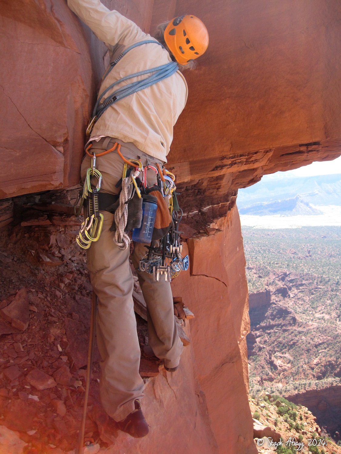
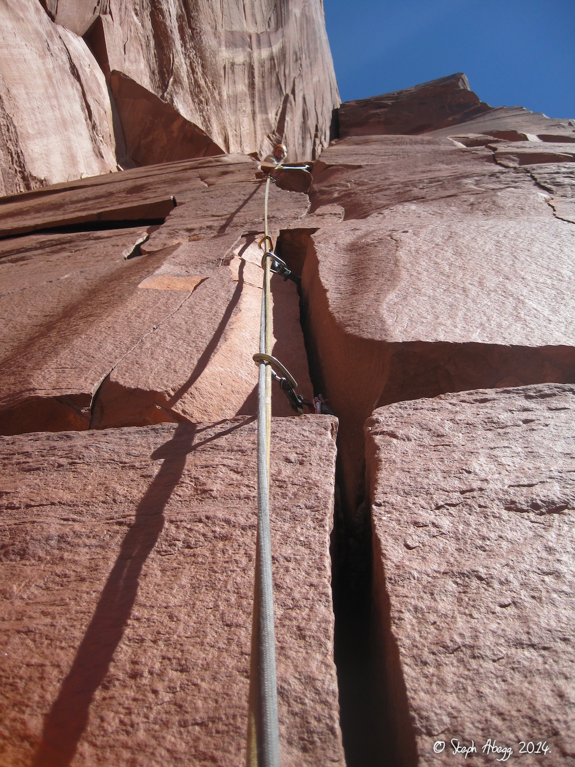
l-o. The route starts at the base of the obvious flaring chimney. I rapped down first, but since I had no gear and could not safely stop at the base of the chimney, I rapped down to the base. This was a mistake (I had to be belayed up to the ledge I should have stopped at, but at least I was able to get a great route photo for an overlay when I was down there). Dow rapped down and stopped at the ledge under the chimney, but 10' to the left of it. This was also a mistake (it was not easy to get to the chimney from here, not clear on the topo). Since Dow had set an anchor 10' to the left of the chimney, we had to traverse a really rotten ledge to the base of the chimney. Dow first tried to do this directly (Photo l), but didn't like the swing potential. He then tried to traverse in high (Photo m), but didn't feel he could get into the chimney easily this way. He finally climbed up the corner a bit (Photo n), set a high piece, and then tensioned over to the base of the flaring chimney of Pitch 1. This fussing around took time and energy. It is best to have the first person down rappel directly to the base of the chimney with gear and set an anchor here. The anchor is somewhat hanging (Photo o). Interesting note: the corner shown in Photo n actually looks like pretty good climbing, and from the top of this corner there is a ledge that you can traverse easily to the top of the chimney Pitch 1.
p. Dow leading the flaring chimney of Pitch 1. This involves jams and stems, up to a 5.10 crux.
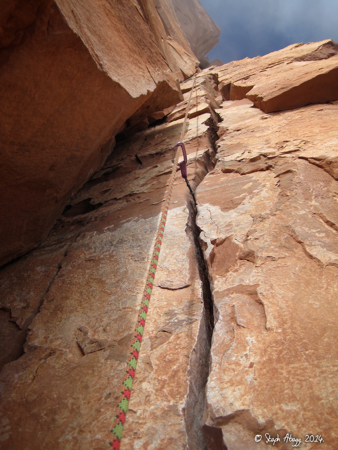
q. Looking up Pitch 2. This was the best climbing on the route. 5.9 hand jams.
r. Another photo looking up Pitch 2, mid-pitch. This was my favorite pitch by far.
s. The view out towards Fisher Towers. I've heard these towers are pretty much the consistency of hard mud. Their main climbing appeal is probably the really cool forms they take (like Ancient Art for example).
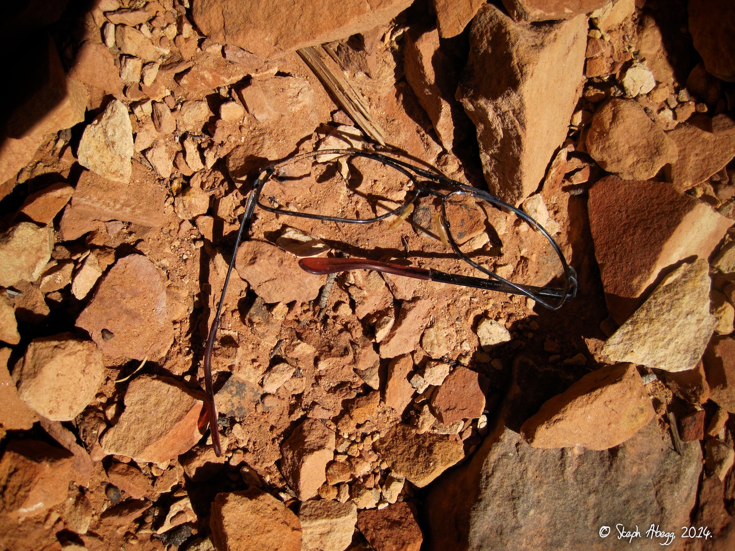
t. A pair of broken eyeglasses at the base of the Pitch 3 chimney.
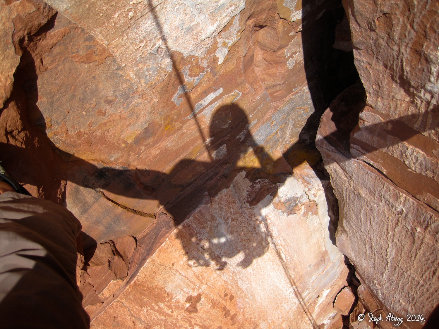
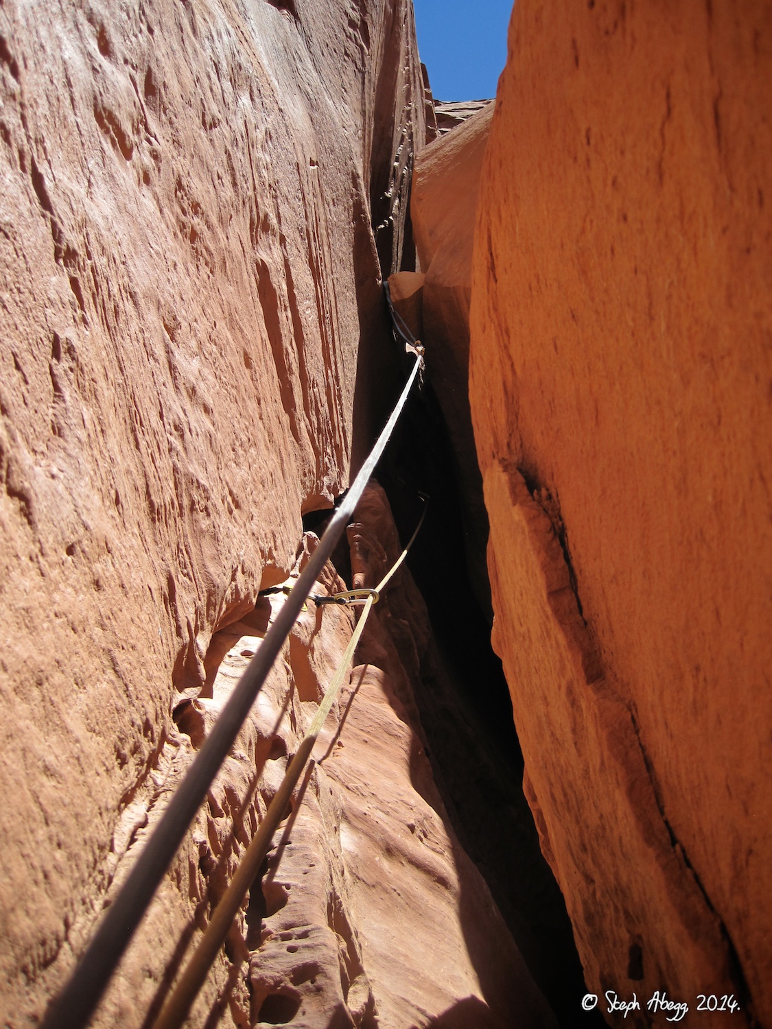
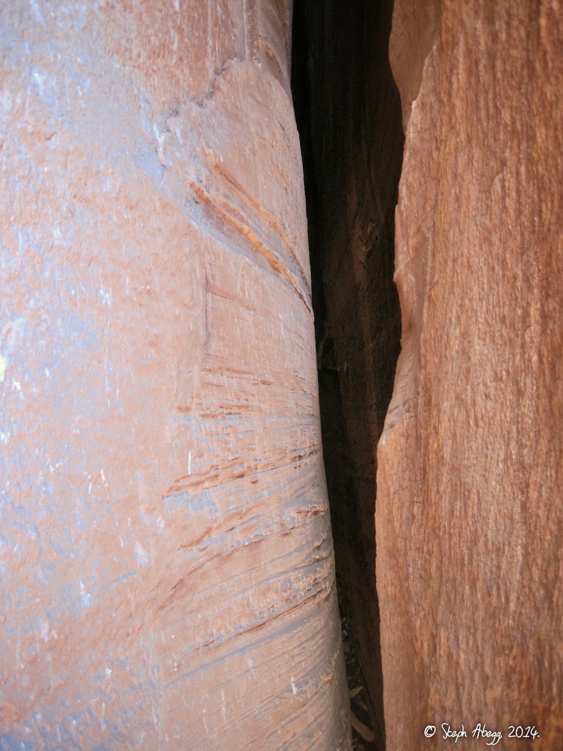
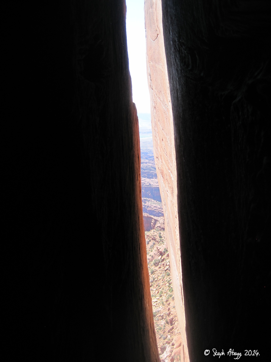
u. Looking up the chimney of Pitch 3.
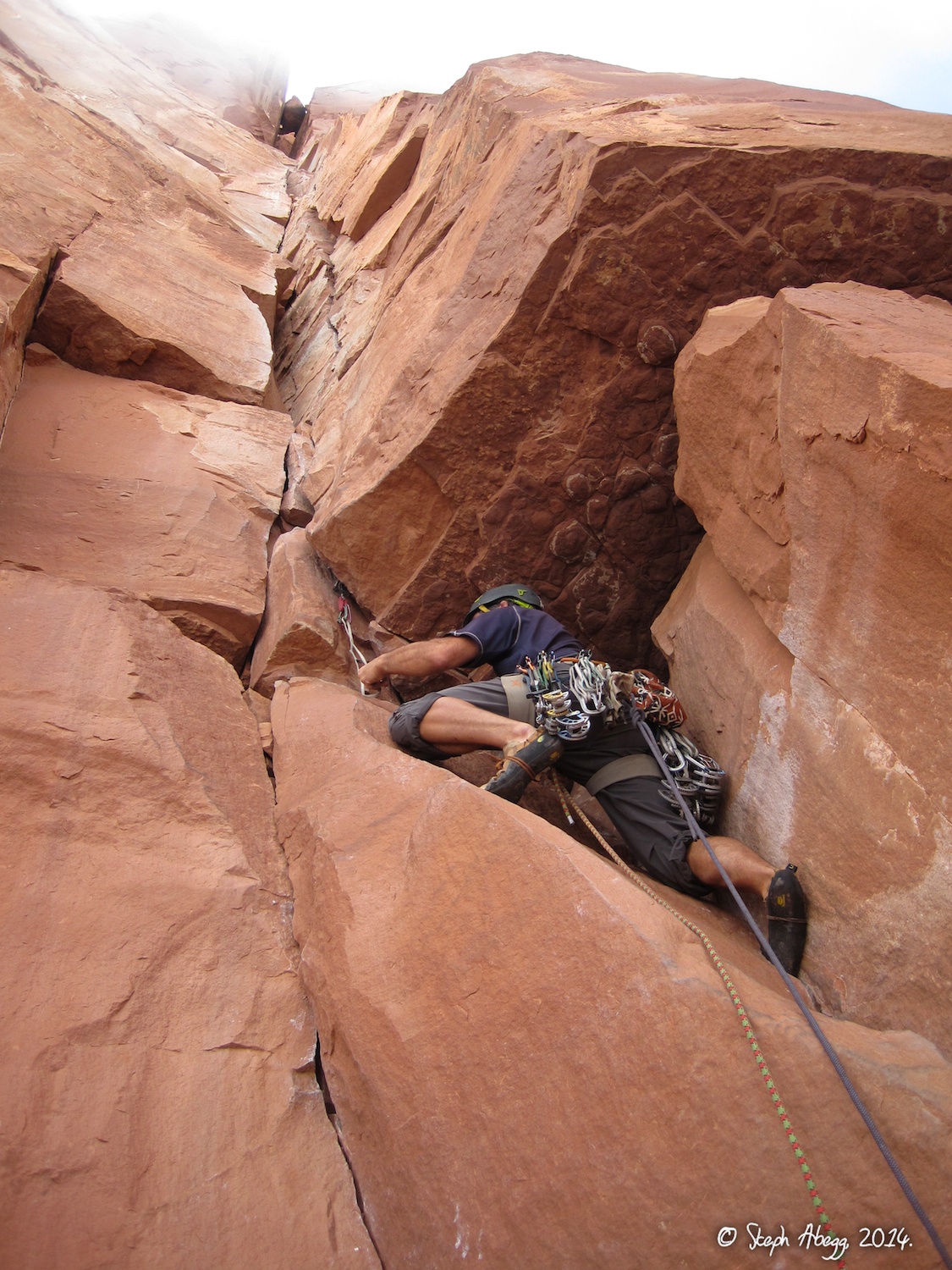
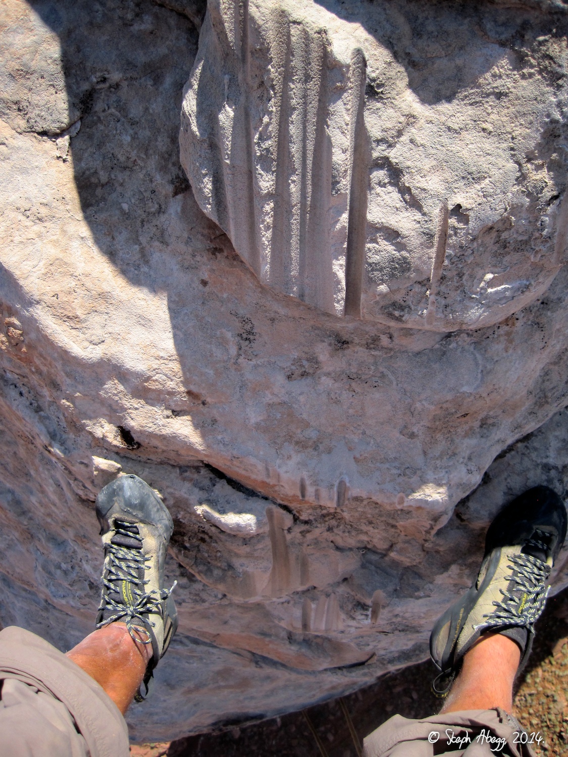
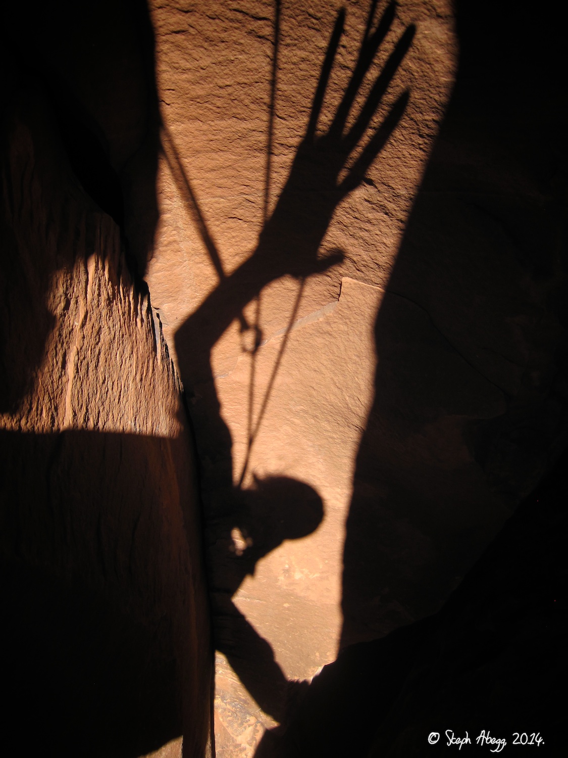
v. Climbing inside the chimney in the lower 2/3. For the first 2/3 of the chimney there are plenty of features and small cracks, and climbing is pretty easy. v. Some sandstone features on the chimney walls. These are a bit friable, but are really nice to have for the feet. x. Looking into the depths of the chimney. We climbed about 10-20 feet back into the chimney from the lip, which made it a bit more secure feeling. y. Looking out of the chimney in the upper 1/3. In the upper 1/3 there are fewer features and opportunities for protection. It is pretty tight so it is difficult to move much more than an inch at a time. At least that makes it pretty secure. (I really liked Josh Janes' description of chimney rating on the MountainProject page for this route: "...Perhaps there should be a new grading system [for chimneys]. CH 1-5? Where CH 1 is a downright enjoyable and easy chimney (say the upper pitches of the Priest), CH 2 is a little harder but the enjoyment factor is still high (say, Epinephrine), CH 3 - you start to wonder how much you're enjoying it, CH 4 is utterly miserable and only enjoyable, if at all, in retrospect, and CH 5 would describe anything that you're still stuck in and awaiting a rescue team. If this were the case, this chimney would check in somewhere around CH 3." z. Shadow fun in the chimney.
Arches National Park
Arches National Park just north of Moab is a 70,000+ acre wonderland of eroded sandstone fins, towers, ribs, gargoyles, hoodoos, balanced rocks, and exquisite arches. There are countless unique, airy summits that are accessible by interesting climbing. Routes in Arches are usually only a few hundred feet from the road so the approaches are casual. The climbing is challenging, though, since the Entrada sandstone tends to be sandy, rounded, hard-to-protect, and unforgiving.
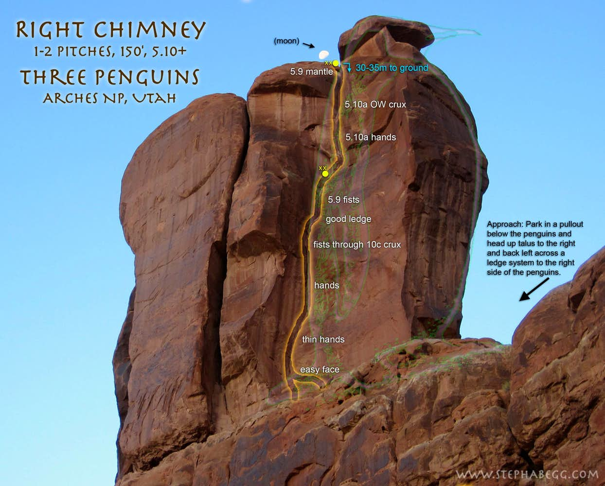
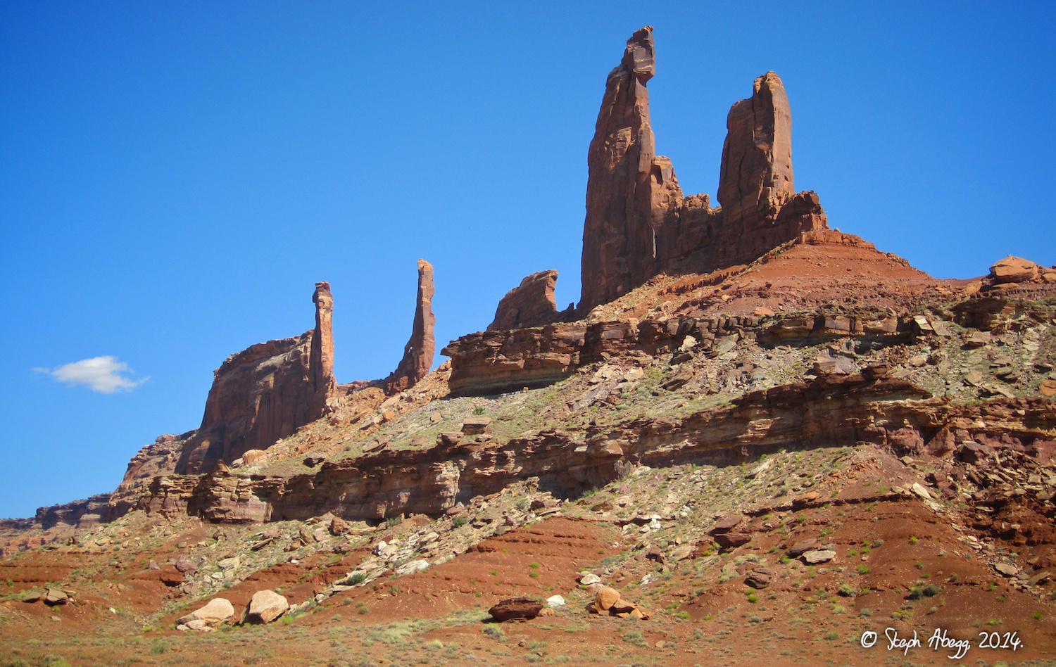
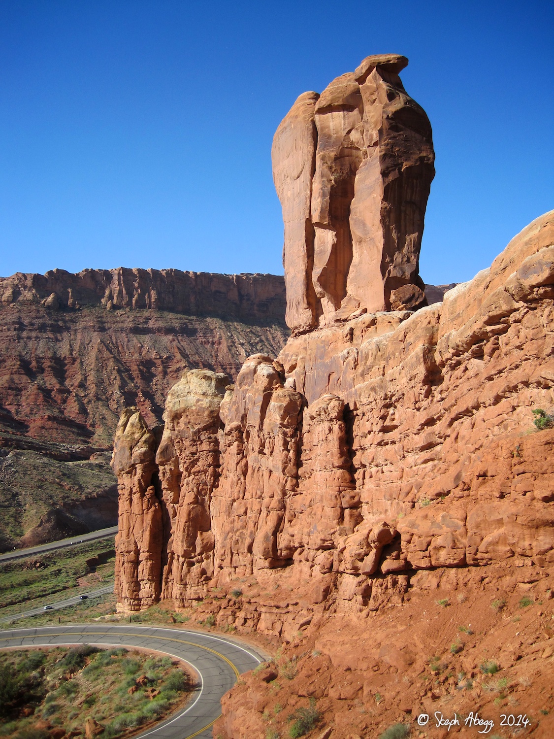
Several of the rock formations in Arches NP are named because they look like their namesake: The Three Penguins, The Three Gossips, Devil's Golf Ball, The Phallus, The Pickle, The Wishbone, The Organ, etc. I thought it would be fun to climb one of these, as it would make for a fun route overlay. The Three Penguins huddling above the south entrance to the park had compelled me ever since I had first driven into Arches a week previous. Dow had climbed the Right Chimney route in 2010, and it had been good enough he was happy to climb it again. The Right Chimney is the most popular route on the formation.
The Route
It is no wonder this route is popular, with its short approach, great views, and single long pitch (or two short pitches) of quality 5.10 climbing. The route climbs the crack system on the SE side between the middle and north (right) penguins, topping out on the middle penguin's head. The first two thirds of the route basically starts at fingers and works its way to fists—the crux being getting over the obvious bulge. The last third of the route is a delightful struggle up a flaring off-width—the definite crux of the route for me. "Chimney" is a misnomer for this route, since there is not a chimney move on the route, besides maybe a single move getting from the middle penguin's head to the north penguin's head. The rock on the entire route is solid and takes great gear. But typical of Entrada sandstone, the rock is soft so the edges of the cracks are rounded and the footholds are sandy slopes, making the climbing insecure and strenuous.
Note on wide gear: We found that a double rack up to #4 and a single #5 (to protect the final moves) was a comfortable amount to climb the route in a single pitch.
Photo descriptions:
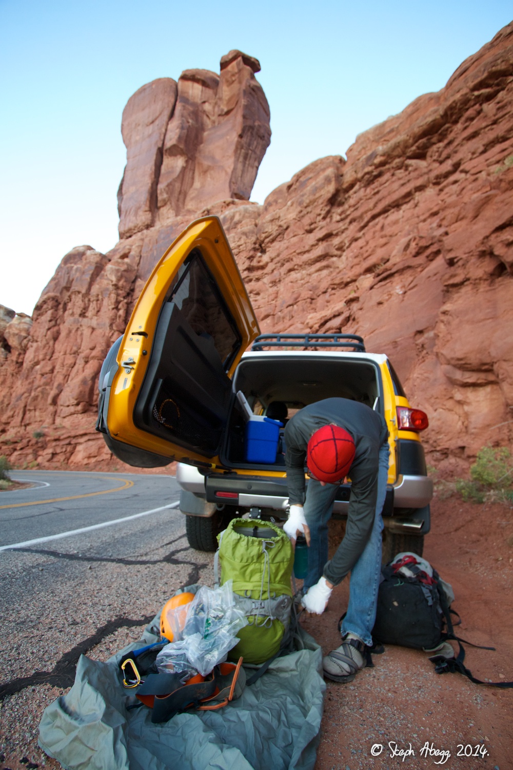
a. Getting our gear together at the pullout just below the Three Penguins.
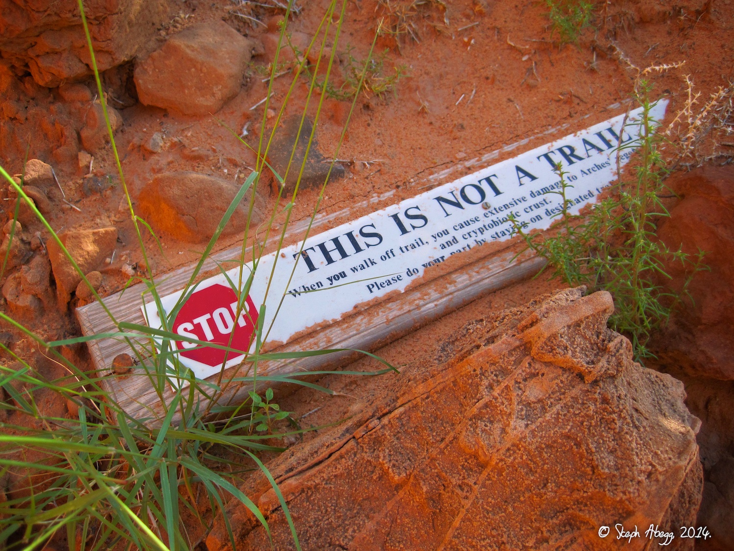
b. The approach involves heading right into a talus gully to gain the ramp on the right side of the Penguins. There's a sign here telling people that this is not a trail.
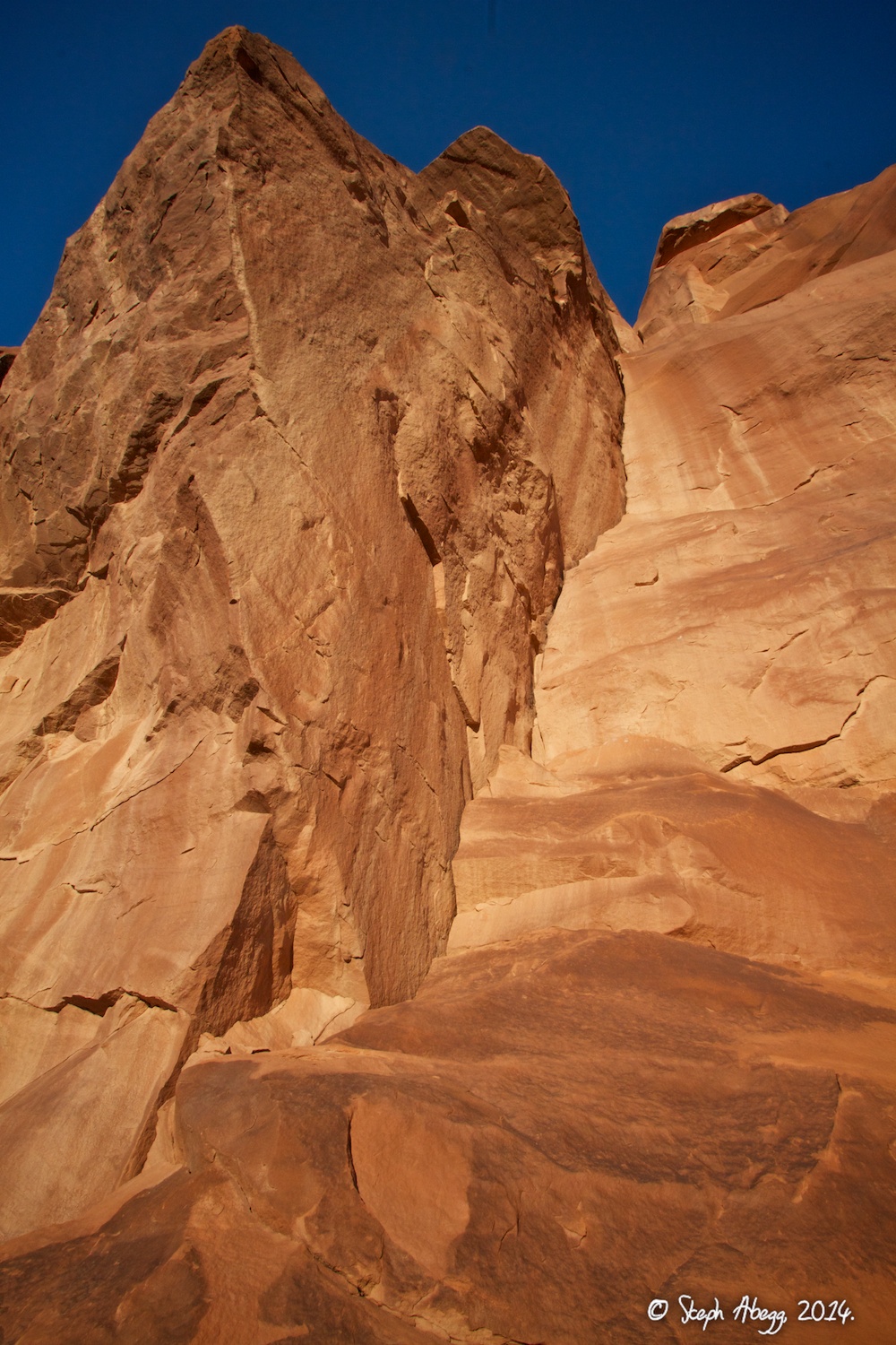
c. Morning light on the Three Penguins from the approach ramp.
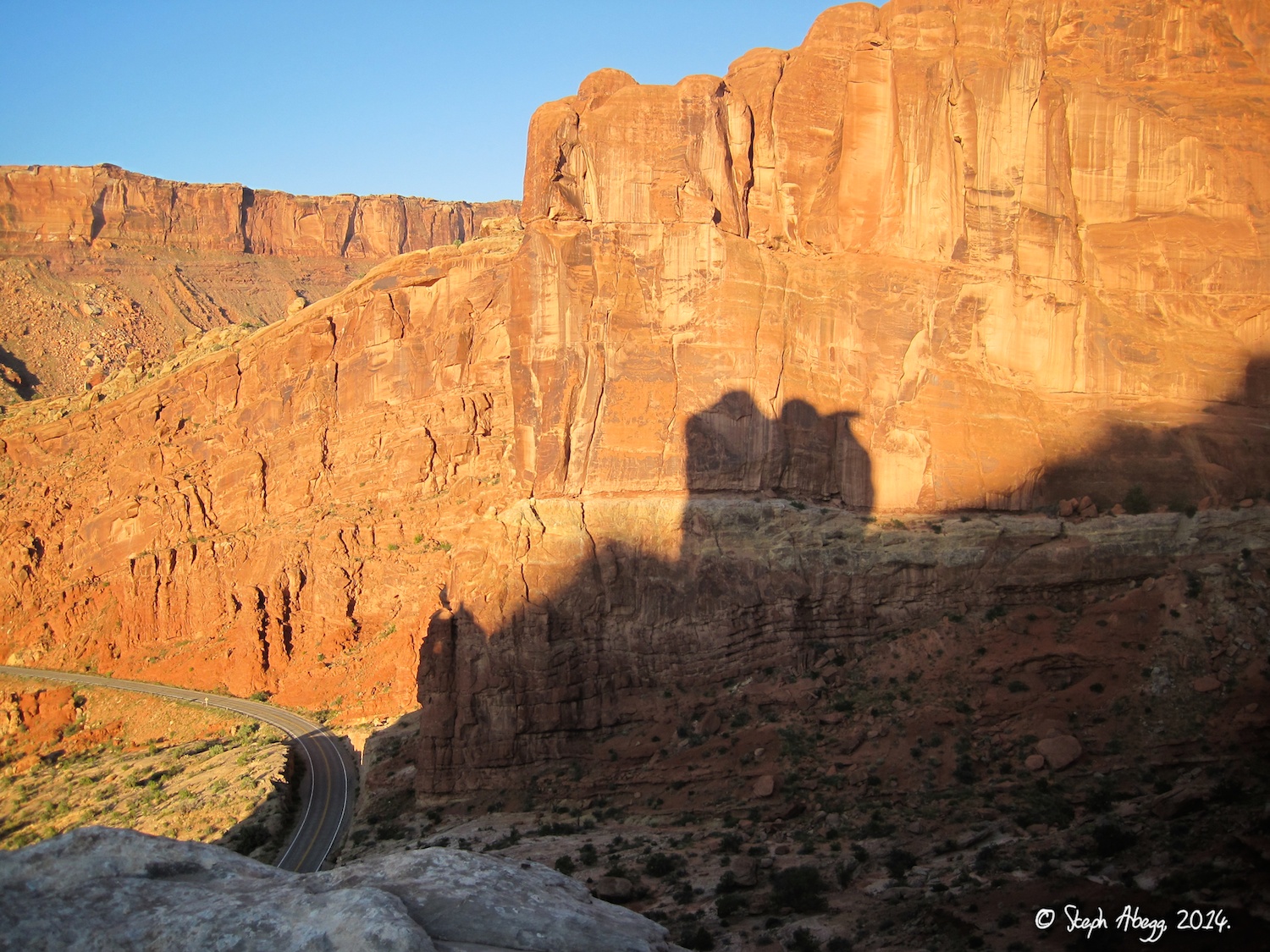
d. Shadow of the Three Penguins on the sandstone walls to the west.
e. Looking up the climb: a finger to hand to fist to knee crack. "Chimney" is definitely a mis-nomer.
f. Dow racked up and ready to go. This climb takes a fair amount of big gear. We had doubles up to #4 and one #5.
g. A photo taken mid-climb. The rock is solid, but the rounded crack edges make climbing more insecure and strenuous.
h. Dow on top of the middle Penguin's head.
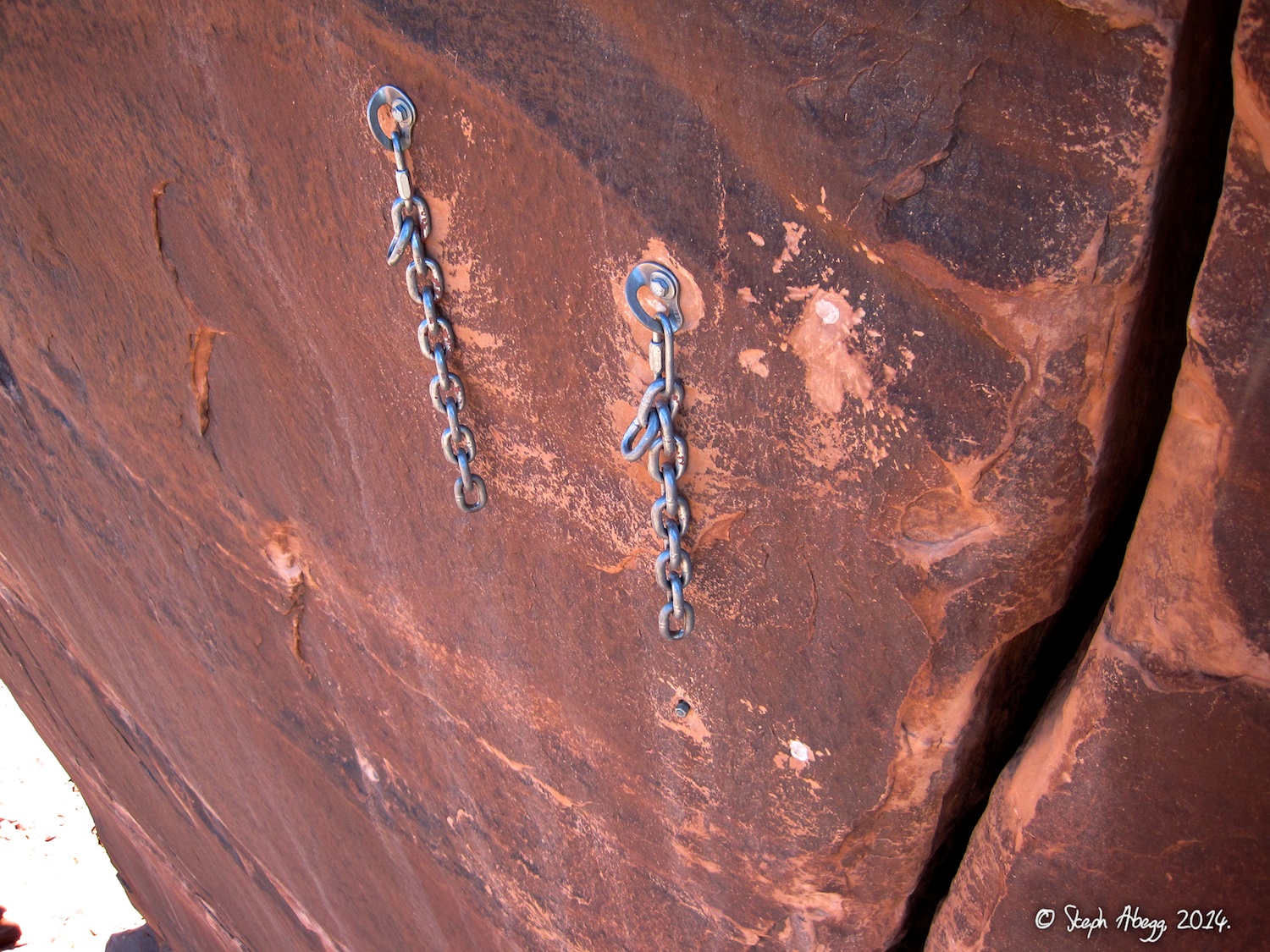
i. Dow rappelling from the middle Penguin's head. A single rappel on a single 70m rope will get you back down to the base. A 60m rope would be short, and require a second rappel at the intermediate anchors.
j. The Entrada sandstone is soft, as evidenced by the grooves cut into it by ropes.
k. Shadow fun on the rappel.
l. There are four routes on the Three Penguins, but the most popular by far is the Right Chimney. This photo is taken looking up a route on the left end of the east face, called Anorexia (10a). It gets a single star on MountainProject so we did not bother climbing it.
m. A parting view of the Three Penguins huddled above the road, on the short hike back to the car.
The Route
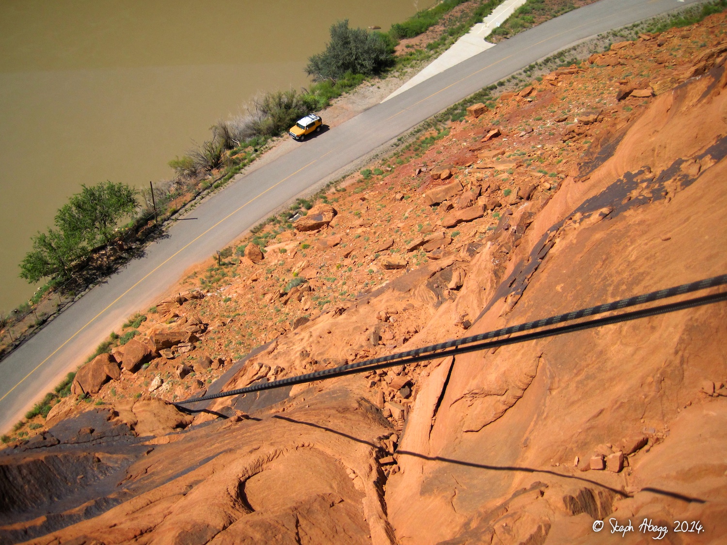
The climb of Three Penguins went quickly (after all the formation is only 150' tall) and we still had time for another short climb. So we jumped back in the car and drove 5 minutes over to the entrance to the River Road Canyon and climbed El Segundo, a great single-pitch 5.9+ corner that I had spotted as I paged through my new guidebook. Although accessed from River Road, this climb is actually within the park boundary.
This is the striking, obvious right-facing corner seen from the bridge while driving north across the Colorado River bridge from Moab toward Arches. You can park right below the climb on the dirt road just north of the bridge, but to get to the actual climb involves hiking along the highway (on the bike path) towards the entrance of Courthouse Wash, where you gain the ramping bench on the right and backtrack to the climb (and pass some beautiful pictographs and petroglyphs on the way). The first pitch involves a short 5th class traverse to gain the shelf below the corner. The second pitch climbs the flakes and crack in the corner, with pretty good hand jams the whole way up. 5.9+ crack climbing fun. The descent completes the loop trip by rappelling twice (a single 70m rope will do) to the hillside just above where you parked. This climb is a worthy adventure if you've got an extra hour or two.
Photo descriptions:
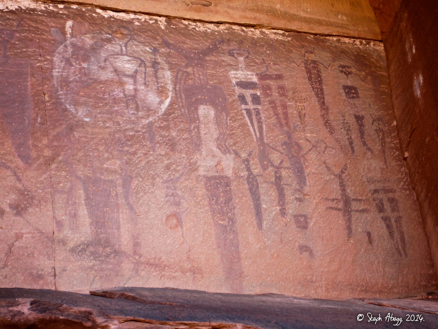
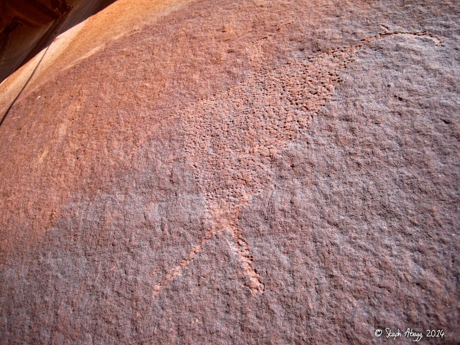
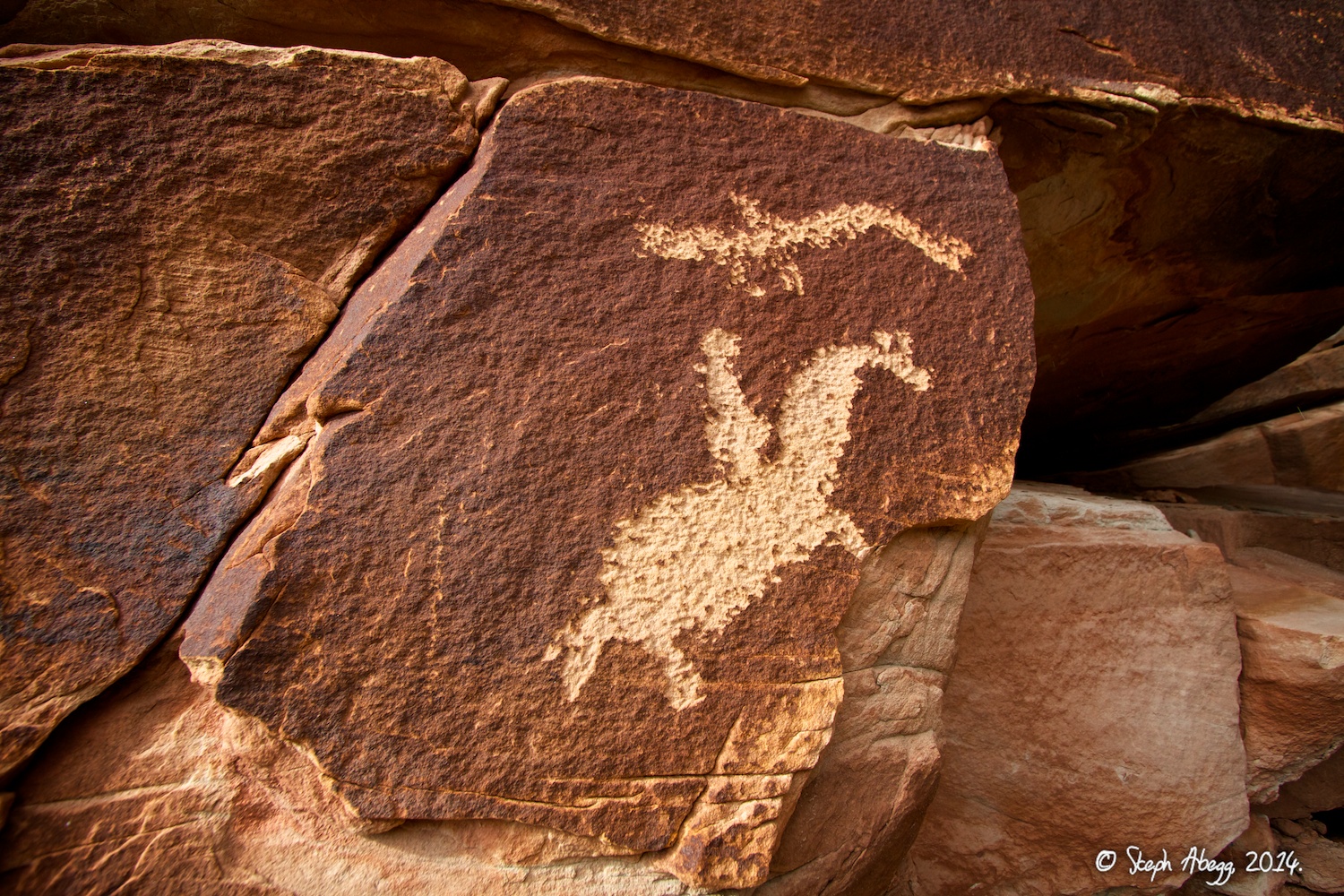
a-d. There is a nice rock art display ("Courthouse Rock Art Display") on the approach to the climb. NPS website: "Rock art is often found at crossroads and near waterways. One such site can be seen a few miles north of Moab, where Courthouse Wash joins the Colorado River. This large and colorful panel displays evidence of people's passage for hundreds of years.
Although rock art cannot be dated, it is thought that Archaic Indians first painted the long, tapered figures in what archeologists call the Barrier Canyon style. Later, ancestral Puebloans or Utes added bright white circular forms that resemble shields. Petroglyphs - images pecked, incised or abraded on stone - by Utes appear elsewhere on the wall and adjacent boulder, and on the walkway below.
In 1980, this ancient rock art was vandalized. The National Park Service cleaned the panel, and restoration work revealed older pictographs beneath the white shields. While the original brilliant pigments are gone forever, their absence provided an opportunity to use new technologies to gather additional information about the panel. In 2008, as part of the Multi-Spectral Imaging Project, the panel was photographed in the infrared spectrum, and a comparison with a regular photograph revealed figures not previously visible to the naked eye. Archeologists are using this exciting information to establish a new baseline from which to monitor change in the panel and analyze the order in which individual elements were painted."
e. The first pitch of the climb is a short traverse to the base of the corner. It is pretty easy, but there are a couple of exposed low 5th moves where it feels nice to have a rope just in case.
f. Looking up the corner of Pitch 2. 5.9+ corner crack climbing fun. This is a good pitch, definitely worthy of making the (quite minimal) effort to get up there.
g. There is a faded petroglyph just left of the belay anchor below the corner. It is difficult to see unless you look for it.
h. Thanks to whoever installed the anchors on this route, you can rap from the base of the corner to the hillside just above your car. This completes a nice loop trip. A 70m rope will get you to easy terrain. A 60m rope would probably get you down, but involve a little downclimbing.
Other random photos from my time in the Moab area....
Photos:
a.
b.
c.
d.
e.
f.
g.
h.
i.
j.
k.
Photo descriptions:
a. I stayed at the Lazy Lizard Hostel at the south end of Moab. $10 for a bed, open kitchen, shower, plug, and wi-fi (the last two being the most important of course)— hard to beat that!
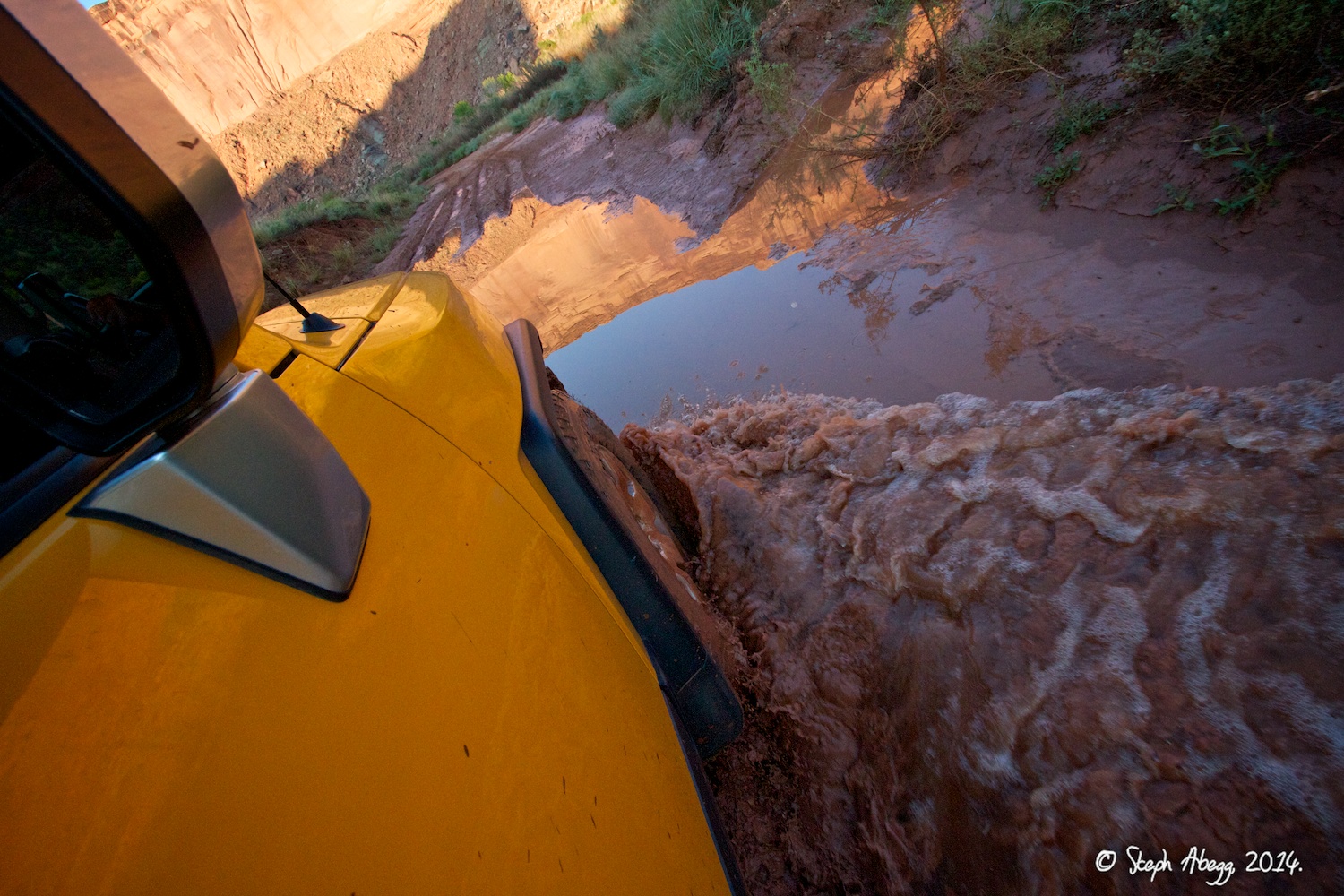
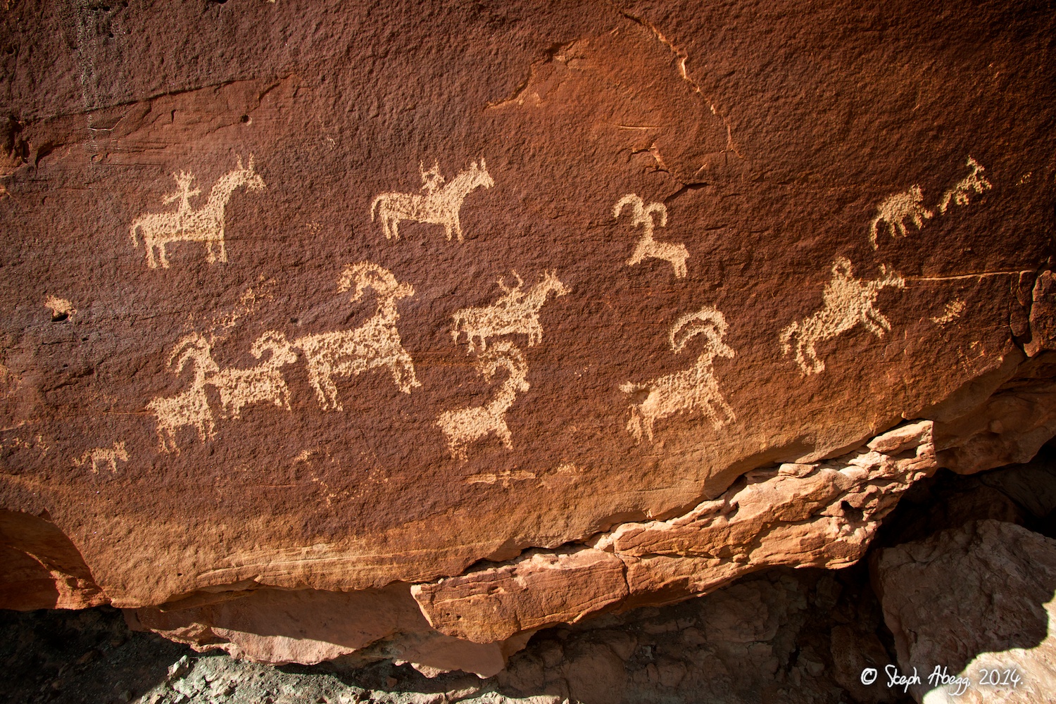
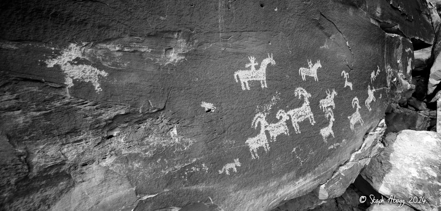
b-d. The heavy rains that delayed the beginning of the climbing part of the trip had caused flooding over the road to Delicate Arch. The road was closed, which meant it was a great time (i.e. no crowds!!) to hike to Delicate Arch and also to check out the petroglyphs near the trailhead. It was only an extra 1.2 miles each way. Plus it was pretty cool to see the mud over the road.
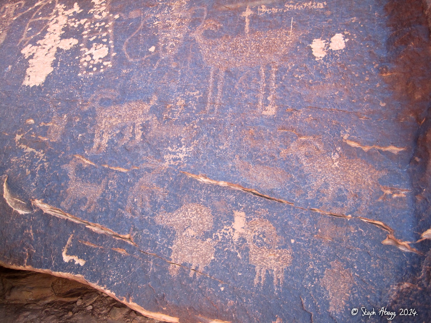
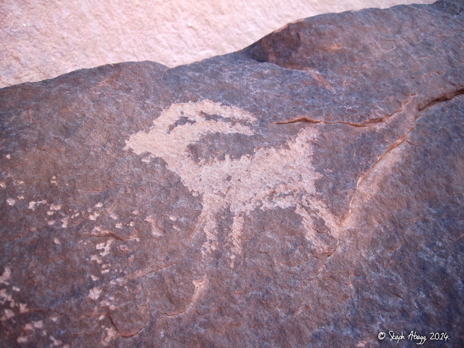
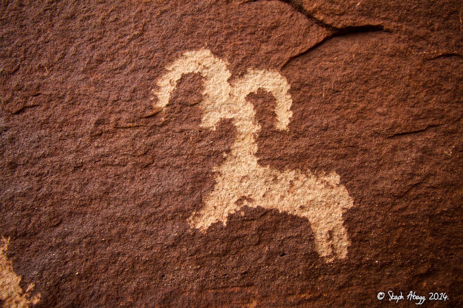
e-j. There are some petroglyphs near the Delicate Arch trailhead. The stylized horse and rider surrounded by bighorn sheep and dog-like animals is typical of Ute rock art. These were carved sometime between AD 1650 and 1850 (horses weren't reintroduced into North America until the Spanish brought them in the 1500s, so the rock art was done after that).
g. There's a sheep (or something else?) that is behind the main group and headed in the opposite direction. The rogue sheep that escaped from the main herd?
k. On my drive through Arches NP before Dow arrived, I was oogling at all the cool features to be climbed. One route I'd like to climb is the West Face of the Three Gossips. The Three Gossips (on the left in the photo) really do look like three gossips. (Dow and I had planned on climbing this route, but lost a day due to the rain and did not have time to climb it.)
Useful beta. Updated route information. Corrections. Historical notes. Interesting facts. No fluff please. Please do not put links in your comment, as my spam filter will filter those comments out.