Mt. Dickerman & Big Four Ice Caves, Trail (snowy late-fall conditions)
Mt. Dickerman & Big Four Ice Caves
Route:
Trail
snowy late-fall conditions
A Thanksgiving break day in the mountains.
Region: Washington
Elev: 5,723 ft (Dickerman summit); 1,900 ft (Ice caves)
Mode:
Date(s): November 27, 2013 (Wed)
Partner(s): solo
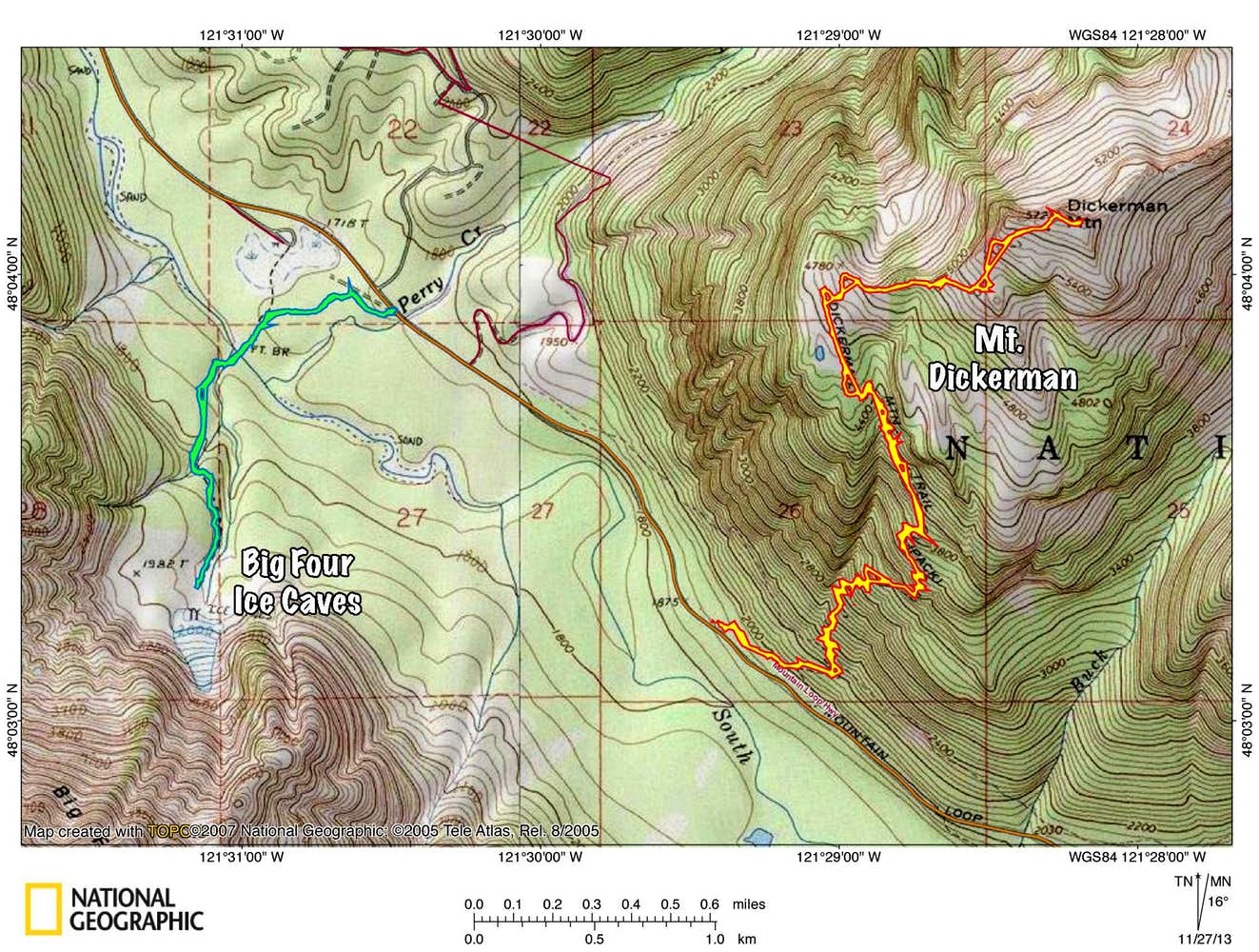
Map
CLICK TO ENLARGE
Trip Report
THIS TRIP REPORT IS STILL MOSTLY IN THE EMBEDDED HTML FORMAT OF MY OLD WEBSITE. MOBILE Tip: Try Landscape mode. It is generally more mobile friendly.
INTRO
With five days off for Thanksgiving, I had hoped to get out into the Cascades on a couple of snowy climbs or an overnight adventure. However, as the holiday weekend approached, so too did the snow. Winter was about to clamp down on the range, leaving the day before Thanksgiving as the only reliable day for getting out and getting views. With only a few hours to plan and pack for a trip after Tuesday's classes, I decided that Mt. Dickerman was a good option. This popular destination offers a satisfying 9-mile, 4000-ft workout with the reward of 360° summit views. Plus this might be one of the last days before the Mountain Loop Highway became snowed in for the winter.
The snow line was still high and the there was a boot-beaten track to the summit, so I was up and down Dickerman in five hours, which included an hour-long view-gazing brunch on the summit. Since it had been an unexpectedly short adventure, I decided to check out the nearby Big Four Ice Caves. These icy catacombs lie in the basin below the towering northern walls of Big Four, reached by just a 2.2-mile hike on a paved/graveled/boardwalked trail from the road. I'd always been curious about these caves, so it was nice to have the extra time to go see them.
It was mellow and highly enjoyable fall day out in the mountains. Map, stats, and photos below.
STATS
7:00 AM : 1,850 FT : Dickerman Trailhead
7:32 AM : Sun rises
9:15 AM : 5,723 FT : Arrive on Dickerman Summit
10:15 AM : 5,723 FT : Leave Dickerman Summit
12:00 PM : 1,850 FT : Dickerman Trailhead
12:20 PM : 1,700 FT : Ice Caves Trailhead
1:00 PM : 1,900 FT : Ice Caves
1:30 PM : 1,700 FT : Ice Caves Trailhead
4:18 PM : Sun sets
PHOTOS
DICKERMAN
The "meadows" near 4400 ft. Dickerman is a popular destination all year round, so there was a deep trench that made travel and route-finding easy.
The first glimpse of the summit. About 1000 feet to go.
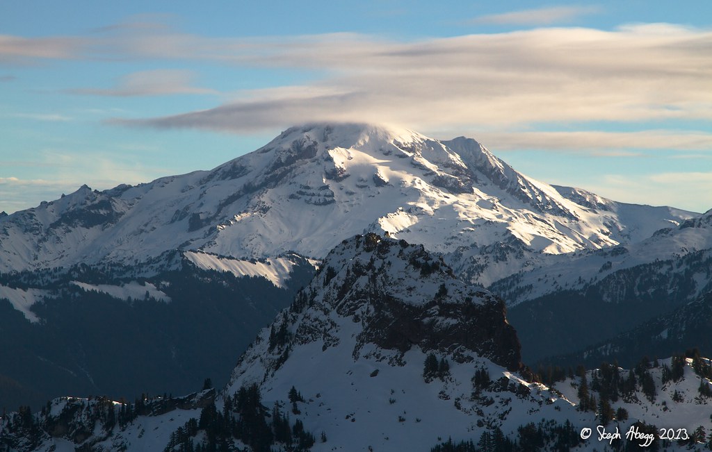
Dickerman's picturesque summit, with steep cliffs off its north side.
The summit has a 360° view. Here are some fun graphics from HeyWhatsThat.com.
Map
Profile
List
And below are some of my summit view photos (clockwise starting in the SW):
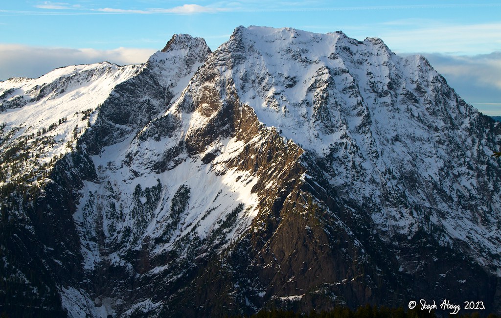
Big Four Mountain dominating the view to the SW...
...Three Fingers to the NW...
(also Whitehorse to the NW and White Chuck to the N, not shown)
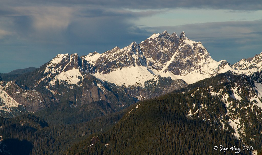
...Mt. Forgotten to the NE...
(also Pugh to the NE, not shown)
...Glacier Peak to the E...
(also Sloan to the E and Monte Cristo Peaks to the SE, not shown)
...Del Campo to the S...
(Morning Star to the SSW not shown)
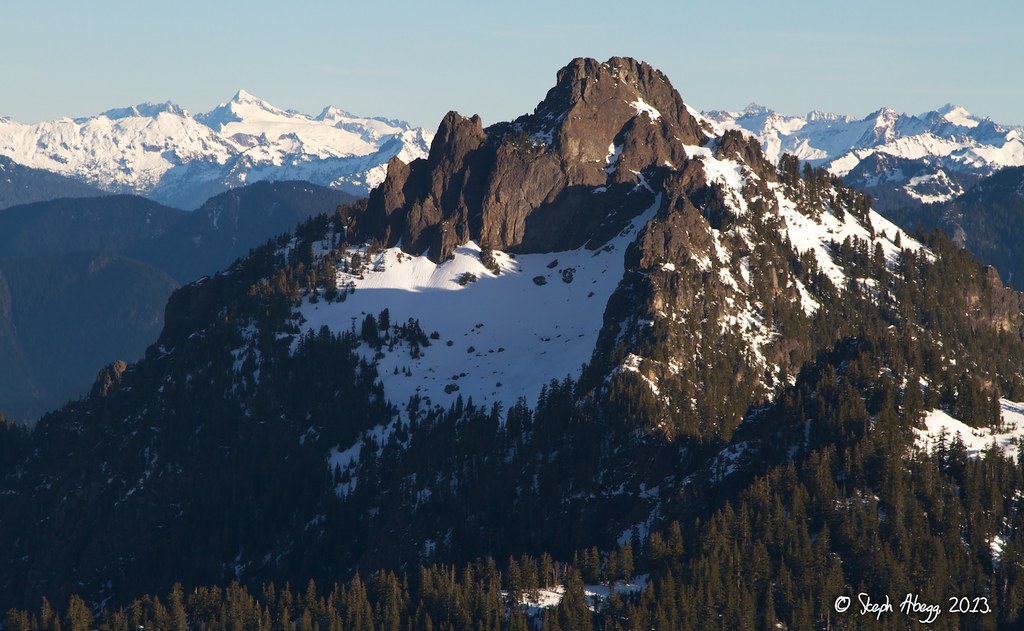
...Sperry Peak and Vesper Peak to the SSW...
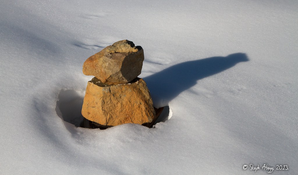
A cairn basking in its last few days of daylight before being buried for the winter.
My summit photo.
Snow waves.
BIG FOUR ICE CAVES
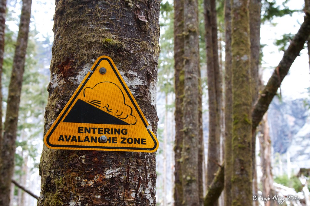
Signs warn of the danger of avalanches in the winter and spring.
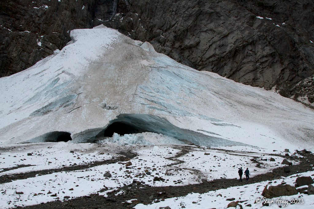
The ice caves are formed from cascading water and warm winds hollowing out heaps of avalanche-deposited snow. Hikers have been marveling at these frozen spectacles of nature for over a century.
A couple of closer views of the ice caves.
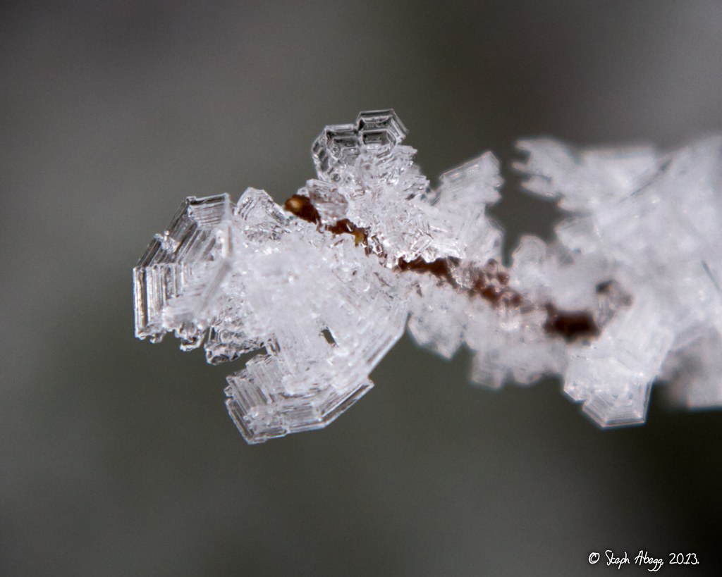
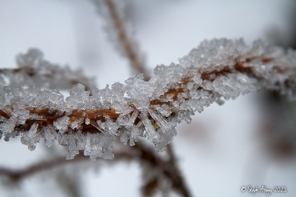
On the mile-long hike to and from the Ice Caves, I admired some hoar frost crystals lining the paved trail.
My favorite Atmospheric Optics website has a nice description of how these are formed. Here's a summary: On a clear and cold night, the ground becomes colder than the surrounding air, and water vapour from the air converts directly to ice to form the hoar frost. Hoar frost takes on a number of crystal structures, but they all have the same basic hexagonal symmetry, which is a manifestation of the atomic structure of ice.
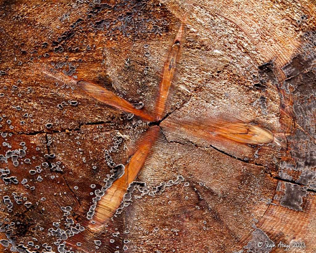
My original caption: I'm not sure how the star-shaped knot in this log formed, but it sure is cool.
Explanation by JoelSkok on summitpost.org (thanks Joel!): "The 'star shaped knot' in the log is simply the encased remains of 4 branches which started growing when the tree trunk was the size of the space between the beginning of each branch. At some point (you can count the tree rings and tell us when) the branches died and fell off leaving only the stubs we see. The tree continued growing, encasing them as I said earlier.…A clumsy explanation, but think about it and it will make sense."
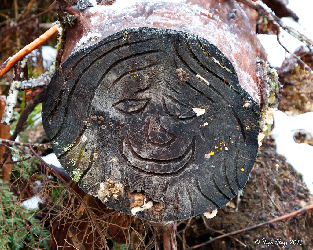
Another unique log cross-section on the Ice Caves trail.
Useful beta. Updated route information. Corrections. Historical notes. Interesting facts. No fluff please. Please do not put links in your comment, as my spam filter will filter those comments out.