Higher Squire, Northeast to Northwest side (snowshoe)
Higher Squire
Route:
NE to NW side
snowshoe
A marvelous idea for a snowshoe romp in the North Cascades.
Region: Washington
Elev: 4,879 ft
Type:
Date(s): January 4, 2014 (Sat)
Partner(s): Gabriel Deal, Lindsay Malone, Yana Radenska, Carla Schauble
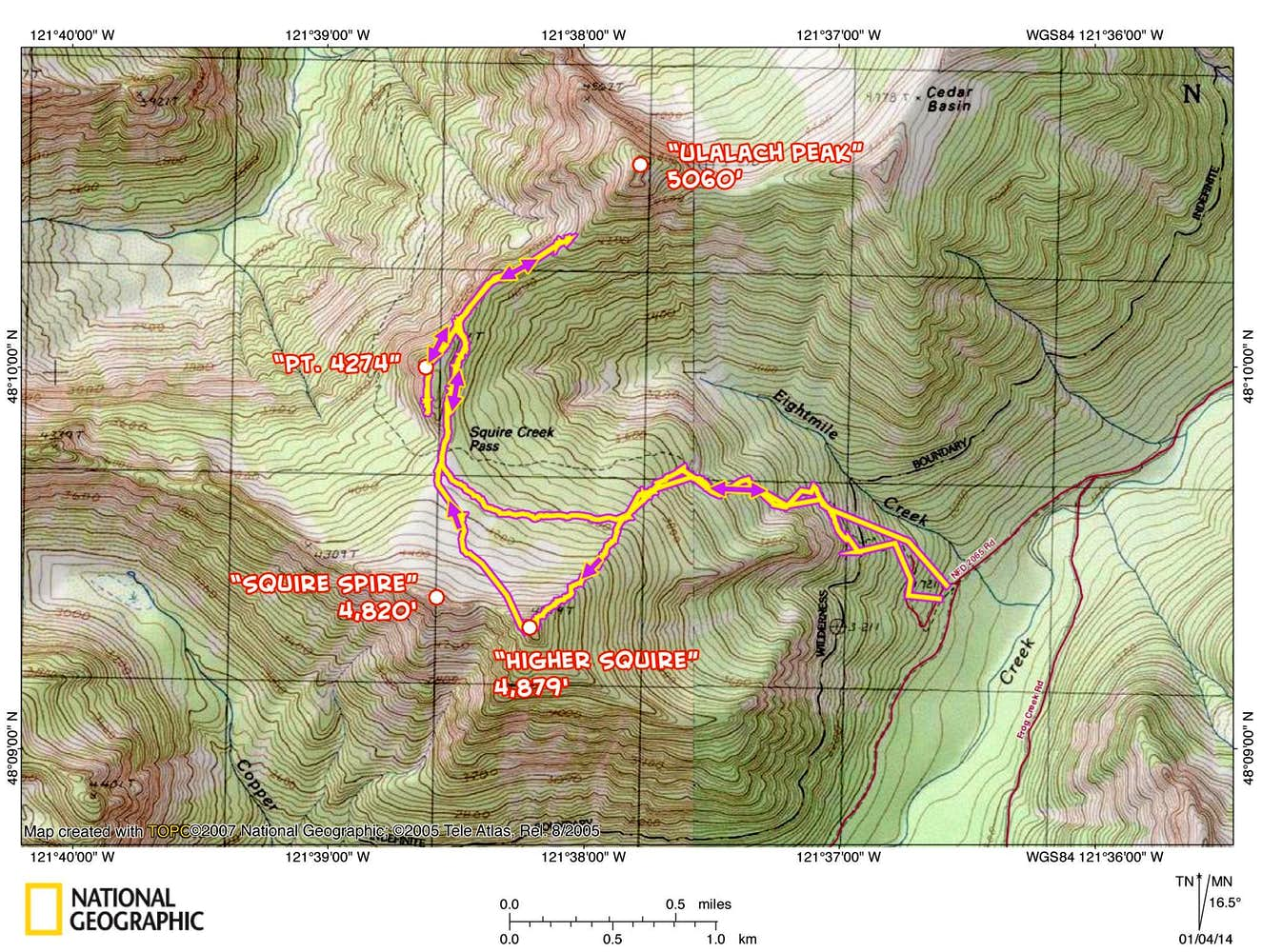
Map
CLICK TO ENLARGE
Trip Report
THIS TRIP REPORT IS STILL MOSTLY IN THE EMBEDDED HTML FORMAT OF MY OLD WEBSITE.
INTRO
The weekend forecast was for sun, so the mountains were calling. I decided to join my friends Gabriel, Lindsay, Carla, and Yana on a snowshoe adventure to Higher Squire off the Mountain Loop Highway (just east of Darrington). This destination proved to be a great choice. The route started on the Eight Mile Creek trail, and once we hit enough snow to put on snowshoes, we cut away from the trail and headed directly up towards the summit of Higher Squire via its NE side. We arrived at the satisfyingly narrow summit three hours after leaving the car. From there we had unobscured views of views of Three Fingers and Whitehorse to the west and northwest. After a long lunch break, we enjoyed a pleasant romp over to Squire Creek Pass, which placed us even closer to the sheer eastern walls of Three Fingers. We had vague intentions to climb Ulalach Peak to the north, so we headed in that direction. By the time we arrived at the final slopes, we knew we had to make a decision between summiting Ulalach and making an entirely-dark descent or turning around, tagging Point 4274 instead, and making most of the descent in the daylight. We chose the latter, arriving back at the car 9.5 hours after we left that morning. What a great way to spend a winter day in the Cascades!
The following page gives a map, stats, and some photos from the day. I had just brought along my point and shoot rather than my SLR, but it still managed to get a few decent photos.
STATS
Total trip: ~7 miles, ~4000 ft gain/loss, 9.5 hours (with a couple of long breaks)
7:45 AM : 1,750 FT : Eight Mile Creek Trailhead
7:58 AM : Sun rises
8:00 AM : 1,750 FT : Start hiking
10:56 AM : 4,879 FT : Higher Squire Summit
11:43 AM : 4,879 FT : Leave Higher Squire Summit
12:26 PM : 4,000 FT : Squire Creek Pass
1:45 PM : 4,200 FT : Turn around point before Ulalach Peak
2:40 PM : 4,274 FT : Top of Point 4274
4:23 PM : Sun sets
5:26 PM : 1,750 FT : Eight Mile Creek Trailhead
PHOTOS
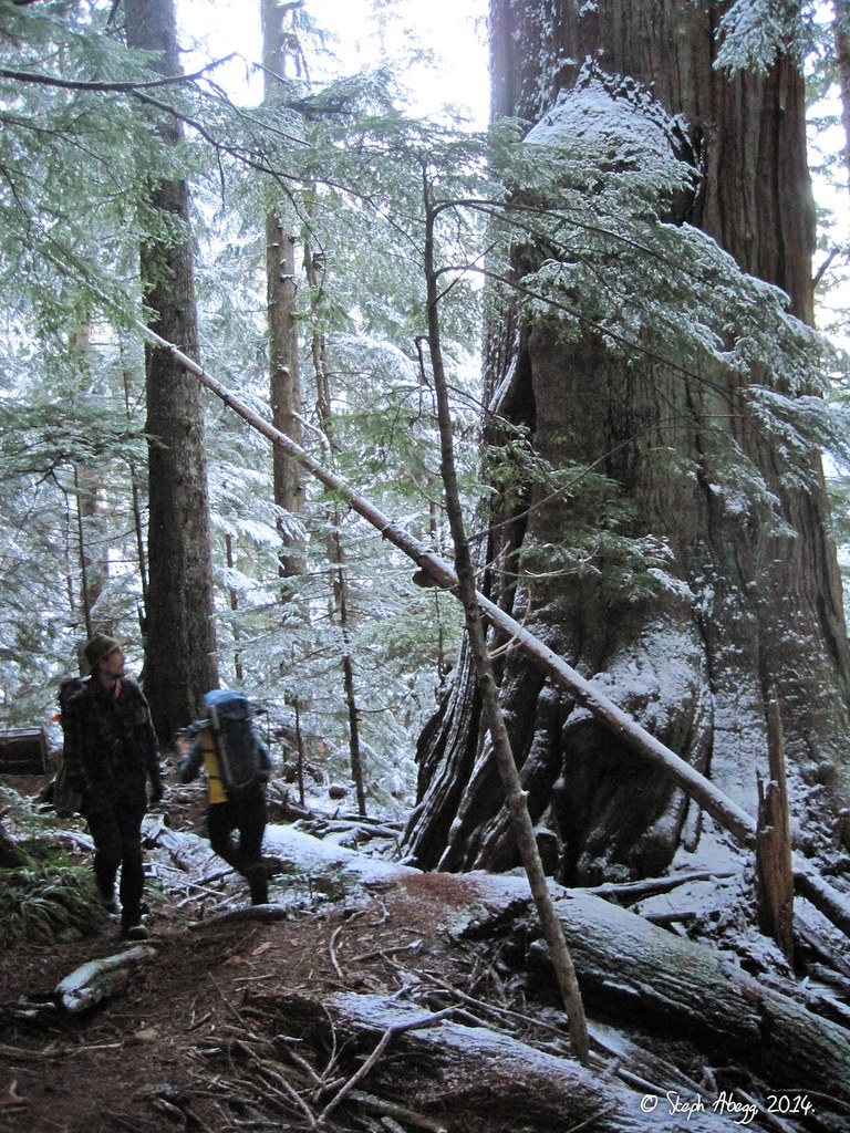
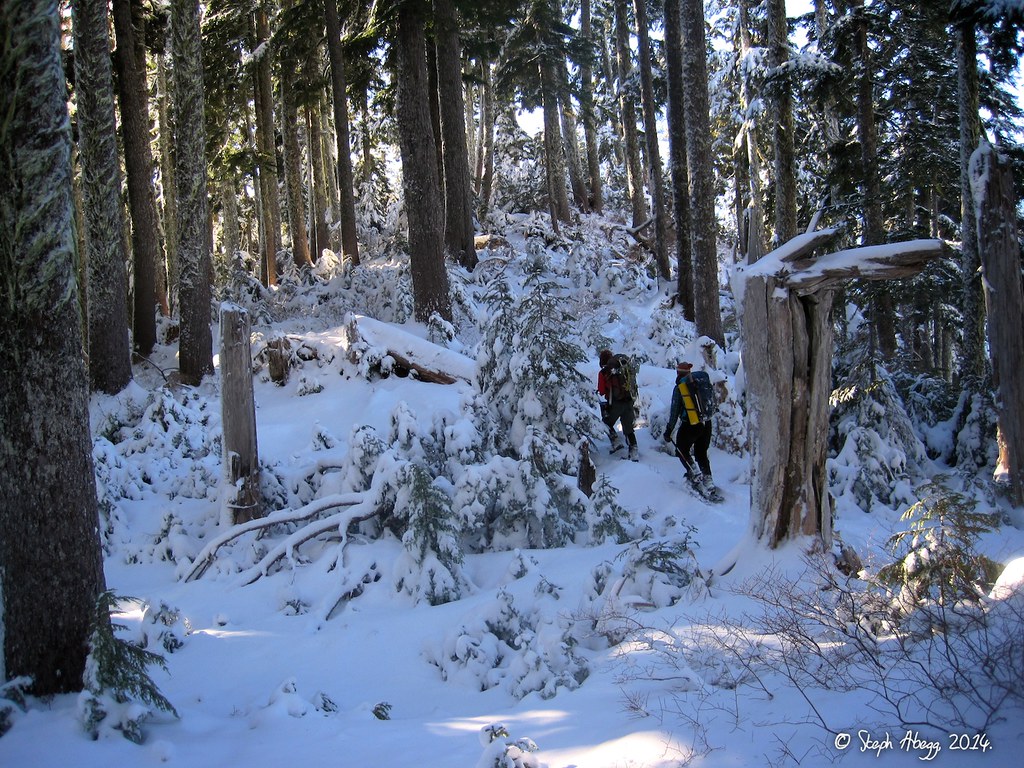
We approached Higher Squire via the Eight Mile Creek trail towards Squire Creek Pass. There were some impressive old-growth trees along the trail, as shown in this photo.
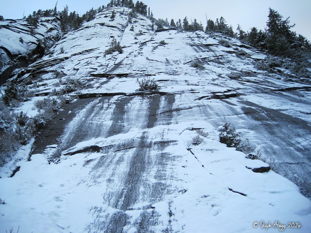
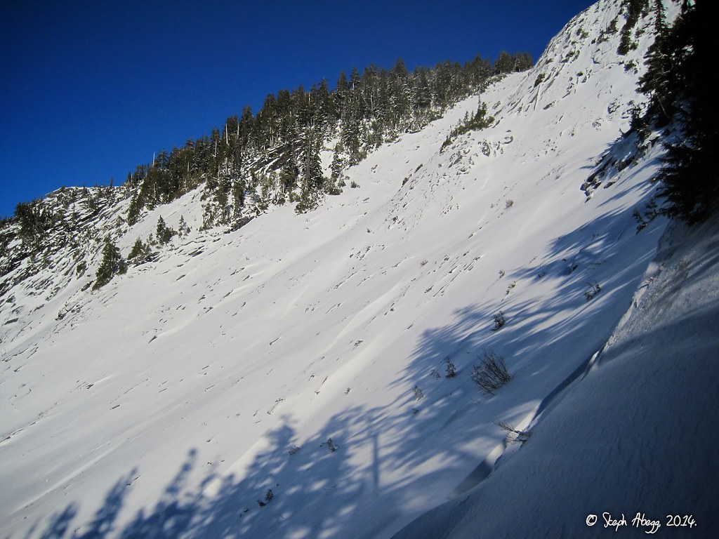
This photo shows some snow-covered slabs about a half hour from the trailhead. There might be some potential for slabby climbing here in the summer.
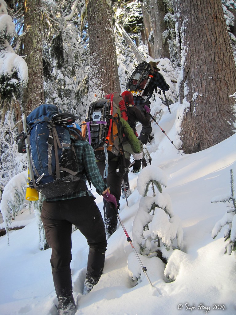
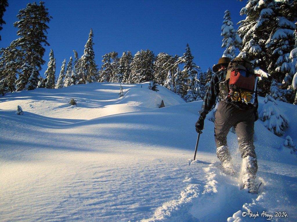
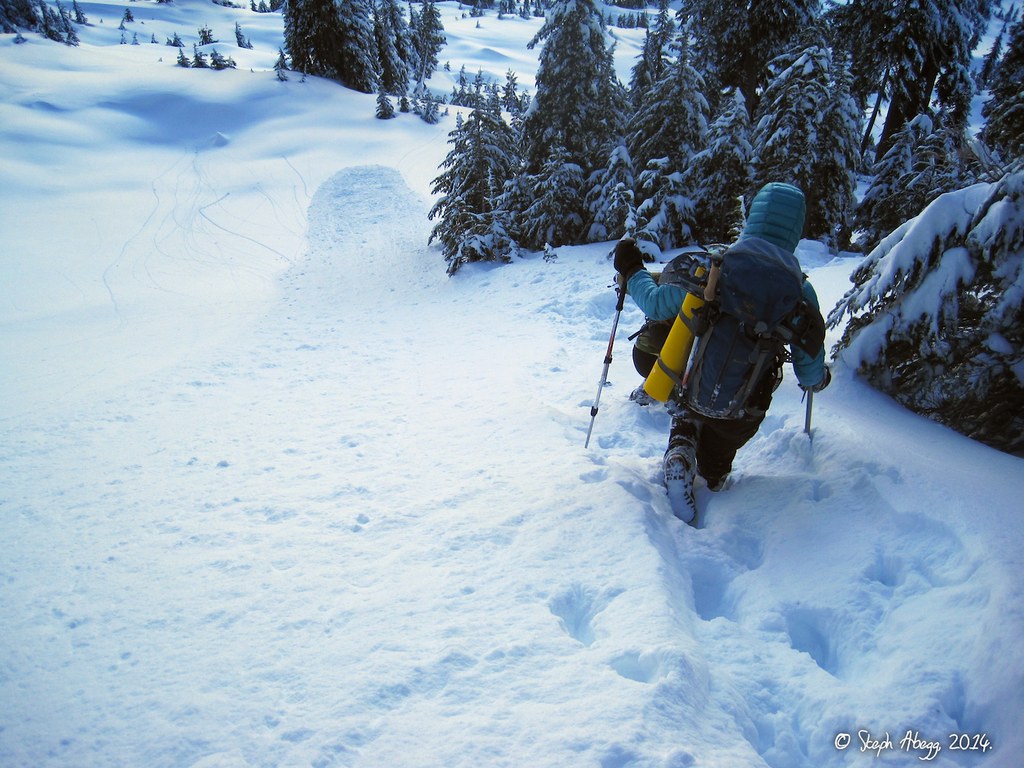
Hiking up the snowy trail. We hit snow by 2400' and put on snowshoes at about 4000'.
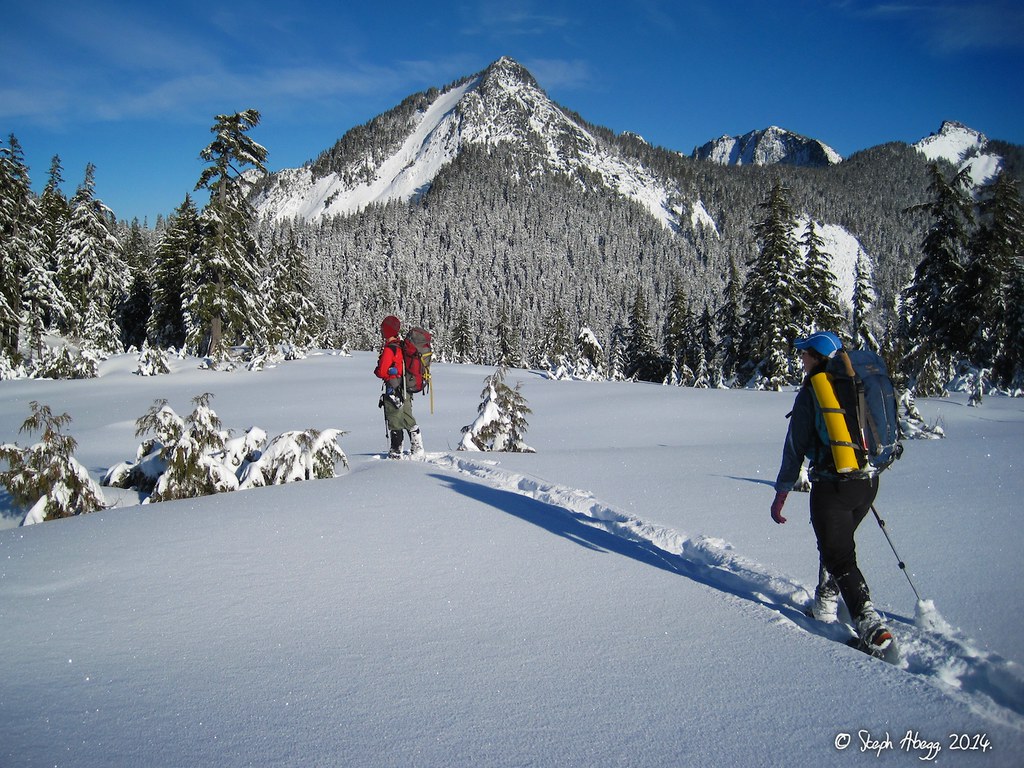
Gabriel slogging up towards the top of Higher Squire via the NE slopes.
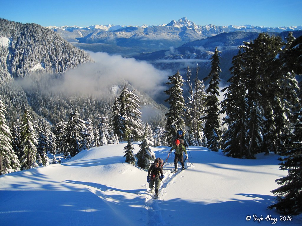
Yana, Carla, and Lindsay slogging up towards the top of Higher Squire via the NE slopes.
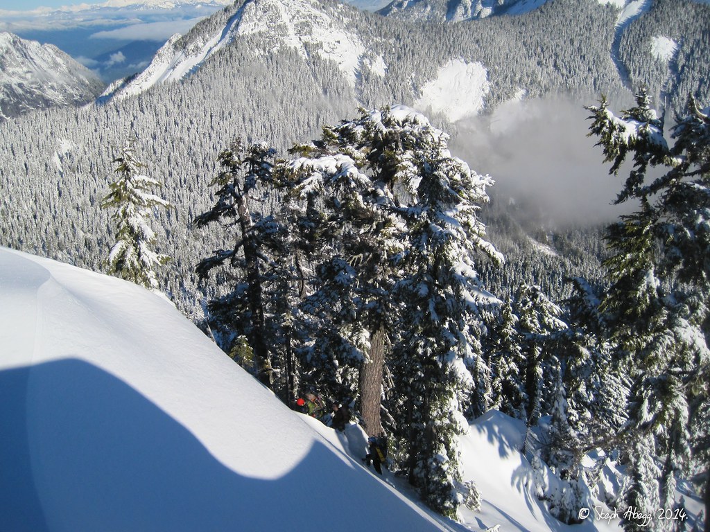
Looking down at the final section below to the summit of Higher Squire. This is the steepest part of the route.
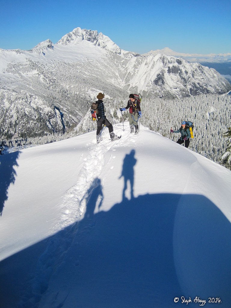
Gabriel on the satisfyingly narrow summit perch of Higher Squire. It took us just under 3 hours from the car.
This photo was taken from the summit of Higher Squire. That's Whiitehorse in the background.
Yep, on the summit!
Descending the NW slopes of Higher Squire towards Squire Creek Pass. We stayed along the edge of the slope since there was a bit of sloughing of the top 8-10 inches of fresh snow. In general the route avoided any potential avalanche slopes.
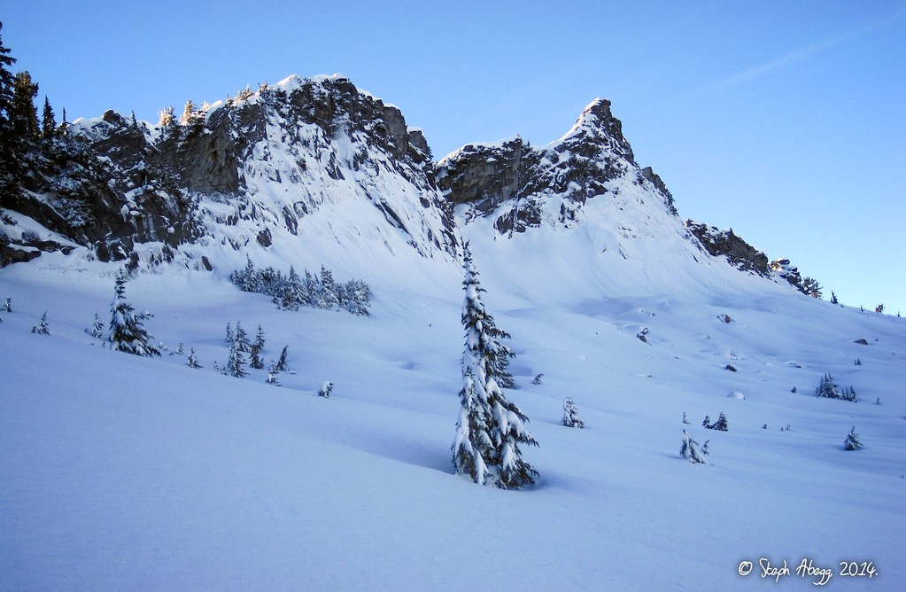
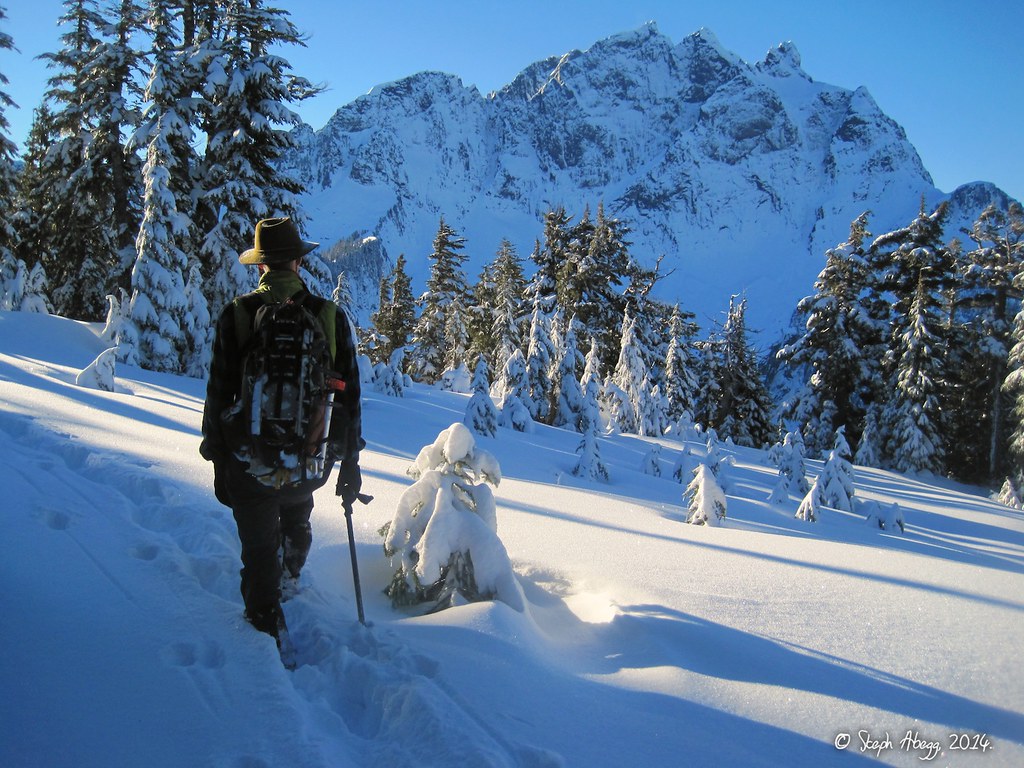
This area between Higher Squire and Squite Creek Pass is ideal for a snowshoe romp. Three Fingers dominates the view to the west.
Looking up at "Squire Spire" just west of Higher Squire.
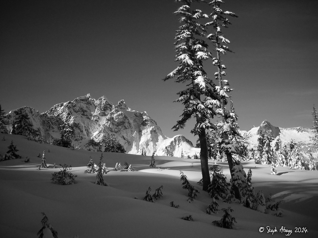
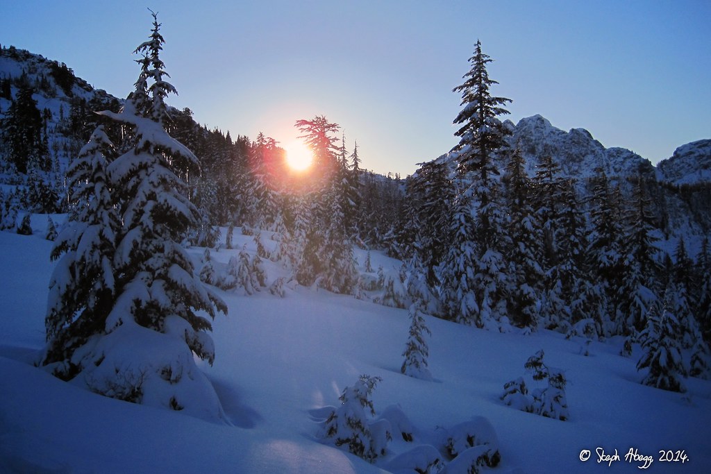
Looking back at the traverse from Higher Squire (below the sun) towards Squire Creek Pass.
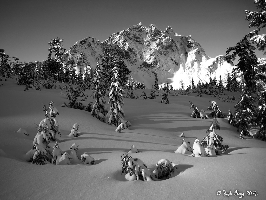
The view of Three Fingers from near Squire Creek Pass.
The view of Three Fingers from near Squire Creek Pass.
Yana and Lindsay at Squire Creek Pass, with Ulalach Peak in the distance. We had vague intentions to climb Ulalach Peak so we headed in that direction.
The west-side slopes just below the summit area of Ulalach Peak. We had a choice to make: (1) we could continue across these slopes and up to the summit, and face the entire decent to the car in the dark or (2) we could turn around here, tag some views on Point 4274, and be back on the trail by the time it got dark. We initially chose (1), but when we tried to get onto the slopes in the photo we encountered a steep section of snow- and ice-covered slabs; we could have carefully kicked our way through it, but this would eat up precious time and also put us briefly in an area where a slip could end quite badly, so we reassessed and decided to go with option (2) and enjoy a safer and more pleasant evening romp back to the car.
The treed ridge between Squire Creek Pass and Ulalach Peak.
Gabriel on Point 4274, which we decided to tag in lieu of Ulalach Peak.
The late afternoon sun, from Squire Creek Pass. We made it back to the car about an hour after sunset, the completion of another fun winter day in the Cascades.
Useful beta. Updated route information. Corrections. Historical notes. Interesting facts. No fluff please. Please do not put links in your comment, as my spam filter will filter those comments out.