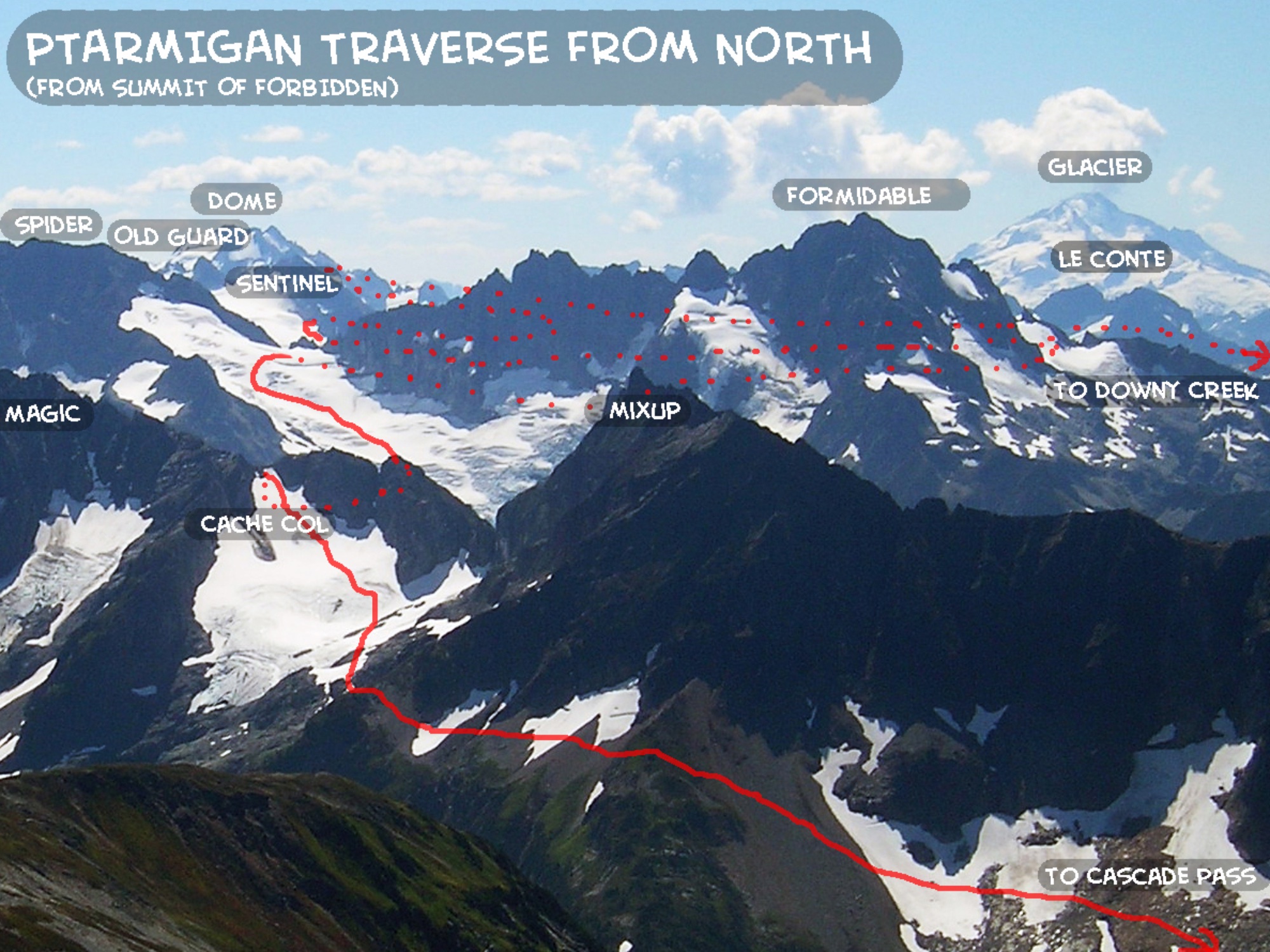
Ptarmigan Traverse South to North 2009 (30+ miles, 13000+ ft gain/loss, 6 days): Dome Peak Dome Glacier, German Helmet North Ridge, Mixup Peak East Face
Ptarmigan Traverse
Route:
South to North
30+ miles, 13000+ ft gain/loss, 6 days
Climbs along the way:
- Dome Peak, Dome Glacier Route
- German Helmet, North Ridge (mid-5th)
- Mixup Peak, East Face (3rd-4th)
Josh had never hiked in the North Cascades, so what better way than to do the Ptarmigan Traverse in the original direction. We climbed Dome, German Helmet, and Mixup along the way.
I’ve done the Ptarmigan Traverse on a few other occasions: in 2003 and 2023 (northern half only) with my parents and sister, and in 2025 as a solo 16.75 hour single push. All of these trips were done north to south, unlike the south-to-north direction of the 2009 traverse featured on this page. Follow this link to see these other trip reports.
Intro
The Ptarmigan Traverse is a popular high-level alpine trek through some of the most beautiful glaciated mountains of the North Cascades. It takes its name from the Ptarmigan Alpine Club because four of its members were part of the original traverse. The Ptarmigan Traverse requires experience at off-trail wilderness navigation and glacier travel. Although the traverse was originally done south to north, most people choose to do the traverse from the north to south (perhaps because there is less elevation gain at the beginning this way). The typical north end access is Cascade Pass and the typical south end access is Downey Creek (although road washouts on the south end might encourage different southern access routes). Most parties take 5-7 days to complete the traverse. There are several peaks that can be climbed along the way.
I had done the Ptarmigan Traverse with my parents and sister in 2003. Since then, as I have developed my photography and climbing skills, I have wanted to revisit this beautiful terrain with a better camera and a light climbing rack. My friend Josh was interested in joining me. So, in July 2009, we set out on a 6-day trek on the Ptarmigan Traverse, planning to hike from south to north (as the original party had done). The 9 miles of extra road on the approach due to a washout was an annoyance, but not enough to stop us!
The following trip report gives photos and details of our wonderful 6-day traverse. We had nearly perfect weather and perfect snow conditions with the early-season snowcover. We enjoyed each other's company and we climbed 3 fun summits along the way: Dome Peak, German Helmet, and Mixup Peak. Also, I went prepared with plenty of batteries for some night photography!
Trip Report by Day
THIS TRIP REPORT IS STILL MOSTLY IN THE EMBEDDED HTML FORMAT OF MY OLD WEBSITE. MOBILE Tip: Try Landscape mode. It is generally more mobile friendly.
CLICK ON DAY TO DROP DOWN CONTENT
DAY 1 - JULY 14
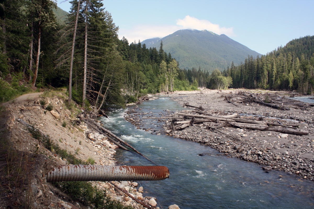
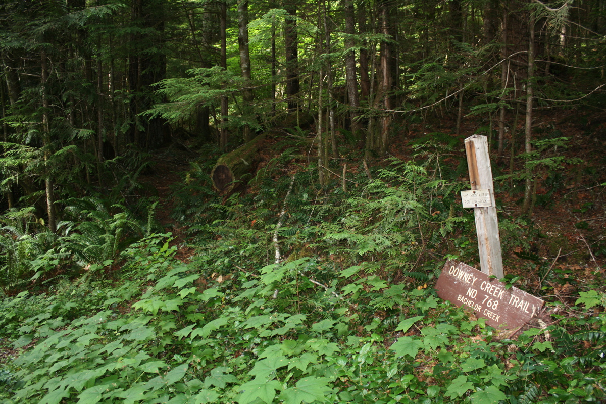
Hike 9 miles along Suiattle River Road (due to washout) and then 6 more miles along Downey Creek Trail to camp at intersection of Downey Creek and Bachelor Creek.
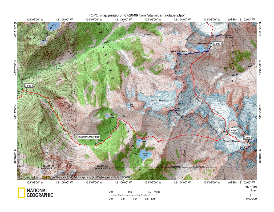
Topo Map for Day 1. Click on image to enlarge.
Washout on Suiattle River Road:
Downey Creek Trailhead:
Downey/Bachelor Creek intersection:
800ft
1500ft
2500ft
Road closure on Suiattle River Road 9 miles from Downey Creek trailhead due to washout.
Walking up 9 flattish miles on Suiattle River Road.
Downey Creek trailhead. The first 6 miles of the Downey Creek trail are relatively gentle and surprisingly well-maintained.
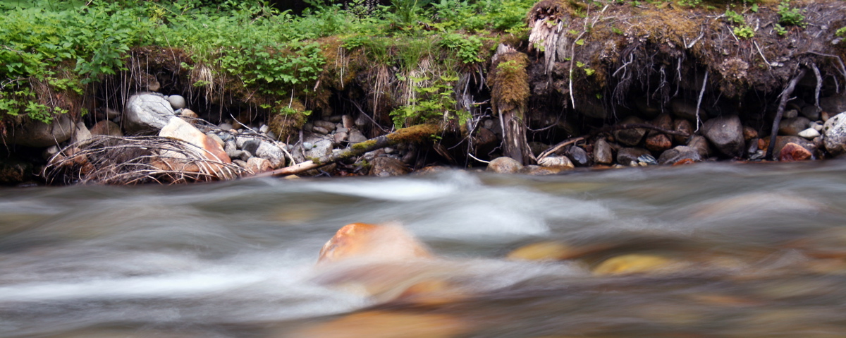
Long exposure shot of Downey Creek. (1.6 second exposure)
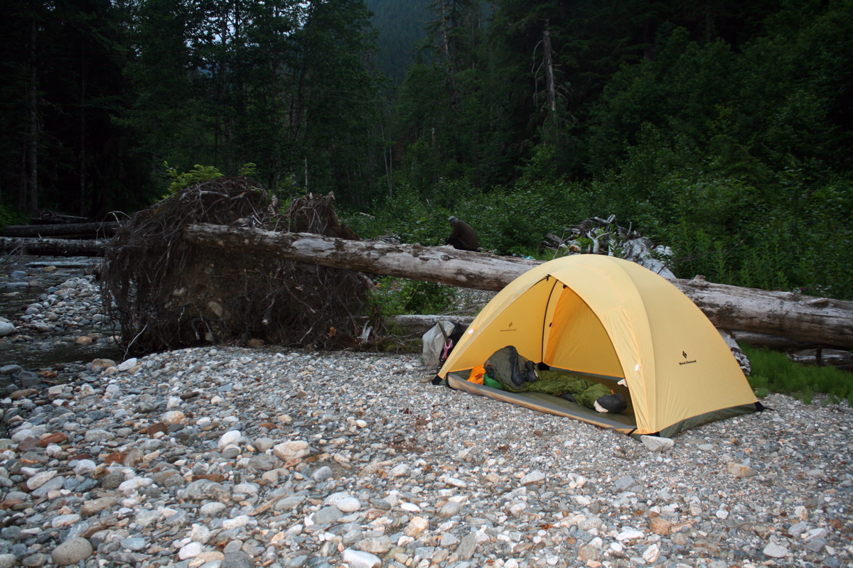
Camp on Downey Creek just above inlet of Bachelor Creek. We had gotten a late start due to having to make a car plant at the northern trailhea at Cascade Pass, so we arrived at camp just before dark.
DAY 2 - JULY 15
Schwack up Bachelor Creek trail to camp near Dome-Dana Col.
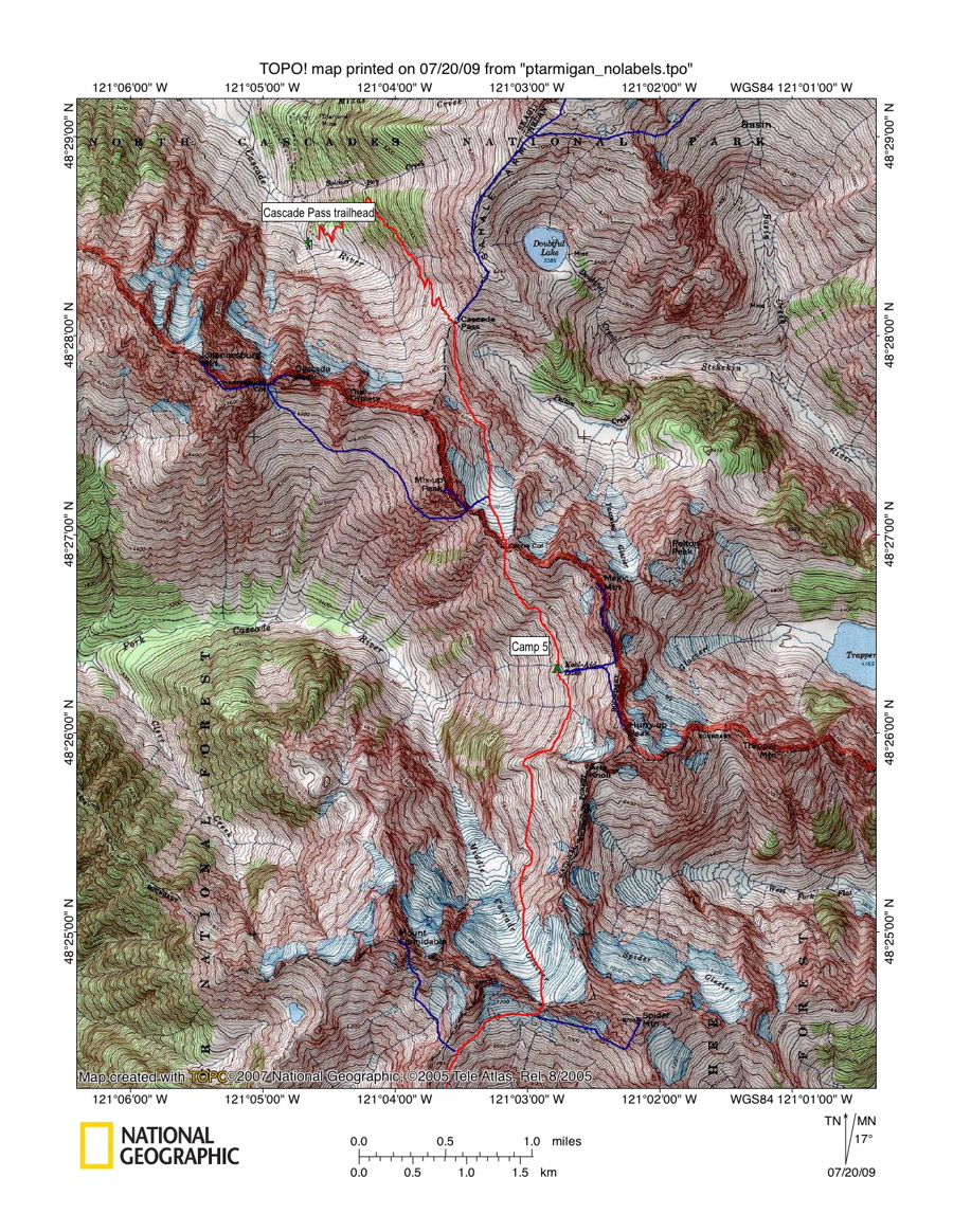
Topo Map for Days 2-4. Click on image to enlarge.
Downey/Bachelor Creek intersection:
Pass above Cub Lake:
Cub Lake:
Itswoot Ridge:
Camp just below Dome-Dana Col:
2500ft
6000ft
5338ft
6400ft
7700ft
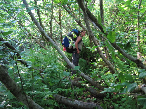
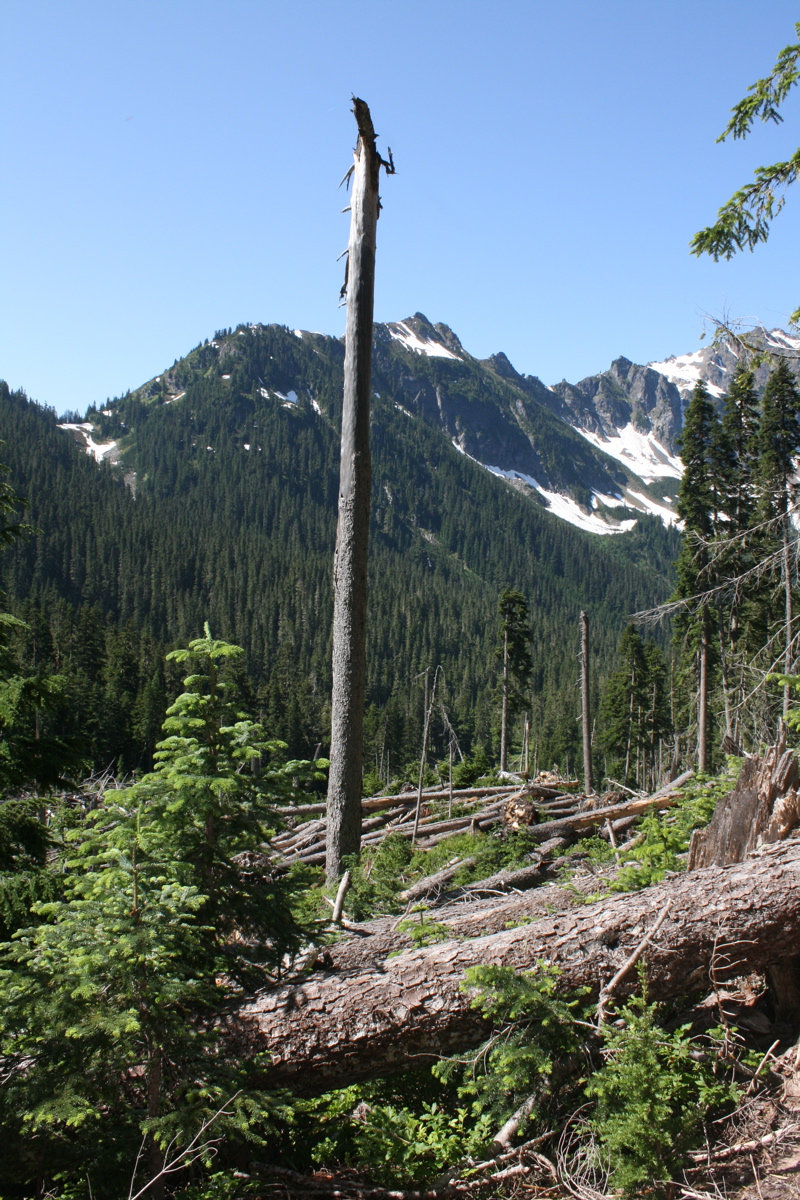
Bachelor Creek trail can be difficult to follow at times. But we knew it would be worth it.
Huge slide area across trail in upper Bachelor Creek. Fun....
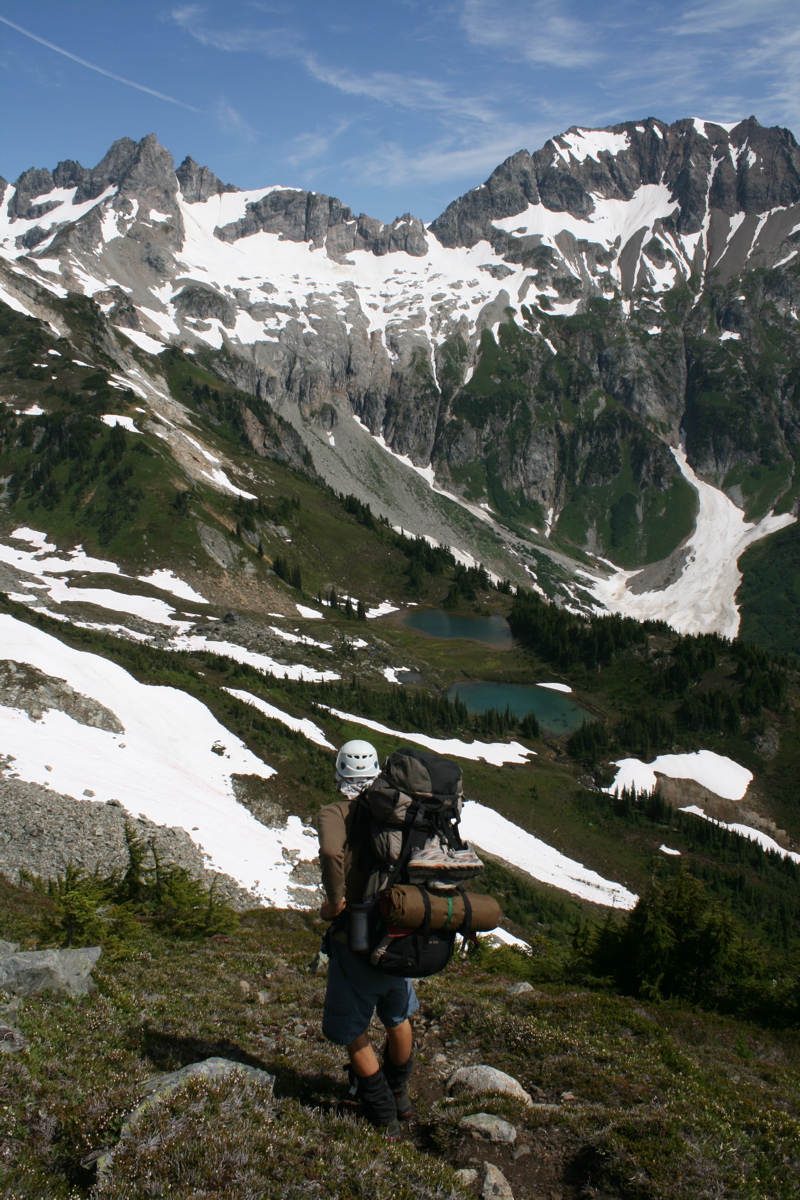
Enjoying a long break on Itswoot Ridge after a rather brushy and arduous ascent up Bachelor Creek. Glacier Peak in the distance.
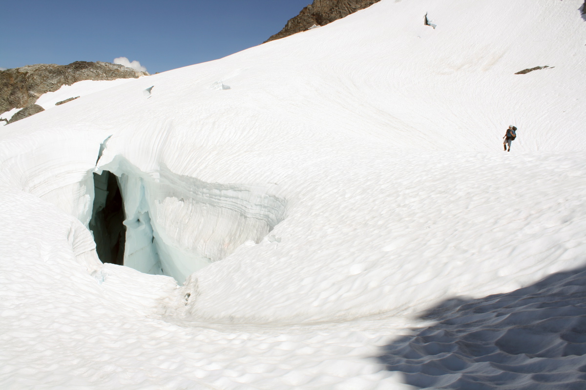
After a long break, we decided to head to the lower Dome Glacier to camp near the Dome-Dana col. 5200ft of elevation gain with full packs, not too shabby! This photo shows some cool Ice formations on lower Dome Glacier.
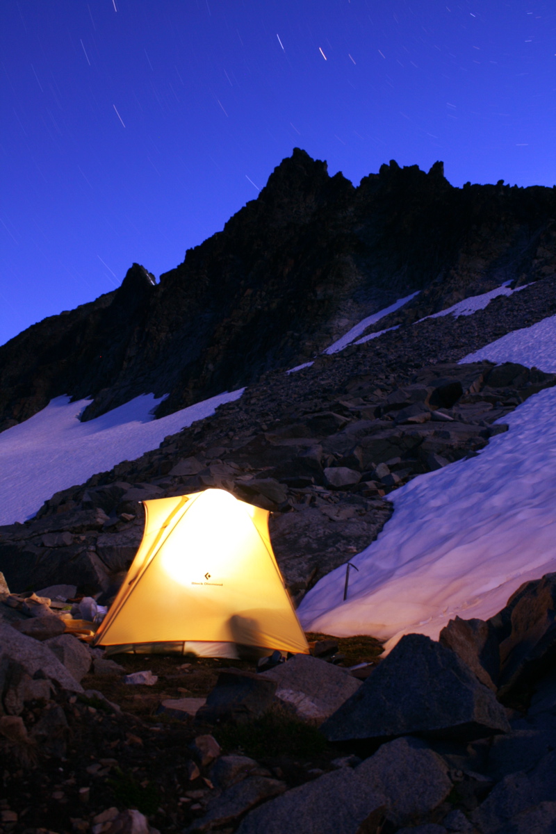
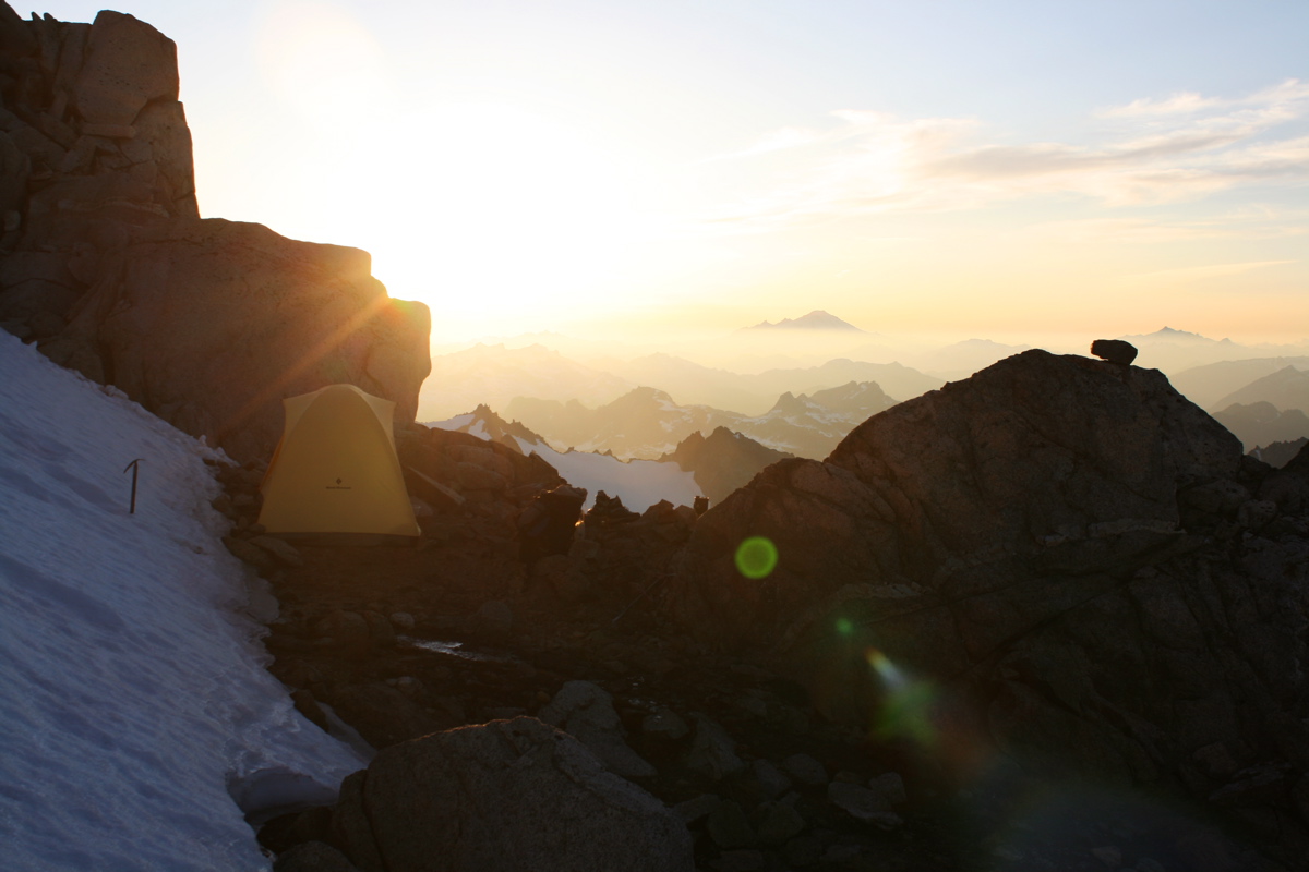
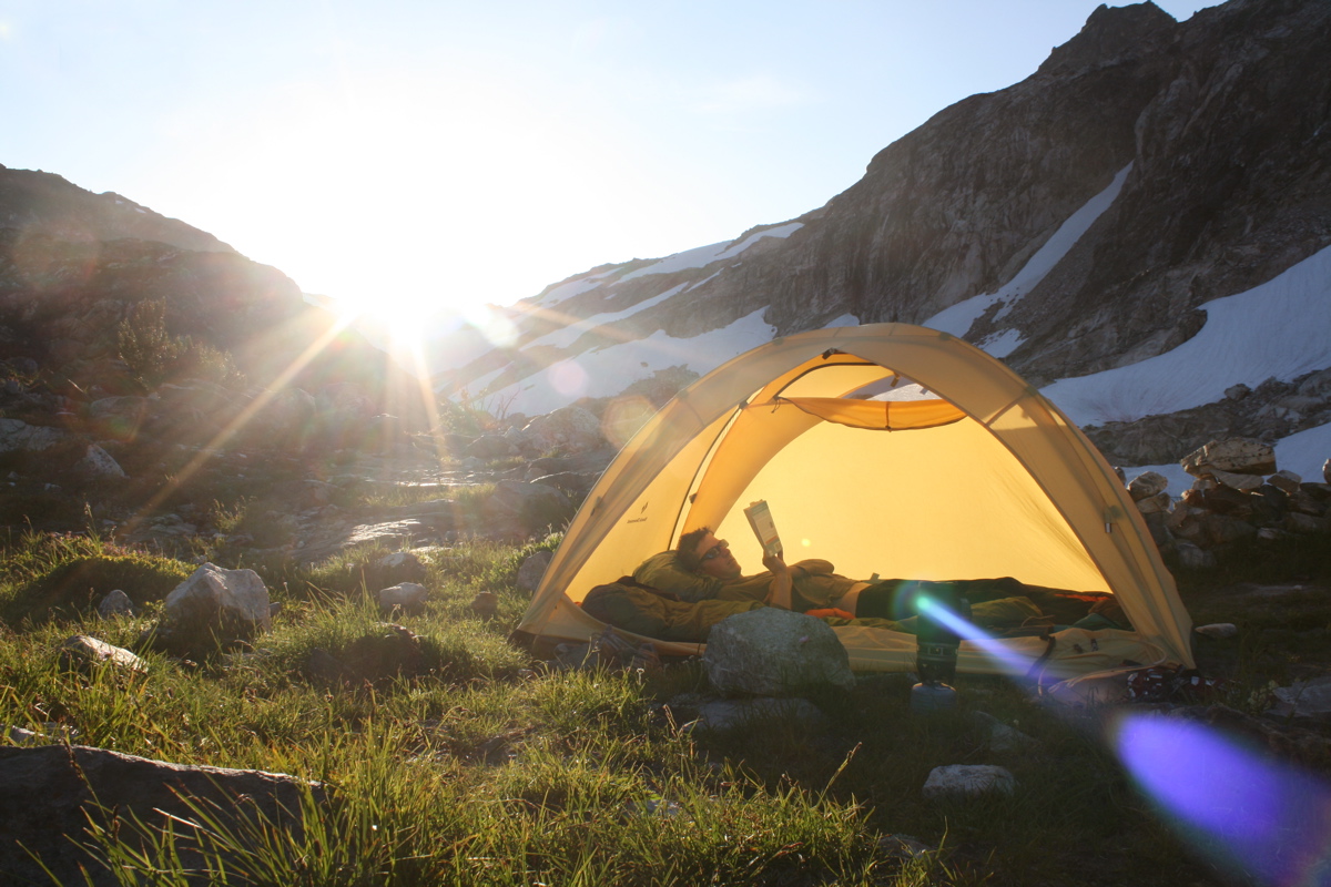
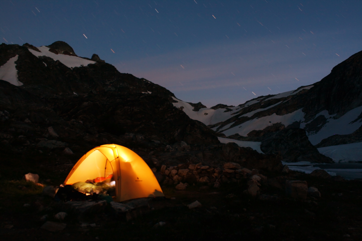
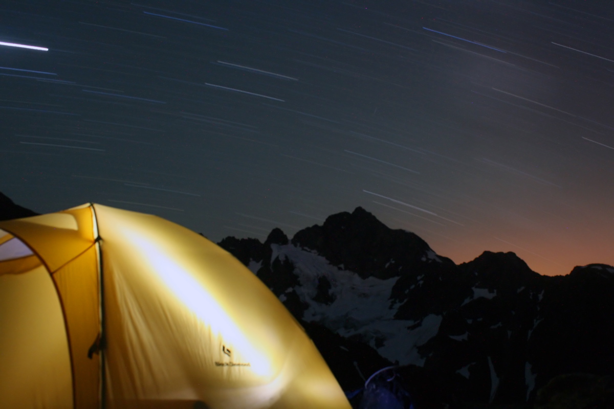
We found a great campsite perched just below the Dome-Dana col. Here is the first of several glowing tent photos I took on this trip. (14 minute exposure)
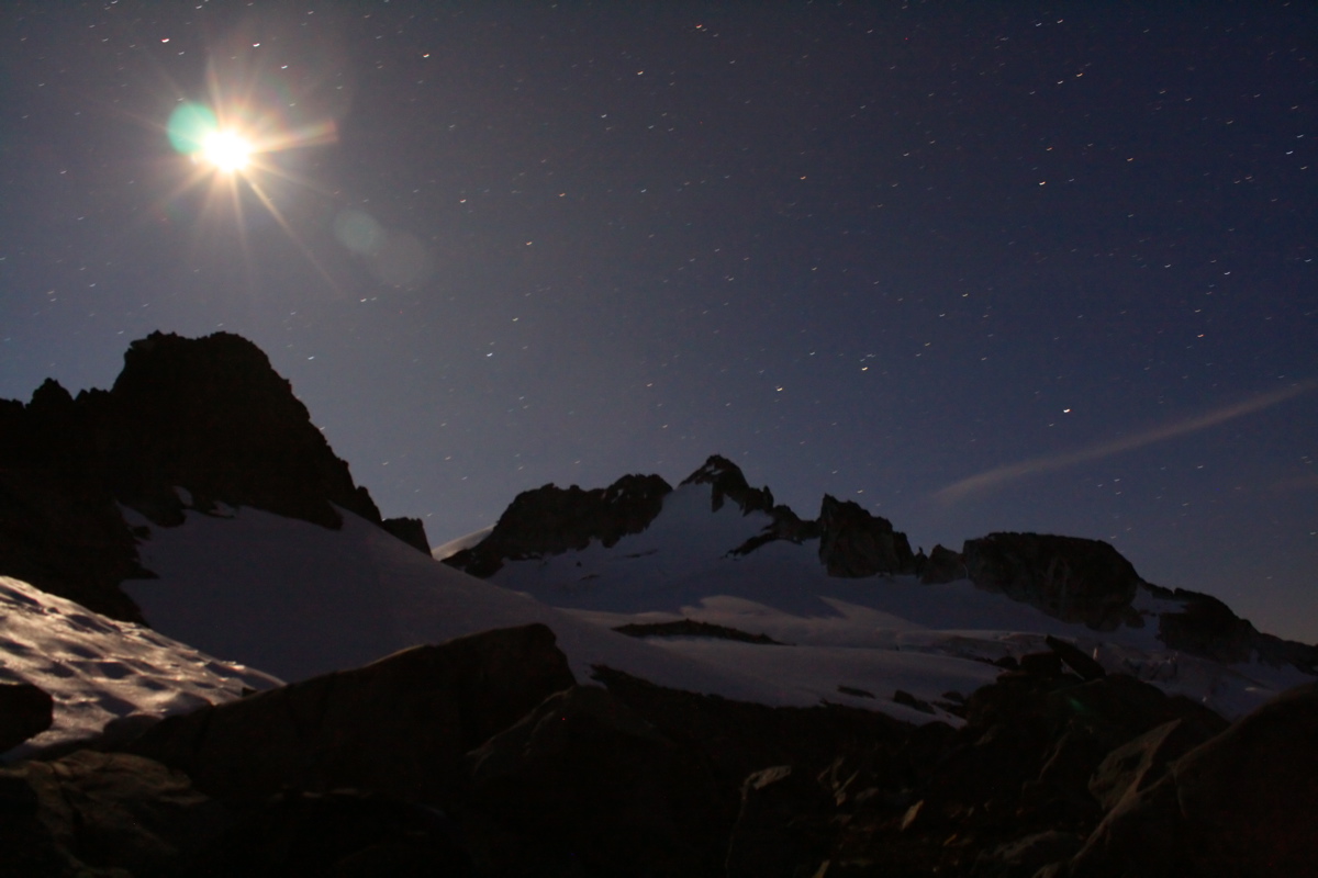
Another night shot showing the moon above our camp near Dome-Dana Col. Dome Peak in in the background. (1 minute exposure)
DAY 3 - JULY 16
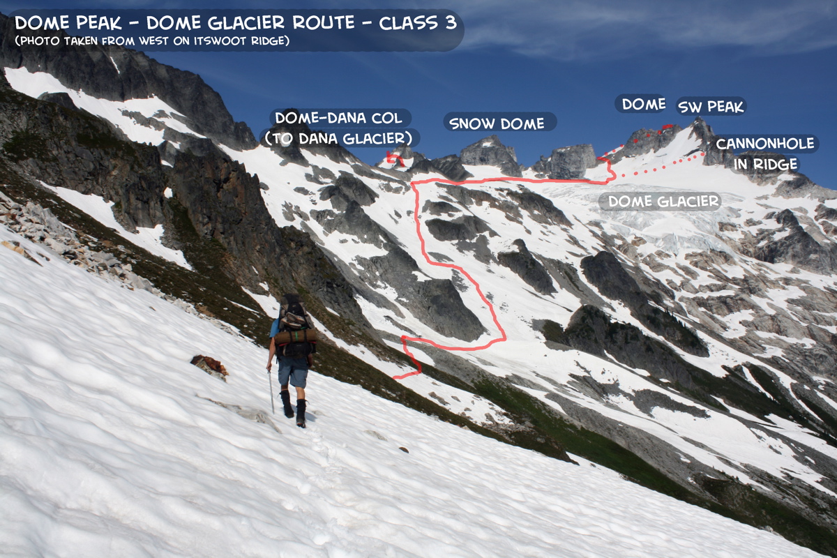
Climb DOME PEAK (DOME GLACIER ROUTE) (3rd Class, 8,920ft). Camp just below NE summit of Dome.
Topo Map for Days 2-4. Click on image to enlarge.
Route line for Dome Glacier Route on Dome Peak. Click on image to enlarge.
Camp just below Dome-Dana Col:
Col below NE Summit:
Summit of Dome:
Camp below summit:
7700ft
8560ft
8920ft
8800ft
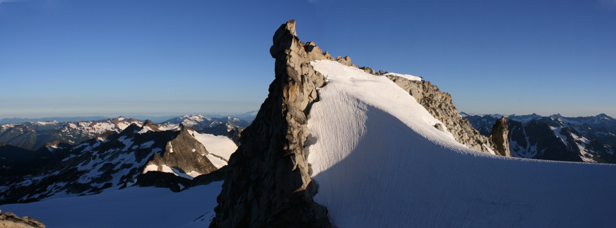
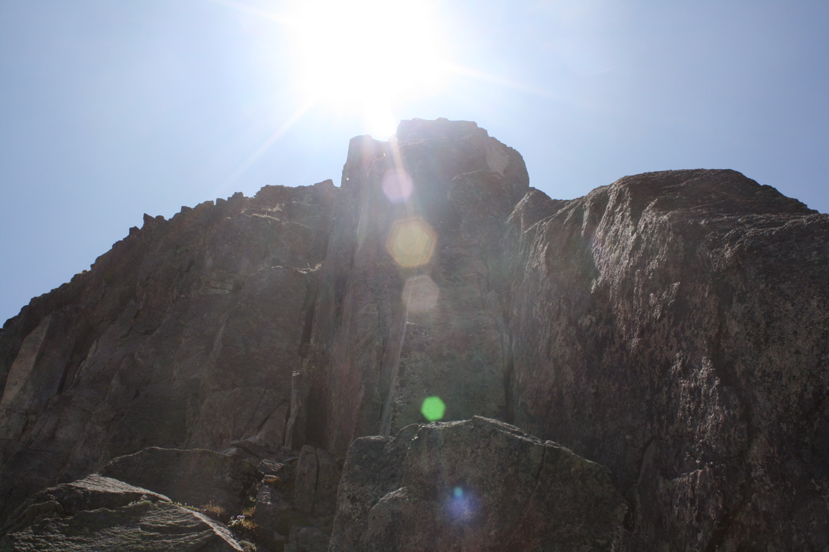
The upper part of the complex SW Peak of Dome has a serrated arete that features a cannonhole of about 10 by 20 ft - perhaps the largest such phenomenon in the Cascade Range. So, naturally, we wanted to climb into it!
Josh in cannonhole. The cannonhole perfectly frames Glacier Peak.
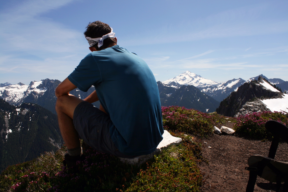
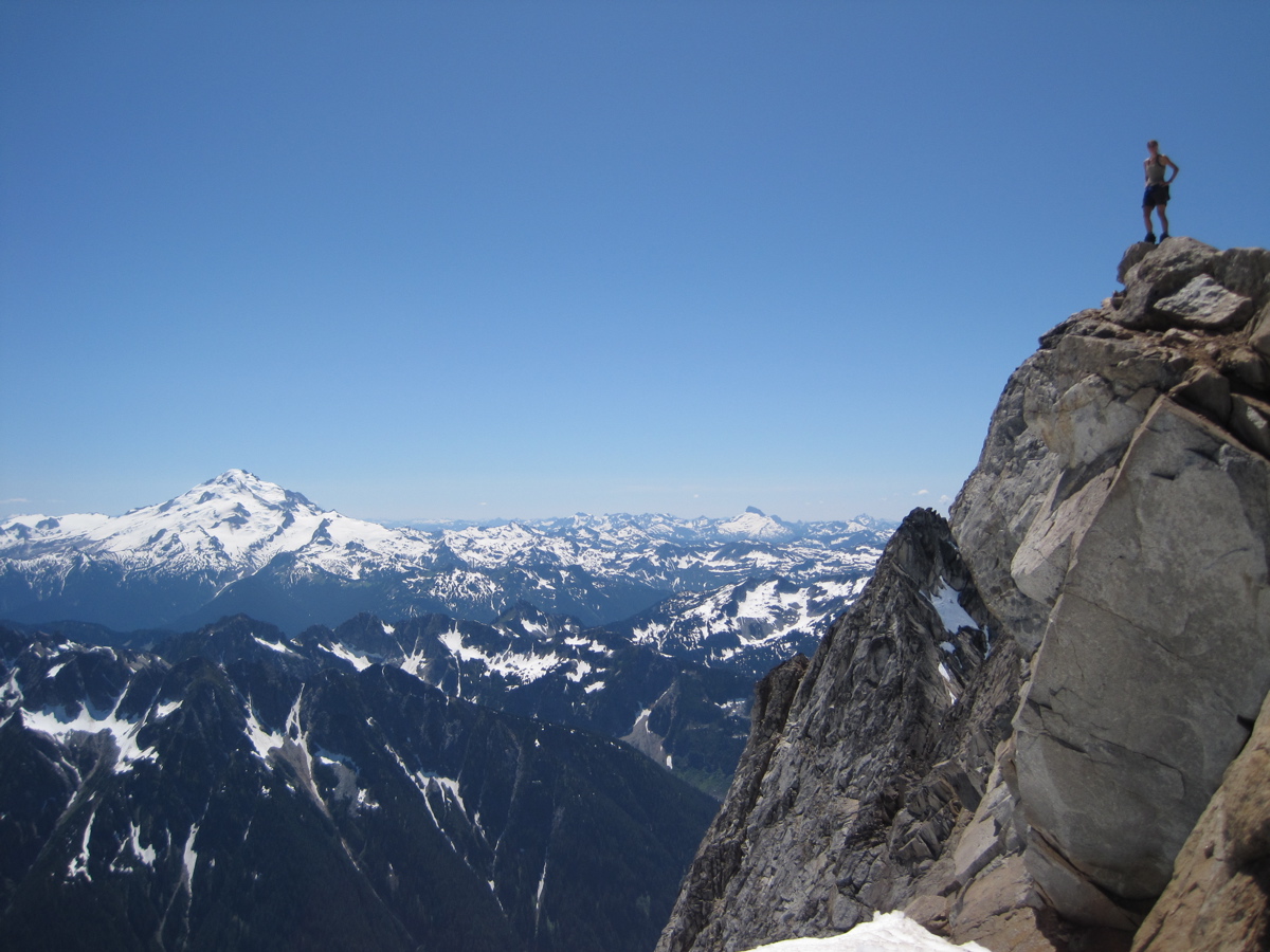
Next, we climbed to the NE summit of Dome Peak. This photo shows Steph on the summit, which is rather fun and exposed Class 3. Glacier Peak is in the distance.
We camped just below the NE summit. I explored the ridge to the east, which gives this view of the NE summit of Dome Peak.
Shadows on snow.
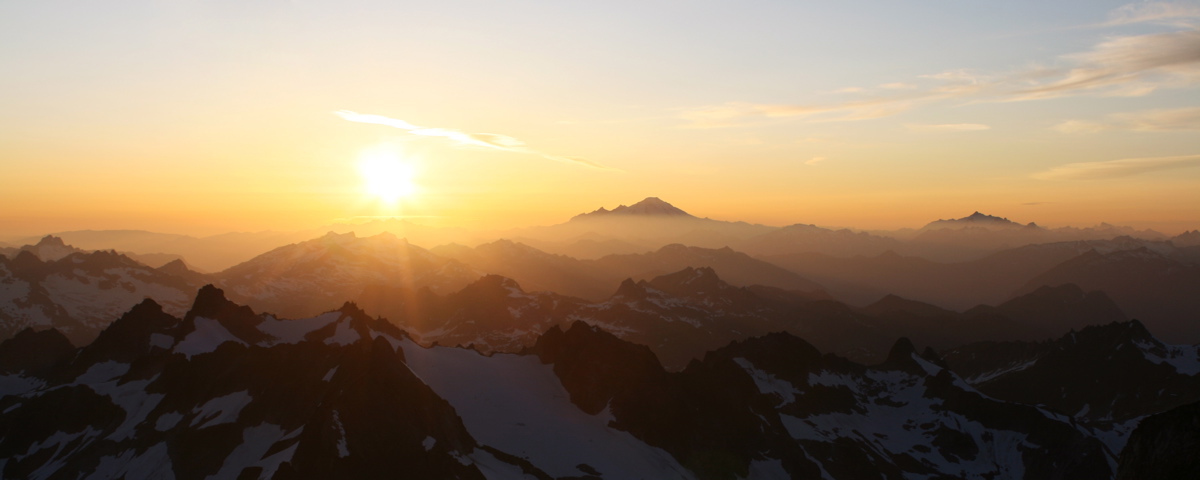
It was a beautiful evening at a spectacular camp just below the summit. I took lots of photos. (Mt. Baker just right of sun.)
Evening shadows and colors at camp just below the summit of Dome Peak. Agnes and Gunsight in background.
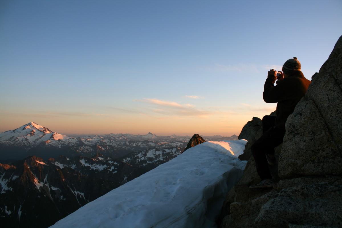
We scrambled 5 minutes up to the summit to enjoy the final sunset. Here, Josh is enjoying sunset colors on Glacier Peak.
Sunset from the summit. Mt Baker and Shuksan are silhouetted.
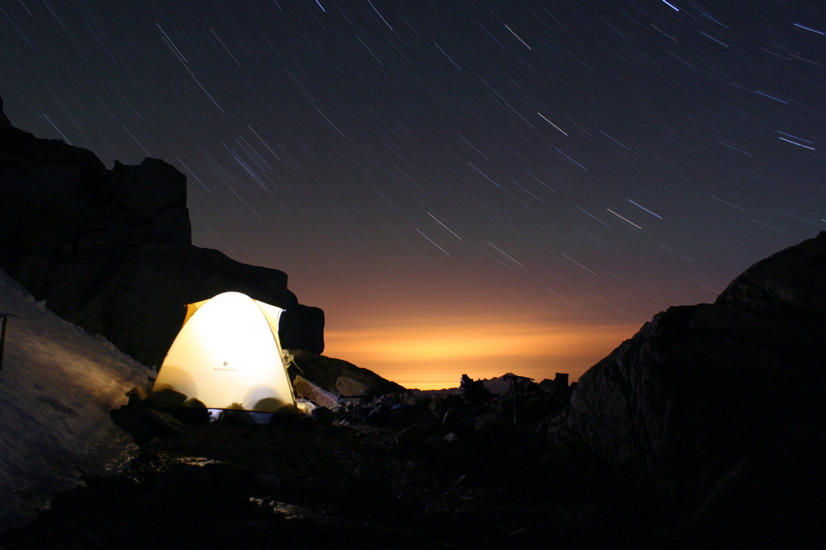
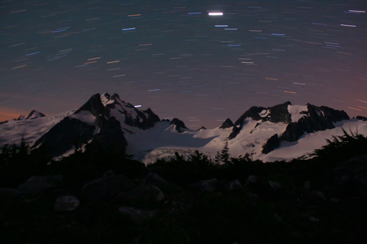
After sunset, I slept for a few hours, then awoke to do some night photography. Here is a 30 minute exposure of star trails above the N. Cascades.
And of course, another glowing tent shot. (16 minute exposure)
DAY 4 - JULY 17
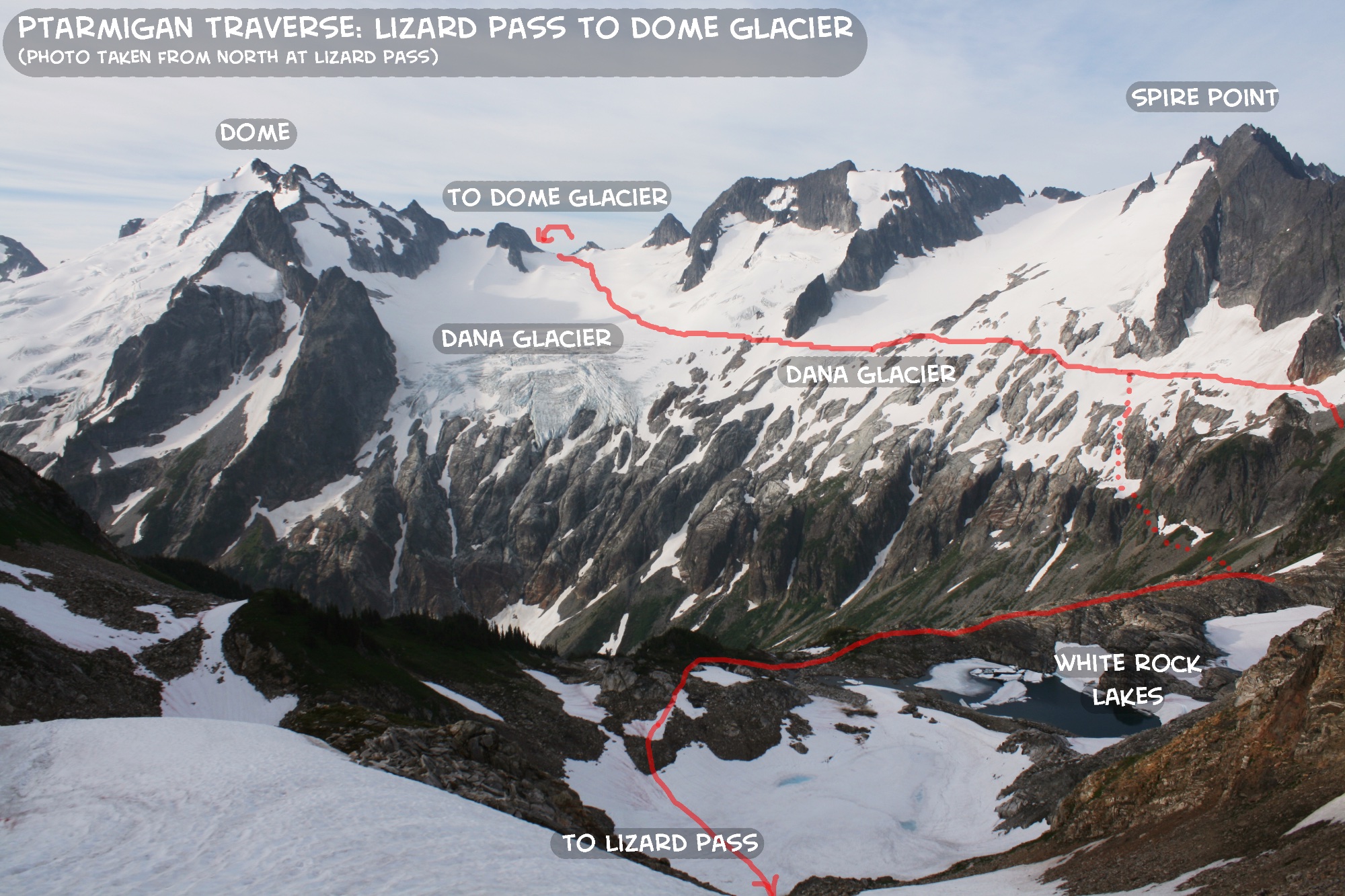
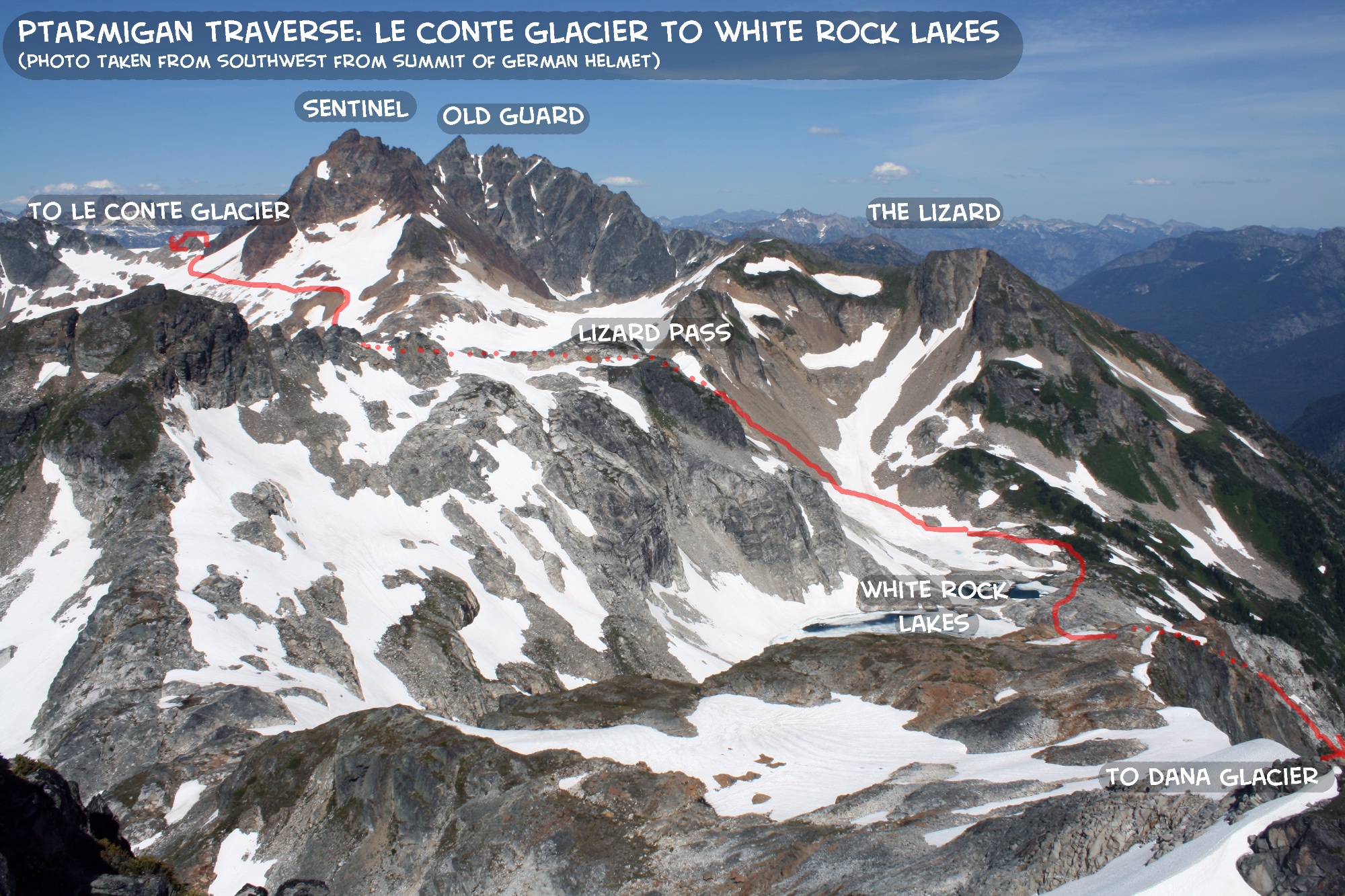
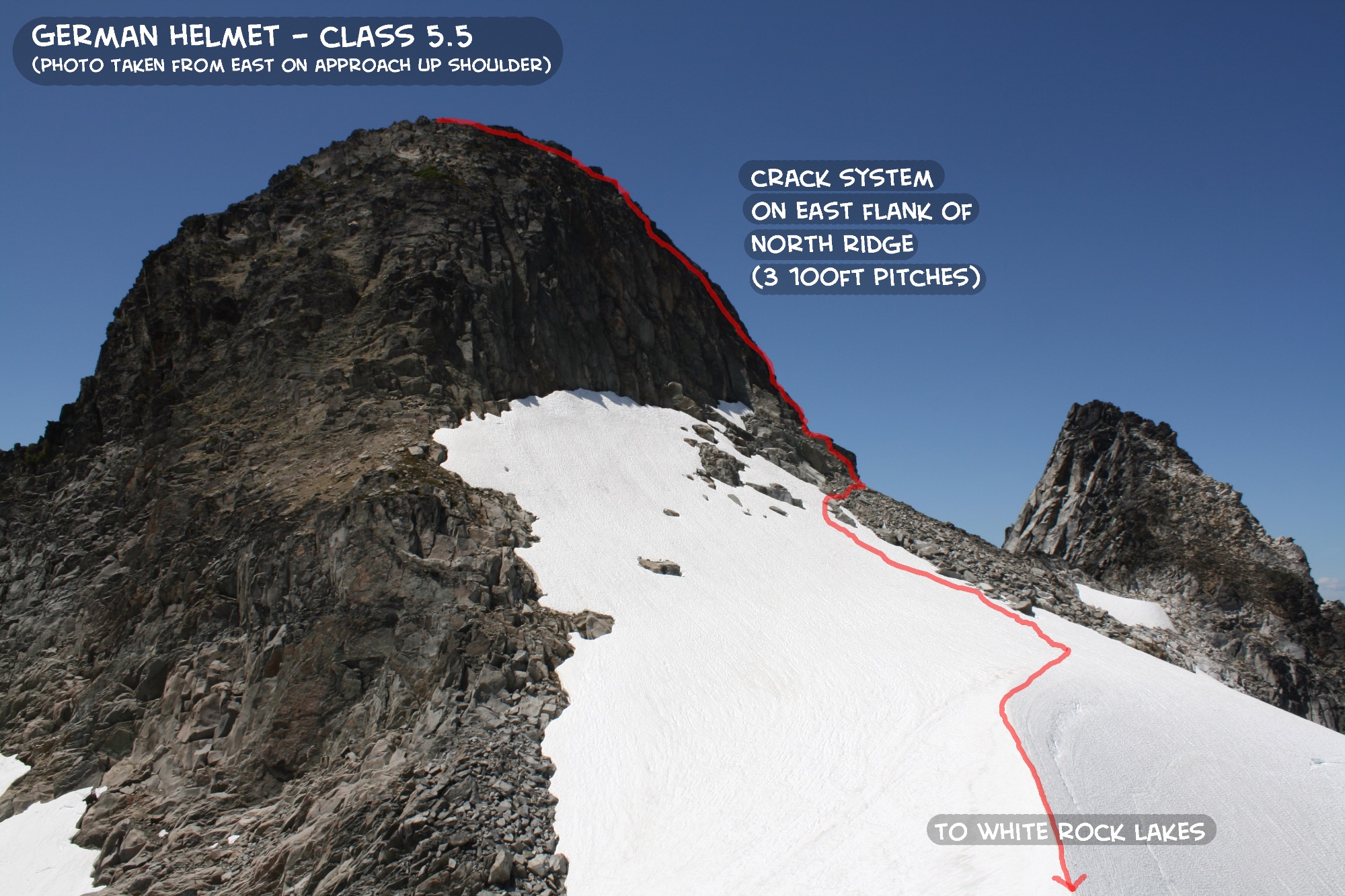
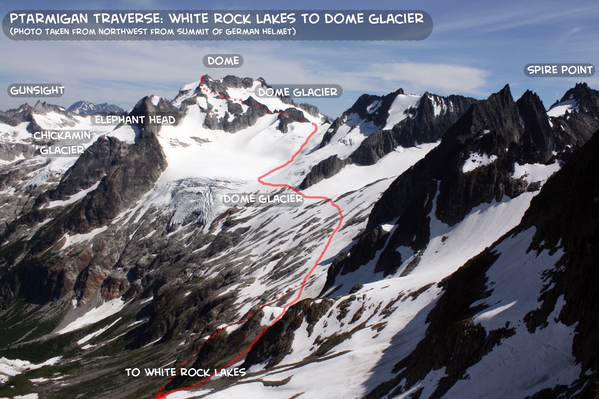
Traverse from Dome Peak to camp at White Rock Lakes. Climb GERMAN HELMET (5.5, 7,510ft).
Topo Map for Days 2-4. Click on image to enlarge.
Route line for North Ridge of German Helmet. Click on image to enlarge.
Camp below summit of Dome:
Dome-Dana Col:
White Rock Lakes:
German Helmet:
8800ft
7750ft
6200ft
7510ft
Morning sun at camp high on Dome Peak.
A cool spire just north of the col below the NE summit of Dome.
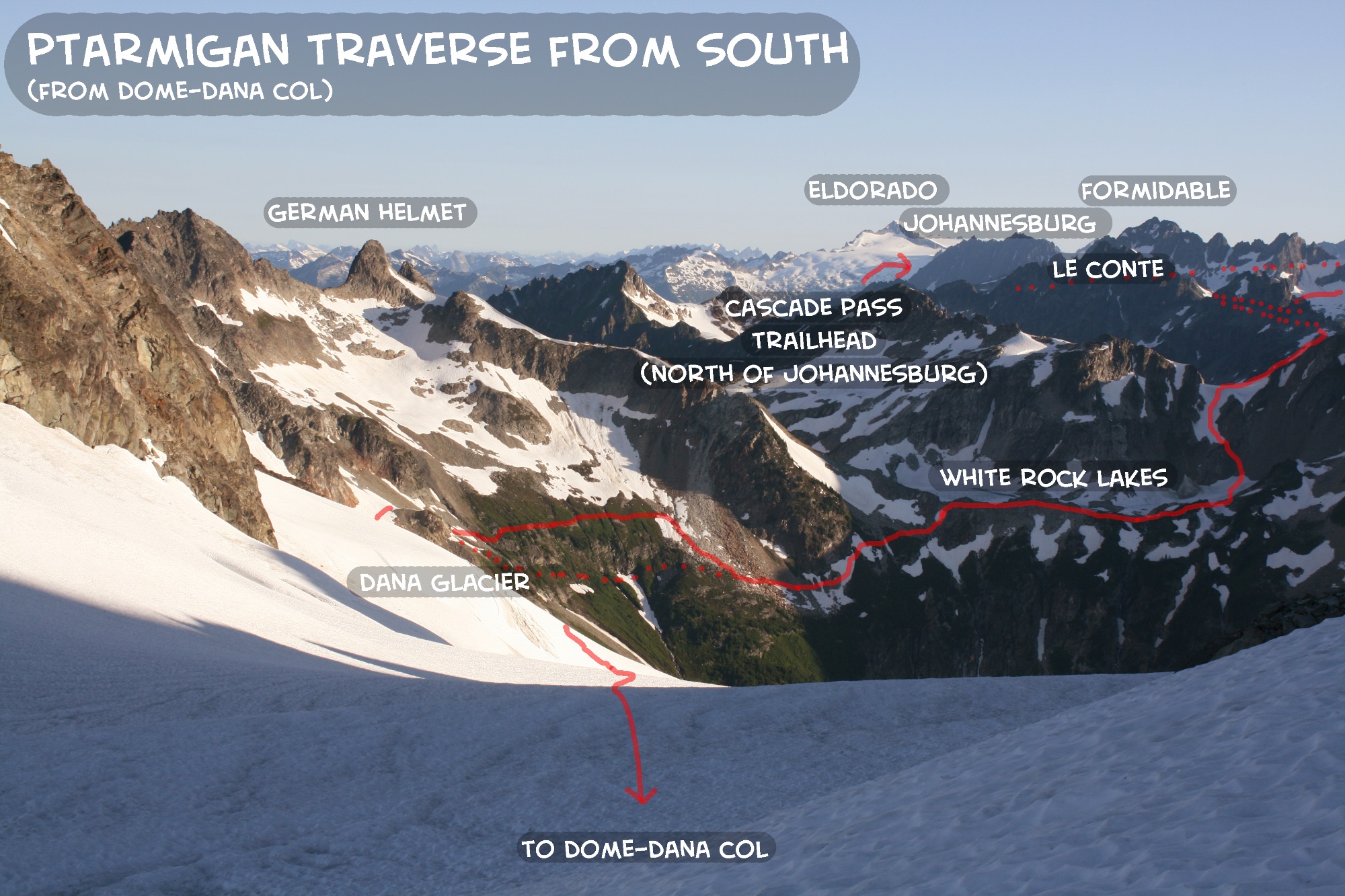
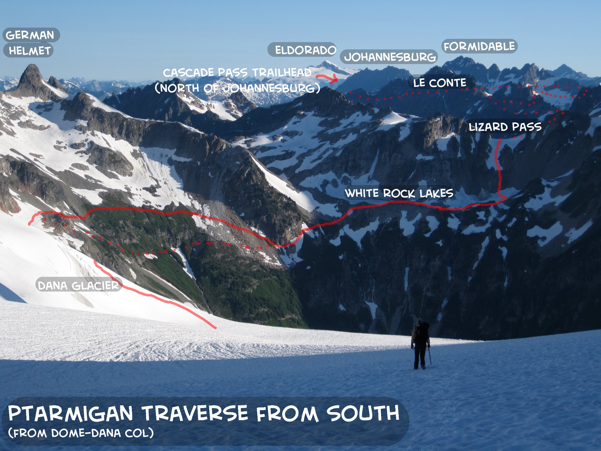
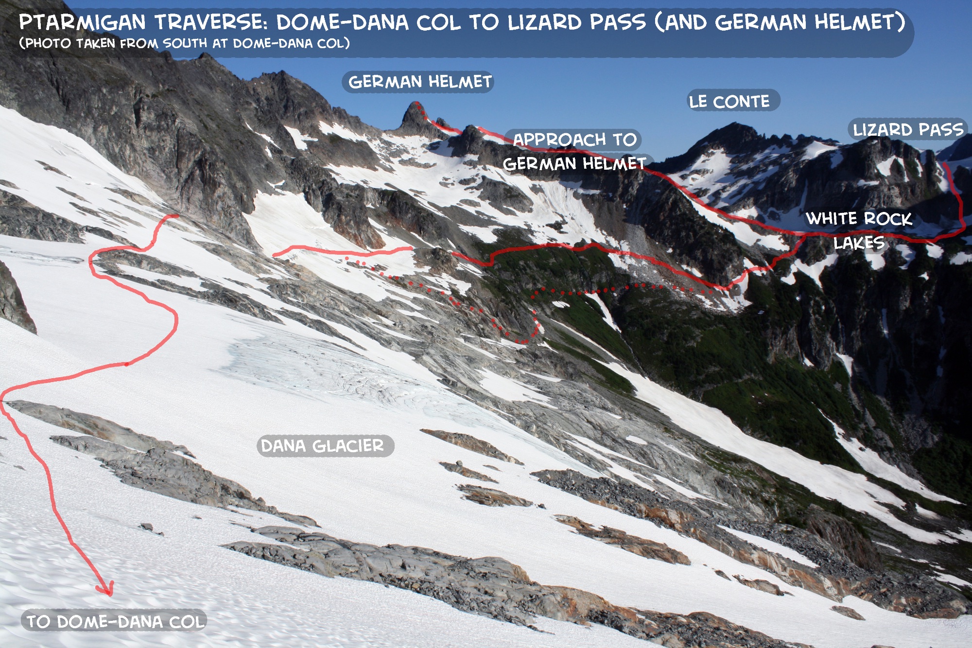
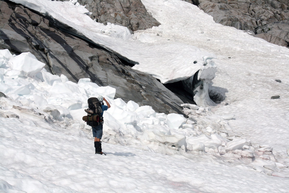
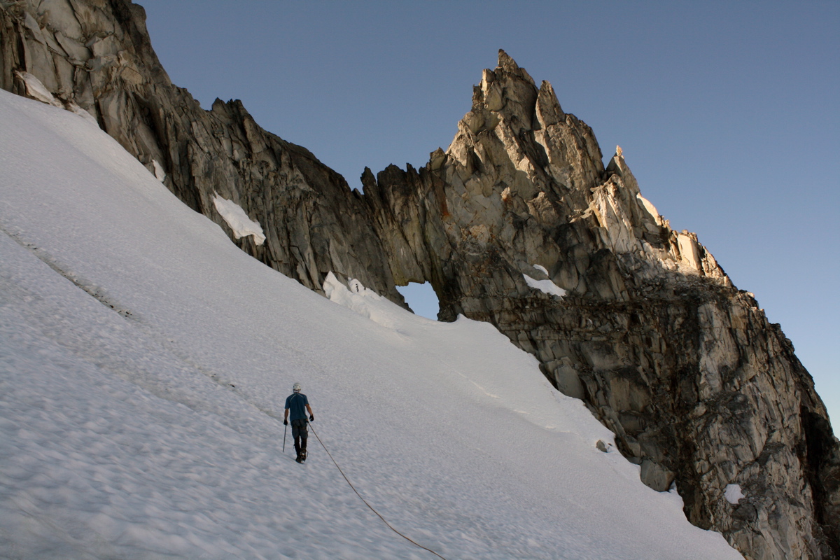
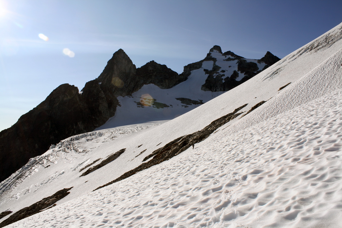
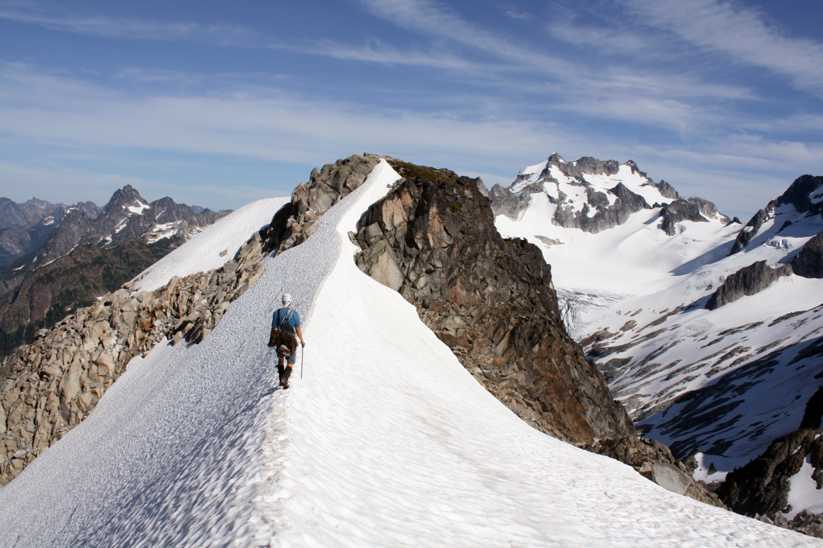
With all the snow, it was an easy crossing from the Dome Glacier to the Dana Glacier. Here is a photo of traversing the Dana Glacier, where we met up with the standard Ptarmigan Traverse route.
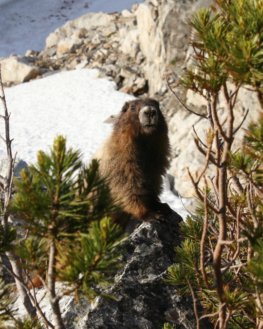
A friendly marmot greeted us at White Rock Lakes where we set up camp.
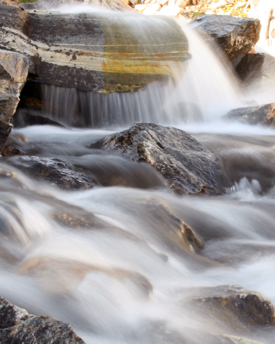
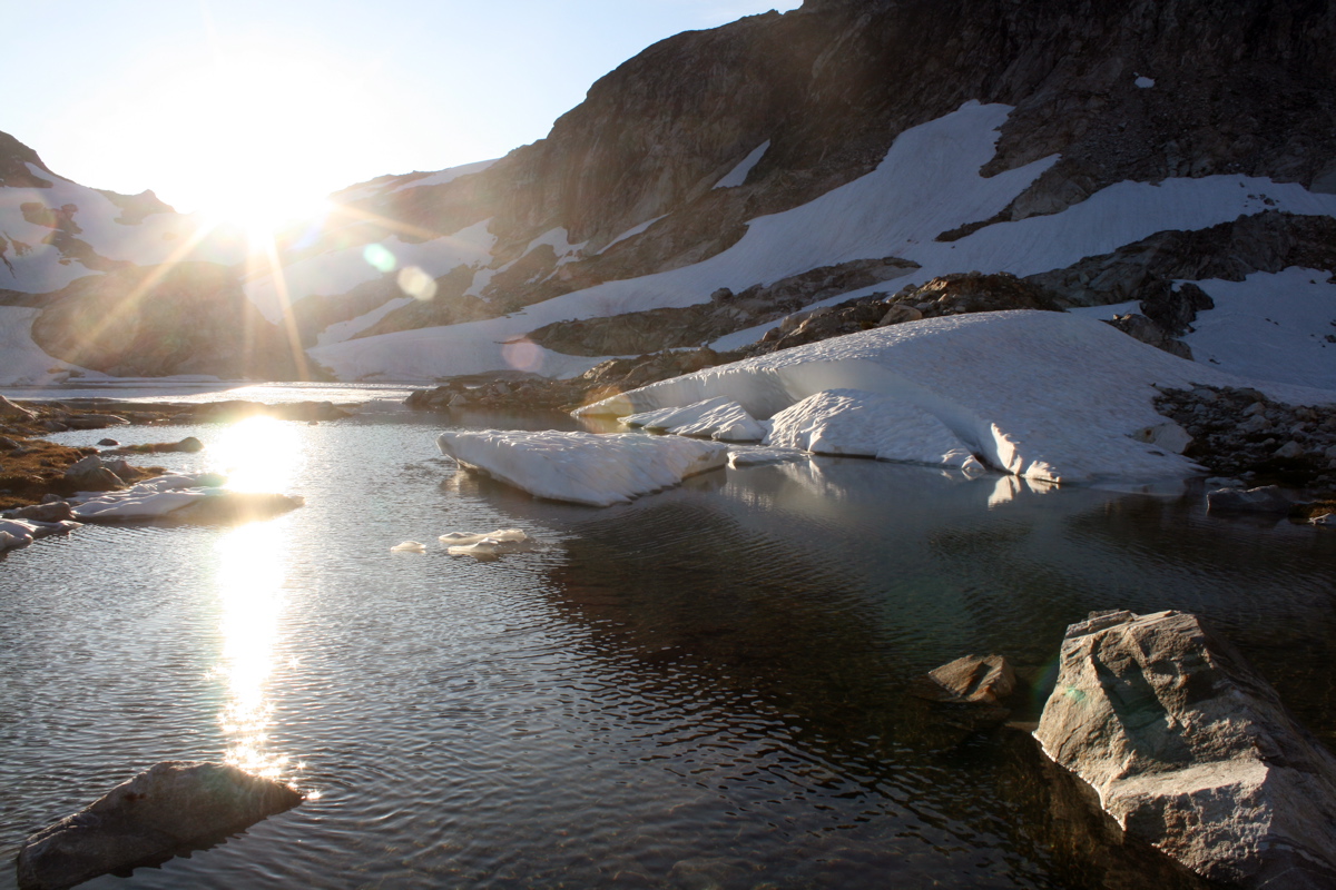
Cascading water at the outlet of White Rock Lakes. (0.8 second exposure)
VIDEO CLIP AT END OF TRIP REPORT
We arrived at camp at White Rock Lakes only a few hours after we left the summit of Dome, as the snow made for quick travel. After lunch, we spent the afternoon climbing German Helmet, which is a dome-like peak just to the west of White Rock Lakes. It is a fun climb up the north ridge (5.5), but is probably not climbed often. Here is a video of panorama view from the summit of German Helmet.
Looking up the 5.5 crack system on the east flank of the north ridge of German Helmet. The slings at the rappel anchors were old, indicating that German Helmet is not often climbed. It's a fun half-day destination from White Rock Lakes!
Descending the shoulder back to camp after the climb.
The view of Dome Peak from White Rock Lakes is spectacular. I couldn't stop taking photos.
Enjoying the evening at White Rock Lakes.
Evening sun at White Rock Lakes.
I brought 8 camera batteries and needed to use them! This photo shows star trails above Dome Peak as seen from our tent window. (9 minute exposure)
And, of course, another glowing tent photo. German Helmet is on left. (3.5 minute exposure)
DAY 5 - JULY 18
Traverse from White Rock Lakes to Yang Yang Lakes to camp at Kool-Aid Lake.
Topo Map for Day 5, Part 1 (White Rock Lakes to Yang Yang Lakes). Click on image to enlarge.
Topo Map for Day 5, Part 2 (Yang Yang Lakes to Kool-Aid Lake). Click on image to enlarge.
White Rock Lakes:
Le Conte-Sentinel Saddle:
Yang Yang Lakes:
Spider-Formidable Col:
Kool-Aid Lake:
6200ft
7280ft
5830ft
7320ft
6120ft
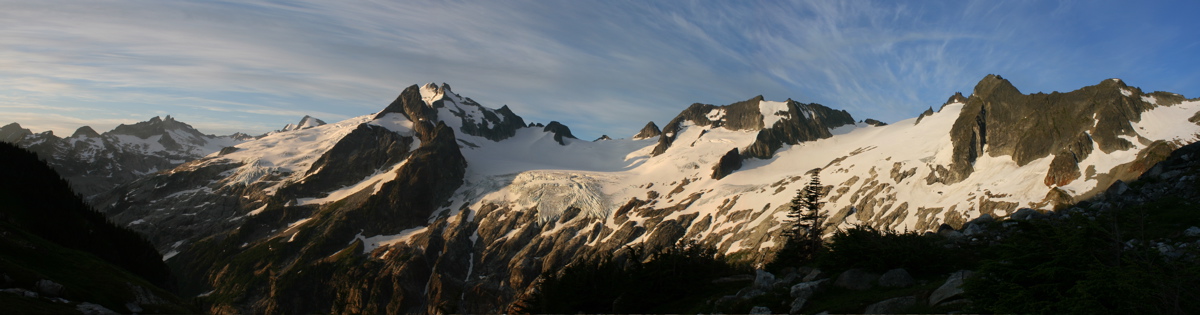
Morning views from camp at White Rock Lakes. From L to R: Gunsight, Sinister, Chickamin Glacier, Dome Peak, Dana Glacier.
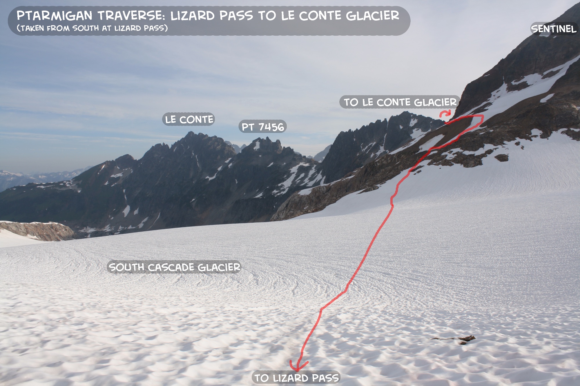
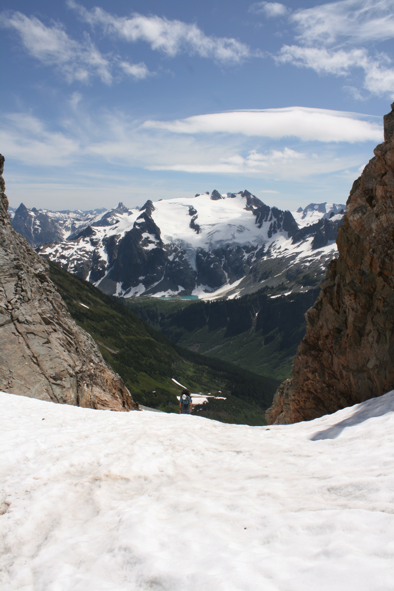
On the other side of Lizard Pass (just south of White Rock Lakes) is the South Cascade Glacier, one of the rare valley glaciers in the N. Cascades not located on a volcano. We traversed the upper section toward the Le Conte-Sentinel Saddle.
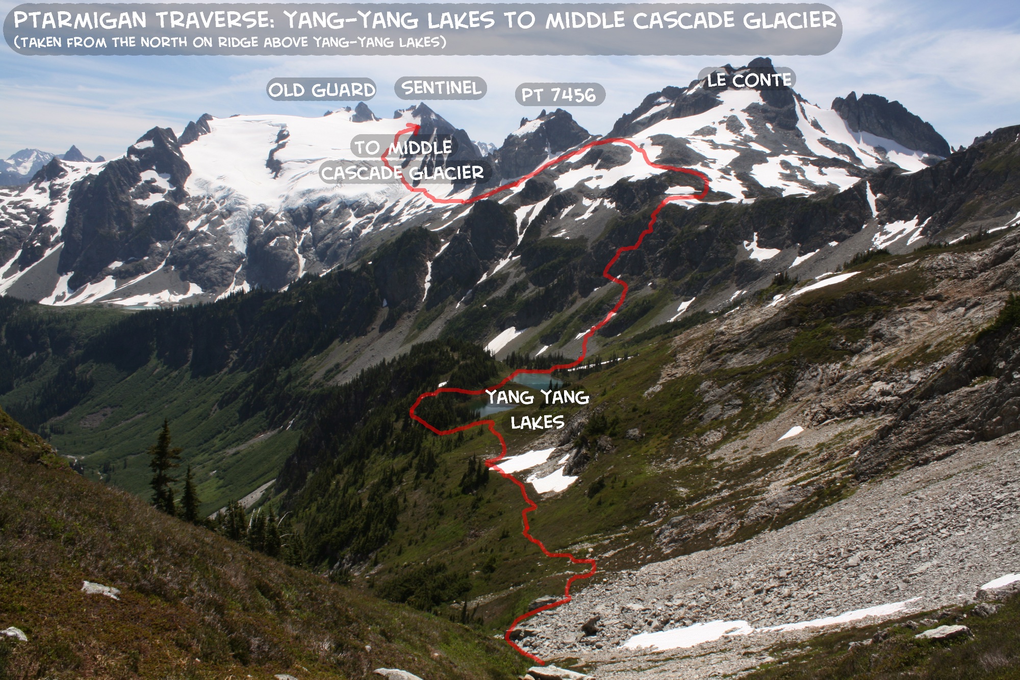
On the other side of the Le Conte-Sentinel Saddle is the giant Le Conte Glacier. This photo shows Old Guard and Sentinel, which are at the head of the glacier.
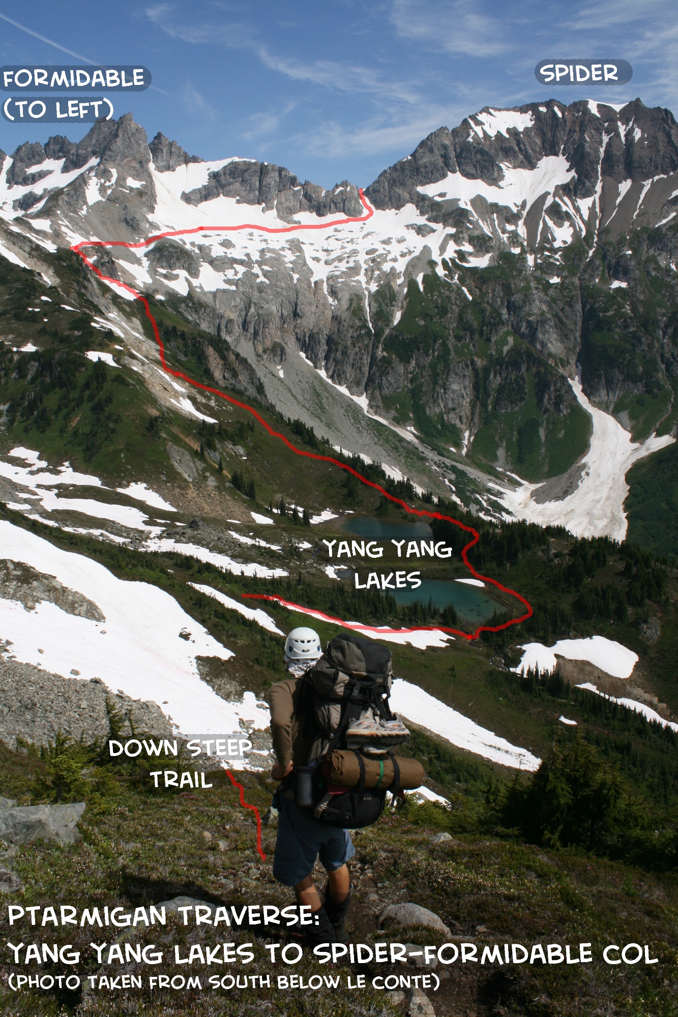
After traversing the Le Conte glaier, we descended to Yang Yang Lakes down a steep knoll (there is a trail, but it seems improbable at first!). This photo shows Yang Yang Lakes with Spider-Formidable Col (the next destination) in the distance.
Looking back to the south at Josh ascending the Spider-Formidable Col. Old Guard and Sentinel and Le Conte Glacier in distance.
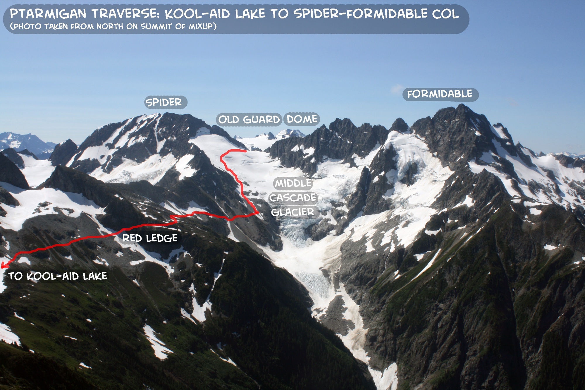
Another glacier to cross! This is the Middle Casade Glacier, which has some rather large cracks. Although we had not roped up for all the glaciers on this trip, we decided that this one warranted roping up for, which was a good decision given that halfway down I actually punched through a small crevasse (I caught myself with my pack and axe though, but it sounded as if it might be deep).
Looking back at Formidable and the icefall of the lower Middle Cascade Glacier.
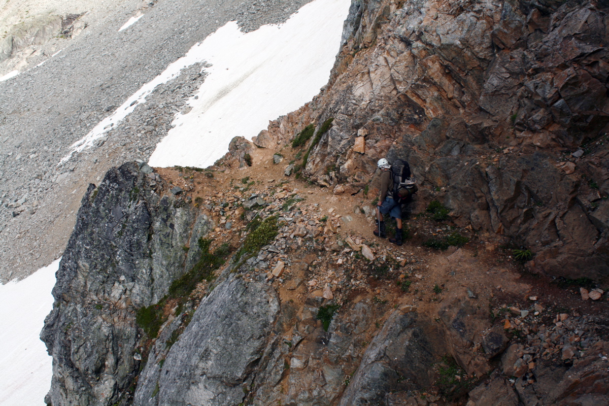
Crossing Red Ledge, one of the last "cruxes" of the trip. Sometimes, the snow on the north side of the ledge can make it difficult to get off/on the ledge, but in this case there was plenty of snow, although it was hard and steep for a short section.
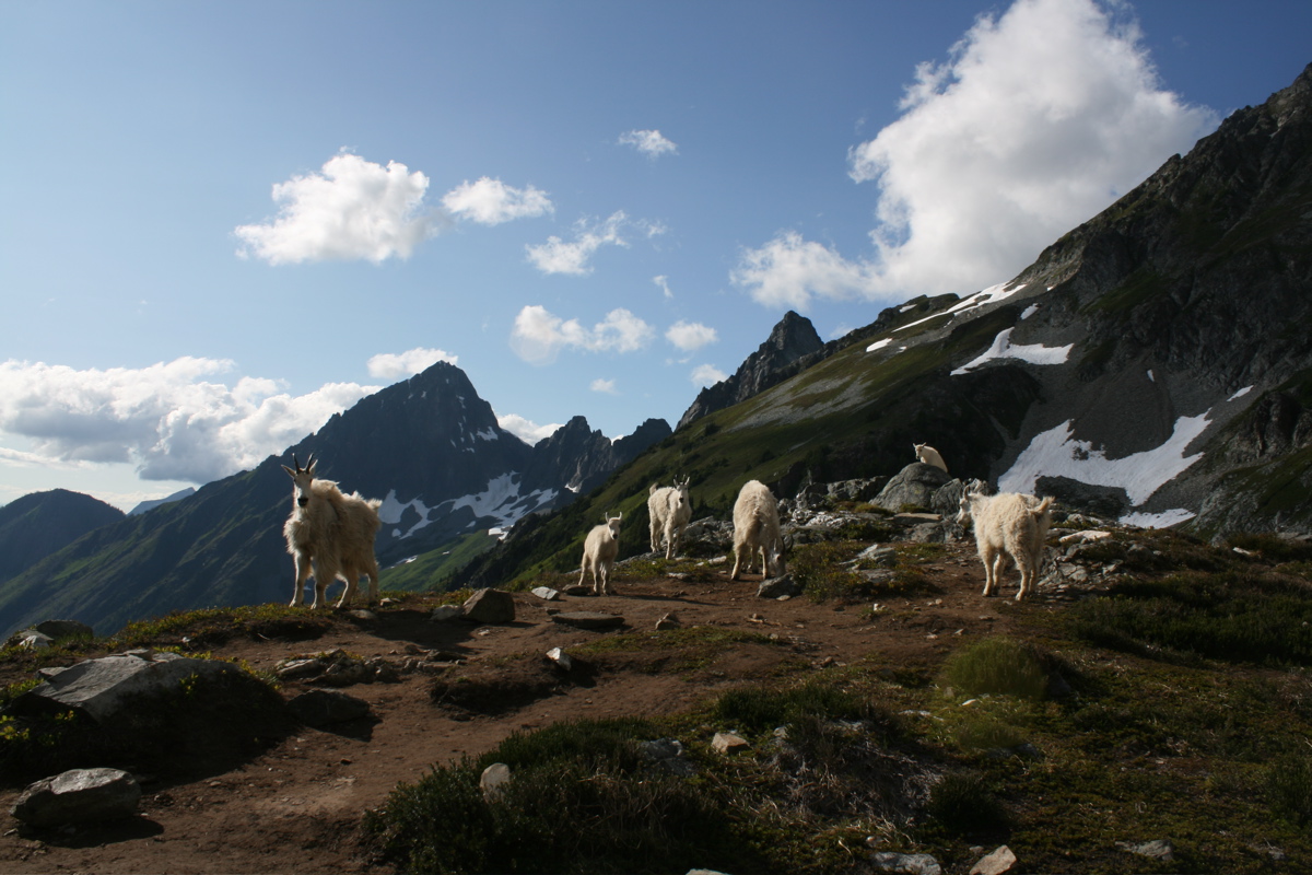
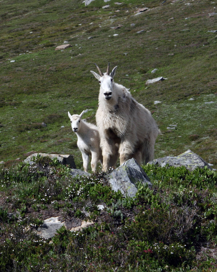
We found an unusually large population of mountain goats at Kool-Aid Lake this year (where we camped). Johannesburg, Cascade Peak, Mixup Peak in background.
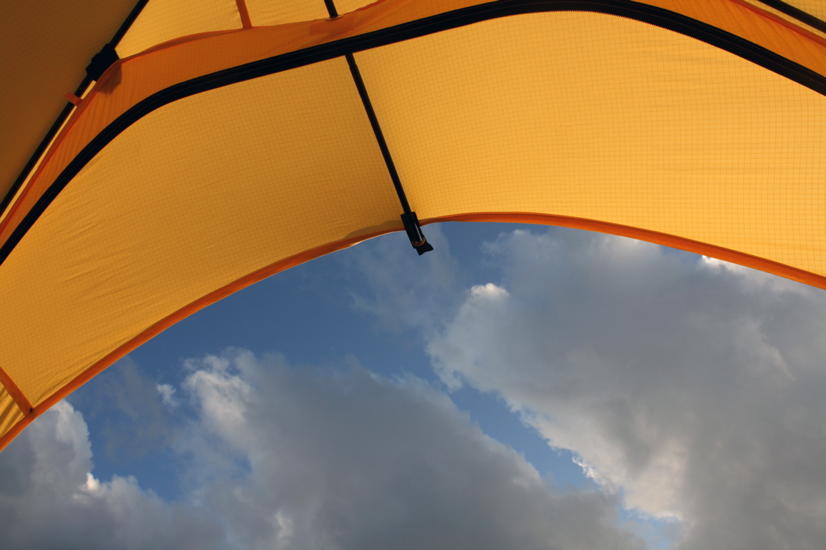
View from the tent. I found this tent to be great for enjoying the views and doing night photography...I might have to buy one of my own....Pro Mountain Sports in Seattle....
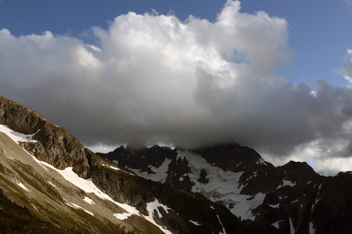
Clouds rolling in over Formidable. These were the only significant clouds we had the entire trip, and didn't last long.
And one last night to take glowing tent photos. This 30 minute exposure shows star trails above camp at Kool-Aid Lake, with Formidable in background.
DAY 6 - JULY 19
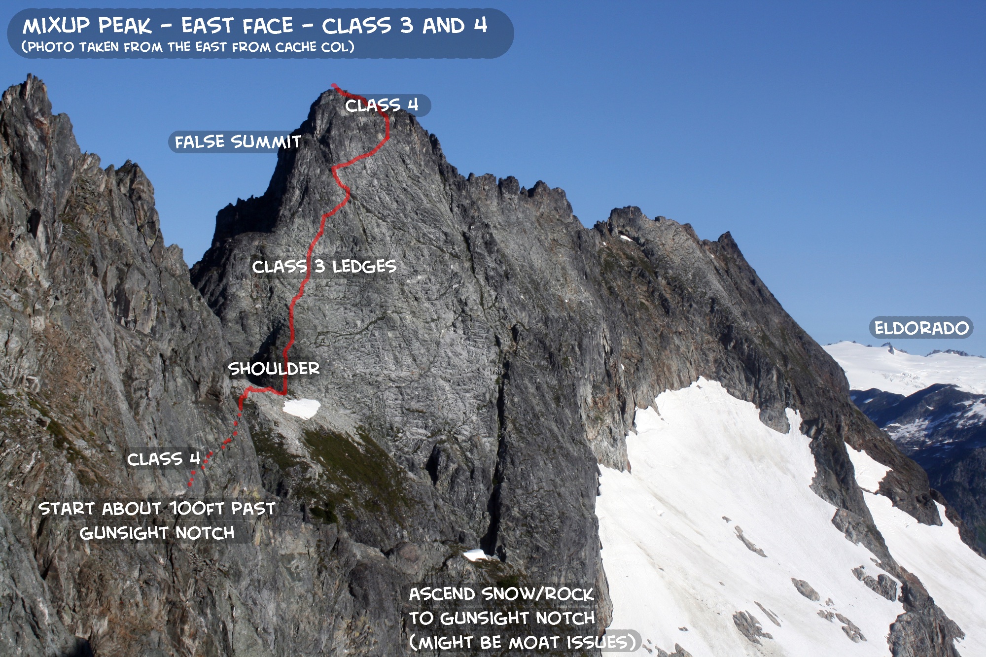
Climb EAST FACE OF MIXUP PEAK (3rd-4th, 7,440ft). Hike out to trailhead at Cascade Pass.
Topo Map for Day 6. Click on image to enlarge.
Route line for East Face of Mixup Peak. Click on image to enlarge.
More mountain goats at Kool-Aid Lake. They were awake and running around all night!
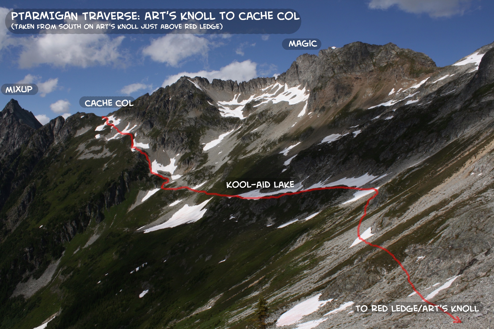
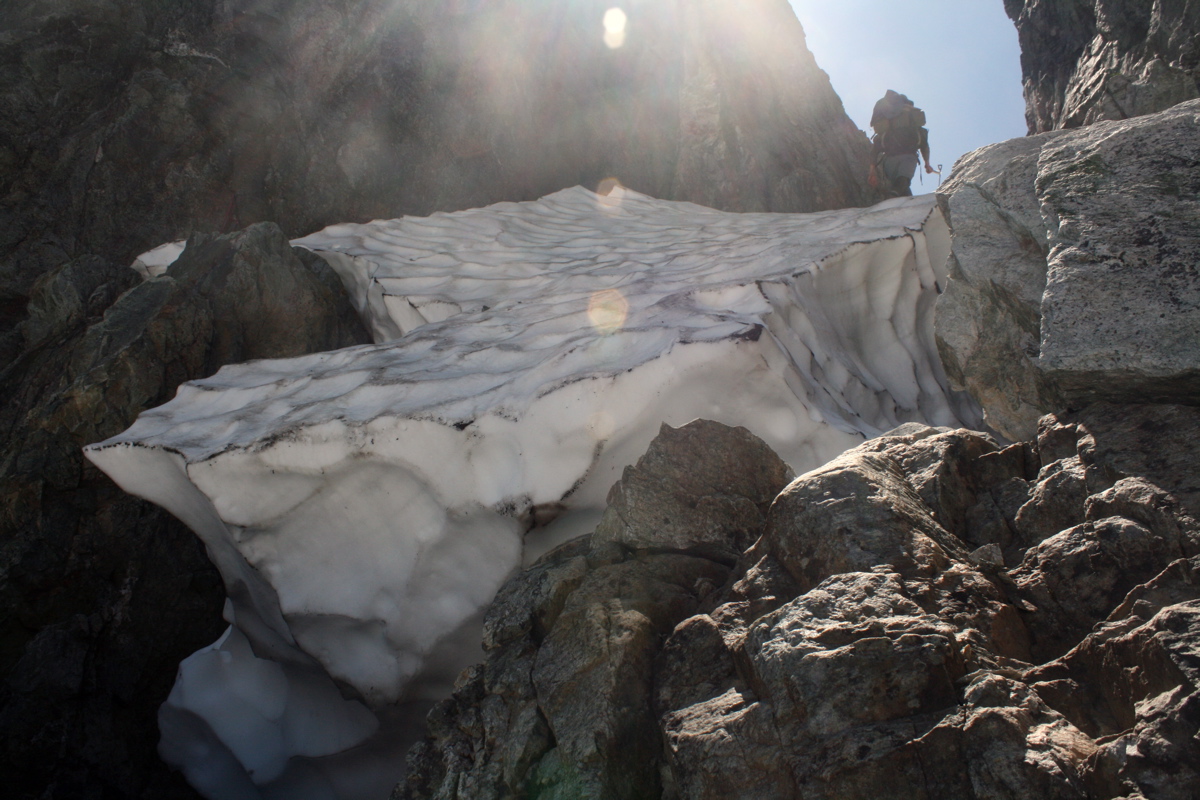
From Kool-Aid Lake, we ascended a trail to Cache Col, and then descended the Cache Glacier. We planned to climb the East Face of Mixup on the way out, so we first headed to Gunsight Notch, which is a few hundred feet below Cache Col. In this photo, Cache Col is on the far left and Gunsight Notch is on the far right.
Even in the early season, Gunsight notch has some moat issues, which can be bypassed by climbing Class 4 rock on right. The ascent up the notch would probably be chossy in late season.
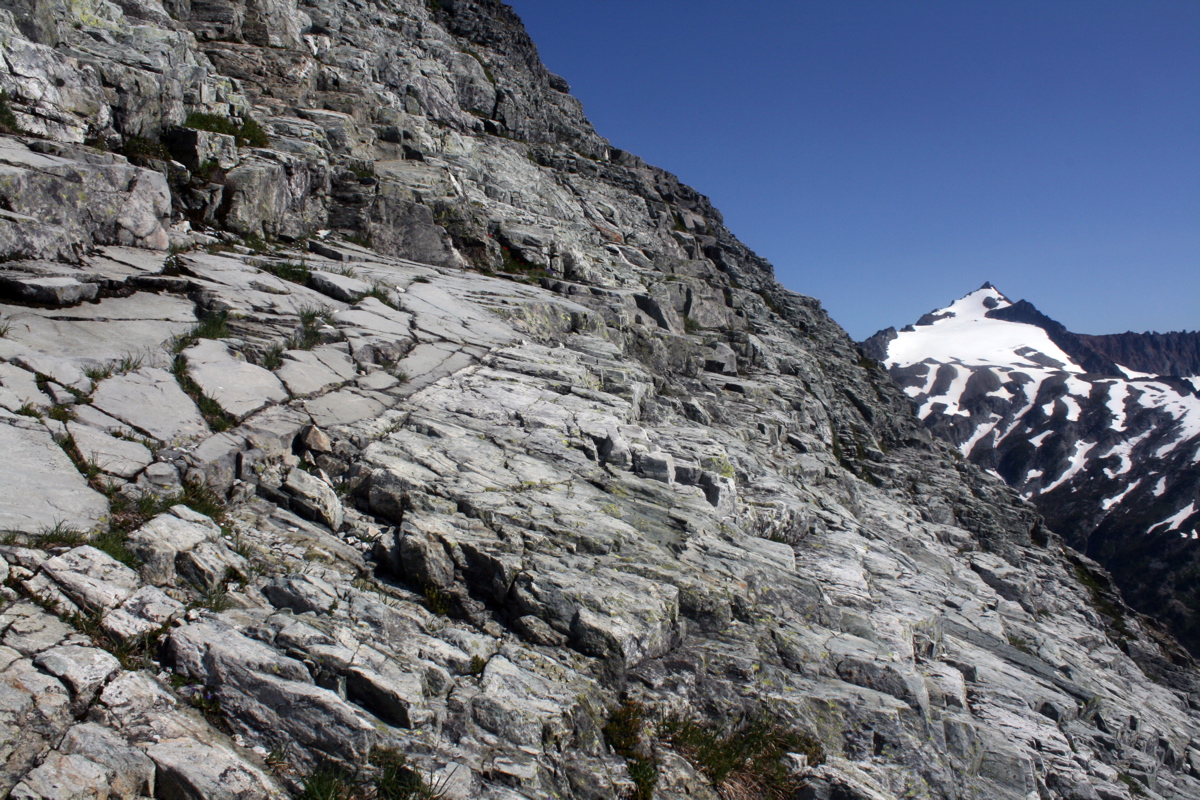
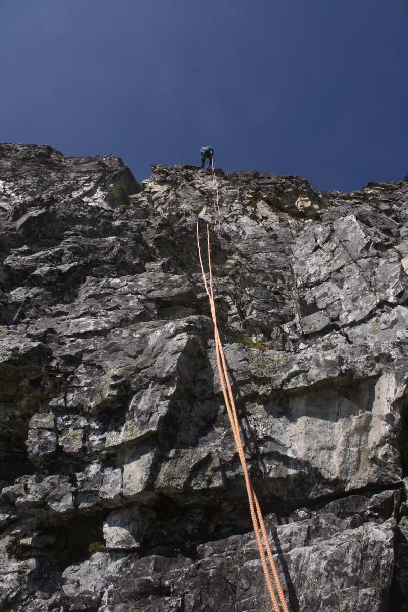
The East Face of Mixup looks improbable and steep, but it turns into fun Class 3 stairsteps of Skagit Gneiss for most of the climb. The climb begins and ends with short ledgy Class 4 sections. Watch out that you don't head to the false summit on the left as we initially did! Perhaps this is why it is called Mixup Peak....it's easy to make a mixup here....
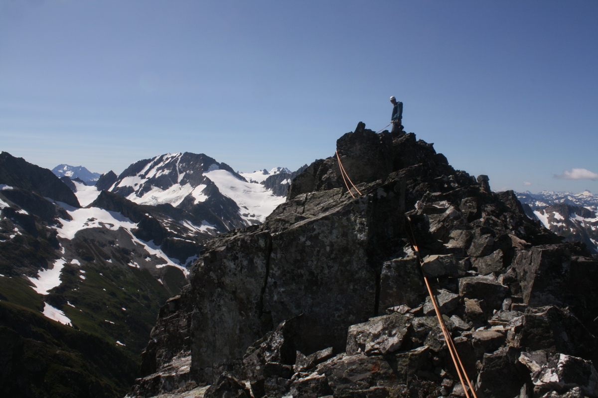
Josh on summit of Mixup Peak. There was a summit register on top, indicating this peak is climbed a few times a year.
The descent from Mixup involves 2 rappels from the summit, lots of downclimbing of the 3rd class stairsteps, and 2 more rappels to Gunsight Notch.
After Mixup Peak, we headed for Cascade Pass. Being a Sunday afternoon, the Pass had more people than we had seen in the last week combined. We almost turned around and hiked the Ptarmigan Traverse N to S....
What a great trip! Thanks Josh!
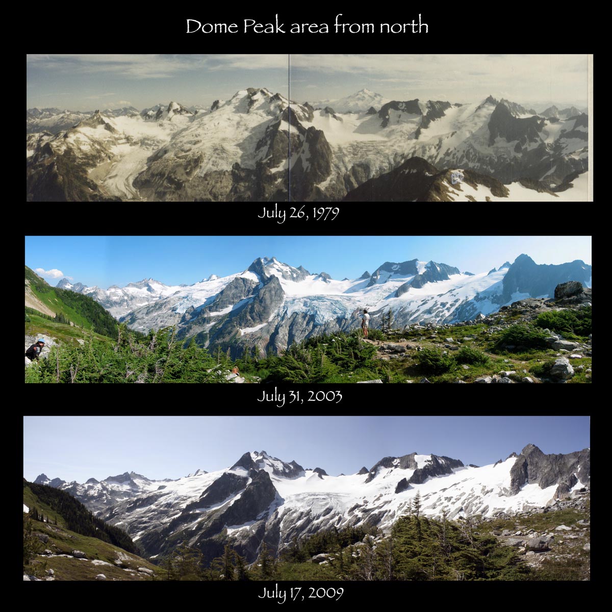
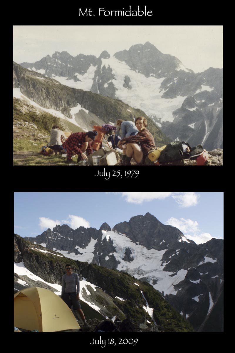
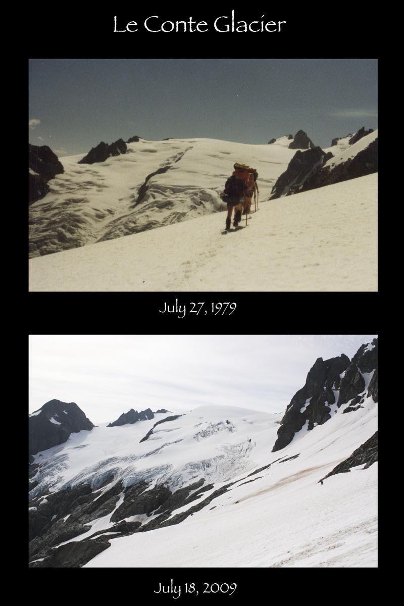
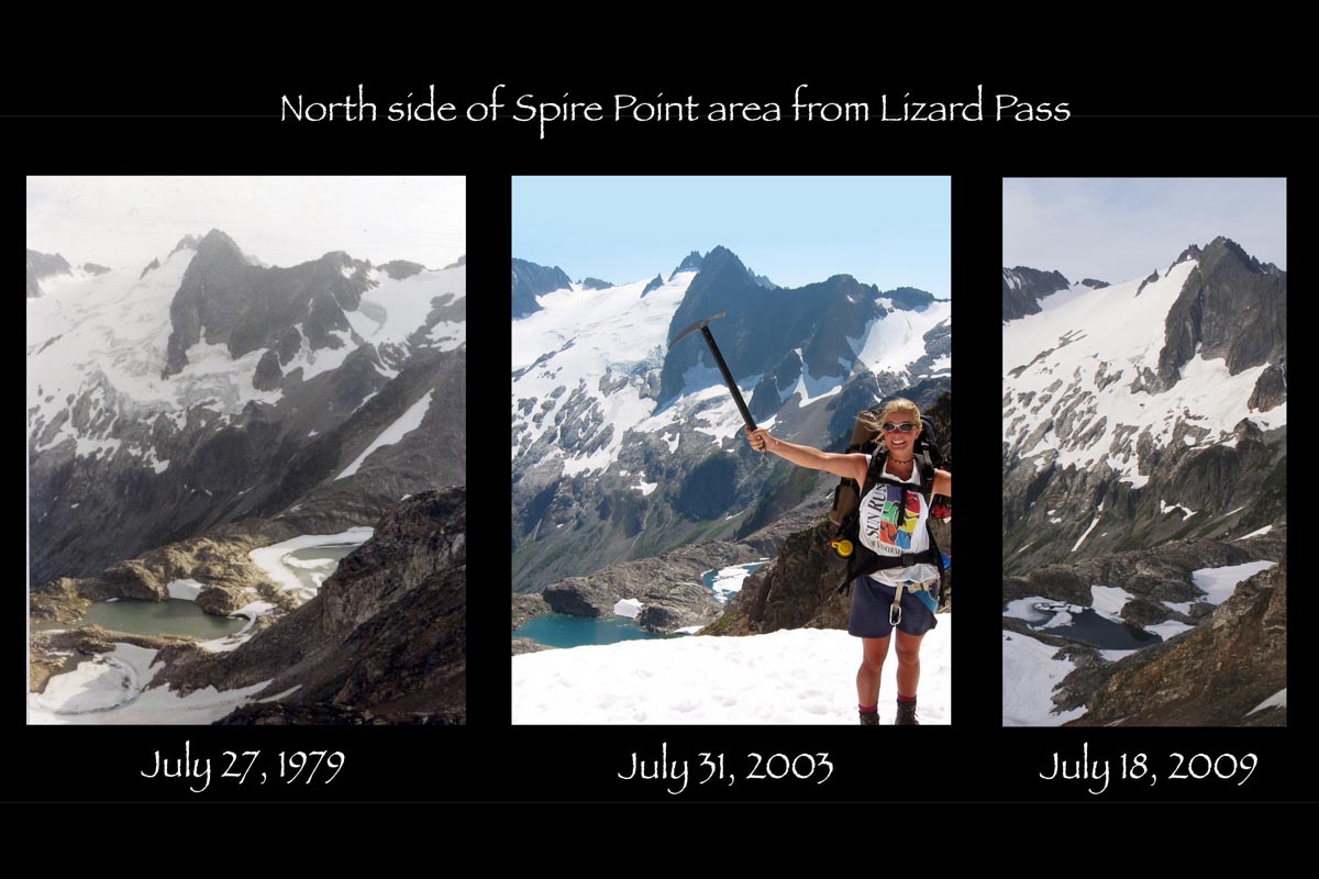
Tracking Glacial recession with photography
Comparing my parents' old photos from when they hiked the Ptarmigan Traverse in 1979 with some of my photos. This page has more comparisons with my parents' photos.
Dome Peak area (can see recession even between 2003 and 2009).
Mt. Formidable
Le Conte Glacier
Above White Rock Lakes (glacier almost gone in 30 yrs!)
Useful beta. Updated route information. Corrections. Historical notes. Interesting facts. No fluff please. Please do not put links in your comment, as my spam filter will filter those comments out.