THIS TRIP REPORT IS STILL MOSTLY IN THE EMBEDDED HTML FORMAT OF MY OLD WEBSITE. MOBILE Tip: Try Landscape mode. It is generally more mobile friendly.
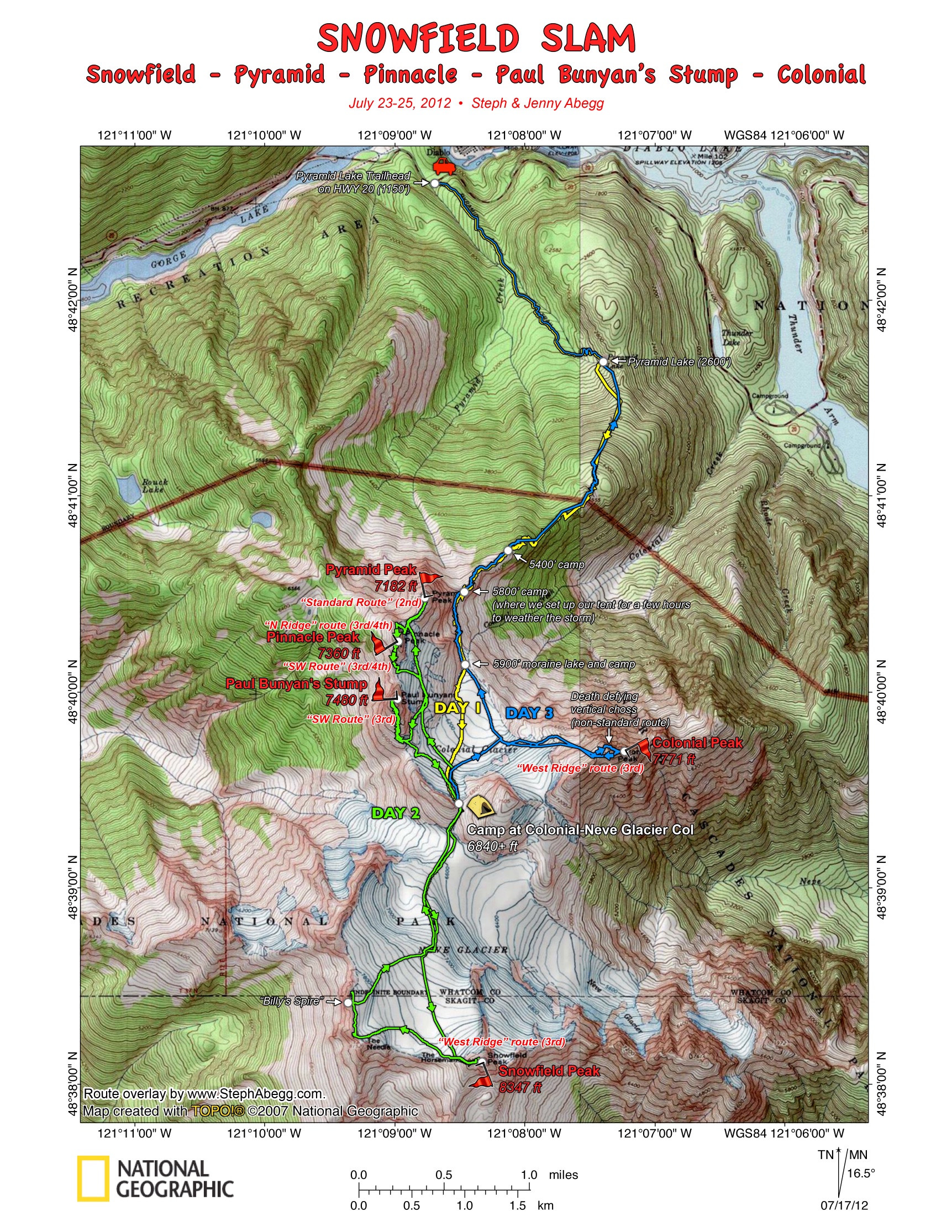
My sister Jenny and I had been trying to plan a trip together. (It had been almost 2 years since our last (rather memorable) climbing trip together.) The criteria: good exercise, great views, nice high camp, and some peaks to climb. The Snowfield area quickly moved to the top of the list. We had three days, and figured that in this amount of time we could climb all of the major objectives in the area: Snowfield, Colonial, Pyramid, Pinnacle, and Paul Bunyan's Stump. The weather looked a bit questionable, but NOAA promised sun for the second and third day. Sure enough, after arriving at camp in a chilly whiteout the first day, we woke up surrounded by mountains gleaming under the cloudless and calm skies. And a wonderful romp over glaciers and summits ensued. The Cascades at their best.
The following page gives maps, route overlays, photos, videos, commentary, and the continuing adventures of a particular tiny stuffed mountain goat. Enjoy!
Itinerary
Day 1: (6.6 miles, 7130' gain, 1640' loss, 7 hours)
From Pyramid Lake trailhead (1150 ft) on HWY 20, we hiked 2.1 miles to Pyramid Lake (2600 ft), then followed a climbers' trail steeply south to the ridge crest and then along the ridge to the base of Pyramid Peak. Here, we set up the tent and weathered out inclement weather for a few hours, then packed up, descended to the Colonial Glacier, traversed/ascended to the Colonial-Neve Glacier col (6840 ft), set up camp, and did logic puzzles for the rest of the evening.
Day 2: (9.7 miles, 6230' gain/loss, 13 hours)
Climbed Snowfield Peak(8347 ft) via its standard West Ridge route.
Attempted to climb The Horseman but decided against it when we encountered slippery black lichen. We proceeded to scramble up a couple of small spires along the ridge to the west before we descended the Neve Glacier back to the Colonial-Neve Glacier col.
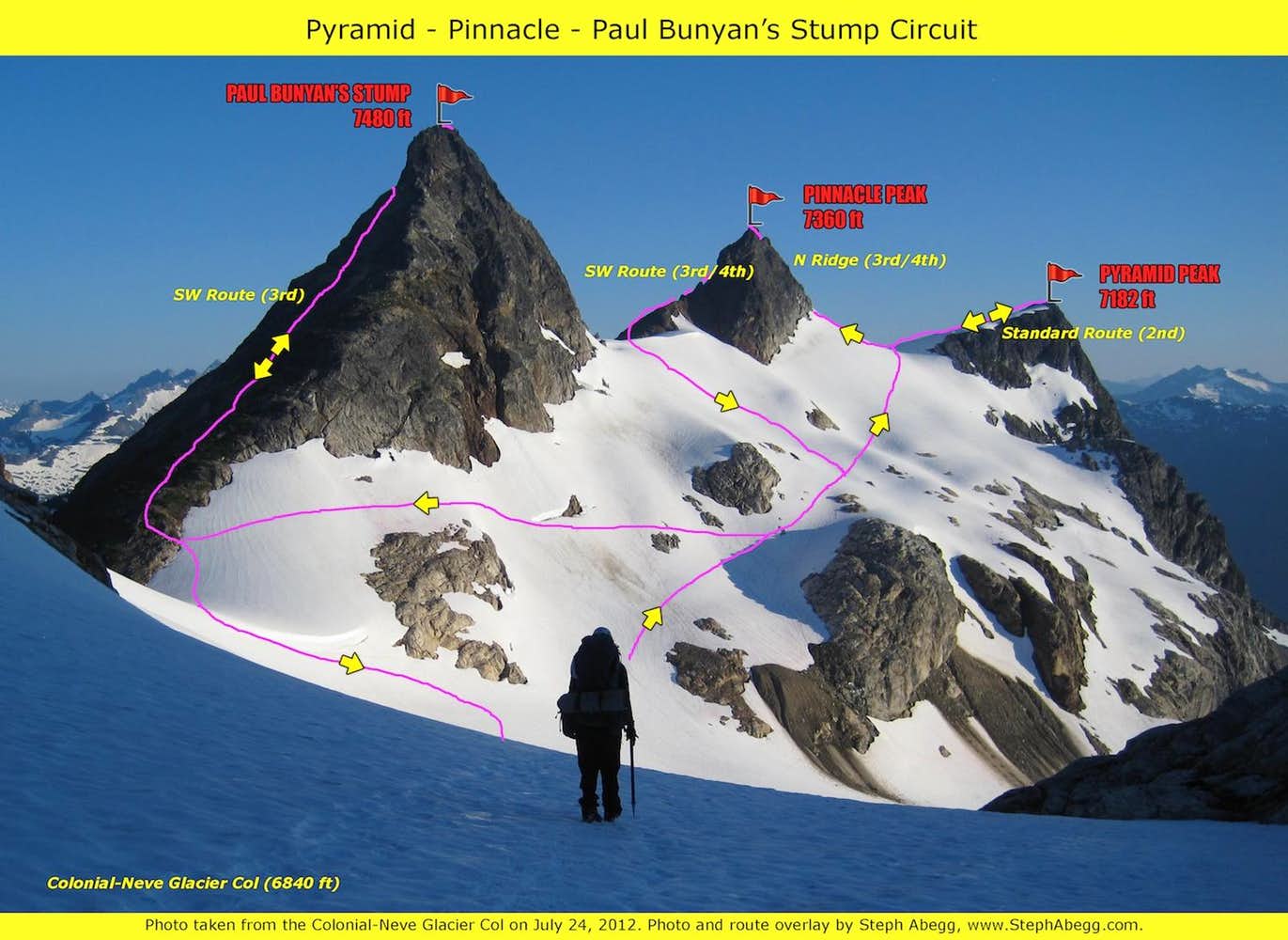
Climbed Pyramid Peak(7182 ft) via its standard South Slope route. Then climbed Pinnacle Peak(7360 ft) via its North Ridge and descended via its SW Route. Then climbed Paul Bunyan's Stump(7480 ft) via its SW Route.
Returned to camp at the Colonial-Neve Glacier col.
Day 3: (7.2 miles, 2320' gain, 7880' loss, 9 hours)
Packed up camp and descended to the Colonial Glacier.
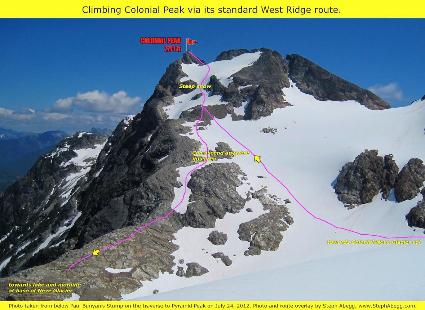
Climbed Colonial Peak(7771 ft) via its standard West Ridge route.
Hiked out to the car the same way we came in.
Total trip mileage: 23.5 miles (according to my GPS) Total trip elevation gain/loss: ~15,700' cumulative (according to my GPS)
Trip Report by Day
CLICK ON DAY TO DROP DOWN CONTENT
Day 1: Approach
We began the trip on a day where the forecast called for rain, maybe snow, and gusty winds. Fortunately, the trail between Pyramid Lake and the ridgecrest was steep enough to keep us warm in this "this is July?' wintery weather.Just another typical summer day in the Cascades.
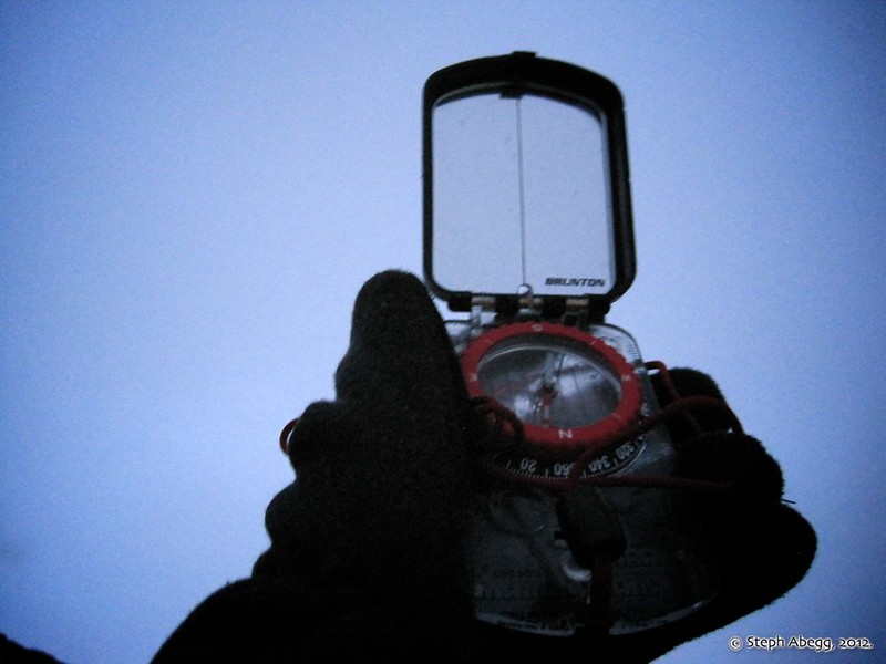
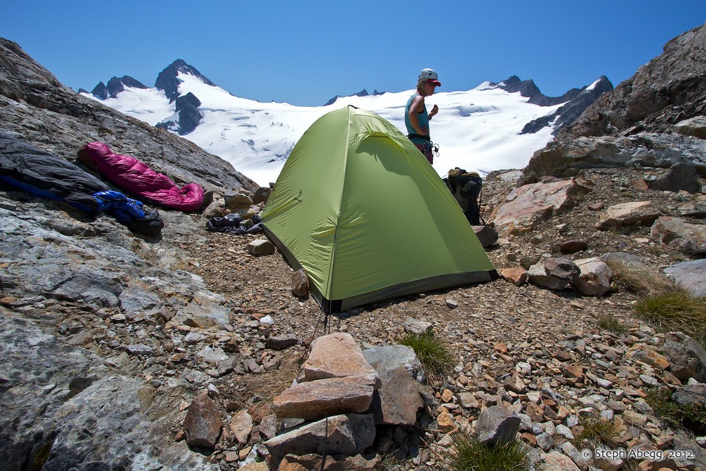
When we reached what we figured was the end of the ridge below the base of Pyramid Peak, visibility was only 100-200 feet and we were pretty cold. We decided to set up the tent to warm up and study the map.
Three hours of logic puzzles and down booties later, we packed up the tent and headed in the direction (due south) of the Colonial-Neve Glacier Col where we planned on setting up our camp. Visibility was now about 50 feet.
Two hours later, we made it to what looked like a col. There was a nice bivy site and running water. We set up the tent and dove inside. Eventually we went to sleep.
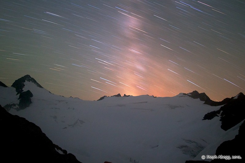
At around midnight I woke up and took a peek outside. Mountains and Stars! Weather patterns in the Cascades never cease to amaze me. This photo was taken looking south towards Snowfield Peak. The glow is from the Milky Way. Exposure: 25 min, f/5.6, ISO 500.
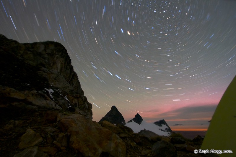
Photo taken looking north towards Paul Bunyan's Stump, Pinnacle Peak, and Pyramid Peak. Exposure: 21 min, f/4.0, ISO 640.
Day 2: Climb Snowfield Peak, Pyramid Peak, Pinnacle Peak, Paul Bunyan's Stump.
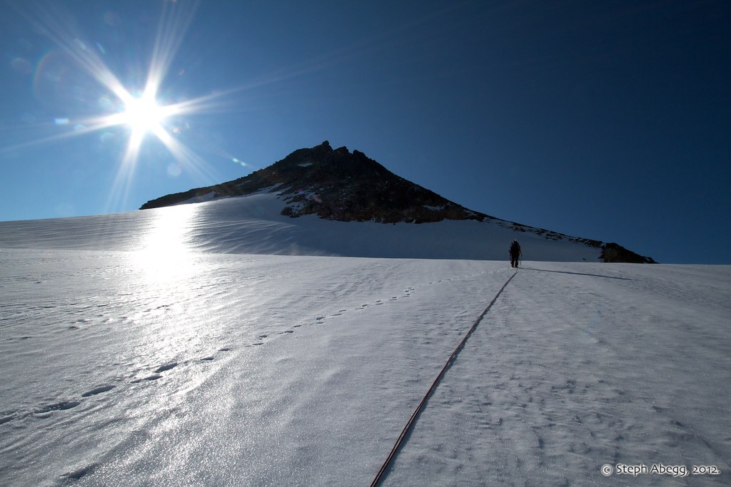
Our first objective of the day was Snowfield Peak, via the standard West Ridge route (Class 3).
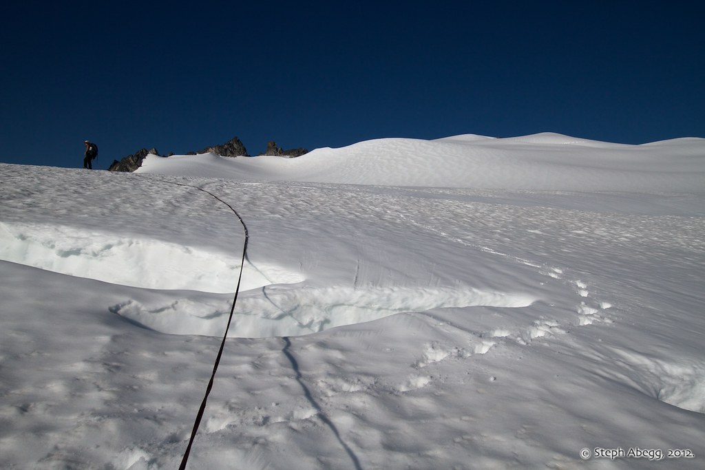
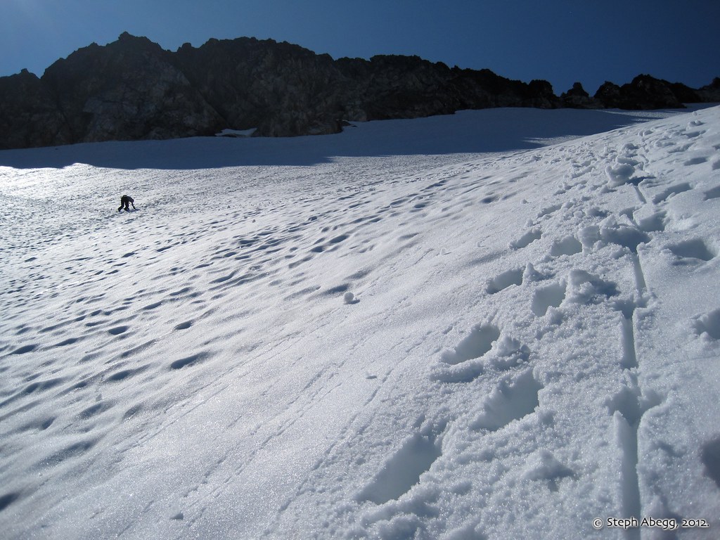
There were some large cracks starting to open up on the Neve Glacier, but there were always good snowbridges to be found.
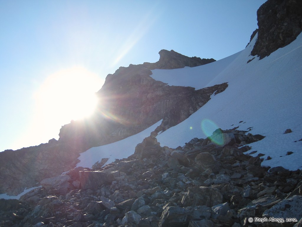
What a change in the weather from the day before! Approaching the west ridge of Snowfield Peak.
Another photo of approaching the west ridge of Snowfield Peak.
"Go to the West Ridge and follow a boot track for ~200' to a gully which leads to a very obvious notch, downclimb about 60', then scramble Class 3 to summit." This photo shows the gully to the obvious notch.
"Go to the West Ridge and follow a boot track for ~200' to a gully which leads to a very obvious notch, downclimb about 60', then scramble Class 3 to summit." This photo shows the Class 3 to the summit. The recent wintery weather had left some ice and snow on the rock which made it a bit more challenging.
On the summit of Snowfield Peak! 2:15 from camp at the col.
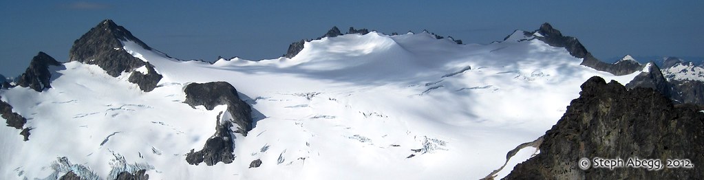
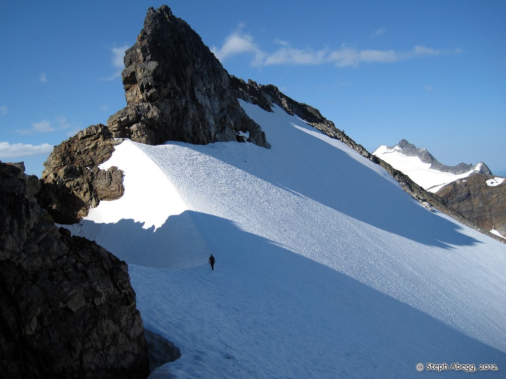
Next we headed west along the rim of the Neve Glacier towards The Horseman. However, we became confused when the USGS map didn't seem to agree with the route description or the labeled image in the Cascade Alpine Guide. We were pretty sure that this feature in this photo is The Horseman, since it looks a lot like a man riding a horse (this suggests that the USGS map is wrong, which I confirmed is indeed the case the following evening when I got home). So we headed for this spire, hoping to find and climb the 2-pitch 5.7 route on the E side of the N Ridge.
Unfortunately, The Horseman is covered in black lichen, which was pretty slippery after the recent precipitation. So we decided to head for the little spire that we called "Horse's Ear," and see if we could climb that instead (photo shows Jenny approaching it). The top block looked rather detached, so I decided I was satisfied to just stand beside it.
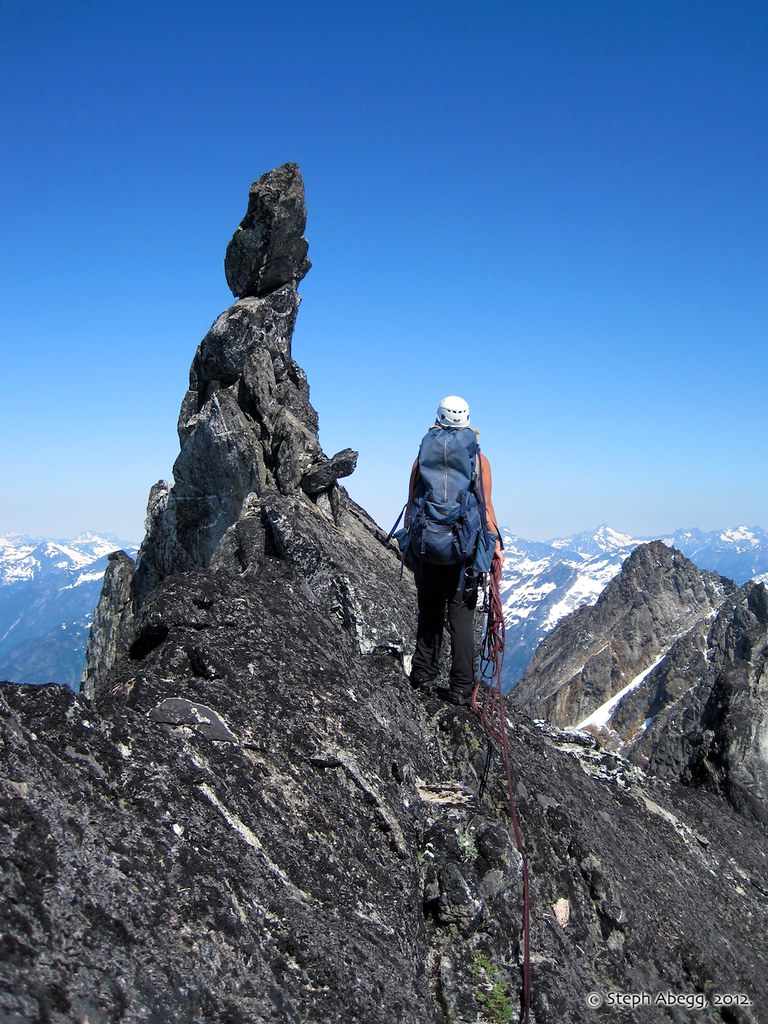
Feeling the insatiable desire to get to the top of something, we headed towards the next spire north along the ridge.
Here I am on top of the spire.
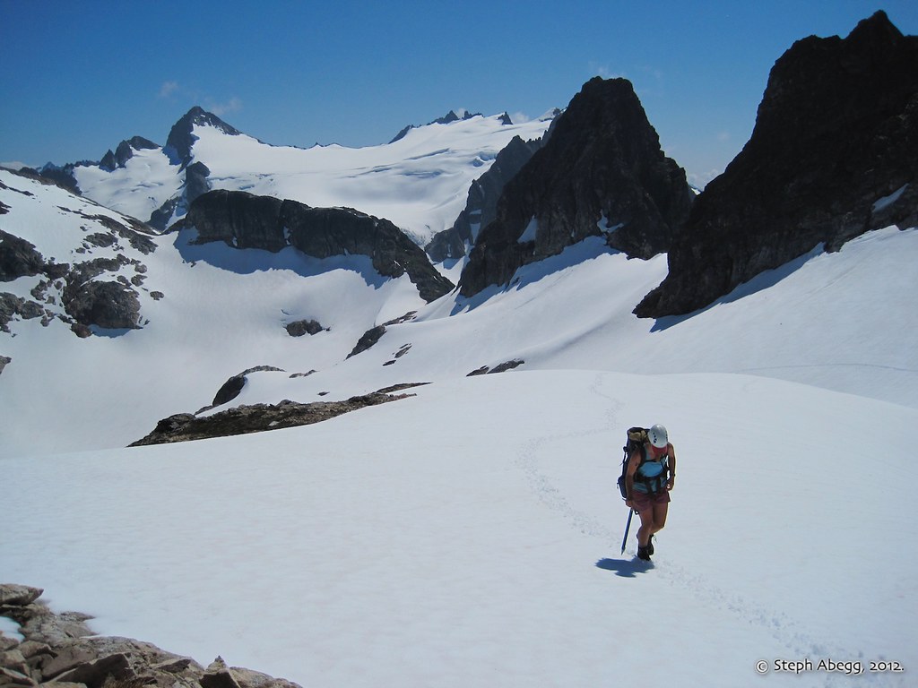
Our next climbing objectives of the day were on the other side of the Colonial-Neve Glacier col where our camp was. We planned to climb all three spires: Pyramid, Pinnacle, and Paul Bunyan's Stump.
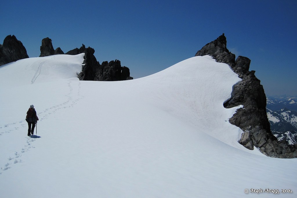
Jenny ascending easy snow slopes towards Pyramid Peak (Class 2). Behind her are Snowfield, the Colonial-Neve Col, Paul Bunyan's Stump, and part of Pinnacle Peak.
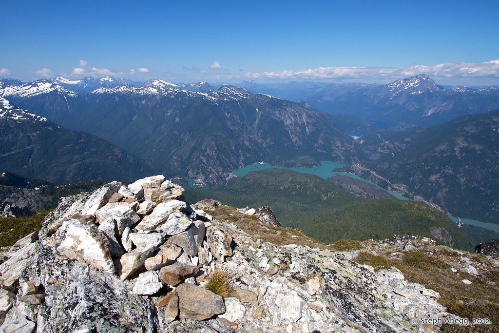
The view north from the summit of Pyramid Peak, looking down onto Diablo and Ross Lakes and Jack Mountain on the right. It took us only an hour to get to the summit of Pyramid Peak from camp at the col.
After being spoiled by an easy saunter up Pyramid Peak, we were somewhat confused with how to tackle Pinnacle Peak. A gaping moat prevented us from getting onto the Class 3 East Route. So we opted for the North Ridge (3rd/4th), which we gained via a steep snow finger. The North Ridge is the closest ridge in the photo. For the most part we were able to keep it at Class 3 by making west side detours.
The final summit pyramid of Pinnacle Peak is....
...Class 4 with lots of ledges and great exposure. Kind of fun.
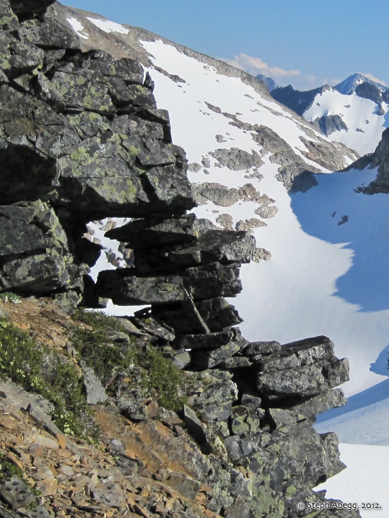
We decided to descend the SW Route (3rd/4th) on Pinnacle Peak towards the saddle between Pinnacle and Paul Bunyan's Stump. I noticed this airy gap in the ridge of Pinnacle Peak. Looks like a bunch of Jenga blocks.
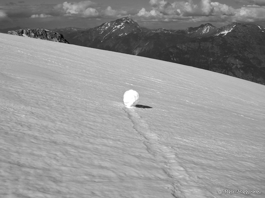
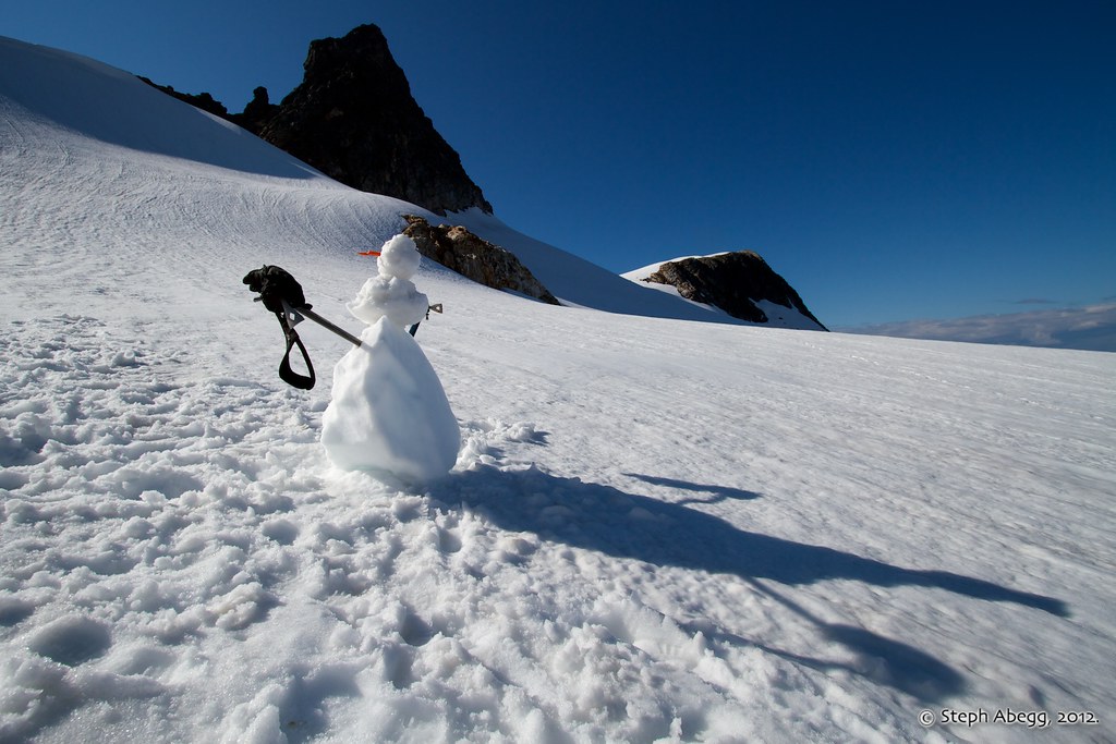
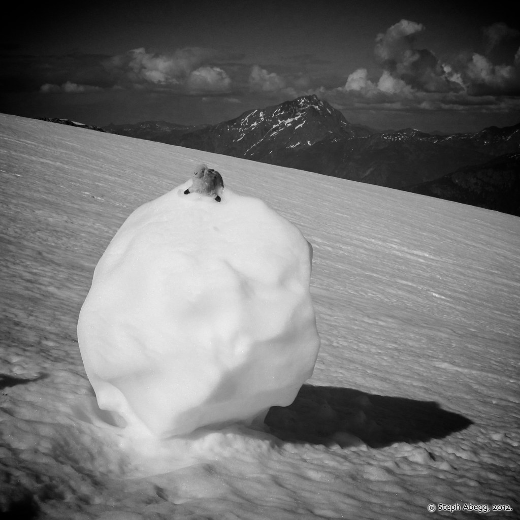
A lone snowball....
We couldn't resist making a snowman. With the axes and long afternoon shadow, the snowman took on an eerie sort of persona.
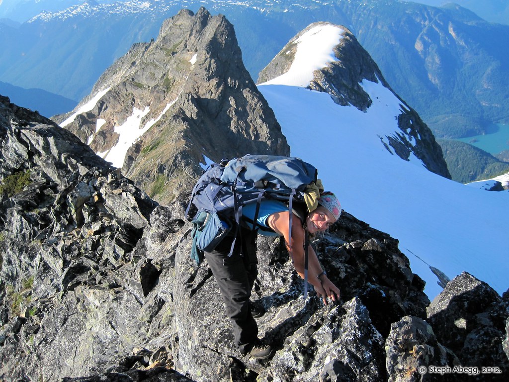
Our final objective of the day was Paul Bunyan's Stump via the SW Route (3rd). This ridge was really green and pretty.
Jenny on the summit ridge of Paul Bunyan's Stump, with Pinnacle Peak and Pyramid Peak behind.
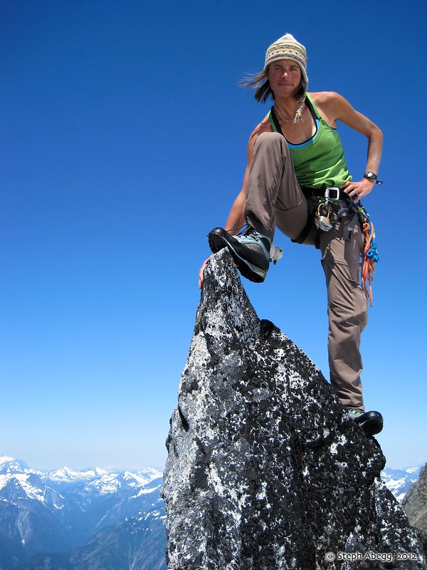
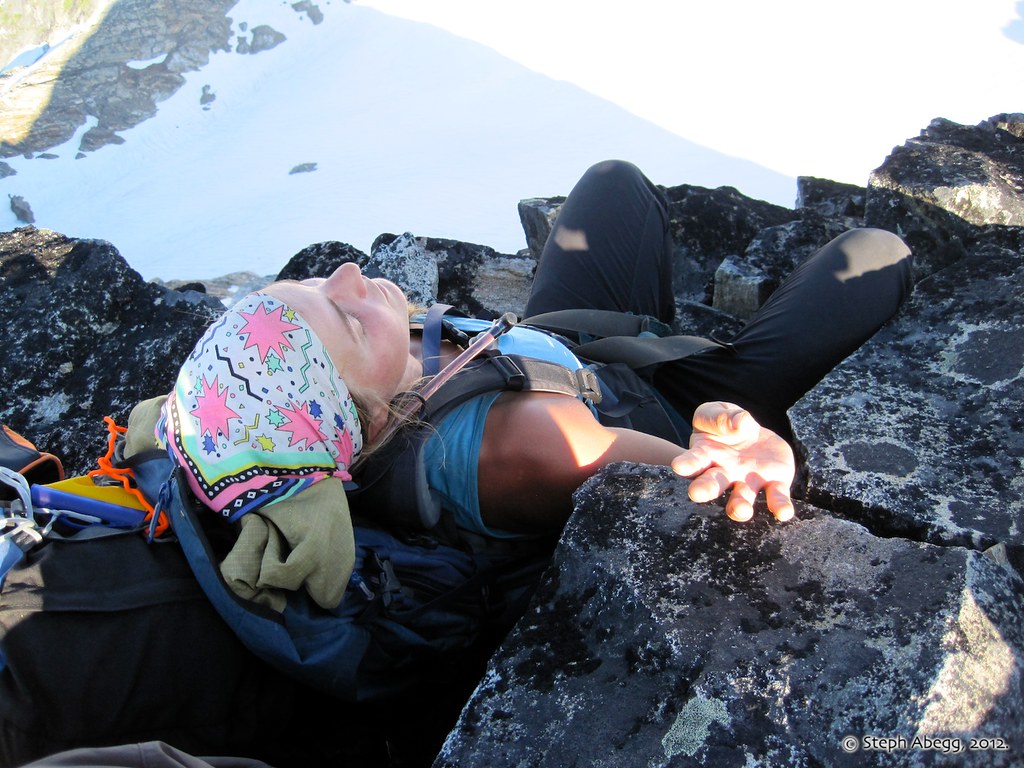
Jenny on the summit of Paul Bunyan's Stump. "4 summits in one day!"
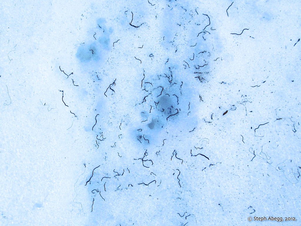
We tromped over thousands of ice worms on the Colonial Glacier. These cool critters only come out to the surface of the glaciers in the evening and morning. According to Wikipedia:
The first ice worms species were discovered in 1887 in Alaska. These
glacier ice worms can be found on glaciers in Alaska, Washington,
Oregon and British Columbia. They have not been found in other glaciated
regions of the world. Enzymes in ice worms have very low optimal temperatures, and
can be denatured at even a few degrees above 0 °C (32 °F). When ice
worms are exposed to temperatures as high as 5 °C (41 °F), their
membrane structures disassociate and fall apart (i.e., "melt") causing
the worm itself to liquify. Hence, ice worms hide beneath the snow during the day. Ice worms are several centimeters long, and can be black,
blue, or white in color. On Suiattle Glacier in the North Cascades
population counts indicated over 7 billion ice worms on that glacier
alone.
It is not known how ice worms tunnel through the ice. Some scientists
believe they travel through microscopic fissures in ice sheets, while
others believe they secrete some chemical which can melt ice by lowering
its freezing point, like an antifreeze. They feed on snow algae.
The Colonial-Neve Glacier Col is really quite a spectacular camp. Definitely worth the extra effort to get there.
We even had running water close-by.
Day 3: Climb Colonial Peak, Hike out.
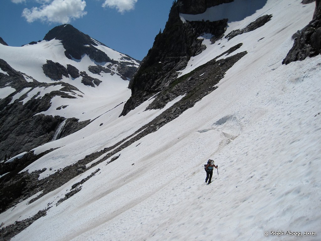
On the morning of our last day, we packed up camp and headed down into the Colonial Glacier basin. We then shouldered daypacks and headed up towards the summit of Colonial Peak.
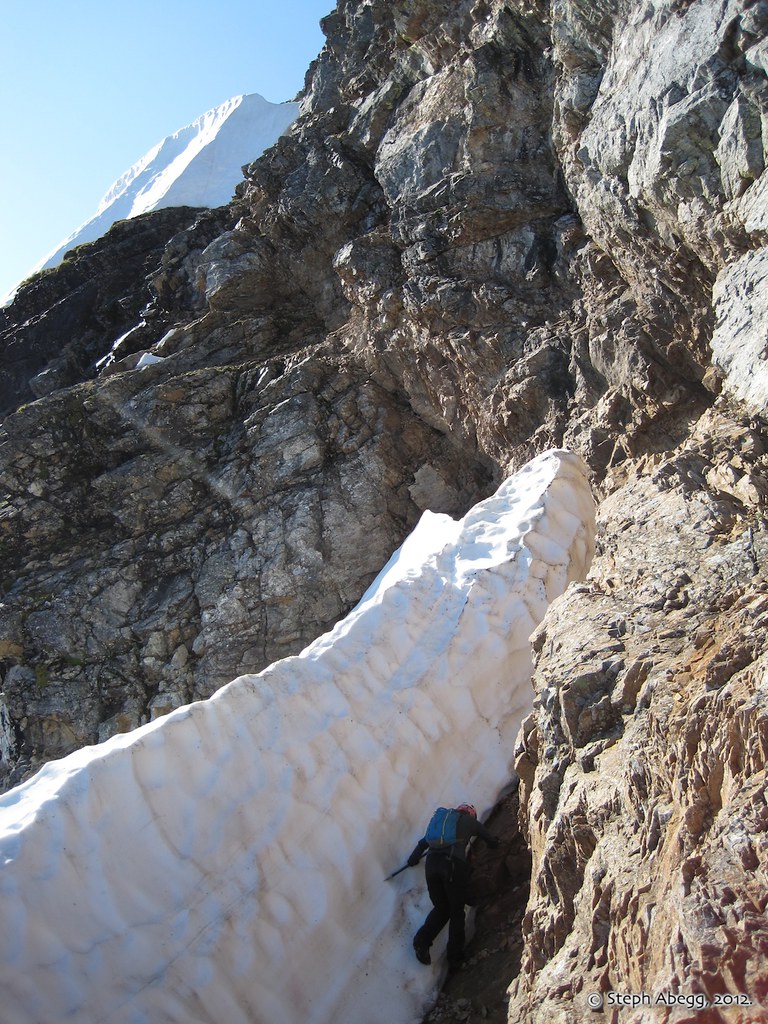
Looking up the upper snowfinger.
The snow is fairly steep on the snowfinger.
Jenny at the notch above the snowfinger. We should have traversed through the notch and then up the final summit ridge (to the left of the notch in this photo). However, the route description mentioned a "short loose rock scramble left" which we erroneously took for a talus slope to the left of this notch, when in fact we had already crossed the area on early-season snow. Hence begins an off route adventure.
Our off route adventure took us towards a rather impressive display of vertical choss. I ended up finding a way to the summit diagonally up and left, but I wouldn't recommend this route. Slowed down by our off route adventure, Colonial Peak took us 4 hours pack-to-pack.
Descending back down the steep snow.
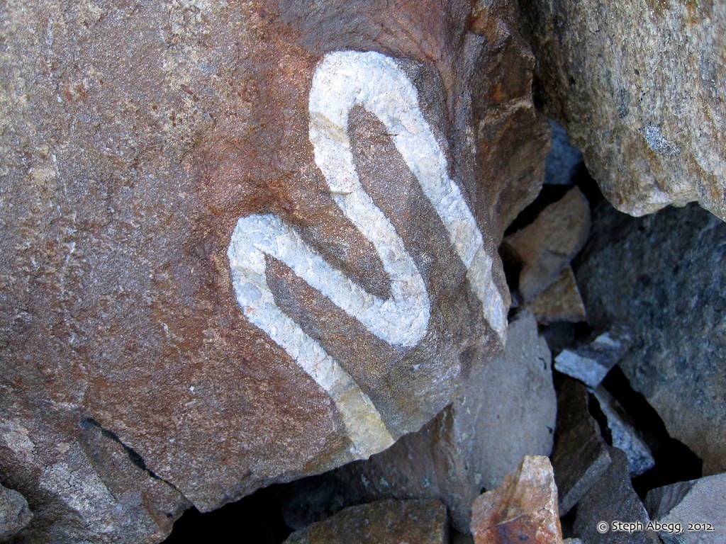
There are some pretty metamorphic rocks on Colonial. M is for Mountains.
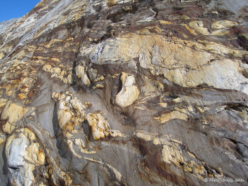
Some more pretty rocks on the west side of Colonial.
We picked up our packs and began the traverse out below the east walls of Pyramid Peak.
Diablo Lake about 4500 feet below. Jack Mountain in the distance.
And finally....what we've all been waiting for...
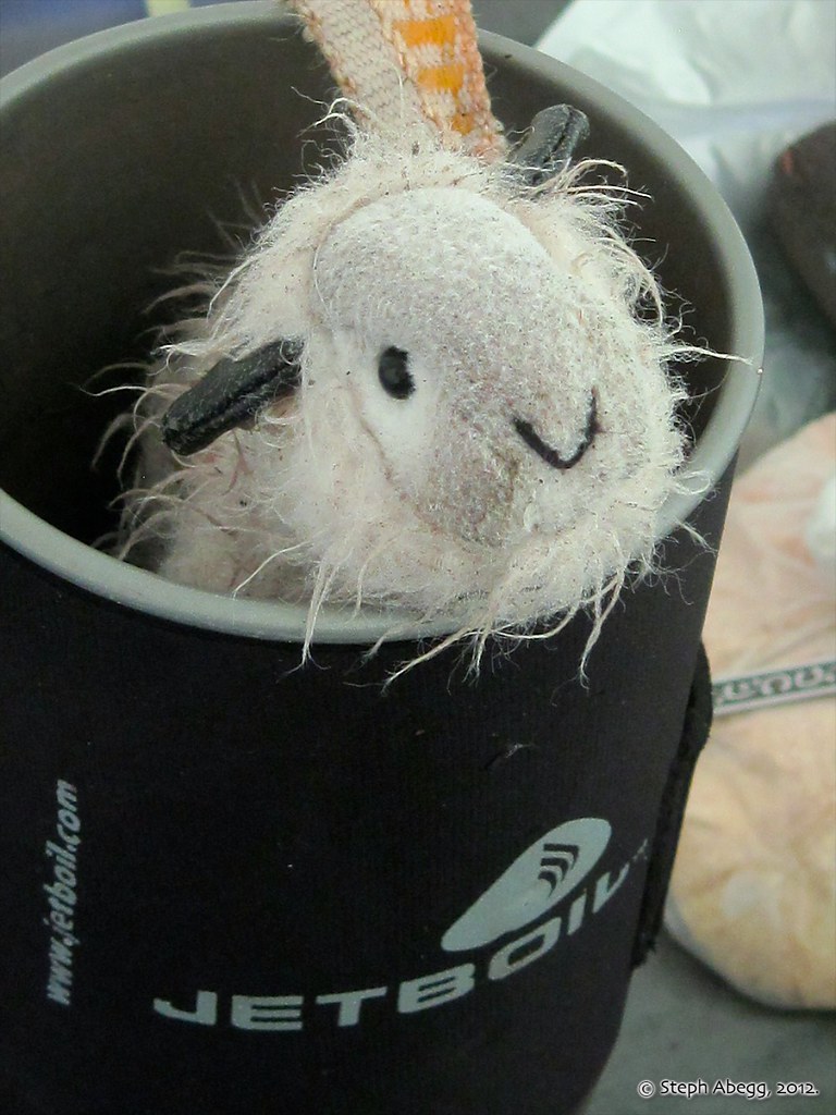
•THE ADVENTURES OF "SNOWFIELD BILLY"•
Billy's summer climbing adventures continue...
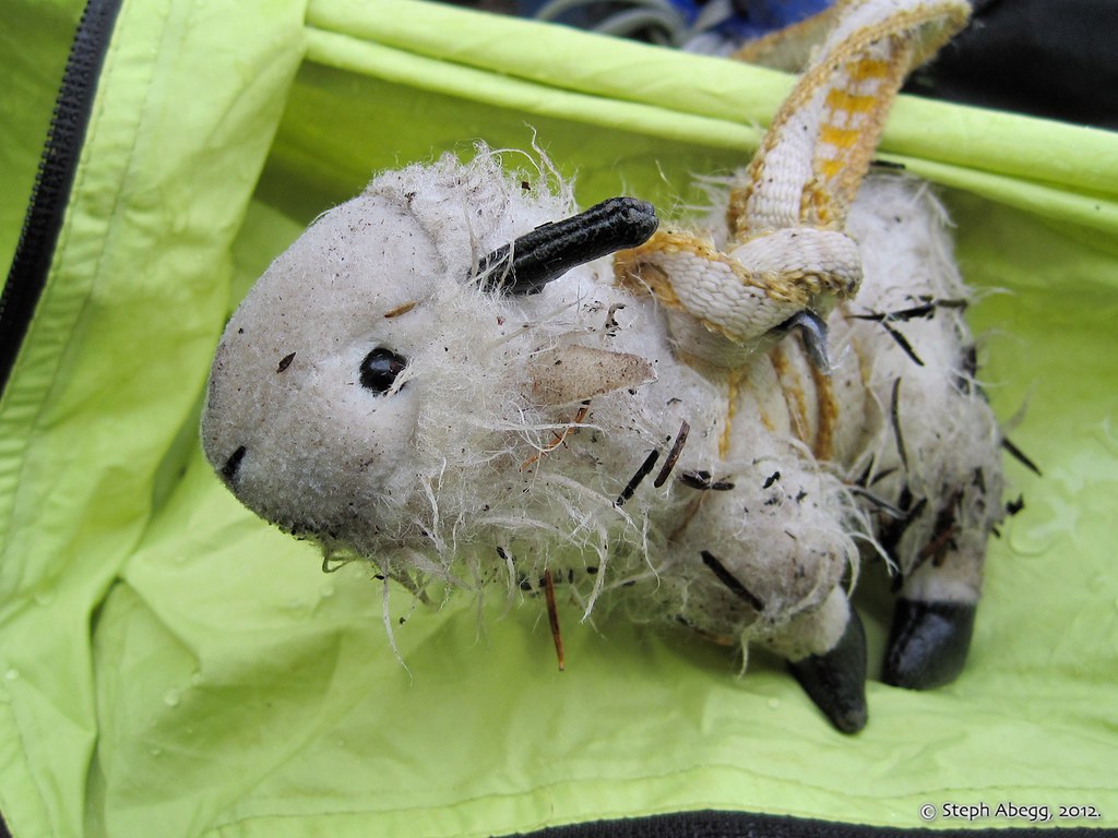
A bedraggled Billy on Day 1.
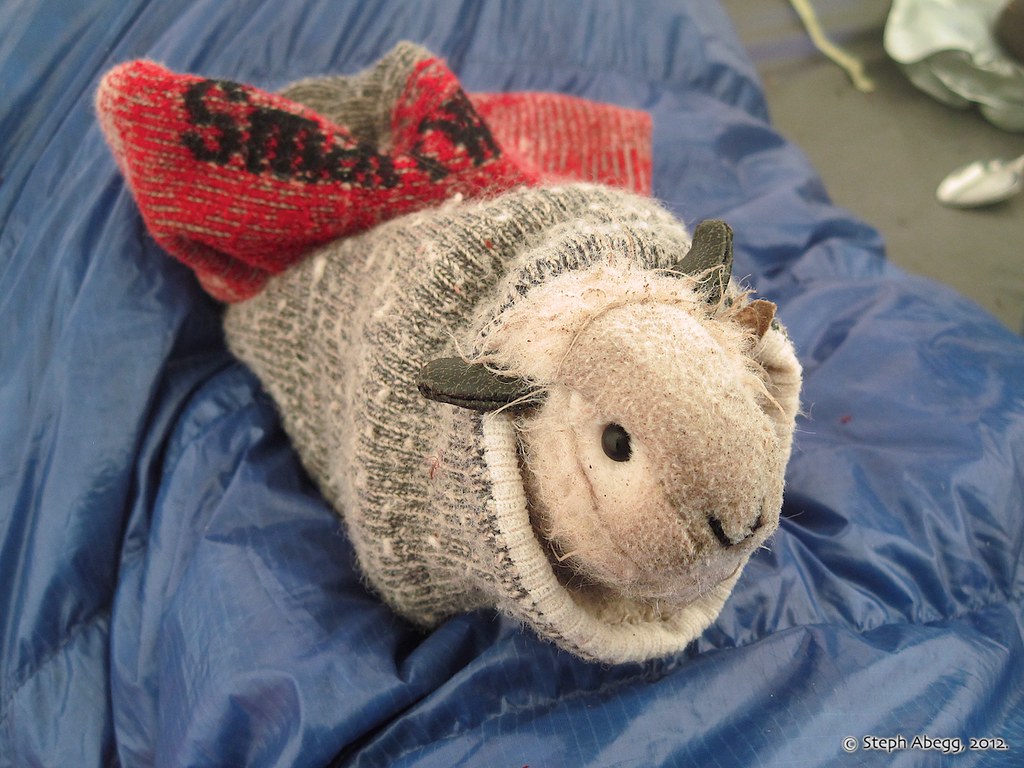
Billy in his sleeping bag.
Billy secured the warmest spot in the tent.
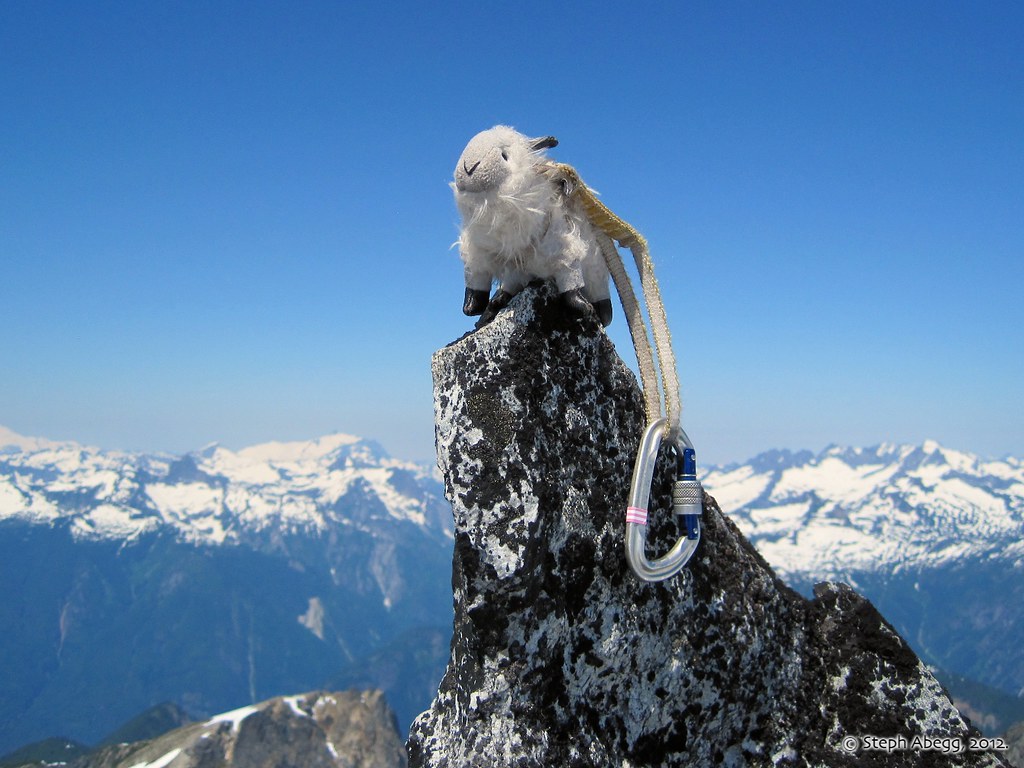
On top of "Billy's Spire"
Billy summits a giant snowball.
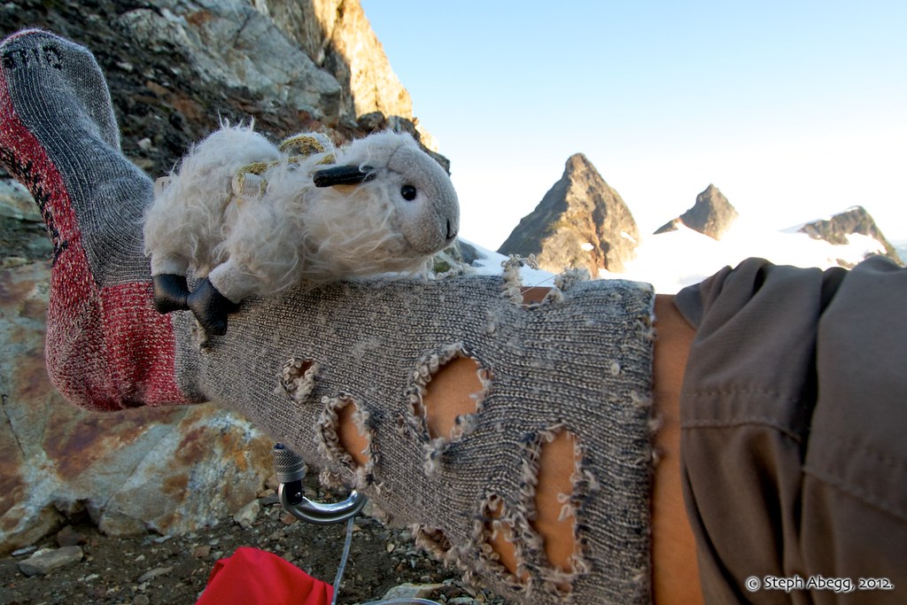
I woke up the second morning to discover that something had chewed holes in my socks (which I had left outside the tent). Billy swore it wasn't he.
Useful beta. Updated route information. Corrections. Historical notes. Interesting facts. No fluff please. Please do not put links in your comment, as my spam filter will filter those comments out.