Pasayten 2016: The Deacon North to South (3rd), Cathedral Peak Southeast Buttress (5.9, 1000′), Amphitheater Mountain West Ridge (3rd)
Pasayten Trip: 3 Climbs
Routes:
- The Deacon, North to South (3rd)
- Cathedral Peak, Southeast Buttress (5.9, 1000')
- Amphitheater Mountain, West Ridge (3rd)
50 miles of hiking for 10 pitches of rock climbing. Fortunately it was a beautiful area to be and the climbing was excellent.
Region: Washington, British Columbia
Elev: 8,376 ft / 2,550 m (Deacon); 8,601 ft (Cathedral); 8,358 ft (Amphitheater)
Rock type: Granite
Type:
Date(s): July 19-22, 2016 (Tue-Fri)
Partner(s): Janet Arendall
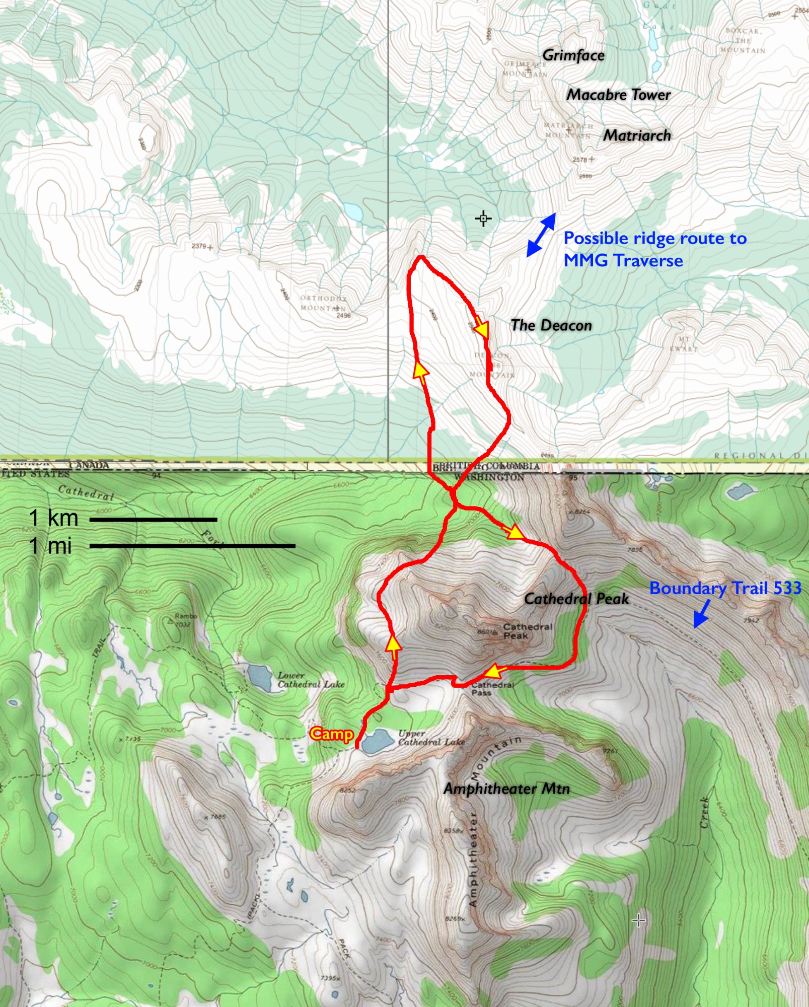
Route Overlay
CLICK TO ENLARGE
Maps
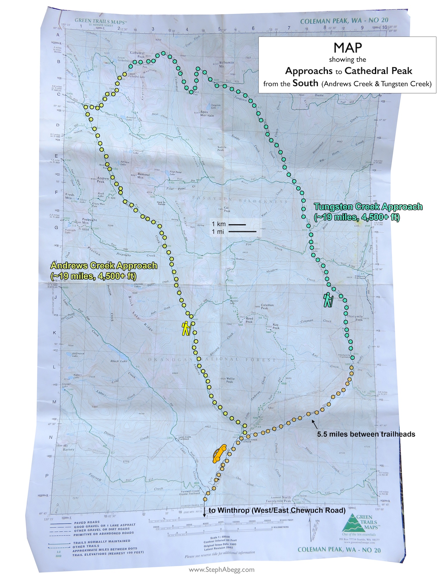
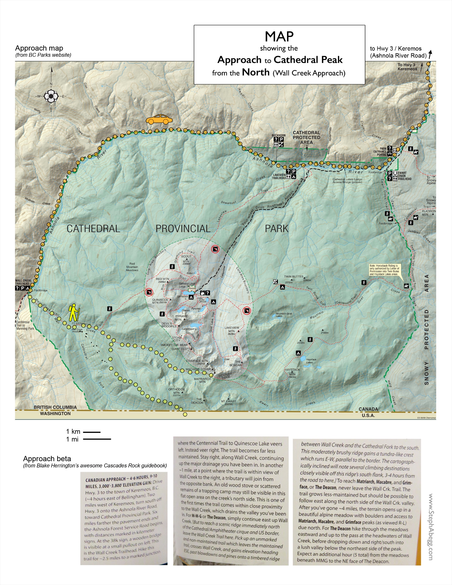
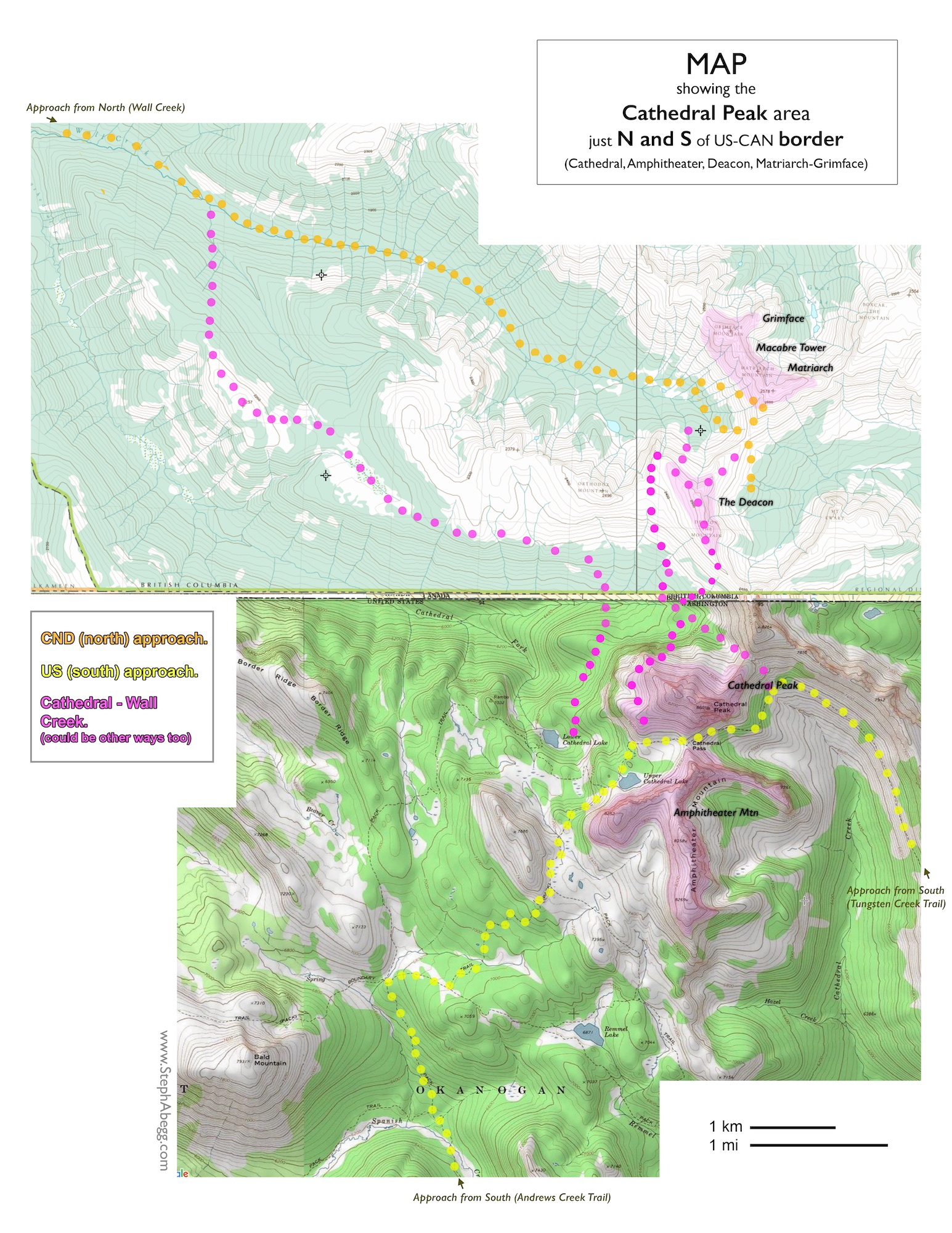
There is always the question of whether to enter from the south or the north. The southern approach is longer and involves several miles along a trail, while the northern approach is shorter but involves a longer drive and probably does not save any time in the end. My personal conclusion is that if Cathedral and camp at Upper Cathedral Lake is the main goal, then the southern approach is best, while if MMG and The Deacon are the main goals, then the northern approach is best.
THIS TRIP REPORT IS STILL MOSTLY IN THE EMBEDDED HTML FORMAT OF MY OLD WEBSITE.
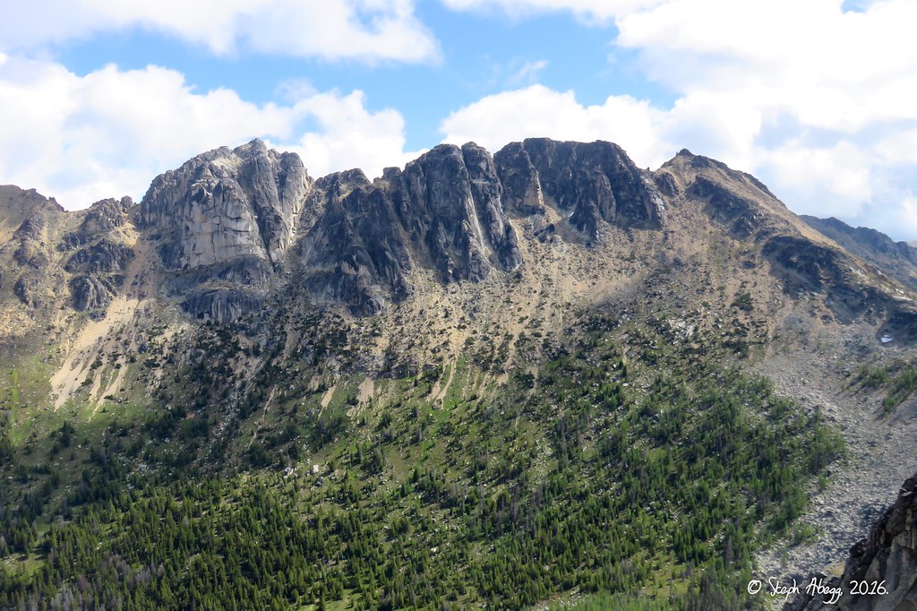
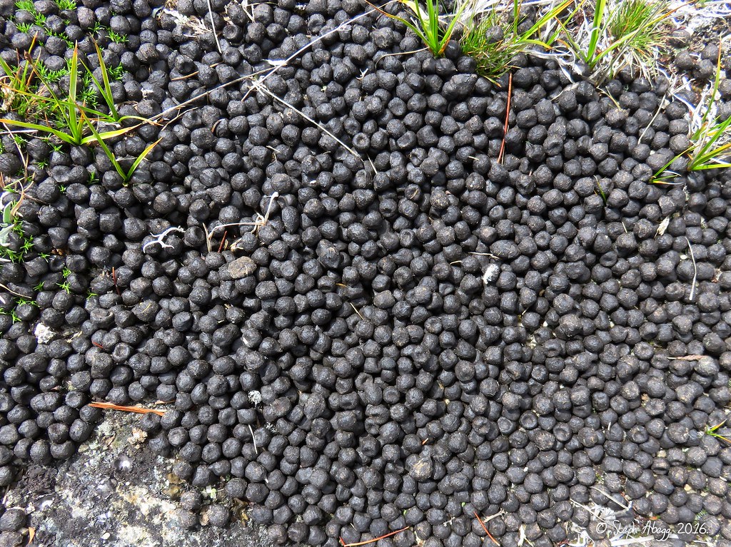
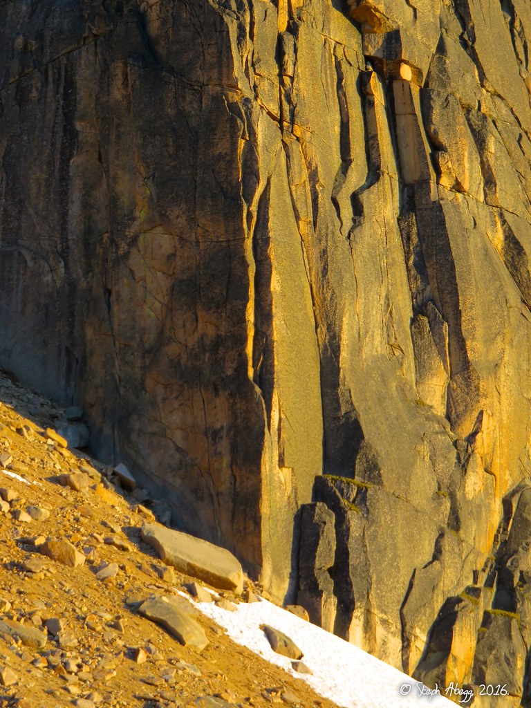
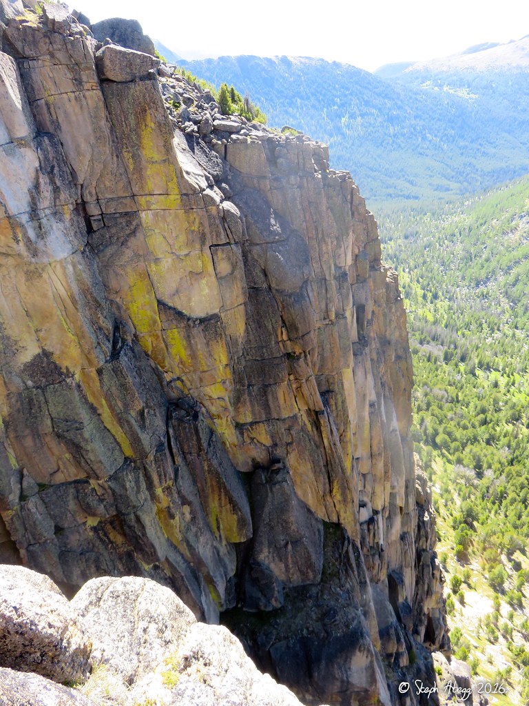
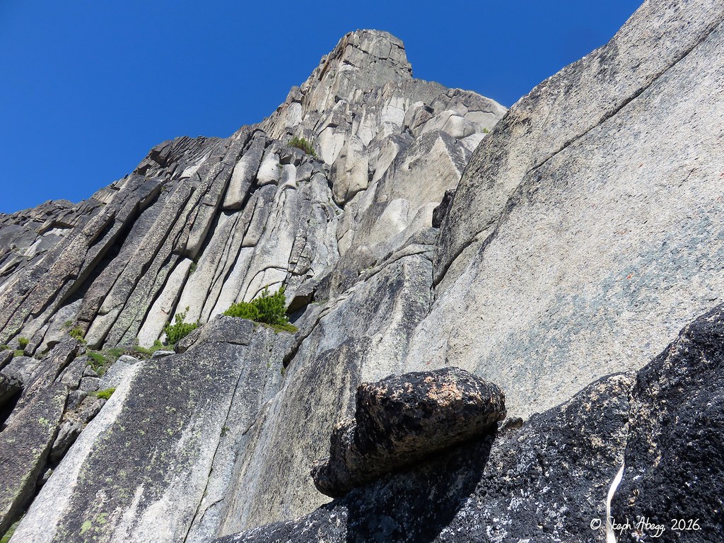
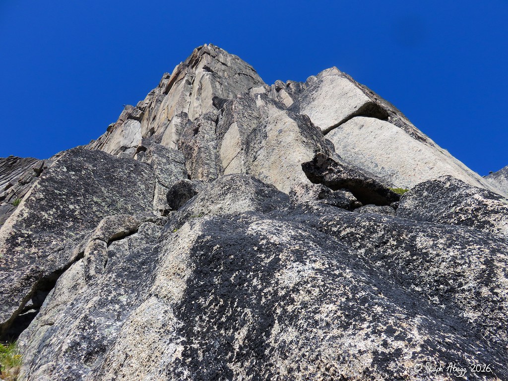
For awhile now, I have been curious about the Pasayten area straddling the US-Canada border in northeast Washington. The area is home to Cathedral Peak, whose SE Buttress is claimed to be one of the best alpine rock routes of the Cascades. The SE Buttress features 1000 feet of 5.7-5.9 steep hand and finger cracks on superb alpine granite. The only downside is the longish approach into the area, entailing either 19 miles on trail (if coming from the south) or a long drive into Canada (if coming from the north). But the approach would be worth it for a few days of climbing. The nearby Amphitheater on the US side and The Deacon and Grimface on the Canadian side have some good routes on them as well.
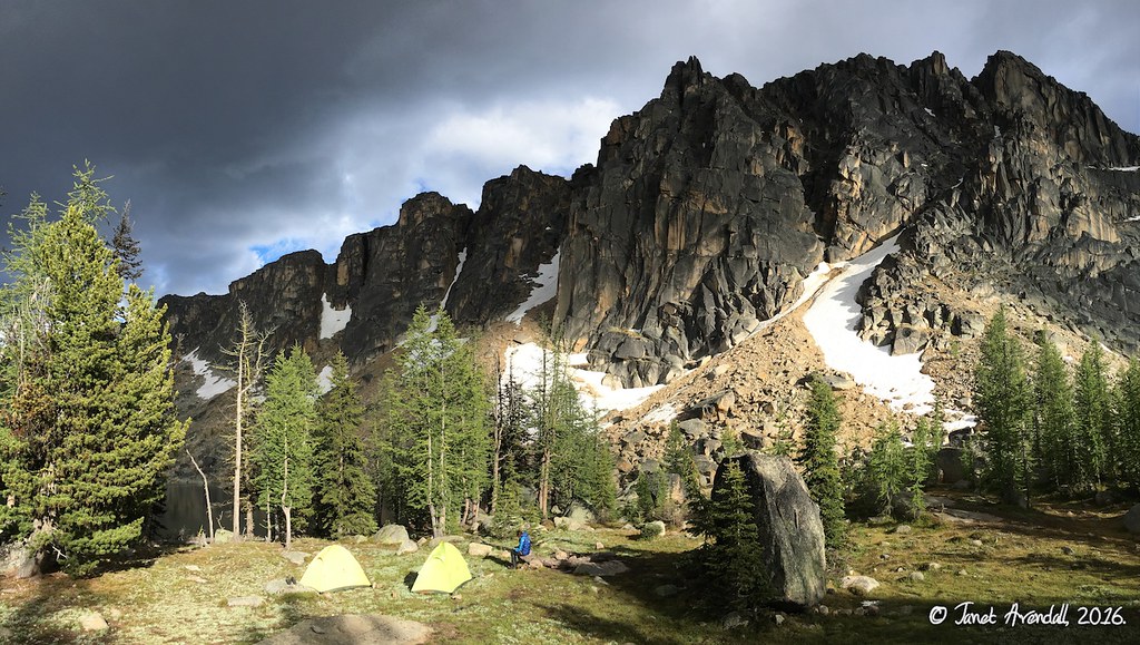
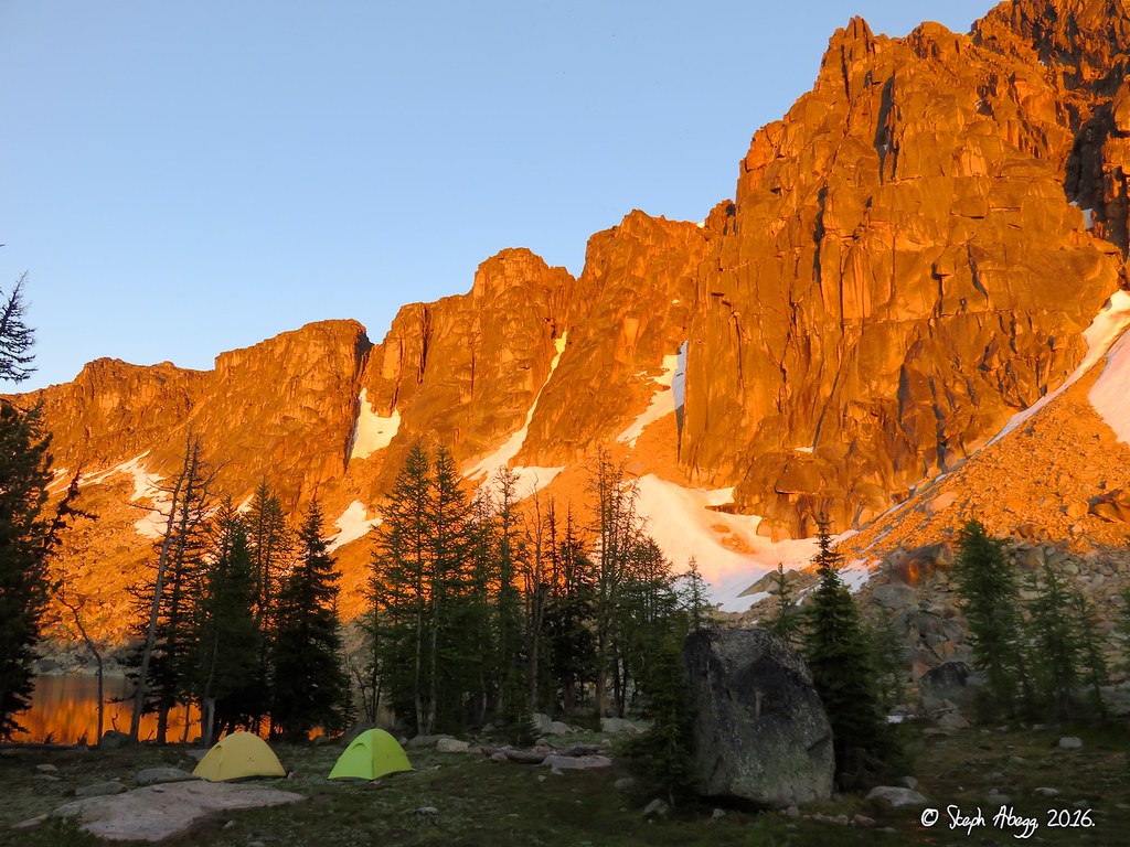
So my friend Janet and I formulated a plan for a 5-day trip to the area. This would give us three days to climb. The Grand Plan was to climb the SE Buttress of Cathedral (5.9, 1000') on the first day, do the Matriarch-Macabre-Grimface Traverse (5.7 A0, ~0.5 mile of ridge) on the second day, and climb Pilgrimage to Mecca (5.9, 500') and Left Side Route (5.10b/c, 500') on Amphitheater Mountain on the third day. We would camp at Upper Cathedral Lake and approach from the south.
But the one thing getting in the way of our Grand Plan was the weather, which turned out worse than forecasted. On the first of our three climbing days, the weather was questionable enough that we just spent the day exploring the beautiful high parklike terrain north of Cathedral Peak; in the process we scrambled over the summit of The Deacon. On the second of our climbing days we awoke to bluebird skies, so Janet and I decided this was the day to climb the SE Buttress of Cathedral Peak. It was a great day of climbing, and we agreed that this was one of the best alpine climbs we've done in the Cascades. The third of our climbing days we woke up to rain, so I scrambled to the top of Amphitheater to at least get to the summit, and then we hiked out a day early.
Despite the disappointment of having to downgrade our plans to just one climb instead of three, overall it was a worthwhile and enjoyable trip. The SE Buttress was a great climb. Plus, our camp was beautiful and it was nice to check out a new area. And if nothing else, the ~50 miles of hiking we did over the course of 4 days made the 3-mile approach into the Bugaboos (where I headed immediately after this trip) seem trivial. Ever upbeat even when we were soaking wet, Janet was an awesome partner for this trip. Janet and I are already talking about a trip back into the Pasayten next summer and revisiting our plans to climb the routes on Amphitheater, the MMG Traverse, and maybe even a route on the steep east wall of The Deacon.
The following page gives some maps, photos, and overlays for our climb of the SE Buttress of Cathedral and our other days in the Pasayten.
Trip Report by Day
CLICK ON DAY TO DROP DOWN CONTENT
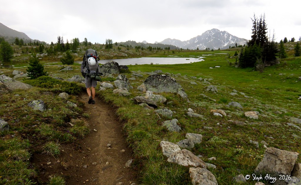
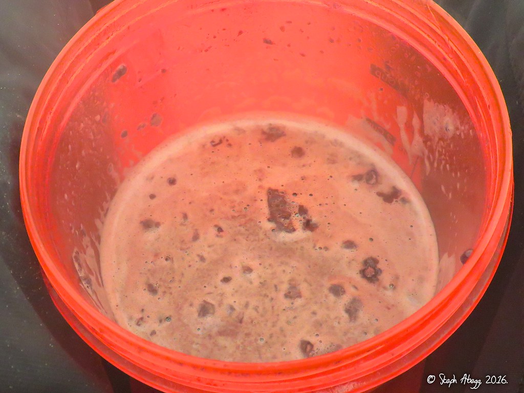
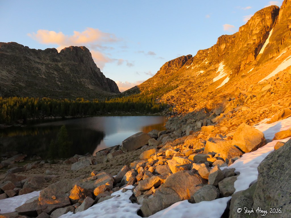
July 19 - Hike in 19 miles (10+ hours), get drenched by wet bushes and then a thundershower, establish camp at Upper Cathedral Lake, and drink a half-gallon of hot chocolate to get warm again. Miserable as it might sound, I actually enjoyed the hike in, as it was good exercise and new terrain and good company.
Photos:
1.
2.
3.
4.
5.
6.
7.
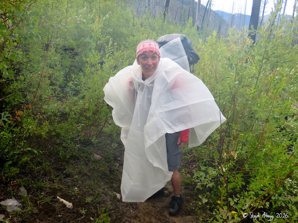
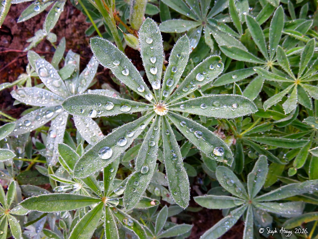
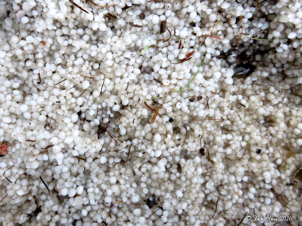
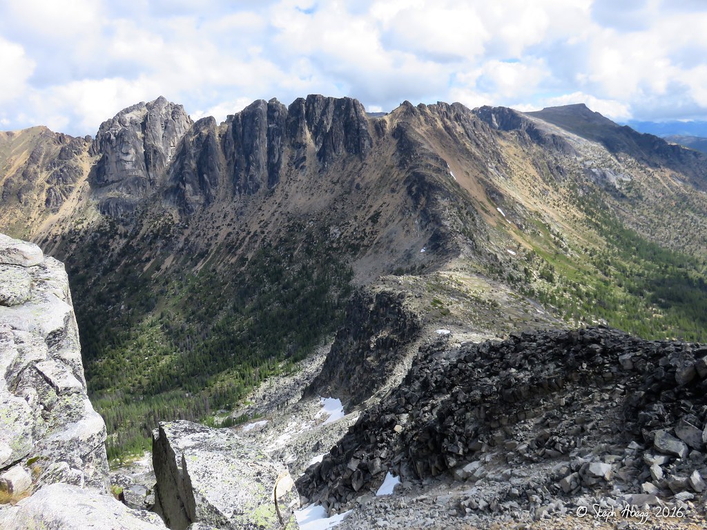
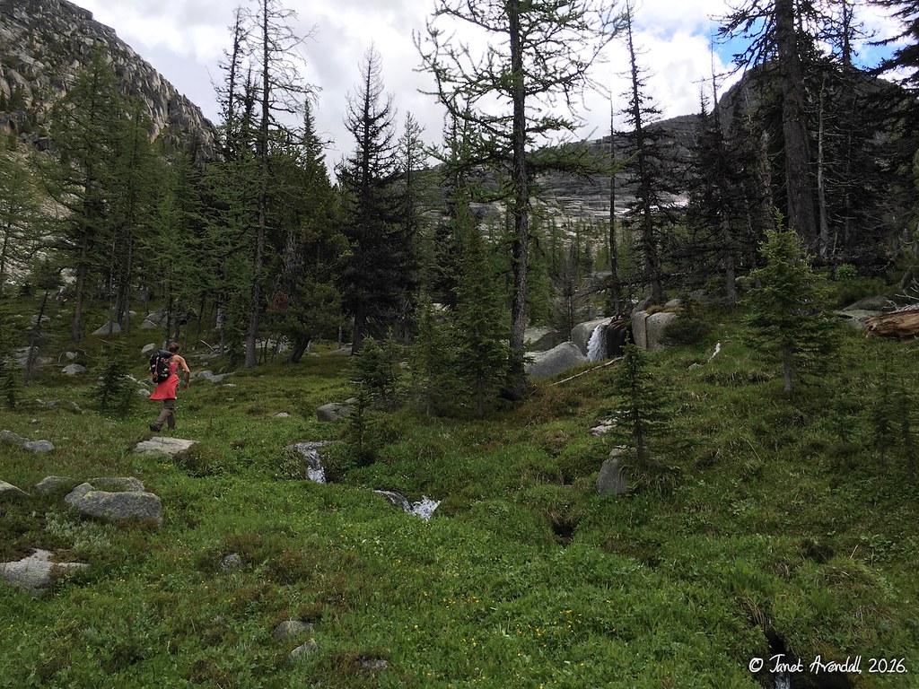
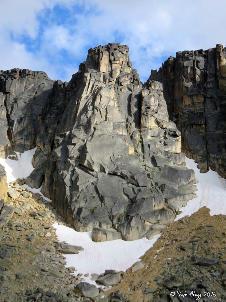
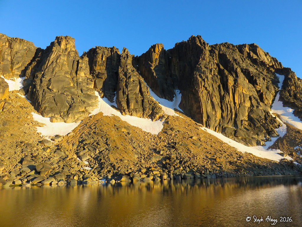
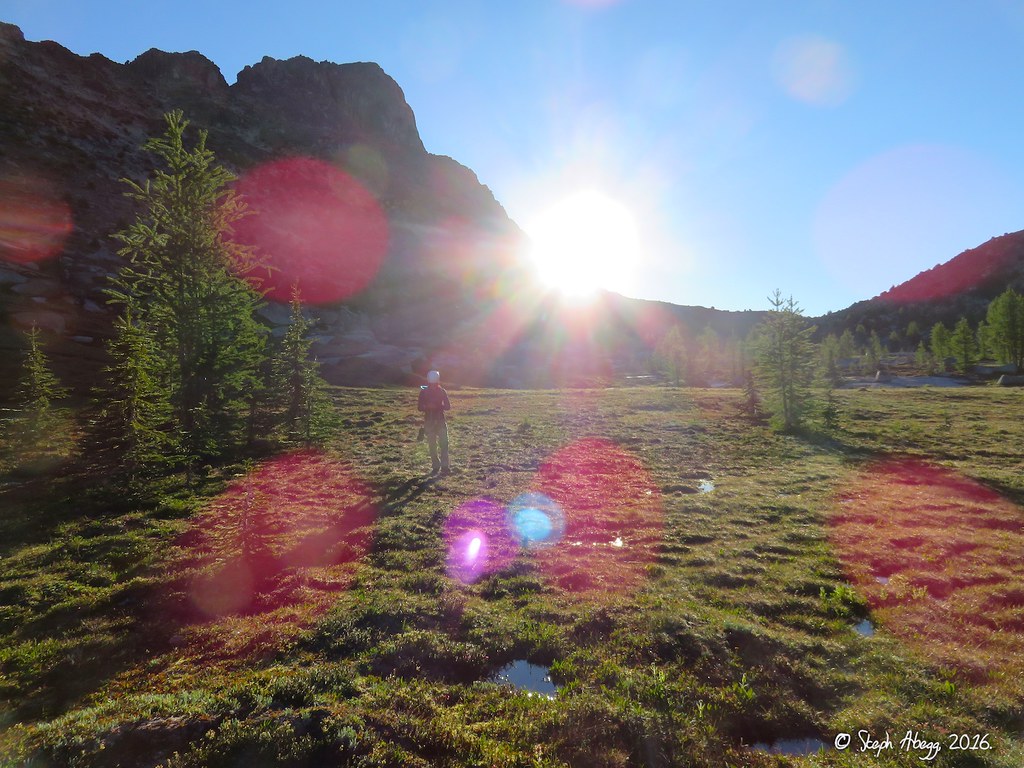
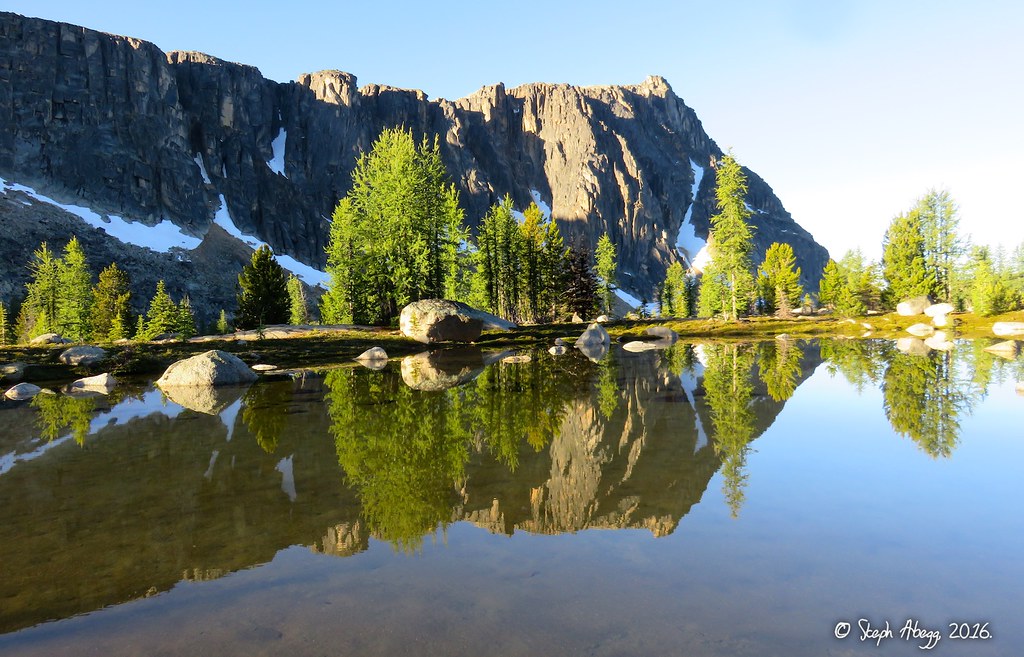
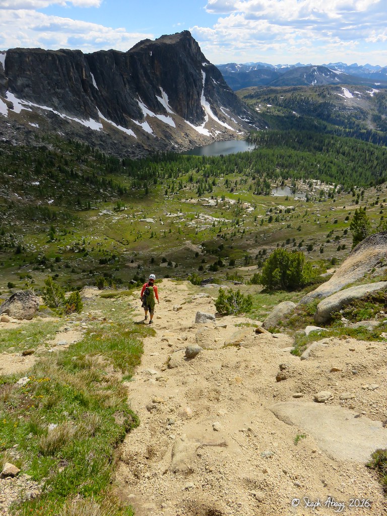
Photo Descriptions: 1. Janet, the White Ghost of Andrews Creek. I had a yellow poncho so I was more like the Big Bird of Andrews Creek. Because of the fire damage, there was a lot of brush for the first 10 miles of the approach. The brush was wet from recent rains, so even with the ponchos on we got soaked. We found with the ponchos on you could kind of zone out and just plod along in Poncholand. 2. Pretty water droplets on lupine leaves. 3. As we got closer to Andrew's Pass (12 miles in), the brush thinned, so we began to dry off a bit. We left Poncholand for awhile. 4. Hiking along the Boundary Trail after Andrews Pass. Mt. Remmel (I think) in the distance. Despite the gloomy weather, this was a pretty area. 5. Just as we had gotten dry from the brush shower of the Andrews Creek Valley and were 30 minutes from Upper Cathedral Lake, a thundershower moved in and pelted us with hail. I quickly reverted to Big Bird and retreated into yellow Poncholand. Janet discovered she had lost her poncho somewhere along the trail (amazingly, on the hike out we found it on the trail right where it had fallen off her pack). 6. Our first view of Upper Cathedral Lake. The crags of Amphitheater Mountain rise above. Ka'aba Buttress on the left and Middle Finger Buttress on the right. 7. After a long wet day of hiking, it was nice to just sit in the tent and drink hot chocolate. I drank half my trip's hot chocolate supply the first night.
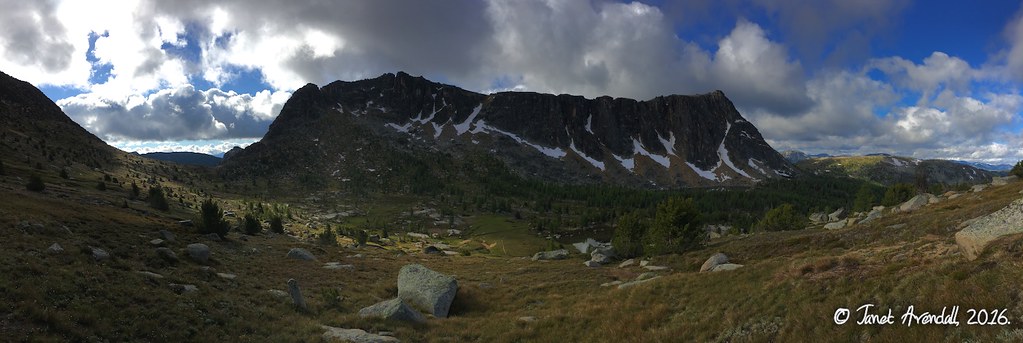
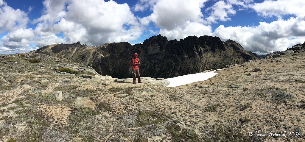
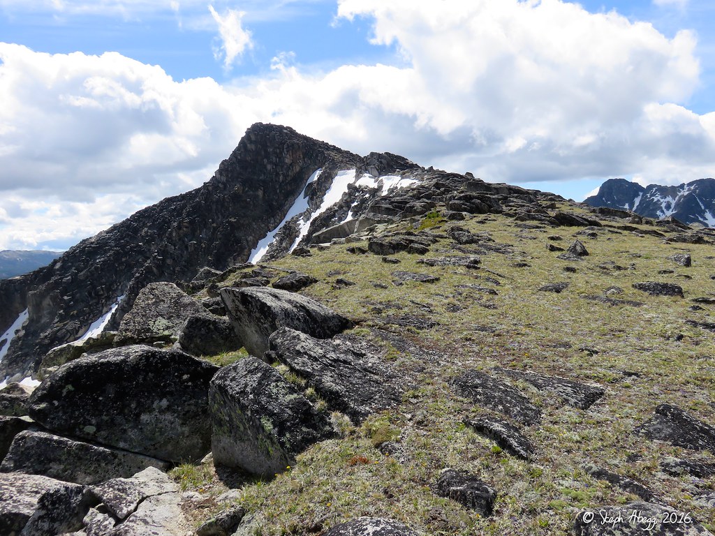
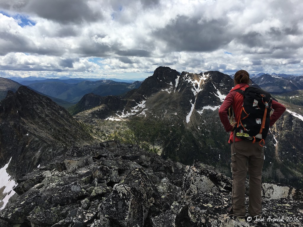
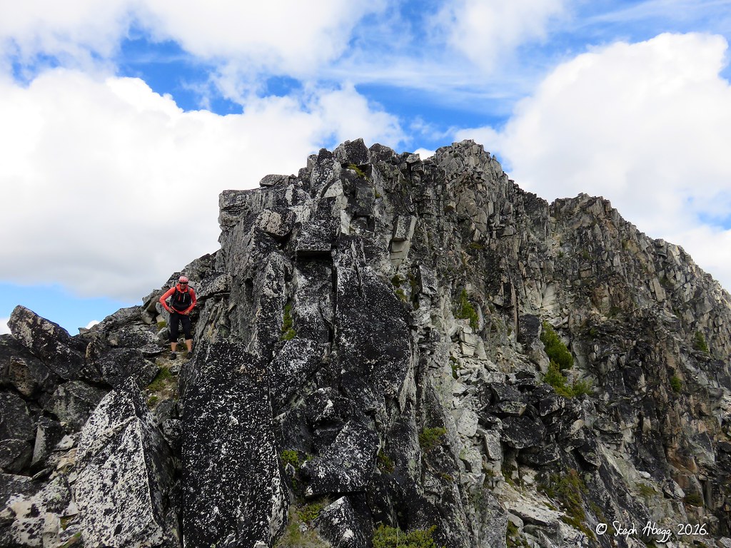
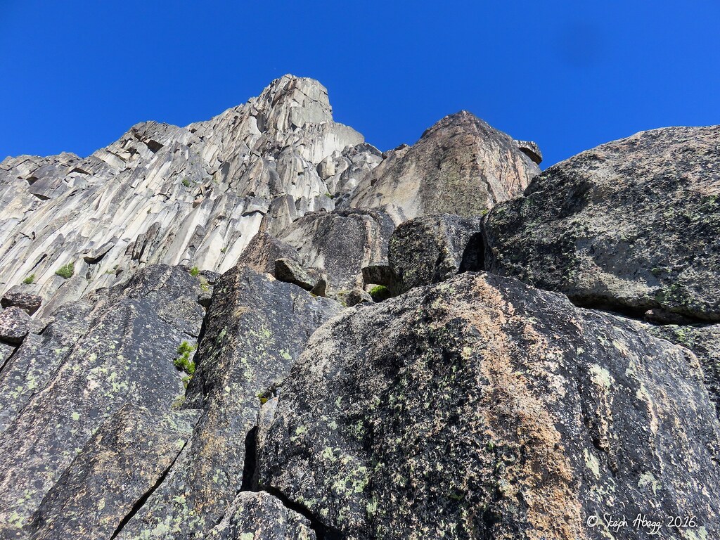
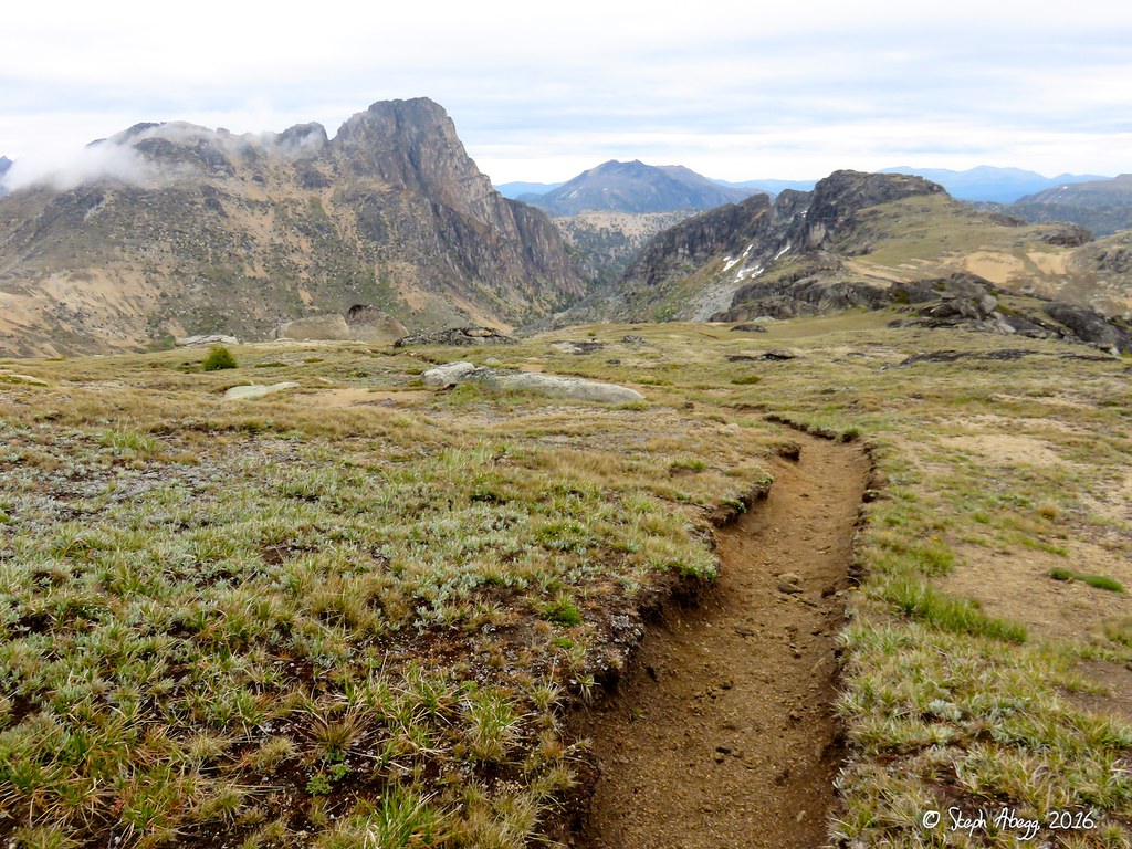
July 20 - Exploration day. Scramble/hike around west side of Cathedral, cross US-Canada border, scramble/hike up to north shoulder of The Deacon, scramble over the summit of The Deacon (8,400'), and scramble/hike through a saddle to intersect the Boundary Trail on the east side of Cathedral. We enjoyed seeing new terrain, and were impressed with how friendly the Pasayten terrain is to rambling (unlike the more rugged terrain of the North Cascades to the southwest we were used to). Note: We had tentatively planned on including the MMG (Matriarch, Macabre, Grimface) Traverse in the circuit. But we had two concerns that prevented us from going for the Traverse: (1) the potential for afternoon thundershowers and (2) whether two high energy output days in a row would affect our plans to climb Cathedral, which was the primary objective of the trip. If we had done the MMG Traverse on this day, we probably would have decided to climb Cathedral two days later and then gotten shut down due to the unforecasted rain. So overall, I'm glad for our decision not to do the MMG Traverse.)
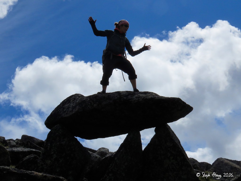
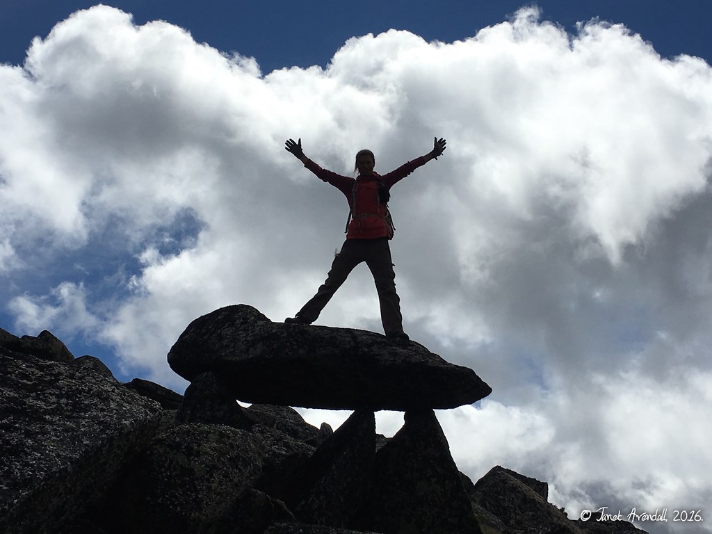
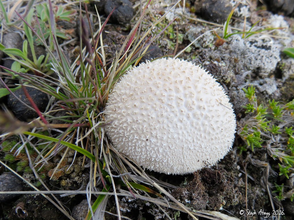
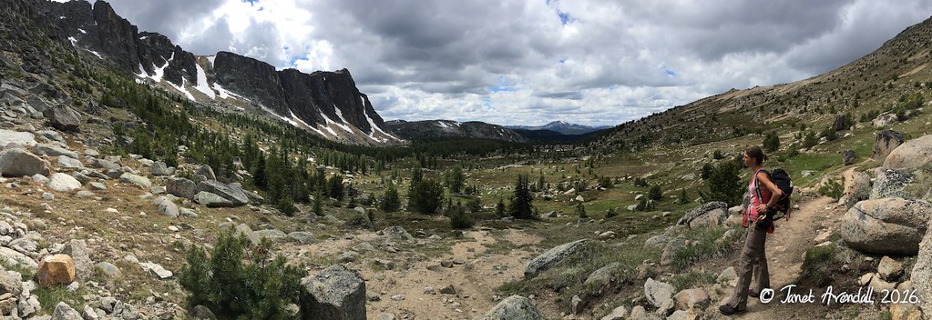
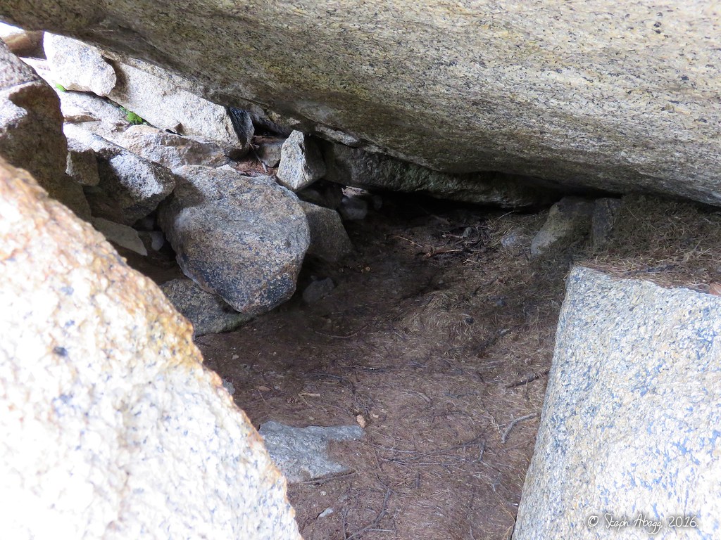
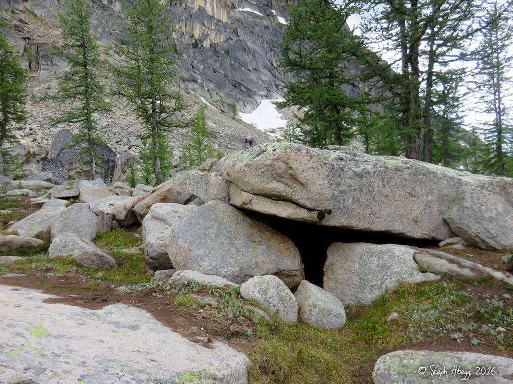
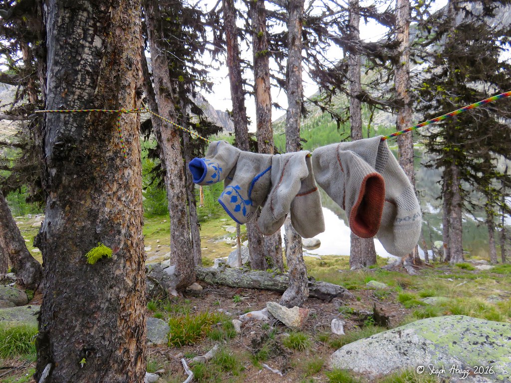
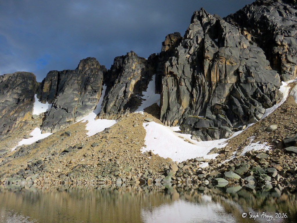
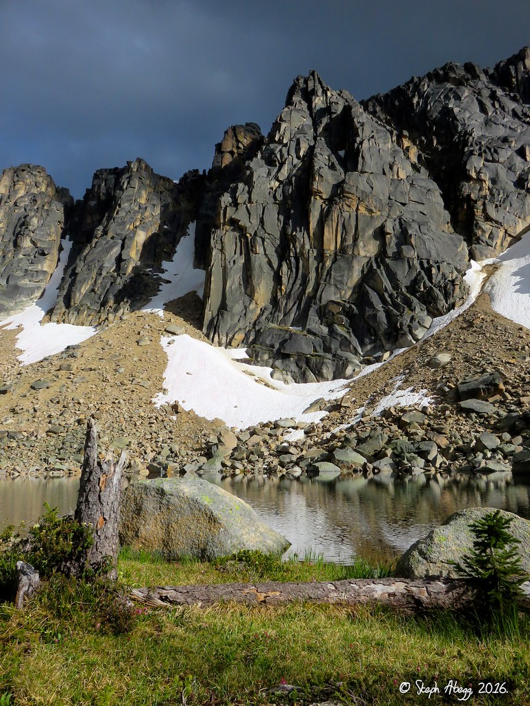
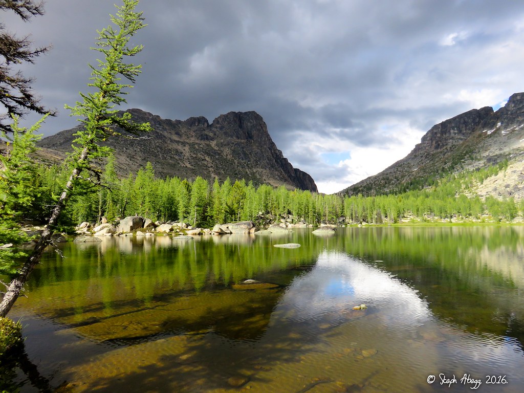
Photo Descriptions: 8. The view back towards Amphitheater and Upper Cathedral Lake from the west shoulder of Cathedral. Cathedral Pass on left. 9. Enjoying the open terrain on the broad saddle between Orthodox Mountain and The Deacon. 10. Mt. Grimface, Macabre Tower, Matriarch Mountain. The MMG Traverse (5.7 A0, ~0.5 mile of ridge) is supposedly a really fun traverse of these three summits, typically done right to left in this photo. Janet and I both want to come back and do the traverse. 11. Janet standing on our furthest north point of the day, overlooking the Wall Creek Valley. Wall Creek is the typical Canadian approach to MMG and The Deacon. 12. On the ridge north of The Deacon. MMG group behind. 13. Looking towards the summit of The Deacon along its north ridge. We scrambled over the summit of The Deacon as we hiked back towards our camp. Janet and I want to come back and climb a route on the steep east face of The Deacon. 14. Looking down the ridge between The Deacon and MMG group. I think this ridge would be a nice way to access the MMG Traverse if coming at it from the US side. The MMG Traverse would be a long day from camp at Upper Cathedral Lake, but it would be very possible, especially using this ridge. 15. Janet surfing on a large rock perched near the summit of The Deacon. 16. Me on the large rock. 17. Mushroom. 18. It seems we found the location of the resident mountain goats' bathroom. 19. On the summit of The Deacon, looking towards Cathedral Peak. On the way back we traversed through the saddle between The Pope and Cathedral in the photo and intersected the Boundary Trail on the other side. 20. A pleasant 3rd class scramble down the south ridge of The Deacon. 21. This feature just south of The Deacon and lying right on the US-Canada border is called The Pope. 22. Crossing back into the US on the western flanks of The Deacon/The Pope. Note the border swath in the distance. 23. Meadowy slopes leading to the saddle between The Pope and Cathedral. 24. The mellow terrain between the saddle and the Boundary Trail. 25. At Cathedral Pass. The Boundary Trail brought us through Cathedral Pass and then down to Upper Cathedral Lake. Now that we had gone around both the west and east sides of Cathedral, I would say that going around the east side is probably a bit easier way to access The Deacon from Upper Cathedral Lake, but both ways work fine. 26-27. A nice bivy spot under a boulder at the south end of Upper Cathedral Lake. If you could guarantee a goat had not already claimed this spot you could hike in without a tent. 28. Sock-drying at camp. 29. There were a few mountain goats that hung out near our camp at the south end of the lake, on call any time one of had to pee. 30-31. Stormy afternoon light on the crags of Amphitheater rising above Upper Cathedral Lake. The buttress on the left is Ka'aba Buttress and the one on the right is Middle Finger Buttress. 32. Ka'aba Buttress. On this trip we had planned to climb a route called Pilgrimage to Mecca that goes up the left side of Ka'aba Buttress. 33. Buttress between Ka'aba Buttress and Middle Finger Buttress. I am not aware of any good climbs on it but there must be some routes. 34. Middle Finger Buttres. On this trip we had planned to climb a route called Left Side Route that goes up the left side (no surprise) of Middle Finger Buttress. 35-36. Evening light on Cathedral Peak as seen from Upper Cathedral Lake. 37. The 10b/c corner of the first pitch of Left Side Route on Middle Finger Buttress. This is reportedly one of the best 5.10 corner pitches in the Cascades. It does look good.... 38-41. The weather improved as the evening went on, giving a more golden glow to the light on the buttresses.
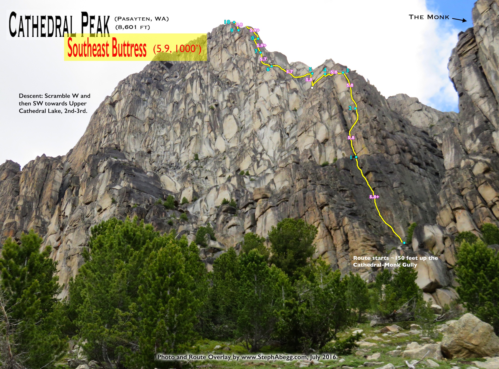
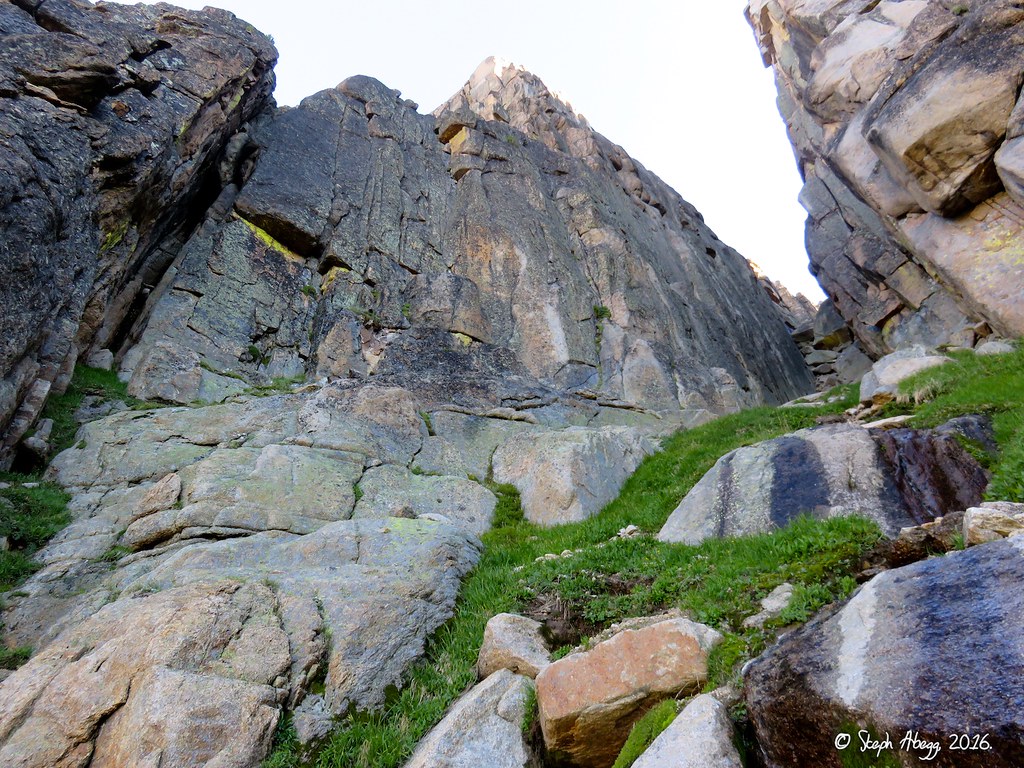
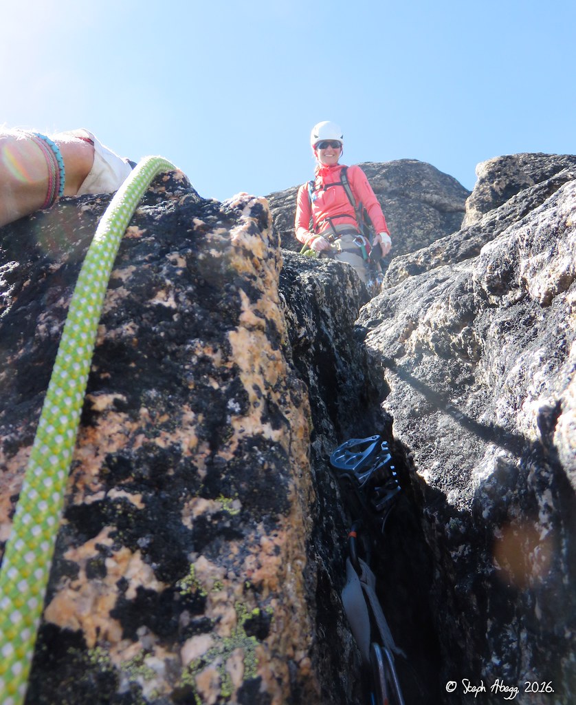
July 21 - Climb SE Buttress of Cathedral Peak. The SE Buttress of Cathedral is one of the great moderate rock routes in the Cascades. The route features 1000 feet of 5.7-5.9 steep hand and finger cracks on solid rock. Plus, the belay ledges were comfy and the approach and descent from camp were short and enjoyable romps through beautiful parkland. Janet and I agreed that this was one of the best alpine climbs we've done in the North Cascades. We were fortunate to choose the best weather day of the trip to climb it too.
Time Stats
Camp to Base of Route: 40 min Base of Route to Summit: 7 hours 10 min Summit to Camp: 45 min
Route Overlay
Pitch-by-Pitch Photos
Photos:
Photo Descriptions:
Approach
Upper Cathedral Lake, through Cathedral Pass
42.
43.
44.
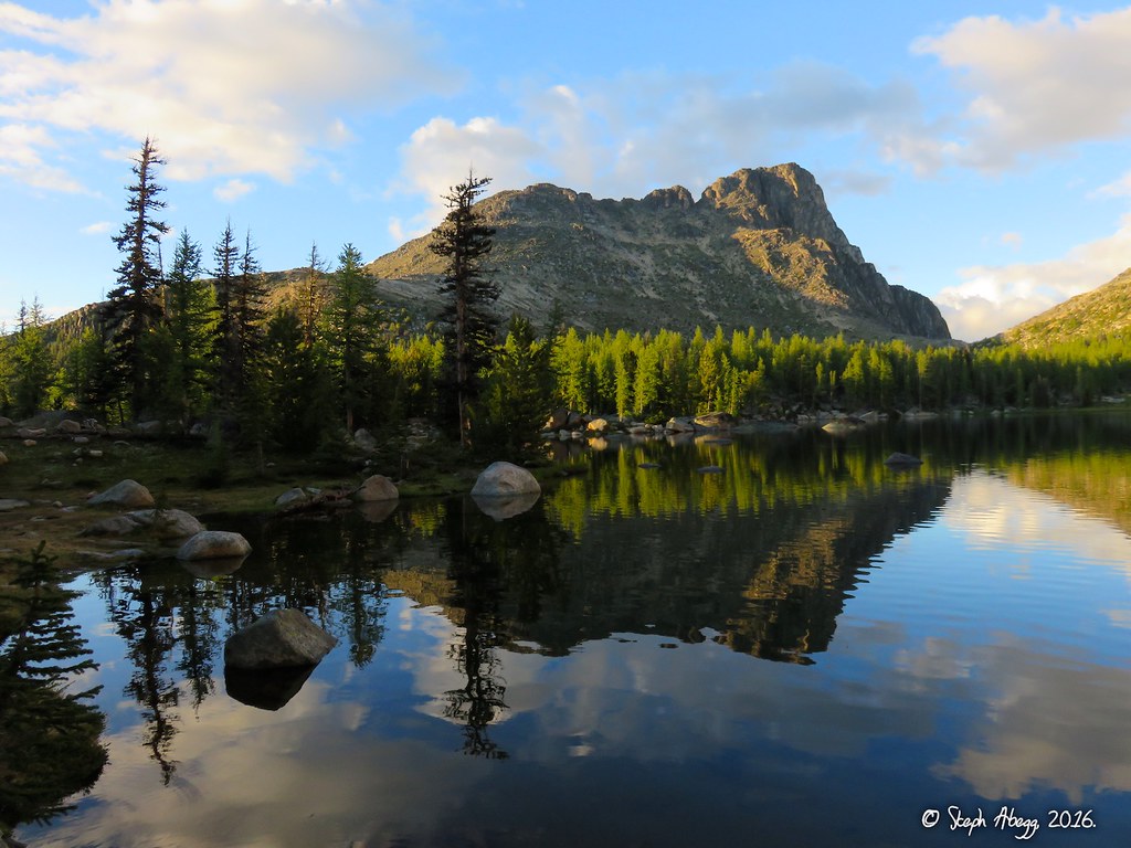
43. Approaching Cathedral Peak through beautiful parkland between Upper Cathedral Lake and Cathedral Pass. The SE Buttress is on the skyline. 42. Morning light on Amphitheater Mountain, as seen across a lake between Upper Cathedral Lake and Cathedral Pass. 44. The route starts about 150 feet up the Cathedral-Monk gully. It took us about 40 minutes to get to the base of the route from camp at Upper Cathedral Lake.
Pitch
1
5.8+
45. 46.
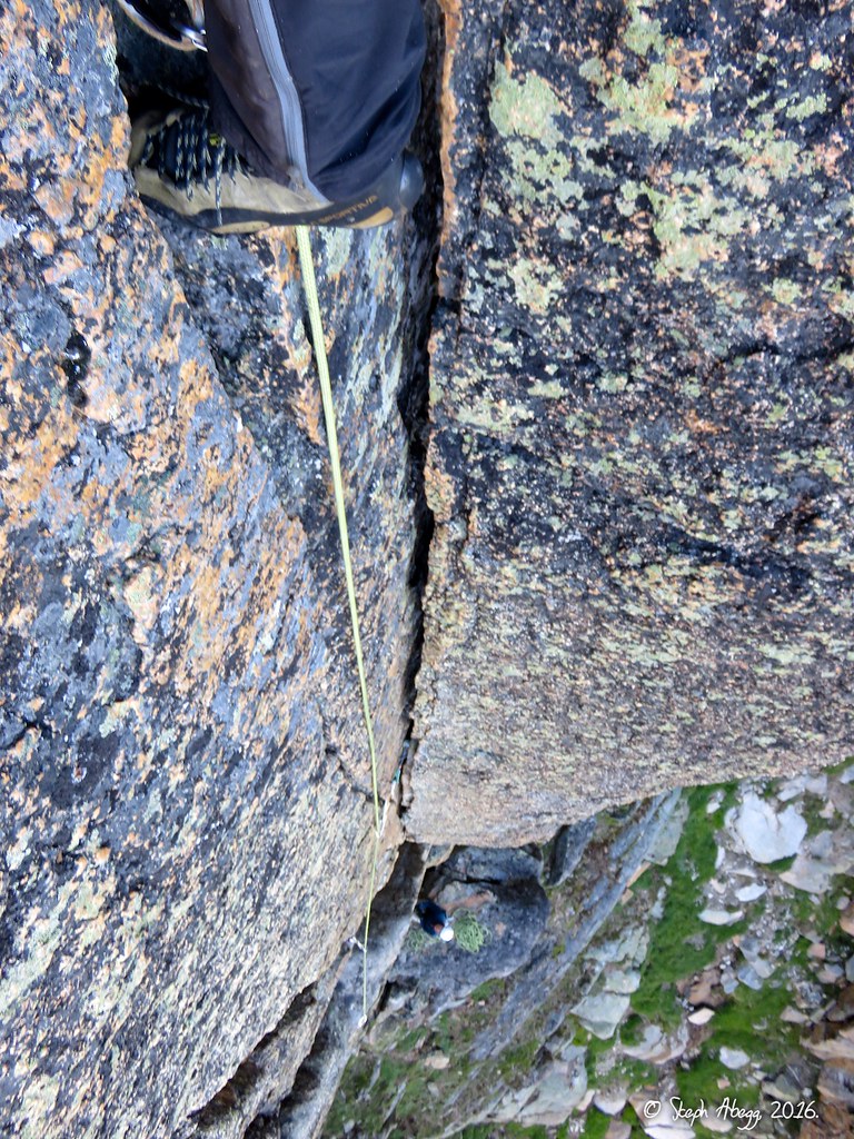
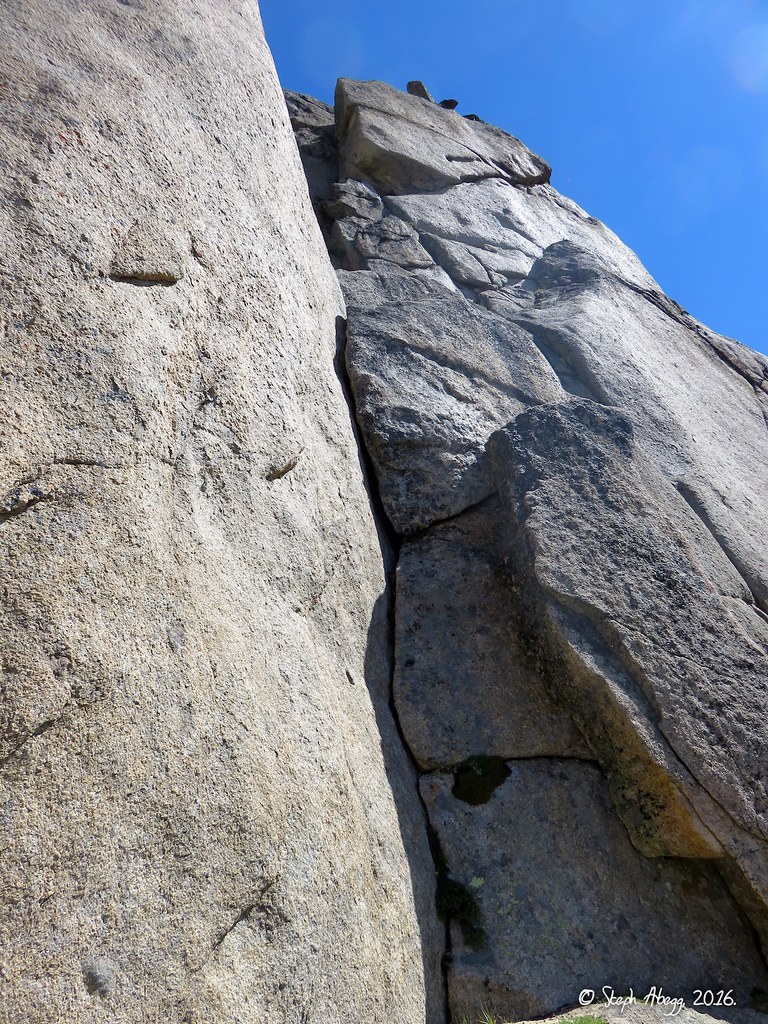
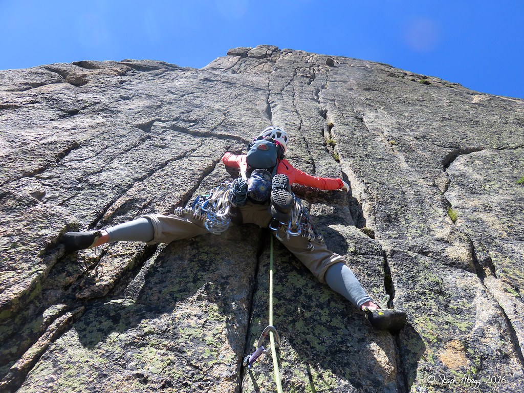
45. Looking up the first pitch, which climbs a left-facing corner and wide crack. It is a longish pitch. I started the pitch to the left and then stepped right into the corner. I found a #4 useful for protecting some wider moves at the start (a #4 is not called for in the route description but we had it for Amphitheater so we decided to bring it along on Cathedral and used it a few times on the route). 46. Looking down while climbing the first pitch. This was really great climbing.
Pitch
2
5.8
47. 48.
47. Janet starting up the second pitch, which goes up past the chockstones and exits the chimney out right to a small stance. We climbed outside the chockstone, which felt hard until I stemmed across and was back making 5.8 moves. 48. It would be possible to go behind the chockstone but it would be pretty grungy. I don't think many climbers go that way.
Pitch
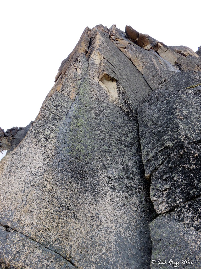
3
5.8
49. 50. 51.
52.
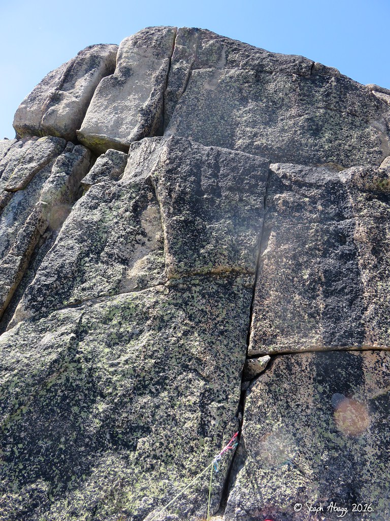
49. This is where we started Pitch 3, which continues up a small corner and crack to the right of the chimney. I think this is the start of the pitch, although it would have been possible to climb higher on Pitch 2. 50. According to the route description we had, Pitch 3 is supposed to end at a large ledge, but I ended my lead at a smallish ledge, so I think I stopped too soon. The topo made it look as if Pitches 2 and 3 are both short pitches and about the same length, but if where we set the belay at the top of Pitch 2 was correct, then Pitch 3 was a much longer pitch than Pitch 2. In this photo Janet is starting here lead of what we had initially thought was Pitch 4, but we later concluded this was still part of Pitch 3. 51. Looking down on The Monk from Pitch 3. 52. Amphitheater as seen from the SE Buttress of Cathedral.
Pitch
4
5.8
53. 54.
53. Pitch 4 as per the route description starts somewhere in here. 54. The quartz dike near the top of Pitch 4.
Pitch
5
5.8
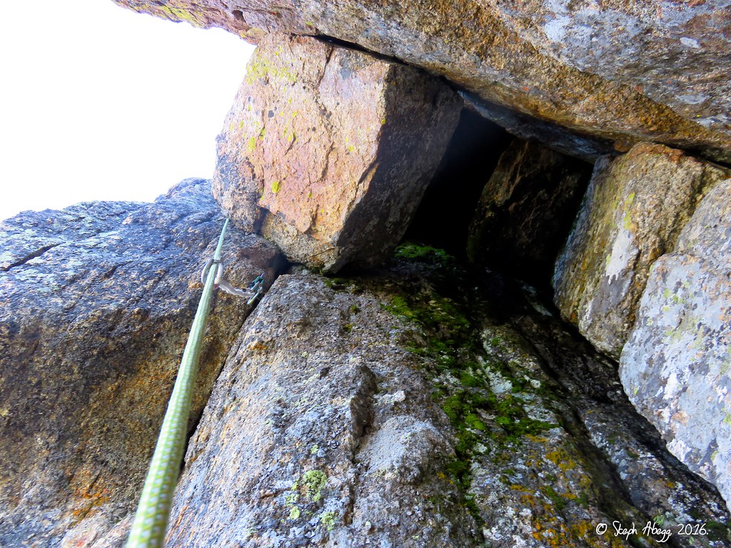
55. 56.
57.
55. Walking across the ledge to the start of Pitch 5. Pitch 5 climbs up the flake in the corner in the photo. 56. Pitch 5 starts with a rather burly layback up a flake. 57. Pitch 5 ends with a chimney. From below it doesn't look too enjoyable, but it is actually a really fun chimney and protects well with small gear on the left.
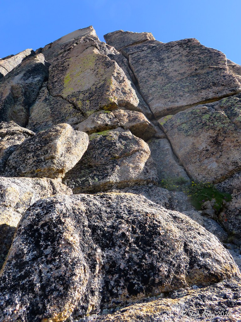
Pitch
6
5.7
58.
58. Pitches 6 and 7 just follow blocks and corners to the base of the headwall above. Choose your own 5.7 adventure. We belayed at the tree on the ledge just left and up of center in the photo.
Pitch
7
5.7
59.
59. Blocky 5.7 cracks to the base of the headwall. There are lots of options.
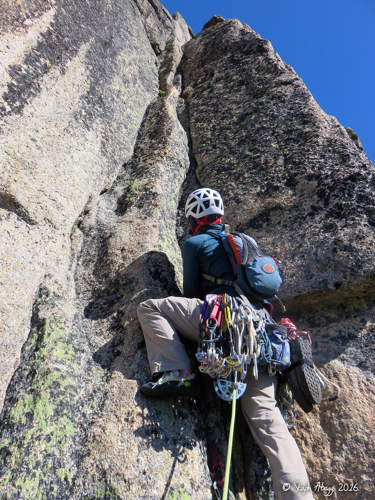
Pitch
8
5.9+
60.
60. Janet led the first pitch of the headwall, which has some cruxy thin moves at the start (can protect with small cams) and then eases up as it enters some hand cracks.
Pitch
9
5.9+
61.
62.
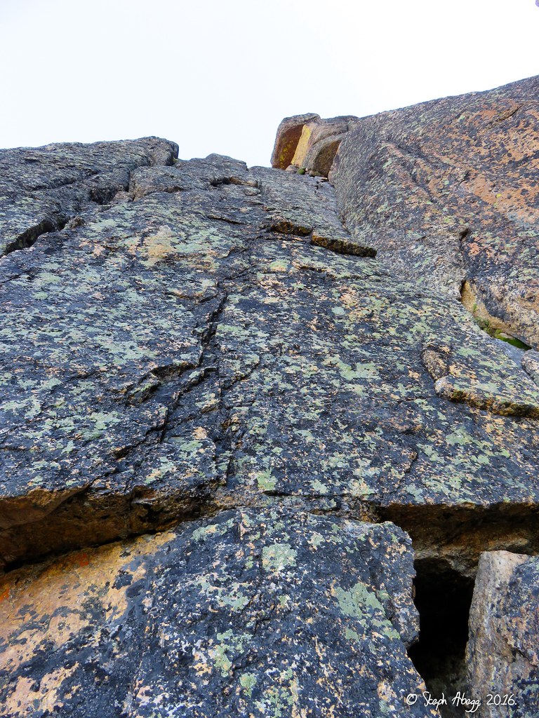
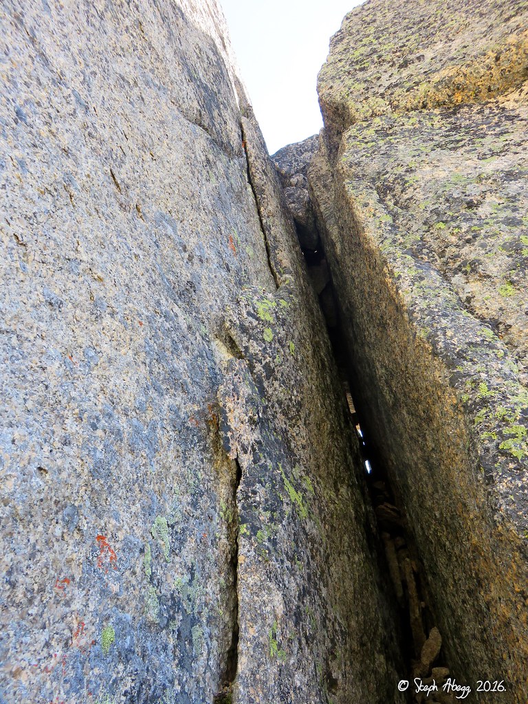
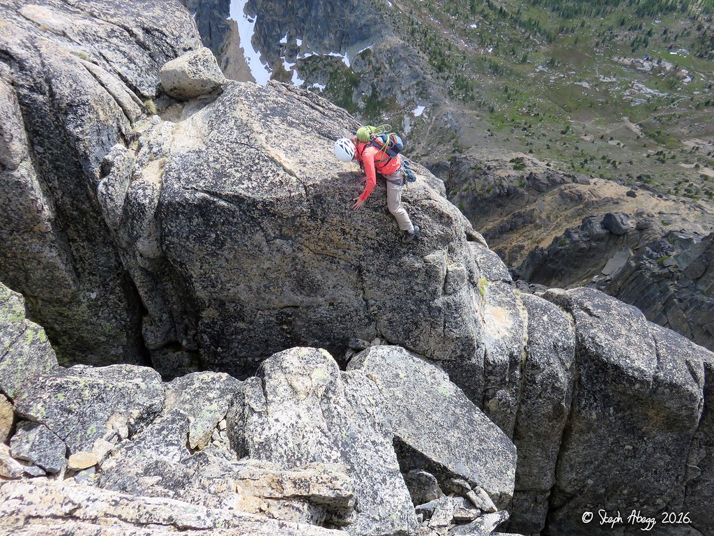
61. From the top of Pitch 8, go right past a looming offwidth (shown in this photo) and to a finger crack about 4 feet to the right of the offwidth. The original route climbed the offwidth, but this is now usually skipped in favor of the finger crack. I actually enjoy offwidths but I would have wanted a #5 and maybe an extra #4 to lead it comfortably. 62. Looking down at the fingercrack. I sewed it up with gear. We felt the 5.10a grade given in our topo was fair. The hand traverse left at the top of the pitch also felt tricky. Excellent climbing on this pitch.
Pitch
10
5.8
63. 64.
63. The route finishes with a hand crack, broken into two parts by a ledge. 64. The handcrack got a bit wide near the top of the pitch. We were happy to have the #4 for the exit move from the handcrack, especially with the ledge below. Interestingly, the #4 had been really nice to have for both the first and last piece of the route. We placed it elsewhere on occasion although it was not really needed anywhere else. Other climbs in the are (such as on Amphitheater) require a #4, so if you have it with you already, you may as well bring it on the SE Buttress.
Summit
8,601'
65.
66.
67.
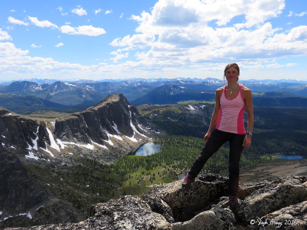
65. Janet on the summit, looking north towards Canada. 66. Steph on the summit, with Amphitheater and Upper Cathedral Lake behind. 67. Panoramic summit view.
Descent
walk-off
68.
69.
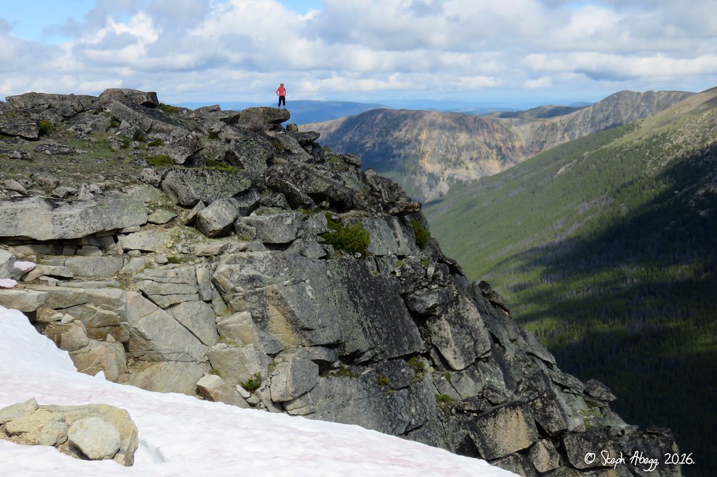
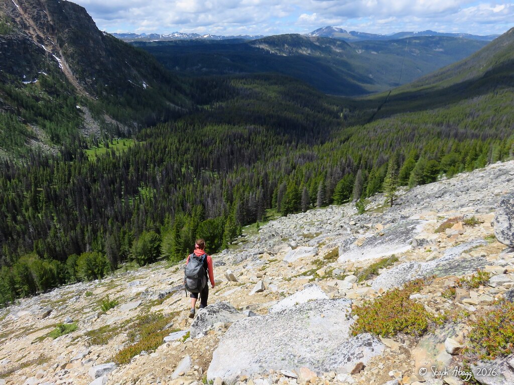
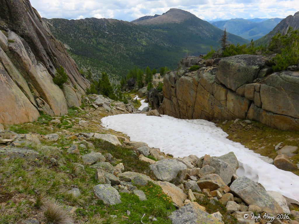
68. Except for one section, the descent is an easy scramble to the West and then SW back to Upper Cathedral Lake. The crux of the descent is the section pictured in the photo, which the guidebook mentions you must hop across. We bypassed the hop by downcliming the exposed nose and easily stepping across. The downclimb is pretty easy (if dry!) but it is no-fall terrain. 69. Once off the summit area of Cathedral it is an easy hike down scree slopes to Upper Cathedral Lake. It took us about 45 minutes from summit to camp.
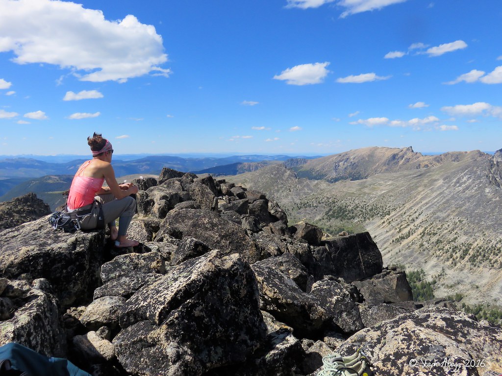
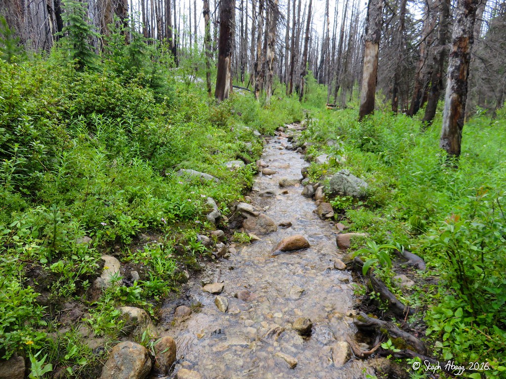
July 22 - Wake up to rain. Scramble up West Ridge of Amphitheater to the summit (8,358'). Slog out a squishy 19 miles.
Photos:
70.
71.
72.
73.
74.
75.
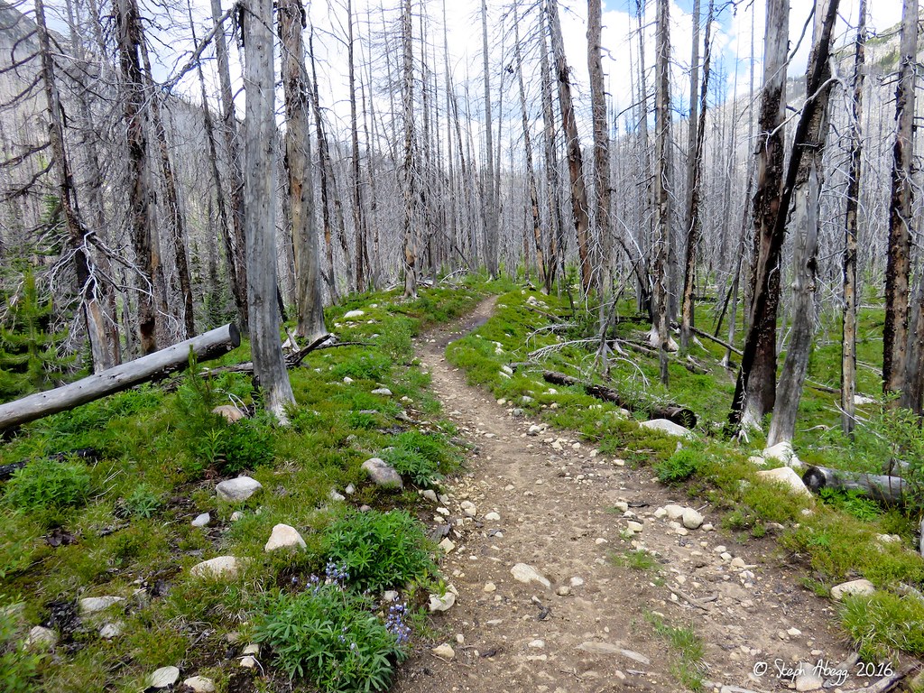
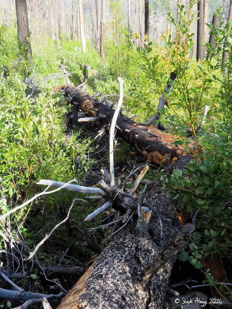
Photo Descriptions: 70. On the broad summit of Amphitheater after scrambling up the west ridge. Amphitheater is shaped like a "T", so a nice stroll would be to walk the entire T. I waked along the top of the western arm of the mountain, which forms the left side of the upper line of the T. 71. Looking back at the western arm of Amphitheater and Upper Cathedral Lake below. 72. On my way back to camp, I detoured to check out the Left Side Route on Middle Finger Buttress. This photo is taken looking up at the 10b/c corner of the first pitch of Left Side Route. This is reportedly one of the best 5.10 corner pitches in the Cascades. We had planned to climb this but it was too wet to climb at this point, especially with the lichen which gets quite slippery when wet. 73. The rain clouds had settled in over Amphitheater Mountain by mid-morning. It did not look like the weather would clear and the rock would dry anytime soon, so we packed up and hiked out. Back to Poncholand. 74. The trail had become a stream in a couple of places. Squish squish squish. We wished we had put a car at the Tungsten trailhead so that at least we could have been squishing out a different way, but we had not even thought of that when we planned the trip. Next time. 75. There were several new blowdowns on the trail that had not been there when we hiked in a few days earlier. The trail crew has their work cut out for them with the first 12 miles of the Andrews Creek trail, where the scorched dead trees are falling one by one.
Useful beta. Updated route information. Corrections. Historical notes. Interesting facts. No fluff please. Please do not put links in your comment, as my spam filter will filter those comments out.